Johnson Mountain and Malcolm Mountain - 10.21.2014
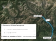
Directions from the entrance to 29 Pines Campground to the Johnson Medra Trailhead (~3100') on FS-9737.
|
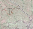
Our approximate route to the summits of Johnson Mountain and Malcolm Mountain... ~12 miles roundtrip, gaining ~3000 feet of elevation.
|
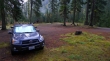
We parked a short distance beyond Beverly Campground... just off of FS-9737... across the road from the N. Fork Teanaway River and the Johnson Medra Trailhead.
|
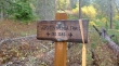
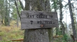
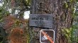
This sign is on the same side of the road as Beverly Campground... about an eighth of a mile beyond the campground.
|
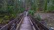
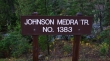
Within seconds after starting the hike we crossed the N. Fork Teanaway River on the Johnson Medra Trail #1383.
|
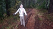
Basking in the only sunshine we had for the first two hours of the hike... although we did have a lot of liquid sunshine... ugh.
|
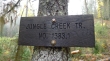
After hiking .7 miles on Johnson Medra Trail #1383 we reached a junction with the Jungle Creek Trail #1383.1.
|
We will follow the Jungle Creek Trail #1383.1 for two miles up to a junction (~4500') with the Way Creek Trail #1235.
|
We will follow the Way Creek Trail #1235 for ~1 mile over to the west ridge of Johnson Mountain.
|
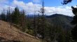
Fall colors in the Teanaway.
|
We have reached the west ridge (~4800') of Johnson Mountain... time to leave the Way Creek Trail and follow our noses up to the summit.
|
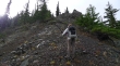
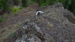
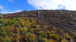
Snowdog is off trail and heading up for the Johnson Mountain summit.
|
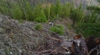
Steeper than we thought it would be... on our return from the summit we realized that we had left the Way Creek Trail too soon.
|
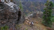
Izzy keeps a close eye on Snowdog's progress on the Class 2 terrain.
|
The wet rock made the Class 2 terrain a bit more interesting.
|
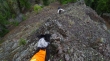
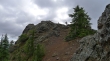
Continuing up toward the summit of Johnson Mountain.
|
Ever upward.
|
Izzy and Snowdog are almost on the Johnson summit.
|
Snowdog reaches the Johnson Mountain summit (5220').
|
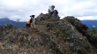
Izzy poses while Snowdog hunkers down on the summit of Johnson Mountain.
|
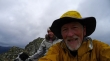
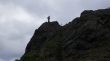
A selfie on the summit of Johnson Mountain.
|
Off of the Johnson Mountain summit now and back on good trail... now we will follow the Koppen Mountain Trail #1225 as we head for Malcolm Mountain.
|
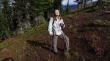
It has been awhile since we felt the warmth of the sun.
|
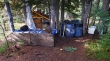
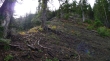
We have followed the Koppen Mountain Trail for a bit more than 1.5 miles and reached the NE ridge of Malcolm Mountain (~5000')... where we found this hunter's camp.
|
Izzy and Snowdog near the summit of Malcolm Mountain... about a half-mile, off-trail hike from the hunter's camp.
|
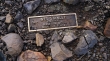
We found this plaque on the summit (5480') of Malcolm Mountain. I googled the person's name and did not find any information.
|
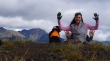
Snowdog uses her four hands to signify that she has completed the Teanaway Twenty List of peaks... Izzy is not amused.
|
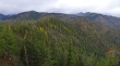
Cloud cover over the Teanaway... except for Iron Peak, which chooses to be in the sunshine.
|
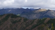
A closeup of Iron Peak in the sunshine... and it looks like the Stuart Range might also be in the sunshine.
|
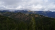
Off of Malcolm now and heading back toward Johnson Mountain (right) as we head back to the car... still have a little more than 5 miles to get back to the car.
|
