Tahtlum Peak - 11.17.2014
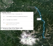
Directions from the Naches Tavern in Greenwater, Washington to where we parked in a turnout near Tipsoo Lake on Hwy 410... a half-mile south of Chinook Pass.
|
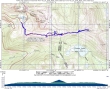
rodman's GPS track from our May, 2005 trip to Tahtlum Peak... the same route we used today.
|

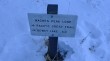
We parked (~5320') in a turnout above Tipsoo Lake on Hwy 410... about a half-mile south of Chinook Pass.
|
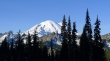
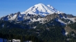
A nice view of Mt. Rainier from where we parked.
|
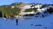
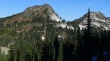
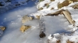
We found the beginning of the south portion of the Naches Loop Trail near this unnamed tarn below the west side of Naches Peak.
|
Starting from the beginning of the south portion of the Naches Peak Loop Trail... we will hike 1.4 miles to the junction with the Pacific Crest Trail.
|
Yes... it was very chilly.
|
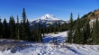
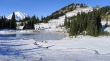
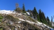
We got this view of Mt. Rainier after hiking less than 15 minutes.
|
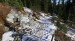
Compact ice and snow on the trail today.
|
Looking back at Yakima Peak (left) and Deadwood Peak as we gain elevation on the Naches Peak Loop Trail.
|
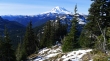
Continuing on the south portion of the Naches Peak Loop Trail... looking back at Mt. Rainier.
|
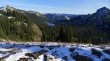
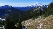
Our target (Tahtlum Peak) is on the far left of the photo... Dewey Lake (center) and Dewey Peak (far right)... with Nelson Ridge on the horizon.
|
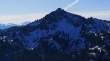
Denali Girl continues on the south portion of the Naches Peak Loop Trail... heading for Tahtlum Peak in the distance.
|
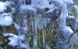
Serious ice in places on the trail.
|
Continuing on the south portion of the Naches Peak Loop Trail... looking back at Mt. Rainier... with Naches Peak on the far right.
|
After hiking 1.4 miles from the highway we have reached a junction with the Pacific Crest Trail that goes down to Dewey Lake... but we will stay left on the loop trail.
|
After hiking 100 steps from the junction with the PCT, we will leave the main trail and give back 100 feet of elevation as we work our way around a cliff band.
|
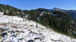
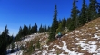
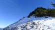
Almost ready to start gaining elevation on our way to the Tahtlum Peak summit.
|
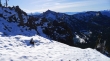
Looking back at Mt. Rainier as we work our way up to the west ridge of Tahtlum Peak... Dewey Lake and Seymour Peak in the left foreground.
|
A closeup of Dewey Peak... with Goat Rocks and Mt. Adams on the left.
|
Denali Girl on the west ridge of Tahtlum Peak.
|
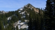
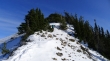
Looking up the west ridge of Tahtlum Peak.
|
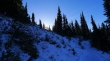
Denali Girl still ascending the west ridge of Tahtlum Peak... Sunrise Peaks are on the right skyline... with the Tatoosh Range on the left skyline.
|
Nearing the Tahtlum Peak summit... looking down on Dewey Lake and over to Dewey Peak... with Mt. Adams on the left skyline... and Mt. St. Helens and the Tatoosh Range on the right skyline.
|
Denali Girl is almost on the summit.
|
So close to the summit now.
|
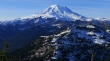
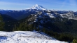
Mount Rainier from the Tahtlum Peak summit (6567').
|
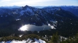
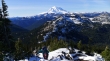
Dewey Lake, Dewey Peak and Seymour Peak from the Tahtlum Peak summit... Mt. Adams and Goat Rocks on the left skyline... with Mt. St. Helens and the Tatoosh Range on the right skyline.
|
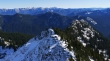
Looking east from Tahtlum Peak to Nelson Ridge on the skyline.
|
Denali Girl descending along the west ridge of Tahtlum Peak... as we follow our steps back to the car.
|
