Van Epps Peak - 7.23.2015
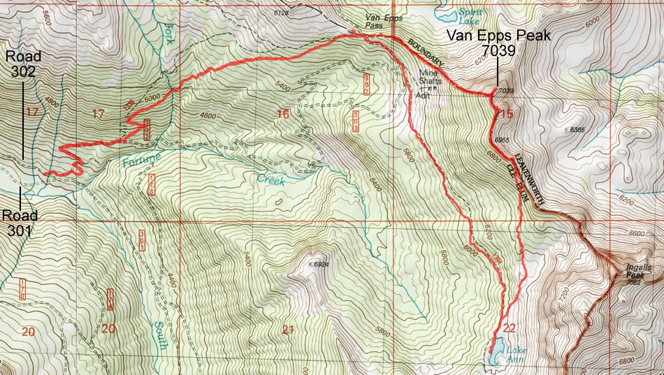
A photo of the GPS track for our trip to Van Epps Peak... 8.8 miles roundtrip, gaining 3322 feet of elevation.
|
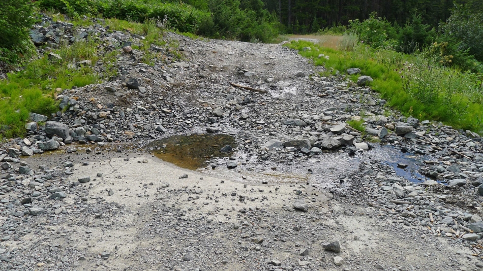
This is a photo of what you can expect on the 4WD Road 302... my Toyota Rav4 barely made it. Use the 'Trailhead Directions' link above this photo to find where to turn off of FS-4330 because Road 302 (aka Road 160) is not signed where it junctions off of FS-4330.
|
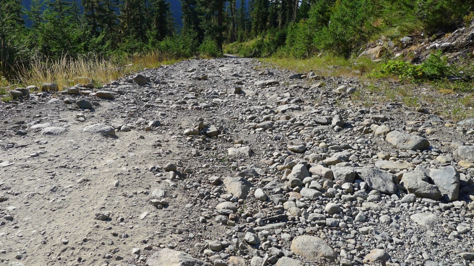
Another photo of 4WD Road 302. It is a jeep road. When we turned onto it off of FS-4330 we drove it for 2.6 miles and parked where it meets 4WD Road 301.
|

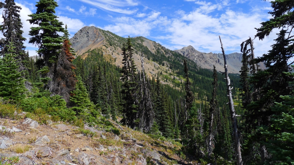
We parked (4040') where Roads 301 and 302 meet. Road 301 goes to the right and on up past Gallagher Lake between Esmeralda Peak and Hawkins Mountain. We will go uphill to the left on Road 302 in search of the N. Fork Fortune Creek Trail #1339.
|
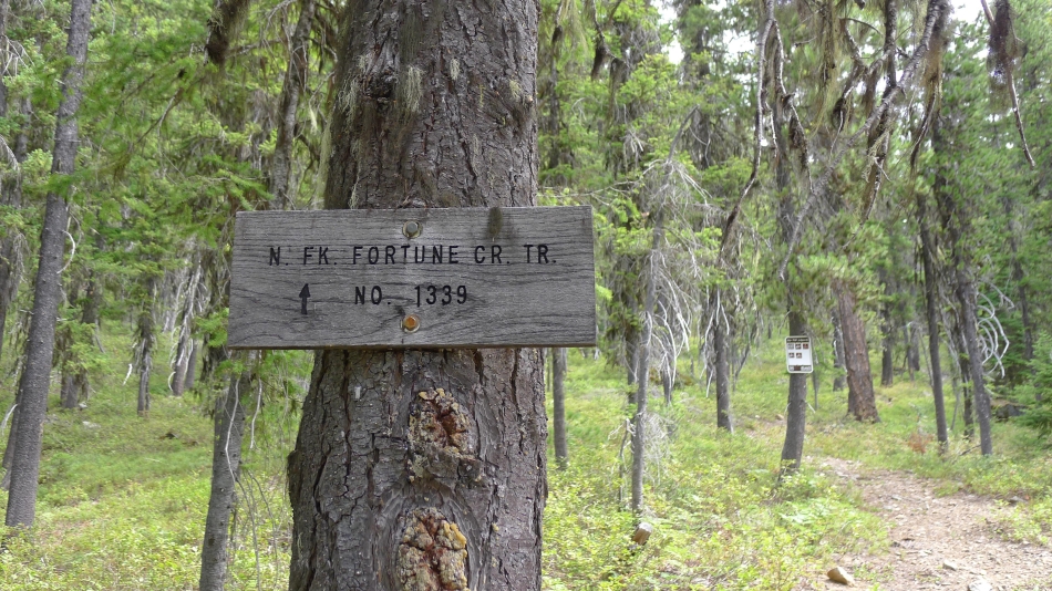
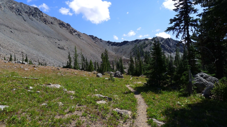
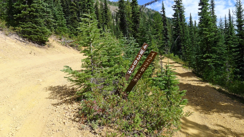
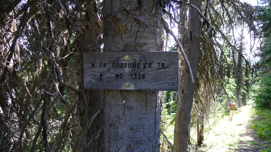
After walking Road 302 for a half-mile we have found the N. Fork Fortune Creek Trail.
|
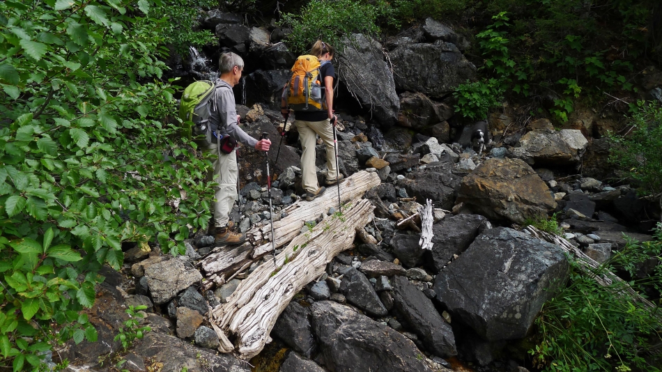
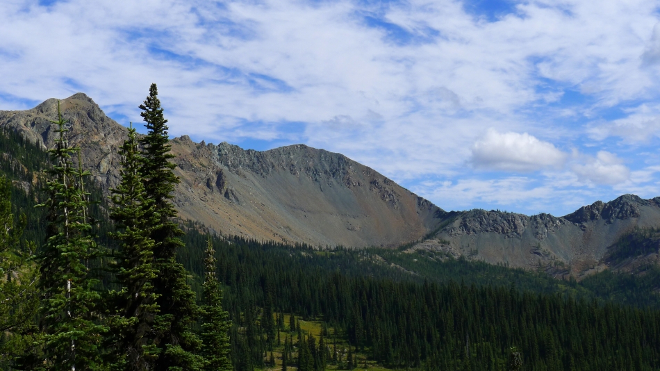
Even though it has been a very dry summer, there was plenty of water sources on all of the trails that we used.
|
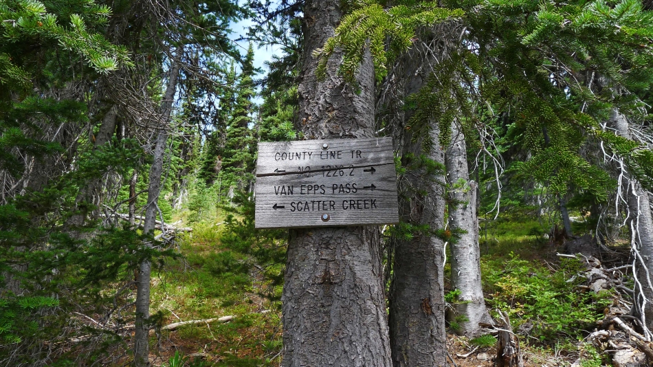
10 minutes short of reaching Van Epps Pass we meet (5840') the County Line Trail... we will follow it on over to Van Epps Pass.
|
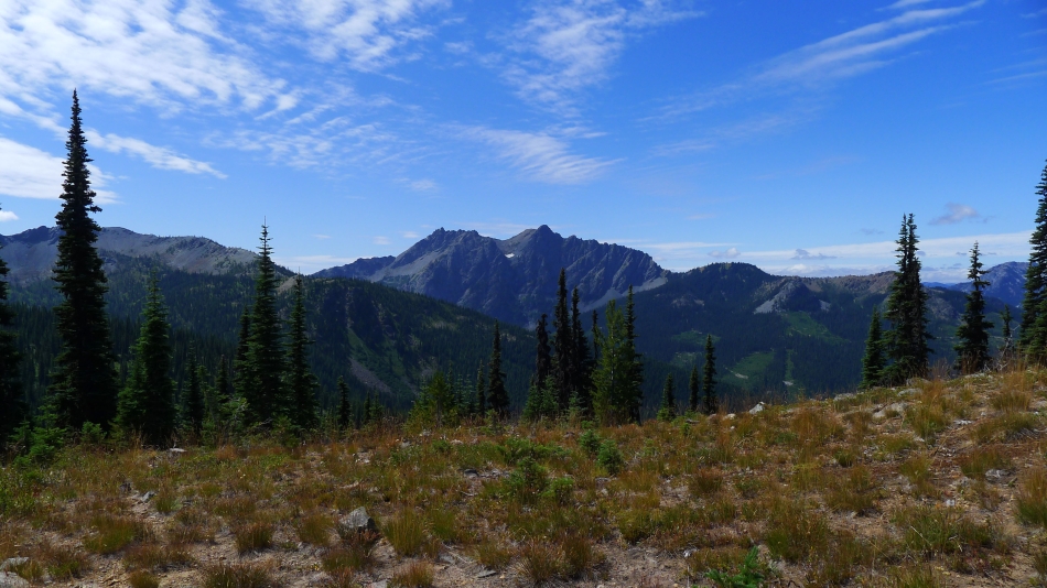
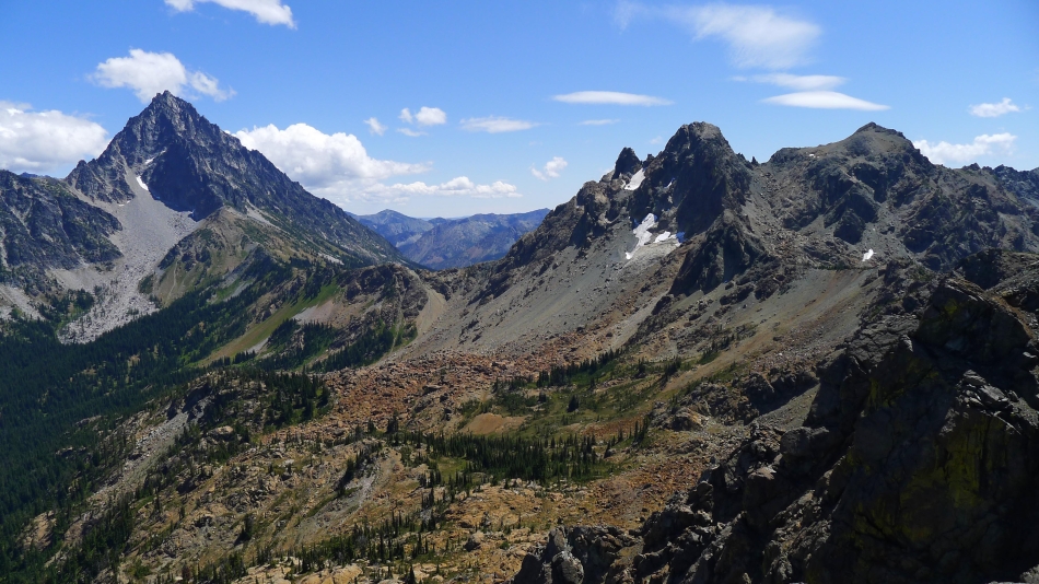
We have reached Van Epps Pass (5900')... the SE end of Scatter Peaks on the left... with Fish Eagle Peak and Harding Mountain in the center of the photo... with Grindstone Mountain in the distance on the far right.
|
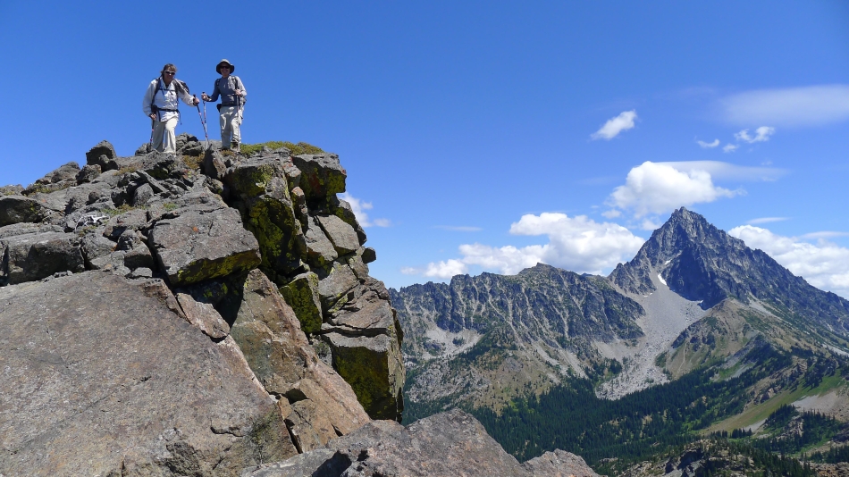
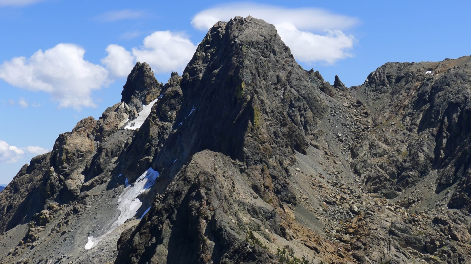
rodman and Snowdog at Van Epps Pass... with Van Epps Peak on the left... with South Ingalls and Fortune Peak on the right.
|
Hawkins Mountain from Van Epps Pass.
|
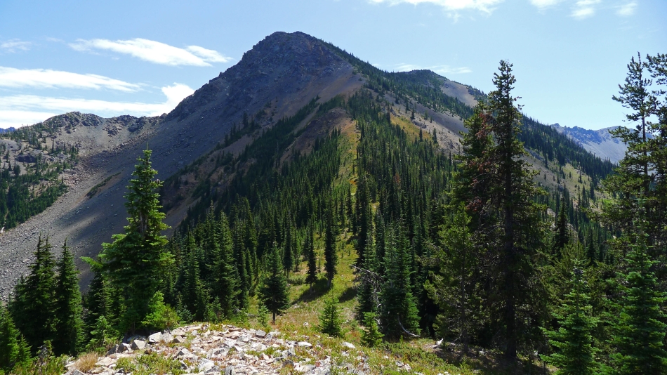
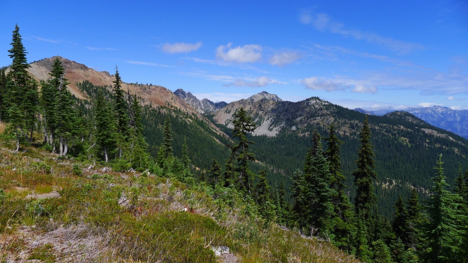
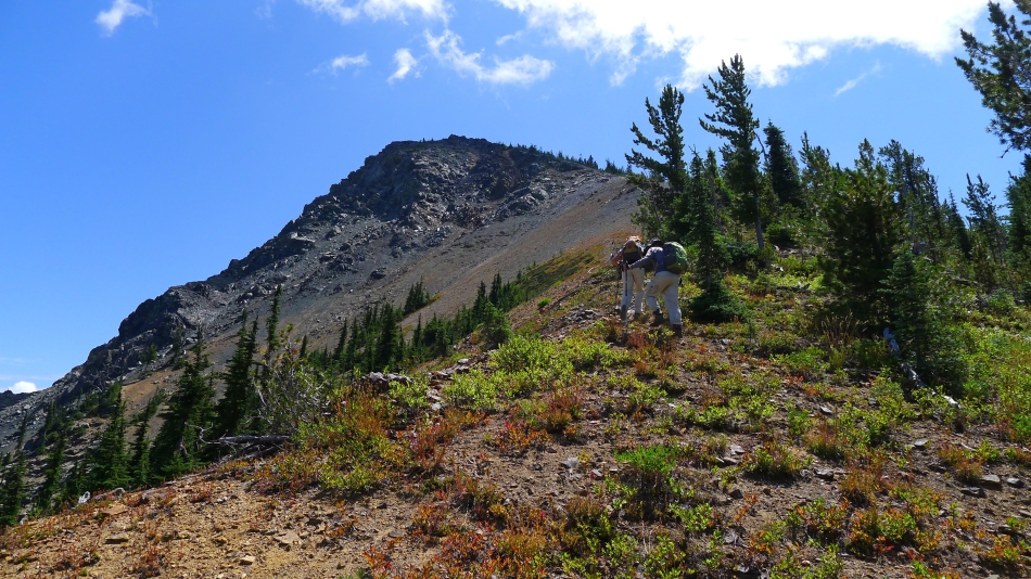
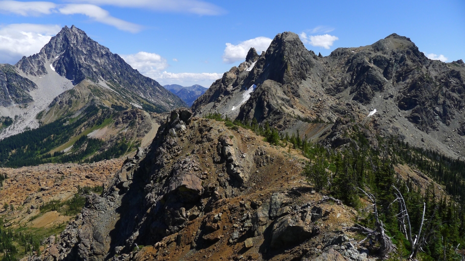
Looking at the west ridge of Van Epps Peak from Van Epps Pass... we will follow it to the summit.
|
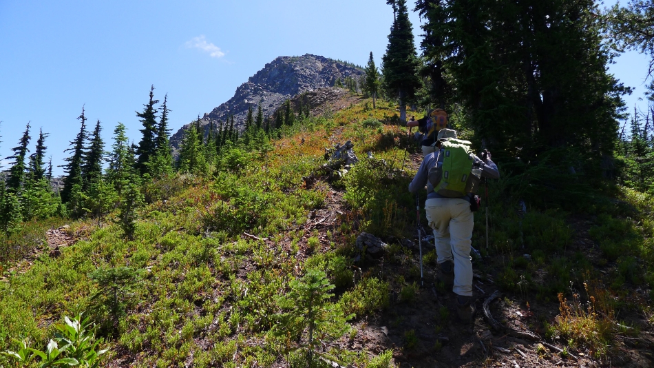
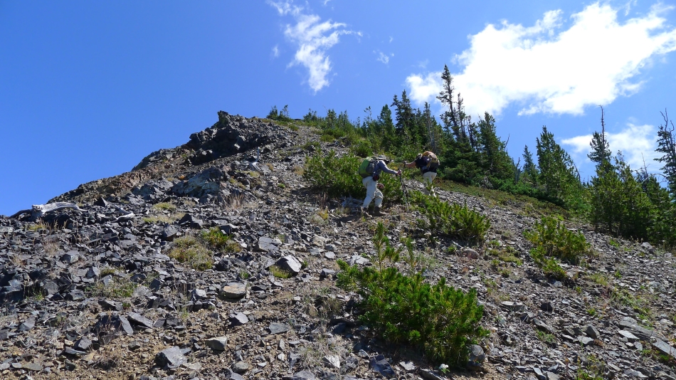
Heading up the west ridge of Van Epps Peak... following a good path now.
|
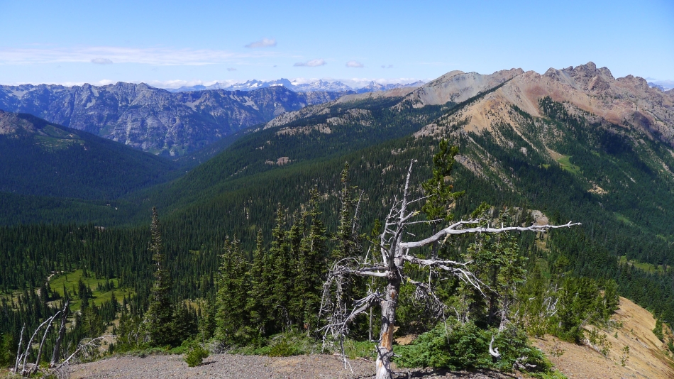
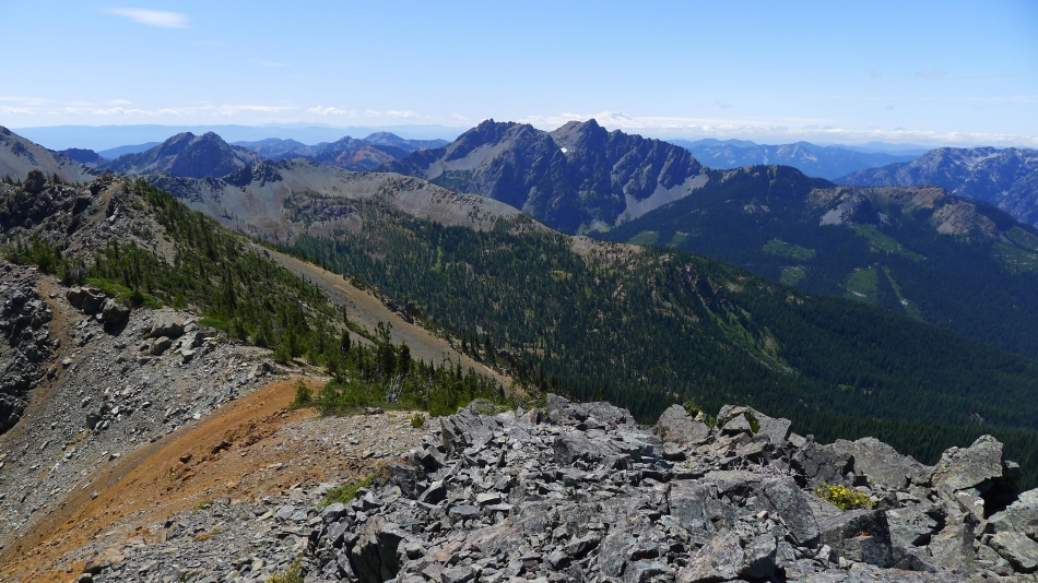
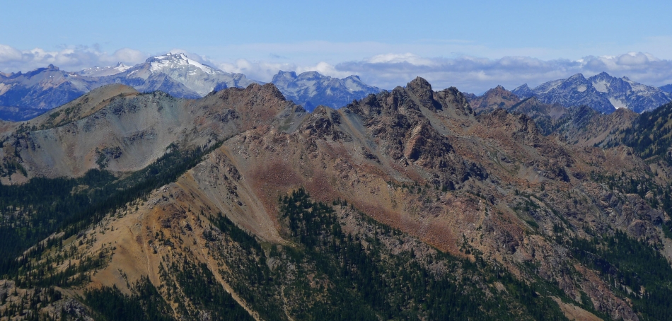
Gaining elevation on the west ridge of Van Epps Peak... looking back at Scatter Peaks (the orange colored ones)... with Fish Eagle and Harding in the center... Van Epps Pass on the far left.
|
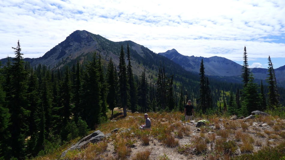
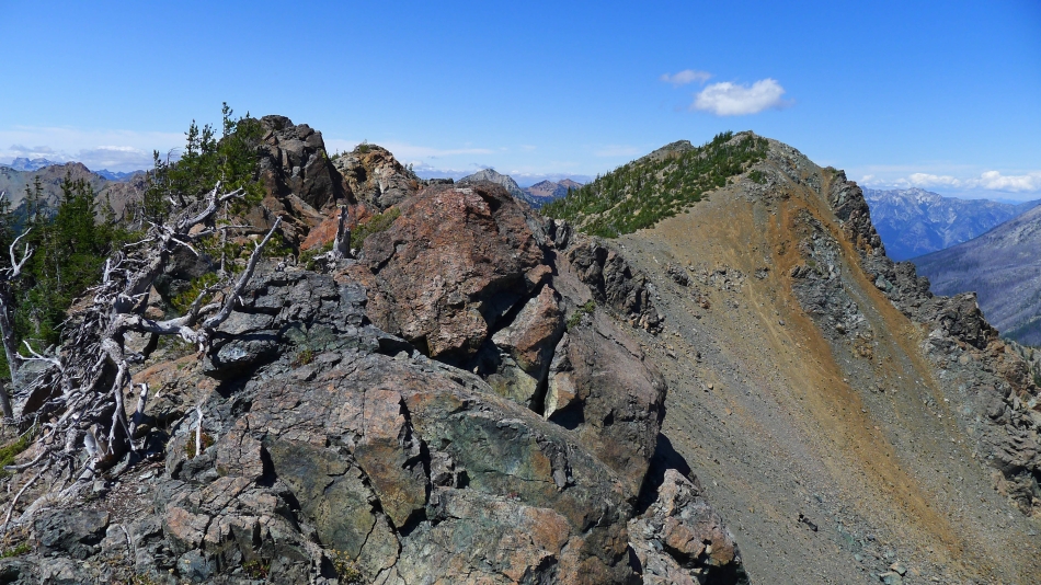
Still on a reasonable path on the way to the summit of Van Epps Peak.
|
Still ascending... with Hawkins Mountain on the left... Davis Peak and Goat Mountain on the right.
|
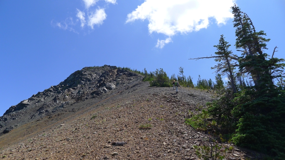
Now the path is faint... but it is pretty obvious where we need to go.
|
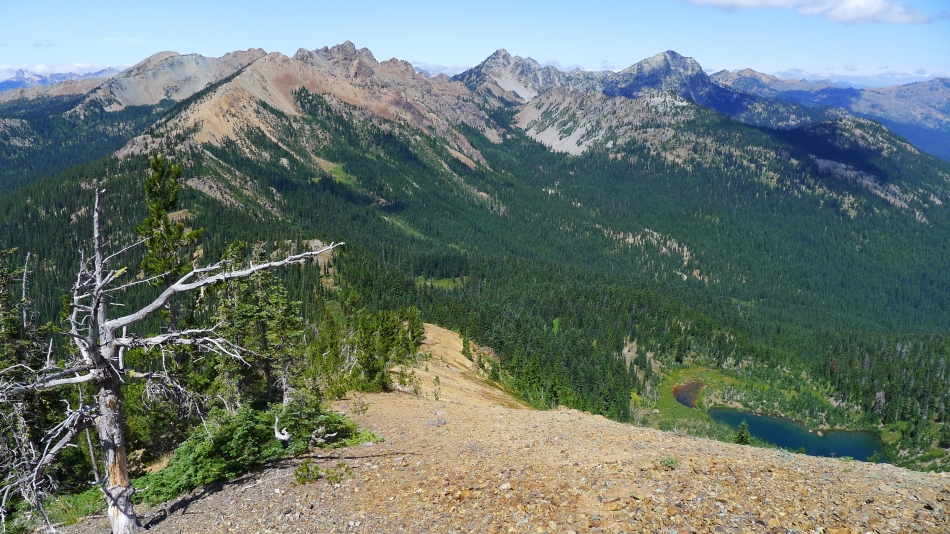
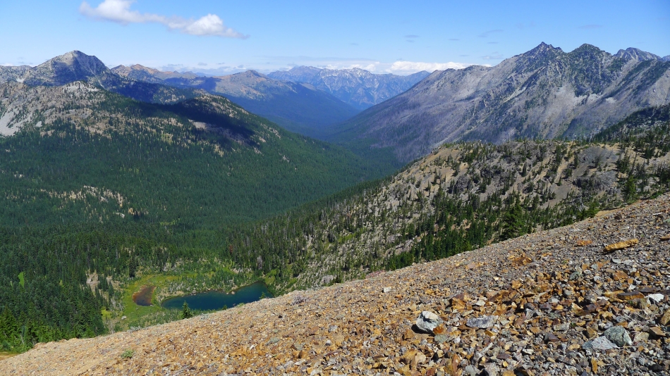
The views broaden with every step higher... looking down on Spirit Lake.
|
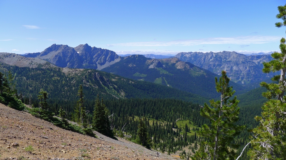
Scatter Peaks on the right... with Goat Mountain on the left... horizon peaks in the center of the photo include Chikamin, Lemah, Chimney Rock, Summit Chief and Bears Breast.
|
Harding Mountain on the left... Hi-Jack Peak and Eightmile Mountain on the far right... looking up valley to Grindstone Mountain.
|
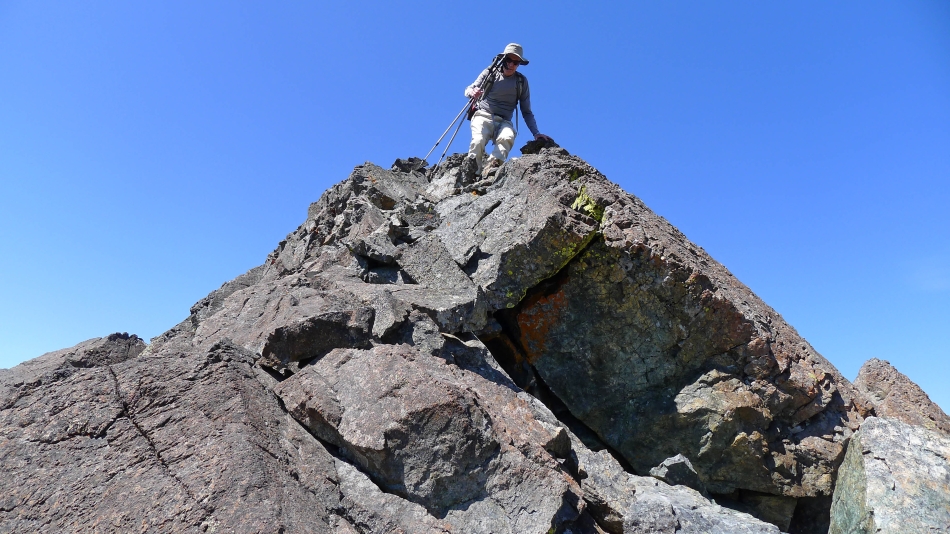
Almost on the summit.
|
Snowdog and Izzy reach the summit (7039') of Van Epps Peak... Hi-Jack, Eightmile and Cashmere are in the center of the photo... with Jack Ridge on the right... the Chiwaukum Mountains and Grindstone on the left.
|
Mount Stuart (left) and Ingalls Peak from Van Epps Peak... looking across Stuart Pass to Navaho Peak, Bills Peak and Earl Peak.
|
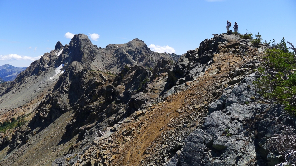
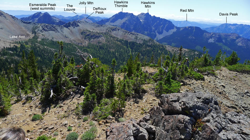
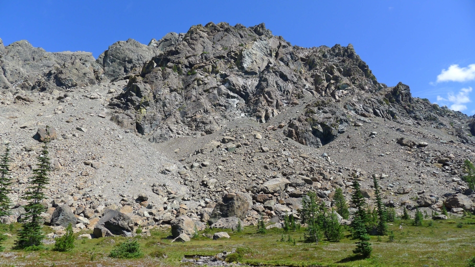
The twin west summits of Esmeralda Peaks on the left... Hawkins Mountain in the center... Davis Peak on the far right.
|
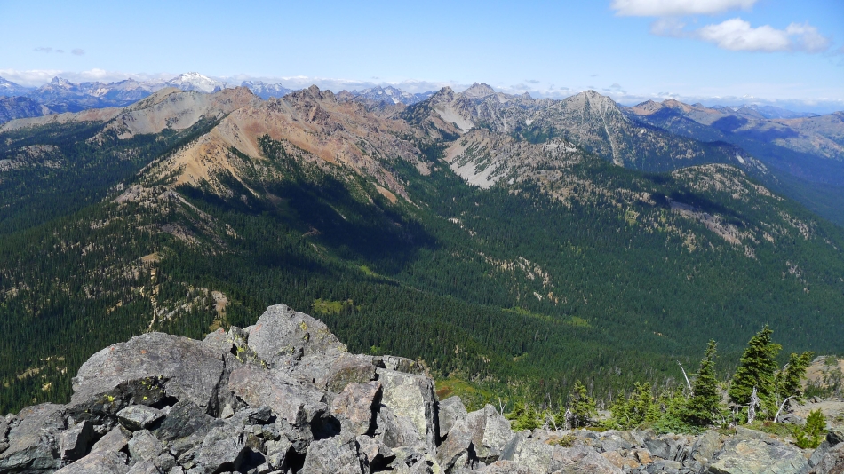
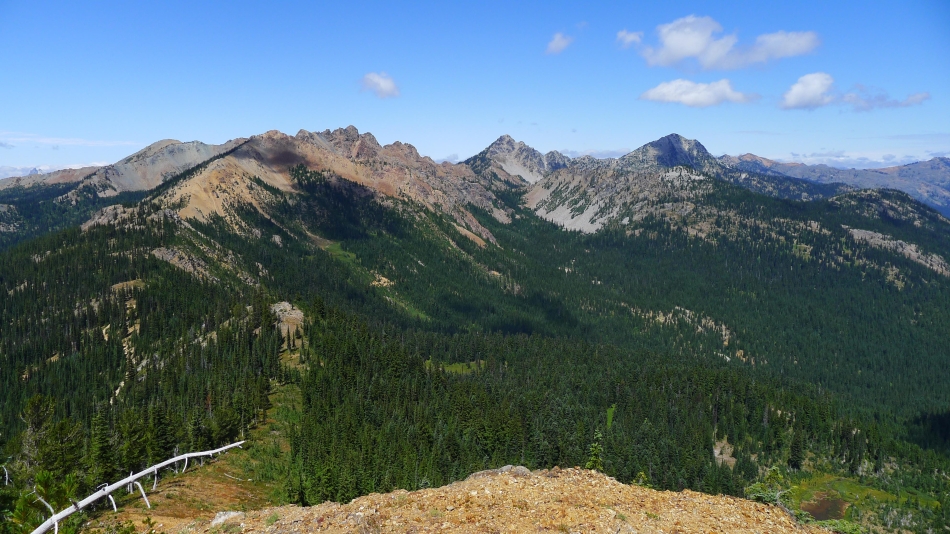
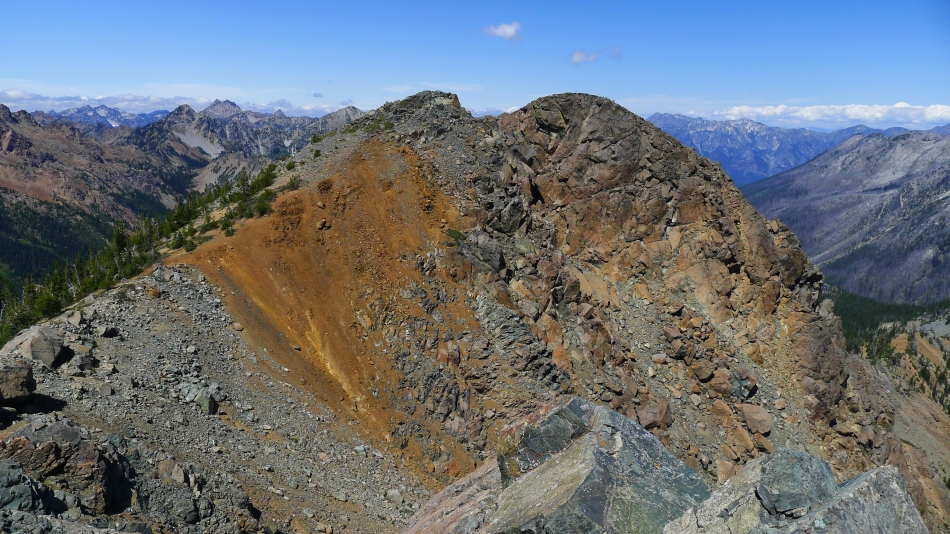
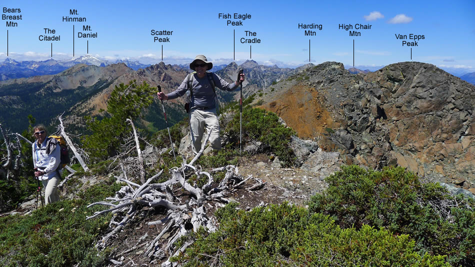
Earth tones... Scatter Peaks in the left foreground... Granite Mountain, Fish Eagle, The Cradle and Harding in the center... Highchair Mountain and Sixtysix Hundred Ridge on the right... Bears Breast, Hinman and Daniel on the left.
|
Chikamin Peak on the extreme left to Granite Mountain on the extreme right... with Bears Breast, The Citadel, Hinman and Daniel on the horizon in the center of the photo.
|
|
Looking into the heart of the Alpine Lakes Wilderness.
|
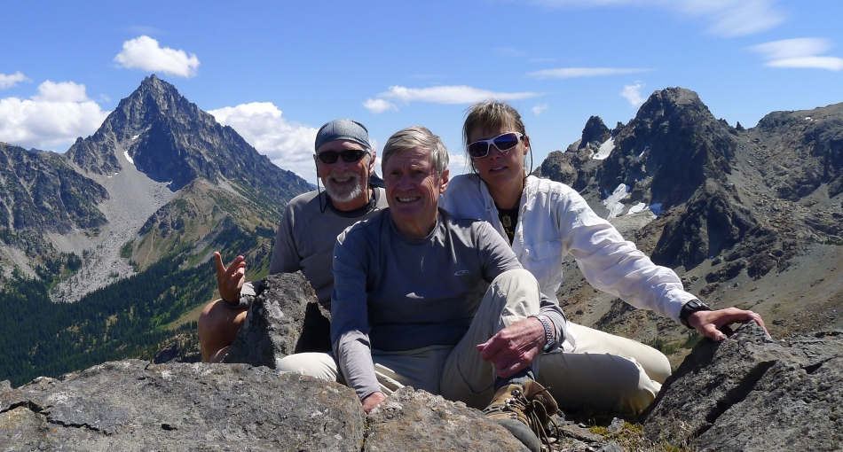
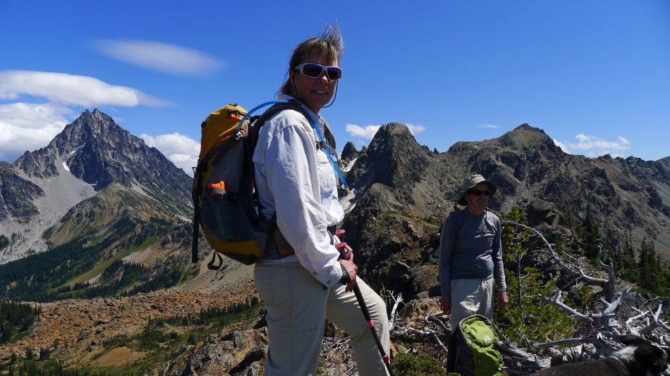
Group shot from the summit of Van Epps Peak... ragman, rodman and Snowdog.
|
Scatter Peaks in the foreground... Mt. Daniel dominates on the left skyline... Granite Mountain dominates on the far right.
|
Snowdog and rodman leave the Van Epps summit... with Mt. Stuart on the right.
|
We are going to follow the ridge over toward Ingalls Peak.
|
Looking back at Van Epps Peak as we continue along the ridge toward Ingalls Peak.
|
On the ridge between Van Epps Peak and Ingalls Peak.
|
Izzy, Snowdog and rodman on one of several high points on the ridge between Van Epps Peak and Ingalls Peak.
|
Snowdog sports a punk hairdo on the ridge between Van Epps Peak and Ingalls Peak.
|
Still on the ridge... looking back at part of our route from Van Epps Peak.
|
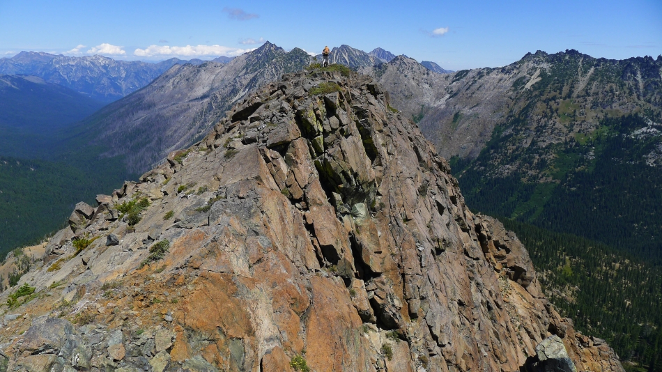
Still on the ridge... getting closer to Ingalls Peak.
|
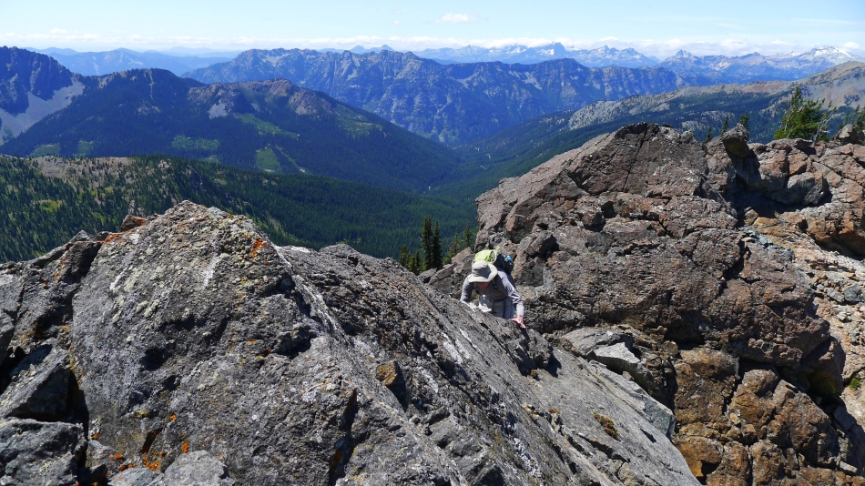
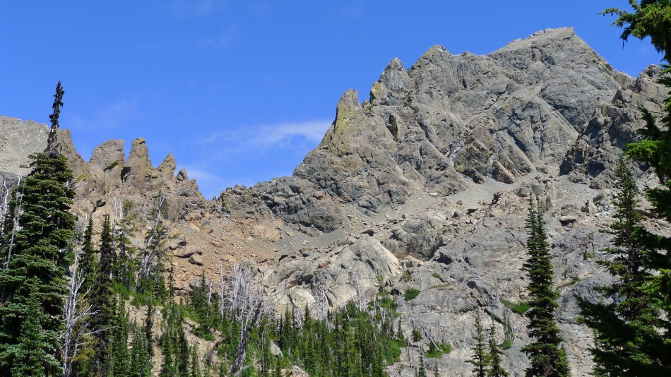
This sporty section along the ridge was optional... could just as easily gone around it.
|
If you choose to go up a sporty section, you have to also find a way down it.
|
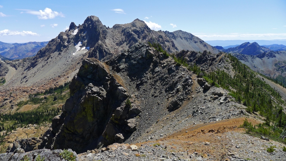
The main summit of Ingalls Peak is in the center of the photo... East Ingalls is on the left.
|
We are going to leave the ridge and head cross-country for Lake Ann in the far left of the photo.
|
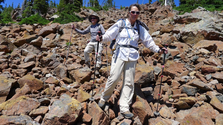
Leaving the ridge and working the boulders... not the most fun part of the trip.
|
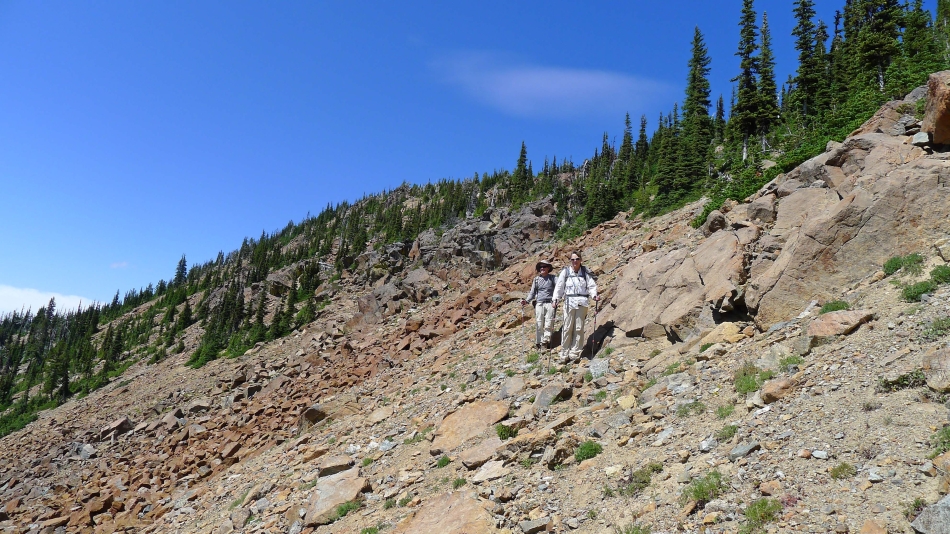
Off of the boulders and on loose scree... I liked the boulders better.
|
North Ingalls on the right.
|
A pretty meadow on the west side of South Ingalls.
|
We found the County Line Trail (it comes over from Van Epps Pass) just before we got to Lake Ann.
|
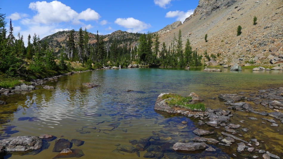
Beautiful Lake Ann... named for my sister.
|

Snowdog soaks her little puppies... while her big doggie swims for the frisbee.
|
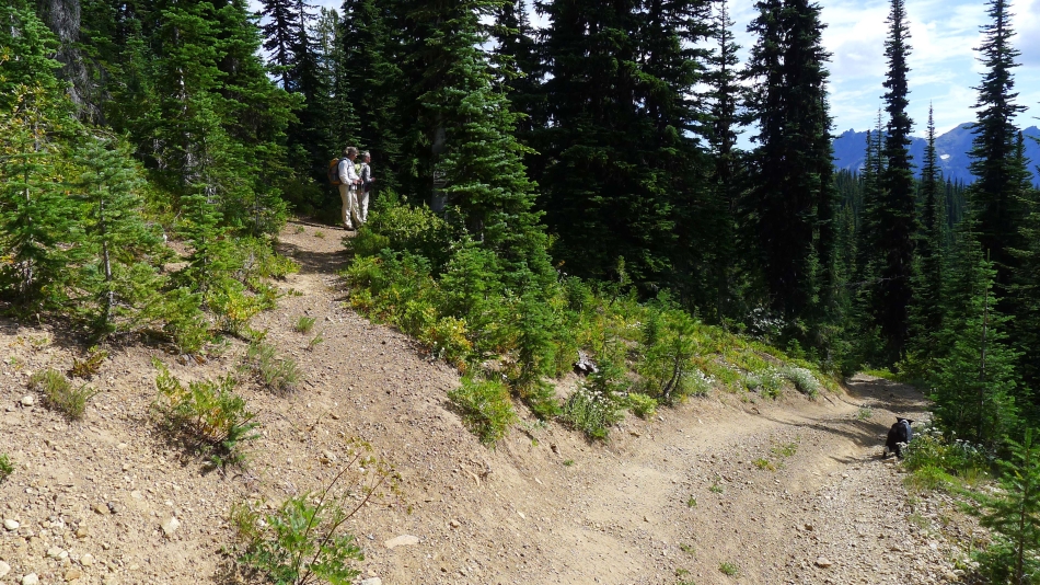
We have hiked on the County Line Trail (#1226.2) ~1.5 miles from Lake Ann... here it is intersecting with Road 303... but don't go downhill here... Road 303 continues up here for a very short distance to intersect with Road 302... which will take us on up to Van Epps Pass.
|
We have been hiking uphill for a short time here... coming up on Road 303 (the one on the right)... which the County Line Trail (#1226.2) led us to from Lake Ann... the unsigned road on the left probably goes up to Van Epps Mine.
|
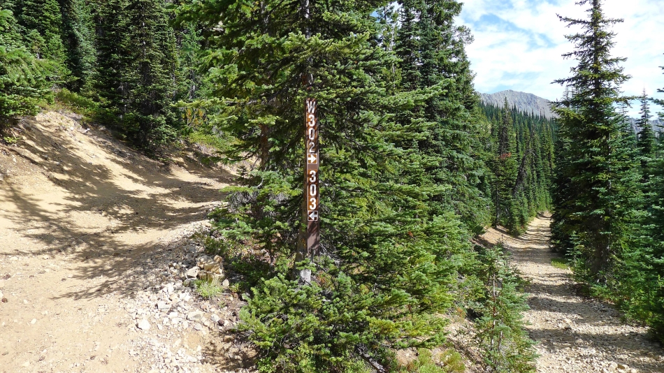
The junction of roads 303 and 302... we have come from 303 on the left... and could take 302 down to where we parked at the beginning of the day... but we will continue up a little further on 302 to Van Epps Pass... where we will find the County Line Trail.
|
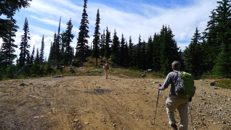
We have reached Van Epps Pass... and Snowdog heads for the Trail sign.
|
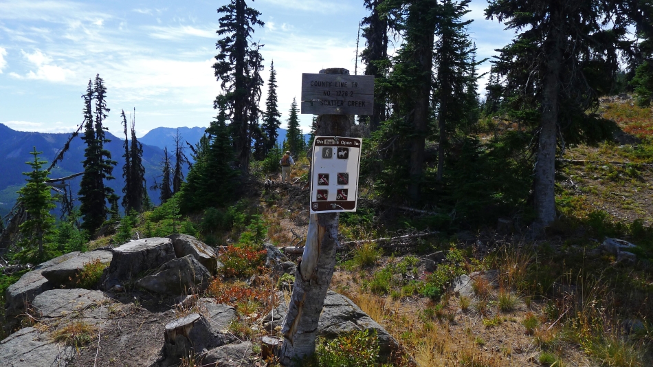
We will make the 5 minute hike on the County Line Trail and connect with the N. Fork Fortune Creek Trail that will get us back down to Road 302 and our car.
|
Van Epps Peak (left) and South Ingalls Peak from Van Epps Pass.
|
South Ingalls (far left) and Fortune Peak (center) from Van Epps Pass.
|
We will take the N. Fork Fortune Creek Trail down to Road 302... then walk the road a half-mile to our car.
|
