Miller Peak and Iron Bear - 9.18.2015
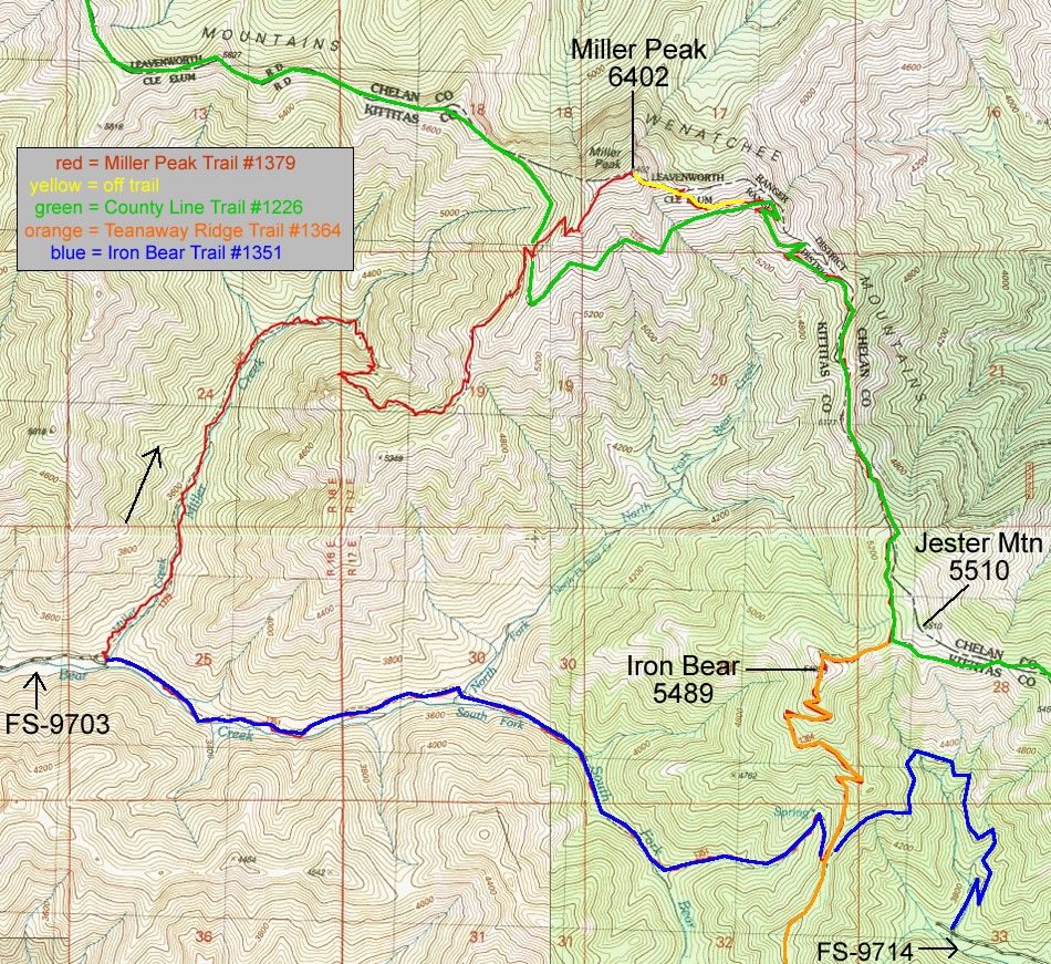
A photo of the GPS track for our loop trip that used Miller Peak Trail #1379, a short section of off-trail travel, portions of the County Line Trail #1226, Iron Bear Trail #1351 and Teanaway Ridge Trail #1364... 12.8 miles of hiking that gained 3968 feet of elevation.
|
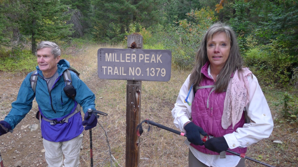
Parking at 3200 feet... we started out on Miller Peak Trail #1379 which is located at the end of FS-9703... the parking area is shared with the trailhead for the western end of Iron Bear Trail #1351.
|
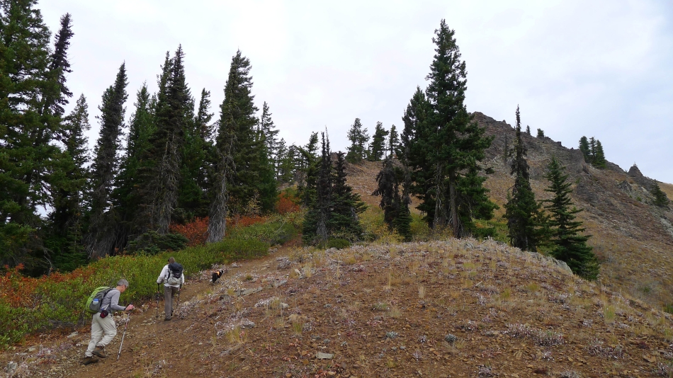
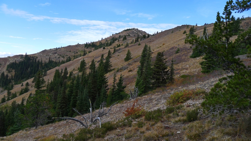
The Miller Peak Trail follows along Miller Creek for 1.5 miles... then the terrain steepens for the next mile up to Miller's SW ridge (5200') which is shown in this photo.
|
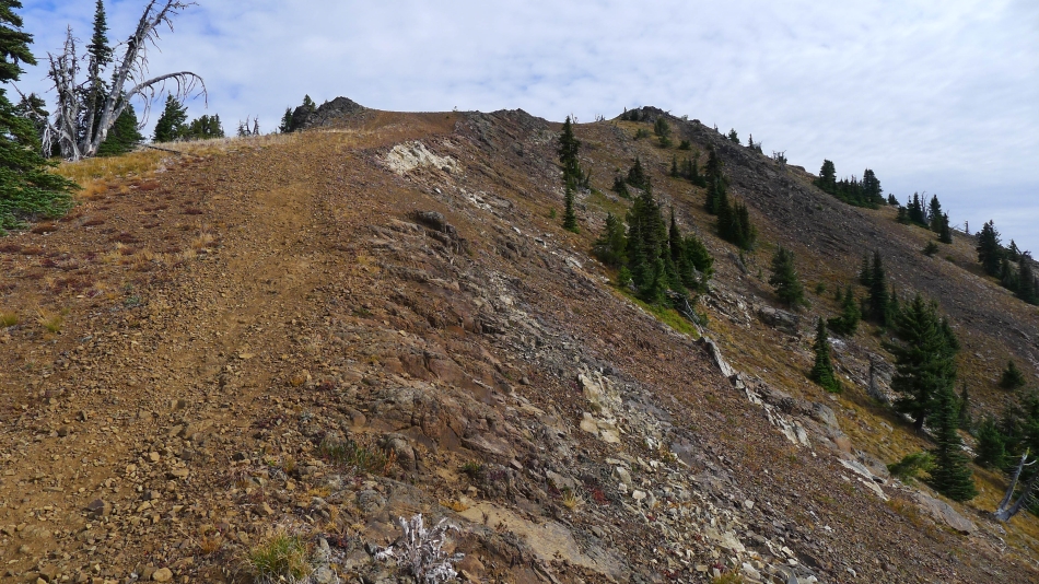
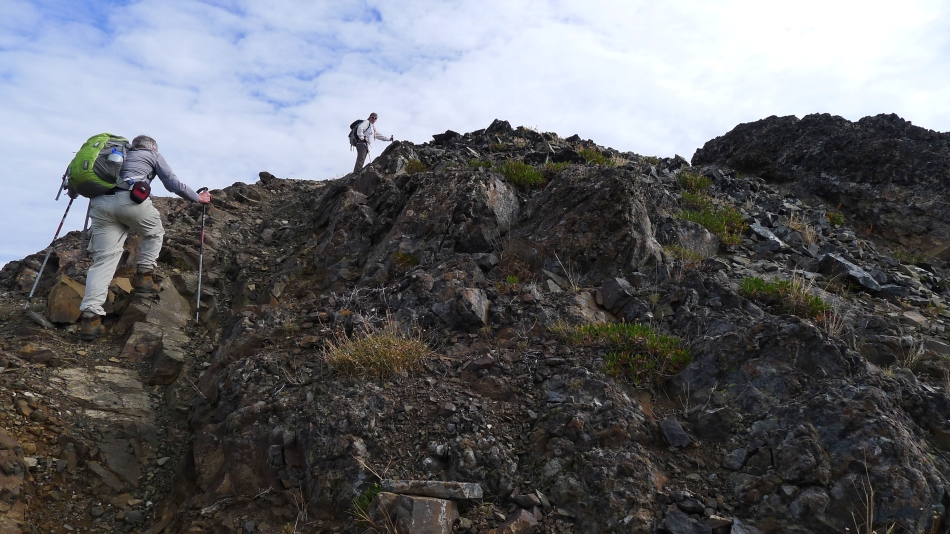
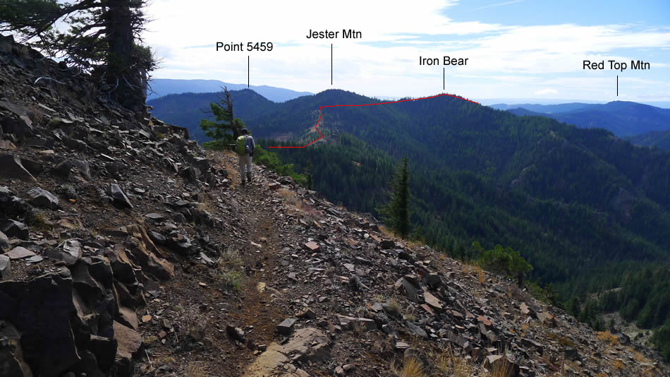
The next mile or so of the Miller Peak Trail follows just below the west side of Miller's SW ridge before returning to the SW ridge for the last half-mile to the summit, which is on the right in this photo.
|
rodman and Snowdog near the Miller Peak summit.
|
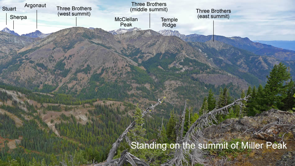
From the Miller Peak summit (6402') we are looking at Three Brothers... with the Stuart Range on the horizon.
|
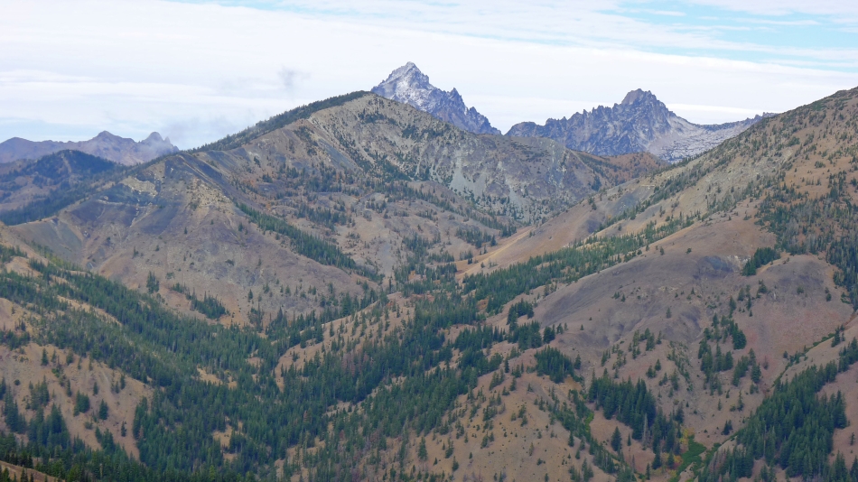
A close up of Navaho Peak in the foreground... in front of Mt. Stuart, Sherpa Peak and Argonaut Peak... with Fortune Peak and the three summits of Ingalls Peak on the far left horizon... the shoulder of the west summit of Three Brothers is in the right foreground.
|
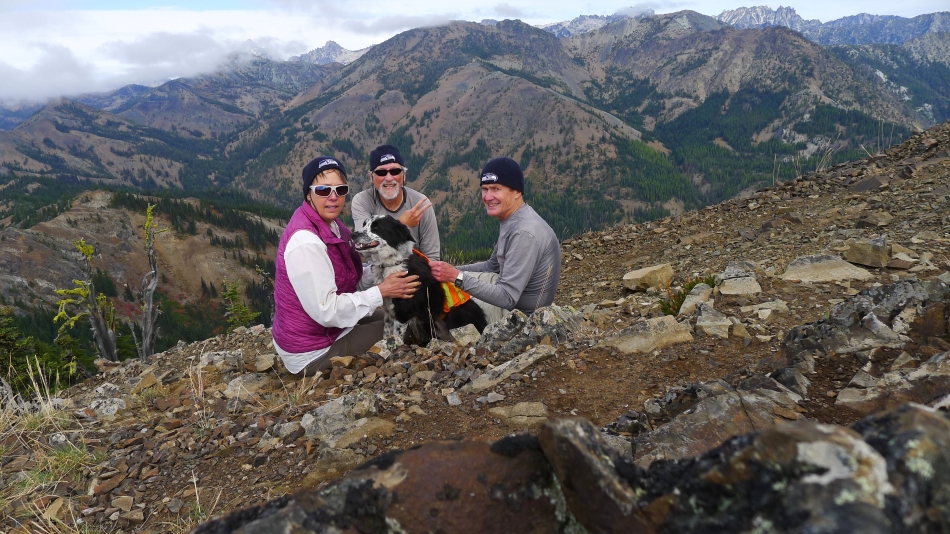
Group shot on the Miller Peak summit... Snowdog, ragman, Izzy and rodman.
|
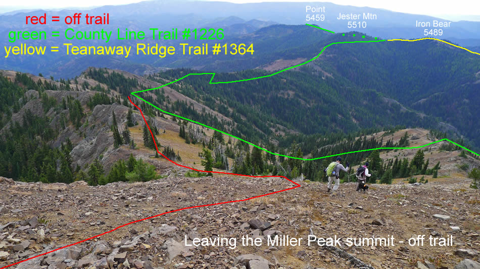
We have left the Miller Peak summit and heading down to join the County Line Trail.
|
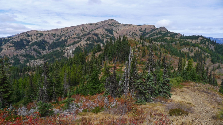
Looking back up at Miller Peak as we continue along the County Line Trail on our way over to Iron Bear.
|
Continuing on the County Line Trail... working our way over to Iron Bear.
|
Looking back at Miller Peak from the saddle (~5000') between Miller Peak and Jester Mountain.
|
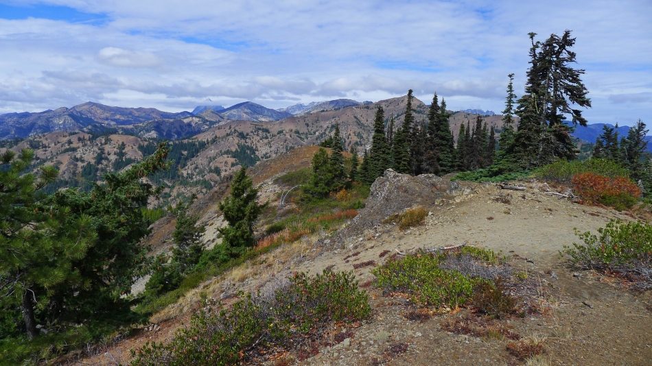
Looking north from the Iron Bear summit (5489') to Earl Peak (far left), Navaho Peak, the Stuart Range, the west summit of Three Brothers and Miller Peak.
|
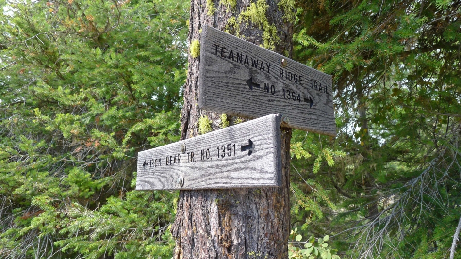
From the Iron Bear summit we used the Teanaway Ridge Trail to reach this junction with the Iron Bear Trail... now we will head west on the Iron Bear Trail and follow it back to our car.
|
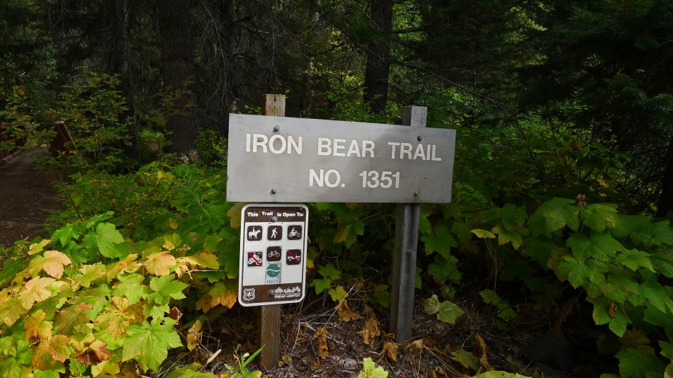
Back at the shared parking area for Miller Peak Trail #1379 and the west end of Iron Bear Trail #1351... as we close our loop hike.
|
