Eagle Crags - 4.10.2016
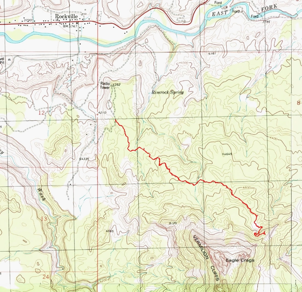
A photo of the GPS track for our hike to Eagle Crags... 5.3 miles roundtrip, gaining 1066 feet of elevation.
|
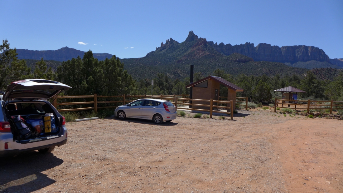
Turn onto Bridge Road in the town of Rockville... the last mile to the trailhead (4367') is on a pretty rugged road... high clearance on your vehicle is a good thing... here we are looking at Eagle Crags in the distance.
|
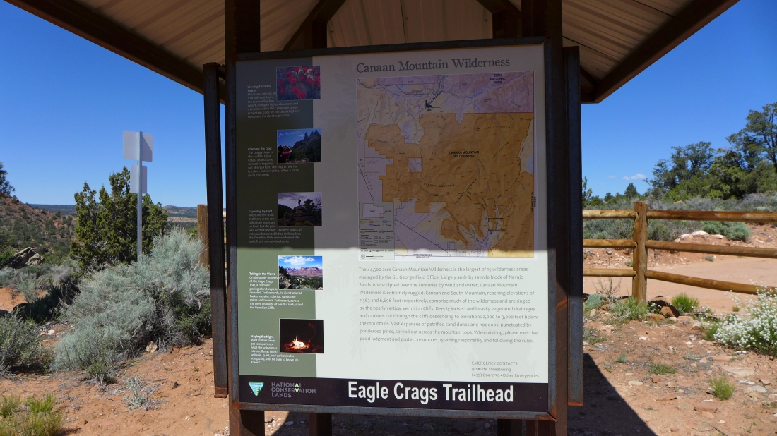
Eagle Crags are in the Canaan Mountain Wilderness.
|
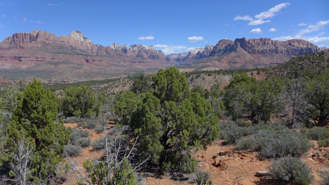
Gaining elevation on the trail to Eagle Crags and looking at Zion Canyon in the center of the photo... Mt. Kinesava and The West Temple stand out on the left... Bridge Mountain, The Watchman and Johnson Mountain stand out on the right.
|
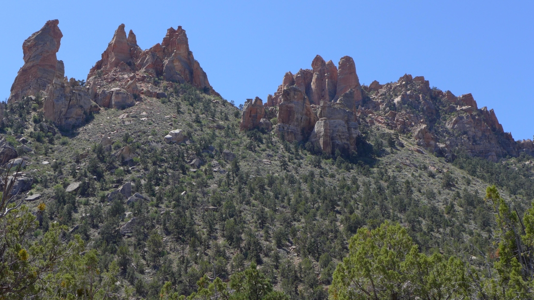
Eagle Crags from our high point of 5151 feet.
|
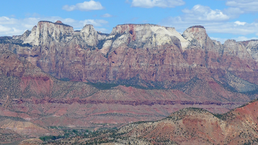
A closeup of 'The Towers of the Virgin' in Zion National Park.
|
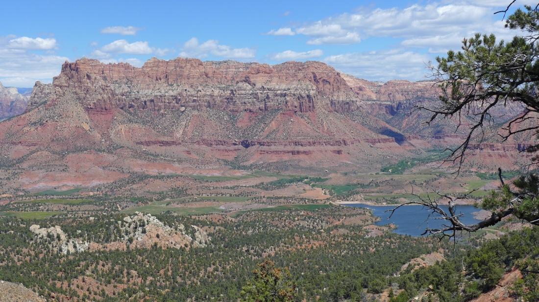
Johnson Mountain and Trees Ranch Reservoir from our high point (5151').
|
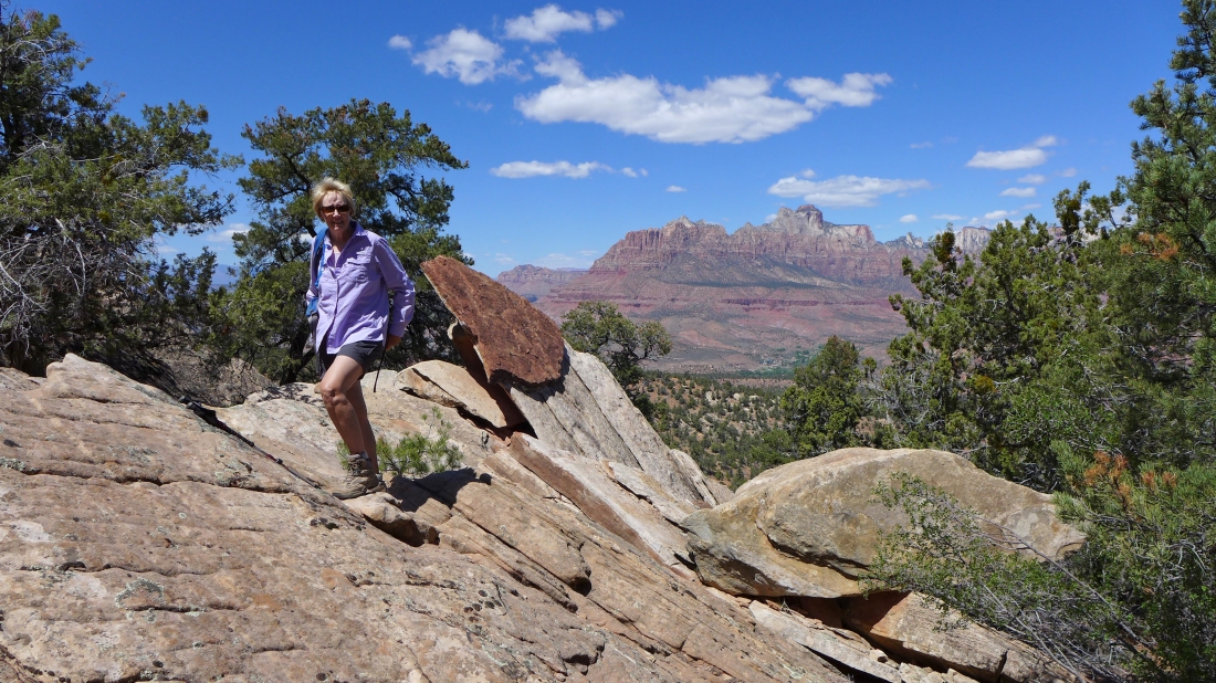
Denali Girl near our high point... Mt. Kinesava and The West Temple in the distance.
|
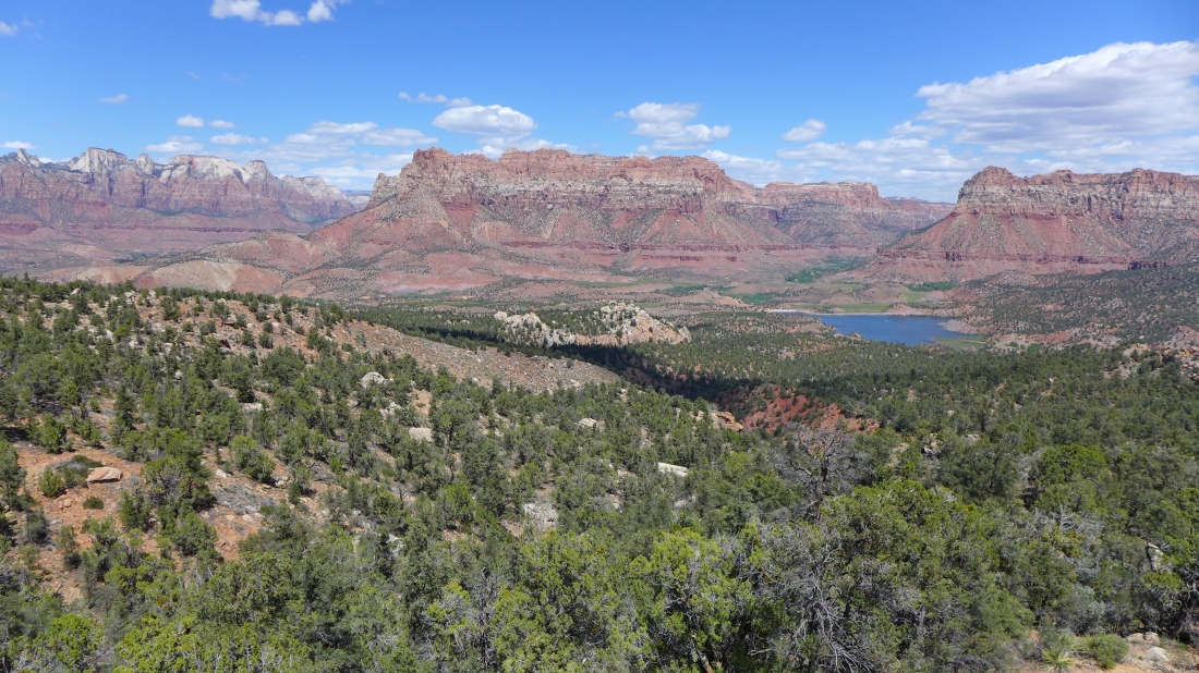
'Towers of the Virgin' on the left... Johnson Mountain in the center... Shunesburg Mountain on the right above Trees Ranch Reservoir.
|
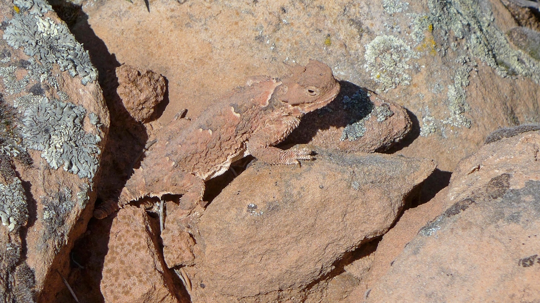
A well disguised horned lizard... almost back to the car.
|
