Van Epps Peak - 6.28.2016
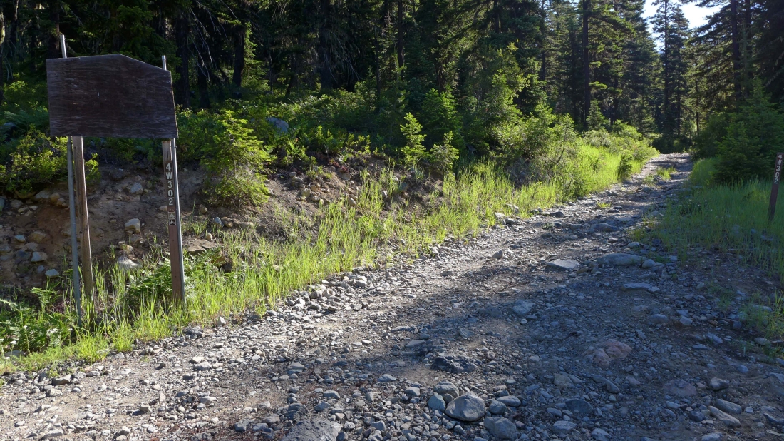
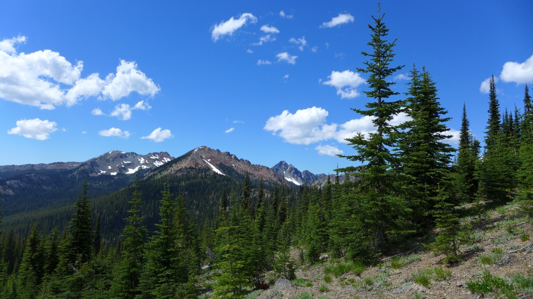
After driving FS-4330 for 7.6 miles and Road 302 for 2.5 miles we parked here at the junction with Road 301 which is out of frame to the right. We will hike the road for a half-mile and connect with N. Fortune Creek Trail #1339.
|

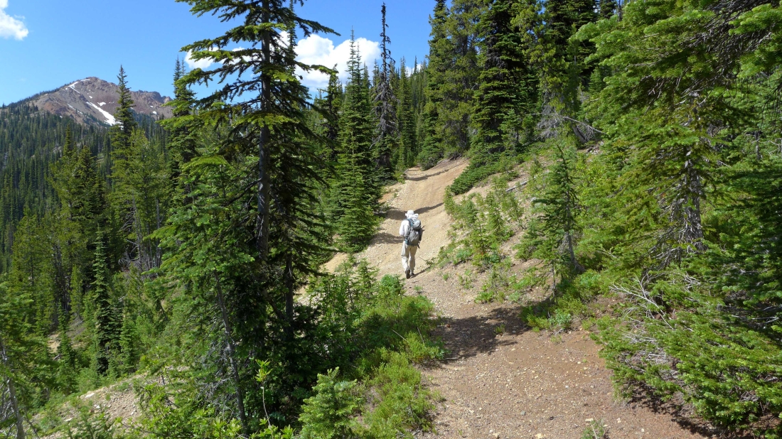
After walking Road 302 for a half-mile we have arrived at the junction with the N. Fortune Creek Trail.
|
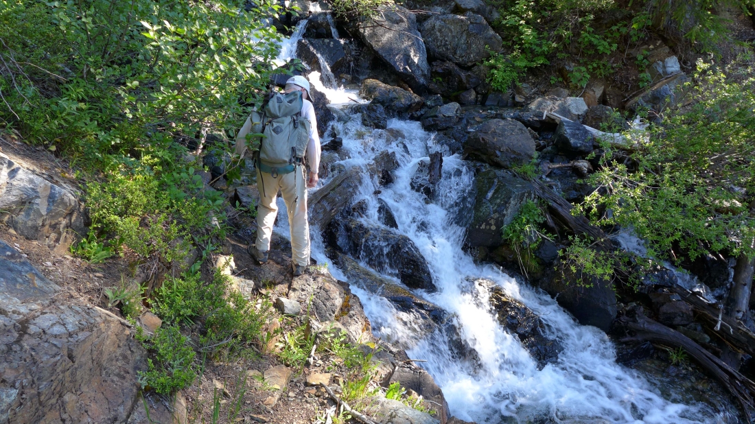
A challenging crossing of the North Fork of Fortune Creek.
|

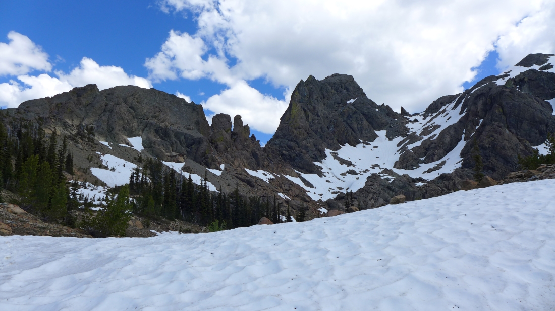
The N. Fortune Creek Trail gains 1400 feet of elevation in less than 2 miles where it connects with the County Line Trail... we will follow the County Line Trail a very short distance over to Van Epps Pass.
|
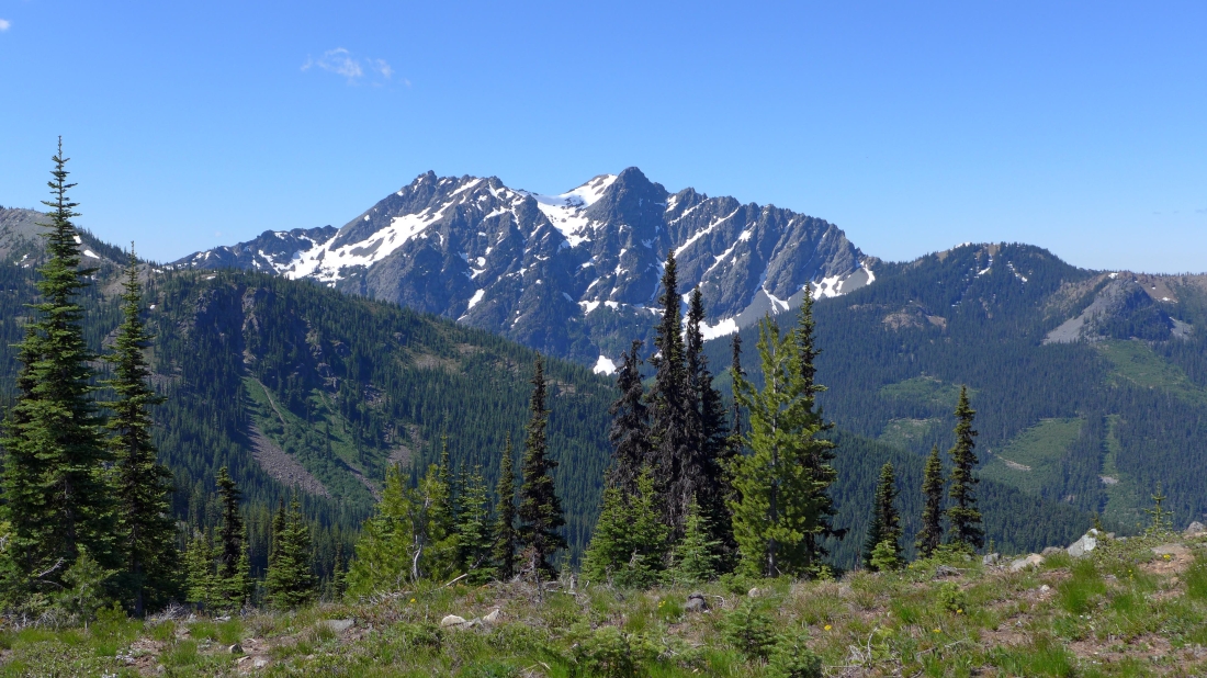
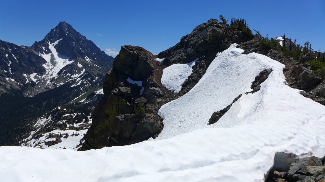
Hawkins Mountain from Van Epps Pass.
|
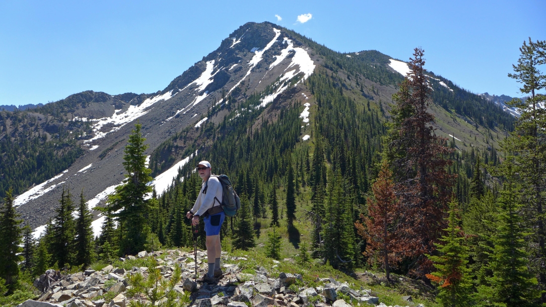
Just above Van Epps Pass now... with Van Epps Peak in the distance... just follow the ridge up.
|
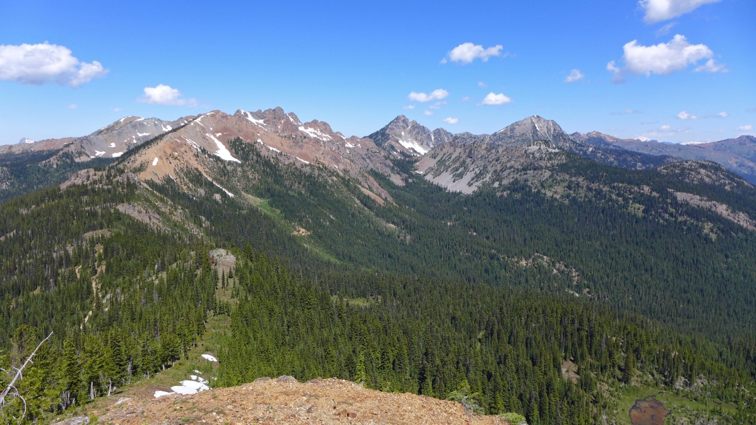
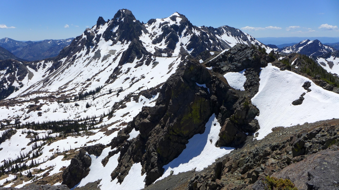
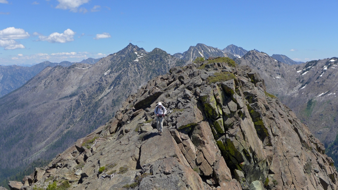
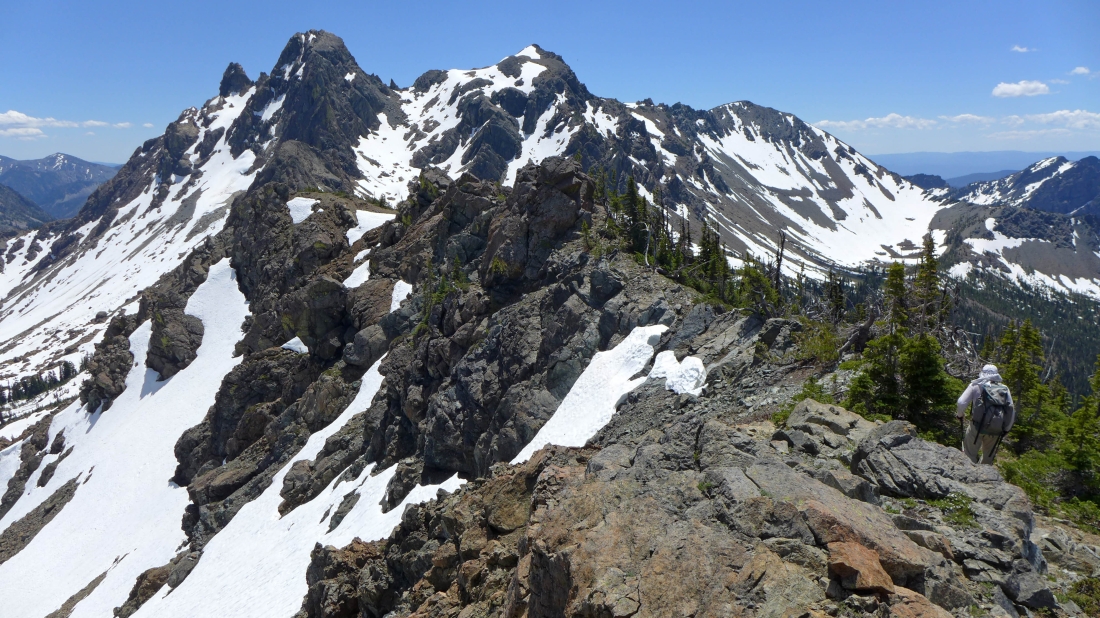
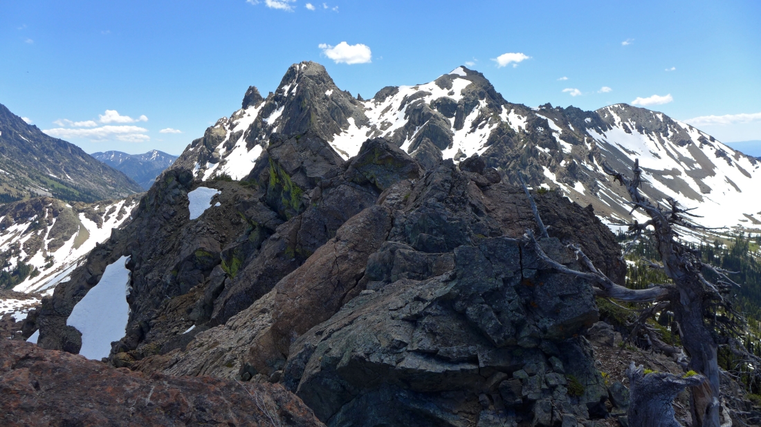
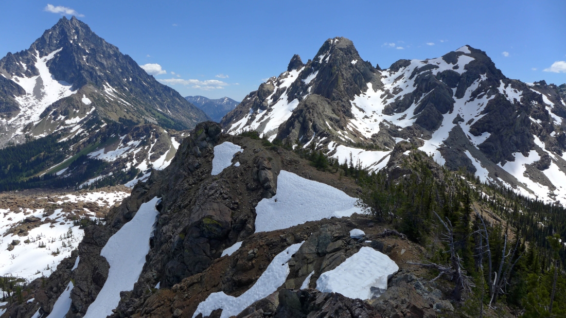
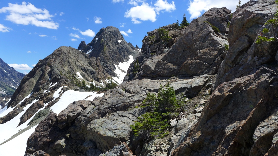
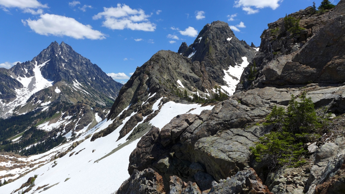
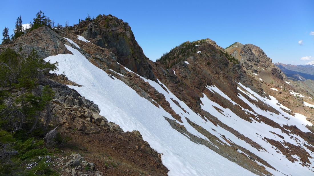
Slogging our way up the NW ridge of Van Epps Peak... Scatter Peaks, Fish Eagle Peak and Harding Mountain are in the center of the photo... in the lower left corner of the photo Road 302 reaches Van Epps Pass.
|
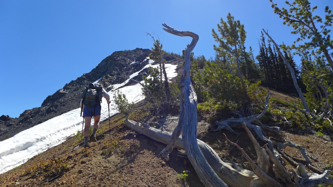
Gaining elevation on the NW ridge of Van Epps Peak.
|
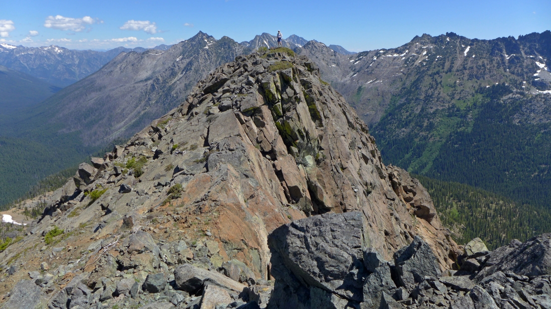
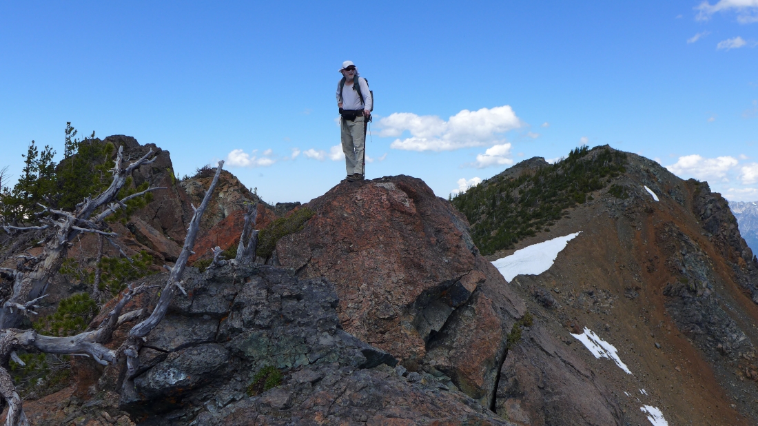
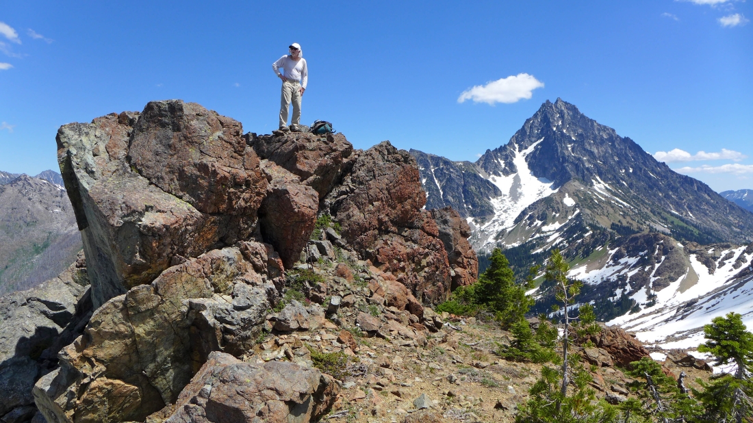
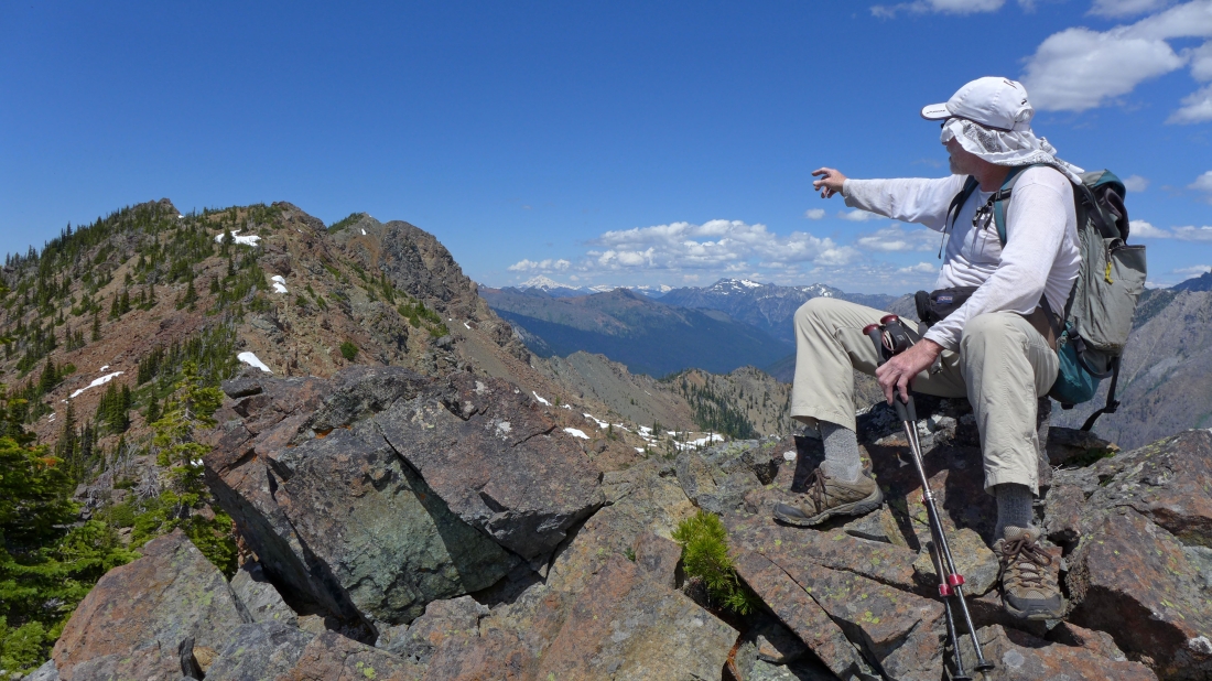
rocman stands on the summit (7039') of Van Epps Peak... in between Eightmile Mountain and Cashmere Mountain in the distance... Jack Ridge runs from the right side of the photo to the center... Grindstone Mountain is at the end of the valley on the left.
|
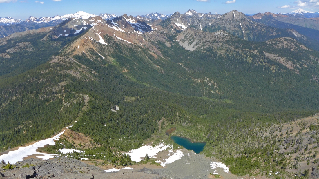
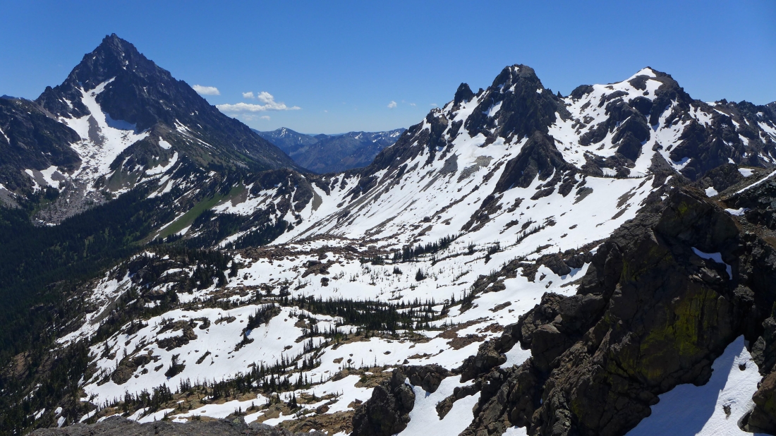
Looking into the heart of the Alpine Lakes Wilderness from the summit of Van Epps Peak... Spirit Lake is below... Scatter Peaks, Fish Eagle and Harding are in the foreground... Mt. Daniel dominates on the left horizon... while Glacier Peak dominates on the far right horizon.
|
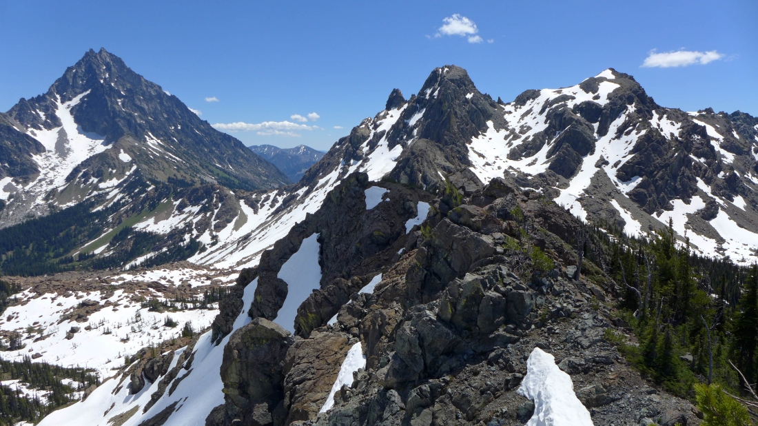
The three summits of Ingalls Peak and Fortune Peak in the center of the photo... the west summits of Esmeralda Peaks on the far right... on the left we are looking across Stuart Pass to Navaho Peak and Earl Peak.
|
Mt. Stuart (left) and Ingalls Peak on the right... Stuart Pass in the center... with Navaho Peak and Earl Peak beyond the pass.
|
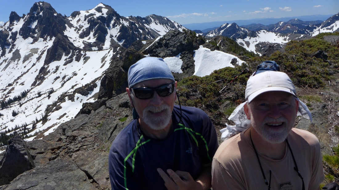
ragman and rocman on the Van Epps summit... with Ingalls Peak and Fortune Peak on the left... Esmeralda, DeRoux, The Louvre and Jolly on the right.
|
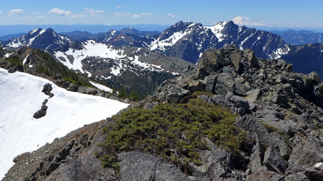
Looking beyond Hawkins Mountain to Mt. Rainier... the west summits of Esmeralda Peaks on the far left... with DeRoux (it's red), The Louvre and Jolly in the left center.
|
rocman leaving the Van Epps summit.
|
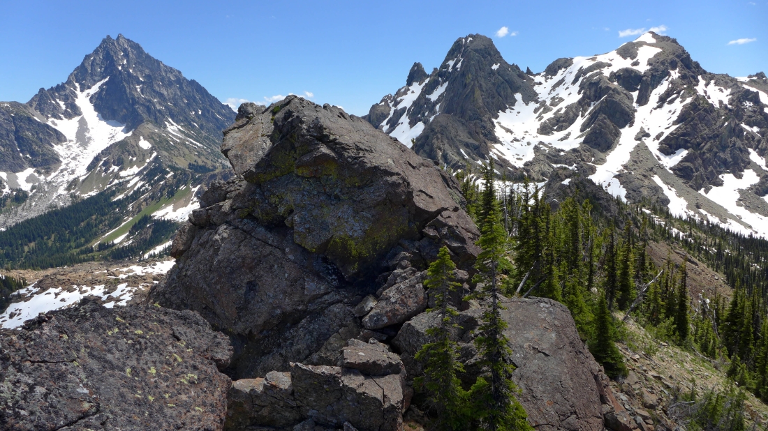
We decided to follow the ridge over toward Ingalls Peak... this is the first bump (7000+) we need to cross over... Mt. Stuart on the left.
|

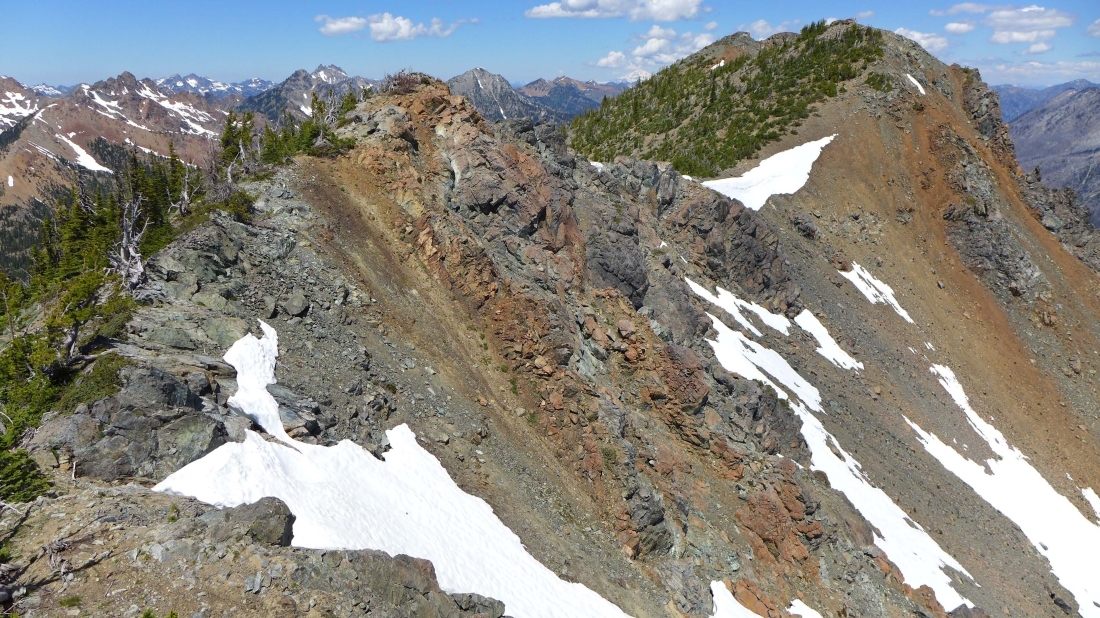
Looking back at the Van Epps summit on the right... my GPS says that both bumps are the same height.
|
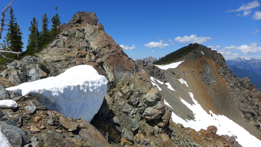
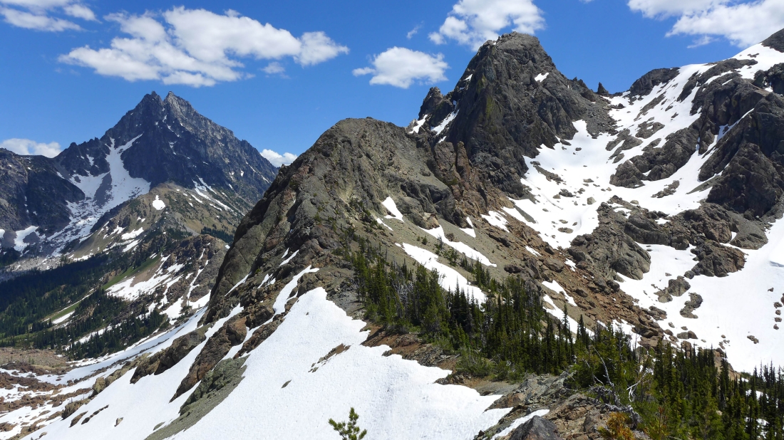
We are on our third 7000+ bump of the day... and can get a good look at the rest of the ridge leading over to Ingalls Peak... Point 6955 (marked on the USGS topo map) is in the right foreground and we are heading over there next.
|
rocman heads for Point 6955... with Ingalls Peak on the left.
|

Heading for the top of Point 6955.
|
Leaving Point 6955 and continuing on the ridge toward Ingalls Peak.
|
Looking back at our route from the Van Epps summit... Point 6955 is in the left foreground.
|
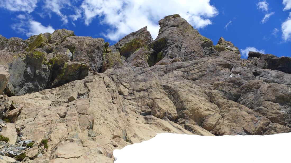
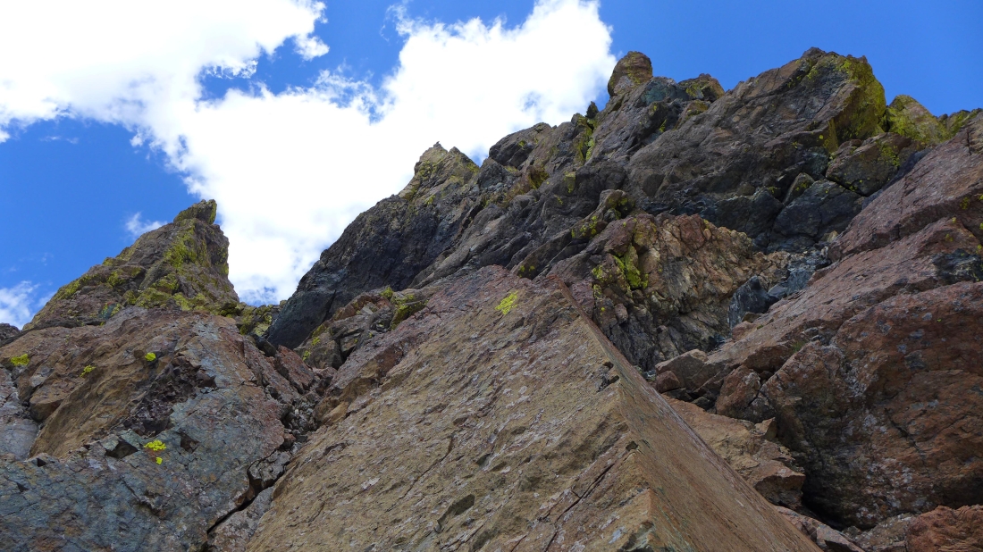
A gnarly section of the ridge leading to Ingalls Peak... Mt. Stuart on the left.
|
Working our way along the ridge toward Ingalls Peak.
|
Did I mention that the ridge was a little gnarly in this section?
|
rocman on the ridge leading from Van Epps to Ingalls Peak... the Van Epps summit is just out of view on the right.
|
We will go to the right here and get on top of this one from the other side.
|

Some exposure on this one.
|
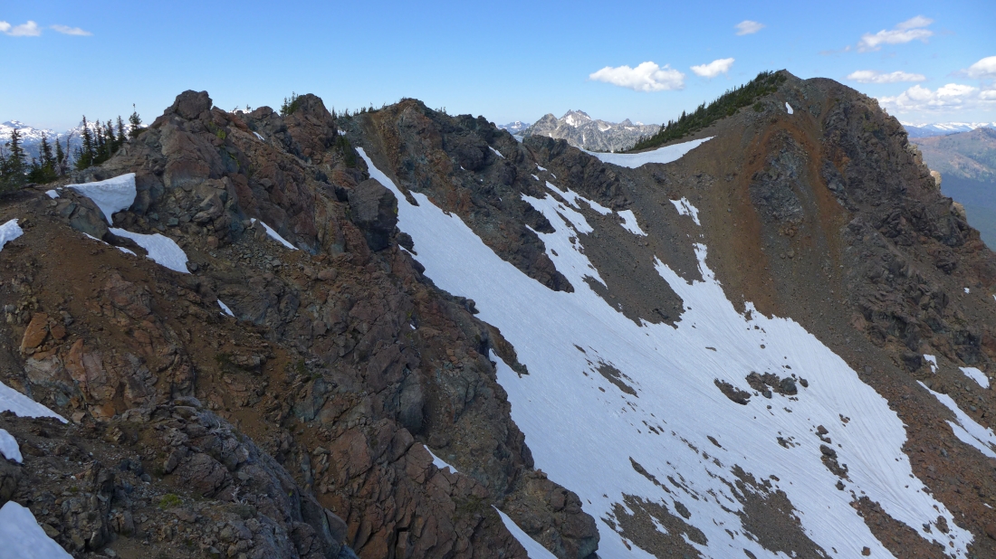
Looking back at our ridge route.
|
Still working our way along the ridge over toward Ingalls Peak.
|
Looking back toward the Van Epps summit on the right.
|

rocman is getting ready to get up on the little bump on the left.
|
rocman on one of the many bumps along the ridge from Van Epps Peak to Ingalls Peak... Mt. Stuart on the right.
|
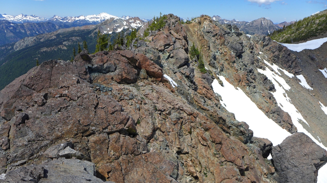
Looking back at our ridge route... Fish Eagle Peak and The Cradle are visible through the gap on the ridge.
|
We will go up and over this bump in the right foreground... getting closer to Ingalls Peak.
|
Mt. Stuart and Ingalls Peak.
|
rocman looks back at our ridge route.
|
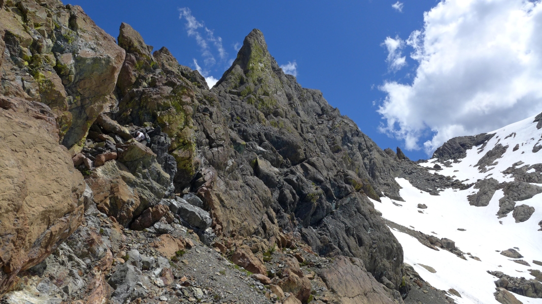
Looking at the very gnarly NW ridge of Ingalls Peak... with Mt. Stuart on the far left.
|

All three summits of Ingalls Peak.
|
Looking back at our ridge route.
|
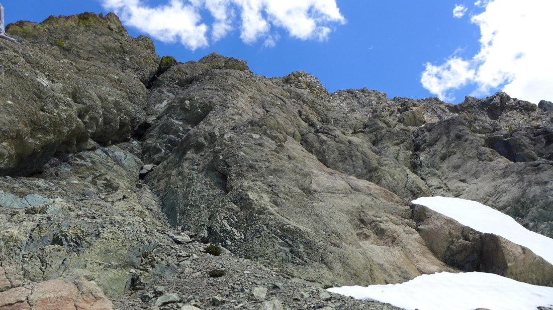
Going underneath the NW ridge of Ingalls... we didn't have the proper gear to try and stay high here.
|

rocman continues below the NW ridge of Ingalls.
|

rocman continues in the moat.
|
Underneath Yellow Lichen Towers.
|
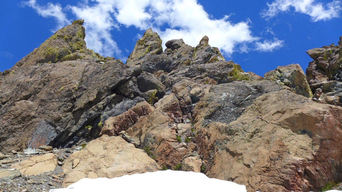
A different look at Yellow Lichen Towers.
|
rocman decides to take a closer look at the towers.
|
Looking up at Yellow Lichen Towers.
|

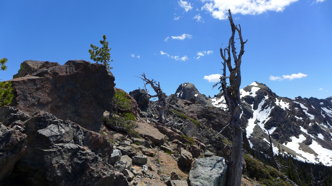
We reached our turnaround time and have started back to Van Epps Pass... looking back at Yellow Lichen Towers and Ingalls Peak.
|
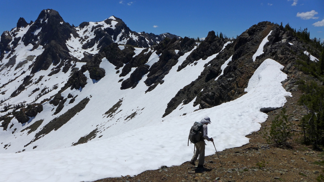
One last look at the peaks... as we head cross-country in search of the County Line Trail which will take us back to Van Epps Pass.
|
A closeup of Yellow Lichen Towers.
|
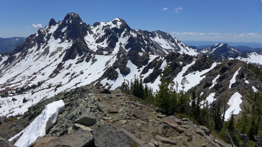
Heading for Van Epps Pass... with Scatter Peaks and Fish Eagle Peak beyond the pass.
|
The County Line Trail joins Road 302... and Van Epps Pass is less than a quarter mile away... where we will quickly join the N. Fortune Creek Trail for the two mile hike back to our car. The total trip was 8.3 miles roundtrip, gaining 3504 feet of elevation.
|
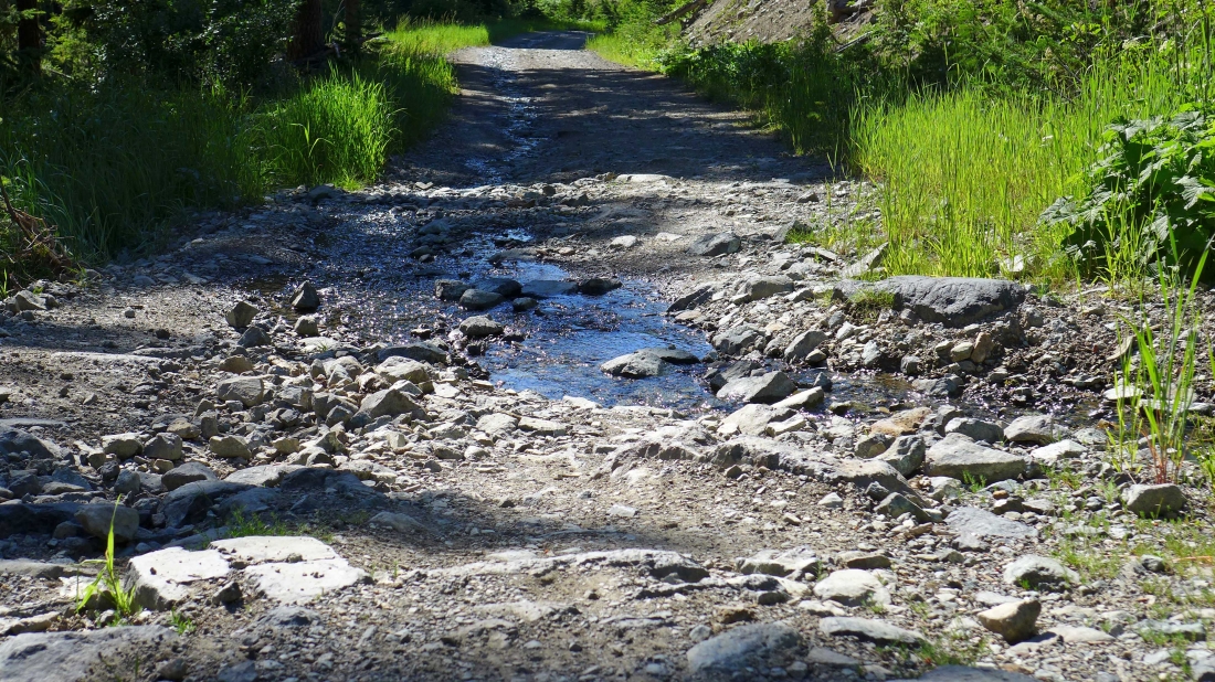
I decided to take a few photos of Road 302 on our way back to FS-4330.
|
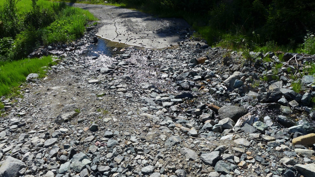
The crux of this trip is dealing with Road 302.
|
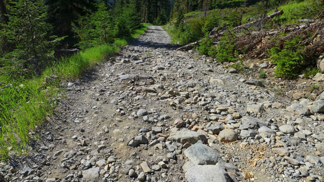
High clearance is needed for Road 302... my Subaru handled it just fine... and last year my Rav4 made it... however the road seemed to be in worse shape this year.
|
