Snoqualmie Mtn (East Summit) - 7.18.2017
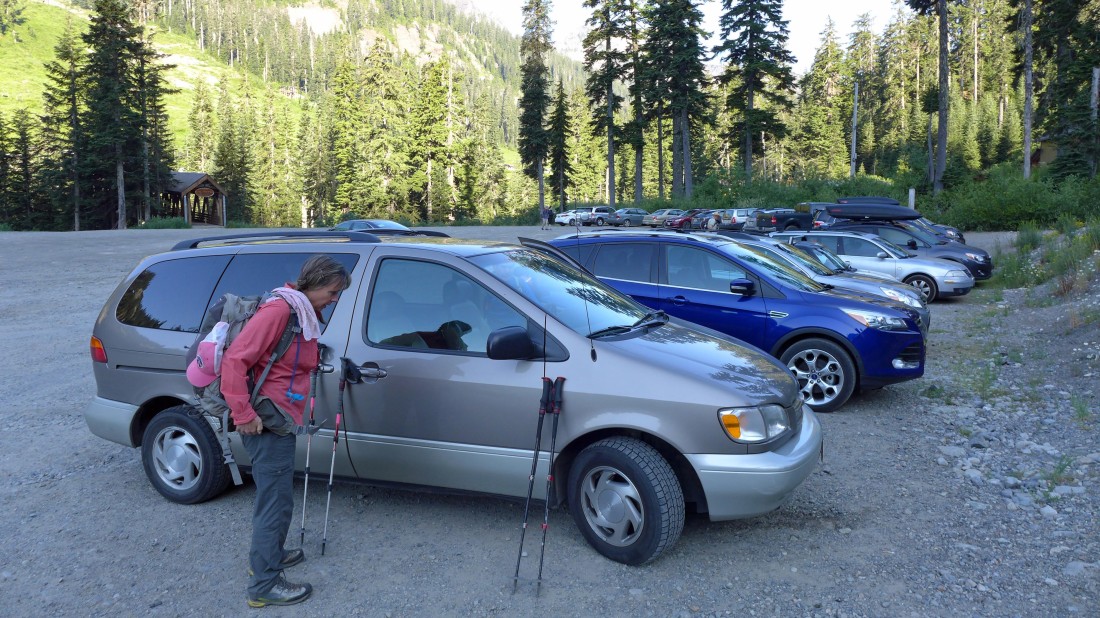
We parked in the Alpental Ski Area parking lot (~3100').
|
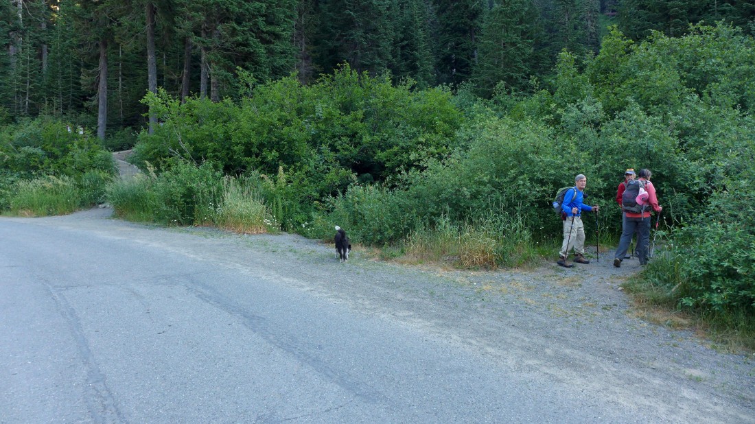
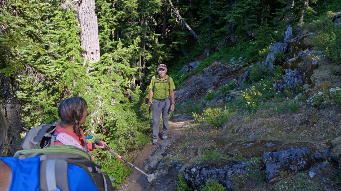
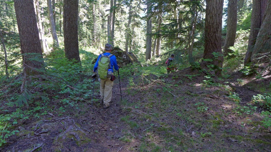
After parking we crossed the road and started up the unsigned, but obvious path... note that the trailhead for Snow Lake is a bit up the road on the left side of the photo. If you go up there, turn around and come back.
|
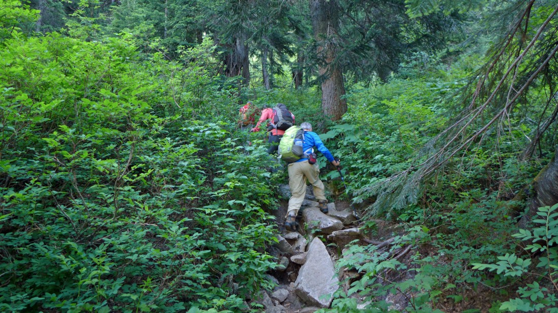
The path turns steep after hiking a short distance.
|
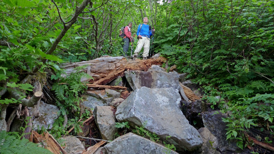
Steep path.
|
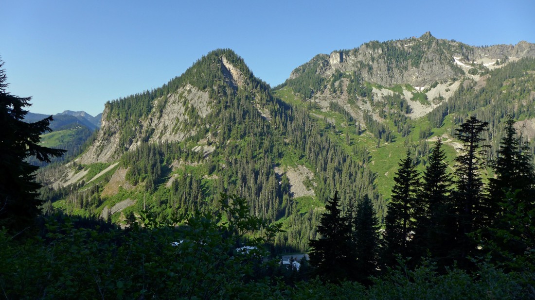
Gaining elevation quickly on the steep path... the community of Alpental is in the valley below... Denny Mountain (right) is across the valley.
|

Continuing up on the steep path.
|
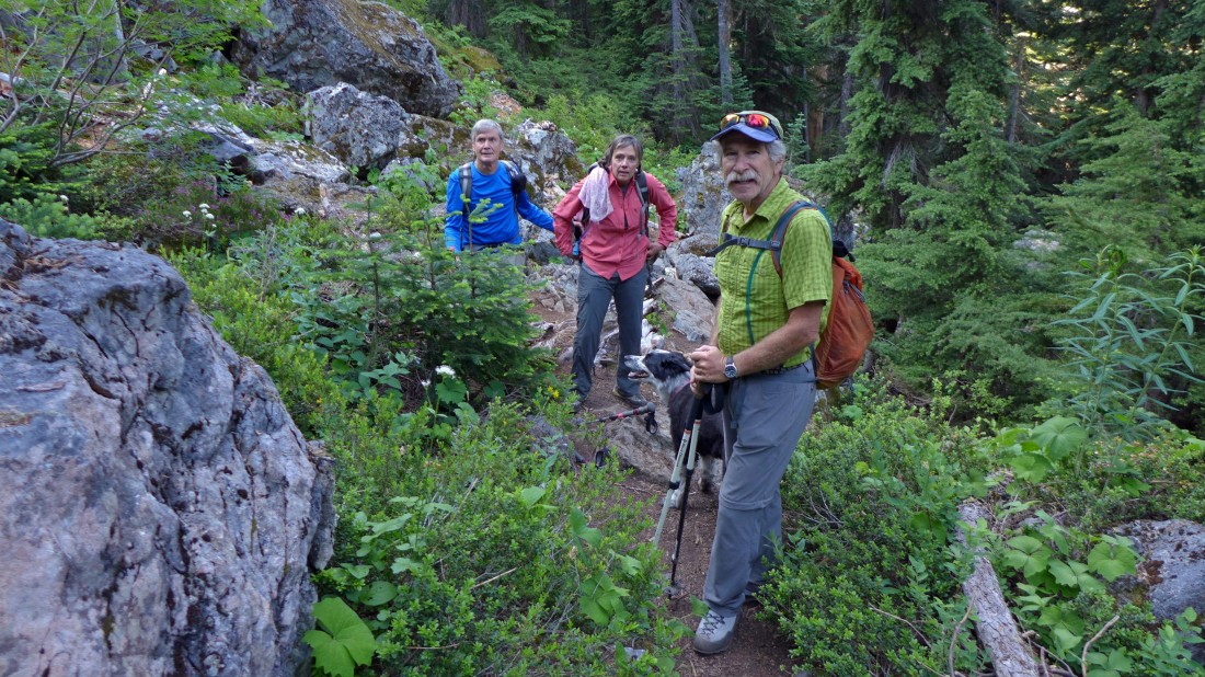
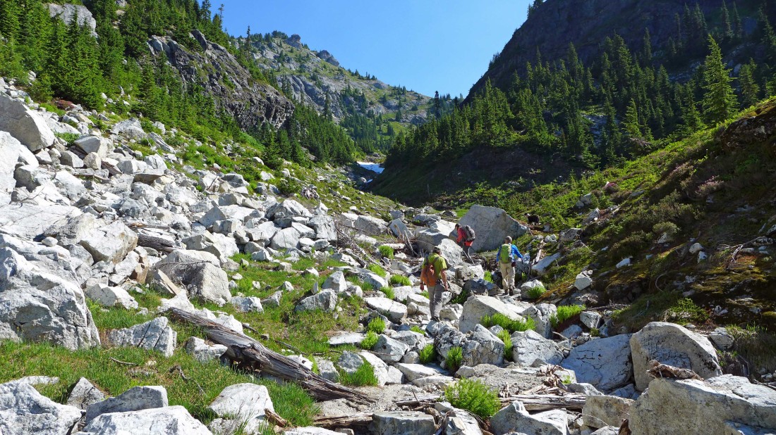
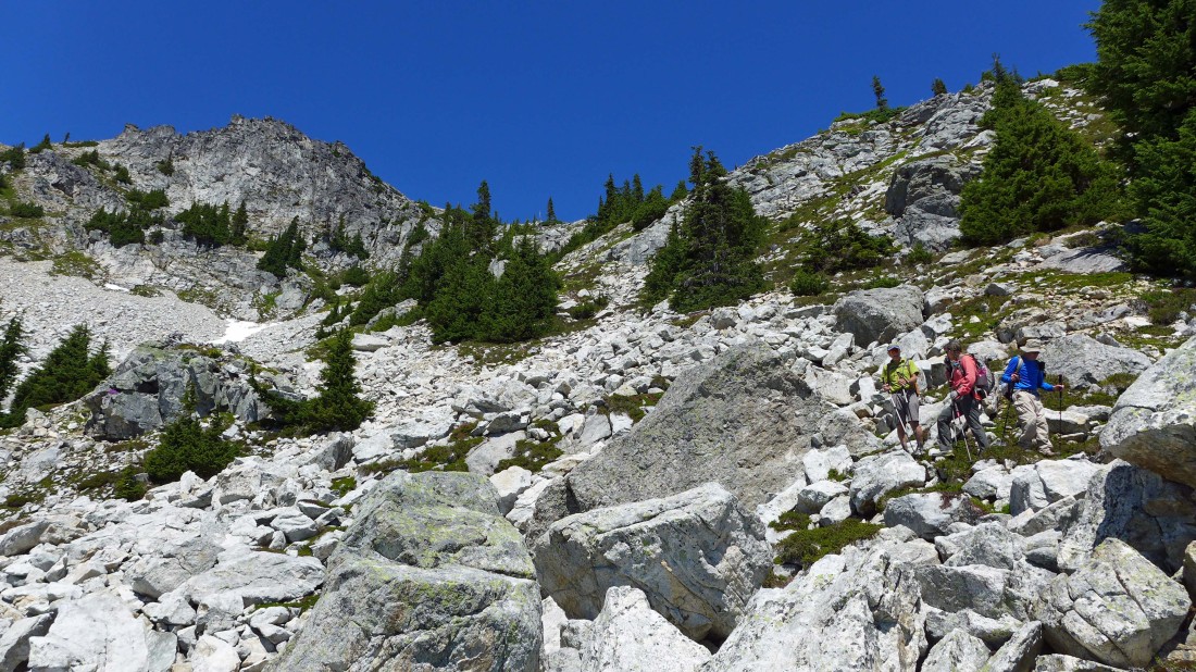
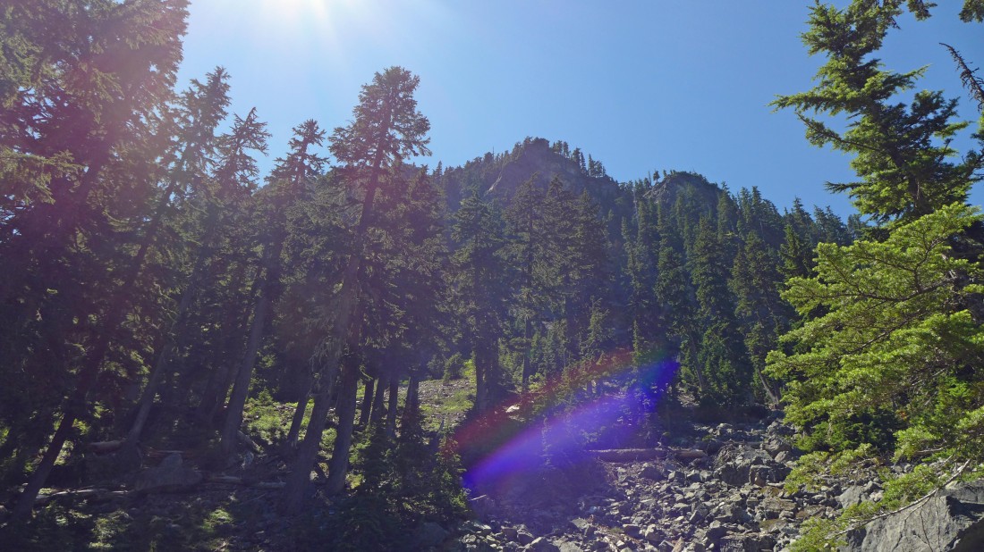
At ~4200 feet we have reached a huge boulder field... if you are going to Guye Peak, turn right and follow cairns across the boulder field toward Guye... we will continue up on the well-defined path.
|
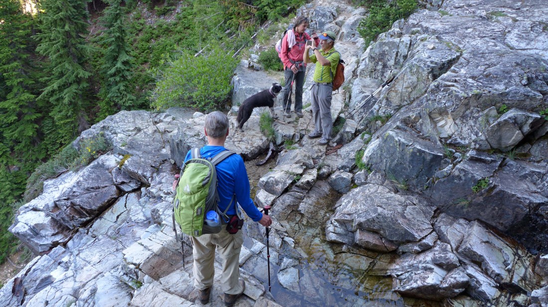
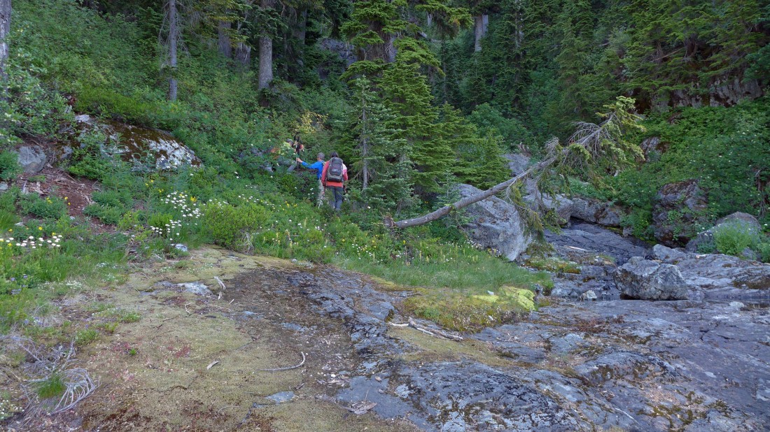
At ~4440 feet we are crossing a stream... just a trickle today.
|
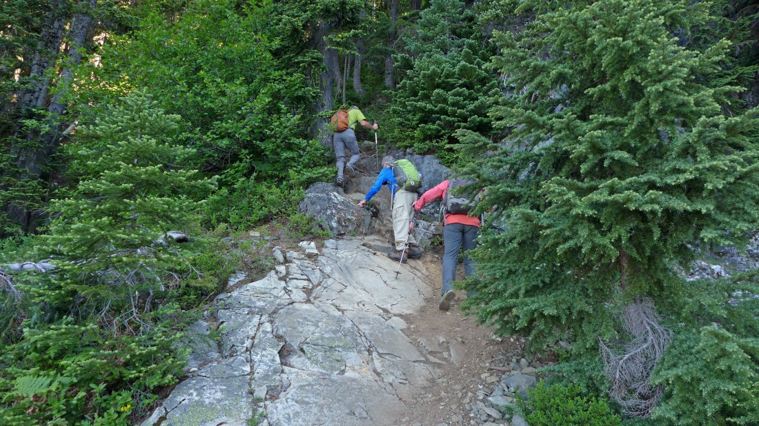
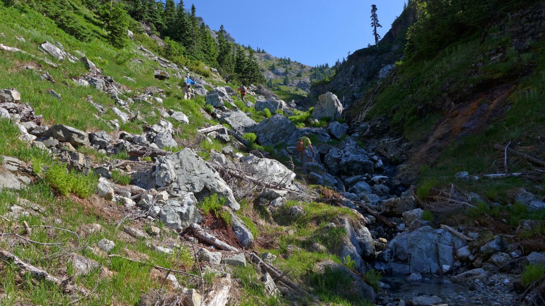
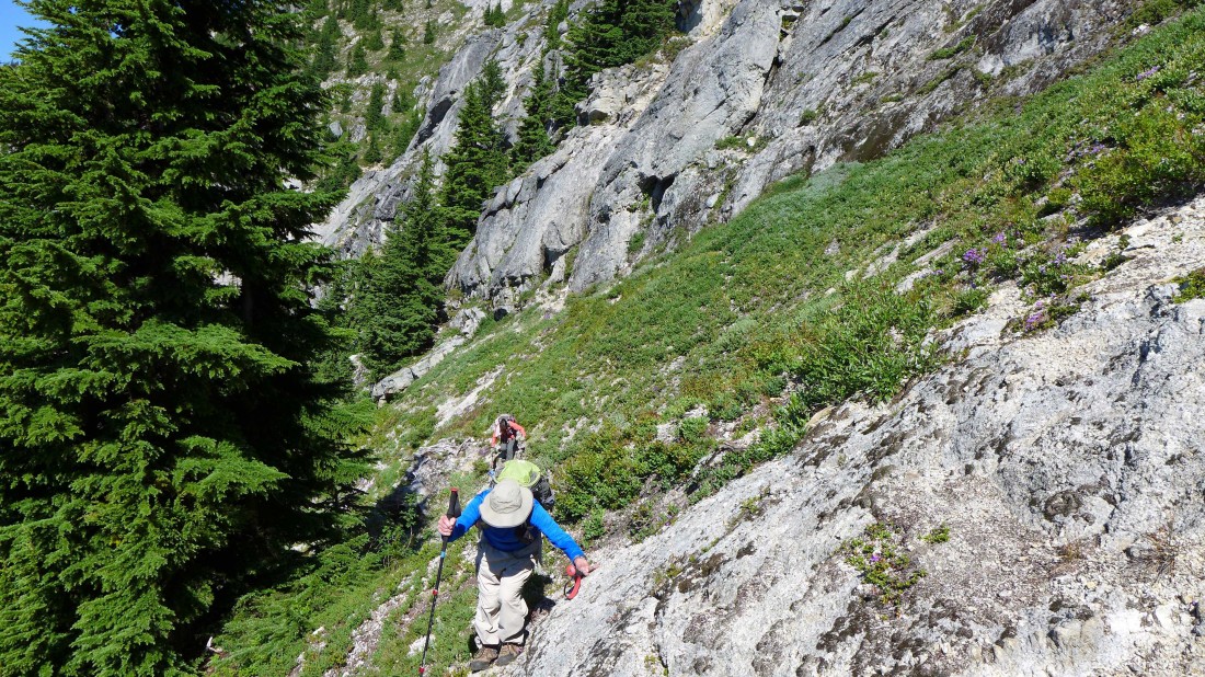
Continuing up on steep terrain... on the the left (west) side of the stream.
|
At ~4530 feet we have left the main path and followed an obvious path over toward the stream (above the waterfall where we originally crossed the stream below at 4440 feet).
|
Continuing up on the left side of the stream.
|

This path is fairly easy to follow.
|

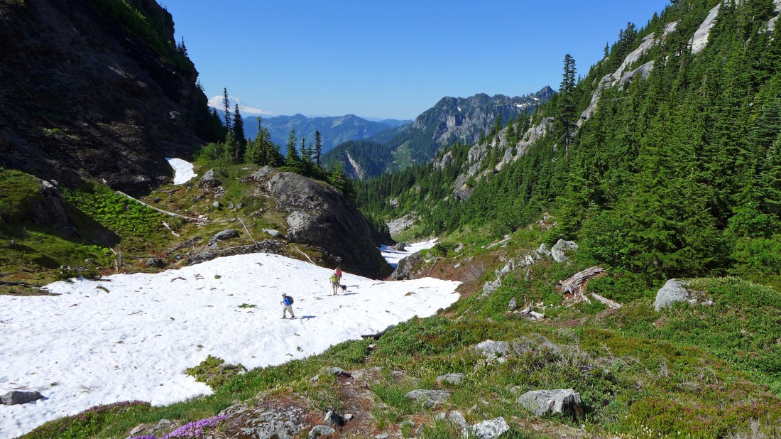
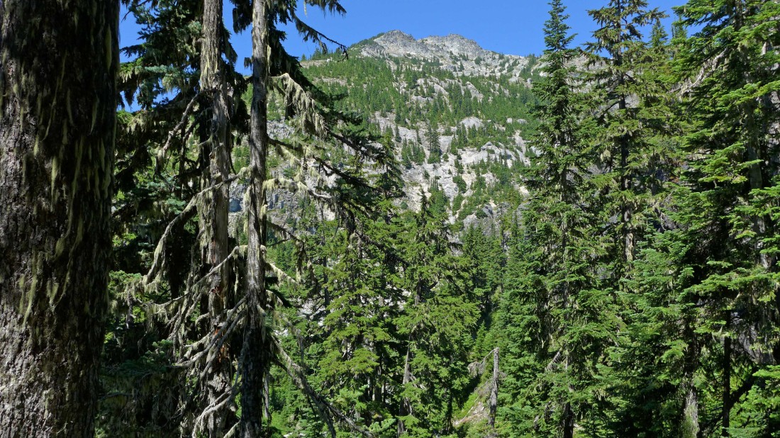
Out of the trees at ~4800 feet... in the valley between Snoqualmie Mountain (left) and Cave Ridge.
|
Heading up the valley between Snoqualmie Mountain (left) and Cave Ridge.
|
Continuing up the valley.
|
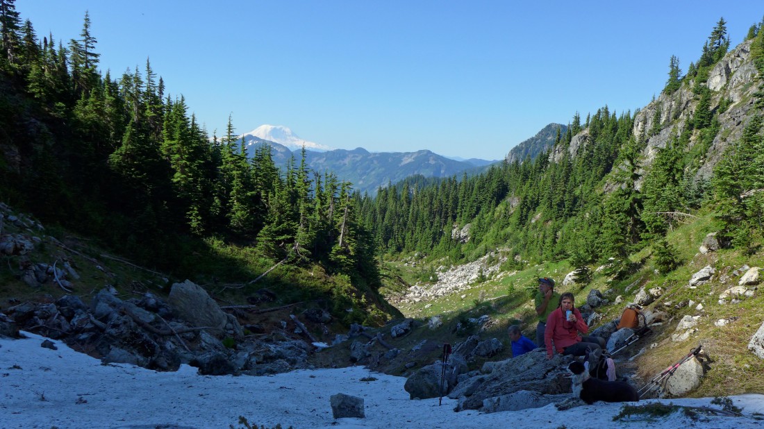
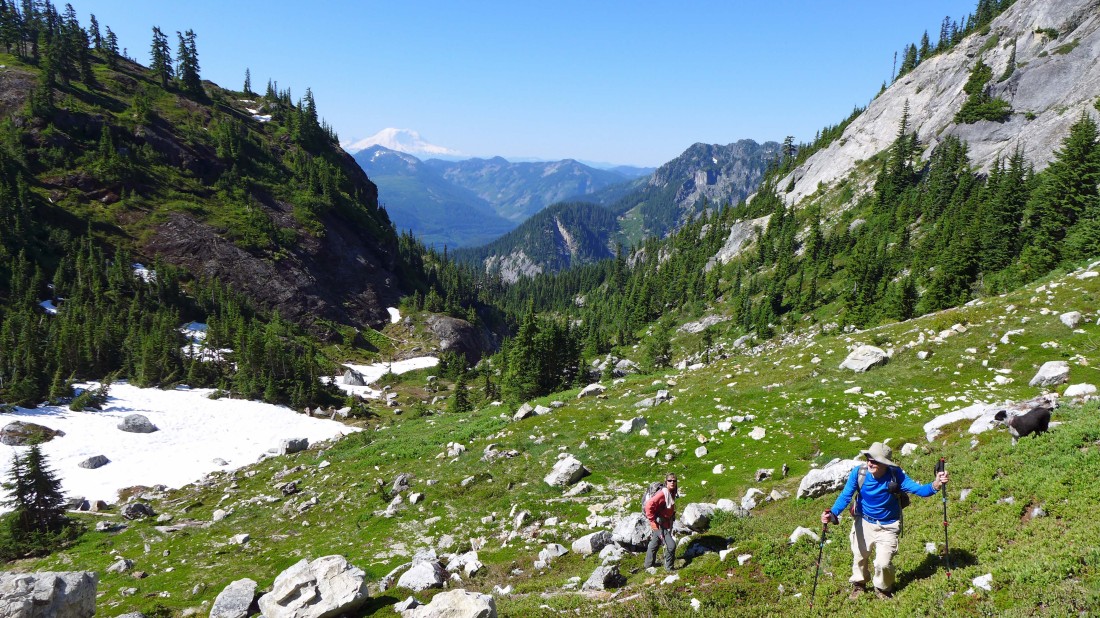
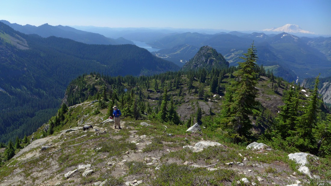
Taking a break in the valley between Snoqualmie Mountain (right) and Cave Ridge... Mt. Rainier in the distance.
|
Continuing up the valley... Mt. Rainier and Denny Mountain in the distance.
|
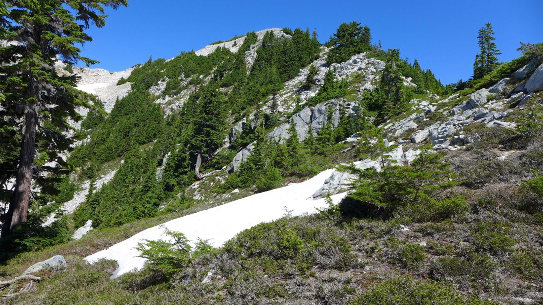
Leaving the valley and heading for Snoqualmie's SE ridge.
|
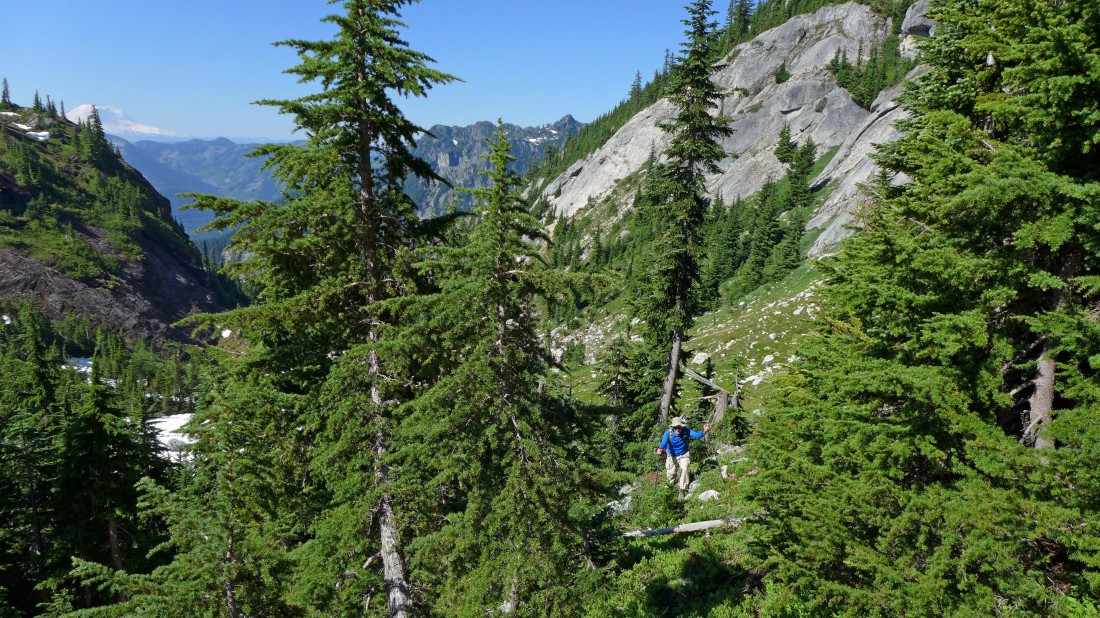
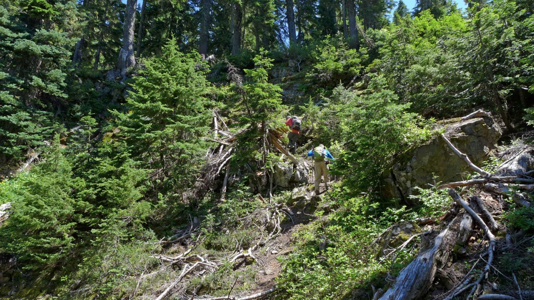
Cutting through some trees as we work our way up to Snoqualmie's SE ridge.
|
On steep terrain on the way to Snoqualmie's SE ridge.
|
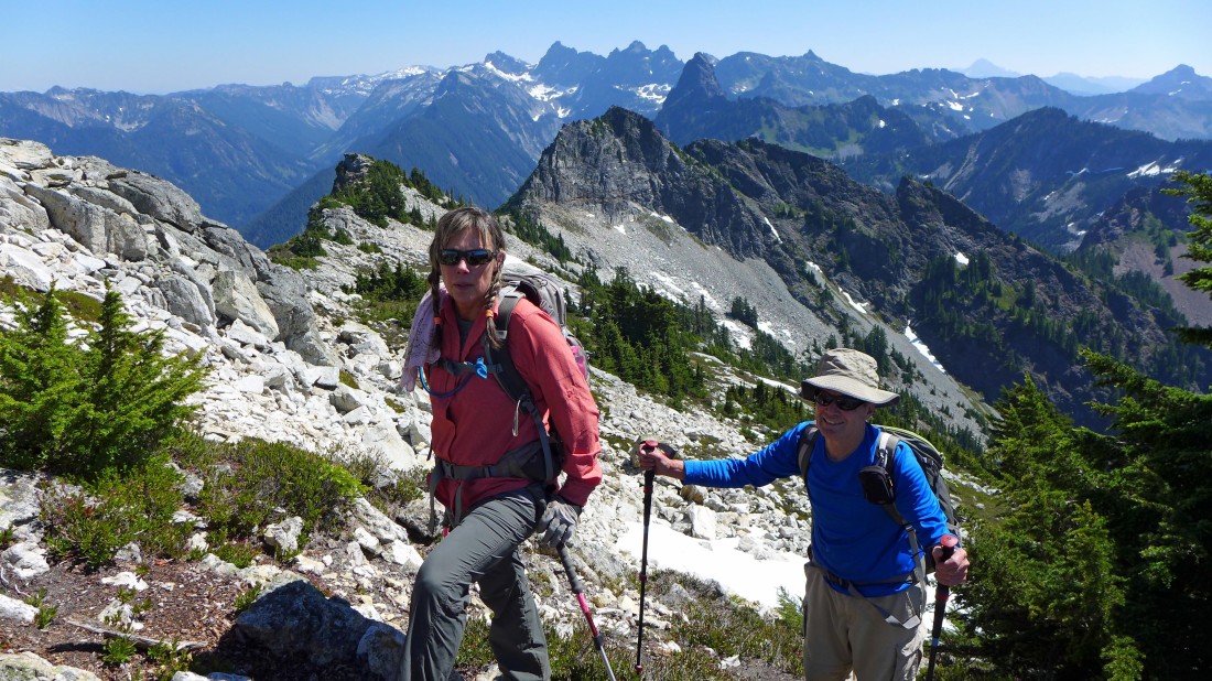
Still on steep trerain... Snoqualmie's east summit is directly above rodman's hat at the top of the photo.
|
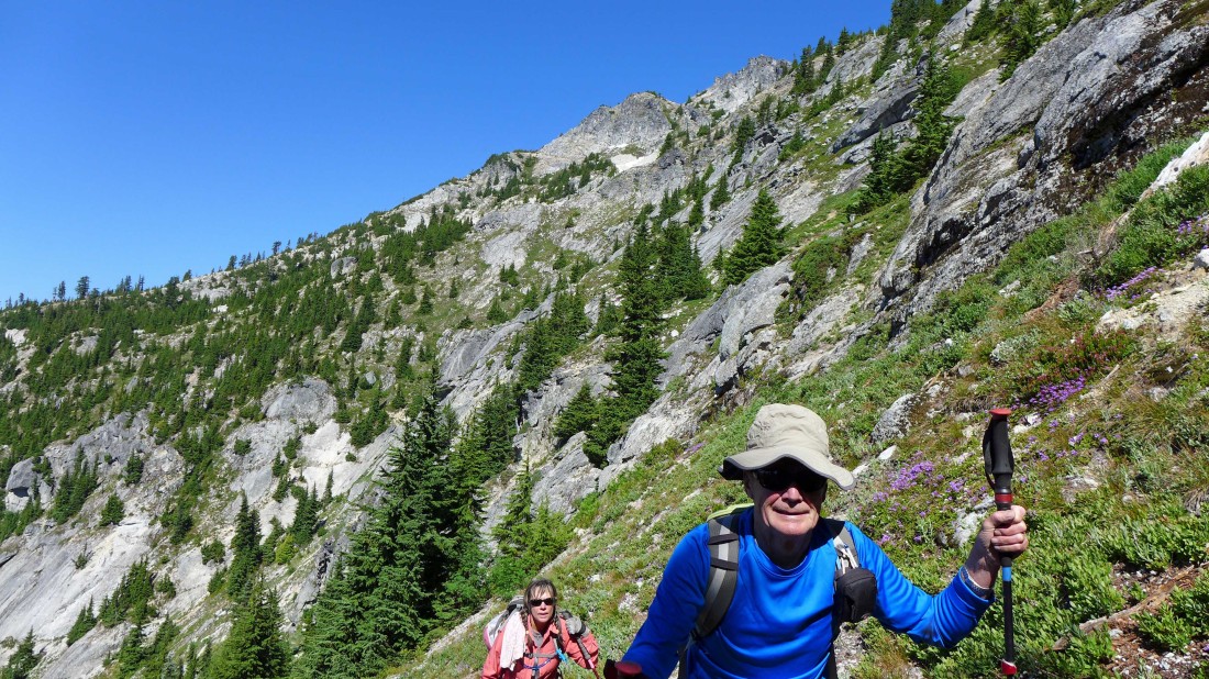
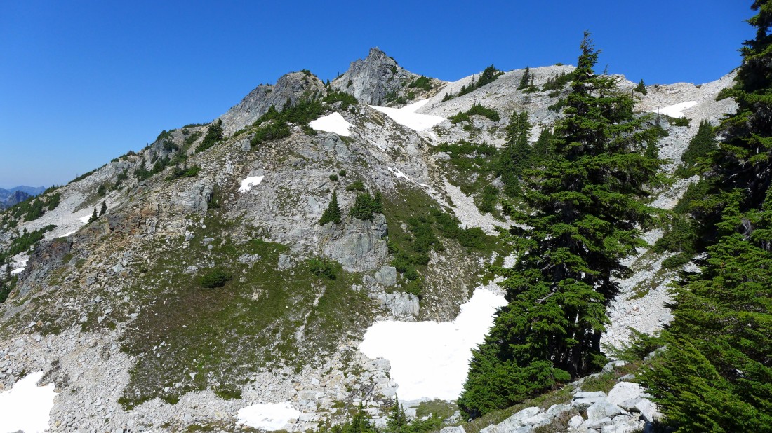
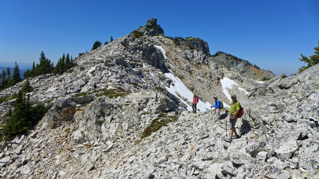
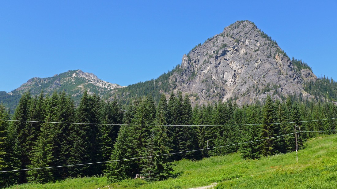
We have reached Snoqualmie's SE ridge (~5400') and got this look at Lundin Peak on the left and Red Mountain on the right.
|
Looking up Snoqualmie's SE ridge to the east summit on the left horizon.
|
Continuing up Snoqualmie's SE ridge... Guye Peak in the center foreground... Keechelus Lake in the distance... with Rainier on the right.
|

Continuing up Snoqualmie's SE ridge... nice rock formations along the way.
|
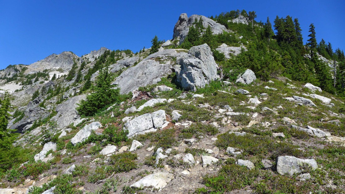
Our target is above in the center of the photo.
|
We will work our way up the SE ridge to the 6160+ bump on Snoqualmie's east ridge.
|
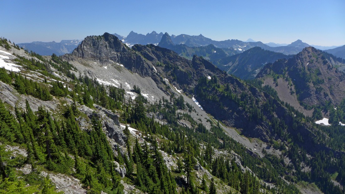
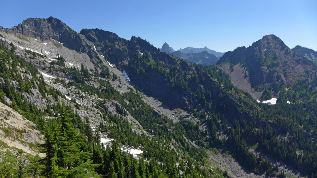
Looking beyond Lundin Peak in the foreground to some of the Middle Fork Snoqualmie peaks.
|
Every step higher gives broader views.
|
Looking south from the SE ridge of Snoqualmie Mountain... the route to the main Snoqualmie summit follows the ridge in the right foreground.
|

We have joined Snoqualmie's east ridge at ~6160 feet... now we will follow the ridge over to the east summit on the left... Snow Lake in the distance... with Chair Peak, Kaleetan Peak and Mt. Roosevelt above the lake.
|
Crossing boulders and heading for the east summit.
|

Getting closer.
|

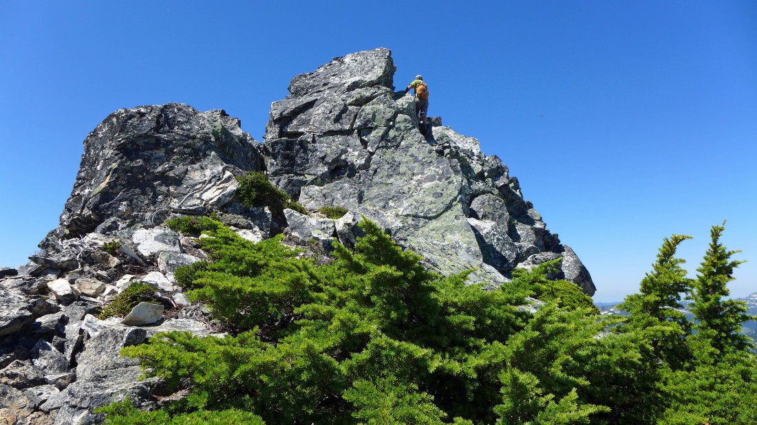
Looking down at Snowdog and rodman as they work their way up to the east summit.
|
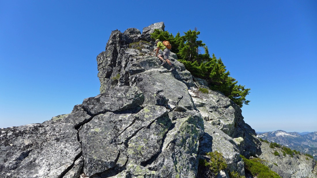
iraman heads for the summit... Class 2 with some easy Class 3.
|
A convenient ramp near the summit.
|
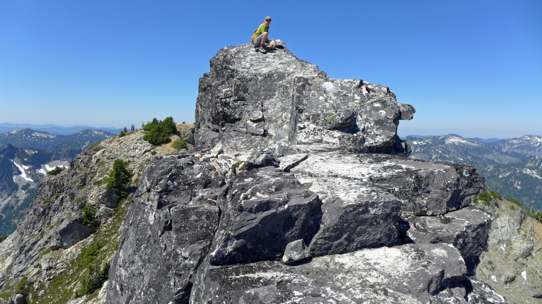
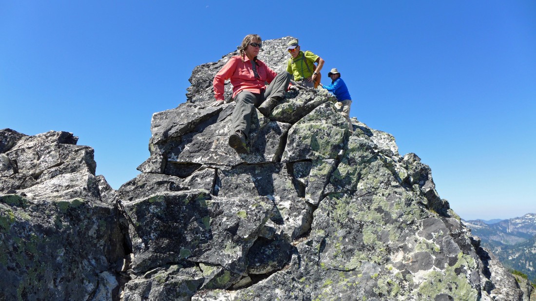
iraman sits on the east summit of Snoqualmie Mountain (6227').
|
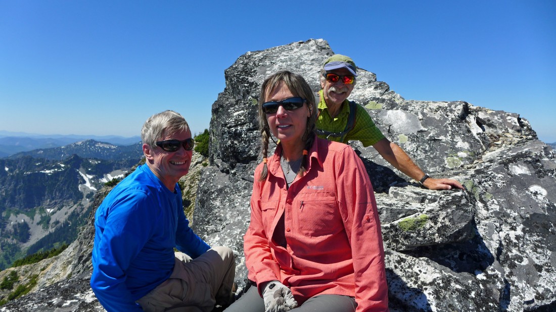
Sitting just below the summit... rodman, Snowdog and iraman.
|
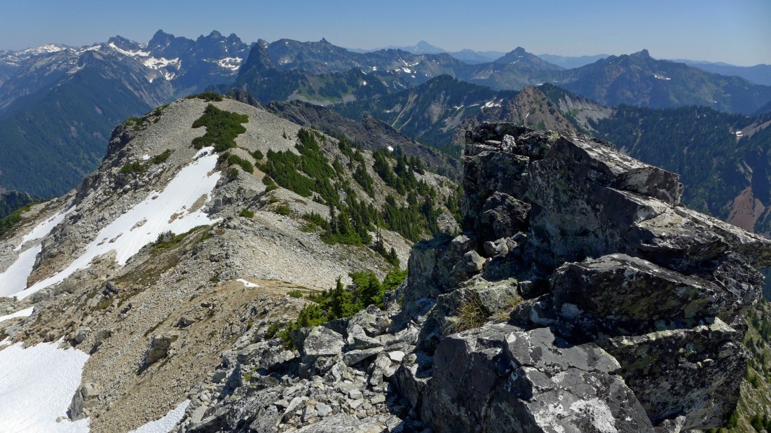
Sitting near the summit... looking east and NE into the heart of the Alpine Lakes Wilderness.
|
Time to head down.
|
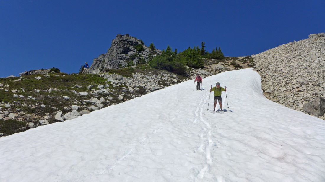
Making good use of the snow as we head for the basin on the south side of Snoqualmie Mountain.
|
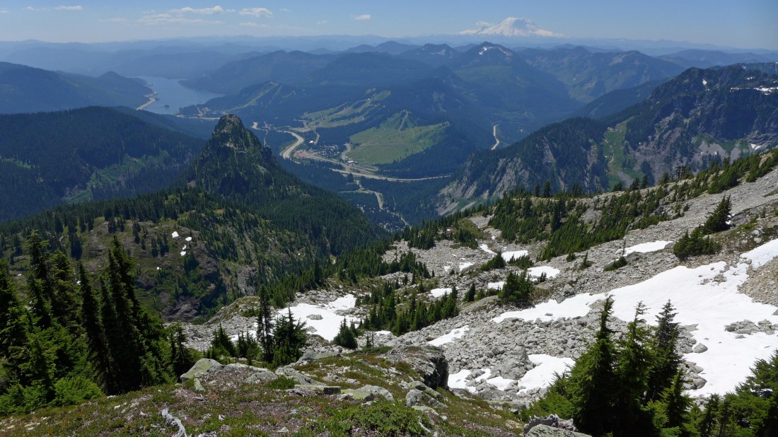
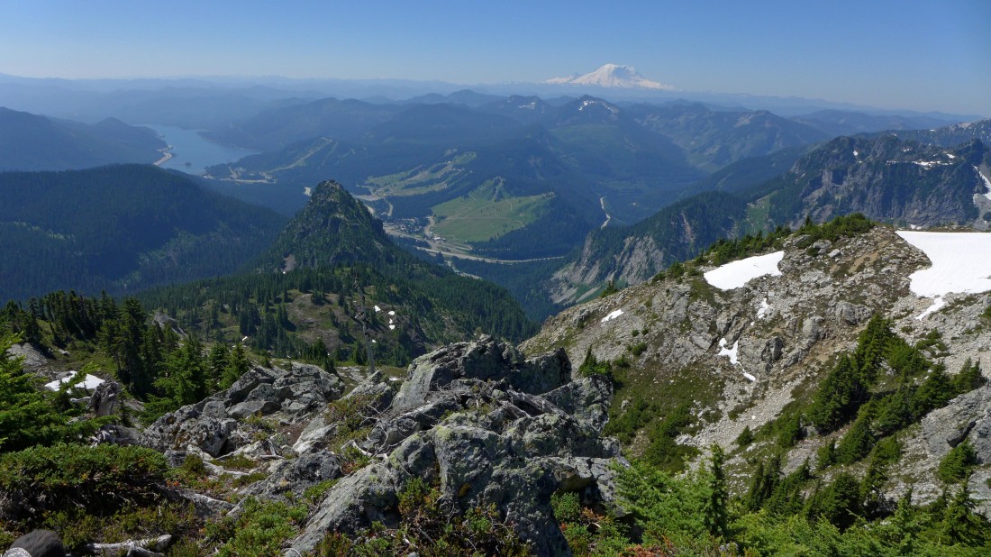
Heading for the basin on the south side of Snoqualmie Mountain... we will go down into the basin and then over to the main path on the ridge in the right foreground... looking across the Snoqualmie Pass Ski Area to Mt. Rainier in the distance.
|
Down into the basin... our summit is directly above.
|
Continuing down into the basin.
|

In the basin and heading for the ridge on the right... where we will quickly find the path that leads down into the valley between Snoqualmie Mountain and Cave Ridge.
|

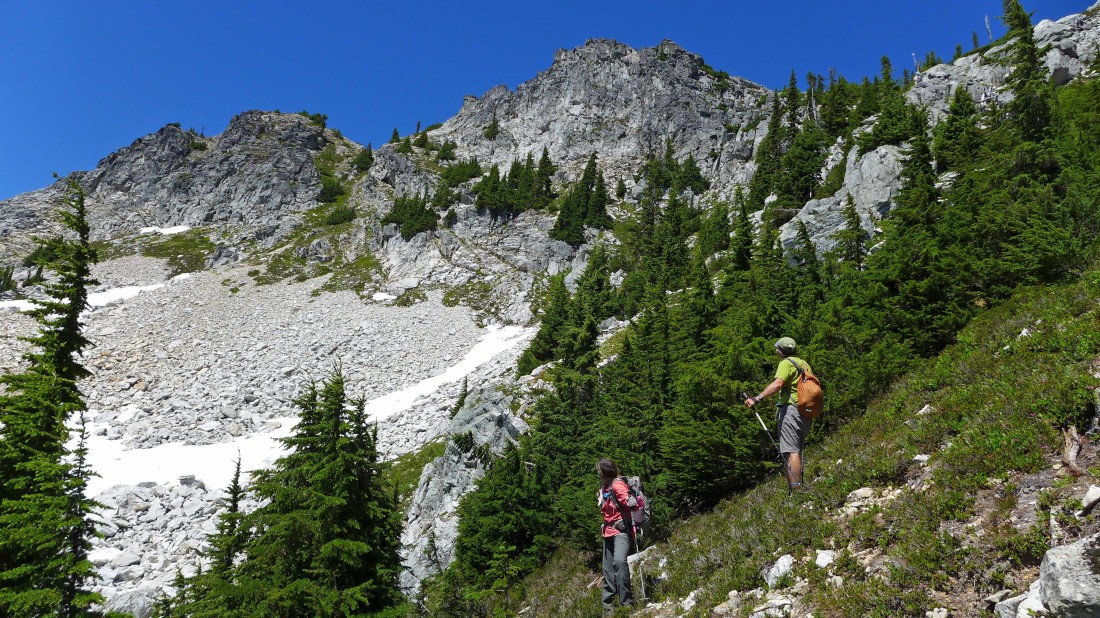
We are in the valley between Snoqualmie Mountain and Cave Ridge... and we have found a path that will take us up and across the SW shoulder of Cave Ridge to the saddle between Cave Ridge and Guye Peak.
|
Need to gain 100 feet of elevation up to the SW side of Cave Ridge before the path levels out and takes us to the Cave Ridge Guye Peak saddle.
|

Almost up to where the path levels out.
|
On the SW shoulder of Cave Ridge... looking back at Snoqualmie Mountain and down at the valley we used to reach the SE ridge of Snoqualmie.
|
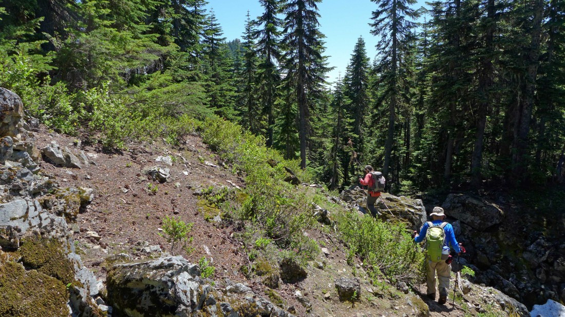
The path has leveled out on the SW shoulder of Cave Ridge and we can see Guye Peak through the trees.
|
We have reached the saddle between Cave Ridge and Guye Peak... and we will take a good path down into Commonwealth Basin for a much more friendly knee-route back to the car.
|
Following a good path on the east side of Guye Peak as we work our way down into Commonwealth Basin.
|

Almost into the basin proper... still following a good path.
|

The path has brought us out of the trees at the Sahalie Ski Club... part of the Snoqualmie Ski Area is in the center of the photo.
|
Looking back at Snoqualmie Mountain and Guye Peak from the lodge at the Sahalie Ski Club... iraman took the short route back to Alpental and drove the one mile to the ski club to save us from having to do the one mile road walk... the trip was 5.4 miles, gaining 3439 feet of elevation.
|
