Burroughs Mountain - 7.22.2017
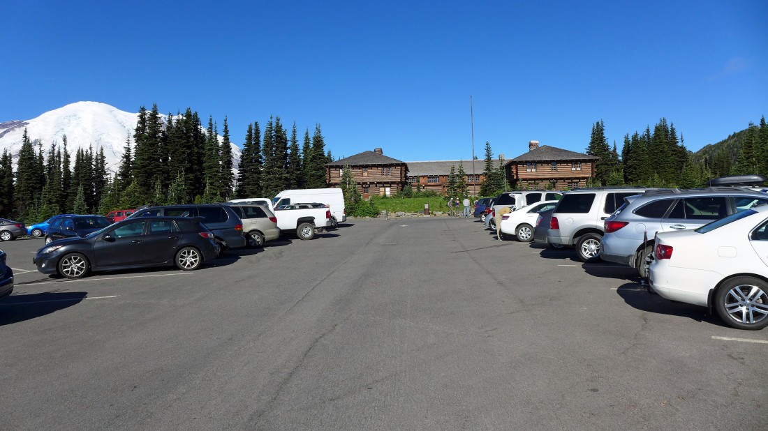
Park (~6400') at Sunrise in Mt. Rainier National Park.
|
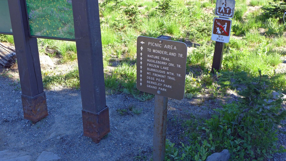
Lots of hiking options out of Sunrise... we will go up to Sourdough Ridge and turn west toward Frozen Lake.
|
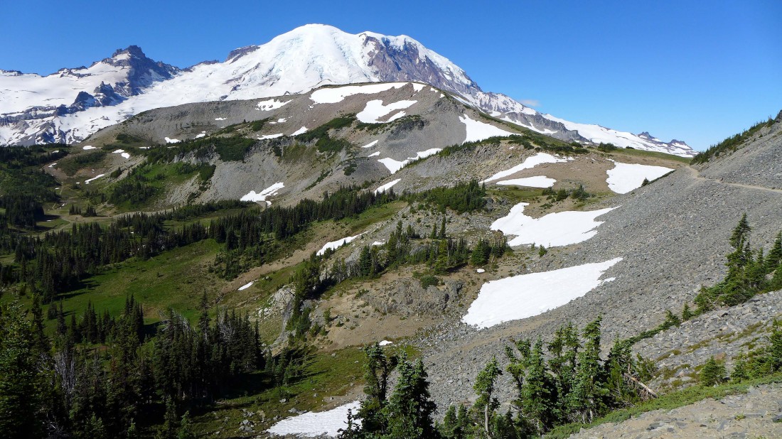
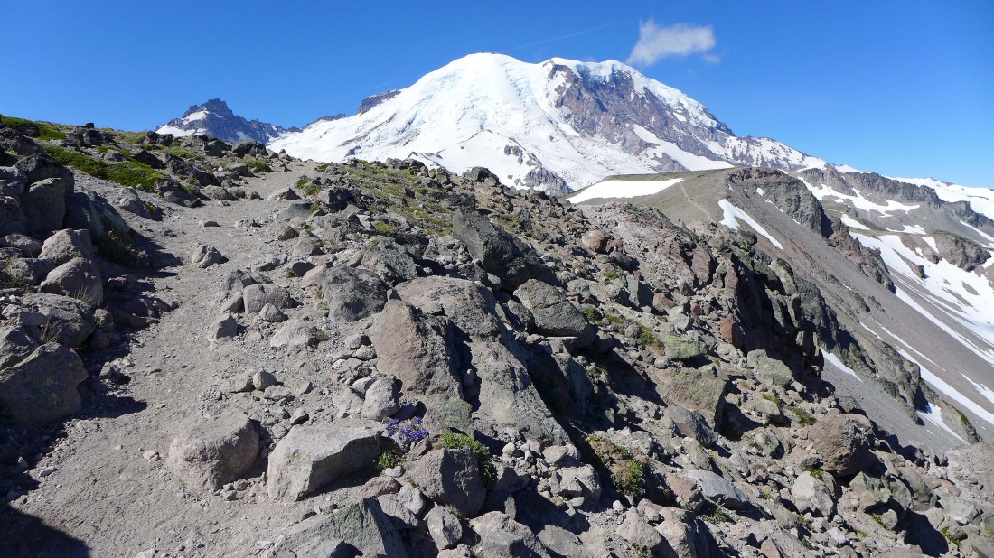
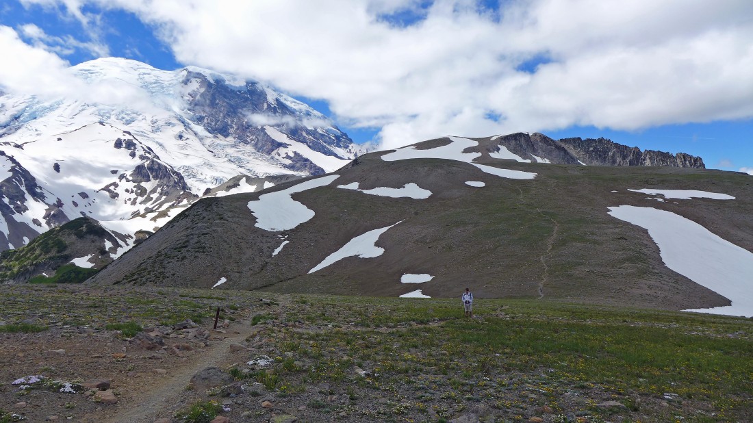
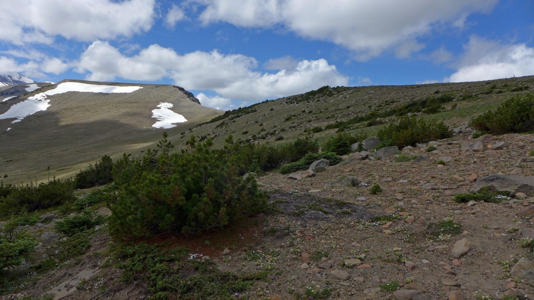
Hiking west on the Sourdough Ridge Trail... heading for Frozen Lake... First Burroughs Mountain in the foreground... with Little Tahoma and Mt. Rainier in the distance... Sunrise Camp is in the basin below.
|
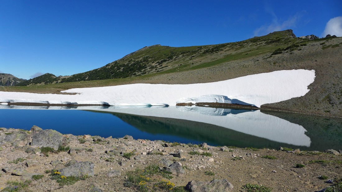
At Frozen Lake where we will pick up the trail to First Burroughs... Mt. Fremont above.
|
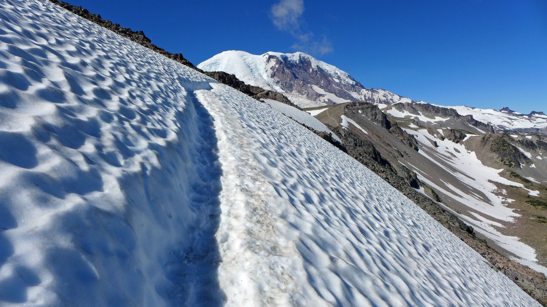
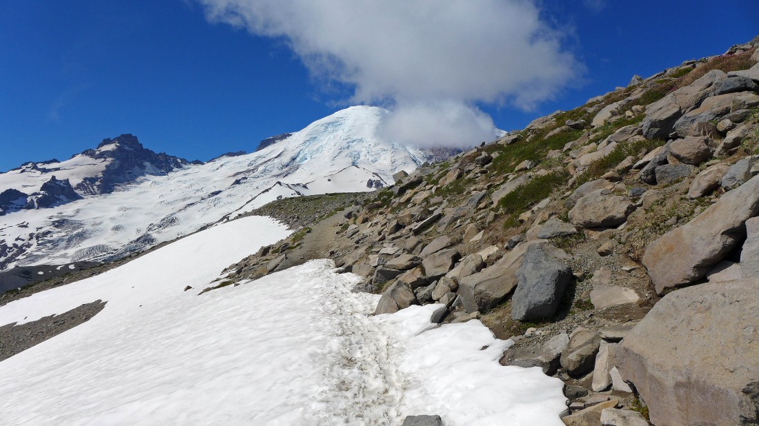
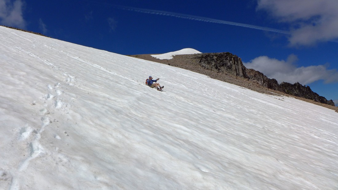
The north side of First Burroughs can be very tricky in the early part of summer... not so much today, but you still have to pay attention when on the snow.
|
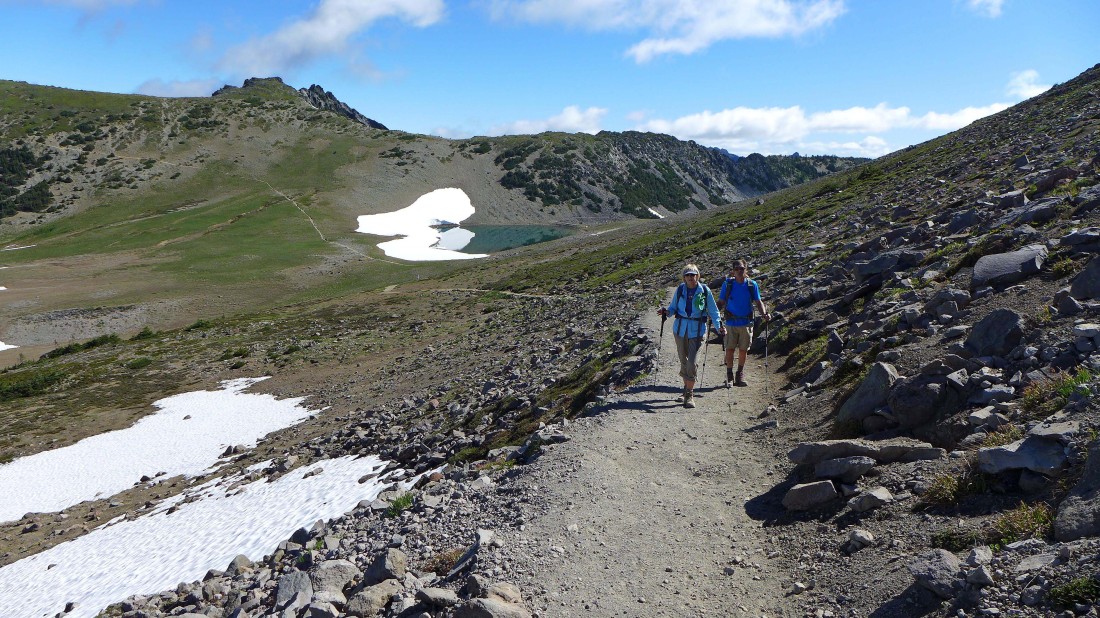
Denali Girl and robman on the trail leading to First Burroughs... Frozen Lake and the south end of Mt. Fremont are behind.
|
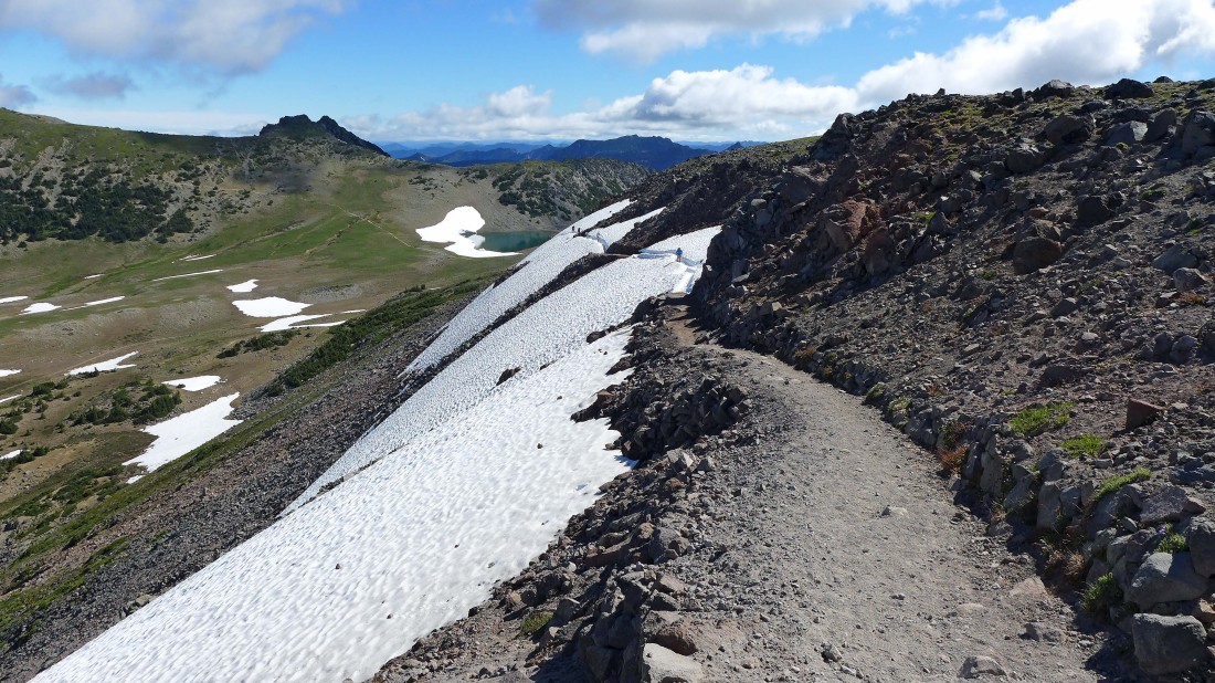
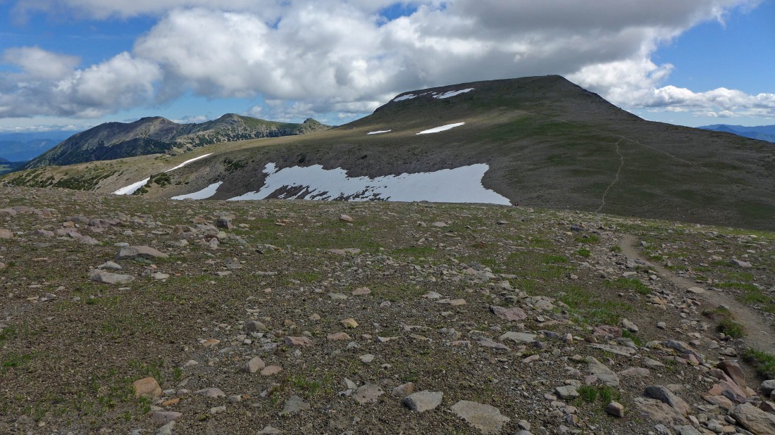
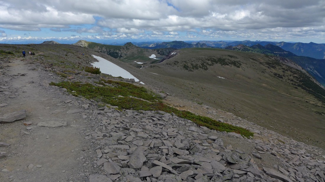
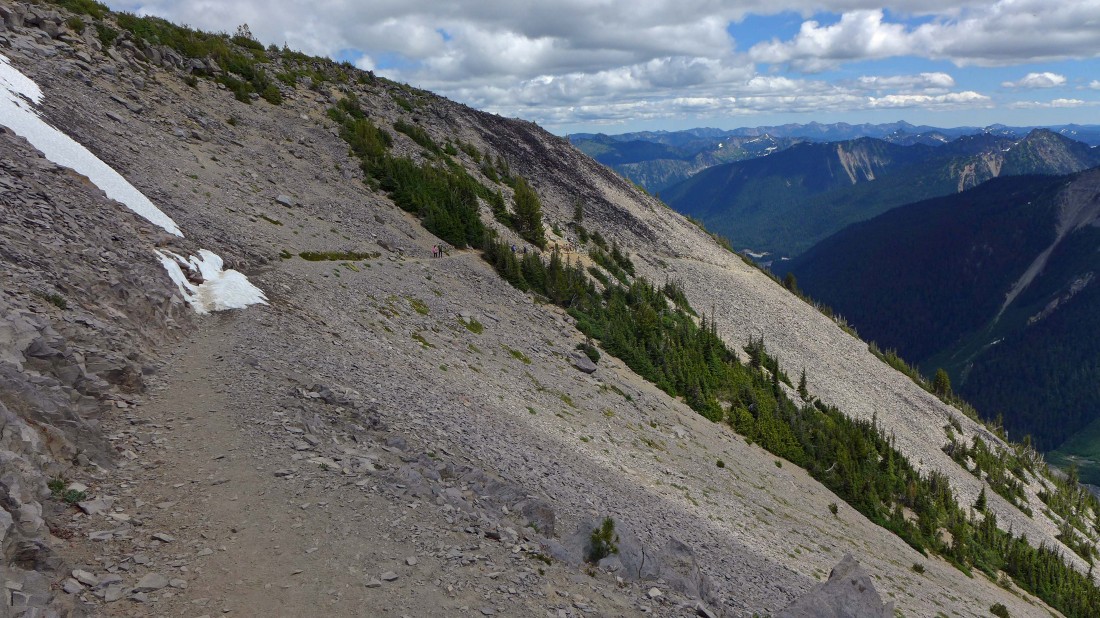
Nearing the top of First Burroughs... you can see the trail going out to Second Burroughs in the distance... Observation Rock and Echo Rock on the far right horizon.
|
Looking back at the snow on the north side of First Burroughs.
|
Reaching the top of First Burroughs... Little Tahoma comes into view on the left.
|
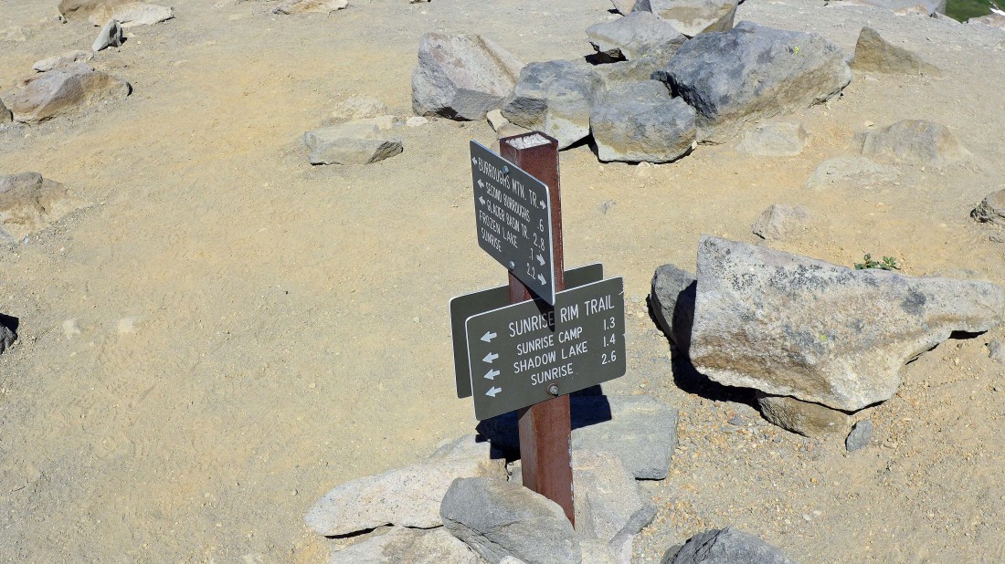
Trail junction at the west end of First Burroughs... we will continue on to Second and Third Burroughs... however, on our return we will take the Sunrise Rim Trail back to Sunrise.
|
Looking at the trail over to Second Burroughs.
|
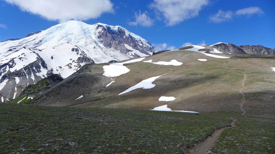
From the west end of First Burroughs we are looking down on Berkeley Park and out to Mt. Fremont.
|
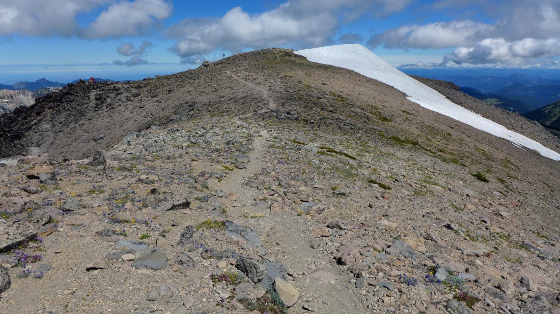
Nearing the top of Second Burroughs.
|
robman nears the top of Second Burroughs... one small patch of snow to deal with... First Burroughs on the right.
|
At the west end of Second Burroughs... going to have to give back some elevation before heading back up to Third Burroughs... Mt. Ruth and Steamboat Prow in the left foreground... with the Inter Glacier between them... Glacier Basin in the valley below left.
|
Giving back some elevation on the way over to Third Burroughs.
|
On the way to Third Burroughs... looking back at Second Burroughs.
|
Heading up for the summit of Third Burroughs on the far right.
|
Looking back at Mt. Fremont, Berkeley Park and Second Burroughs.
|
robman nears the summit area of Third Burroughs... clouds are forming.
|
The north side of Little Tahoma from the summit area of Third Burroughs... Mt. Ruth in the foreground.
|
On the south end of Third Burroughs... leaving a ridge walk over to the summit.
|
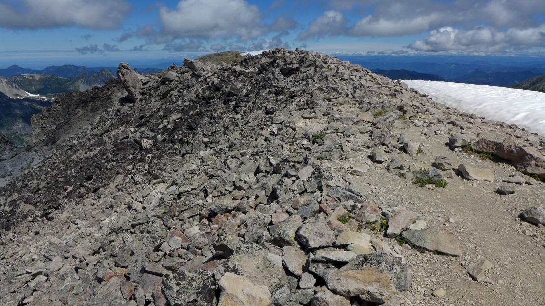
Part of the ridge walk over to the true summit (7828') of Third Burroughs.
|
Lots of Purple and Gold on the summit of Third Burroughs.
|
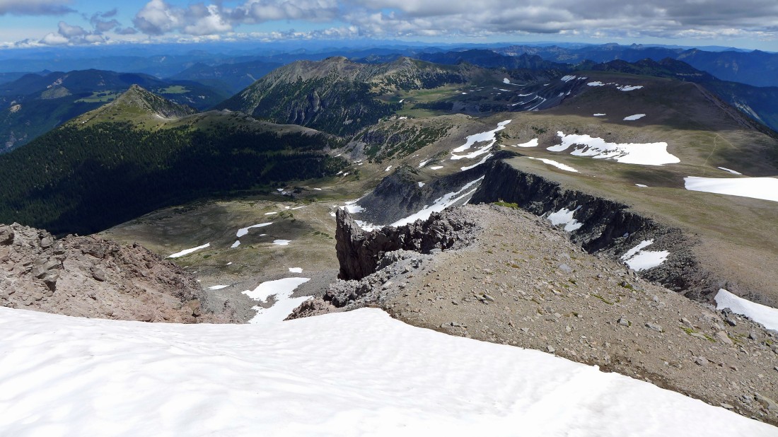
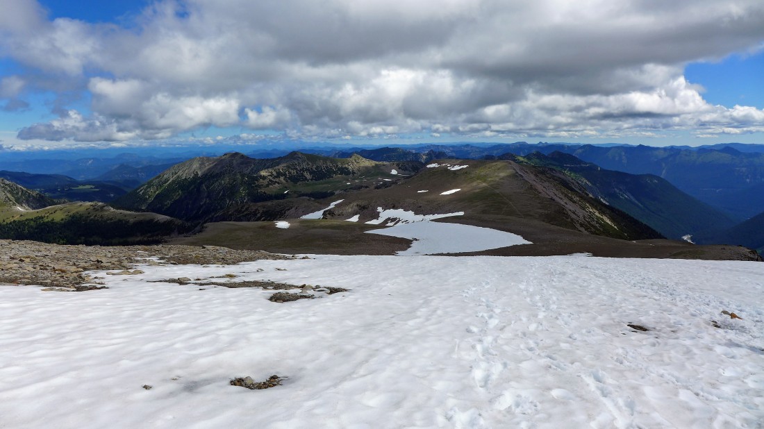
On the summit of Third Burroughs... Skyscraper Mountain on the far left with Grand Park behind it... Mt. Fremont and Berkeley Park in the center of the photo... Second Burroughs in the shade on the right.
|
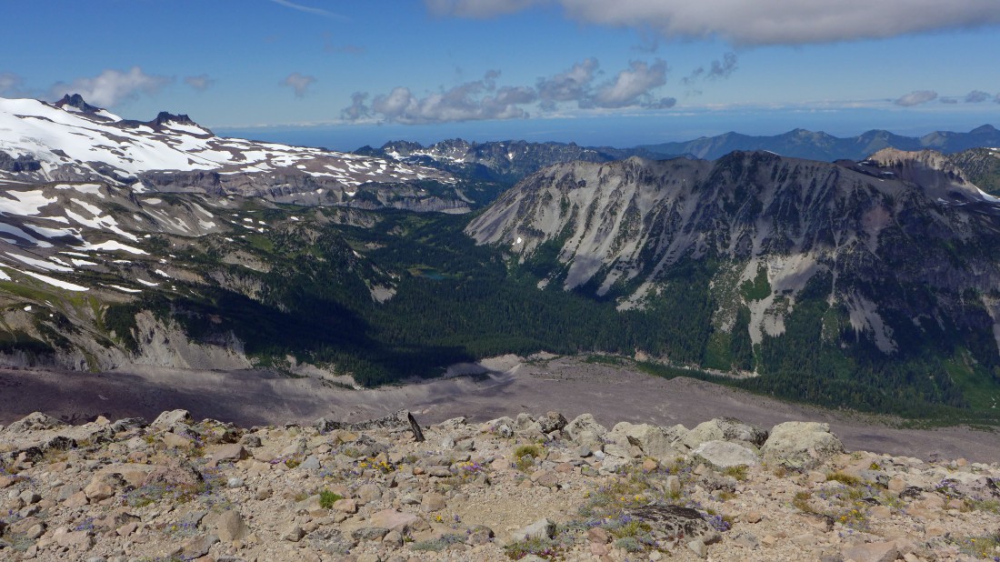
On the summit of Third Burroughs... Observation Rock and Echo Rock on the far left... Fay Peak, Knapsack and Mother Mountain in the center of the photo... Old Desolate in the right foreground above Mystic Lake.
|

Selfie on the summit of Third Burroughs... robman and ragman.
|
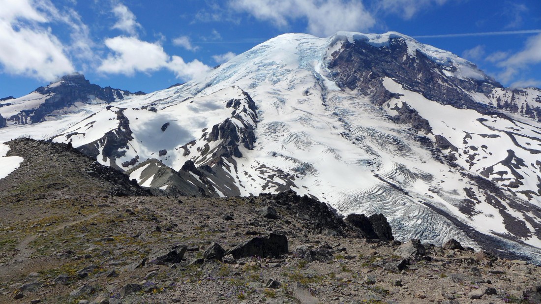
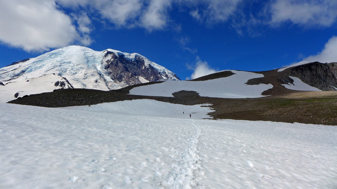
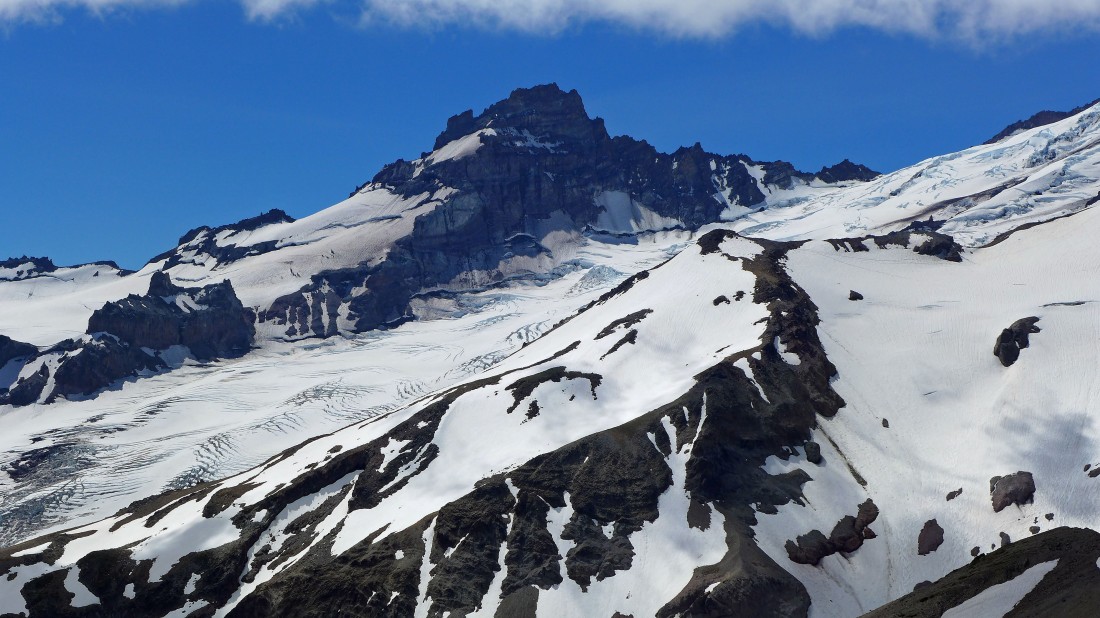
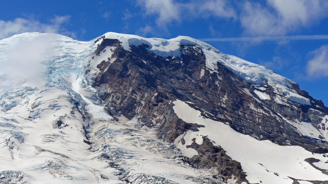
Little Tahoma and Mt. Rainier from the summit of Third Burroughs... Mt. Ruth and Steamboat Prow in the left foreground... the Winthrop Glacier in the center of the photo runs up to Columbia Crest and the summit of Rainier... Curtis Ridge on the right.
|
Serious cornice activity on Curtis Ridge.
|
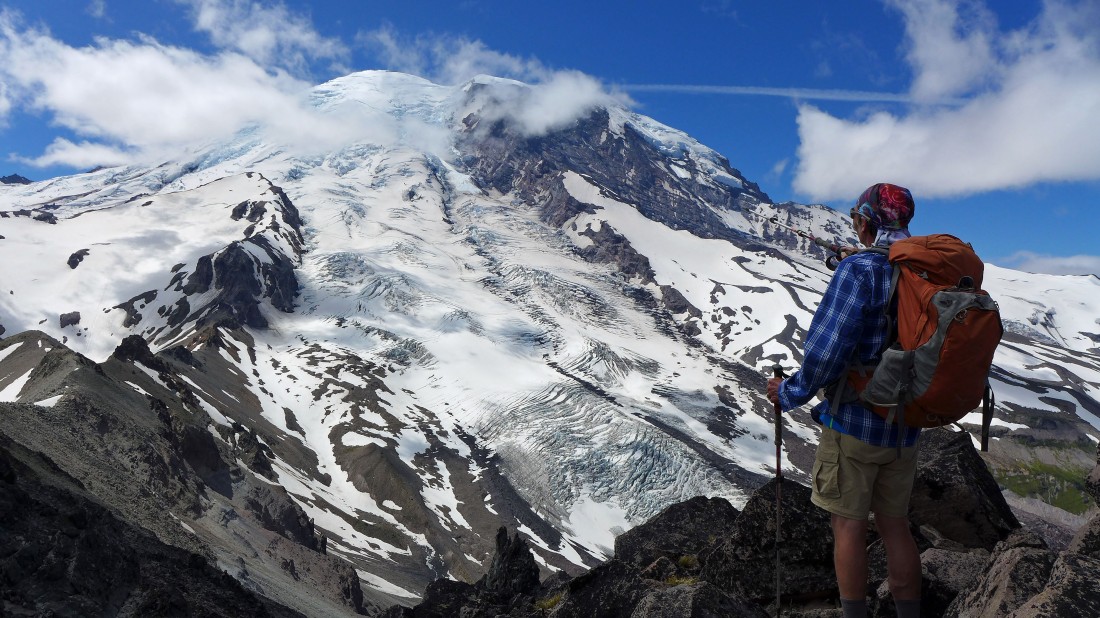
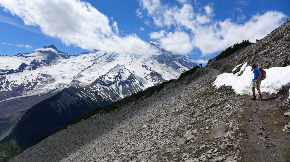
robman enjoys the view of Rainier.
|
We decided to take a shortcut on the way back to Second Burroughs.
|
Looking back at Third Burroughs as we head back to Second Burroughs... clouds are rolling in.
|

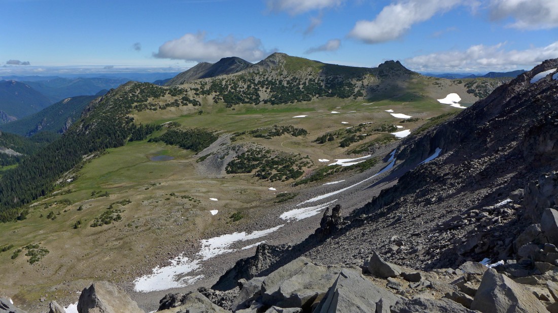
Almost back up to Second Burroughs... looking out to Grand Park... with Skyscraper Mountain on the left... and Mt. Fremont on the right.
|
Back on Second Burroughs... heading for First Burroughs.
|
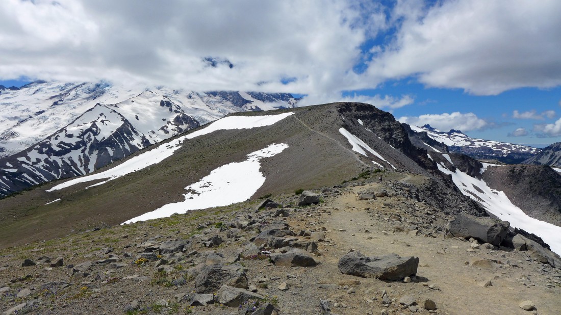
Looking back at Second Burroughs from the west end of First Burroughs... this is where we will start hiking on the Sunrise Rim Trail.
|
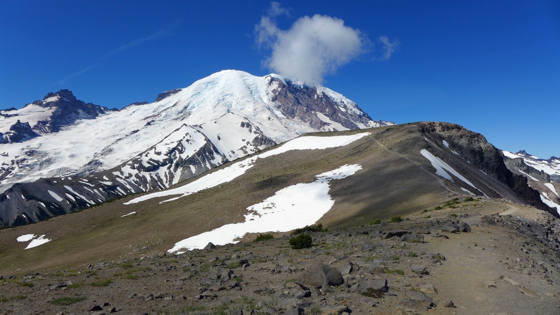
On the south side of First Burroughs... using the Sunrise Rim Trail now... looking back at Third and Second Burroughs.
|
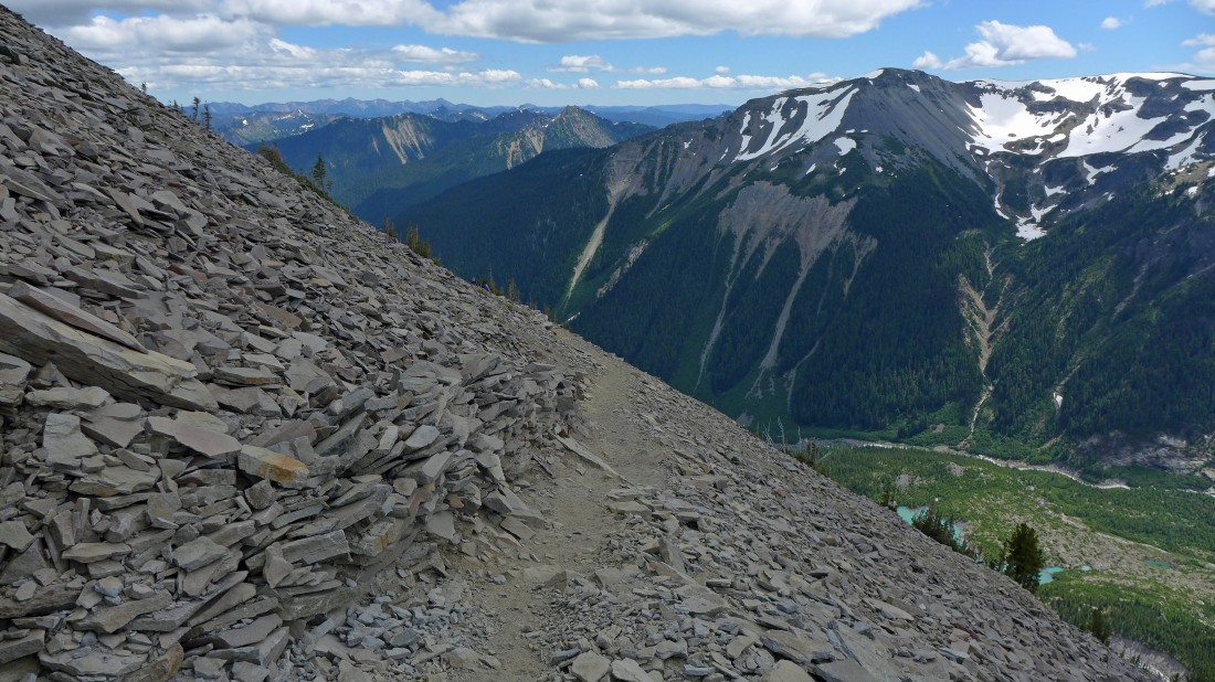
Continuing downhill on the Sunrise Rim Trail... looking over the east shoulder of Goat Island Mountain on the right to Govenors Ridge and Tamanos Mountain.
|
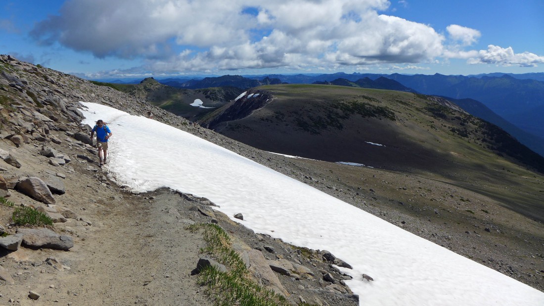
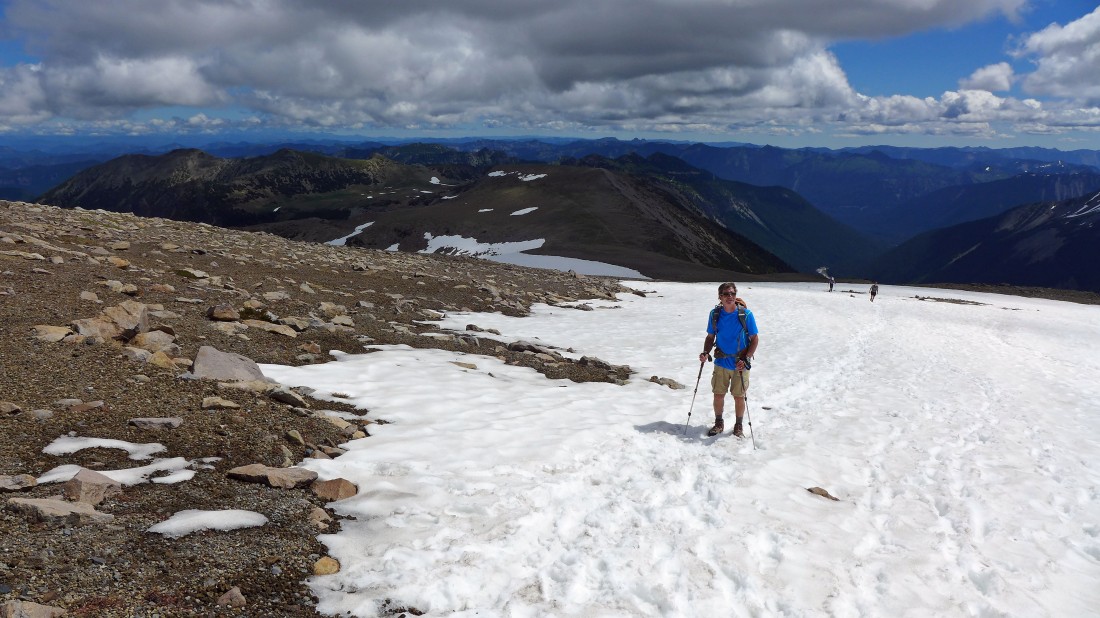
robman finishes up the only patch of snow on the Sunrise Rim Trail.
|
Continuing down the Sunrise Rim Trail... Goat Island Mountain on the right... with Govenors Ridge and Tamanos Mountain on the left.
|
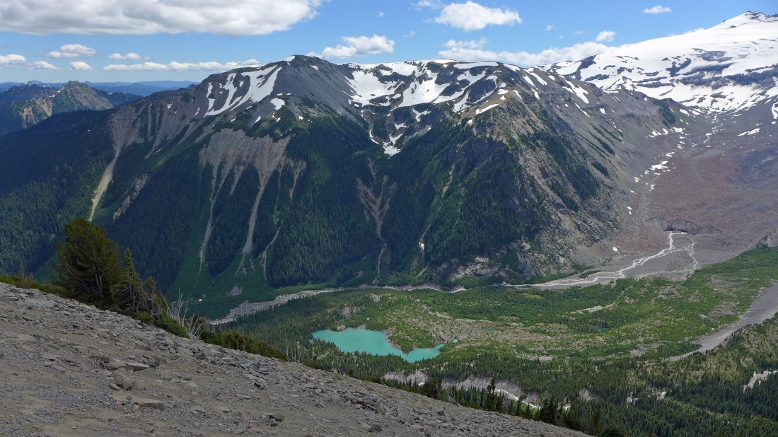
Looking down on an unnamed lake and the White River... and over to Goat Island Mountain... the lower part (brown) of the Emmons Glacier is on the right.
|
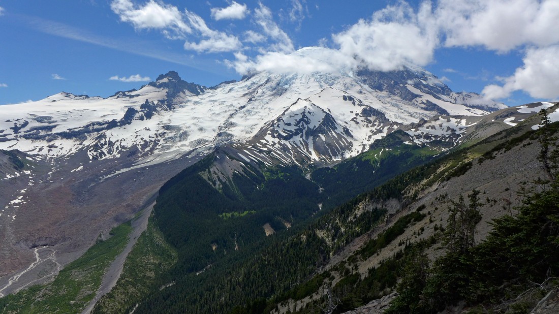
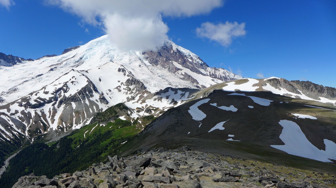
Little Tahoma and Mt. Rainier from the Emmons Overlook.
|
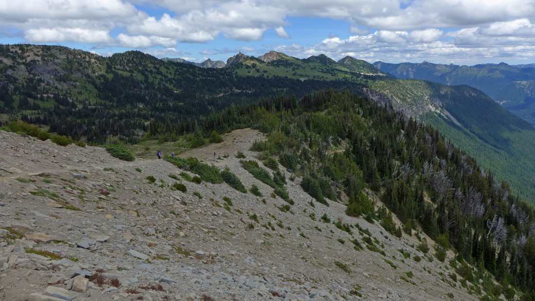
Continuing down the Sunrise Rim Trail.
|
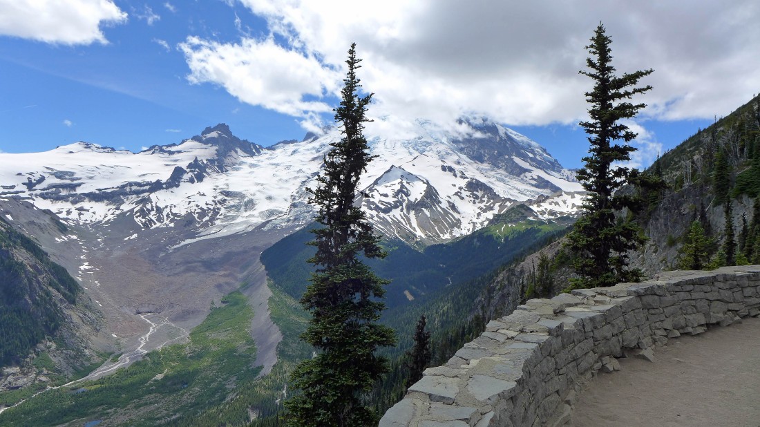
A nice rock wall at Emmons Overlook.
|
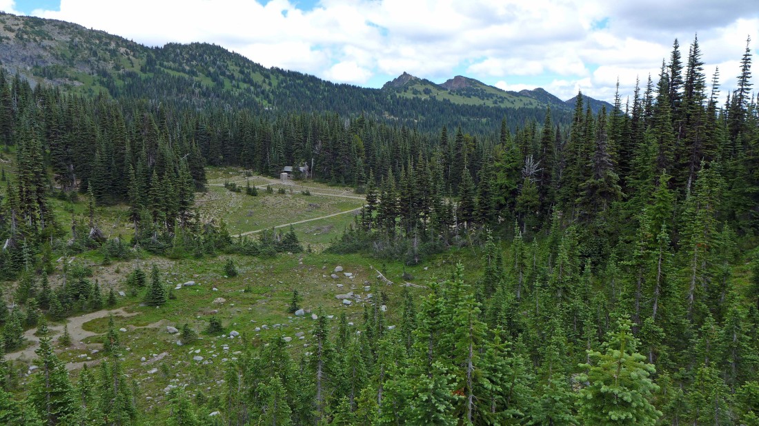
Almost down to Sunrise Camp... used by hikers doing the Wonderland Trail.
|
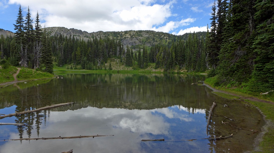
Shadow Lake... a short distance east of Sunrise Camp... a half-mile hike will get us back to the car at Sunrise... a 9.6 mile hike today, gaining 2755 feet of elevation.
|
