Sibley Peak and Sibley Point - 7.11.2018

From Cascade River Road, turn onto FS-1540 and drive 4.7 miles to the end of the road and park (~3530') at the Hidden Lake Trailhead.
|
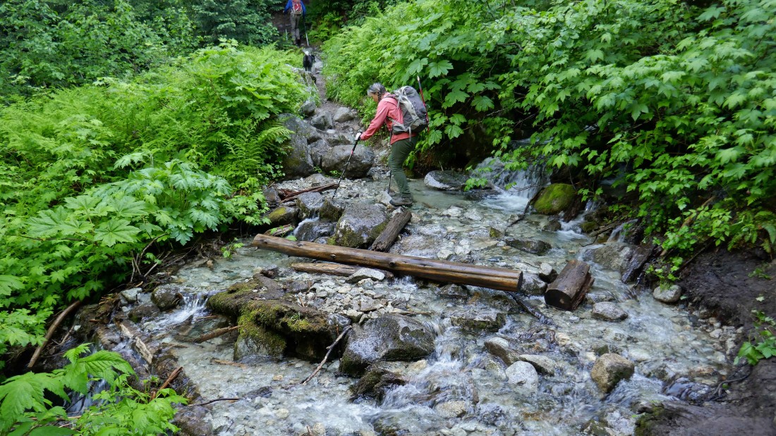
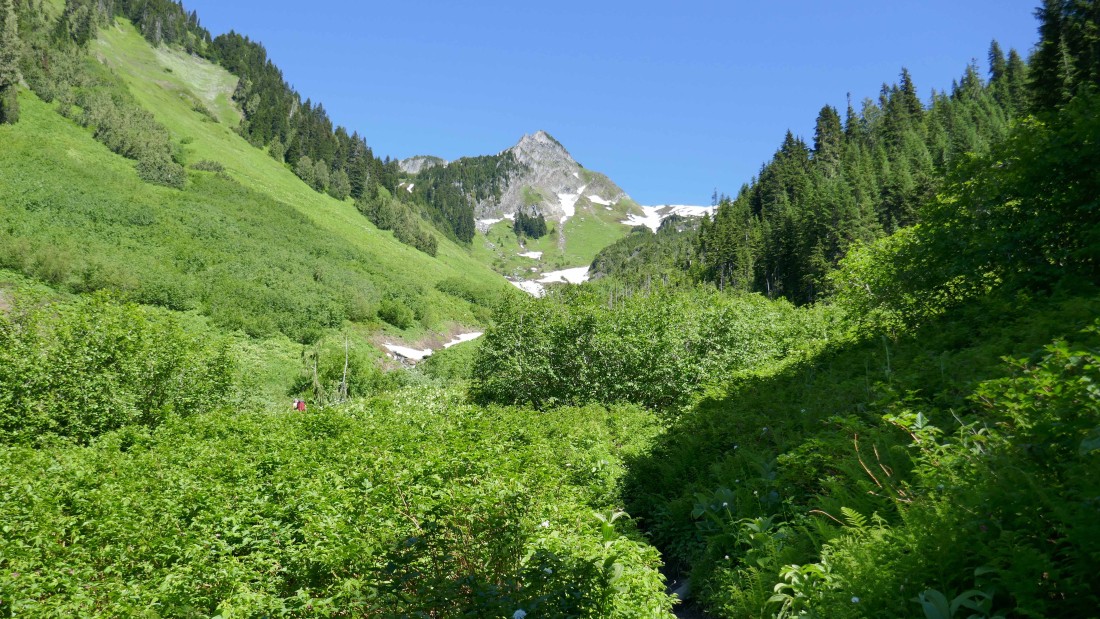
After hiking less than half-a-mile we found what would be the largest stream crossing of the day... and it was very easy to negotiate.
|

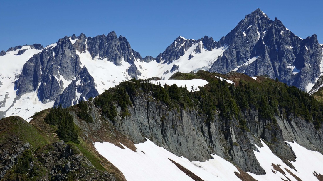
After hiking less than one mile we got our first good look at Sibley Peak... and Sibley Pass to the right of the peak.
|
Gaining elevation up the East Fork drainage of Sibley Creek... Sibley Pass is above.
|
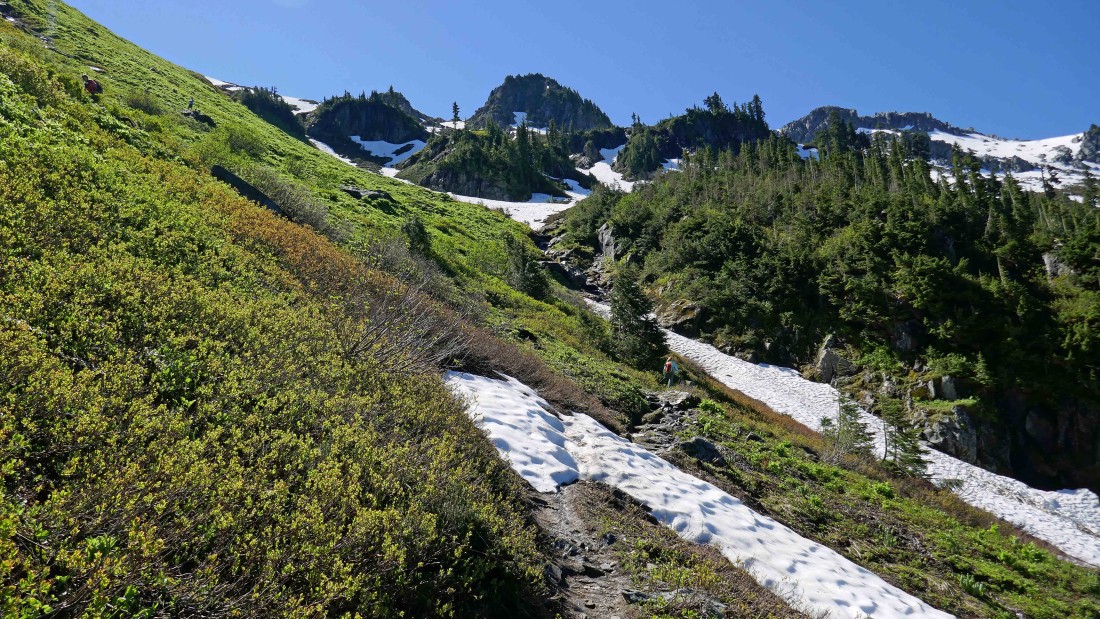
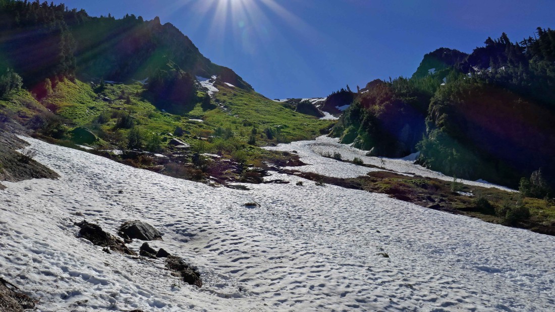
Switchbacking our way up toward Sibley Pass... the trail avoids the snow until ~600 feet below the pass.
|
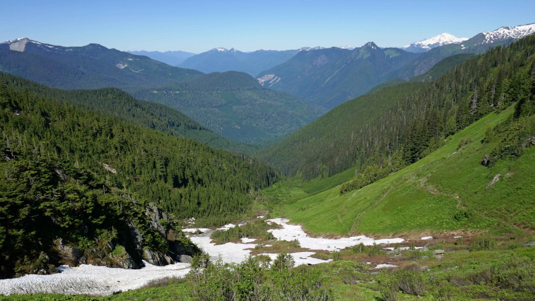
Looking back down the East Fork drainage of Sibley Creek... you can see some of the switchbacks on the hillside... Mt. Baker in the distance on the far right.
|
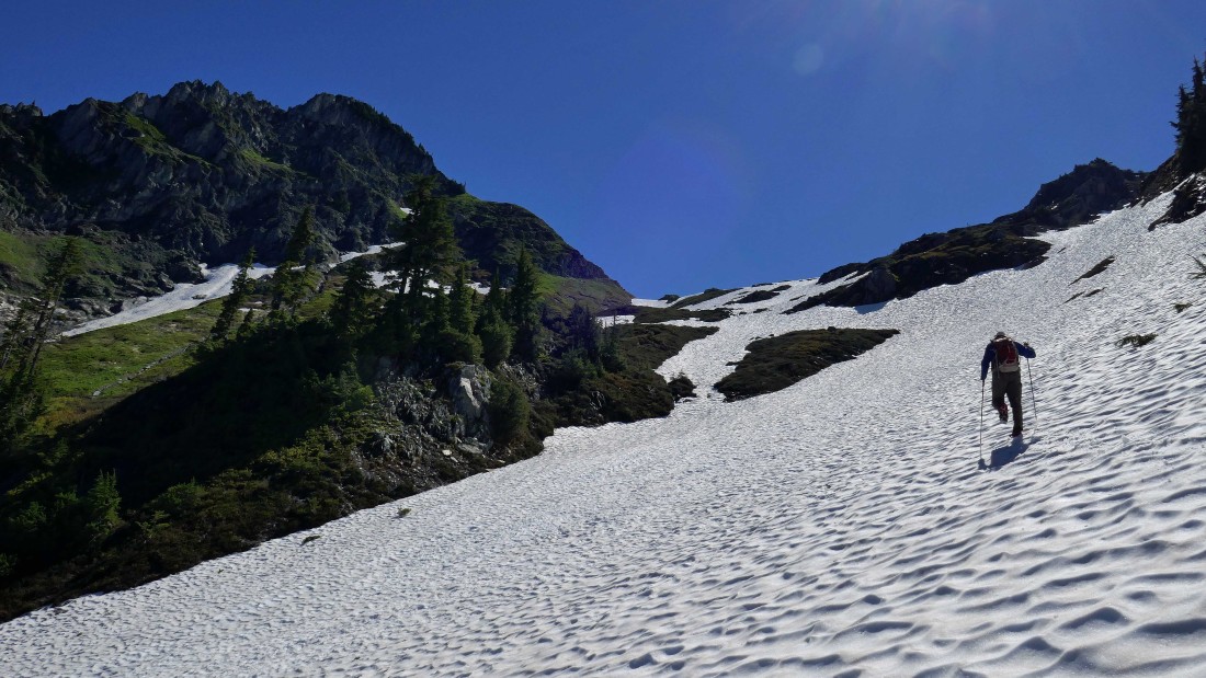
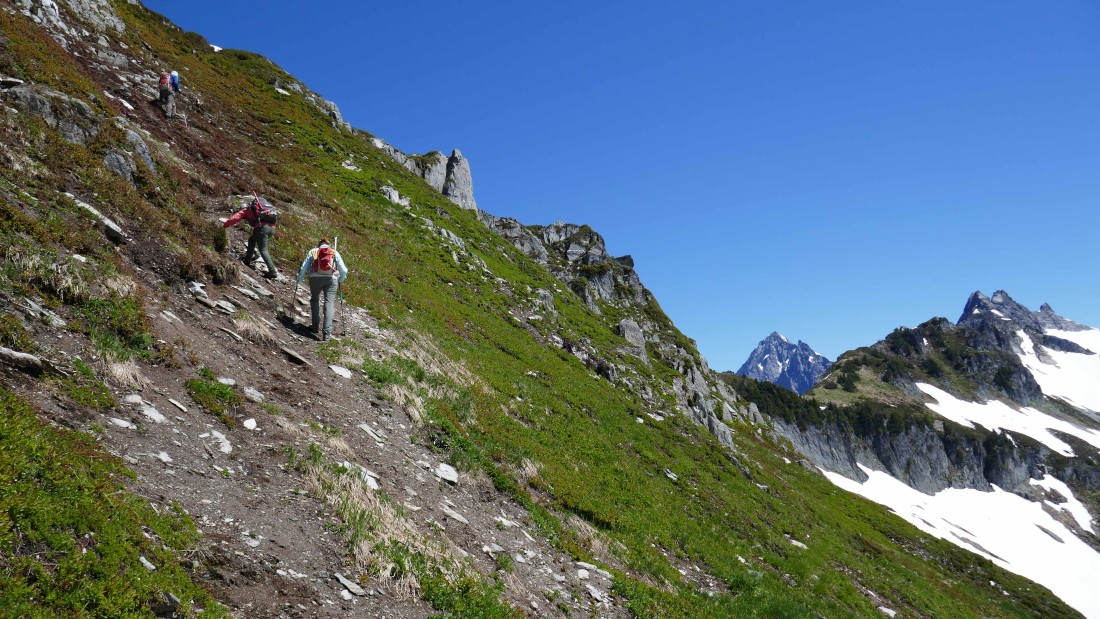
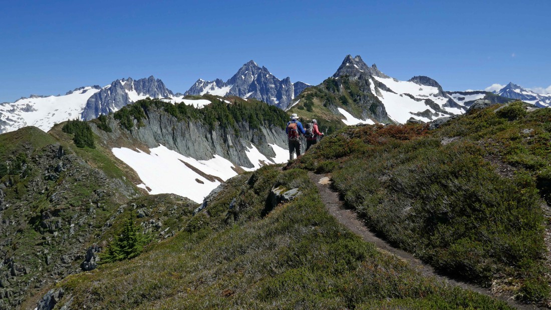
After hiking two miles we left the trail at ~5420 feet and headed up toward Sibley Pass... Sibley Peak is on the left.
|
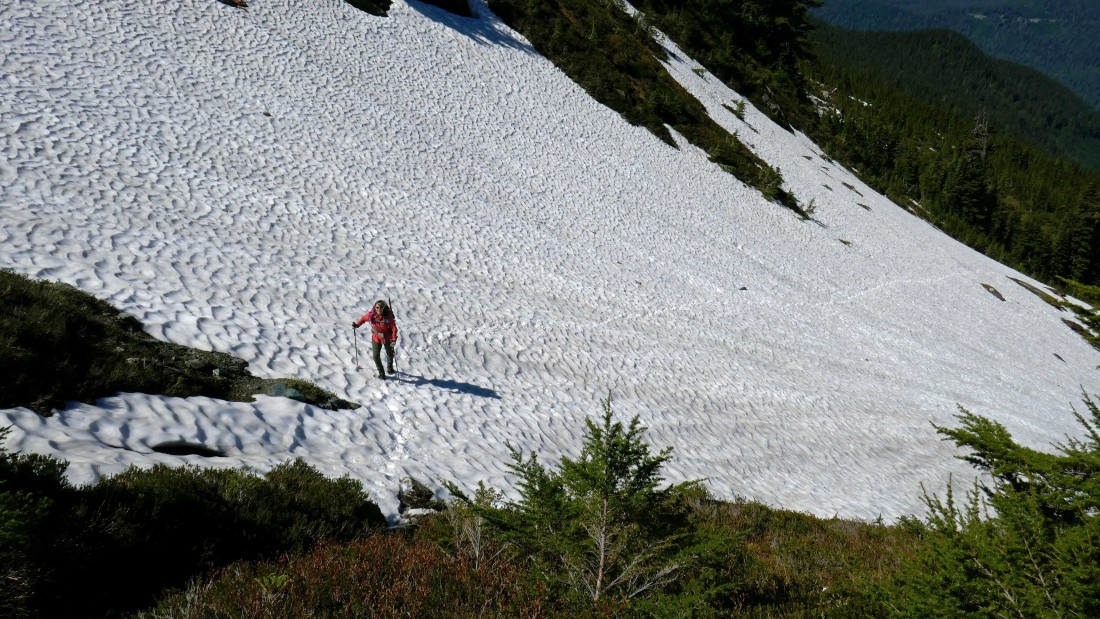
Snowdog on the way up to Sibley Pass... we put on our spikes/crampons after leaving the main trail.
|

Izzy takes a break as we use a combination of snow and heather to get up to Sibley Pass.
|

Still working our way up to Sibley Pass... with Sibley Peak above.
|
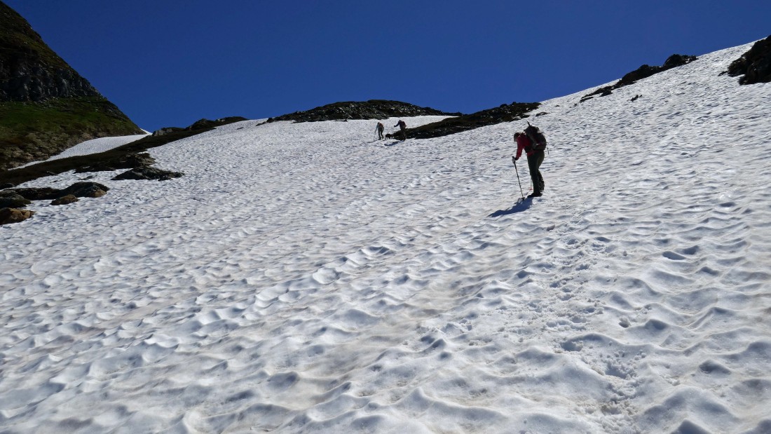
The final stretch to Sibley Pass.
|
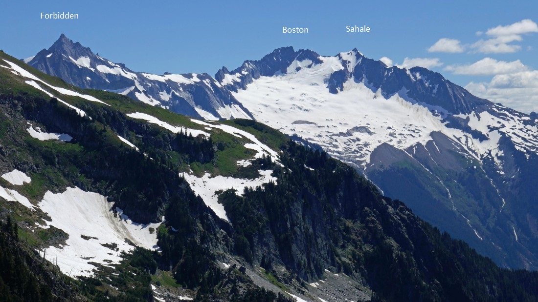
After hiking a total of 2.3 miles we have reached Sibley Pass (6070')... and were greeted with this view... The Triad on the left... then Forbidden, Boston and Sahale in the left-center... Johannesburg in the center... with Spider and Formidable to the right of Johannesburg... and finally, the high point (7088') of Hidden Lake Peaks on the far right.
|
Some peak identification from Sibley Pass.
|
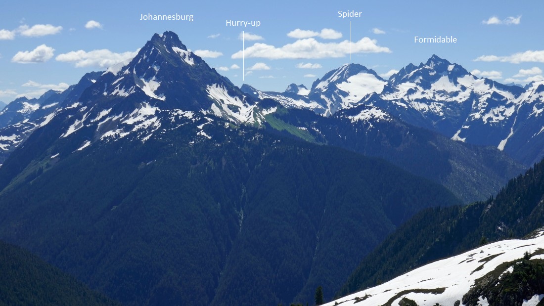
Some more peak identification from Sibley Pass.
|
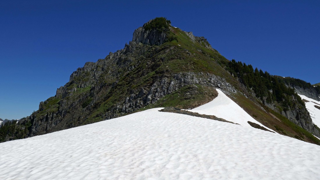
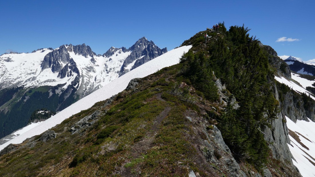
After a short break we will be heading up to Sibley Peak.
|
Once we get up to Sibley Peak we will follow the ridge over to Sibley Point.
|

On the way to the summit of Sibley Peak.
|
Steep terrain from Sibley Pass up to Sibley Peak.
|
Working our way up to Sibley Peak... looking through the gap to Eldorado... with Sibley Point and The Triad on the right.
|
After hiking a total of 2.5 miles we have reached the summit (6498') of Sibley Peak and found this view.
|
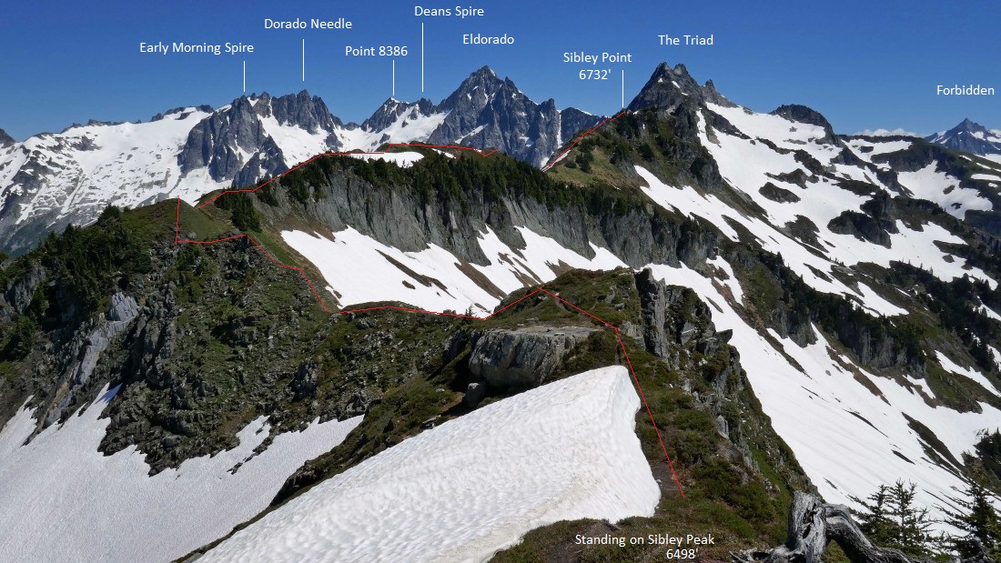
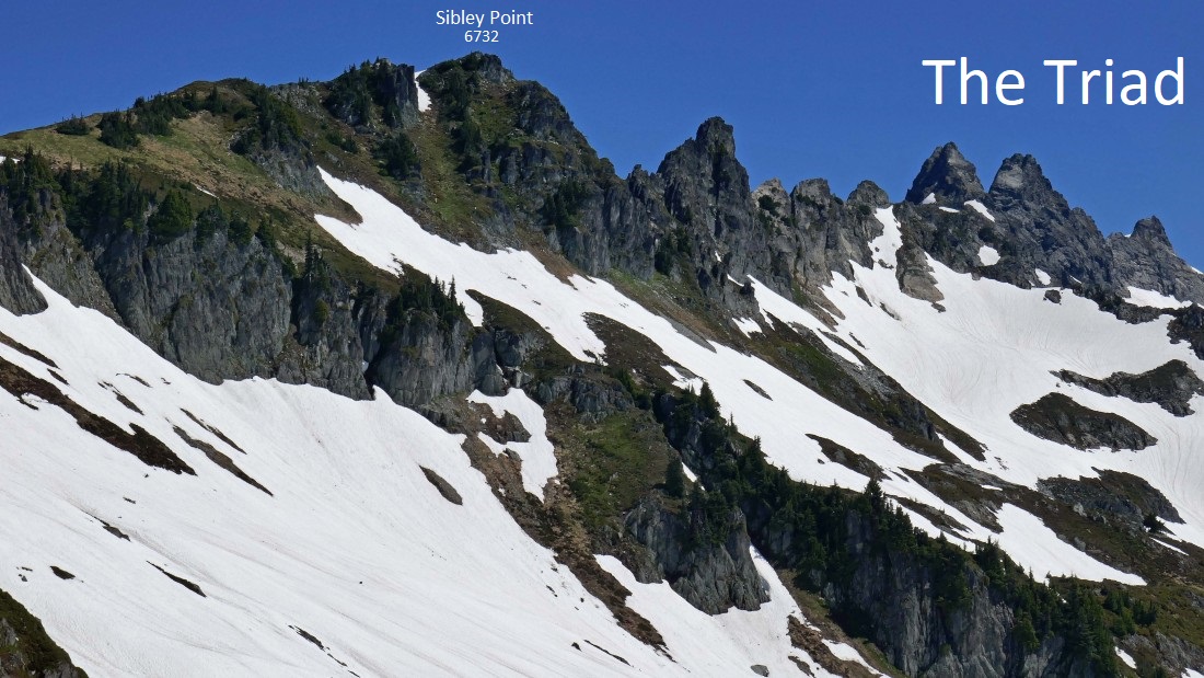
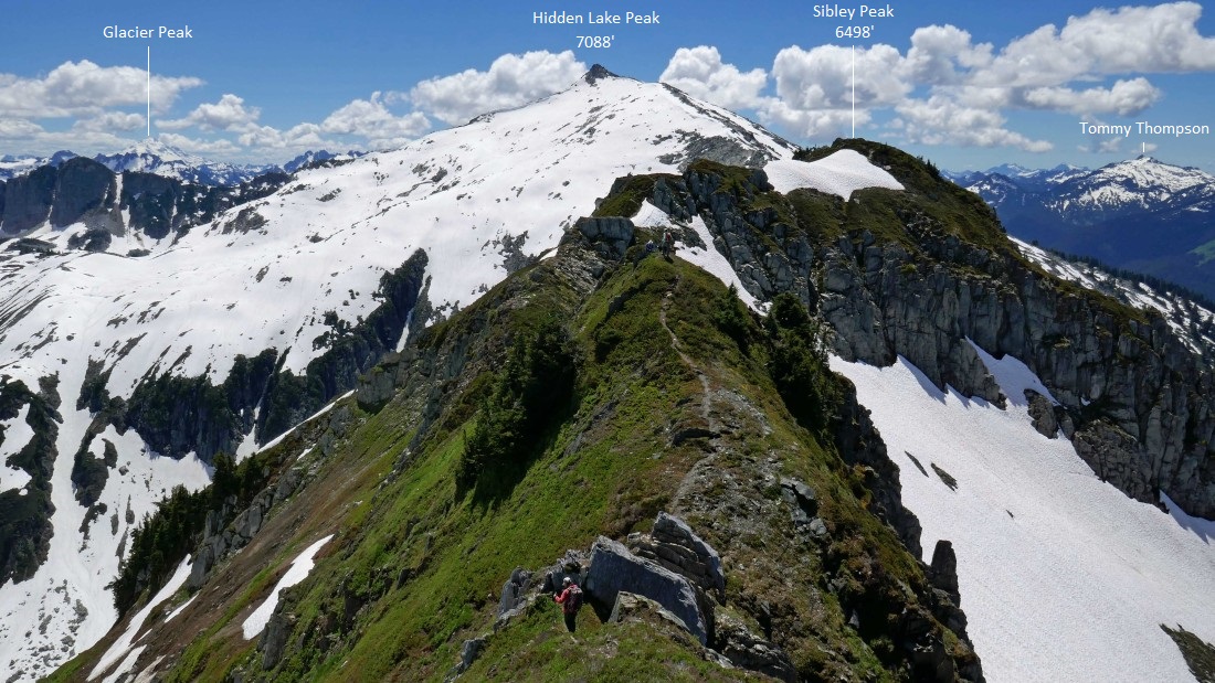
Some peak identification from our perch on Sibley Peak... showing the approximate ridge route that we will use to get over to Sibley Point.
|
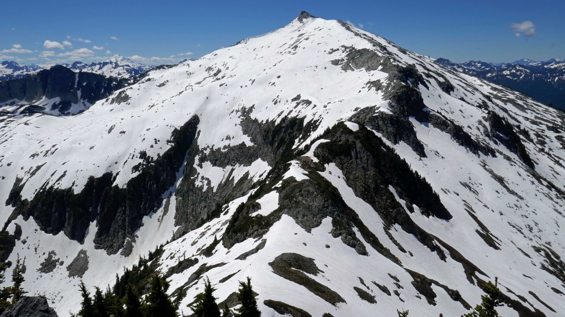
The highest (7088') of the Hidden Lake Peaks... with Glacier Peak in the distance on left... Sibley Pass is in the bottom of the photo.
|
More peak identification from Sibley Peak.
|
A closer look at the ridge we will use to get over to Sibley Point (out of frame)... with Early Morning Spire, Dorado Needle, Point 8386, Deans Spire and Eldorado beyond the ridge.
|

A closeup of Glacier Peak from Sibley Peak.
|
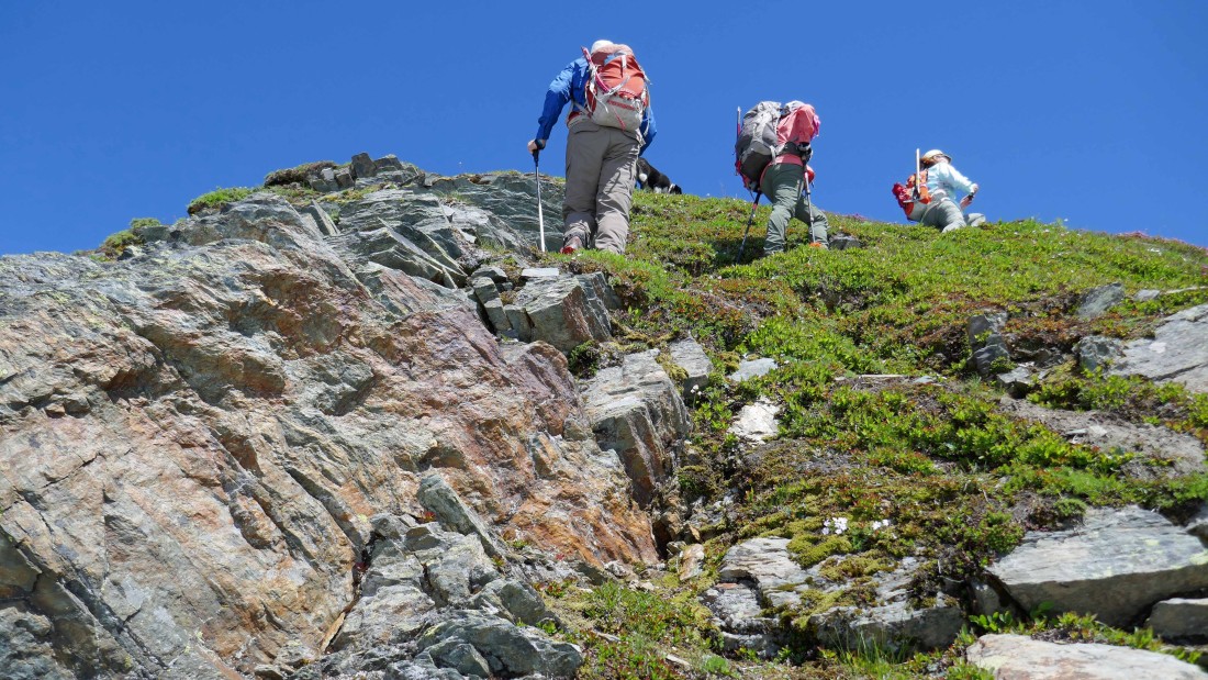
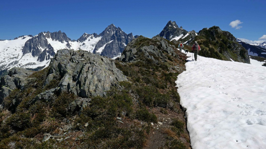
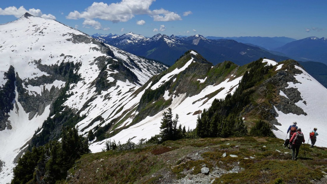
Heading out along the ridge that will get us over to Sibley Point.
|
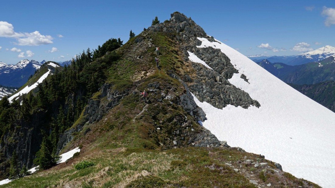
Continuing along the ridge toward The Triad... there are several ups and downs along the ridge.
|
Continuing along the ridge toward The Triad.
|
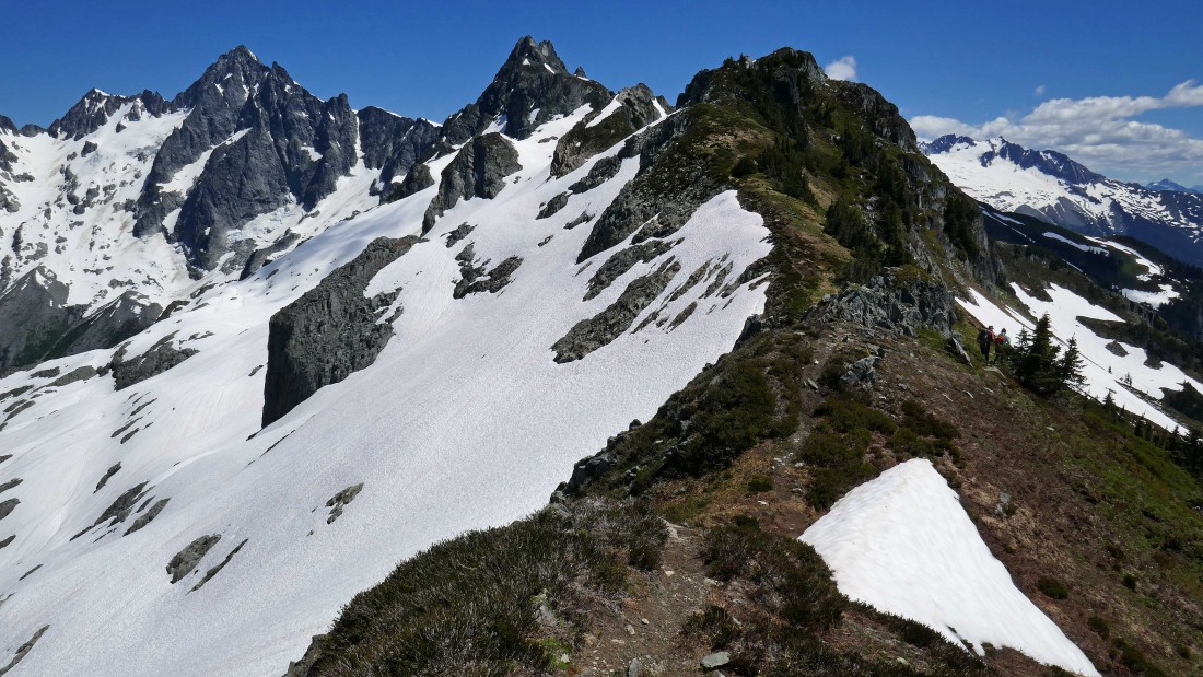
Nearing Sibley Point... with the final up section just ahead.
|
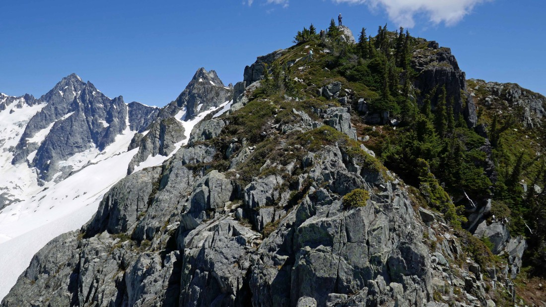
puzzlr is standing on top of Sibley Point (6732')... with Snowdog and BarbE close behind.
|

Can you say... 'The hills are alive with the sound of music'.
|
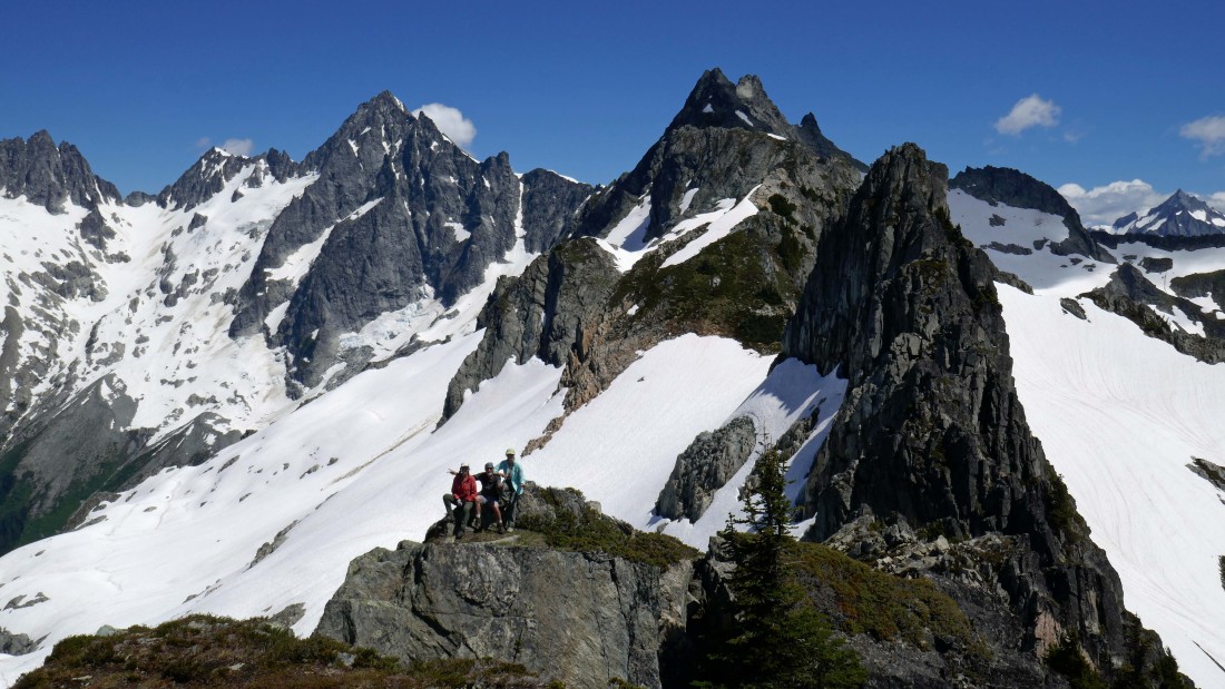
puzzlr took this shot of Snowdog, me and BarbE... dwarfed by Eldorado and the Triad.
|
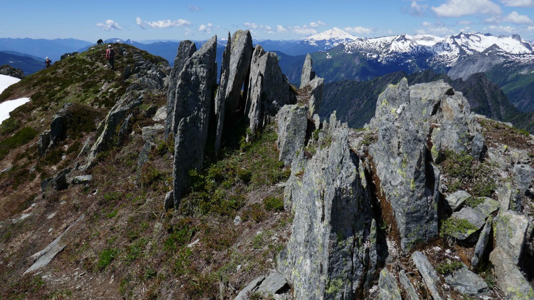
A pano shot from Sibley Point.
|
A pano from Forbidden, Boston and Sahale on the left to the highest of the Hidden Lake Peaks on the far right.
|
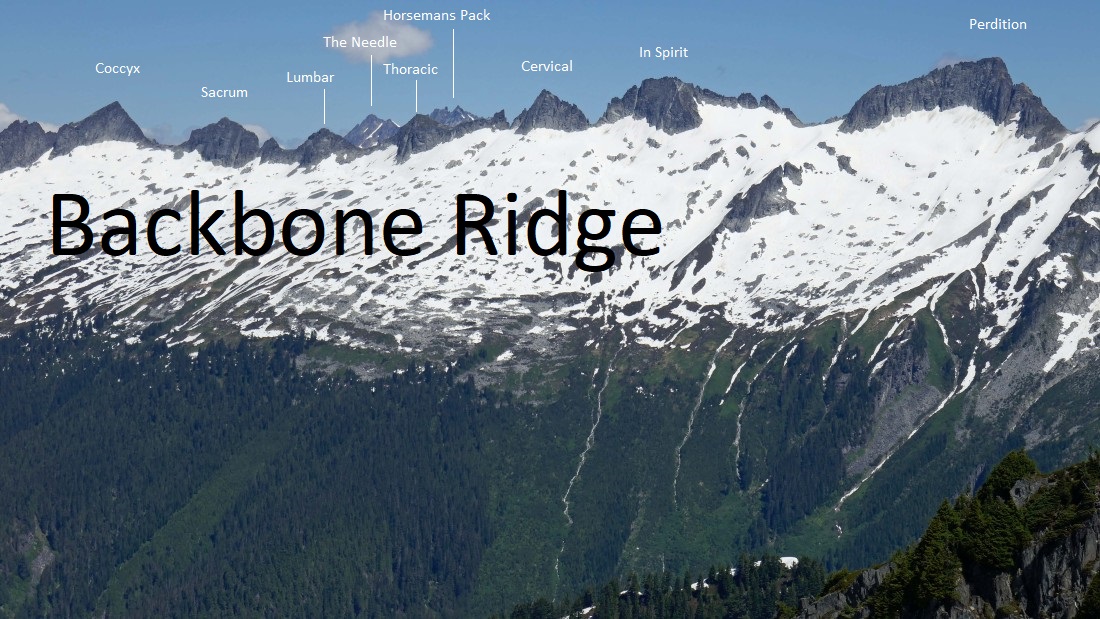
Mt. Baker on the left to Eldorado on the right... with Backbone Ridge in the center of the photo.
|
|
The Southern Pickets are on the far left horizon... then Backbone Ridge, Early Morning Spire, Dorado Needle, Eldorado, The Triad... and Forbidden Peak on the extreme far right.
|
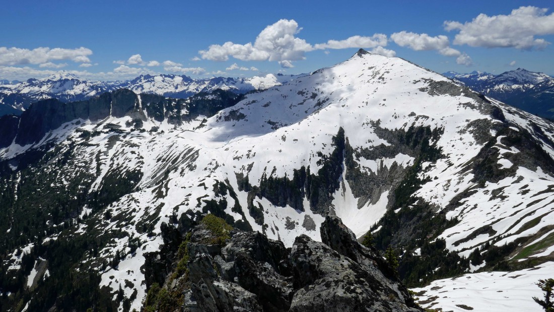
Glacier Peak on the far left horizon... with the highest (7088') of the Hidden Lake Peaks in the right foreground.
|
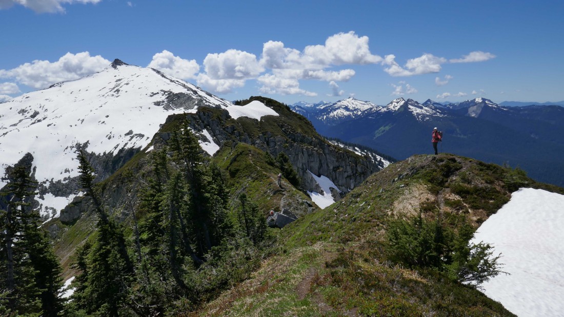
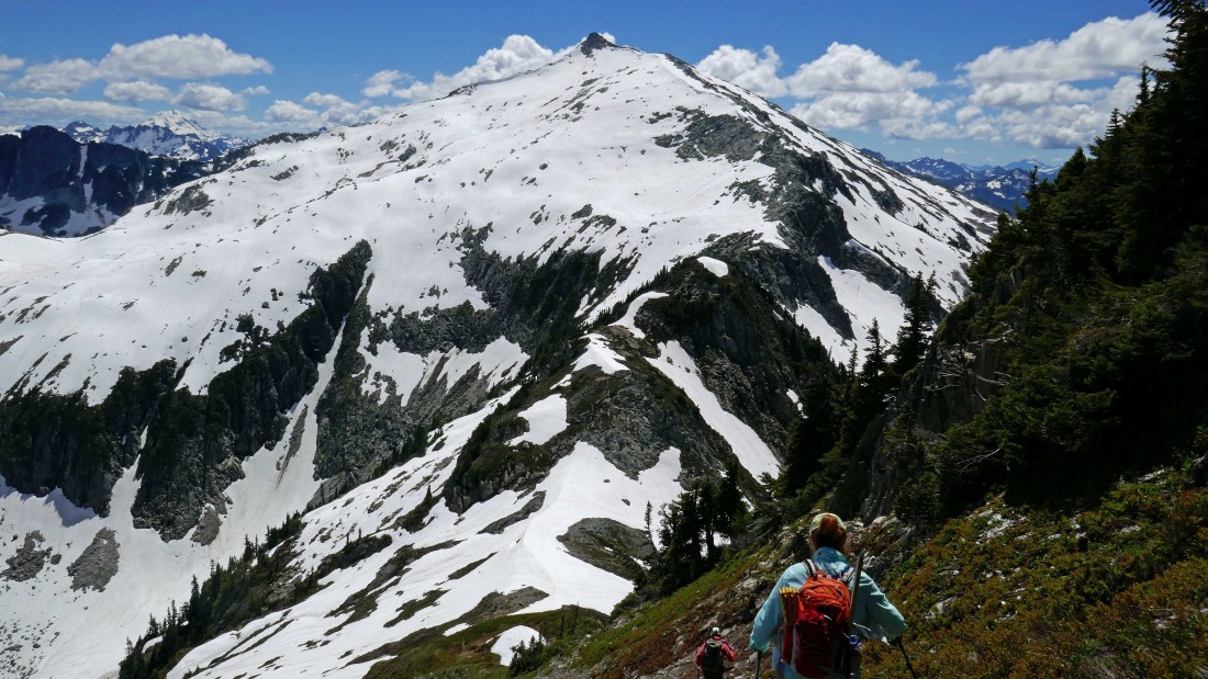
Heading back along the ridge toward Sibley Peak in the center foreground... with Hidden Lake Peaks (7088') and Sibley Pass to the left of the peak.
|
Those ups and downs along the ridge on the way over to Sibley Point have to be dealt with on our return to Sibley Peak in the left foreground... Mt. Baker in the distance on the far right.
|
On the ridge heading back to Sibley Peak... with Mt. Baker, Teebone Ridge Peak, Little Devil Peak, Baskit Peak, Big Devil Peak and Fallen Angel Peak in the distance on the right.
|
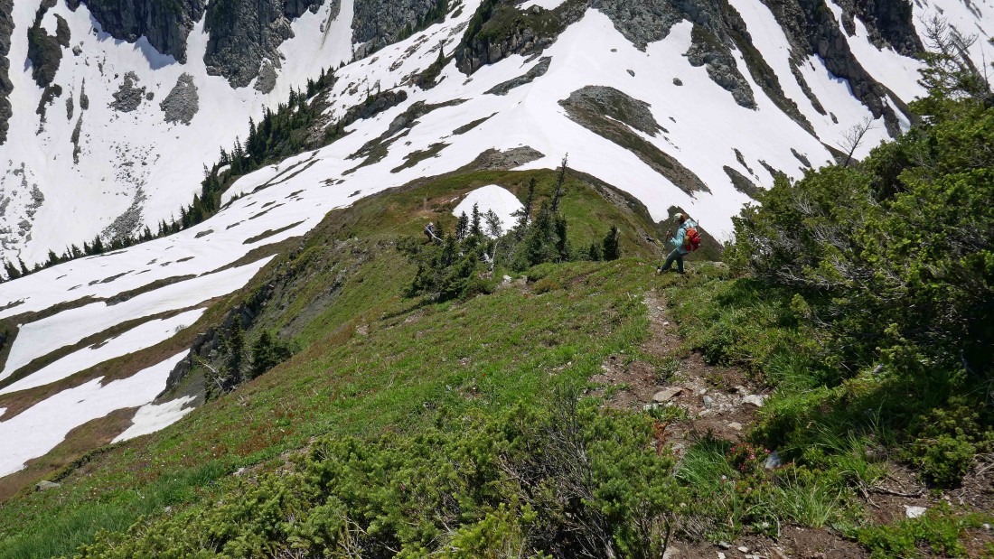
Working the ups and downs that will get us back to Sibley Peak... with the high point of Hidden Lake Peaks on the left.
|
Still working our way back along the ridge to Sibley Peak.
|
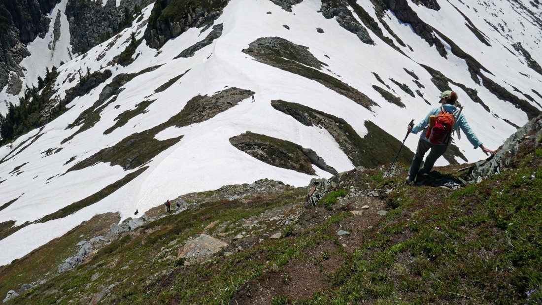
Descending to Sibley Pass below.
|
Working our way down to Sibley Pass.
|
Being extra careful on the steep terrain leading back down to Sibley Pass.
|
puzzlr and Izzy decided to glissade back down to the trail from Sibley Pass.
|
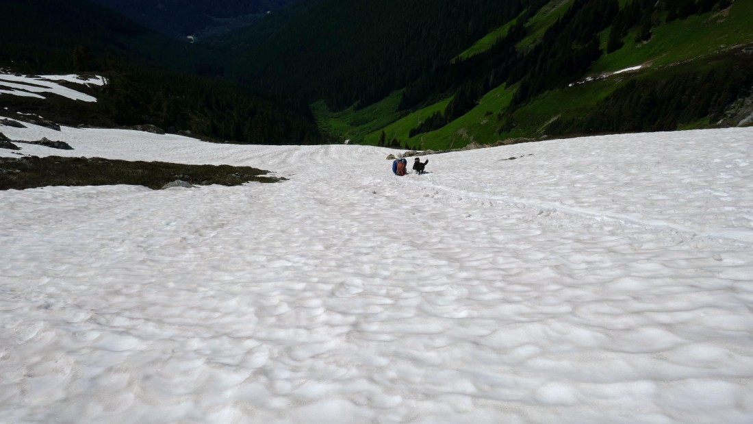
We took advantage of a lingering snowfield to make a quicker descent.
|

Here comes Izzy and Snowdog down the snowfield... with Sibley Peak and Sibley Pass above.
|

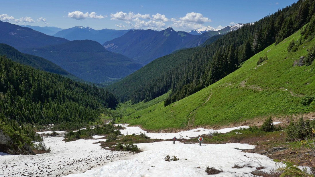
We ran out of snow at ~4730 feet and connected with the trail.
|
Looking back at Sibley Peak and Sibley Pass... and the spot where we ran out of snow... we have less than .75 miles of hiking to get back to the car... our total trip was 5.9 miles, gaining ~3400 feet of elevation.
|
