French Ridge - East Peak and West Peak - 7.18.2018
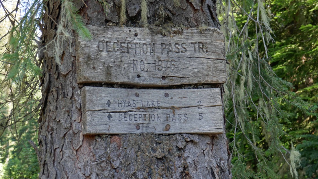
From the Cle Elum Valley Road, turn onto FS-4330 and drive 10.8 miles to the end of the road (~3400 feet)... then start hiking on Deception Pass Trail #1376.
|
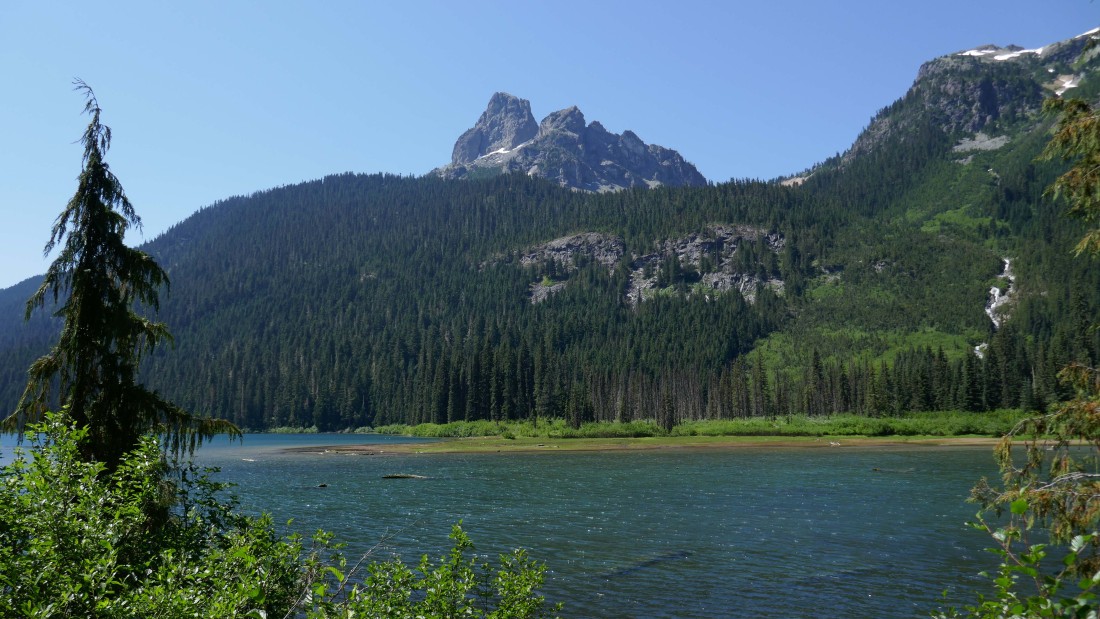
Hiking on Trail #1376 as it passes by Hyas Lake... with a view across the lake to Cathedral Rock.
|
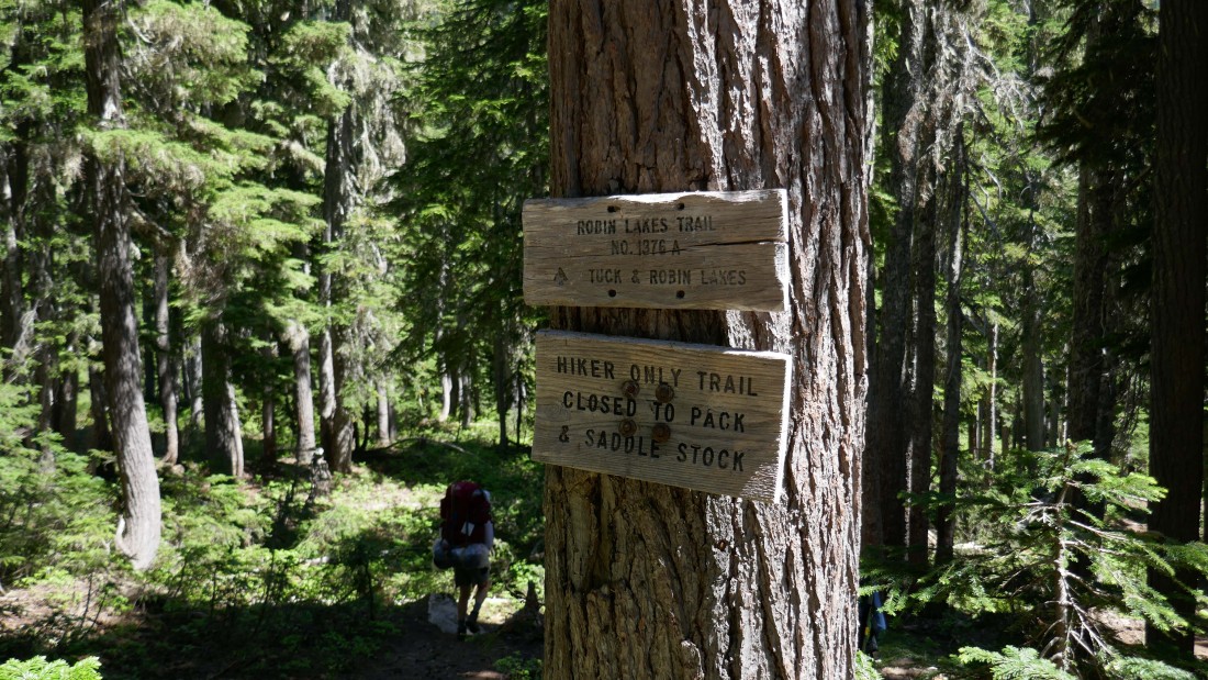
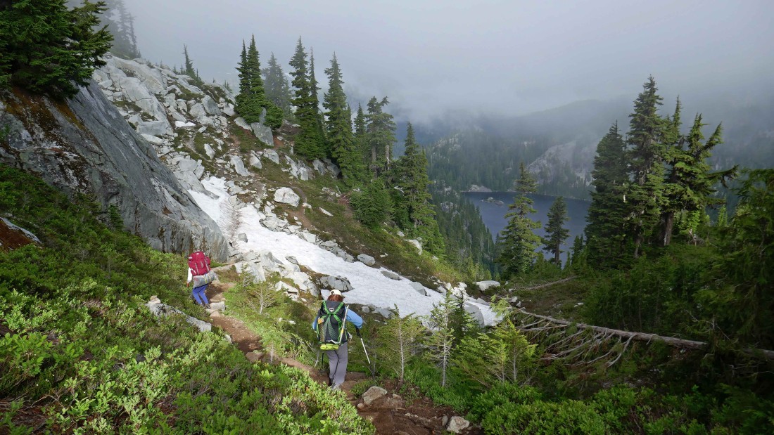
After hiking a total of 4.8 miles, reach the junction (~4200 feet) with Robin Lakes Trail #1376.A and start hiking to Tuck and Robin Lakes.
|
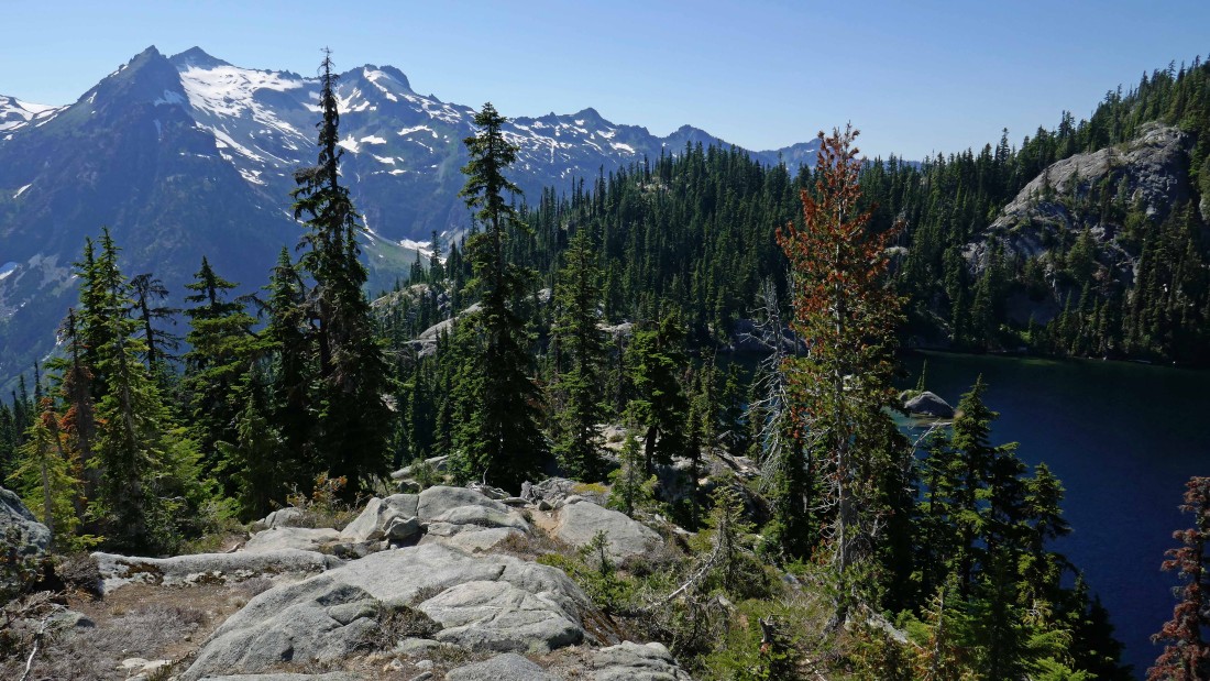
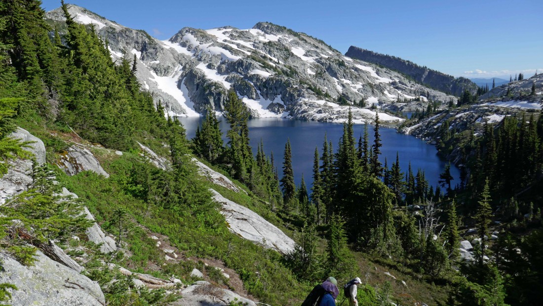
After hiking a total of 6.3 miles, arrive at Tuck Lake (5268')... Robin Lakes are up higher on the other side of the ridge above.
|
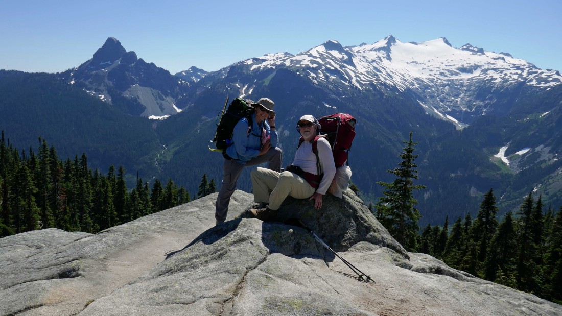
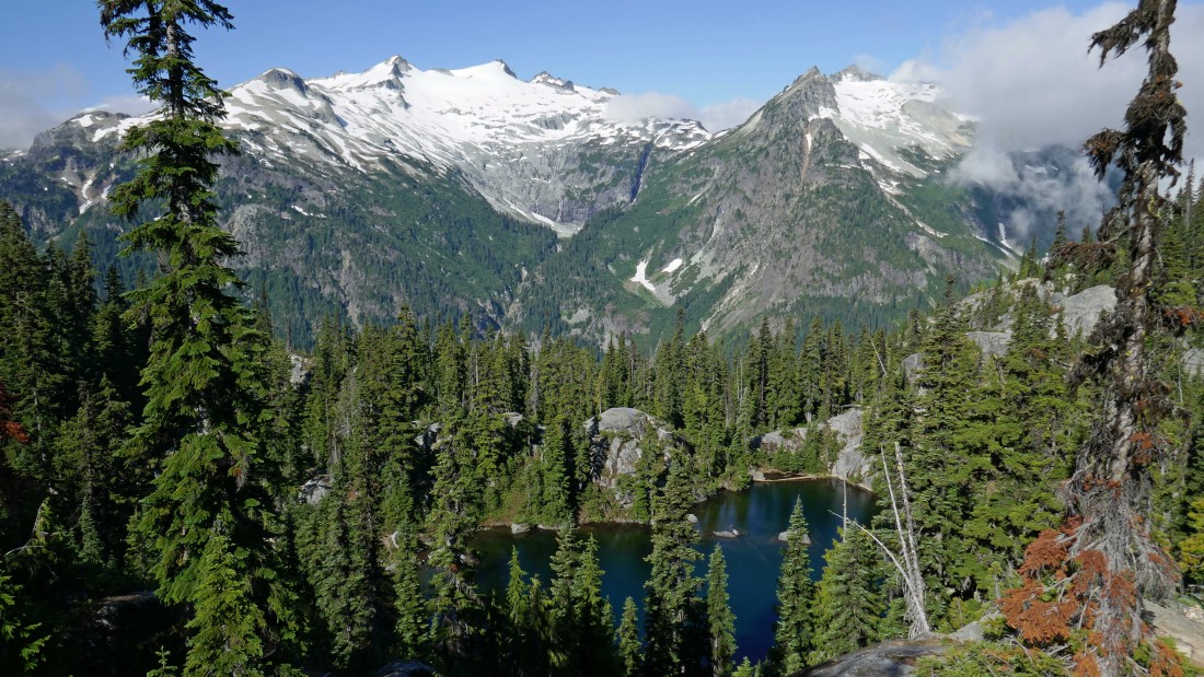
The trail continues around the south side of Tuck Lake... here BarbE and rocman take a break just above Tuck Lake... with Cathedral Rock and Mt. Daniel across the valley.
|
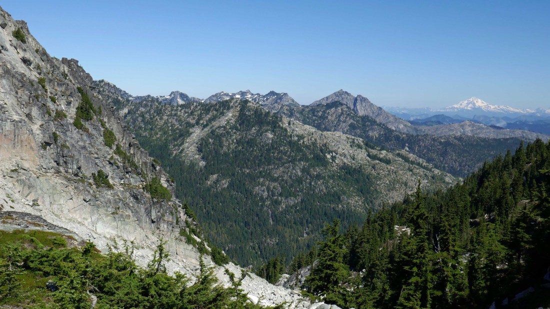
Gaining elevation on the south side of Tuck Lake... with Lynch Peak across the valley.
|

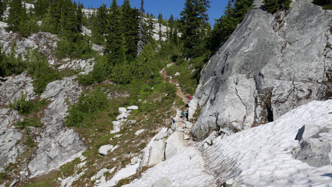
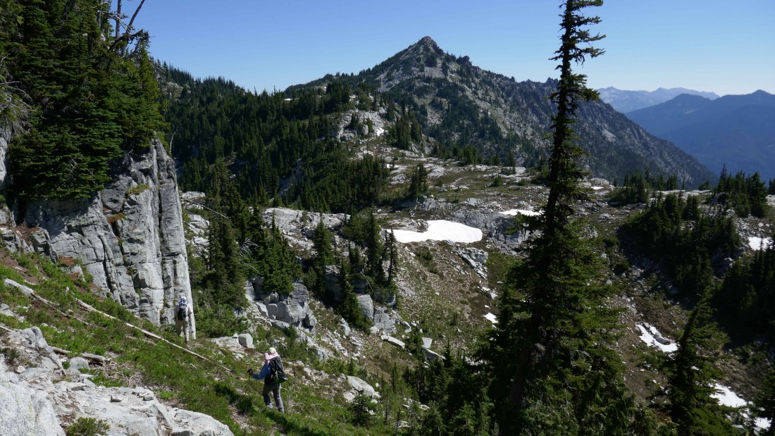
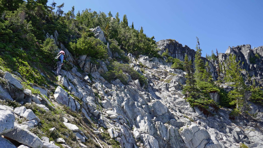
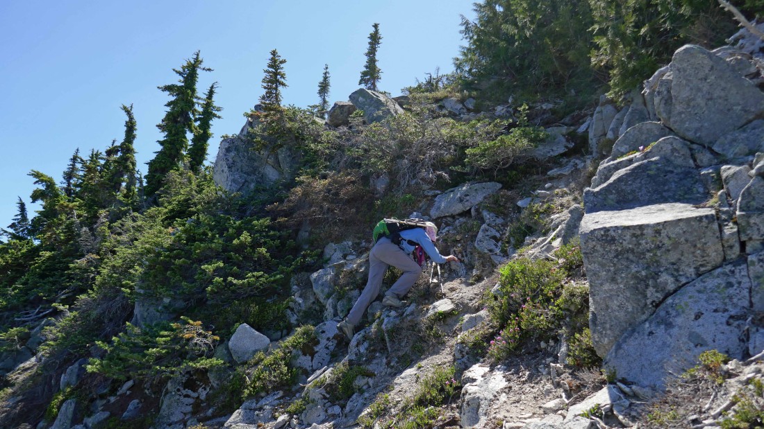
Following a cairned path on the south side of Tuck Lake... steep terrain.
|
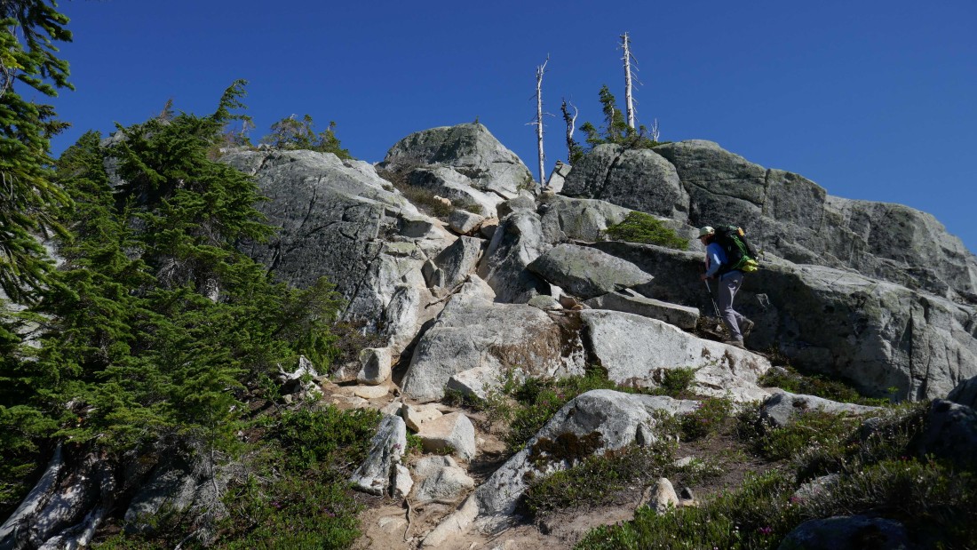
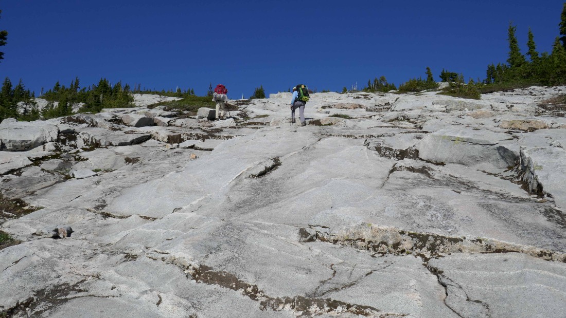
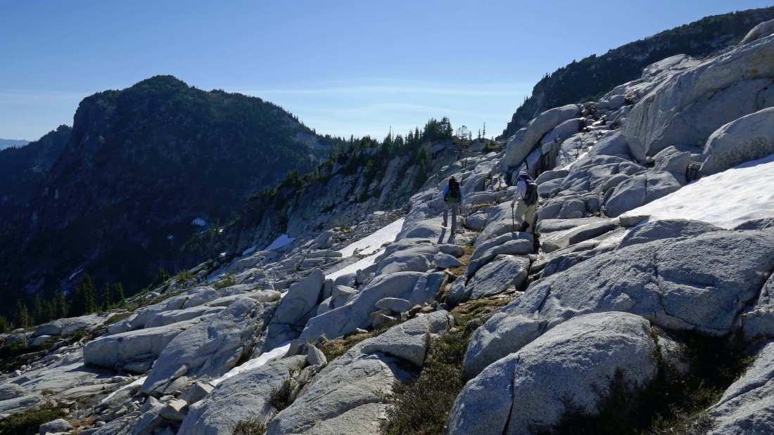
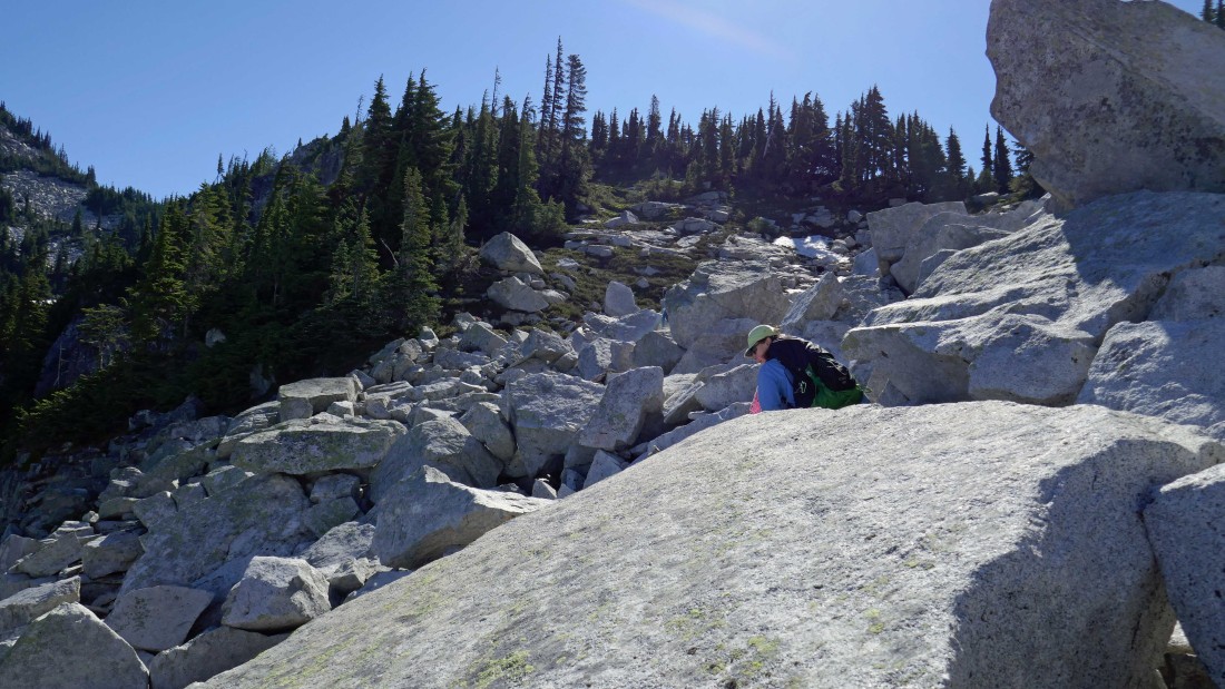
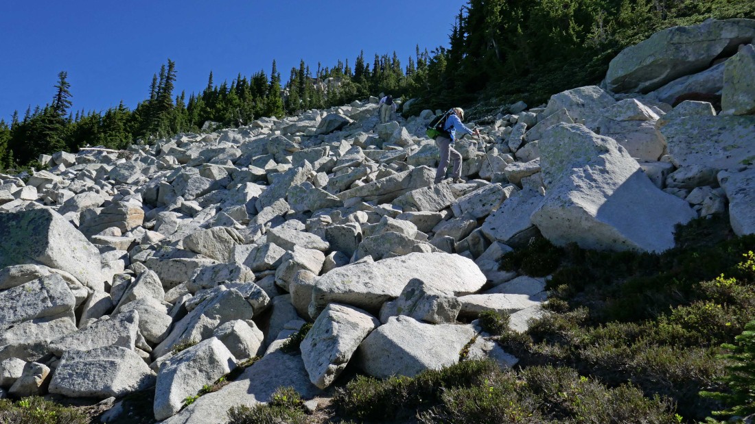
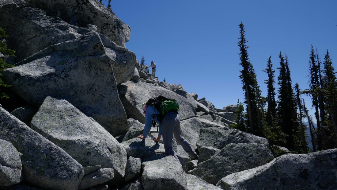
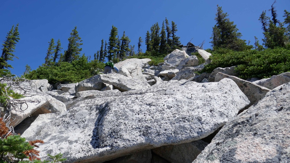
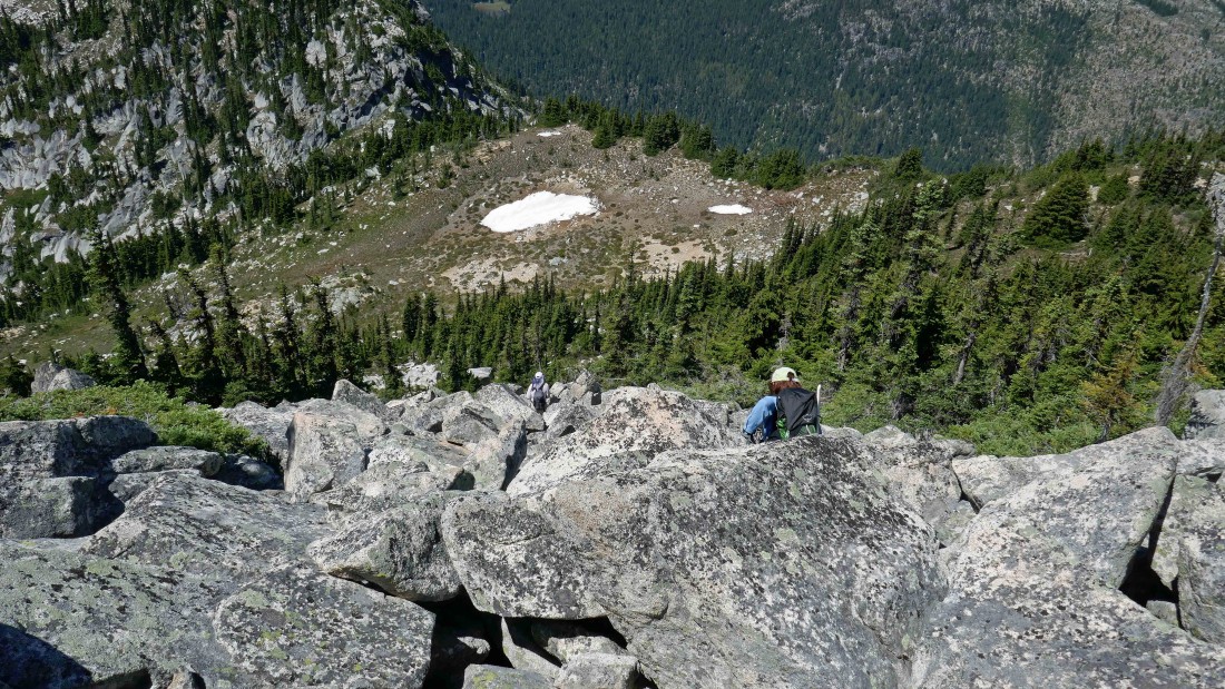
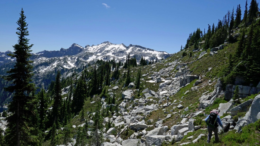
Lots and lots of granite on the route from Tuck Lake to Robin Lakes... with lots and lots of Class 2 terrain.
|
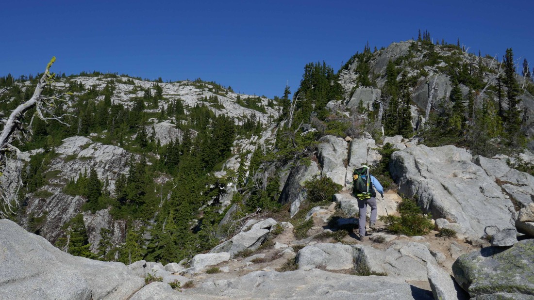
Still gaining elevation on the granite... Robin Lakes is up there somewhere on the other side of the ridge above.
|
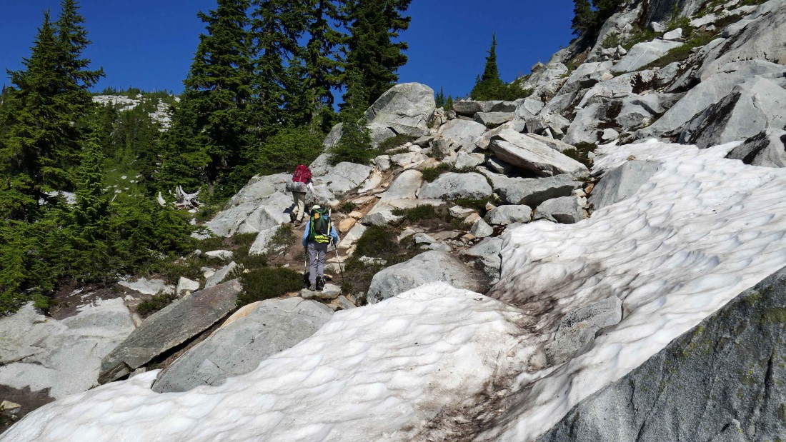
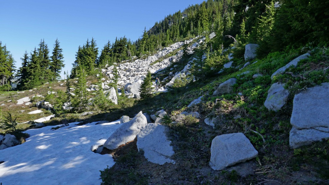
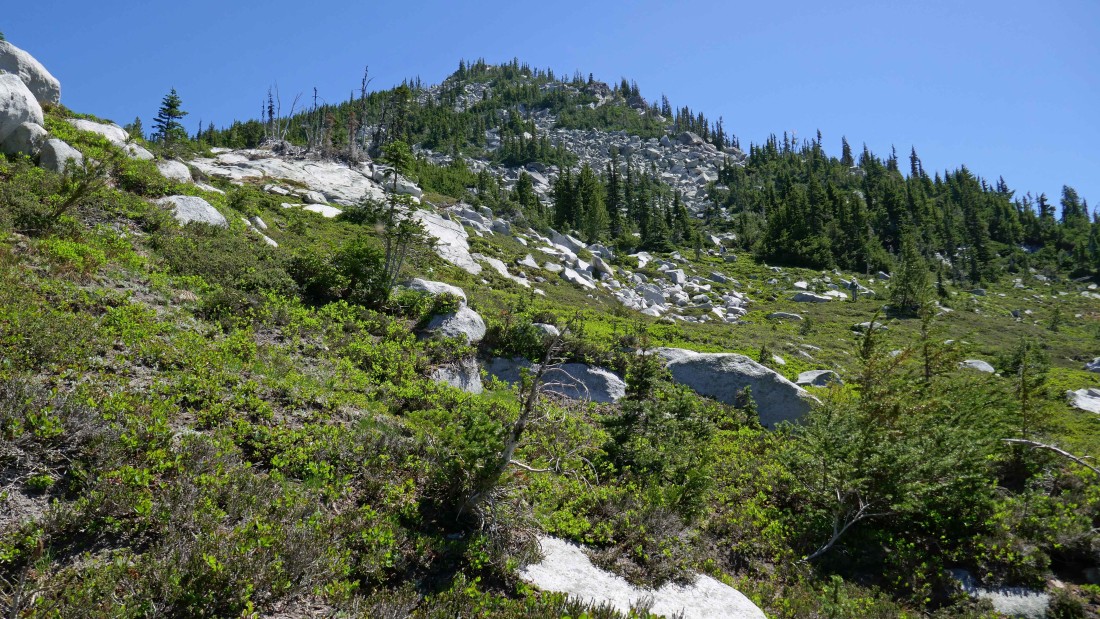
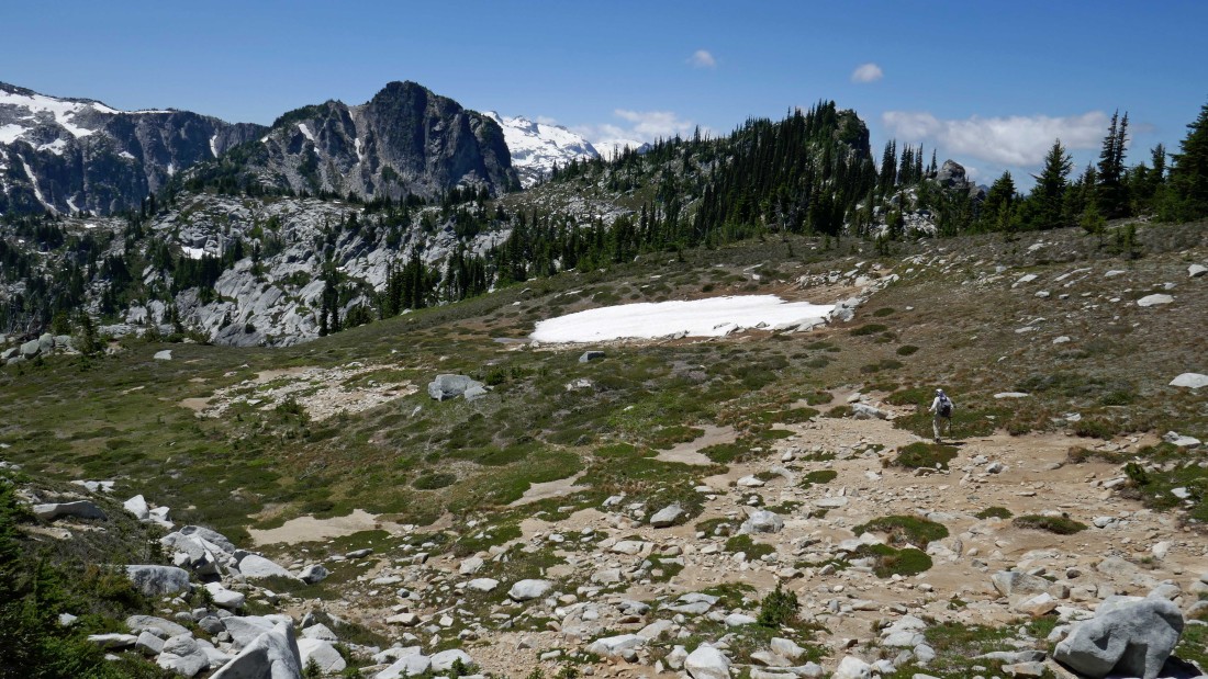
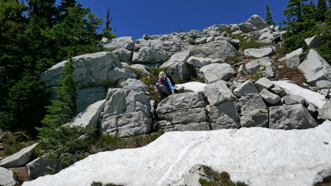
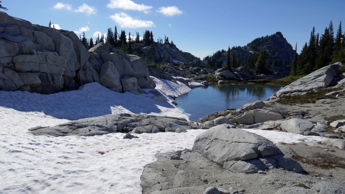
There were only two small patches of snow along the route to the ridge.
|
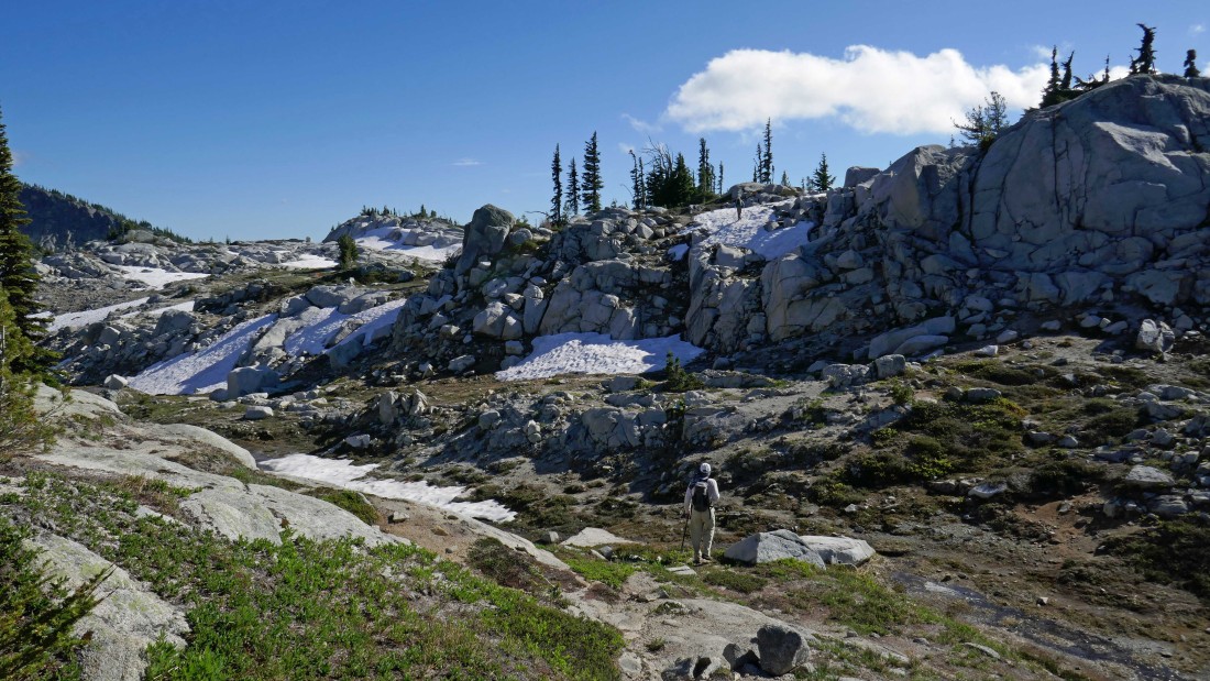
There are definitely a few downs and ups on the route from Tuck Lake to Robin Lakes.
|
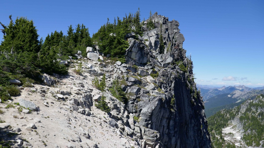
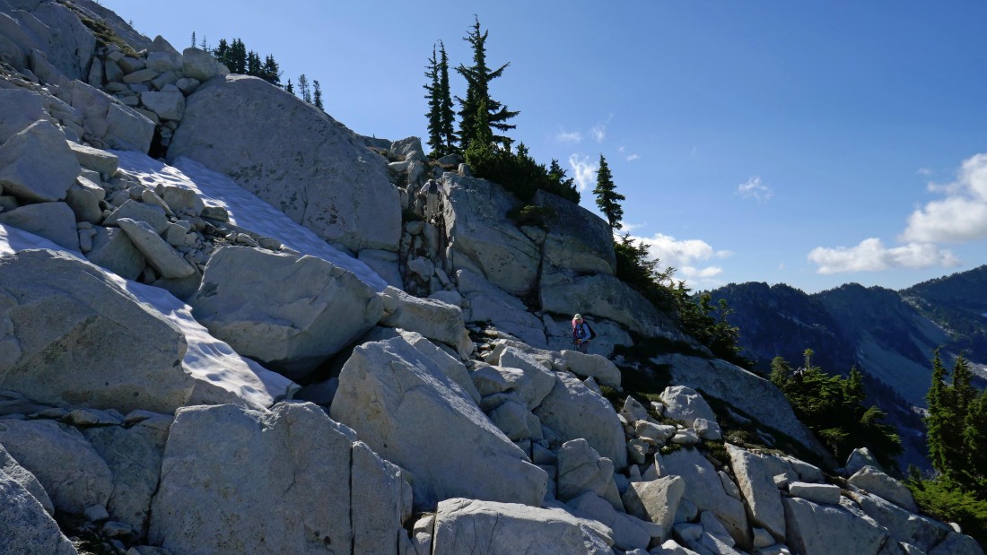
Almost to the top of the ridge.
|
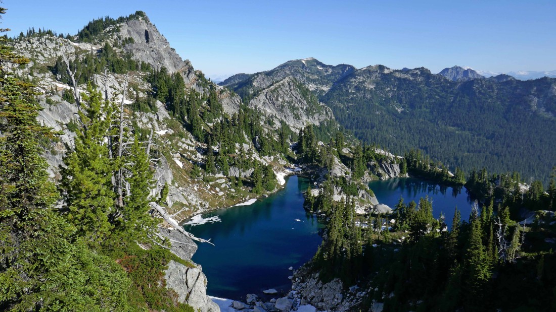
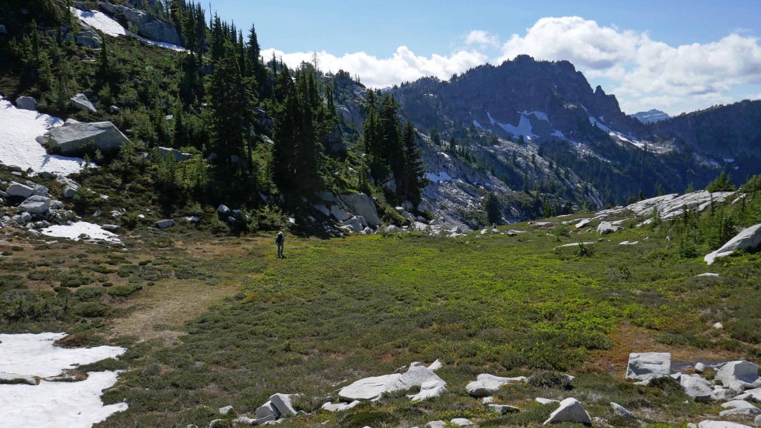
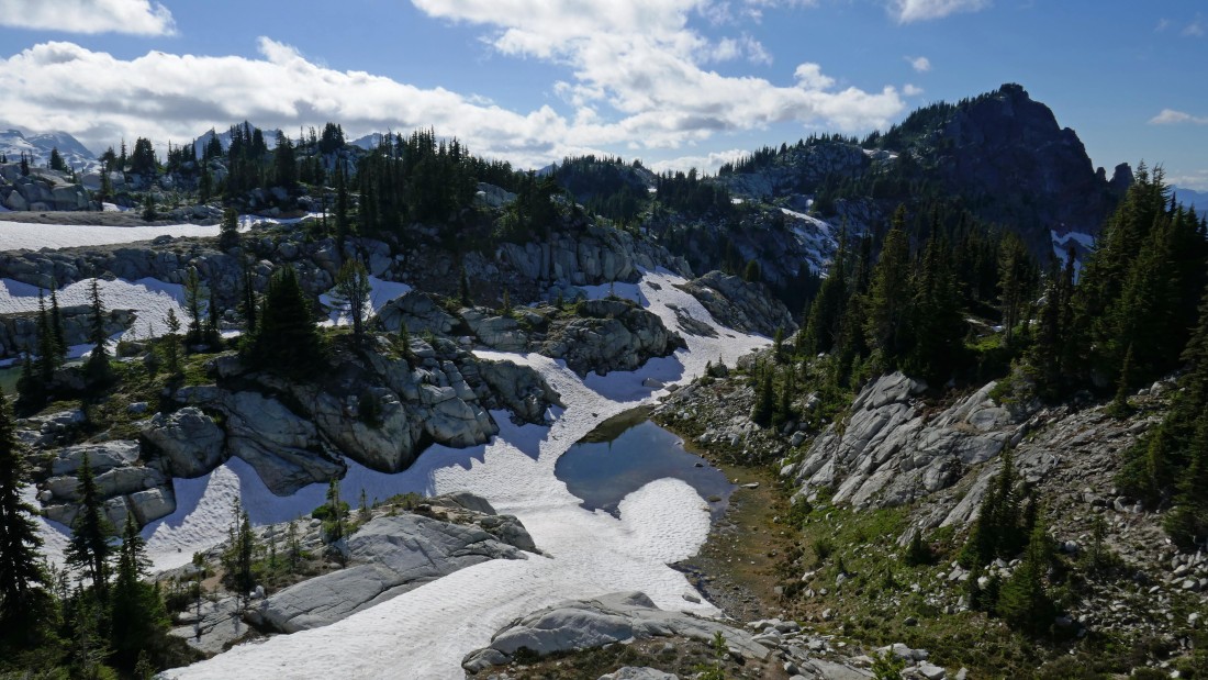
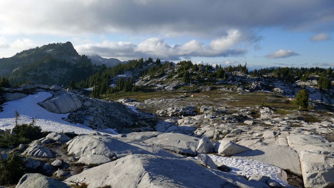
After hiking a total of 8 miles we have reached the lower (6163') of the two Robin Lakes.
|
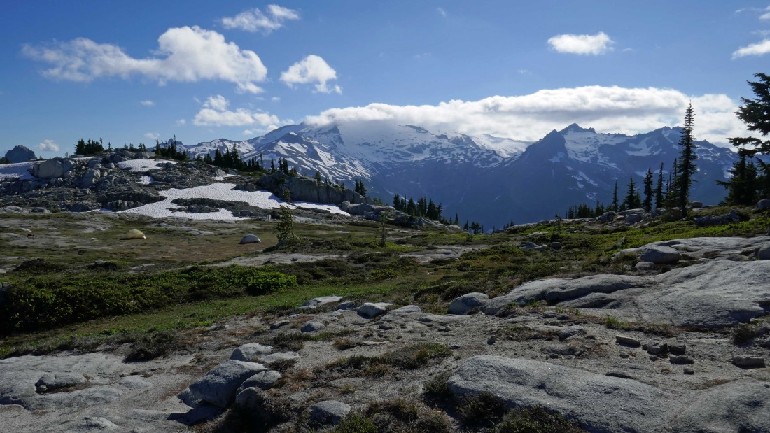
The bugs were very bad at the lakes so we moved up to the ridge on the west side of the upper lake... the Granite Mountain summit is on the other side of the lake in the right center of the photo.
|
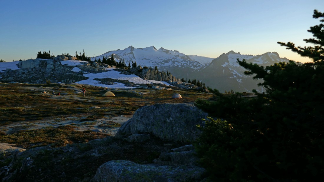
Sunset at our campsite (~6320') on the ridge on the west side of upper Robin Lake... offering a constant view of Mt. Daniel and Lynch Peak.
|
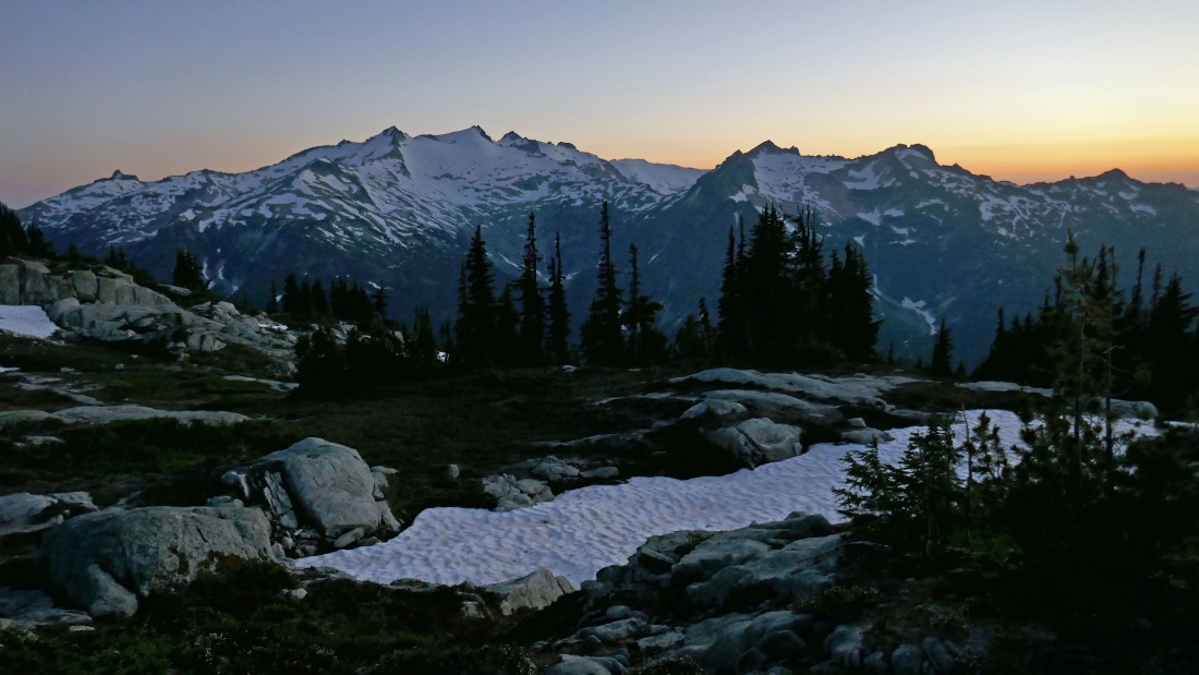
Sunset view from our campsite of Mt. Daniel and Lynch Peak... with Mt. Hinman in the distance between them... and the small nipple on the extreme left is The Citadel.
|

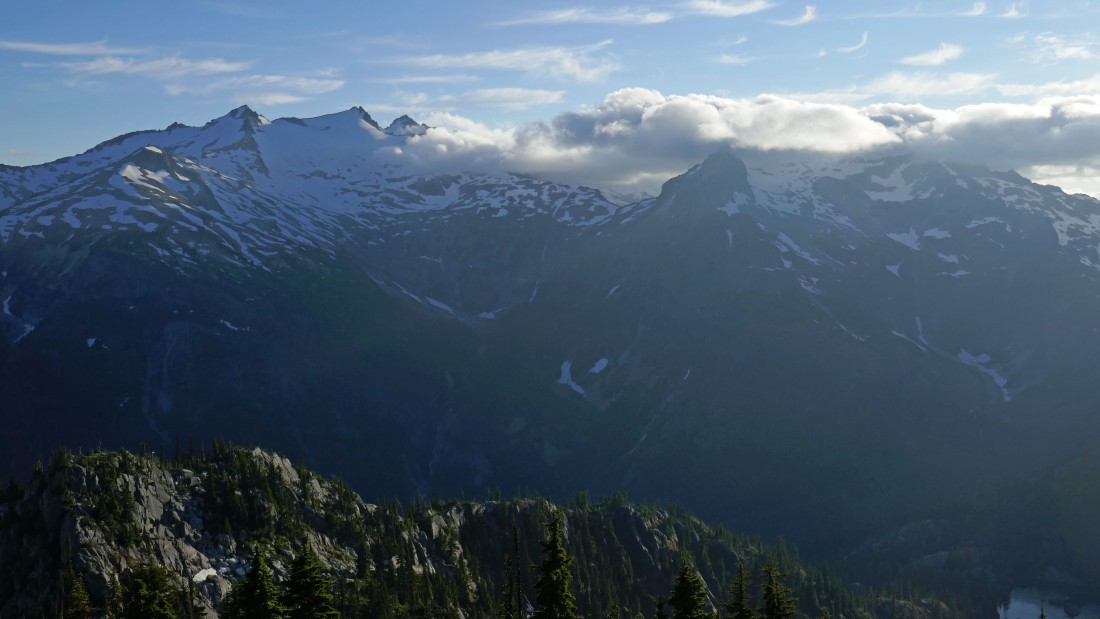
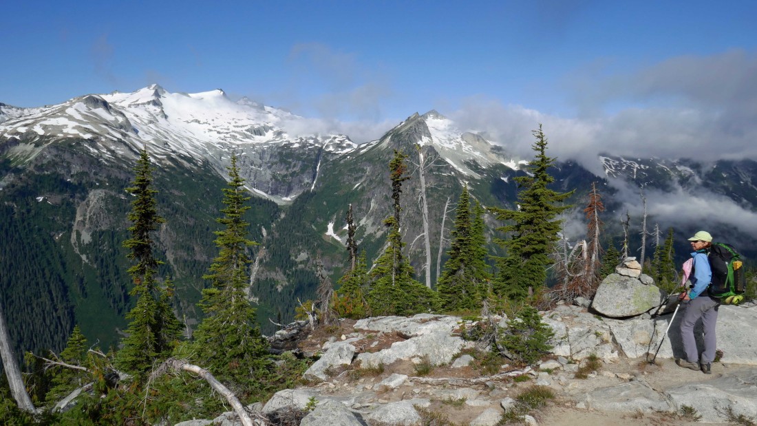
Woke up on day 2 and found this view of Daniel and Lynch.
|

Leaving our campsite and hiking north over toward the Granite Mountain Potholes... here looking back at the Granite Mountain summit on the left.
|

Still heading north toward the Granite Mountain Potholes... less than a quarter mile from camp the path we were following has ended... and we won't see another path until we get back here at the end of our day hike... the summit of Trico Mountain is on the left... with Mac Peak in the distance.
|
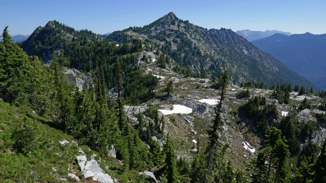
Looking down on the Granite Mountain Potholes... with Trico Mountain in the left foreground... Mac Peak is left center... and the pointy rock face on the right is Thor Peak.
|
We have turned east from our overlook of the potholes and will start working our way over to a saddle between the West Peak (left) of French Ridge and the north end of Granite's north ridge.
|
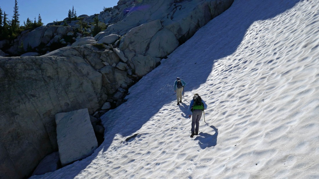
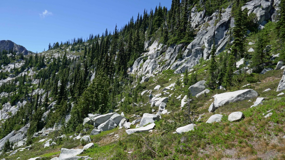
Crossing over a snowfield as we work our way over to the saddle between the West Peak of French Ridge and the north end of Granite's north ridge.
|
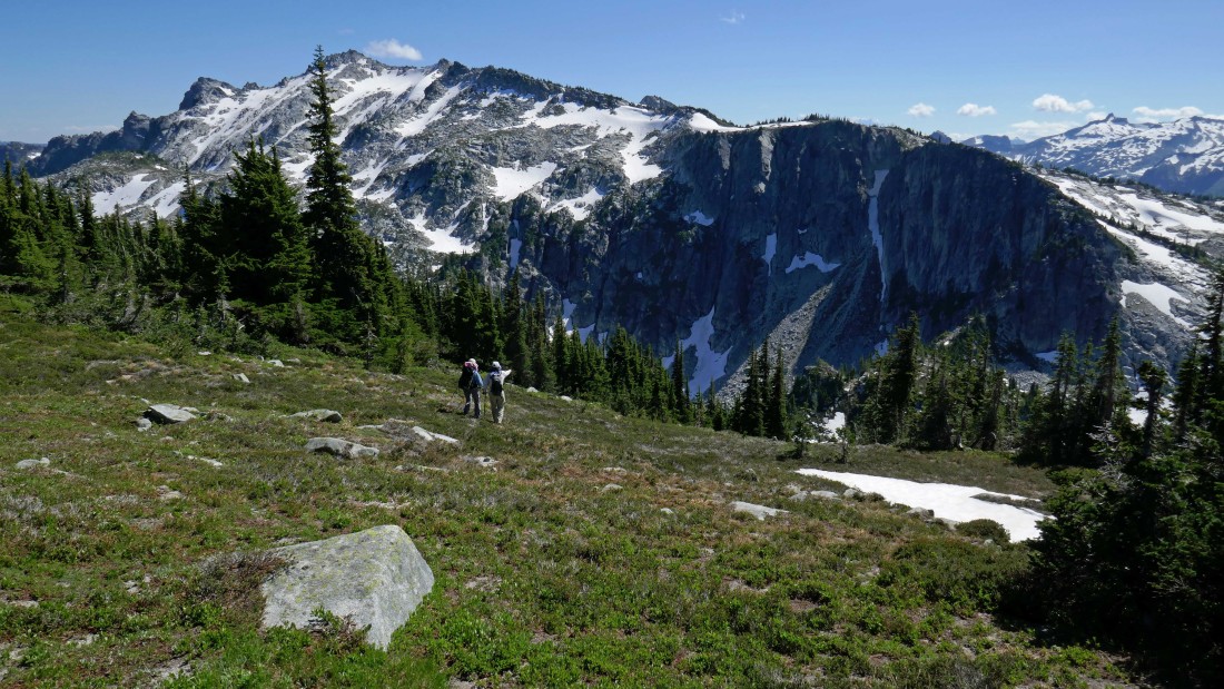
The West Peak of French Ridge is on the left... as we continue to work our way over to the saddle between it and the north end of Granite's north ridge... lots of ups and downs along the way.
|
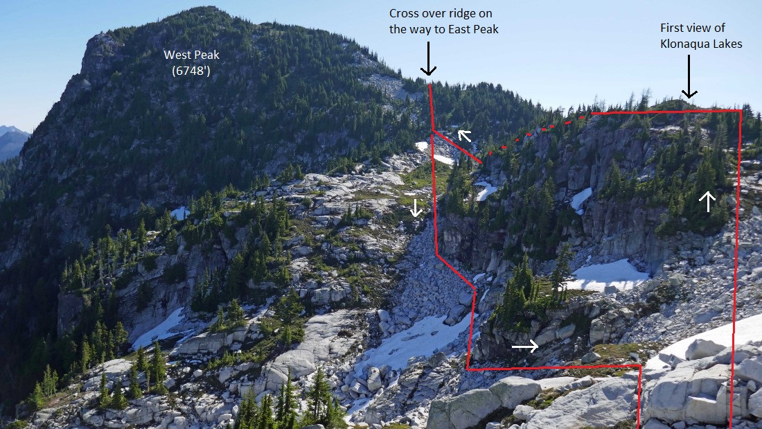
We will continue boulder hopping our way over to the saddle between the West Peak and the north end (out of frame) of Granite Mountain... where we will get our first view of the Klonaqua Lakes... we used the high route on the way over to the saddle... and on our return at the end of the day we used the low route.
|
Boulder hopping over to the French Ridge/Granite Mountain saddle.
|
|
Still slightly higher than the French Ridge/Granite Mtn saddle... but a beautiful look down on an unnamed tarn below... and the two Klonaqua Lakes to the left.
|
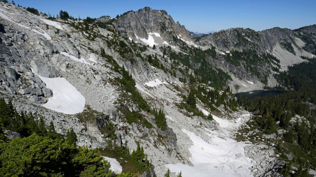
Looking back at the snowfield (far left) we crossed to get over to our view of the Klonaqua Lakes... with Trico Mountain in the distance... and one of the potholes below it.
|

Leaving our Klonaqua Lakes overlook and giving back a little elevation to get down to the French Ridge/Granite Mountain saddle.
|
We have reached the French Ridge/Granite Mountain saddle... time to work some boulders.
|
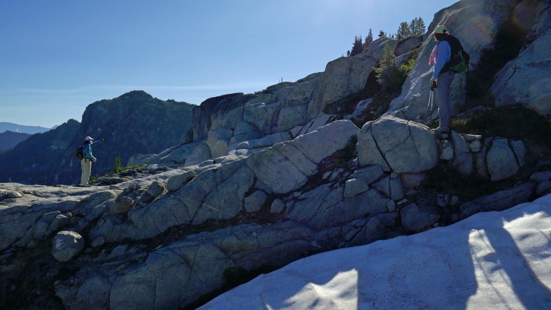
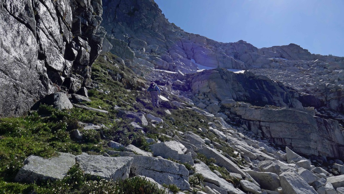
Working our way up the boulders on the south side of French's West Peak.
|

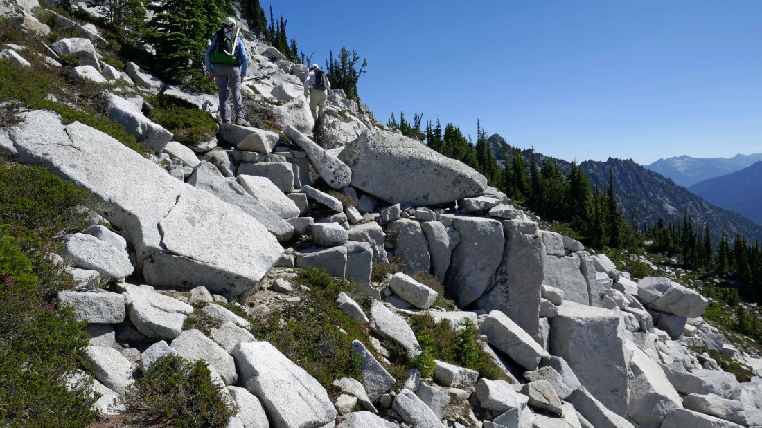
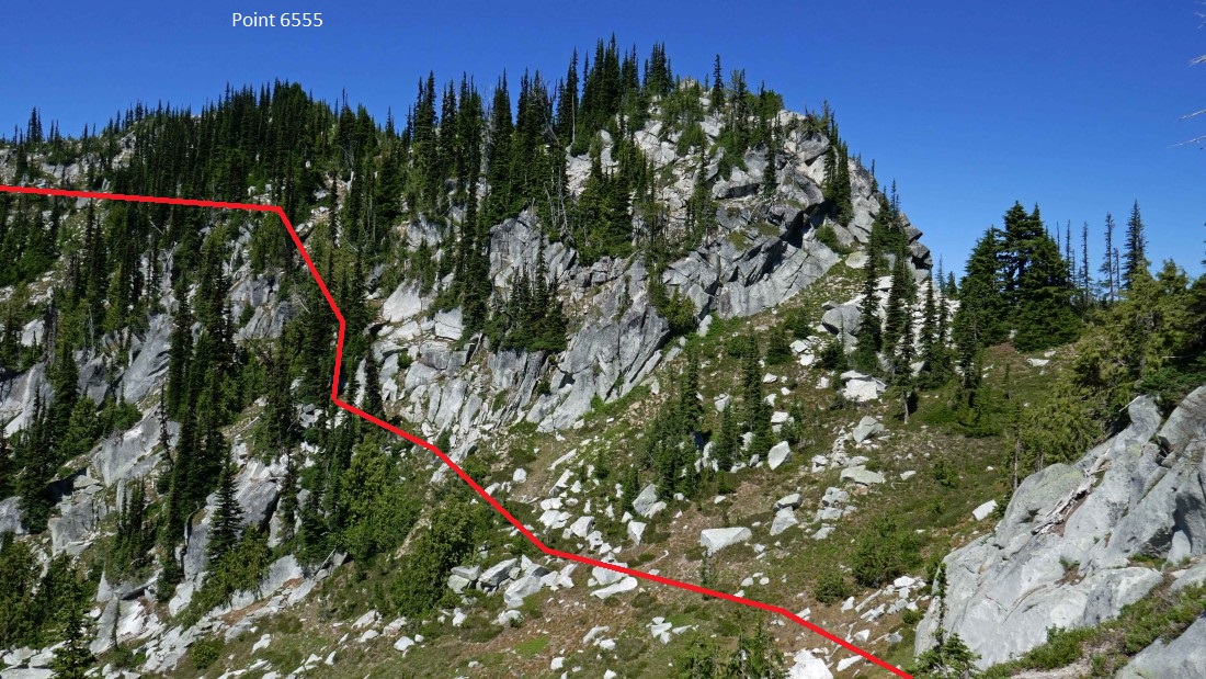
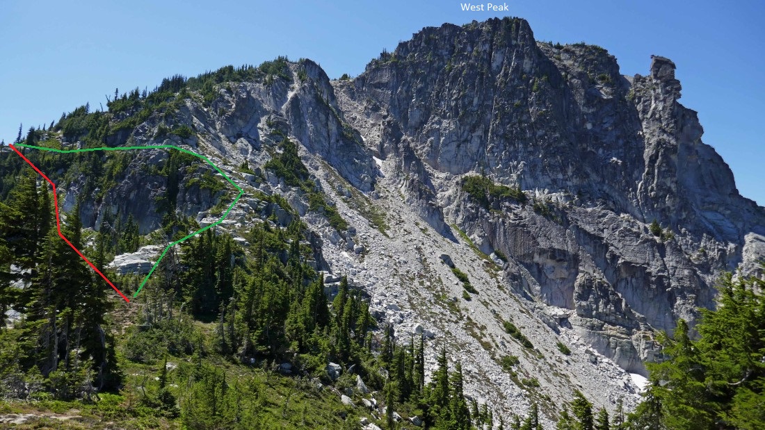
We have boulder hopped our way up the south side of French's West Peak to ~6500 feet... now we will start traversing along the south side and work our way over to the West Peak/Point 6555 saddle... the red route is the route we used to get here... and the green route is the route we used on our return at the end of the day.
|
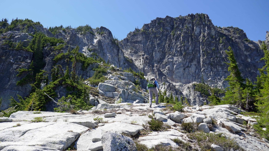
More boulder hopping as we traverse underneath the West Peak summit... on our way to the saddle that separates the West Peak and Point 6555.
|
Heading for the West Peak/Point 6555 saddle... and our first good look at the East Peak of French Ridge in the left foreground... Nursery Peak and The Cradle are in the right foreground.
|
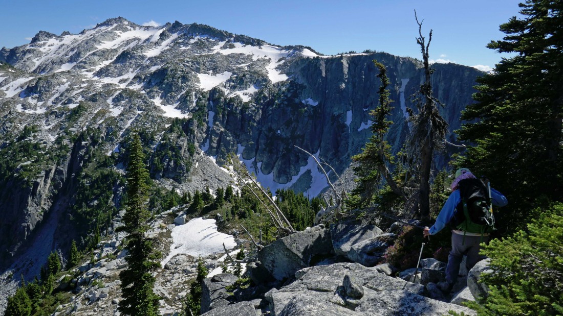
Still traversing the south side of the West Peak... and our first good look at Point 6555 in the left foreground... the West Peak/Point 6555 saddle is just ahead... but there is some steep terrain to deal with in order to get over there.
|
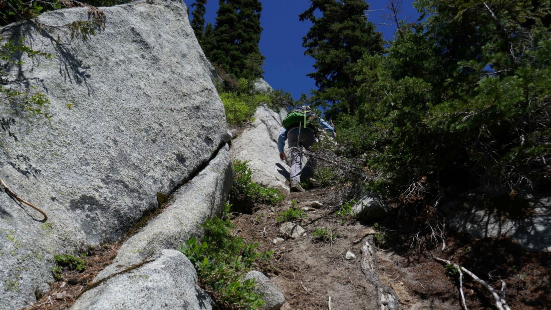
There were some veggie belays on the way down to the West Peak/Point 6555 saddle.
|
Almost down to the West Peak/Point 6555 saddle... with French's East Peak getting closer with every step.
|

We have reached the West Peak/Point 6555 saddle and are looking back at the sheer east face of the West Peak... we will visit the West Peak summit on the way back to camp at the end of the day.
|
Looking north to the Thunder Mountain area and Thor Peak... with Glacier Peak on the far right horizon.
|
A pano shot from the West Peak/Point 6555 saddle... French's East Peak on the far left to Granite Mountain on the right... with Nursery Peak and The Cradle in the center foreground.
|

Time to gain a little elevation from the West Peak/Point 6555 saddle and then traverse underneath Point 6555 and work our way over to the Point 6555/East Peak saddle.
|

On the east side of Point 6555... traversing underneath the Point 6555 summit... heading for the saddle in the center of the photo.
|

On steep terrain... working our way down toward the Point 6555/East Peak saddle.
|

We couldn't find a comfortable route to reach the true saddle... however, we were able to land ~70 feet below the saddle.
|
Heading for the East Peak summit now... looking back at our approximate route down to the Point 6555/East Peak saddle area.
|
Clear sailing now as rocman and BarbE head for the boulders on the west side of the East Peak.
|
Working the boulders on the west side of the East Peak.
|
Nearing the summit of French's East Peak.
|
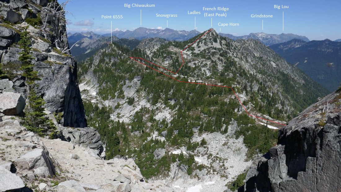
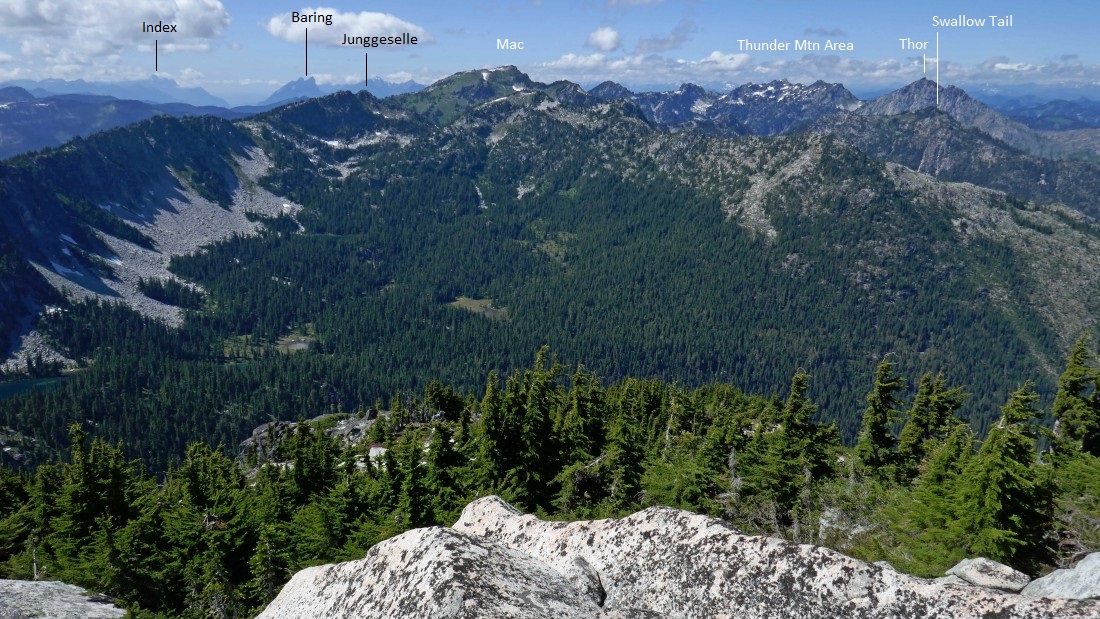
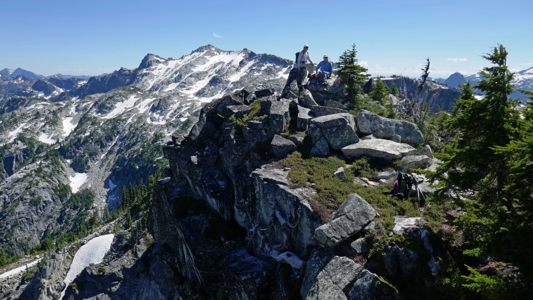
Broad views in every direction from the summit (6767') of East Peak... Nursery and Cradle in the left foreground... with Mt. Stuart on the horizon between them... Granite South and Granite in the right foreground... with Mt. Daniel and Lynch Peak on the right horizon... French's West Peak and Point 6555 are in the right foreground... Cashmere Mountain on the far left horizon.
|
Peak identification from the East Peak of French Ridge... and our approximate route from the south side of French's West Peak.
|
Peak identification from the East Peak of French Ridge... and our approximate route from the south side of French's West Peak.
|
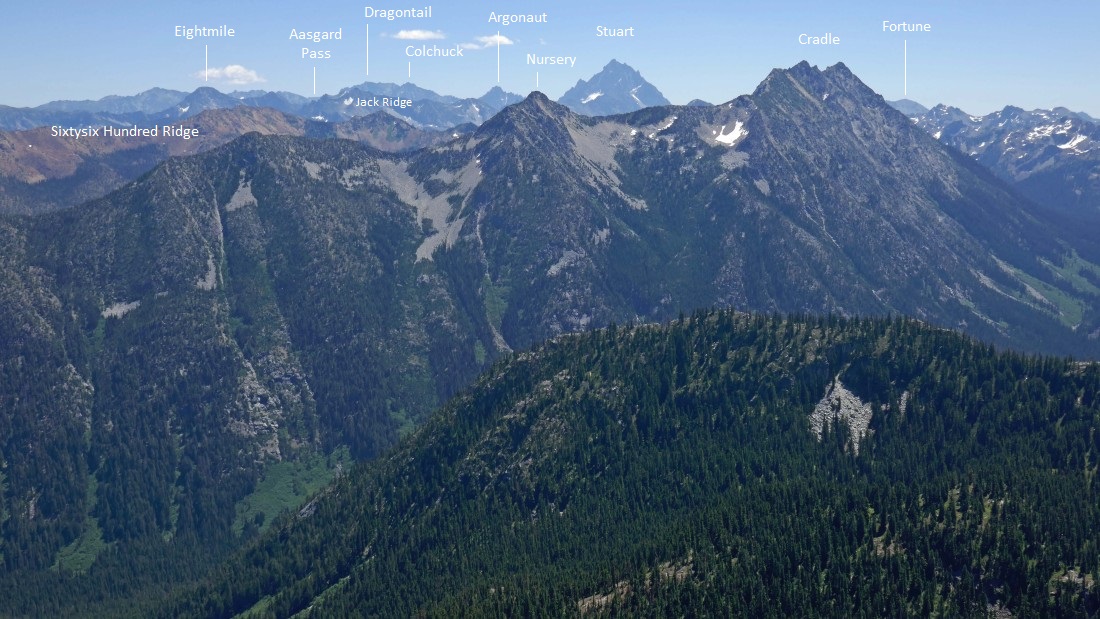
Peak identification from the East Peak of French Ridge.
|
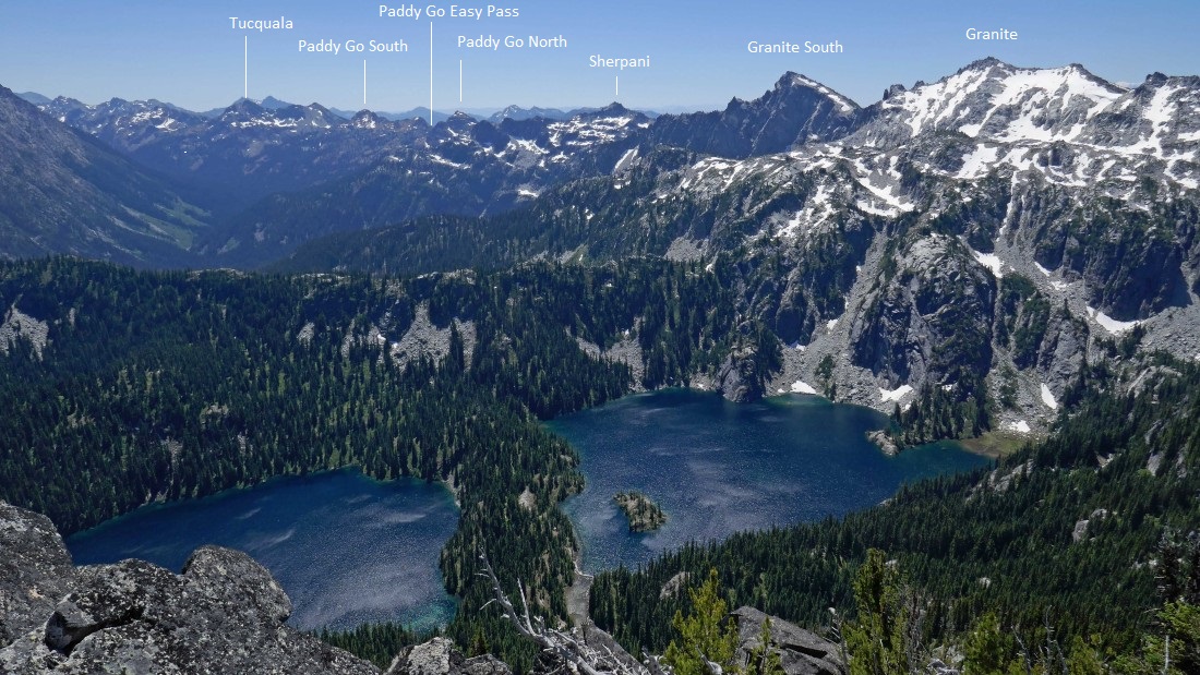
Peak identification from the East Peak of French Ridge.
|
Time to get off of the East Peak summit... can you say 'more boulders'.
|
Off of the boulders for awhile... heading back to the Point 6555/East Peak saddle... as we will more or less trace our steps back to the south side of the West Peak.
|
Back at the Point 6555/East Peak saddle area... and getting ready to head up and over to the West Peak/Point 6555 saddle.
|
Steep terrain to get up to a good spot that will make it possible to traverse ~120 feet underneath the summit of Point 6555.
|
Traversing underneath Point 6555 and heading for the West Peak/Point 6555 saddle... Granite South and Granite are in the distance.
|
A pano shot from near the West Peak/Point 6555 saddle... looking back at the East Peak on the far left.
|
Working our way down to the West Peak/Point 6555 saddle.
|
We have reached the West Peak/Point 6555 saddle... we used the red route earlier in the day to get from the south side of the West Peak to where we are standing... but we are going to use the green route (looks like a natural ramp) now to get over to the south side of the West Peak.
|
rocman and BarbE are working the natural ramp.
|
We decided to head up for the West Peak summit before reaching the south side of the peak... it will go, but ideally we should have been more patient and waited to reach the south side of the peak before heading up.
|
Almost to a place where we can exhale.
|
We can see the summit (6748') of French's West Peak.
|
Peak identification looking north from near the West Peak summit... and the approximate route that we used to get here from the East Peak.
|
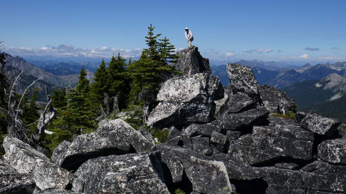
rocman on the West Peak summit (6748') of French Ridge.
|
BarbE on the summit area of French's West Peak... with Granite Mountain behind her.
|
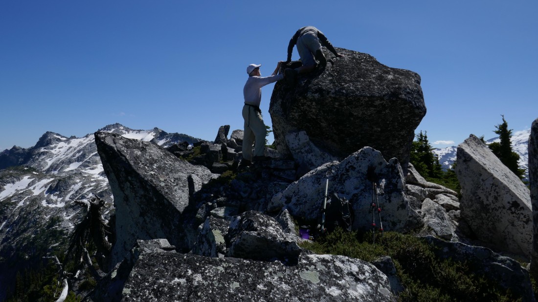
rocman discusses the moves with me on getting to the summit... there is one Class 4 move that is necessary to get where I am on the summit boulder... and while I didn't stand up on the boulder, I did crawl out and touch the summit cairn... but do take note here, the Class 4 move to get up on the boulder is a Class 5 move getting off of the boulder due to a blind and awkward step down... and it is very helpful to have another person help guide your foot onto the blind step.
|
Peak identification from the summit of French's West Peak.
|

Peak identification from the summit of French's West Peak.
|

Peak identification from the summit of French's West Peak... and the approximate route we used to get here from French's East Peak.
|
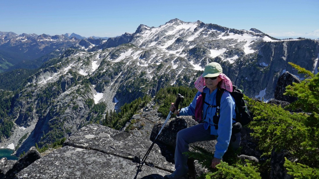
rocman and BarbE relaxing on the summit area of French's West Peak.
|
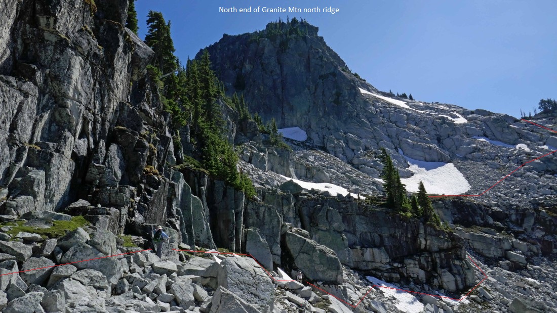
Time to head down from French's West Peak summit... the last challenge of the day will be to get around the north end of Granite's north ridge which is in the foreground.
|
Working our way down to the Granite Mountain/West Peak saddle... uh, more boulders.
|
We have reached the Granite Mountain/West Peak saddle... with Trico Mountain in the distance. Instead of going back up here the way we came in the morning, we will take a lower route on the way back to camp.
|
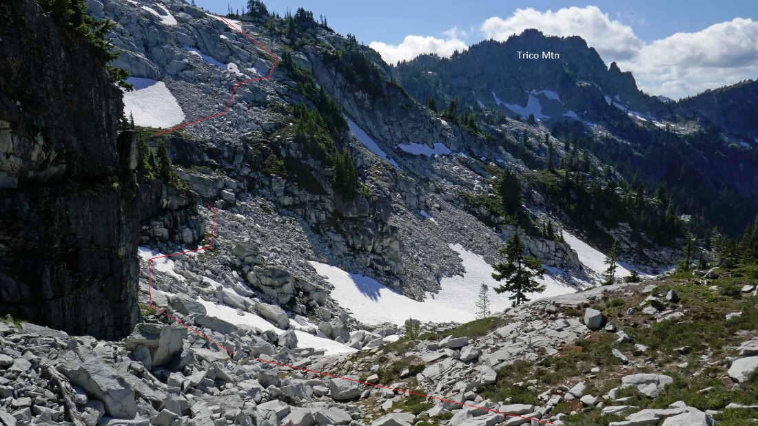
The approximate route we will use to get around the north end of Granite's north ridge.
|
The approximate route we will use to get around the north end of Granite's north ridge.
|

Almost ready to get around a corner and head up.
|
Heading for the snowfield that we crossed earlier in the day.
|
Heading back to camp.
|

BarbE hikes into a cloud as we take a more direct route back to camp... skipping the overlook down on the Granite Mountain Potholes.
|

We can smell our camp now as clouds form over Mt. Daniel and Lynch Peak.
|
Looking over at Trico Mountain as we head for camp.
|
Upper Robin Lake... now we are getting really close to camp.
|

Mac Peak in the distance as we head for camp.
|
Trico Mountain as we head for camp.
|
Just a stone's throw from camp now.
|
Back at camp.
|
Here are the terrain statistics from my GPS track of our French Ridge day hike... the roundtrip was 5.5 miles... and while we never got higher than 6767 feet or lower than 6000 feet, the ups and downs totaled 2866 feet of elevation gain. It was a very strenuous day... camp-to-camp took 9.5 hours... which included a half-hour spent on each summit and 6 to 8 ten minute breaks to snack and add snow to our water bottles.
|
Sunset... upper Robin Lake and Granite Mountain.
|
Trico Mountain and our campsite at sunset.
|
Evening... Mt. Daniel across the valley... with Tuck Lake in the lower right corner of the photo.
|
Both Robin Lakes and Granite Mountain.
|
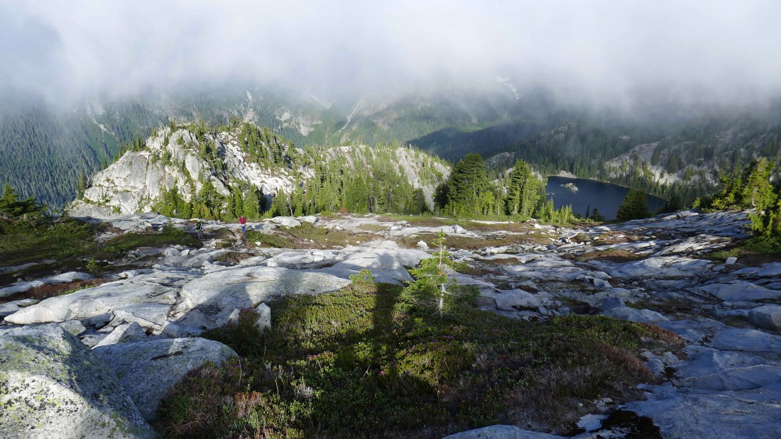
Woke up on day 3 to a cloudy Robin Lakes area as we leave camp and head down to Tuck Lake.
|
Heading down to Tuck Lake.
|
Heading down to Tuck Lake.
|
The clouds are lifting as we get closer to Tuck Lake... with Mt. Daniel and Lynch Peak across the valley.
|
Looking down on Tucks Pot as we get closer to Tuck Lake.
|
One last clean look at Mt. Daniel before we get to Tuck Lake.
|
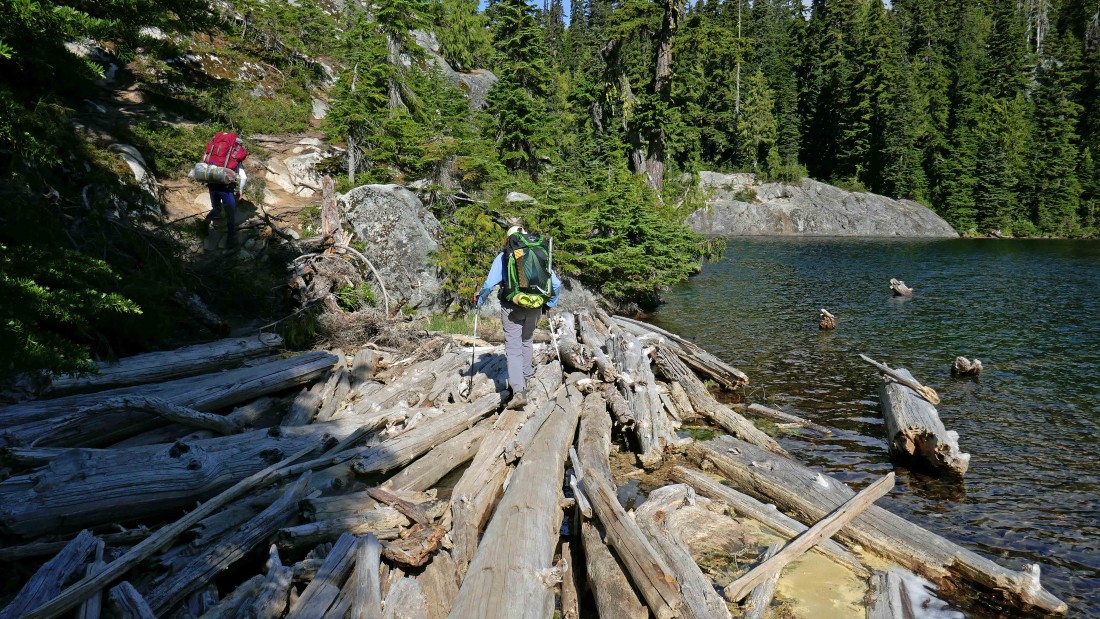
The log crossing that connects Tuck Lake and Tucks Pot... we still have a 6.3 mile hike to get back to our car... the roundtrip stats for the hike to our camp at Robin Lakes and back to the car are 16.8 miles, gaining 3717 feet of elevation... plus our 5.5 mile roundtrip of French Ridge that gained another 2866 feet of elevation.
|
