Stevens Peak - 8.5.2018
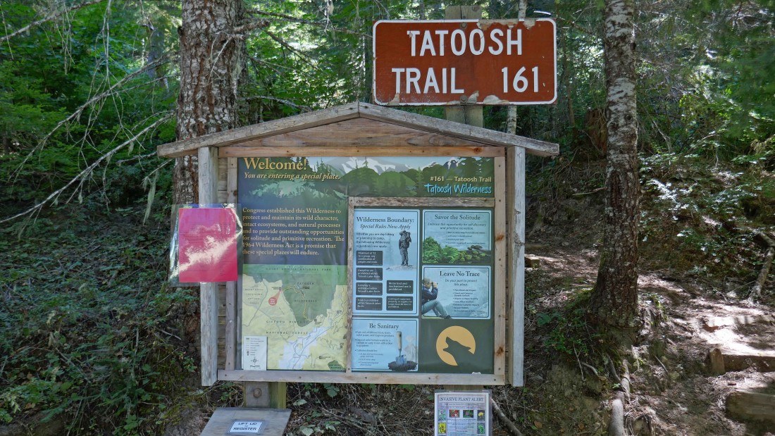
Turn off of the paved Skate Creek Road (aka FS-52) onto FS-5270 and drive a very good gravel road for 7.1 miles to the trailhead (~2900') for Tatoosh Trail #161.
|

We will set up our base camp in the Tatoosh Wilderness.
|
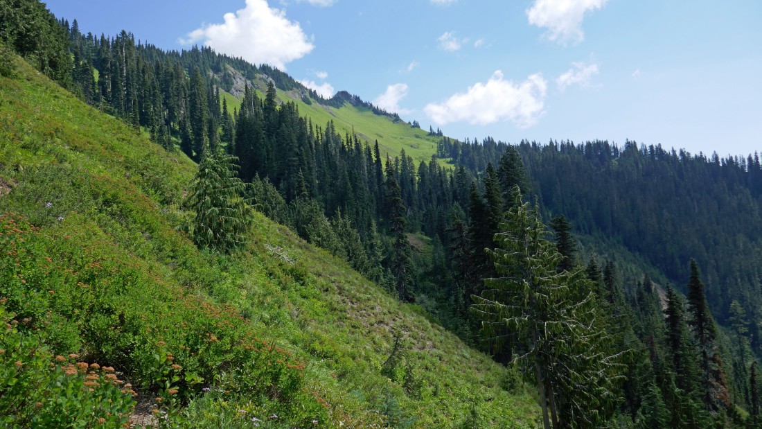
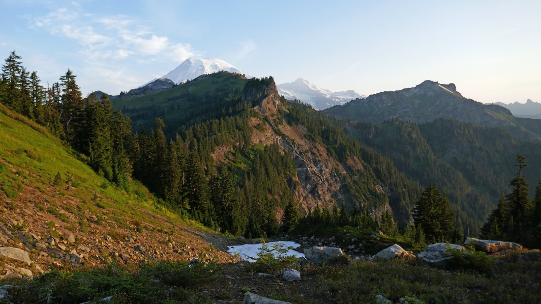
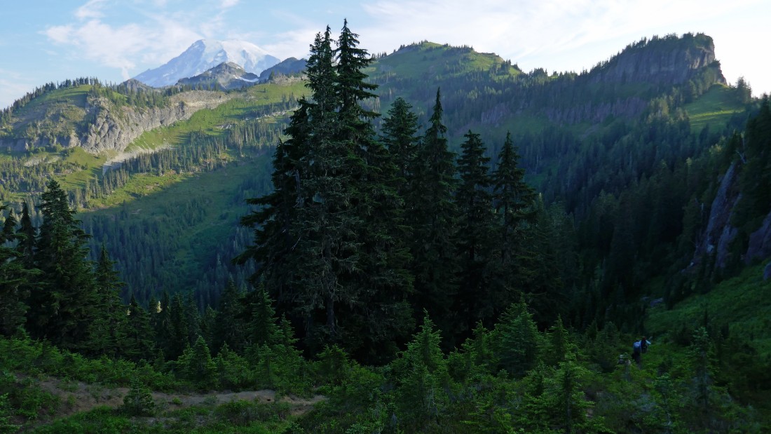
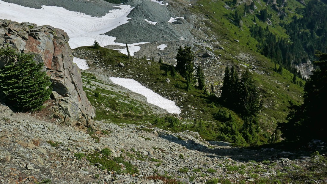
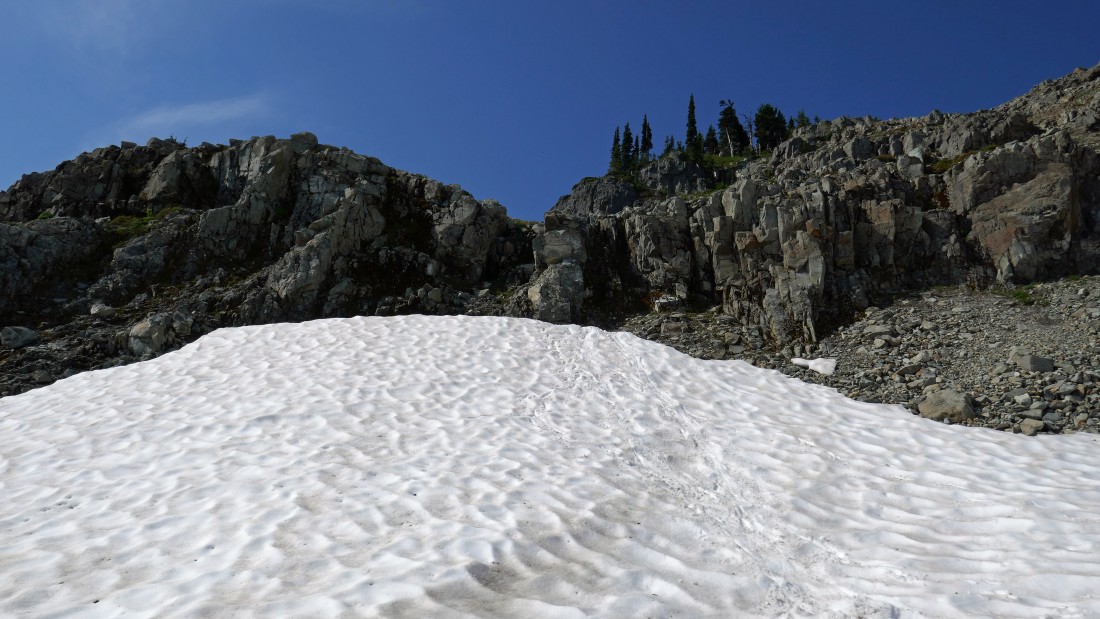
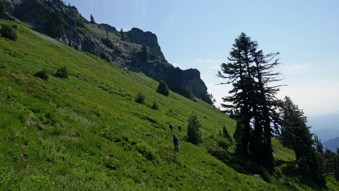
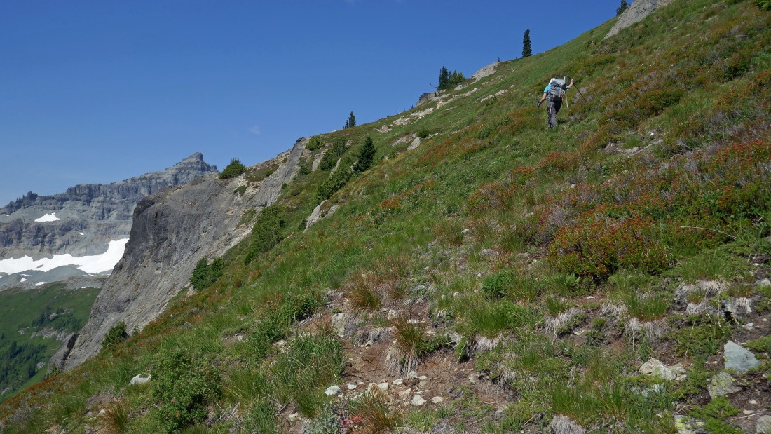
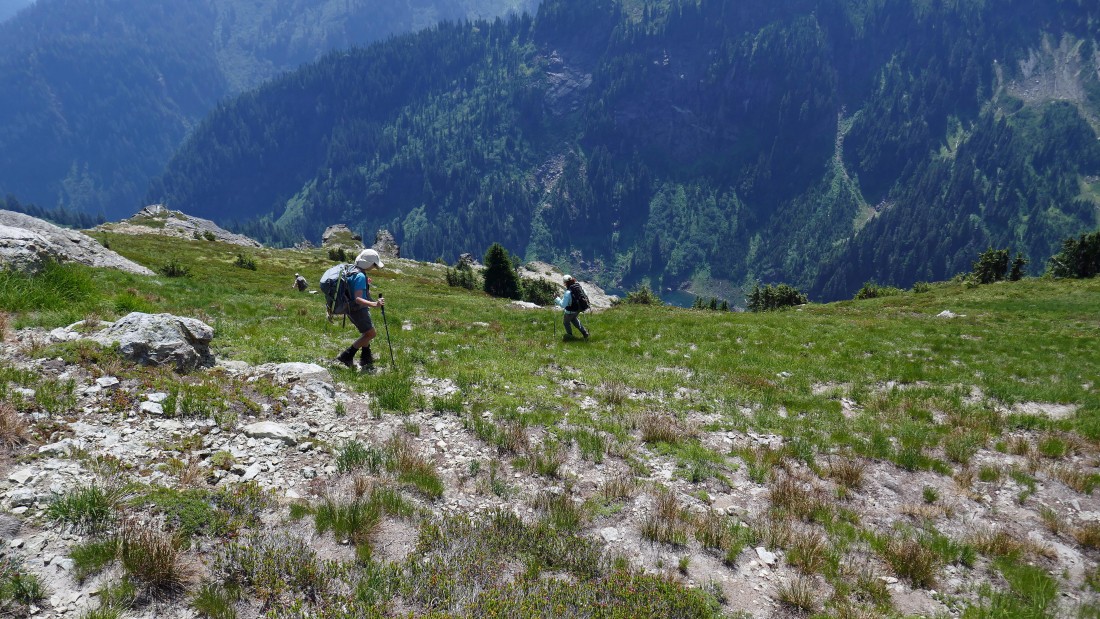
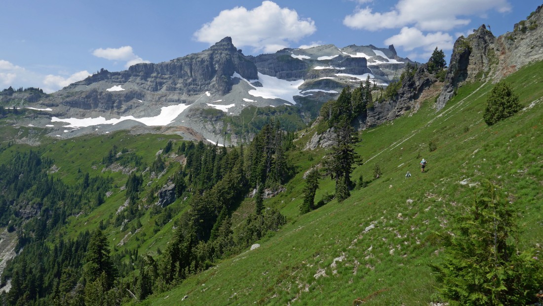
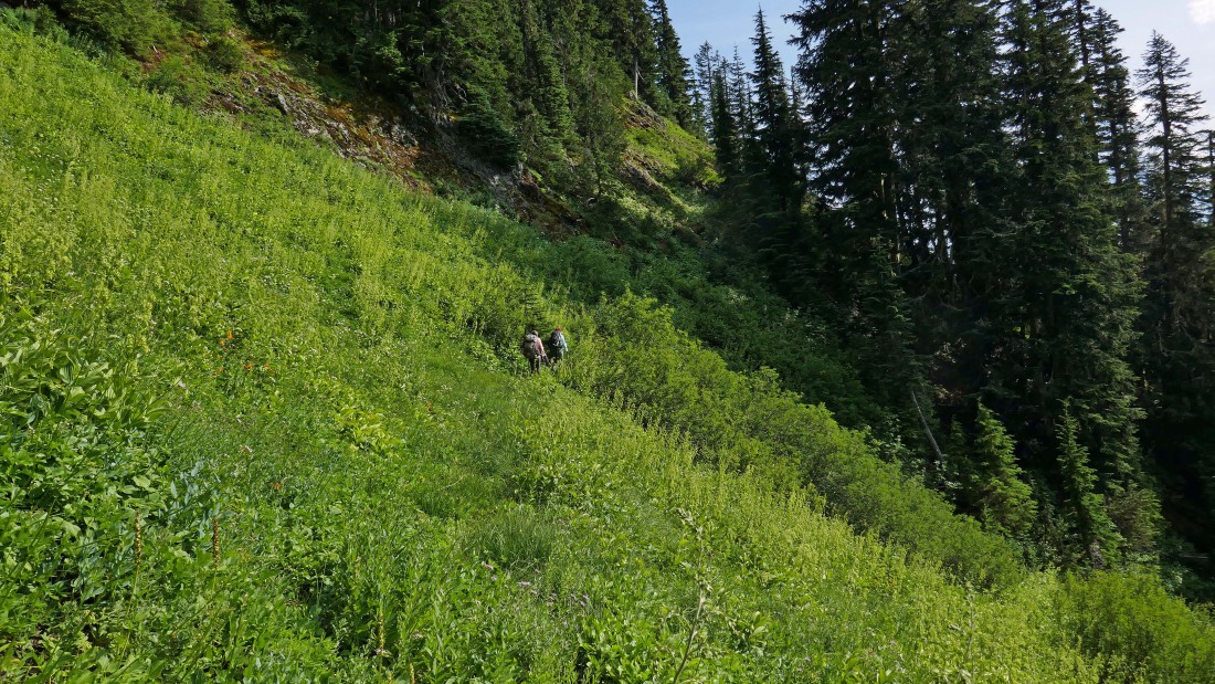
After hiking a little more than two miles we got out of the forest into the open.
|
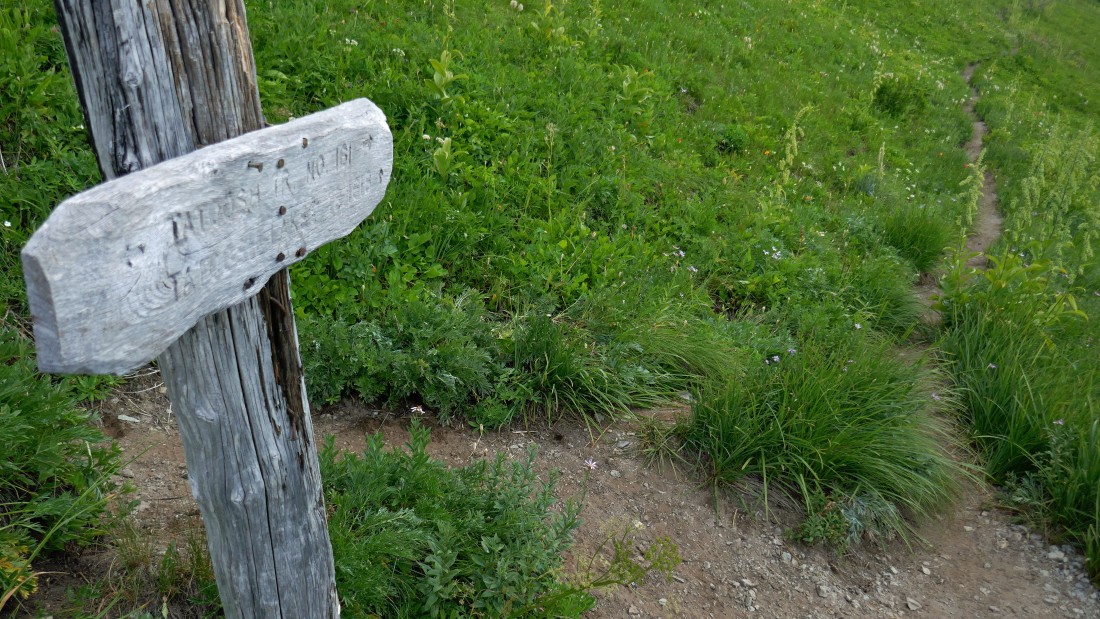
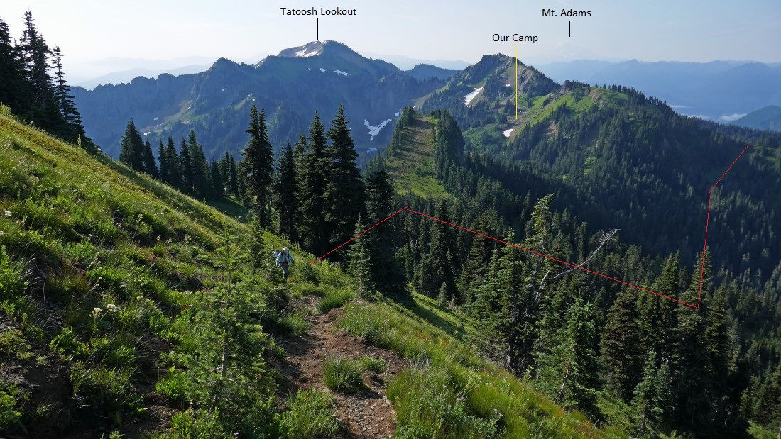
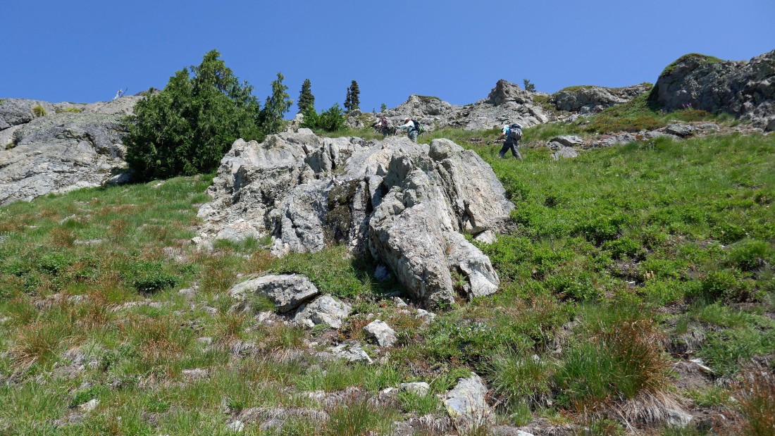
After hiking 2.7 miles (~5520') we will leave Tatoosh Trail #161 and start hiking on Tatoosh Lakes Trail #161B.
|
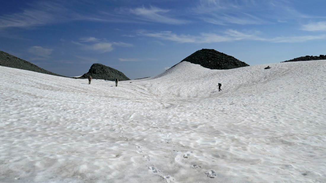
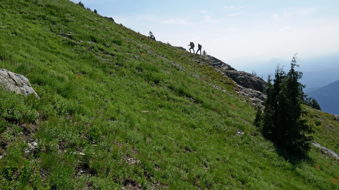
After hiking a total of 2.8 miles we have reached a saddle (~5680') that will be our high point for the day... we will drop down and set up our base camp on the bench at the bottom of the photo.
|

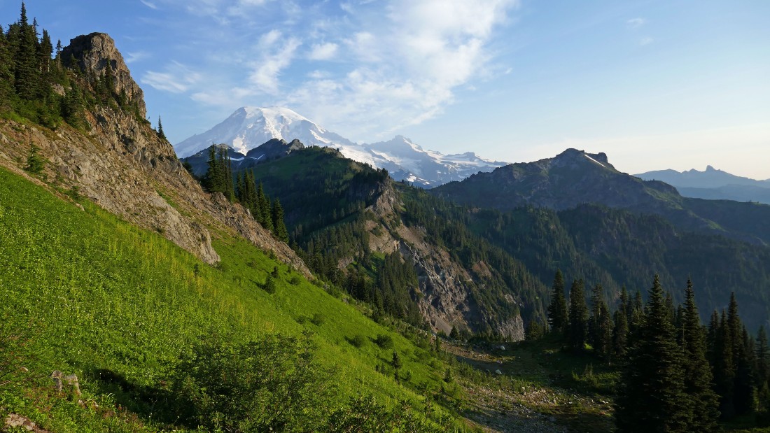
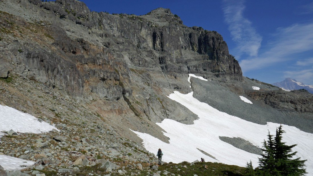
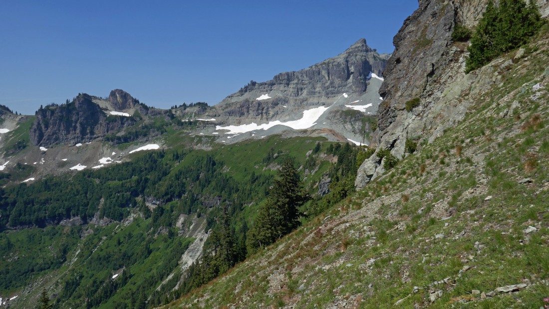
Base camp on a bench that is 500 feet above Tatoosh Lakes... tomorrow's destination (Stevens Peak) is on the right... as we watch a storm brewing.
|
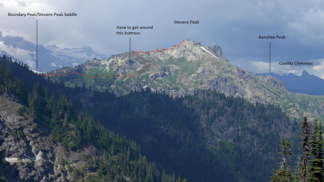
The game plan for tomorrow.
|
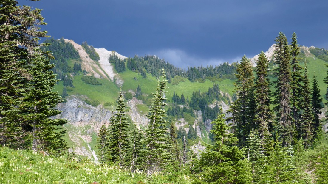
A storm is definitely coming... glad the tents are set up and ready to be occupied.
|
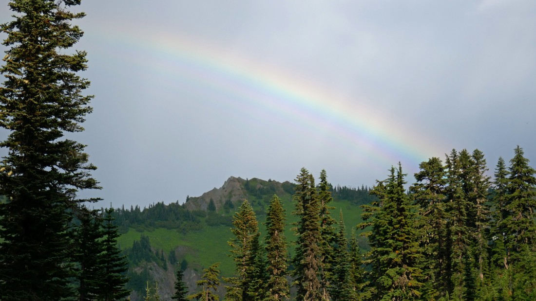
A rainbow greeted us after spending an hour in the tent.
|
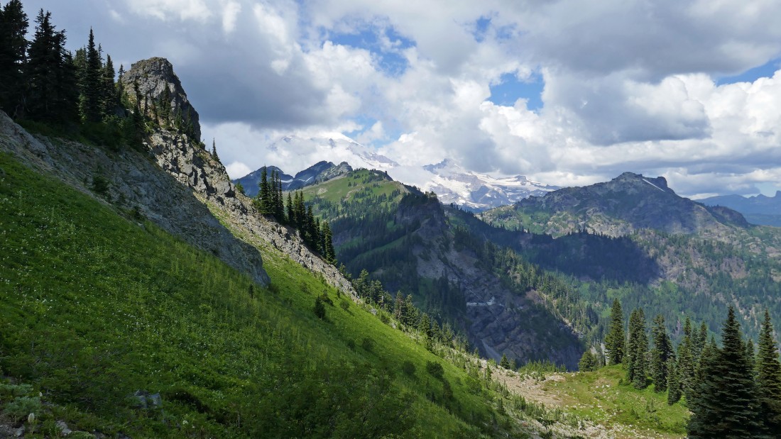
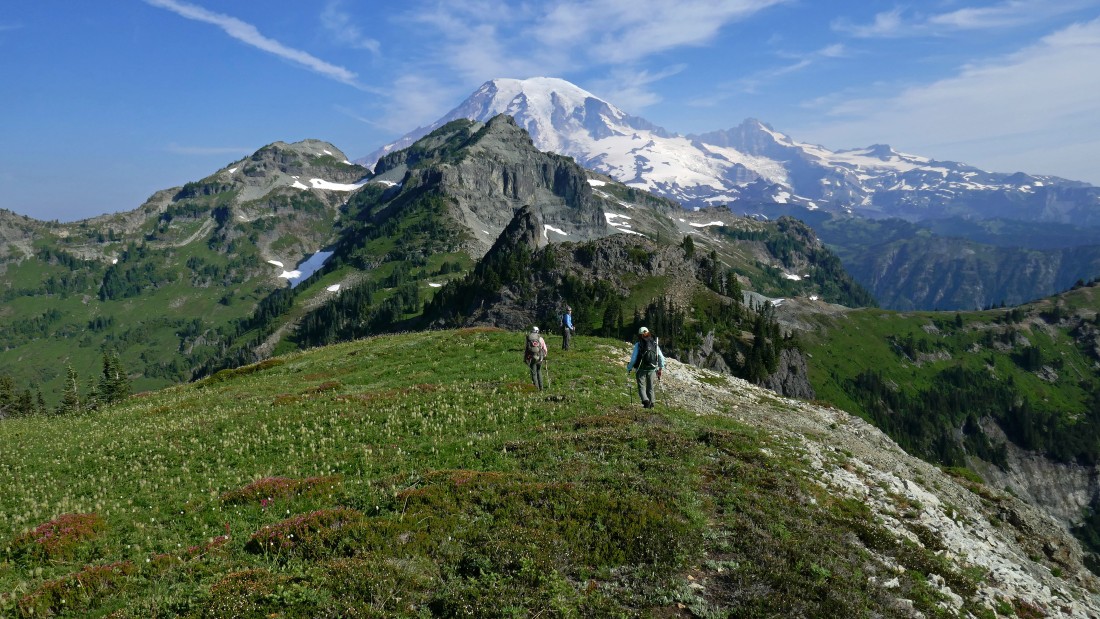
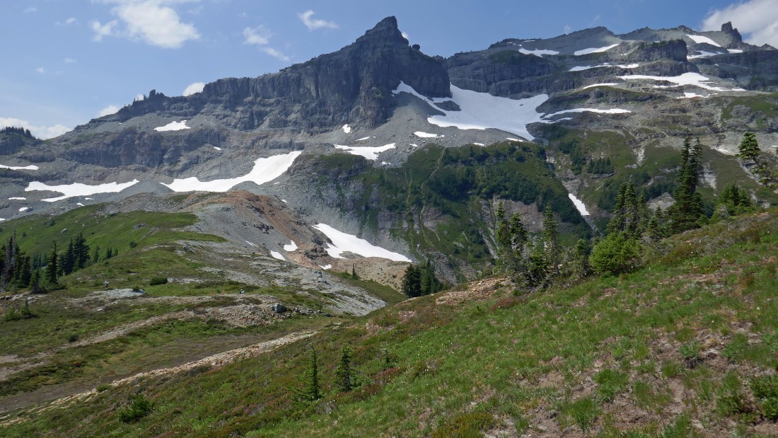
Sunset... time for bed... Point 6240+ is in the foreground (we will hike over it tomorrow)... with Boundary Peak, West Unicorn and Unicorn Peak behind it and in front of Mt. Rainier... Little Tahoma is to the right of Rainier.
|
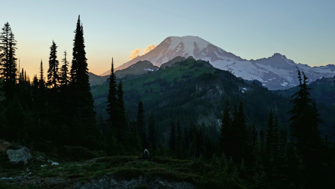
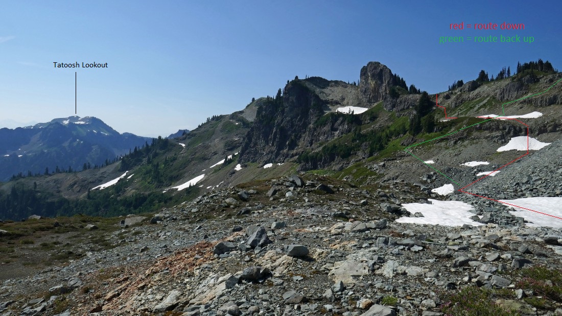
Good morning Mount Rainier... looks like it is going to be a beautiful day... perhaps a little hazy, but big whoop... Stevens Peak is calling out to us.
|
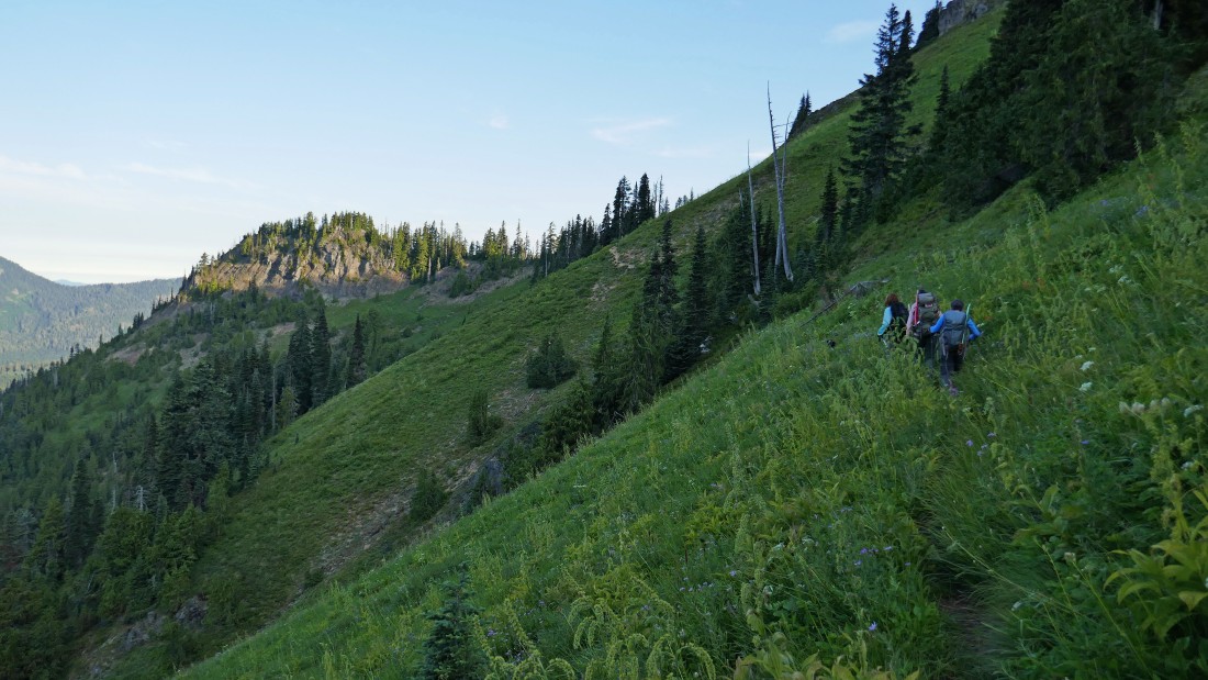
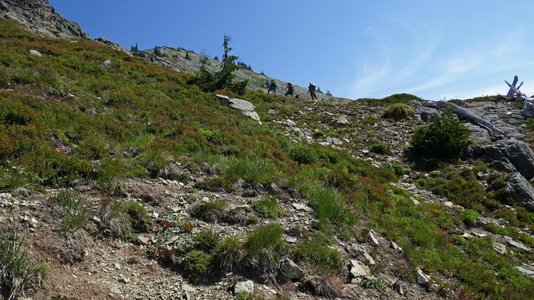
Looking down on our camp from the saddle above... gaining the 160 feet of elevation from our camp to the saddle has warmed us up... now it is time to give back some elevation as we hike back to Trail #161... then trace yesterday's steps down some more to ~5390 feet where we will find the obvious, but unsigned path that will take us north toward Boundary Peak.
|
After hiking .4 miles from camp we found the path that will take us over to the base of Boundary Peak's SSE ridge.
|
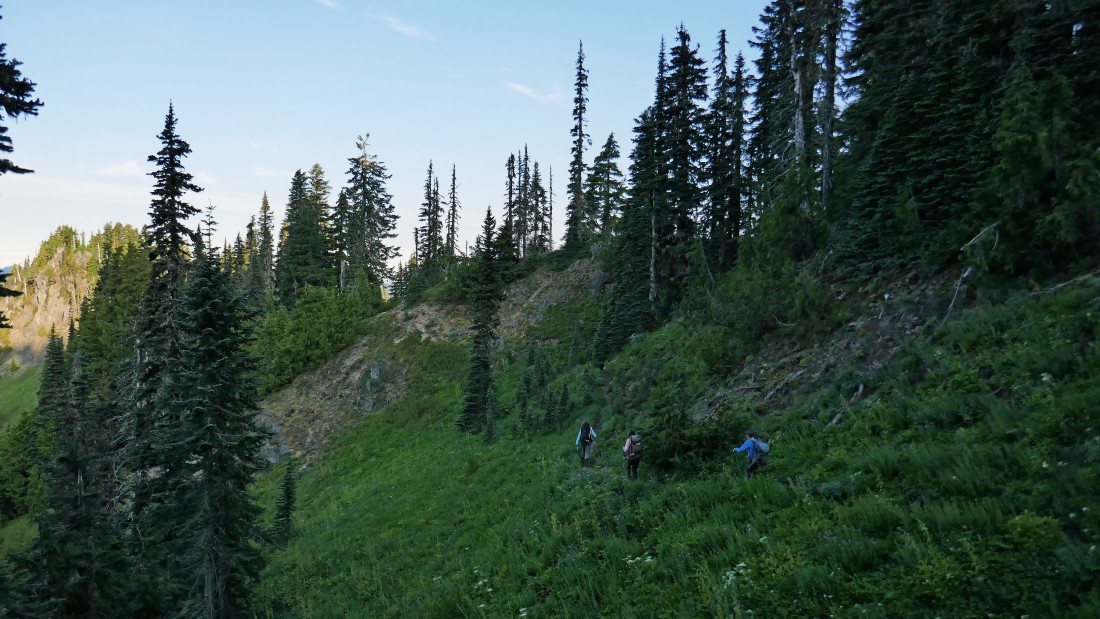
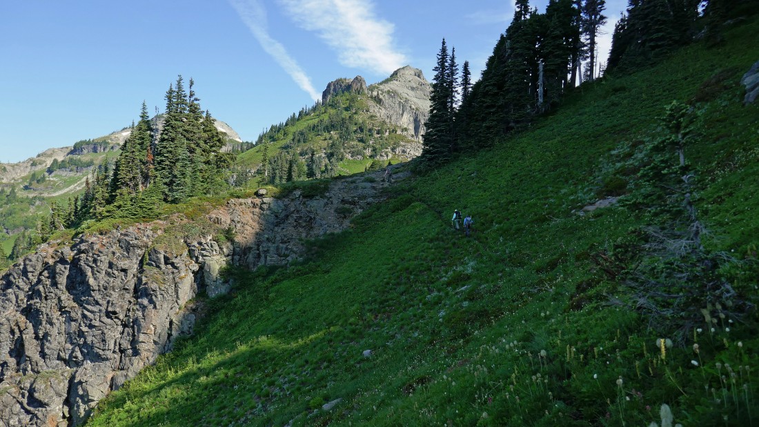
Yes, we are on a reasonable path... but there are plenty of ups and downs along the way.
|
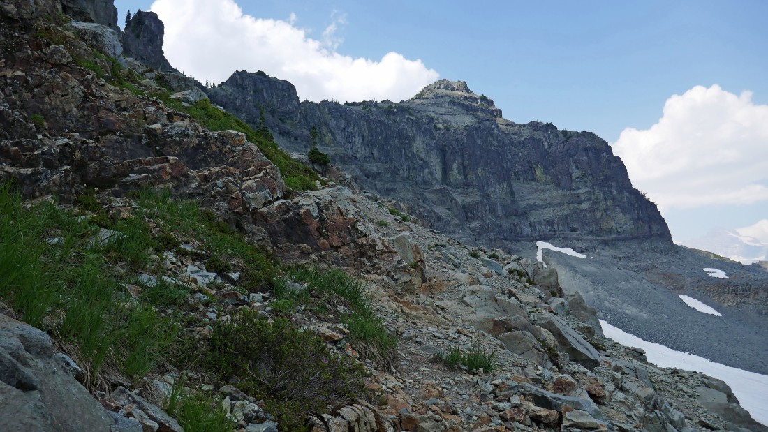
Still on a reasonable path as we give up some elevation to traverse underneath the cliffy terrain on the right and work our way over to Point 6240+ in the center of the photo.
|
Traversing underneath the cliffs... with Point 6240+ up there on the left.
|
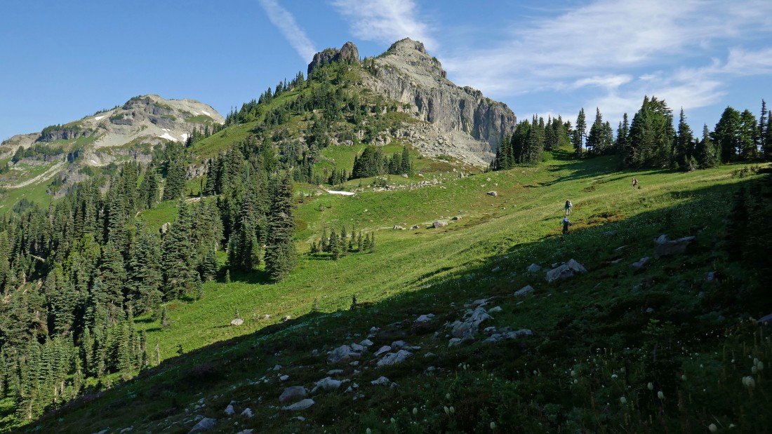
Almost beyond the cliffs now... the path was not as obvious here... however, we did have Tim Hagen's GPS track... and we know that we need to get up to Point 6240+ above.
|
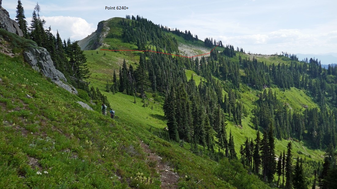
Working the path on the south side of Point 6240+.
|
Working the path on the south side of Point 6240+ and looking back toward our camp.
|

We left the path near its high point at ~6080 feet and headed cross country for the top of Point 6240+ over there on the right... Mt. Rainier is starting to appear.
|
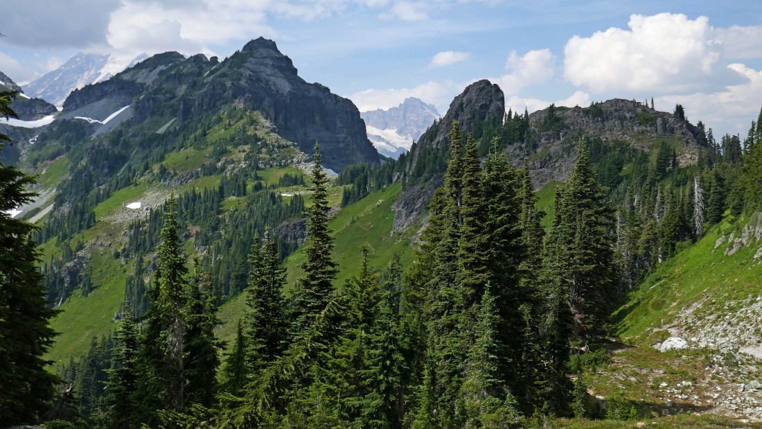
After hiking a total of 2.3 miles we have reached the top of Point 6240+... what a view... Boundary and Unicorn almost look like a single peak in front of Rainier... West Unicorn is on the left... we are heading for a little saddle straight ahead that is between the SSE ridge of Boundary and the impressive looking pinnacle in the foreground above Snowdog's head... as we work our way over toward the Boundary/Stevens saddle over there on the right.
|

Working our way down from Point 6240+... we will follow a good path around to the left of the pinnacle in the foreground.
|
Our approximate route over to the saddle between the pinnacle and Boundary's SSE ridge.
|
Traversing underneath the impressive pinnacle... heading for the saddle around the corner.
|
We have made it around the pinnacle and reached the saddle between it and Boundary's rugged looking SSE ridge.
|
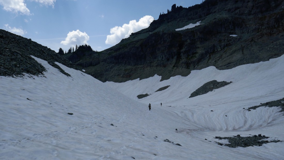
After hiking a total of 2.8 miles we have reached the crux area of the trip... looking down from the Boundary/pinnacle saddle... beginning with 75 feet of steep and loose terrain to get down to the small bench thats holds the two small snow fields.
|
Crossing the small bench shown in the previous photo and looking for the best way to get down to the permanent snow field on the east side of Boundary Peak.
|
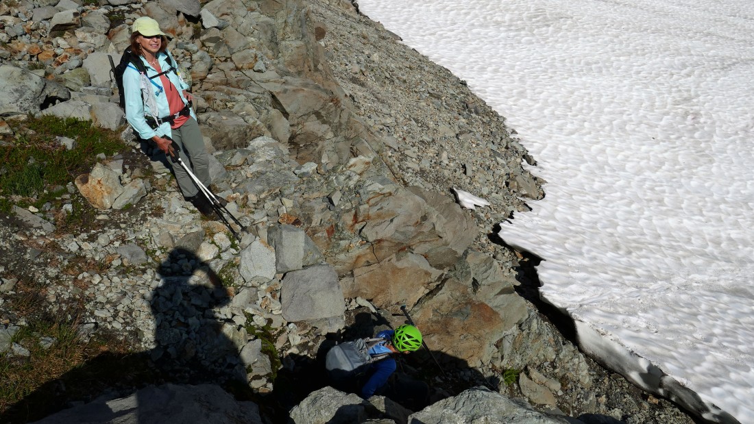
Karen starts down the Class 2/3 chute that will get us down to the permanent snow field on the east side of Boundary Peak.
|
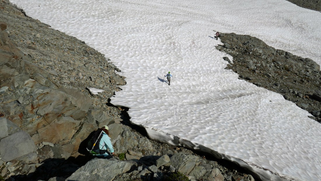
Now it's BarbE's turn to work the chute as Karen and Snowdog watch from below.
|
Looking back at the chute from below.
|
Heading across the fairly flat snow field on the east side of Boundary Peak.
|
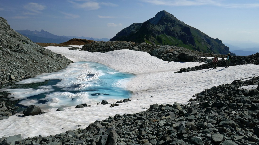
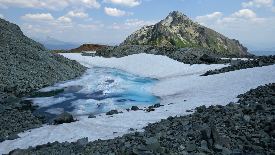
A beautiful tarn as we near the end of the snow field on the east side of Boundary Peak... our destination is straight ahead.
|
Looking back at the approximate route we used to get down to the snow field... and the approximate route we will use on the way back to camp from the Stevens summit.
|

Nearing the Boundary/Stevens saddle... with Stevens Peak pulling us forward.
|
After hiking a total of 3.4 miles we have reached the Boundary/Stevens saddle... looking back on the far left where we got down to the snow field on the east side of Boundary... Unicorn Peak is in the center of the photo... with Rainier and Little Tahoma on the far right.
|
Leaving the Boundary/Stevens saddle we are following a reasonable path on the south side of Stevens that pretty much holds the 5800 foot contour line of the map all the way over to that buttress straight ahead.
|
Looking back at our route as we near the buttress... Boundary Peak and Unicorn Peak dominate... with Point 6240+ (partially blocked by the foreground trees) and the pinnacle on the left.
|
We have successfully passed by the buttress... time to head up to the ridge.
|
Looking back as we have rounded the buttress and are heading for the ridge.
|
The Stevens Peak summit can be seen above... but there is still some steep terrain between us and the ridge that will take us to the summit.
|
Following the path of least resistance as we head back away from the summit for a short distance... we are now above the impressive buttress in the left foreground.
|
Nearing the SW ridge of Stevens Peak.
|
After hiking a total of 4 miles we have reached the SW ridge (6280') of Stevens Peak... with the summit in the distance on the right.
|
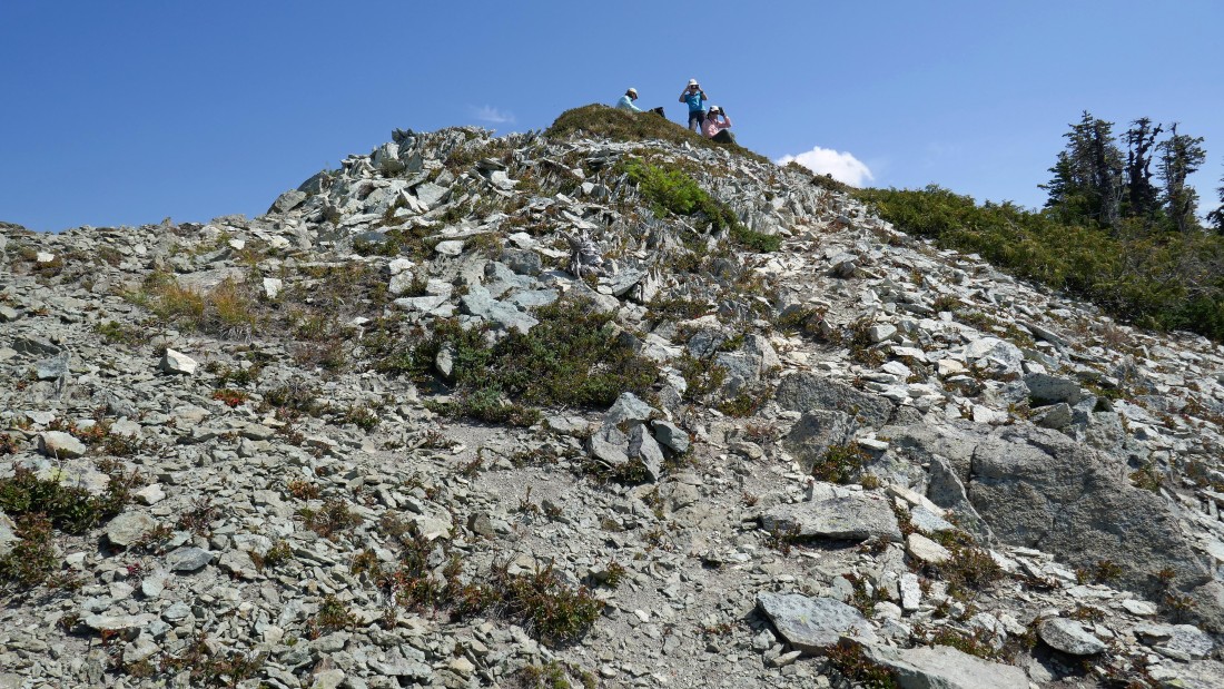
Getting closer to the summit.
|
BarbE, Karen and Snowdog relaxing on the Stevens Peak summit.
|
|
After hiking a total of 4.2 miles we have reached the summit (6560+) of Stevens Peak.
|

I built a cairn on the summit for Denali Girl to celebrate our 44th wedding anniversary... does this mean that I don't have to take her out to dinner?
|
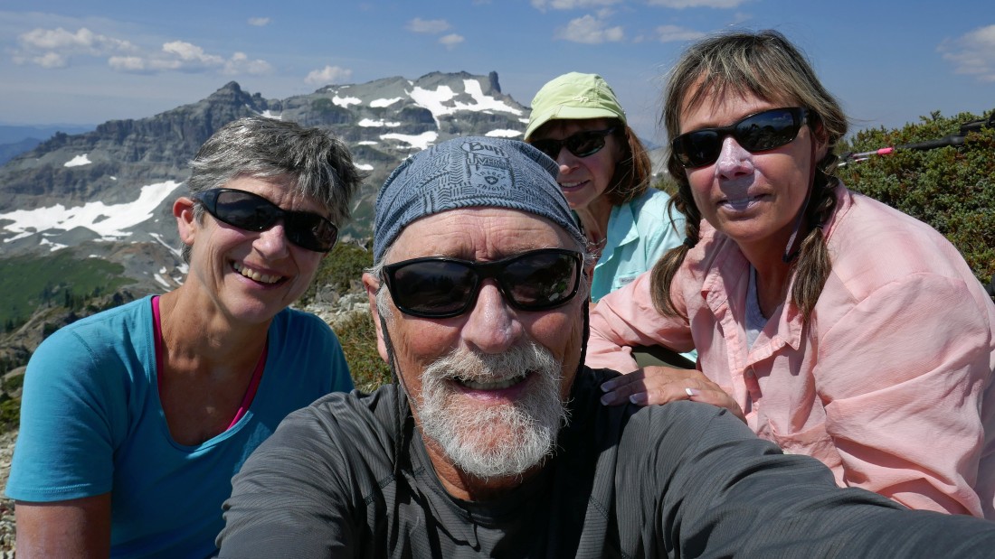
Summit selfie... Karen, me, BarbE and a white nosed Snowdog.
|
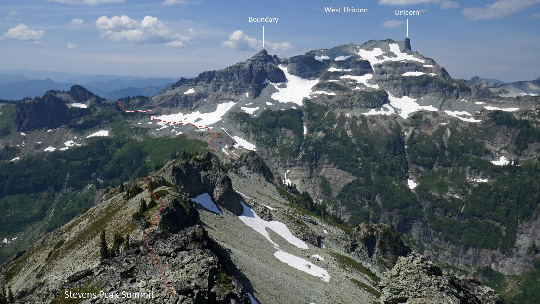
From the Stevens summit we can see our approximate route down from the Boundary/pinnacle saddle to the permanent snow field on the east side of Boundary... and then on over to the Boundary/Stevens saddle.
|

Heading along the SW ridge of Stevens as we more or less trace our steps back to camp.
|
After hiking the SW ridge of Stevens for a quarter mile or so it is time to head down to work our way around the buttress... don't slip here or you might end up in Blue Lake below.
|

Working our way around the buttress.
|
Past the buttress and heading for the Boundary/Stevens saddle in the center of the photo.
|
Almost back to the Boundary/Stevens saddle.
|
The tarn is just as beautiful now as it was earlier in the day.
|
Recrossing the permanent snow field on the east side of Boundary.
|
Working our way back up from the snow field to the Boundary/pinnacle saddle... taking a slightly different route so that we could avoid the Class 2/3 chute that we used on the way down earlier in the day... Stevens Peak and Blue Lake are in the distance.
|
It almost feels like a trail as we near the Boundary/pinnacle saddle.
|
Back on a reasonable path as we traverse underneath the pinnacle... this time we will not return to Point 6240+... instead, we will follow the path that traverses around it.
|
On the reasonable path that traverses around the west side of Point 6240+... looking back at Little Tahoma through the saddle between Boundary Peak and the impressive pinnacle.
|
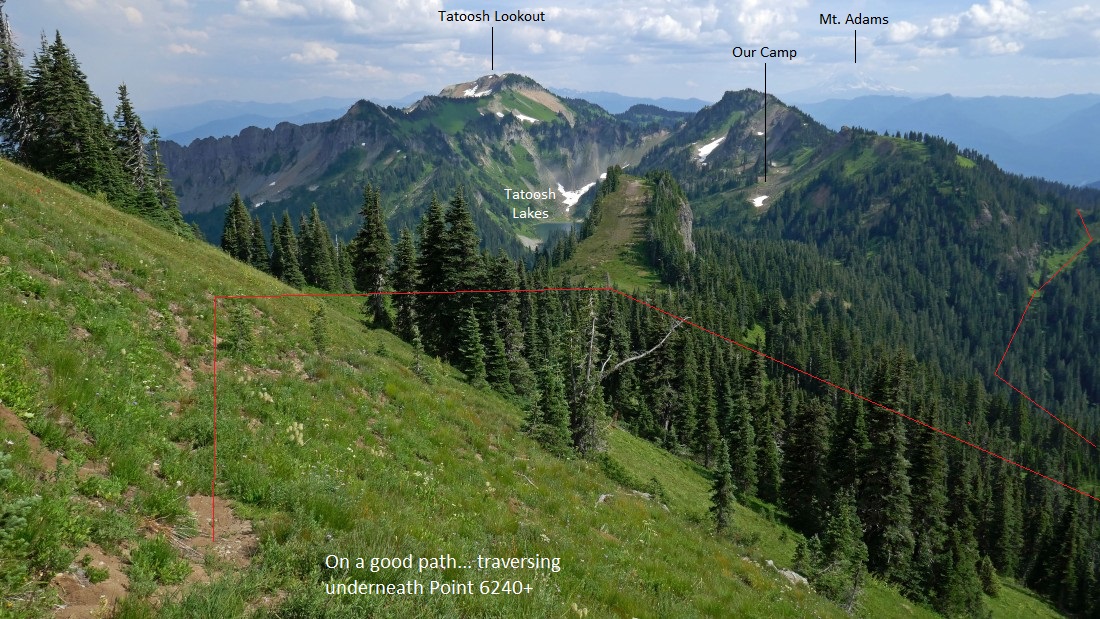
On the path below Point 6240+... and the approximate route that will take us back to our camp.
|
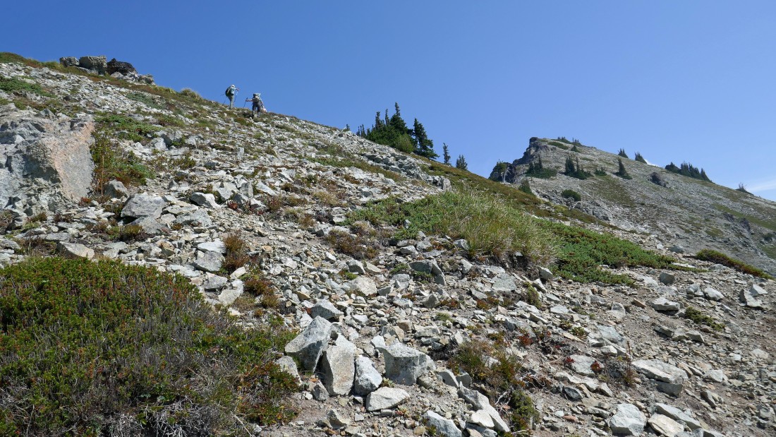
Yes, we are on a reasonable path.
|

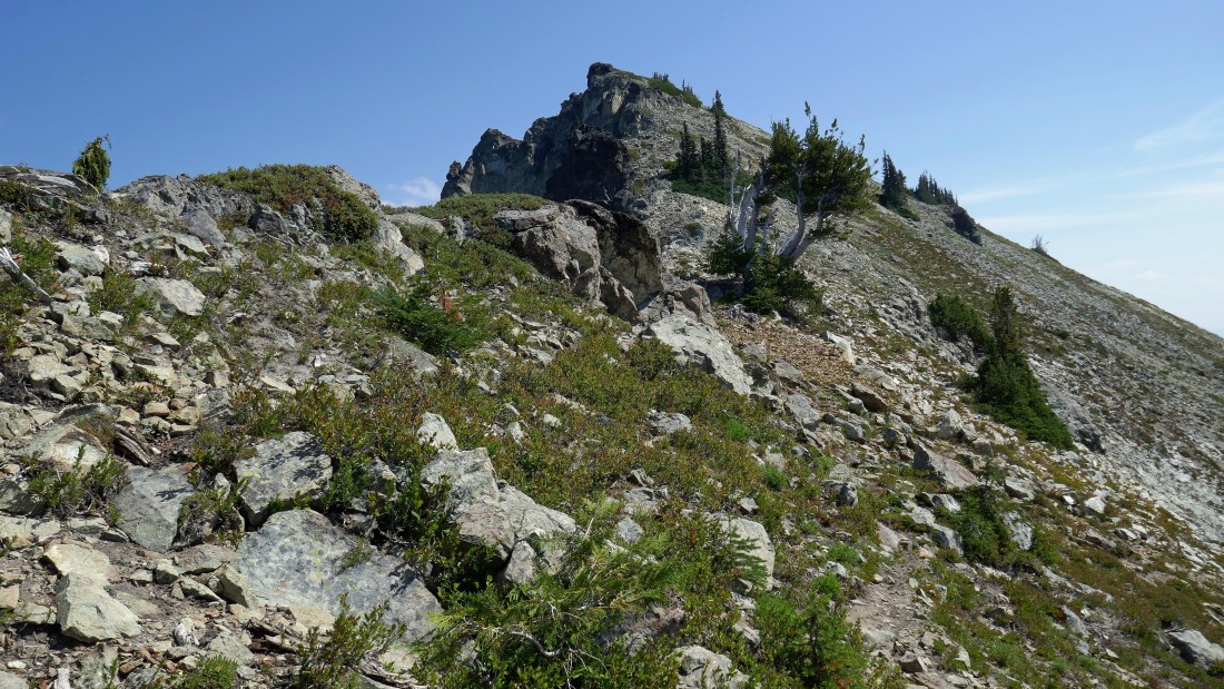
Almost off of the path and back to Tatoosh Trail #161... which we will follow a short distance to Tatoosh Lakes Trail #161B that will take us back to camp.
|

Back at the saddle above our camp... the trip from our camp to the Stevens summit and back to camp was 8.7 miles, gaining 3764 feet of elevation.
|
The terrain statistics of our day hike from camp to Stevens and back to camp... while we were never lower than 5200 feet and never higher than 6560 feet, the ups and downs for the trip totaled 3764 feet of elevation gain... and be sure to toss in a roundtrip of 6 miles and 3175 feet of elevation gain to get from the trailhead to our base camp.
|
