Point 7228 and Panhandle Balcony - 9.6.2018

From the junction of Sunrise Road and WA-410... drive the Sunrise Road for 4.3 miles to the trailhead (~3800 feet) for Summerland... just west of the bridge that crosses Fryingpan Creek... come early because it is a very popular area.
|
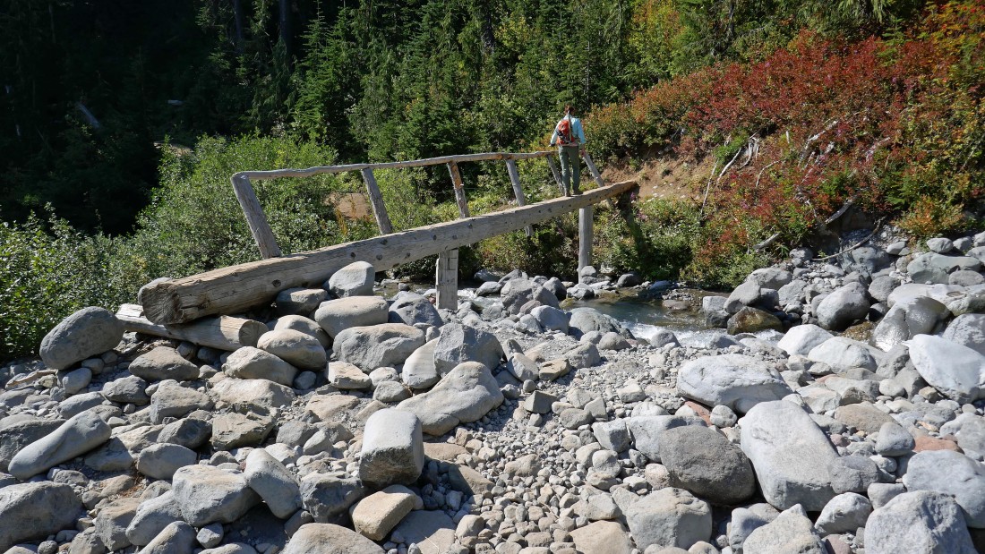
After hiking a total of 3.5 miles (~5200'), make the bridge crossing of Fryingpan Creek.
|
After hiking a total of 4 miles (~5500') reach the place where the trail starts switchbacking up to Summerland.
|

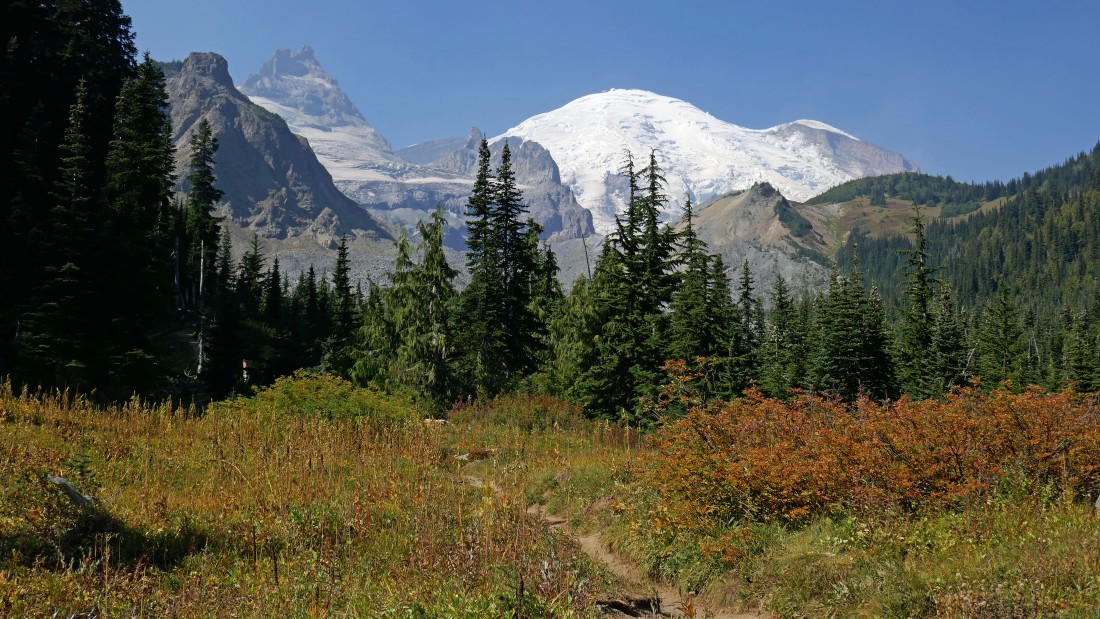
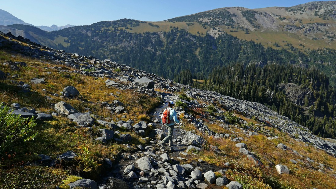
After hiking a total of 4.4 miles (~5900')... reach Summerland... Meany Crest and Point 7573 are in the left foreground... with Little Tahoma and Rainier in the distance on the right.
|

Continuing further into Summerland.
|
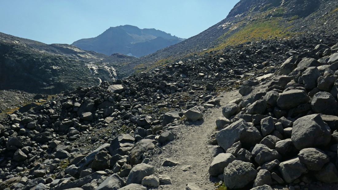
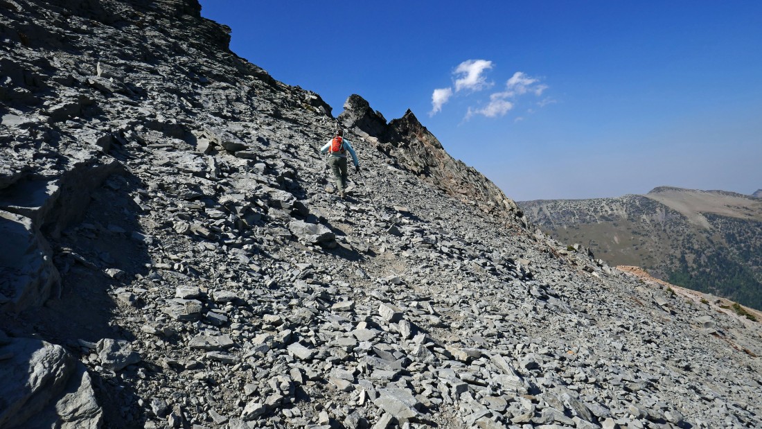
Hiking beyond Summerland into more barren terrain... the path is in excellent shape... it is part of the Wonderland Trail... we didn't realize it at the time, but we are heading for the high point on the horizon.
|
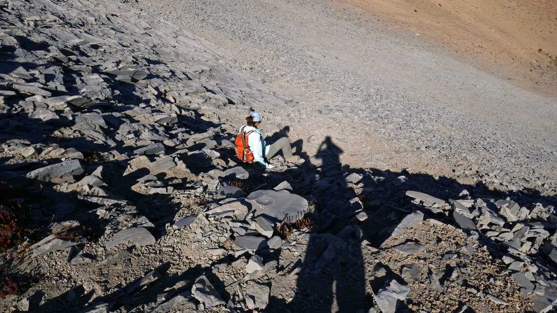
One of the Summerland guardians is resting on a rock in the upper left portion of the photo.
|
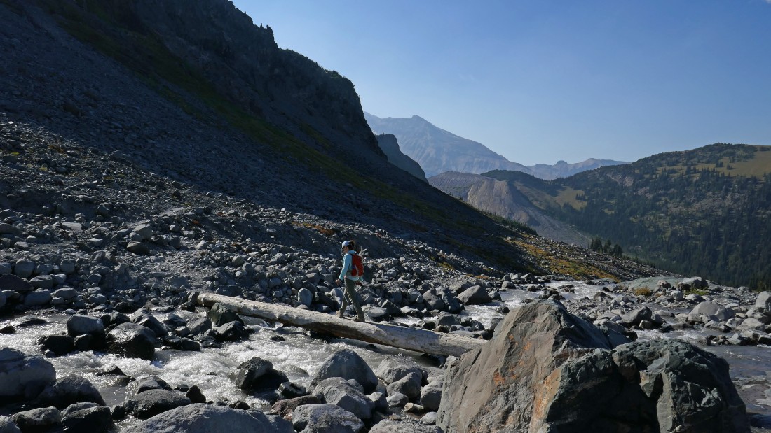
BarbE is crossing a footlog on the far left as we continue toward our objective in the distance.
|
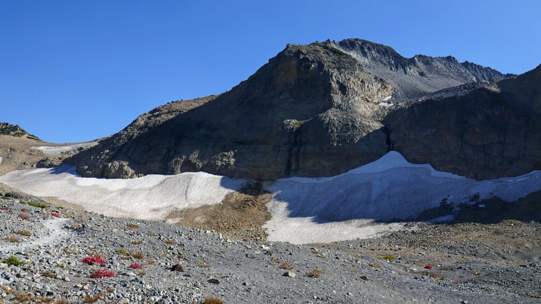
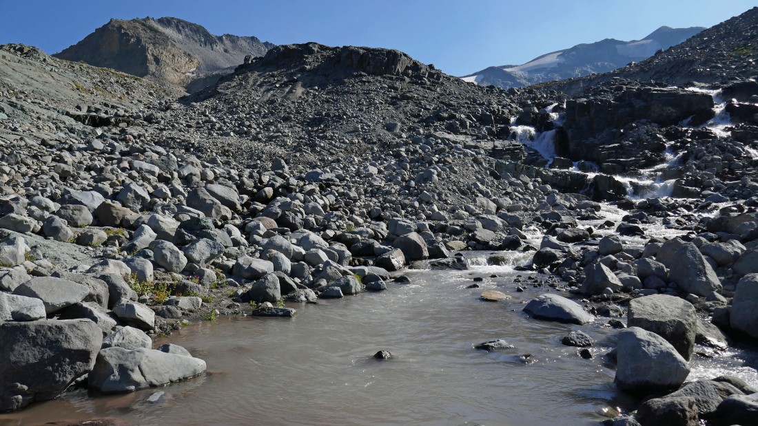
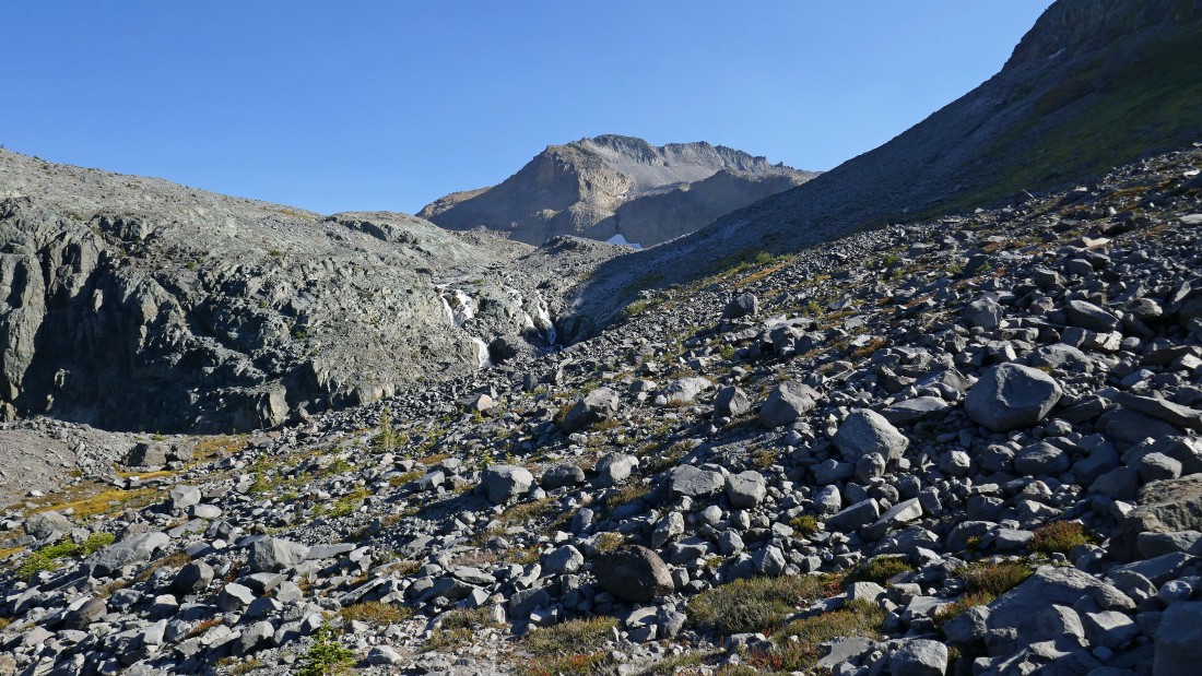
One of several tributaries that feeds Fryingpan Creek.
|
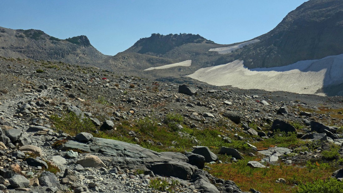
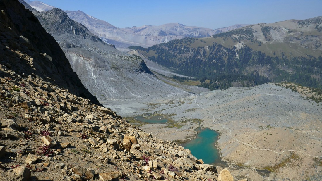
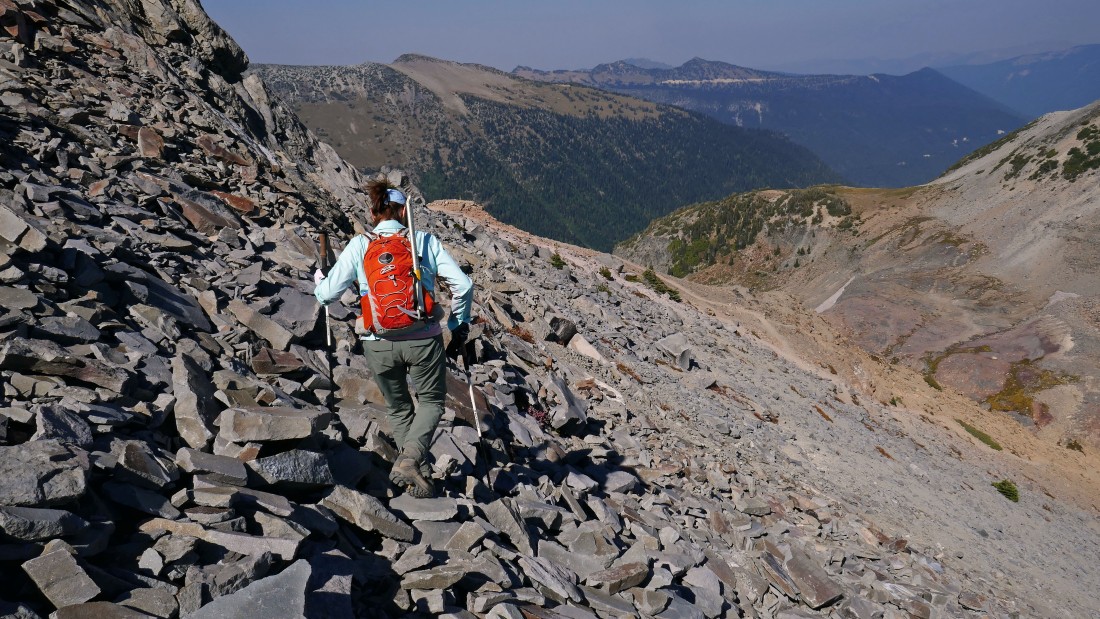
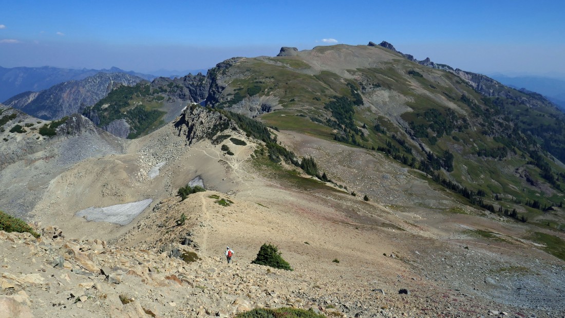
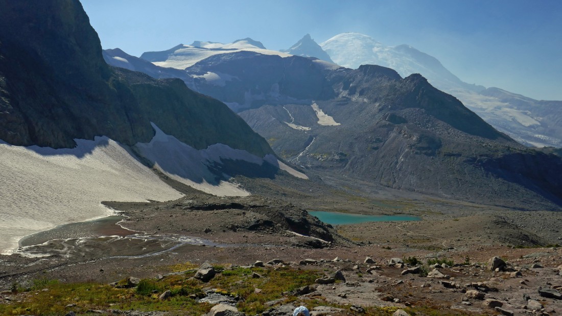
Point 7228 of Panhandle Balcony is in the distance on the far left... Point 7573 and Meany Crest are above on the right... you can see pieces of the lower portion of Fryingpan Glacier on the horizon in the center of the photo.
|
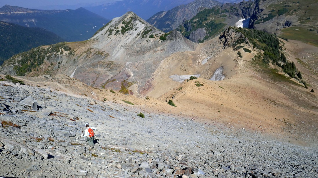
The trail will take us up to Panhandle Gap on the right.
|
Looking back down toward Summerland as we get closer to Panhandle Gap.
|
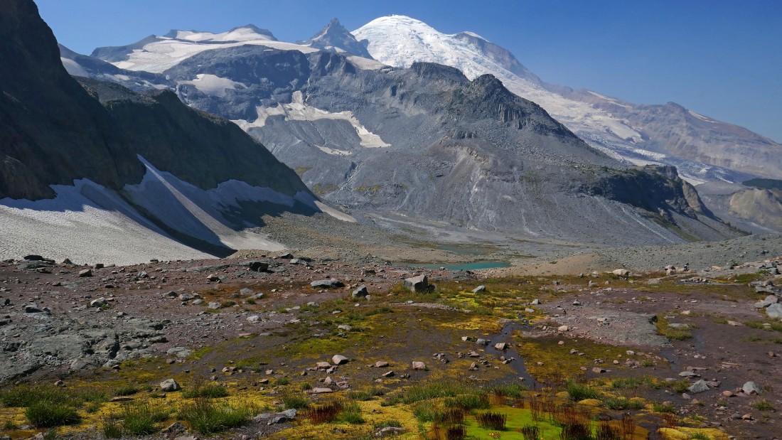
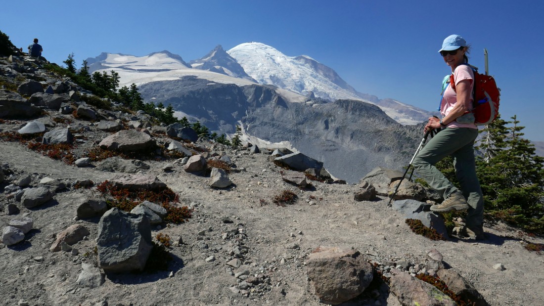
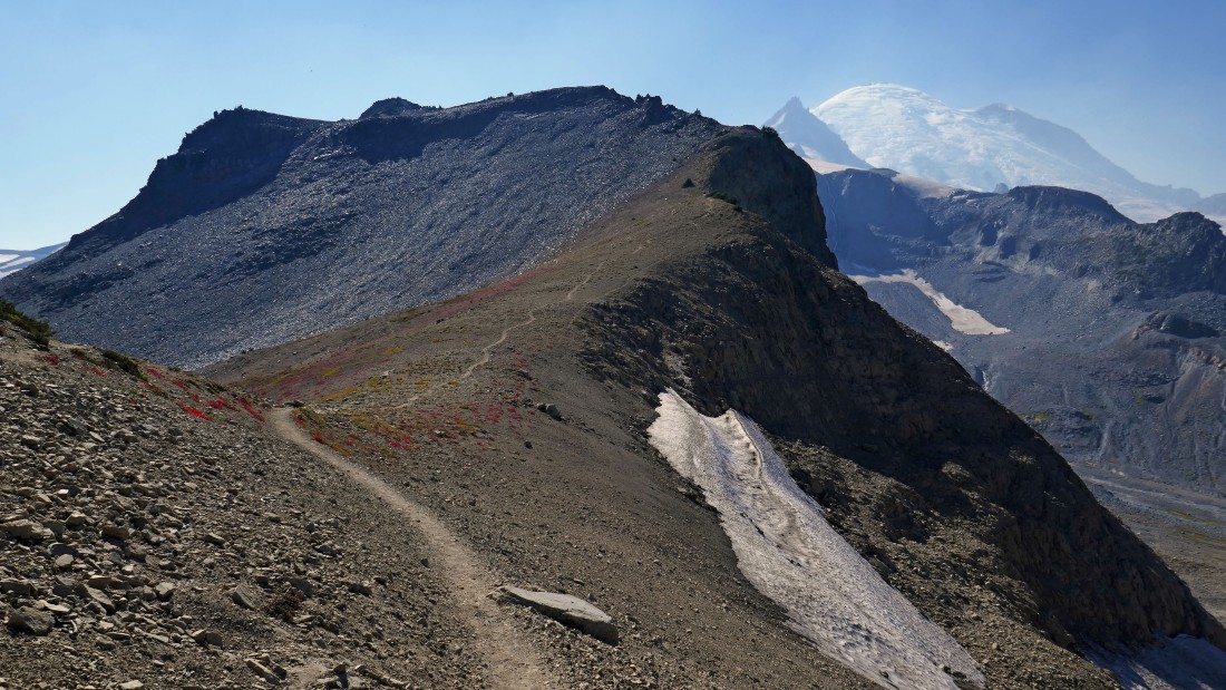
Peak identification as we near Panhandle Gap... the gap is the highest point on the Wonderland Trail.
|
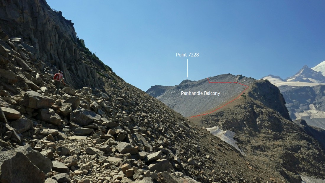
BarbE is following the trail over toward Panhandle Gap and Panhandle Balcony... the red line shows our approximate route up onto the balcony and on over to Point 7228.
|
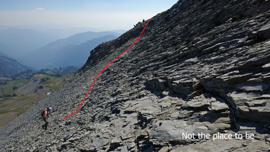
After hiking a total of 5.8 miles (~6800') we have reached Panhandle Gap... I went up to the balcony via the 'yellow' route... definitely not the way to go and if a person chose to come down the 'yellow' route, it might be considered suicide.
|
Looking down at Summerland as we continue up toward Panhandle Balcony.
|

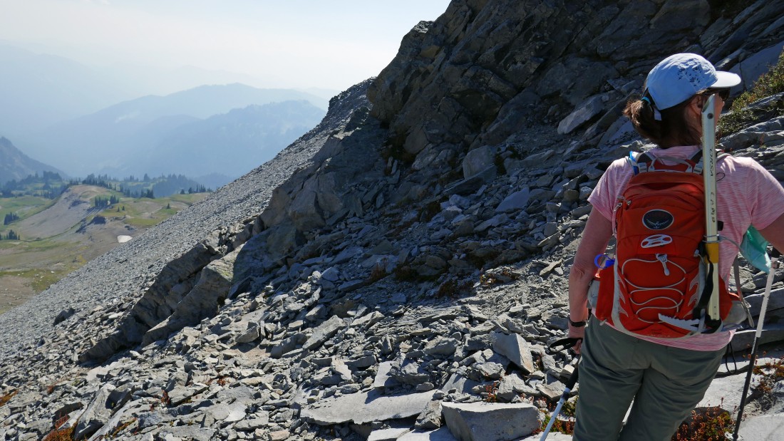
Gaining elevation west of Panhandle Gap below... and looking across at the ridge leading out to Banshee Peak and the Cowlitz Chimneys.
|
Continuing up toward Panhandle Balcony... this would have been a good place to start a traverse over toward the left in the photo... but a more obvious path led up to the right... so we took the obvious path.
|
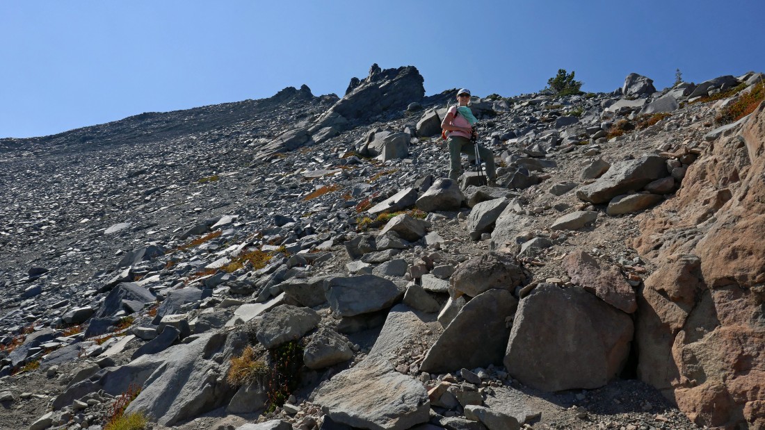
Still gaining elevation on the most obvious path.
|
Well... the obvious path disappeared when we hit a very gnarly rock outcropping... it was easy to figure out why we were on the most obvious path... this is the spot where most folks stop to enjoy the view... we will need to go down a bit here and get around this rib before continuing on up to the balcony.
|
I rounded the rib in the last photo and took a more direct route up toward the balcony... but BarbE found the best route over to the balcony... I could see her route from where I'm standing and I knew that would be the route for both of us on the way back down.
|
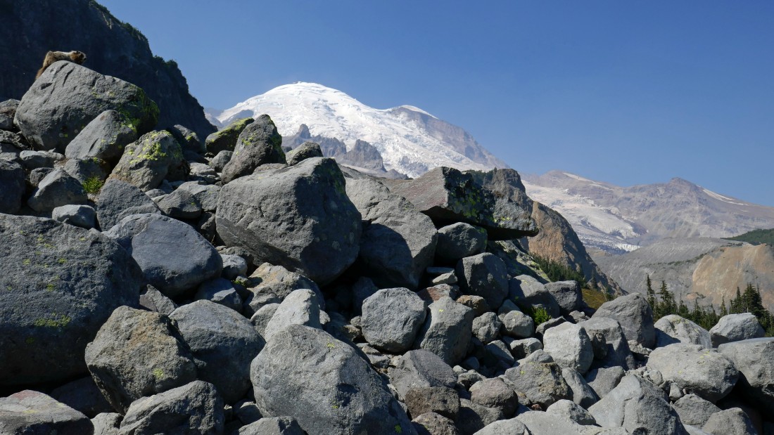
I have reached the north end of Panhandle Balcony and can see that Point 7228 is only a stone's throw away... Whitman Crest, Little Tahoma and Rainier dominate the views on the right.
|

Looking down to Summerland from the north end of Panhandle Balcony... with the massive Goad Island Mountain on the other side of the valley... Burroughs Mountain is on the left horizon beyond Goat Island.
|
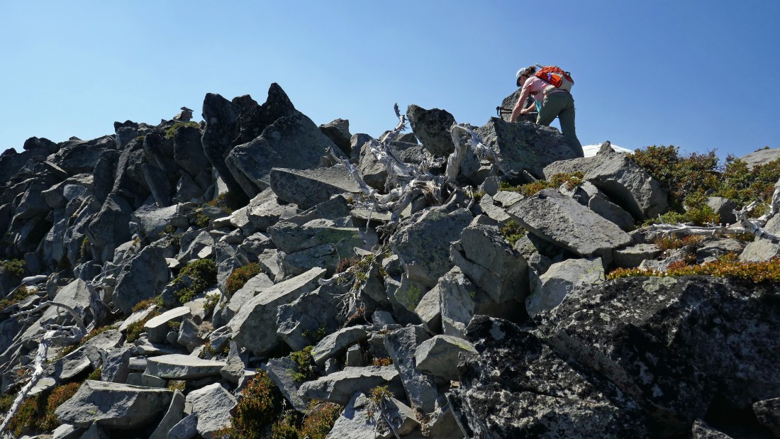
Heading for Point 7228... the high point on Panhandle Balcony.
|
BarbE leads the way.
|
BarbE works her way over toward the summit cairn on the left.
|
After hiking a total of 6.3 miles, BarbE is on the summit of Point 7228.
|
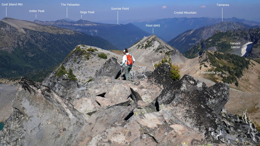
Peak identification from the summit of Point 7228.
|
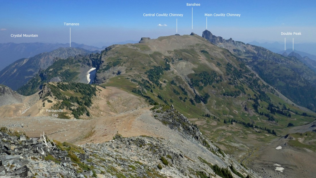
More peak identification from the summit of Point 7228.
|
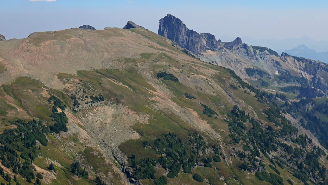
A closer look at Banshee Peak and Main Cowlitz Chimney... kind of looks like a watercolor painting.
|
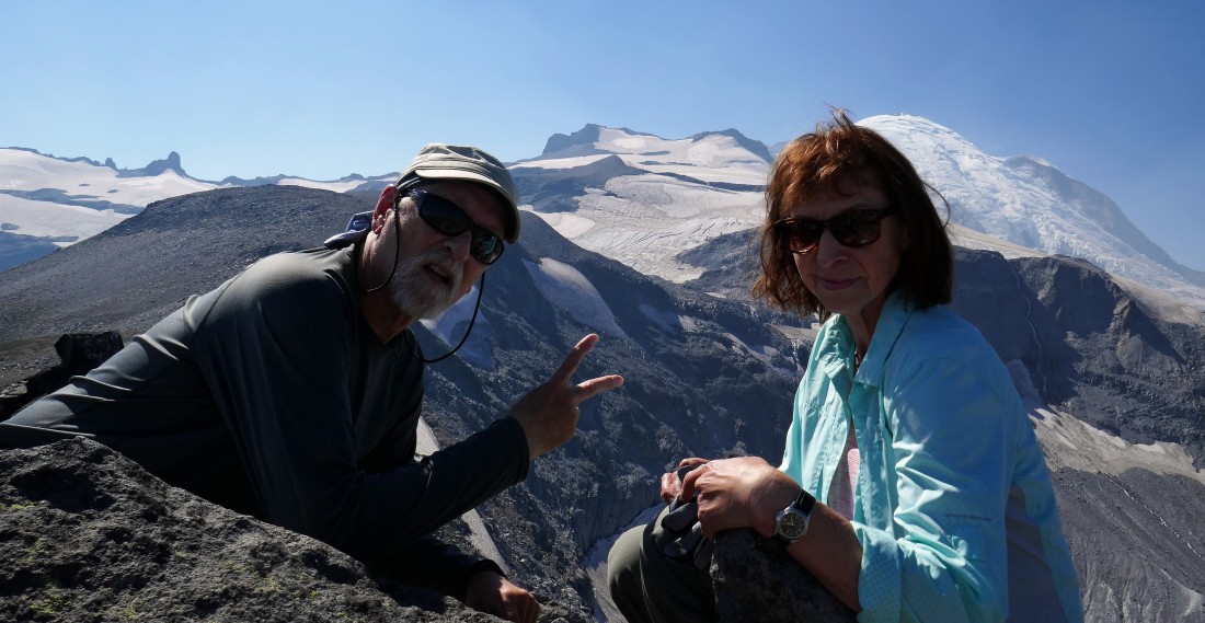
Mandatory summit selfie on Point 7228... Whitman Crest and the Fryingpan Glacier are between us in the distance.
|
Time to head down from Point 7228.
|
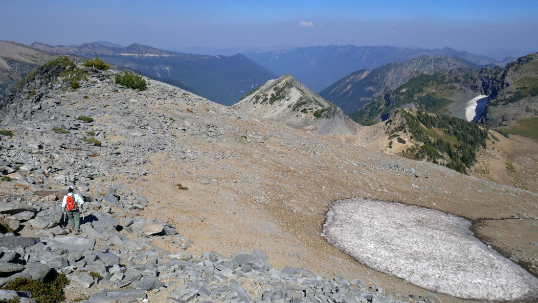
On Panhandle Balcony... not really looking forward to the traverse over talus that will get us back over to easier terrain.
|
Not everything on a hike or scramble is necessarily fun.
|
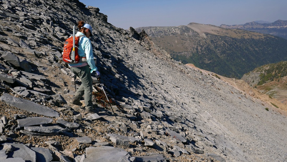
Yes... a few butt moves came in very handy on this loose talus.
|
Traversing underneath Panhandle Balcony on loose talus.
|
Slow going here.
|
Almost back to easier terrain.
|
Finally off of the loose talus and working our way down to Panhandle Gap on a very good path when compared to the loose talus stuff.
|
We got back down to Panhandle Gap and looked back at Panhandle Balcony and were surprised to see several goats coming up from the steep cliffs in the shade on the right.
|
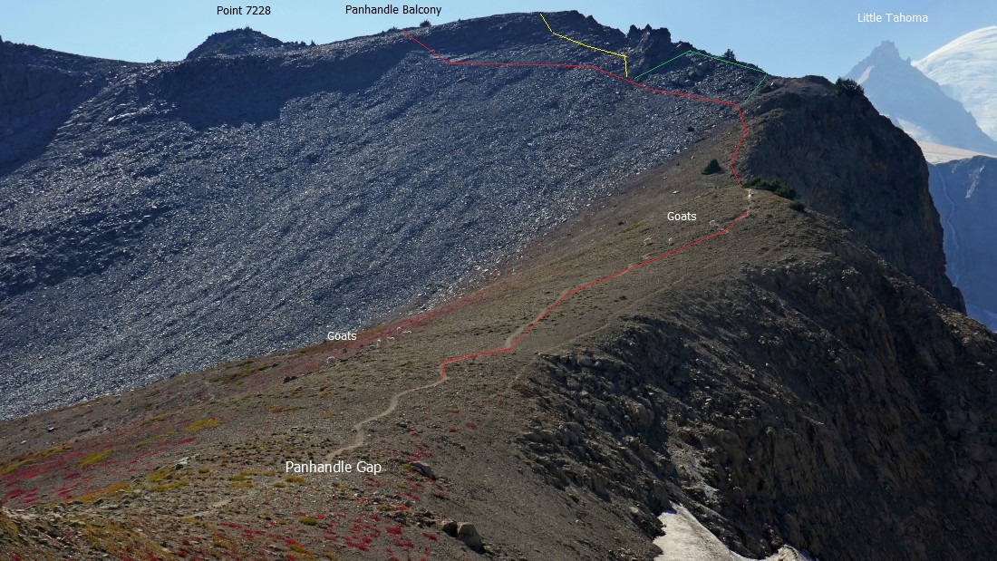
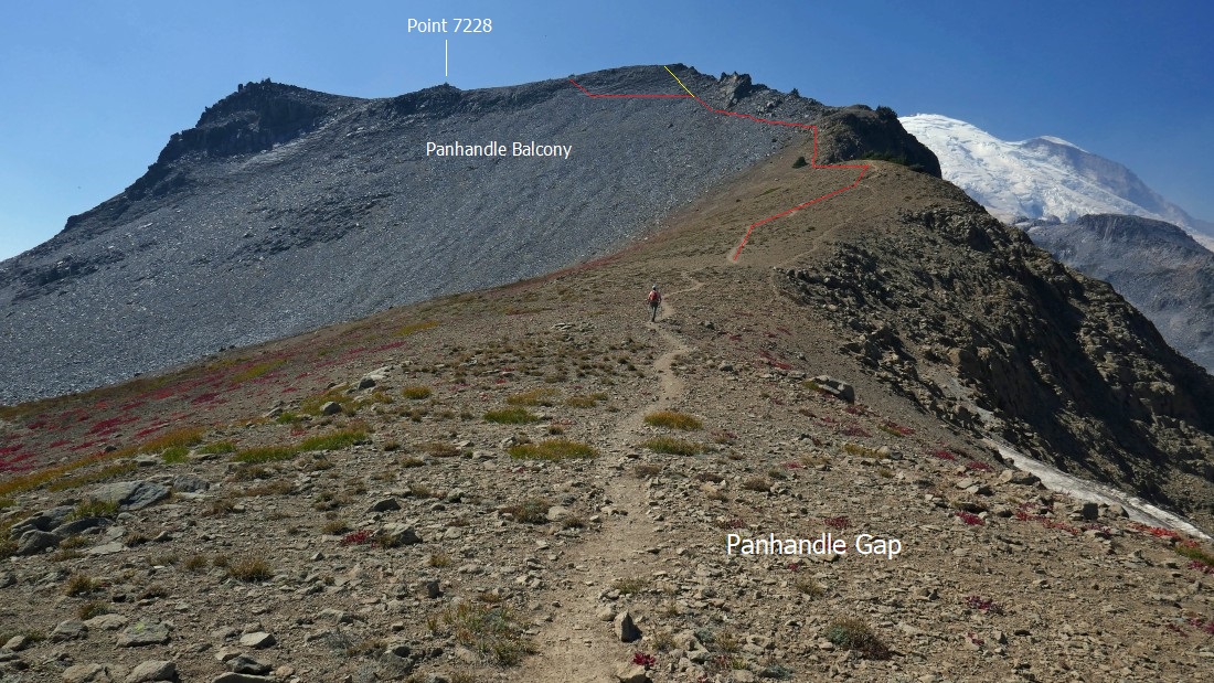
The red route is the way to go if you are heading for Point 7228... I used the yellow route on the way up and it is not a good route... steep and loose... the green route was the way both of us used on the way up, however, it disappeared when we got to the gnarly rock outcropping... forcing us to give back some elevation to get back on the red route.
|
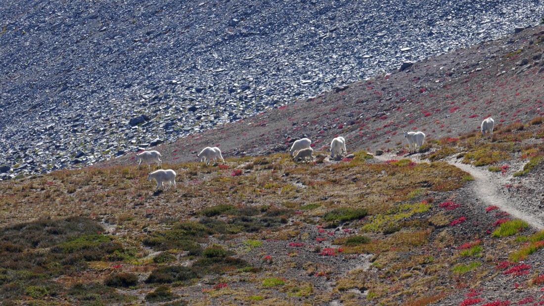
A closer look at some of our Panhandle Gap visitors.
|
Tracing our steps down from Panhandle Gap back toward Summerland.
|
Looking back at Panhandle Balcony as we continue down toward Summerland... Panhandle Gap is on the far left.
|
Lots of water... Panhandle Balcony is on the far left horizon.
|
On our way back down to Summerland.
|
Late afternoon sunshine at Summerland.
|
Looking back at Panhandle Balcony as we continue down toward Summerland.
|
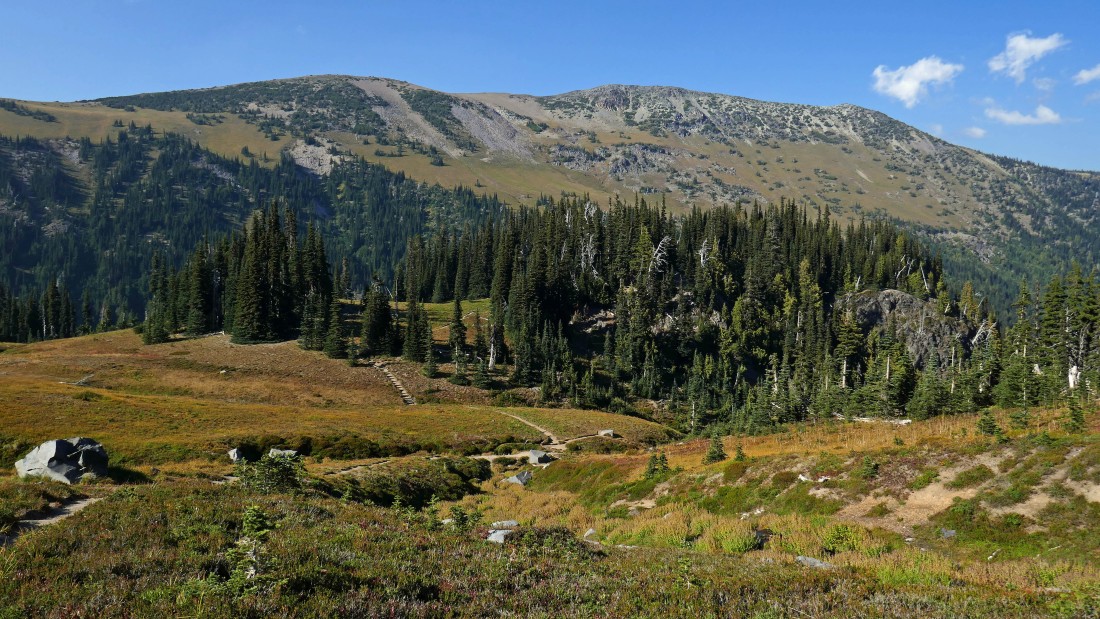
Summerland... with Goat Island Mountain beyond.
|

Back in Summerland after hiking a total of 8 miles... our last look back at Panhandle Balcony before making the 4.5 mile hike back to our car... the total trip was 12.6 miles, gaining 3584 feet of elevation.
|
