Davis Peak - Central Summit and Lookout Site - 10.11.2018

From the Brick Tavern in Roslyn, Washington... drive WA-903/Salmon La Sac Road for 15.5 miles... then turn right onto the unpaved FS-4330 and drive it for 1.6 miles to the signed left-hand turn for Davis Peak Trail #1324... leaving another half-mile drive to the actual trailhead (~2540').
|
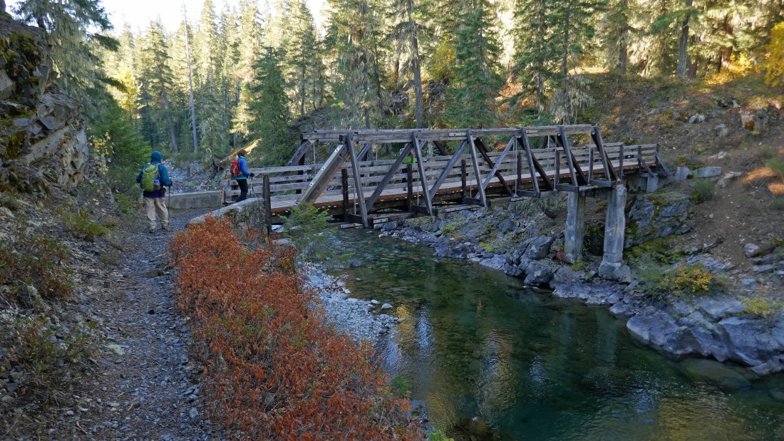
The trail starts out downhill from the parking area and quickly crosses the Cle Elum River.
|
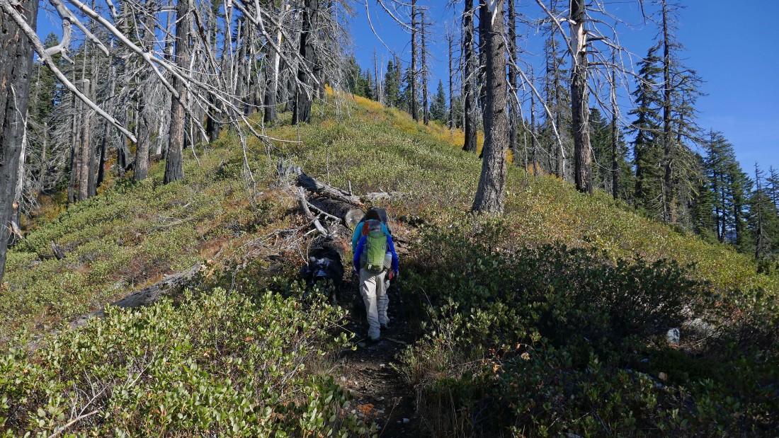
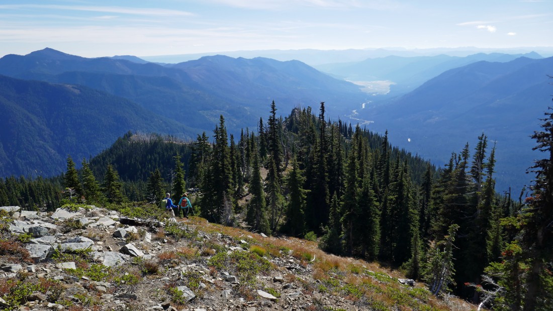
After hiking a couple miles we came out of the trees into more open terrain.
|
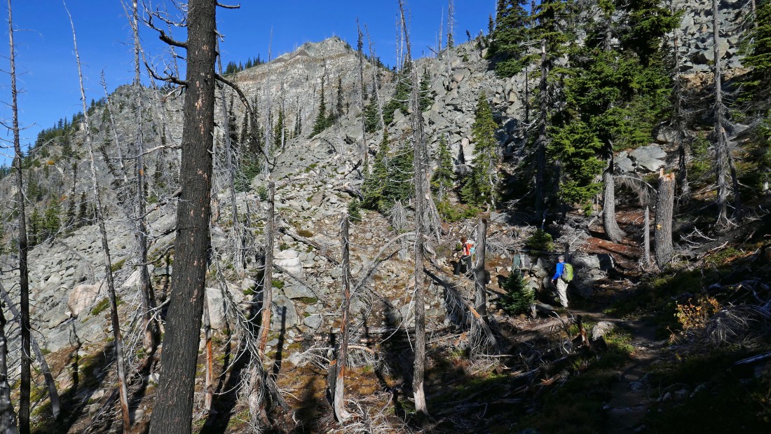
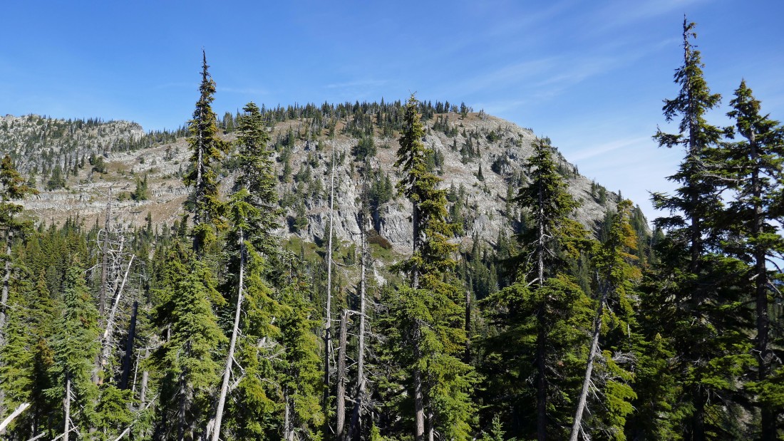
Continuing on the Davis Peak Trail with Point 5988 in the distance.
|
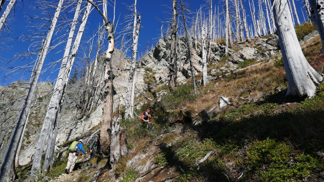
Switchbacking up the Davis Peak Trail to a ridge that will lead us over to the base of Point 5988.
|
We have reached the ridge that will lead us over to the base of Point 5988... and our first look over to the Davis Peak Lookout area.
|
Continuing on the Davis Peak Trail... heading directly toward the base of Point 5988.
|
After hiking a total of 3.7 miles we have reached the base (~5740') of Point 5988... where the trail gives up a little elevation.
|

Giving up a little elevation from the base of Point 5988 as the trail does its best to stay above a drainage.
|
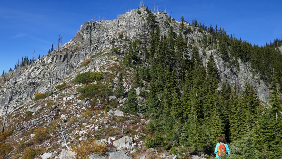
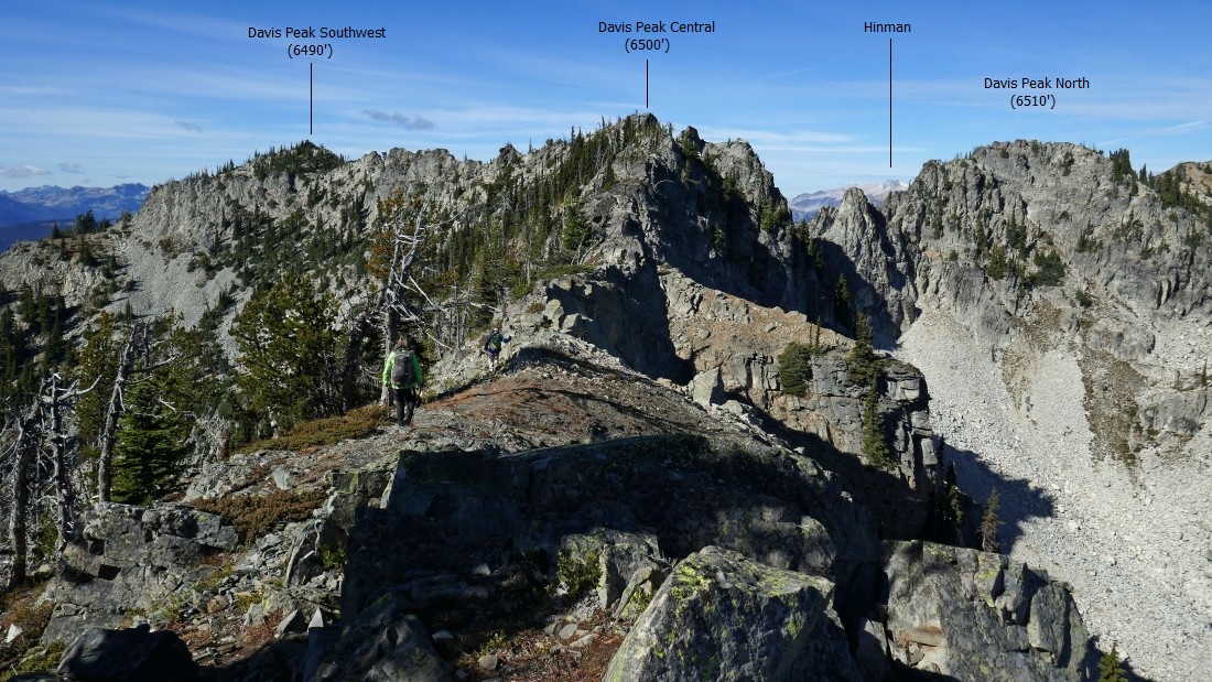
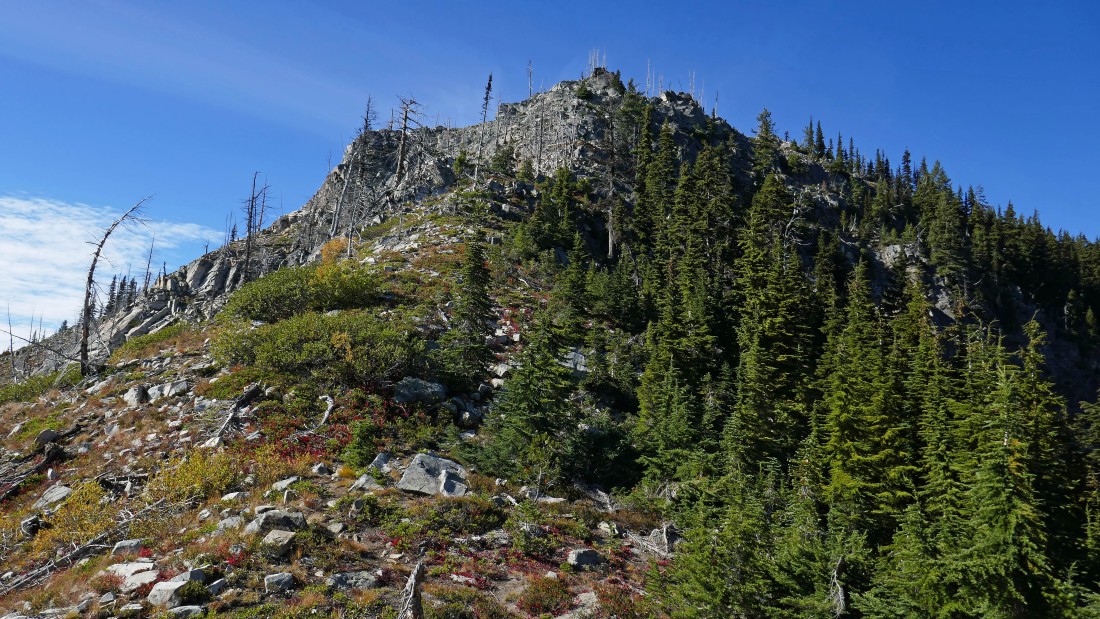
Switchbacking our way up to the lookout site (out of frame on the right) and looking at the southwest summit in the center of the photo... with the central summit kind of hidden in the right-center of the photo.
|
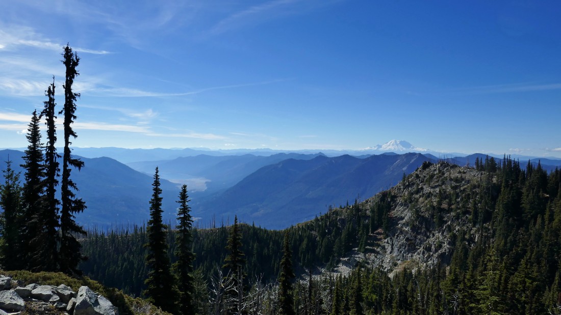
Looking back at Point 5988 in the right foreground... with Mt. Rainier on the horizon... and Cle Elum Lake down the valley.
|
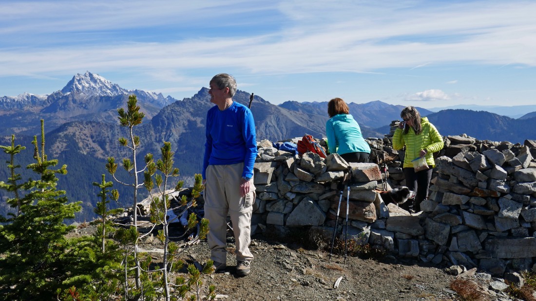
After hiking a total of 4.5 miles we have reached the old lookout site (6426').
|
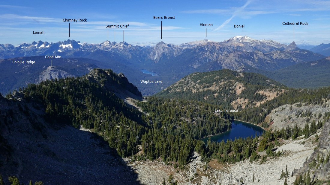
A pano shot from the lookout site... with Davis Peak North in the left foreground... Goat Mountain in the center foreground... and Snowdog in the right foreground.
|
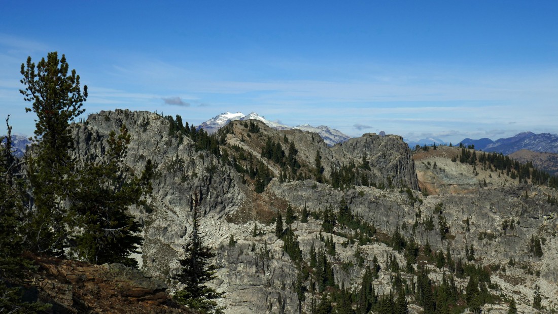
A closer look at the north summit of Davis Peak in the left foreground... and its rugged north ridge that runs across the middle of the photo... with a snow capped Mt. Daniel in the distance beyond the ridge.
|
Looking north from the lookout.
|
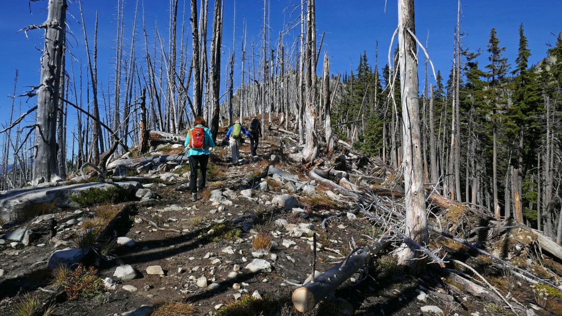
Leaving the lookout site on a good path that will take us over to the central summit of Davis Peak.
|

Still on a good path... but not sure that I would want to be on it in snow.
|

Looking back at Hawkins Mountain in the foreground... with Ingalls Peak and Fortune Peak beyond Hawkins and in front of the Stuart Range on the horizon.
|
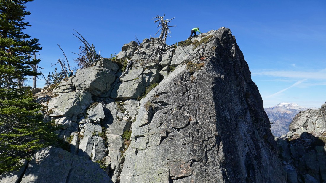
After hiking a total of 4.9 miles, Snowdog nears the central summit (~6500') of Davis Peak... with Mt. Daniel in the distance on the right.
|
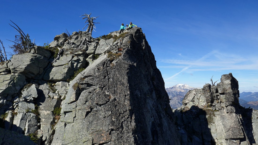
BarbE and rodman join Snowdog on the central summit of Davis Peak.
|
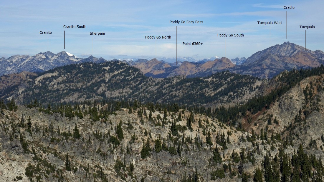
Peak identification looking west (left) to NW from the central summit of Davis Peak.
|

Me on the central summit of Davis Peak... with Mt. Stuart in the distance on the far right.
|

Leaving the central summit of Davis on a faint path that will take us over to the ridge that connects the southwest summit of Davis and Point 5988.
|

Continuing on the faint path that will take us over to the ridge that connects the southwest summit of Davis and Point 5988.
|
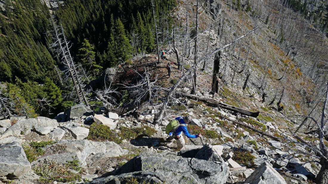
On the ridge now that connects the southwest summit of Davis and Point 5988... looking back at our route from the lookout site (out of frame on the right) to the central summit and then from the central summit to where we are standing now.
|
|
Our route from the lookout site to the central summit.
|
Losing elevation as we head directly for Point 5988... with Cle Elum Lake in the distance.
|
After hiking a total of 5.5 miles we are standing on Point 5988... looking at most of the loop portion of our trip.
|
Heading down from Point 5988 to rejoin the Davis Peak Trail and close the loop portion of our trip.
|
We have rejoined the Davis Peak Trail and are looking back up at Point 5988... leaving a 3.7 mile hike back to the car. The total trip was 9.3 miles, gaining 4249 feet of elevation.
|
