Saddlebag Lake and many more lakes - 5.28.2020
|
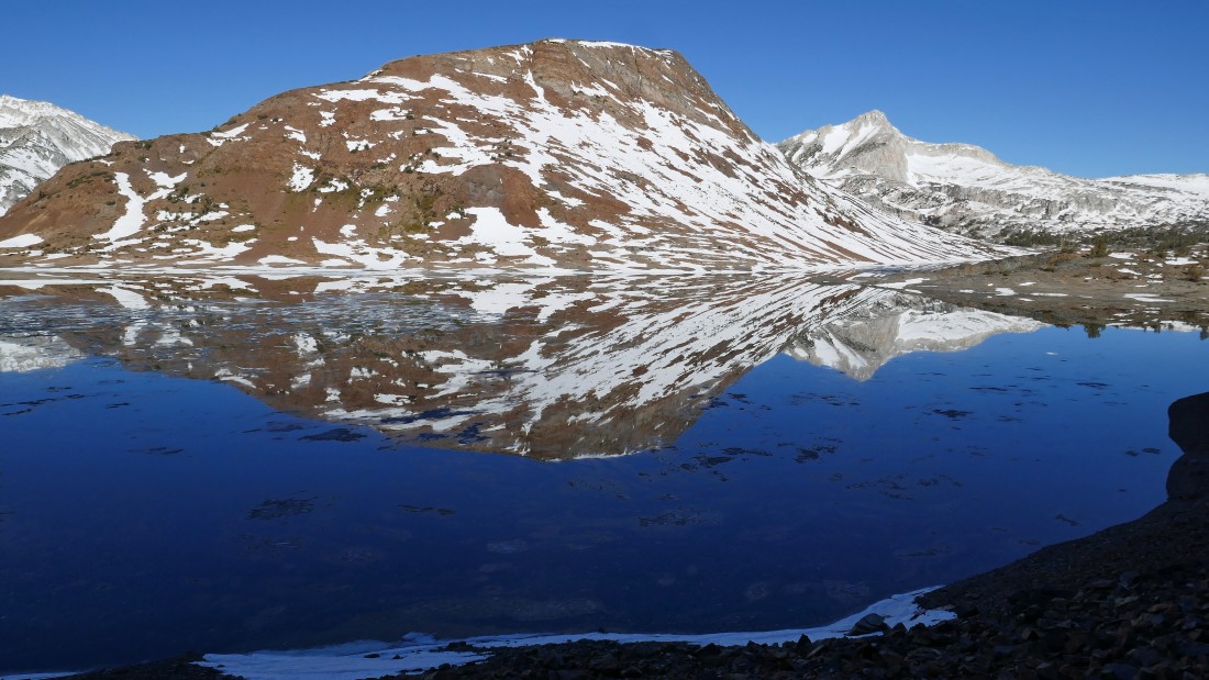
We parked at the Saddlebag Lake Resort... a 10,000 foot lake near the Tioga Pass entrance to Yosemite National Park... Greenstone Ridge is in the left foreground... with Shepherd Crest and Excelsior Mountain on the horizon at the far end of the lake.
|
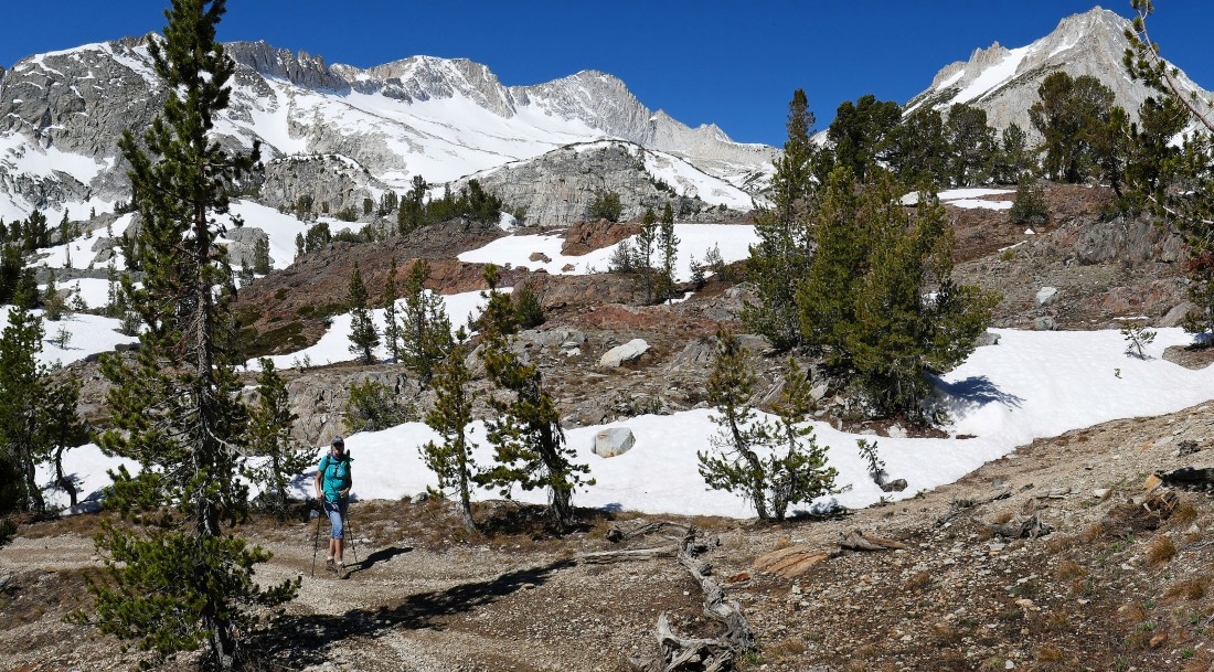
Denali Girl starts around the south end of Saddlebag Lake on the Saddlebag Lake Loop Trail... with part of the Tioga Crest in the right foreground.
|
At the south end of Saddlebag Lake... Greenstone Ridge is in the center foreground... White Mountain and the East Buttress of Mount Conness are on the left... with Shepherd Crest and Excelsior Mountain down at the north end of the lake... with part of the Tioga Crest in the right foreground.
|
There was not a single ripple in the lake at 8:00am... making for great reflections... North Peak is coming into view on the right as we continue around Saddlebag Lake.
|
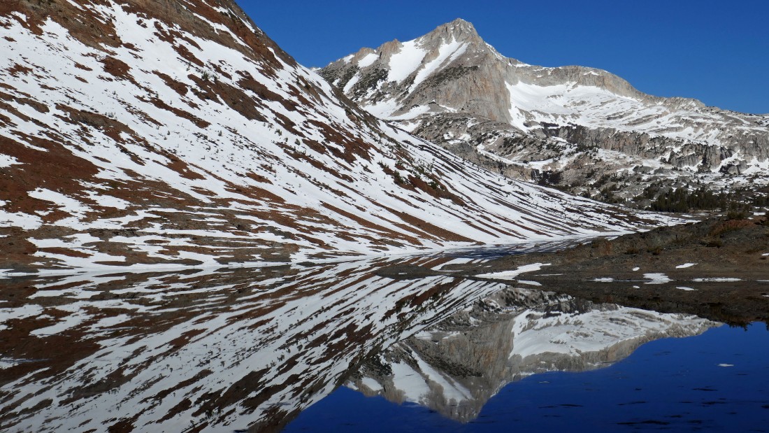
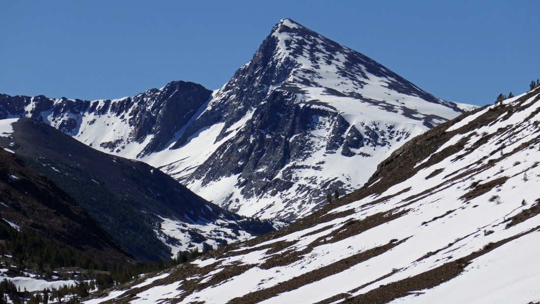
A closer look at North Peak in the distance... I climbed it in 2012, but not from the NE face which appears to be vertical from here.
|
Now on the east side of Saddlebag Lake... looking back at the south end of the lake where we started hiking... with False White Mountain and White Mountain in the center of the photo... and the East Buttress of Mount Conness on the right horizon.
|
Continuing around the east side of Saddlebag Lake... getting a better look at North Peak on the left... with Shepherd Crest and Excelsior Mountain on the right... the lake reflections are not as good here at the north end of the lake due to there being a lot more ice on the lake.
|
Denali Girl hiking on the east side of Saddlebag Lake... with North Peak in the center of the photo... and the true summit of Mount Conness coming into view on the left horizon.
|
Still on the east side of Saddlebag Lake... with Greenstone Ridge dominating the center of the photo... and the Kuna Crest in the distance on the far left... with Mount Conness and North Peak on the right.
|
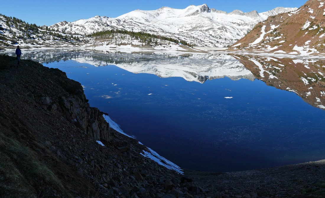
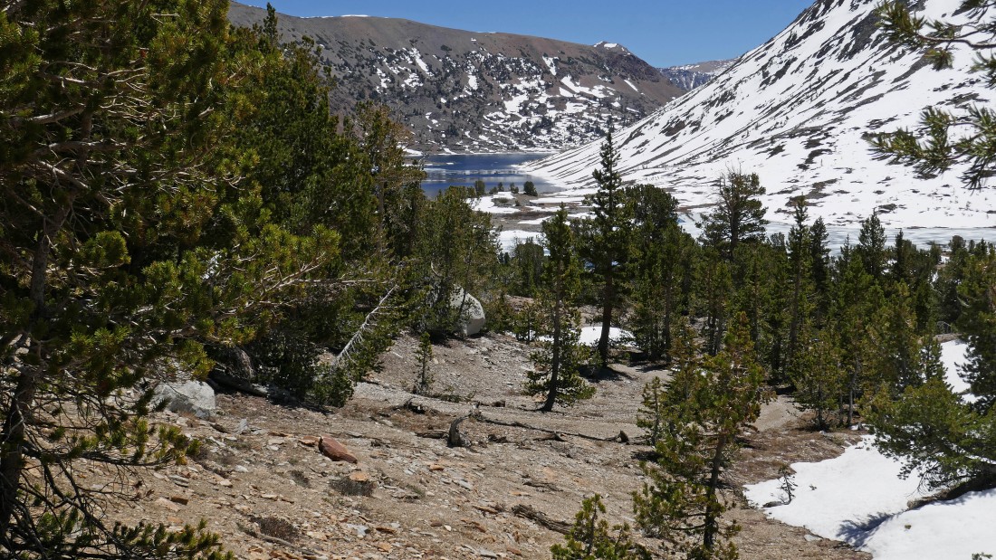
Looking down at the south end of Saddlebag Lake where we started hiking... with the Kuna Crest in the center of the photo... and Mount Dana (the 2nd highest peak in Yosemite) coming into view on the far left of the photo.
|
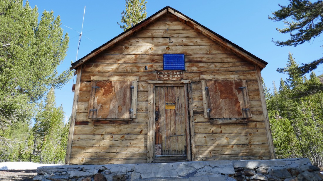
A wilderness ranger station for the Mono Ranger District.
|
Looking back to the south at Mount Dana... at 13,057 feet it is the second highest peak in Yosemite... I climbed it in 2012... but there was a lot less snow in August.
|
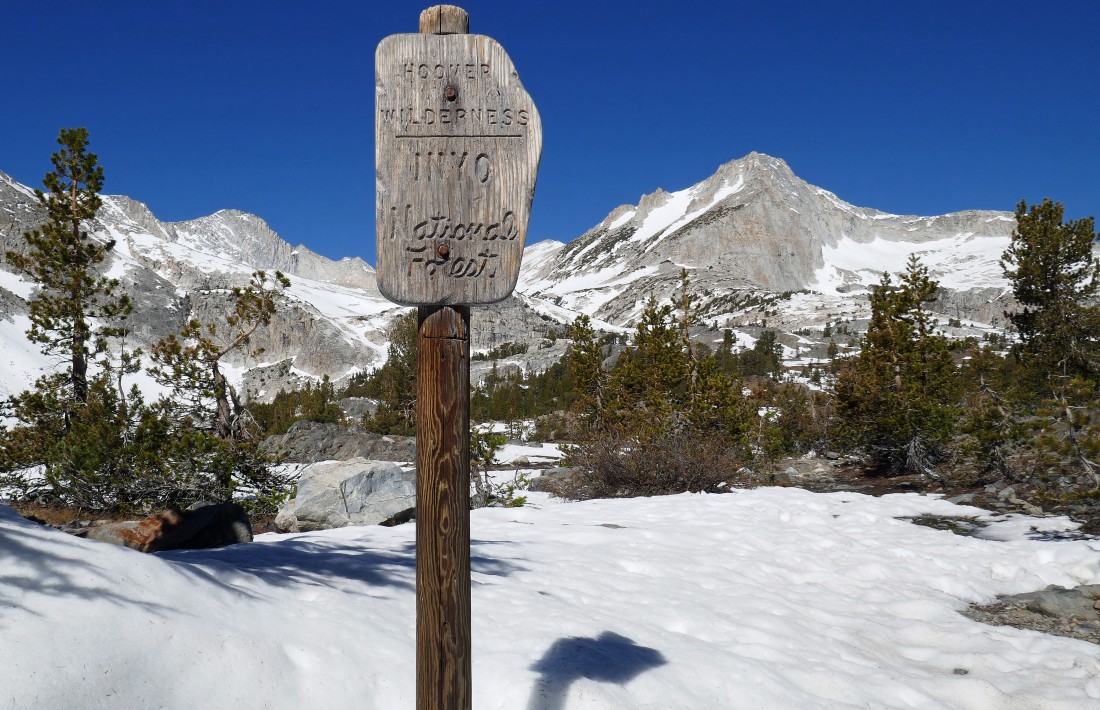
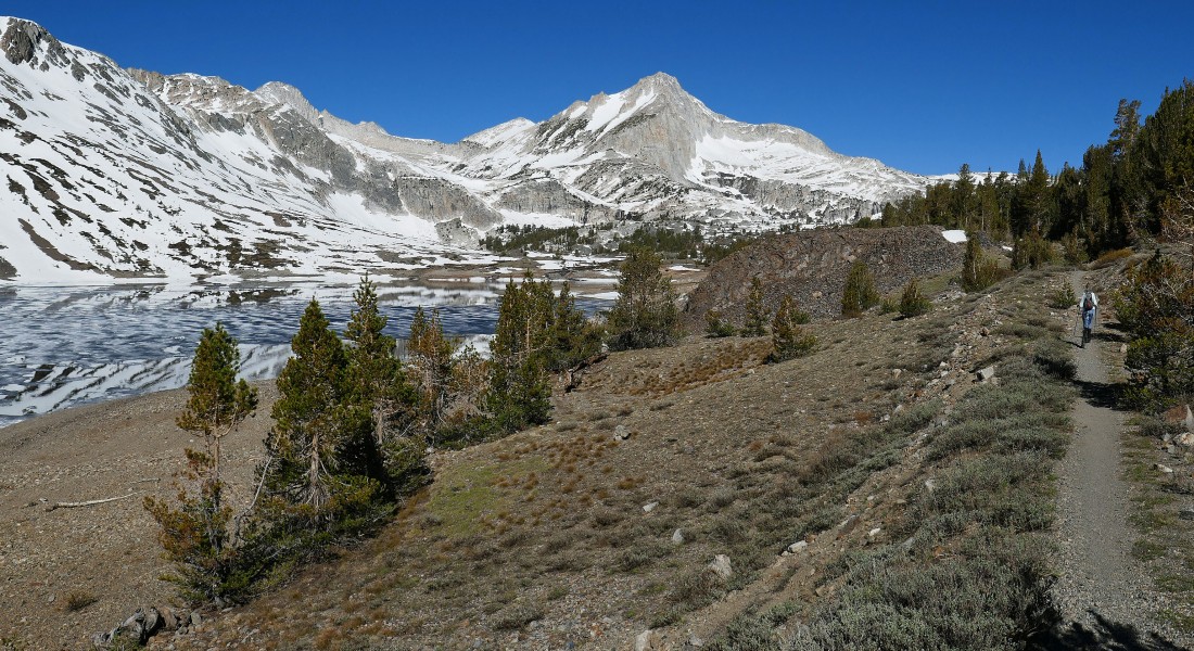
After hiking 2.6 miles we have reached the north end of Saddlebag Lake and entered the Hoover Wilderness... with Mount Conness to the left of the sign... and North Peak to the right of the sign... we will start hiking on the '20 Lakes Basin Loop Trail'.
|
Standing on the east shore of Greenstone Lake... looking at Mount Conness (at 12,590 feet the 9th highest peak in Yosemite) on the left horizon... and North Peak (at 12,242 feet the 20th highest peak in Yosemite) in the center of the photo.
|
We will hike around the north end of Greenstone Lake on the right and head NW toward Shepherd Crest and Excelsior Mountain on the right.
|
Denali Girl hiking on the 20 Lakes Basin Loop Trail... heading NW... looking back at Mount Conness in the center of the photo and North Peak on the far right.
|
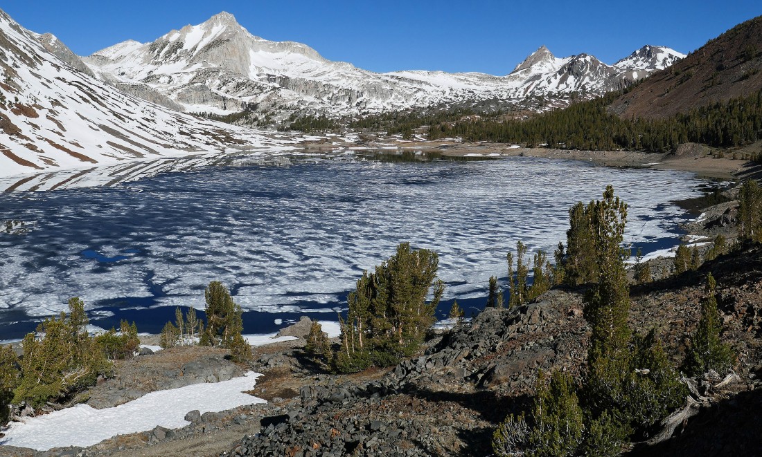
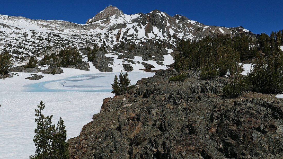
After hiking 3.5 miles we are looking beyond an unnamed tarn in the foreground and Wasco Lake at Mount Conness and North Peak.
|
Continuing beyond Wasco Lake... with the Mount Conness summit on the far right... with the East Buttress of Conness leading to Greenstone Ridge on the far left.
|
After hiking 3.8 miles we are nearing Golden Lake... with the Shepherd Crest and Excelsior Mountain in the distance.
|
Hiking beyond Golden Lake... Looking across the lake to Mount Conness and North Peak.
|
Hiking above Golden Lake... left to right... Greenstone Ridge (far left)... East Buttress of Mount Conness in the center... and Mount Conness summit on the far right.
|
High enough now to get a good look at Steelhead Lake below... and Cascade Lake over at the foot of North Peak on the left... with Shepherd Crest and Excelsior Mountain on the right.
|
We have found a nice balcony to look down on Hidden Lake at the foot of the photo... and Steelhead Lake on the left... but lets go a little bit higher to see more lakes.
|
Nearing our high point of 10,531 feet in the foreground.
|
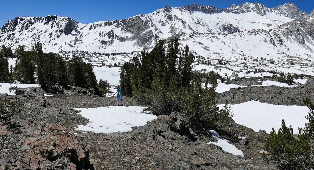
After hiking 4 miles we have reached our high point... looking down on Hidden Lake and Steelhead Lake on the left... with Excelsior Lake in the center of the photo and Shamrock Lake on the far right.
|
|
Denali Girl takes a well deserved break from our high point... looking down to the right at Steelhead Lake... and over to Cascade Lake at the foot of North Peak on the left... with Shepherd Crest on the far right... and Mount Conness on the far left.
|
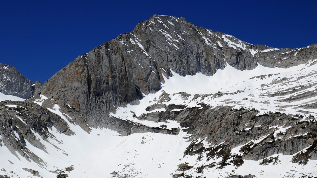
A closeup of the NE face of North Peak.
|
We have left our high point and more or less tracing our steps back to Saddlebag Lake.
|
Heading for the barn... with Wasco Lake in the left foreground.
|
Saddlebag Lake is in view... with part of the Tioga Crest on the center horizon... with Greenstone Lake in the right foreground and part of Greenstone Ridge coming down to meet the lakes.
|
|
After hiking 5.3 miles we are nearing the north end of Saddlebag Lake.
|
Back on the east side of Saddlebag Lake... tracing our steps back down to the south end of the lake... with part of the Tioga Crest in the left foreground... and the Kuna Crest on the horizon in the center of the photo... and Greenstone Ridge on the right.
|
Half way along the east shore of Saddlebag Lake... with White Mountain on the right horizon.
|
Back at the south end of Saddlebag Lake... looking north.
|
We have made it back to the car... the hike was 7.7 miles, gaining 1094 feet of elevation.
|
