Mount Thielsen - 7.14.2020
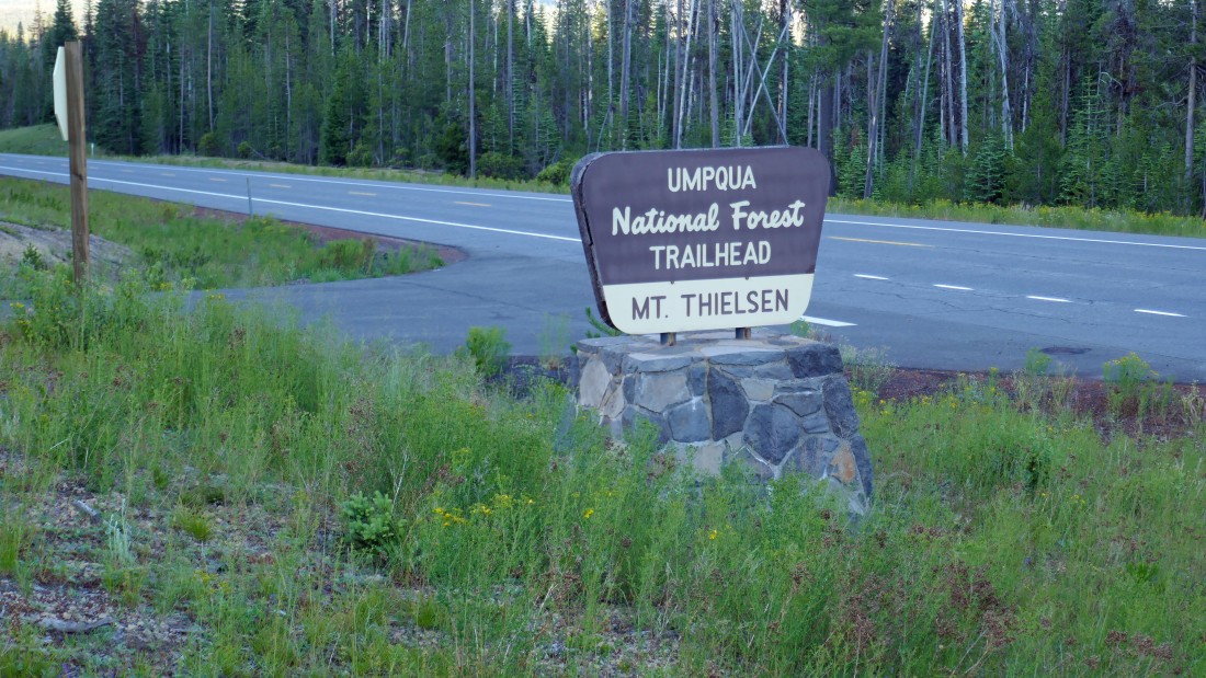
We parked (5400') at the Mt. Thielsen Trailhead... just off of Oregon Hwy 138... on the east side of Diamond Lake.
|
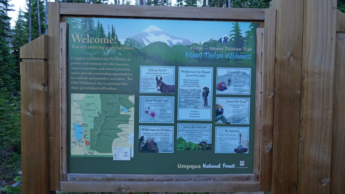
The information board for Mt. Thielsen Trail #1456.
|
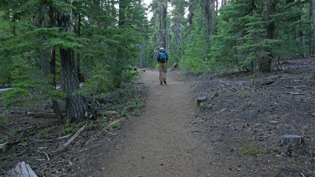
The first 3.9 miles of the hike is in the forest on a really nice trail.
|
After hiking ~1 mile we started getting partial views of Diamond Lake and Mt. Bailey.
|
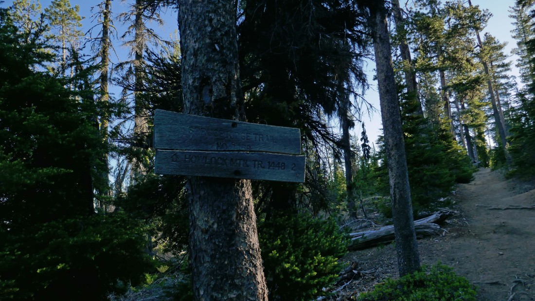
After hiking 1.7 miles (6230') we reached the junction with Spruce Ridge Trail #1458... but we will continue up the Mt. Thielsen Trail.
|
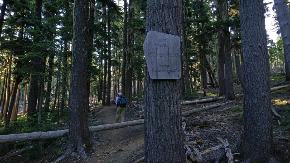
After hiking 2.3 miles (6540') we entered the Mt. Thielsen Wilderness.
|
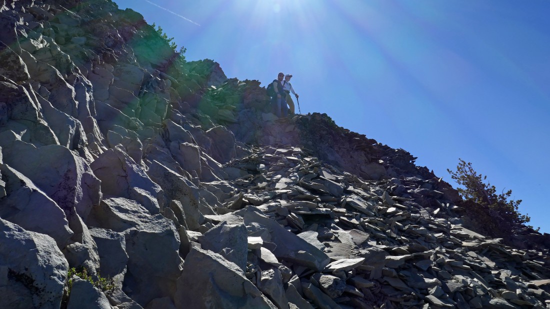
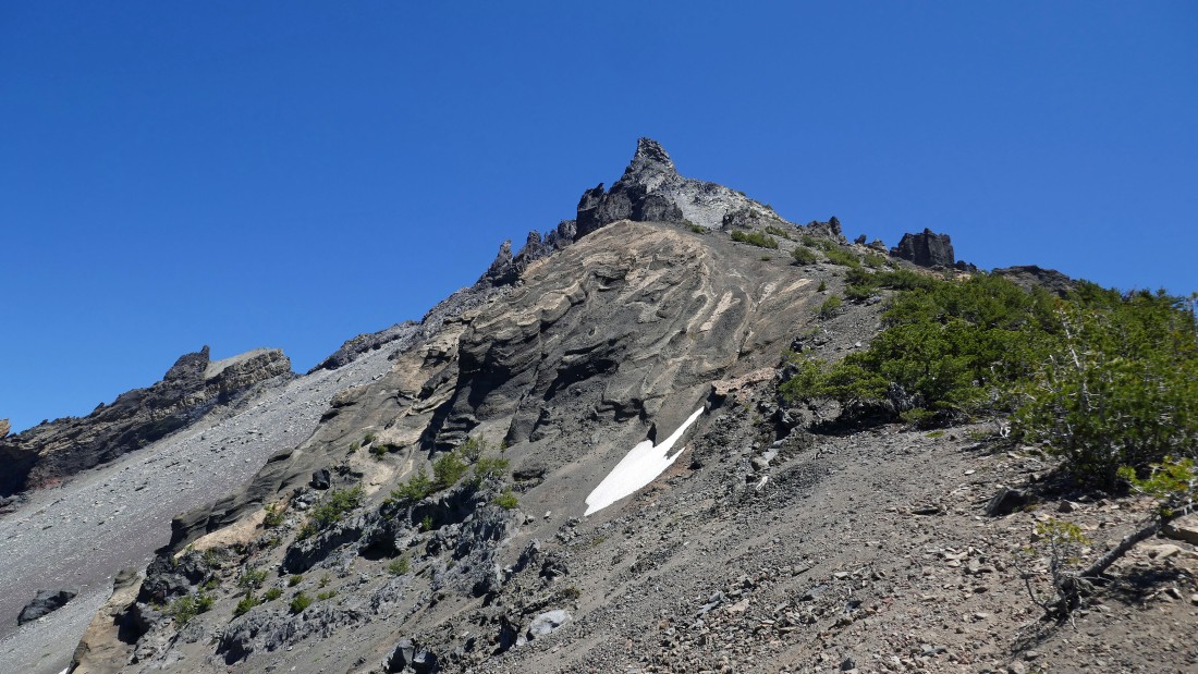
Shortly after entering the wilderness we got a sneak preview of what was coming... aka 'The Lightning Rod of the Cascades'.
|
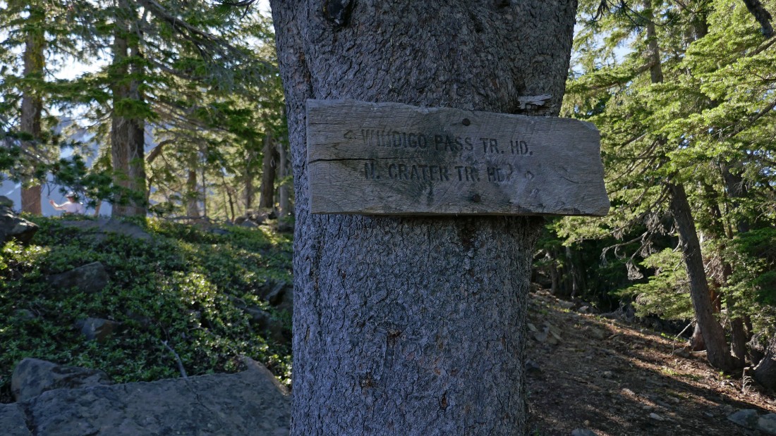
After hiking 3.9 miles (7340') we reached the junction for the Windigo Pass Trailhead and the North Crater Trailhead... which is actually the Pacific Crest Trail... which we will step across and continue steeply uphill on the Mt. Thielsen Climber's Trail.
|
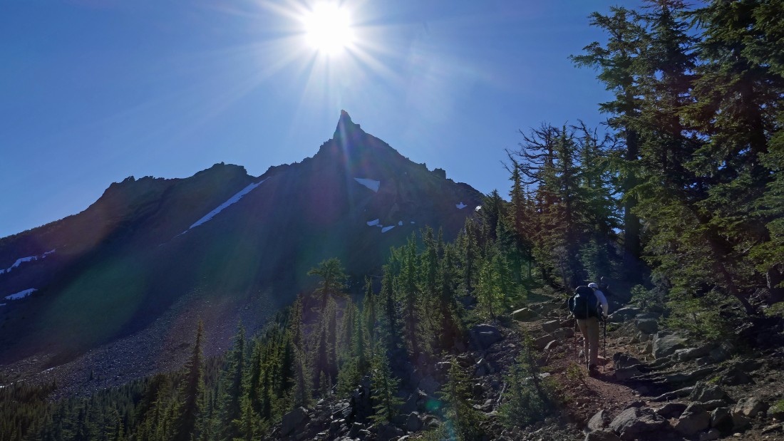
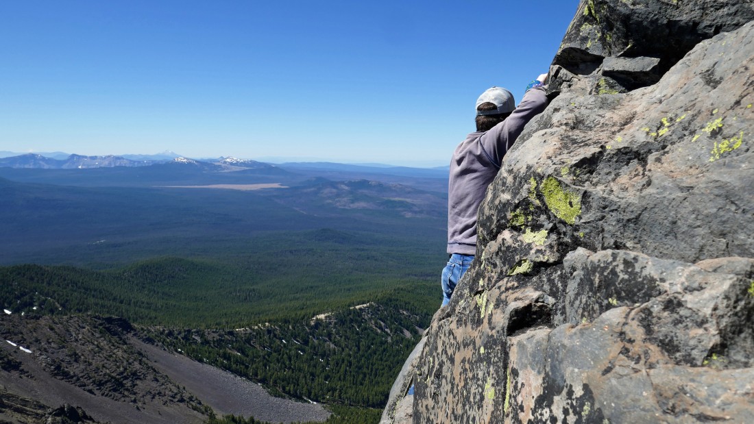
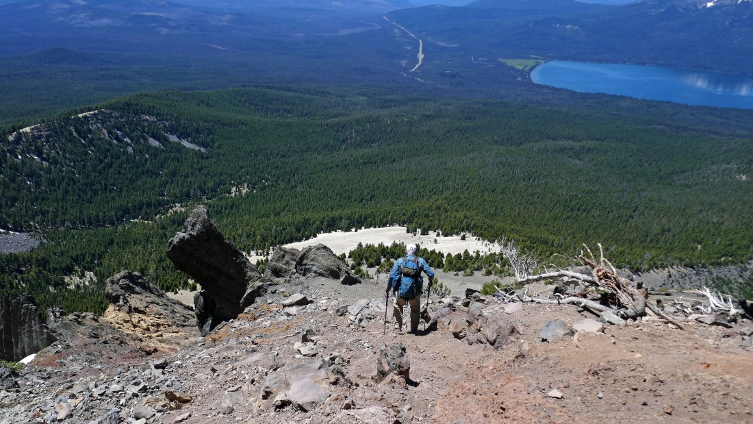
After crossing the PCT the trees were much less dense and the steepness increased significantly.
|
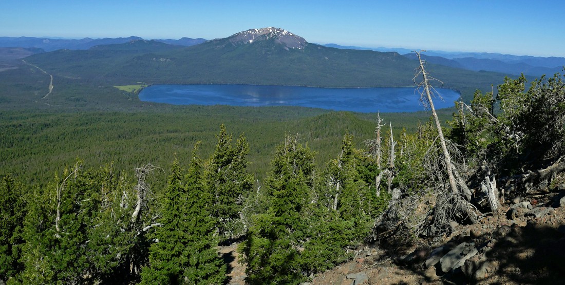
Looking back to the west at Diamond Lake and Mt. Bailey as we continue uphill.
|
|
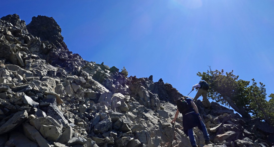
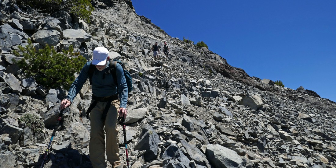
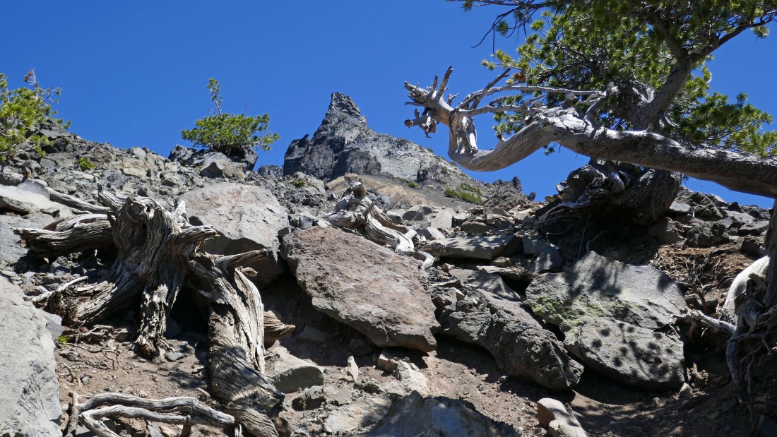
Continuing up Thielsen's west ridge... the path is obvious for awhile... but on very steep terrain where the little switchbacks are very helpful... however, trekking poles are highly recommended.
|
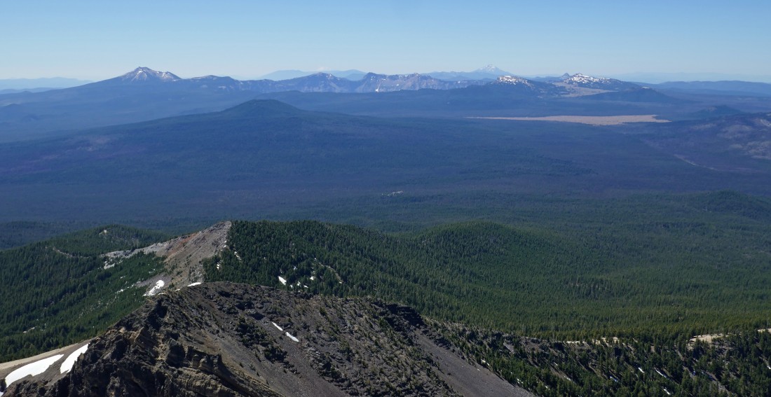
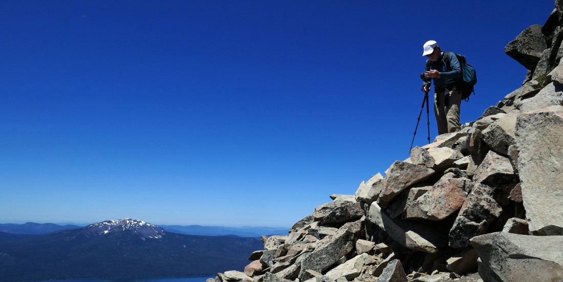
Looking south to Crater Lake National Park... Mt. Scott (the high point in the park) is 1 mile back from the crater rim... with the other peaks being on the crater rim.
|
On steep terrain... looking north to Diamond Peak and the Three Sisters.
|
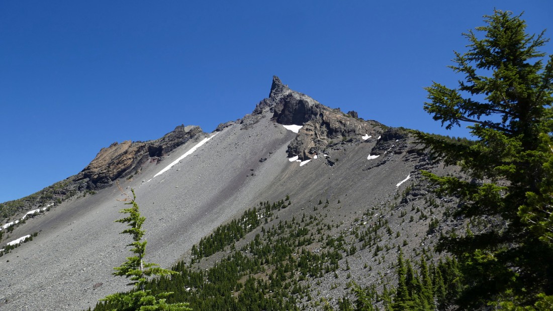
Switchbacking our way up the steep west ridge of Thielsen.
|
Looking west to Diamond Lake and Mount Bailey as we gain elevation on Thielsen's west ridge... with some of the tight switchbacks just below us.
|
|
Kind of hard to find in this photo... but Allan is up there a short distance above us... we thought he was on his way down, however, he wasn't certain of the route going higher and asked if he could join us.
|
rocman and Allan continuing up Thielsen's west ridge.
|
rocman and Allan continuing up Thielsen's west ridge.
|
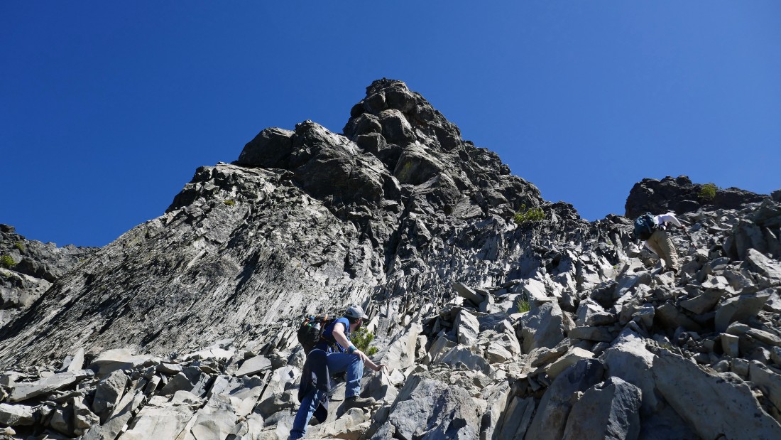
rocman and Allan continuing up Thielsen's west ridge... with the Thielsen summit coming back into view on the far left.
|
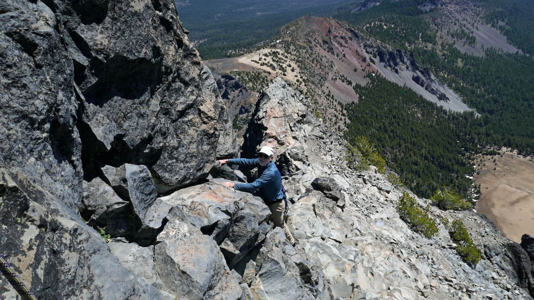
rocman and Allan continuing up Thielsen's west ridge... we are heading for the little gap between the summit block and what looks like a small clump of boulders just to the right of the summit block.
|
|
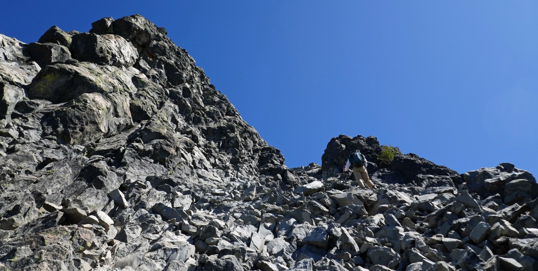
rocman and Allan continuing up Thielsen's west ridge... heading for the ridge line on the right.
|
rocman and Allan continuing up Thielsen's west ridge... heading for the gap above on the right.
|
rocman is heading for the gap on the SE side of Thielsen.
|
Almost at the gap on the SE side of Thielsen.
|
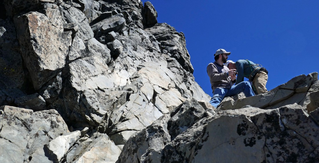
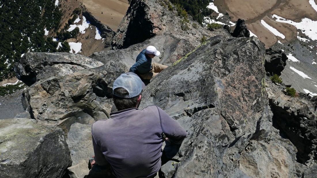
A horrible pano shot... rocman has two backs and Allan has 4 arms... but it does show us in the gap between the Thielsen summit block on the left and the clump of boulders... this is where we stashed our packs and put on our rock climbing shoes.
|
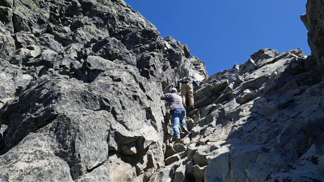
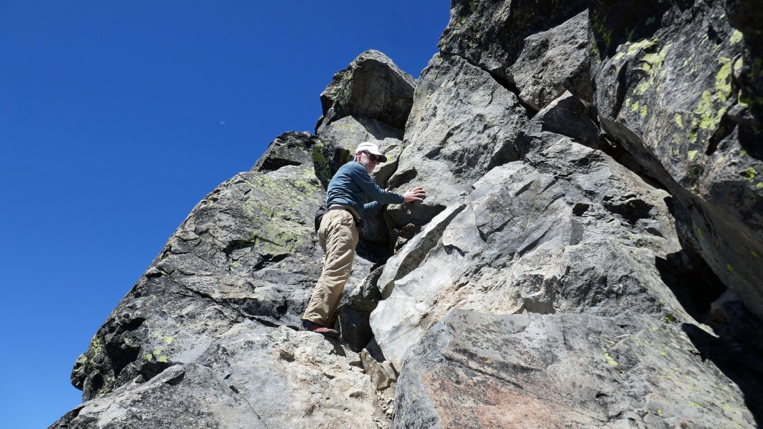
The terrain changes from Class 2 to Class 3 as we leave our packs and make the 30 foot scramble up to 'Chicken Ledge'.
|
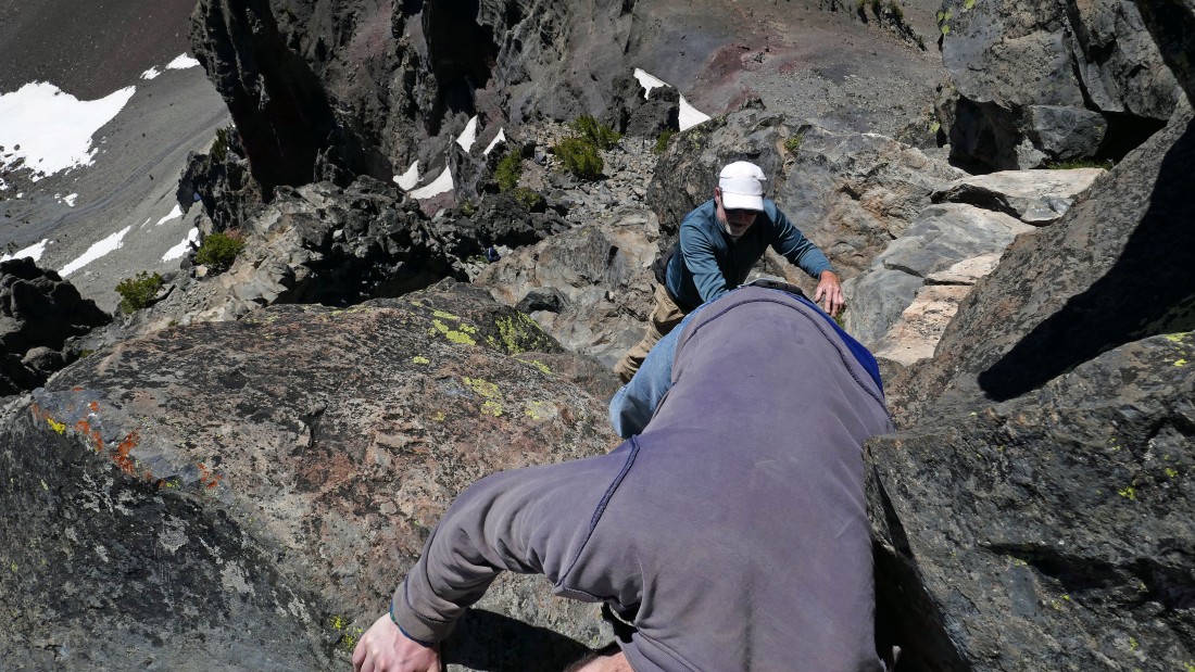
Allan and rocman are standing on Chicken Ledge... now it is time for 40 feet of Class 4 terrain.
|
rocman starts up the Class 4 section.
|
rocman works the chimney near the top of the 40 foot Class 4 section of the route... personally I felt the chimney was the crux area of the scramble.
|
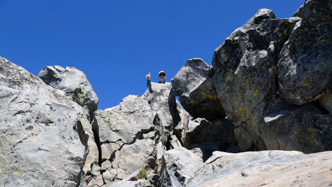
rocman has reached the top of the 40 foot Class 4 section of the route... while Allan tries to determine if he made a good decision in following us up here... rocman has rigged up a hand line for us to use on the way back down so that we don't have to deal with that damn chimney in the previous photo.
|
Allan works his way up the 40 foot Class 4 section... and yes, there is definitely some exposure... with Crater Lake National Park in the distance on the left... and we are high enough now to see Mount Shasta and Mount McLoughlin on the horizon beyond the park.
|
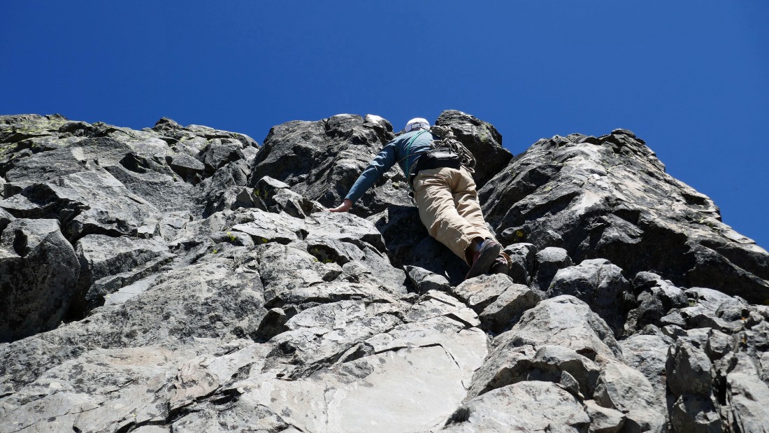
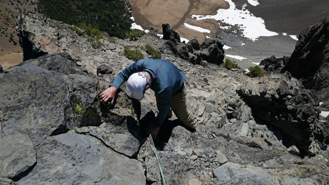
This might not look like we are beyond the 40 foot Class 4 section... but we are on the final 40 foot Class 3 section that will take us to the summit.
|
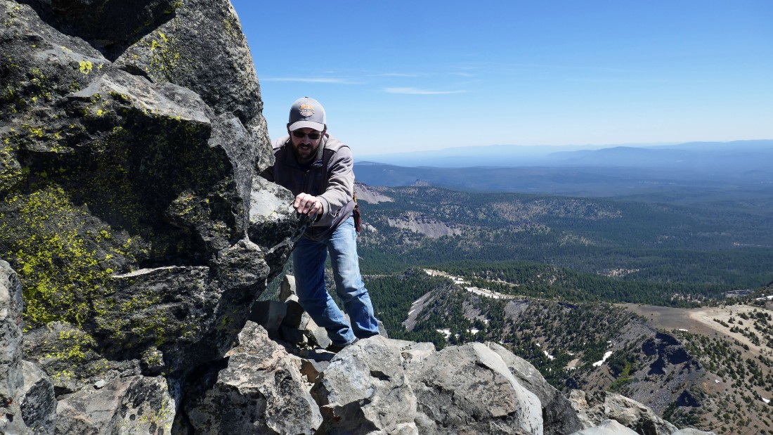
rocman works the final 40 foot Class 3 section to the summit.
|
After hiking and scrambling 5 miles, rocman is on the summit (9182') of Mount Thielsen.
|
Allan reaches the Mount Thielsen summit.
|
Looking south from the Thielsen summit to Crater National Park... with Mt. Shasta and Mount McLoughlin on the horizon beyond the park.
|
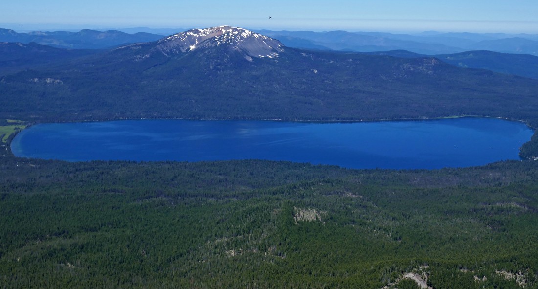
Looking west from the Thielsen summit to Diamond Lake and Mt. Bailey.
|
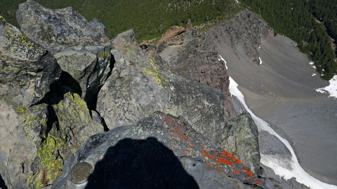
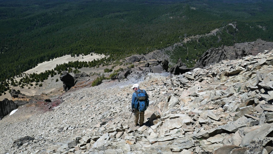
Looking down Thielsen's south ridge.
|
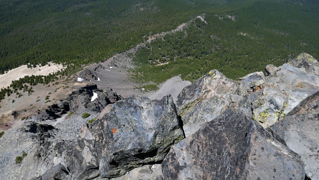
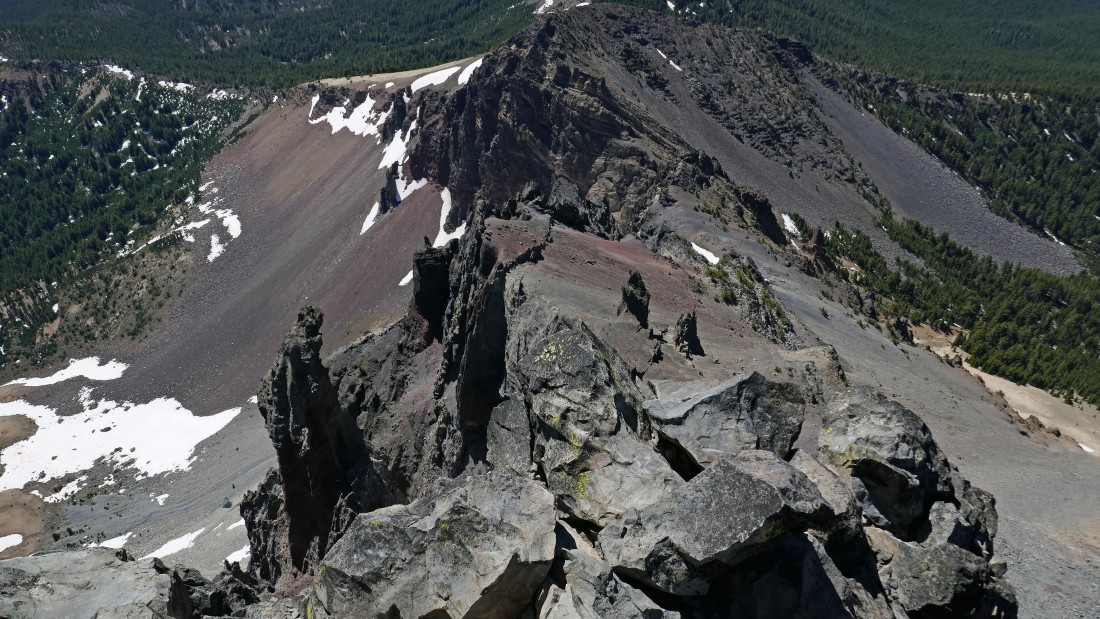
Looking down Thielsen's west ridge... which shows the lower part of our route up to Chicken Ledge.
|
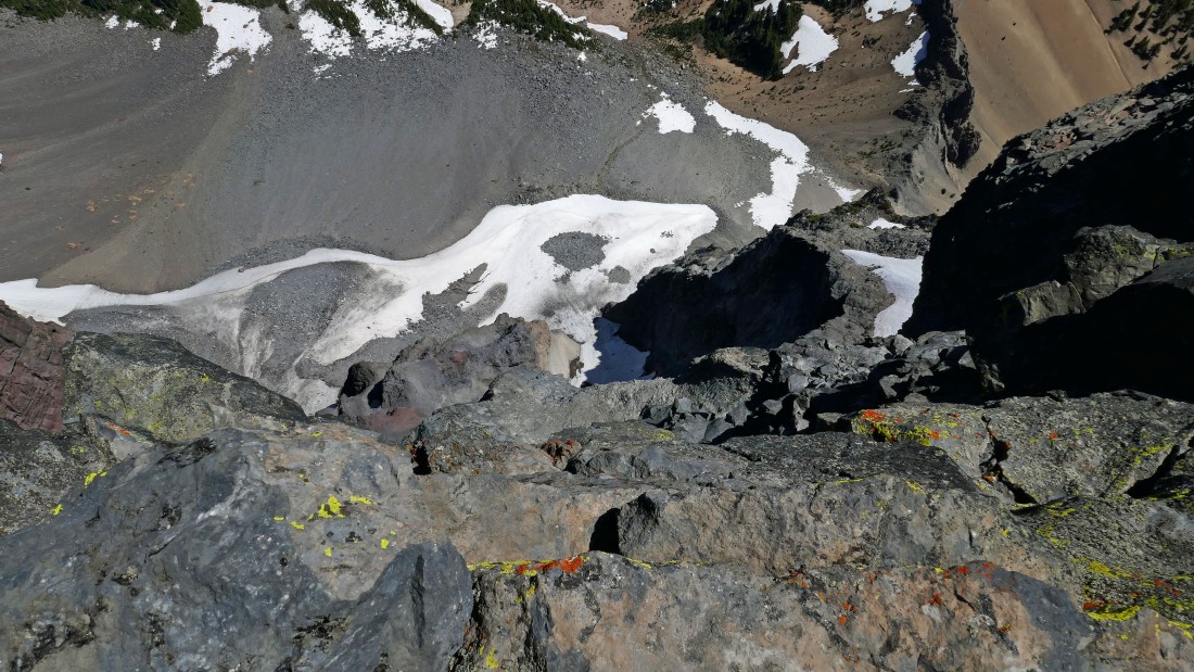
Looking down the east side of Thielsen... kind of hard to call it a ridge because of the steepness.
|
Looking down Thielsen's north ridge.
|
Looking north from Thielsen's summit... Sawtooth Ridge runs from the lower right corner of the photo out to Howlock Mountain.
|
rocman and ragman on the summit of Mt. Thielsen... roommates at the University of Washington 47 years ago... and roommates once again on top of Thielsen... with Lemolo Lake in the distance.
|
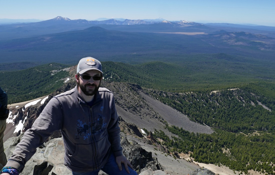
Allan on the summit of Mt. Thielsen with Crater Lake National Park behind him.
|
What goes up must go back down!
|
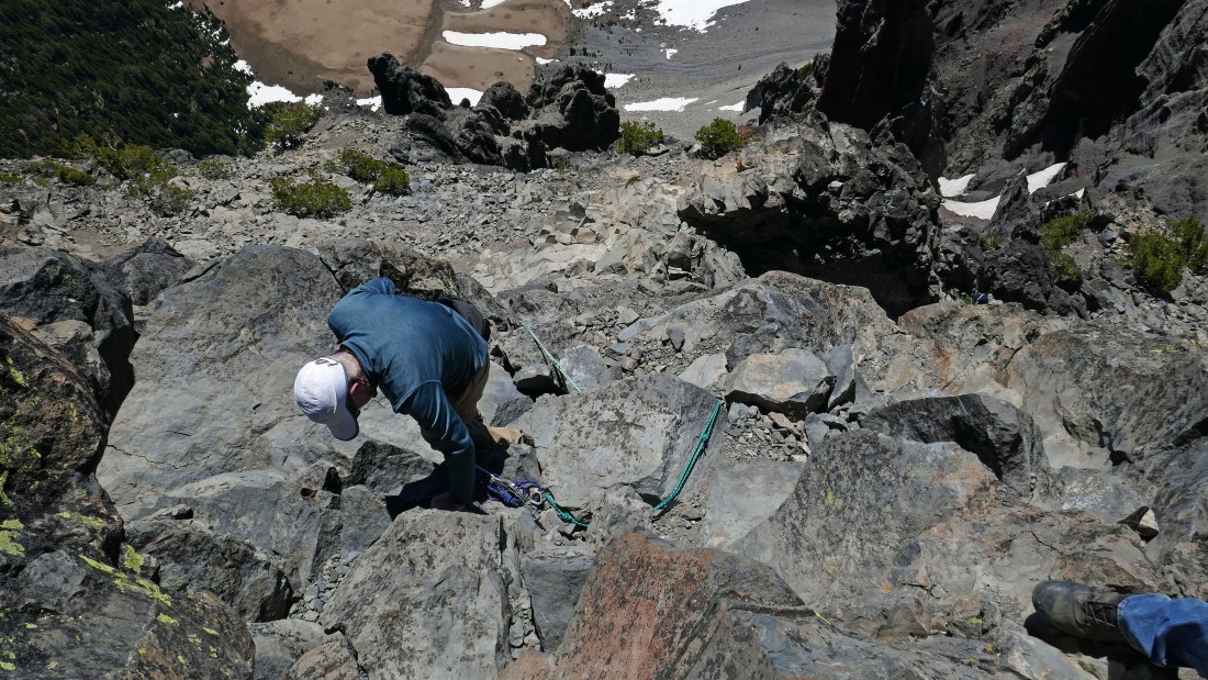
Working the 40 foot Class 3 section on the way back down to Chicken Ledge.
|
rocman talks to Allan about foot placements on the 40 foot Class 3 section on the way back down to Chicken Ledge.
|
We have finished the 40 foot Class 3 section going down... now we will use the hand line to get back down the last 40 feet to Chicken Ledge.
|
rocman starts down the 40 foot section of Class 4 terrain.
|

rocman using the hand line... notice how he has tied 'hand hold knots' in the rope just in case they might be of use.
|
rocman has another 10 or 15 feet to go before getting off of the Class 4 section and onto Chicken Ledge.
|
Allan is down climbing the last 20 feet of the Class 4 section... the hand line helped us to comfortably avoid having to deal with the chimney above Allan's head.
|
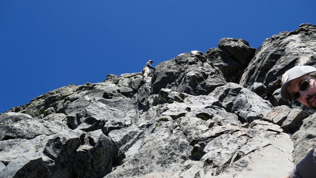
Looking back at our staging area up there where a lady is coming down from Chicken Ledge... her and her partner decided to stop at Chicken Ledge.
|
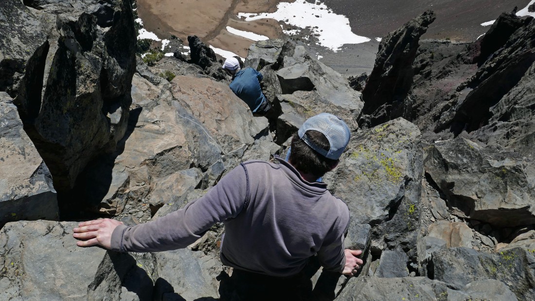
Working our way back down the west ridge of Mount Thielsen.
|
Working our way back down the west ridge of Mount Thielsen.
|
Working our way back down the west ridge of Mount Thielsen.
|
Working our way back down the west ridge of Mount Thielsen.
|
Looking back up Thielsen's west ridge as we continue down... basically tracing our steps back to the car.
|
Almost off of the steep terrain.
|
After hiking and/or scrambling ~6 miles we have returned to the junction of the PCT and Mt. Thielsen Trail... leaving a pleasant 4 mile hike back to the car... our trip was 10 miles, gaining 3775 feet of elevation.
|
