Belknap Crater and Little Belknap - 8.14.2020
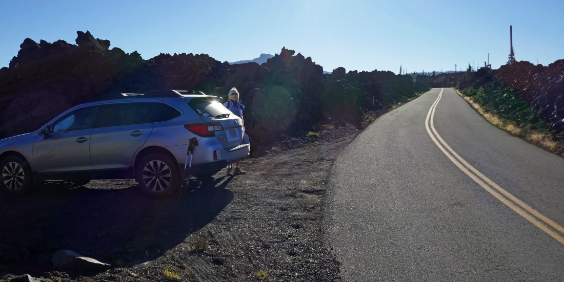
We parked just off of Oregon Hwy 242 at McKenzie Pass... a quarter mile west of the Dee Wright Observatory... very near where the PCT crosses the highway.
|
From where we parked we walked 50 yards back up the highway to where the PCT crosses the road... Belknap Crater is on the left-center horizon... with Little Belknap the little nipple just to the right of the treed island in the center of the photo... with Mount Washington on the right horizon.
|
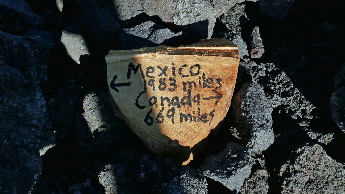
If you are doing the Pacific Crest Trail, this gives you an idea of what lies ahead.
|
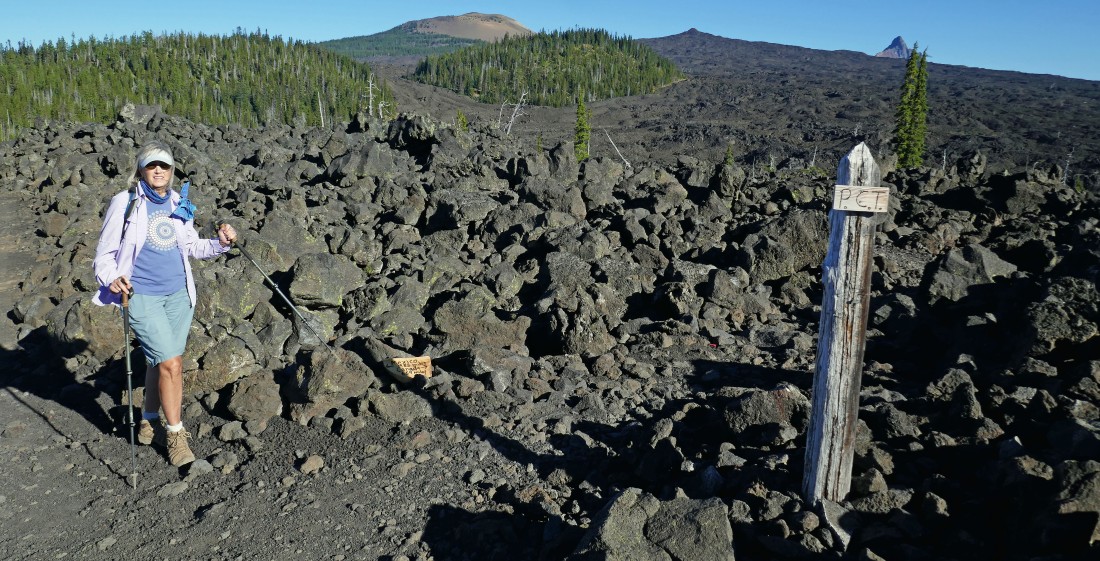
It didn't take very long for us to enter the Mount Washington Wilderness... with Belknap Crater to the left of the sign... and Little Belknap just to the right of the sign.
|
We had started hiking in lava... then got a nice little section of dirt trail... Belknap Crater is in the distance.
|
|
After hiking 1.3 miles we will have steady lava hiking on the PCT for the next 1.5 miles... Belknap Crater on the far left... with Little Belknap on the right.
|
Looking back to the south at North Sister and Middle Sister as we continue hiking through the the lava field on the PCT.
|
After hiking 2.7 miles we have reached the junction of the PCT and Little Belknap Trail #3003... we will continue on the PCT toward Belknap Crater and do Little Belknap on our return if we have the energy to do so... Mount Washington is in the distance on the far right.
|
Little Belknap from the trail junction of the PCT and Little Belknap Trail #3003... with North Sister and Middle Sister in the distance on the right.
|
Continuing north on the PCT... looking for the trail that will take us up to Belknap Crater.
|
|
A closer look at Mount Washington and Point 6762 in the foreground... with Mount Jefferson on the right horizon.
|
After hiking 2.9 miles we found the obvious path (it is not an official trail) that left the PCT and headed for Belknap Crater.
|
We will follow the obvious path that leads over to the north side of Belknap Crater.
|
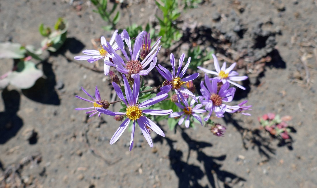
Asters... I think.
|
Denali Girl on the path that leads over to the north side of Belknap Crater... with Little Belknap in the left foreground and Millican Crater behind Little Belknap... with North Sister and Middle Sister on the right.
|
|
Gaining elevation on our way to the north side of Belknap Crater... with Little Belknap in the left foreground.
|
On the north side of Belknap Crater... heading for the top of the crater... with Mount Washington in the distance.
|
After hiking 3.8 miles we have reached the summit area on Belknap Crater... but no one told us there was a 400 foot cone at the top of the crater... so lets go get it.
|
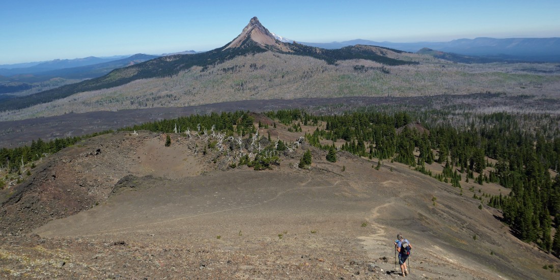
I'm on top (6872') of the 400 foot cone looking back as Denali Girl starts to head over to join me... Mount Washington is in the left foreground... with Three Fingered Jack on the horizon to the left of Washington... and Black Butte on the right horizon.
|
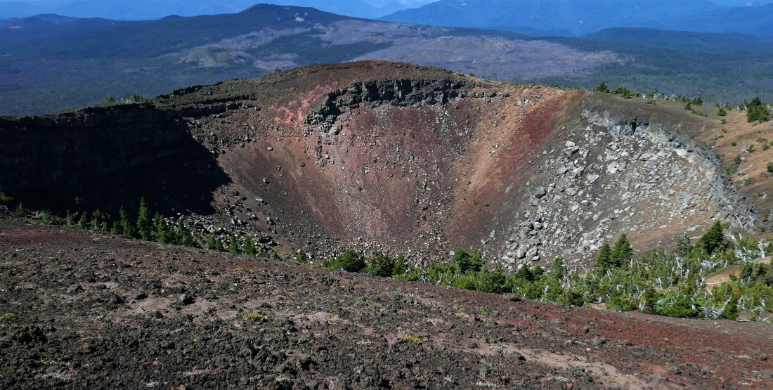
Looking down into Belknap Crater from the top of the 400 foot cone.
|
|
Little Belknap in the left-center foreground... with Millican Crater beyond it... North Sister and Middle Sister on the right.
|
I decided to do a clockwise circumnavigation of the crater while Denali Girl relaxed on top of the 400 foot cone on the extreme far right of the photo.
|
I'm on the south side of Belknap Crater... looking north across the crater to the 400 foot cone in the center of the photo... with Mount Washington and Three Fingered Jack on the left horizon... and Millican Crater on the right horizon.
|
A closer look to the north at Three Fingered Jack (left) and Mount Washington from the rim of Belknap Crater.
|
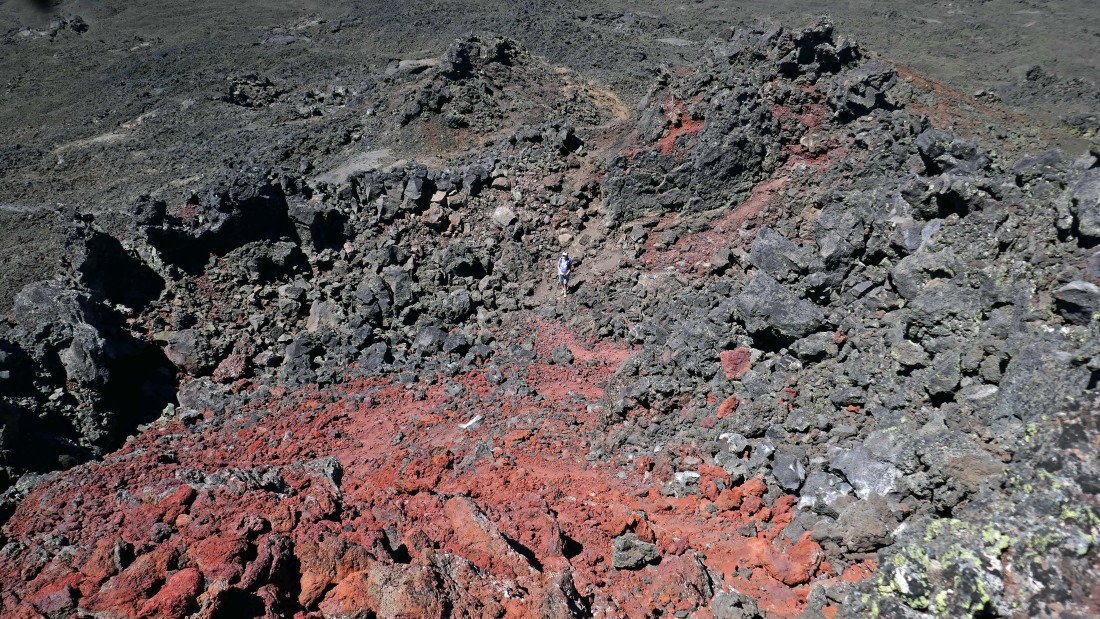
Luv the color of the rock and lava on the rim of Belknap Crater.
|
|
On the west side of Belknap Crater... looking across the crater and beyond the east side of the rim to North Sister and Middle Sister.
|
Heading down from Belknap Crater... tracing our steps back to the Pacific Crest Trail.
|
On our way back to the PCT... with our next stop being Little Belknap in the foreground.
|
After hiking 5.5 miles we are back at the junction of the PCT and Little Belknap... with Belknap Crater in the distance.
|
Heading for Little Belknap on an obvious trail.
|
I'm on top of Little Belknap (6305') watching Denali Girl as she comes up to join me.
|
Denali Girl on top of Little Belknap... with Belknap Crater above her... looking north to Mount Washington, Three Fingered Jack and Mount Jefferson on the right.
|
A closer look at Mount Washington, Point 6762, Three Fingered Jack and Mount Jefferson from the summit of Little Belknap.
|
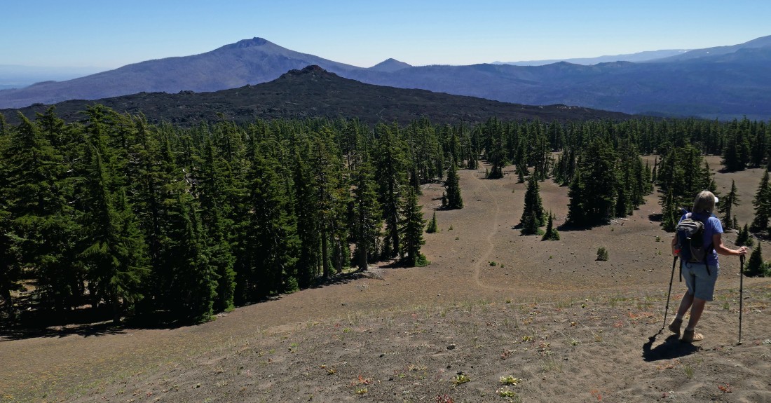
A closer look at North Sister and Middle Sister from the top of Little Belknap... Tam McArthur Rim is on the left horizon.
|
Denali Girl coming down from the top of Little Belknap... with North Sister and Middle Sister on the right horizon.
|
|
Heading back down Little Belknap Trail #3003... on our way to rejoin the PCT and follow it back to our car.
|
Nearing the treed island as we hike back to our car... with Millican Crater on the left... and North Sister and Middle Sister on the right.
|
After hiking 7.4 miles we are pretty much off of the lava with the exception of the last eighth of a mile to the car.
|
Nearing McKenzie Pass... with the Dee Wright Observatory (built from lava) just to the right of the yellow road sign... and Millican Crater on the horizon.
|
After hiking 8.5 miles we have reached the spot where the PCT crosses Oregon Hwy 242 and enters the Three Sisters Wilderness... a 50 yard walk down the highway will get us back to the car... our elevation gain for the day was 2234 feet.
|
