The Wife - 10.9.2020
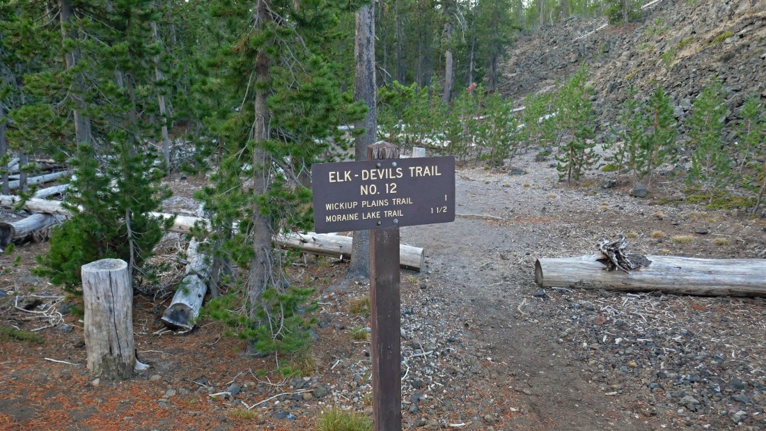
Park at the Devils Lake parking area... just off of Cascade Lakes Hwy (aka Oregon Hwy 46)... and start hiking on Elk-Devils Trail #12.
|
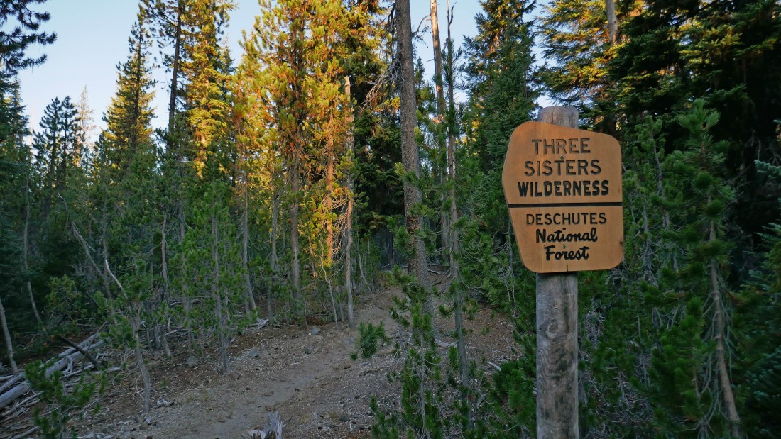
After hiking a quarter mile, enter Three Sisters Wilderness.
|
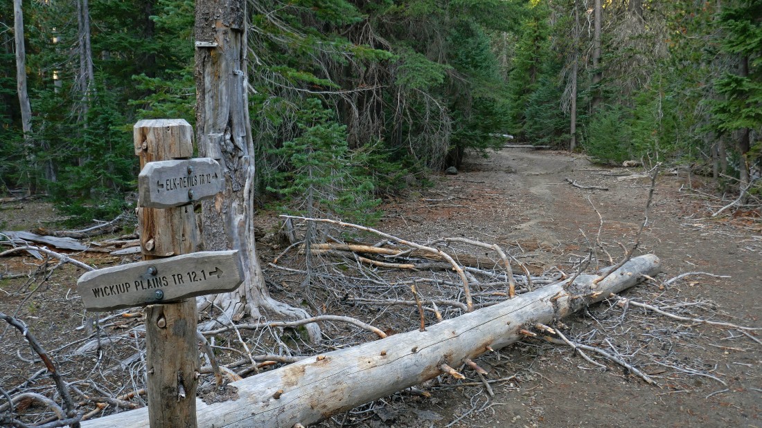
After hiking a total of one mile, leave the Elk-Devils Trail and take Wickiup Plains Trail #12.1.
|
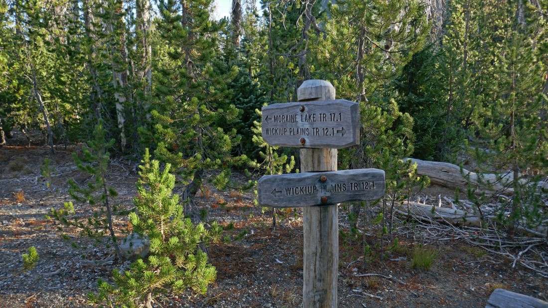
After hiking a total of 2.1 miles, leave Wickiup Plains Trail #12.1 and start hiking on Moraine Lake Trail #17.1.
|
First good look at South Sister as I entered the eastern border of Wickiup Plains.
|
|
A pano shot of Le Conte Crater on the left and South Sister on the right... taken from the eastern border of Wickiup Plains.
|
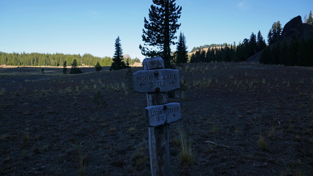
After hiking a total of 2.5 miles, leave Moraine Lake Trail #17.1 and start following Le Conte Crater Trail #12.3... as it hugs the eastern border of Wickiup Plains.
|
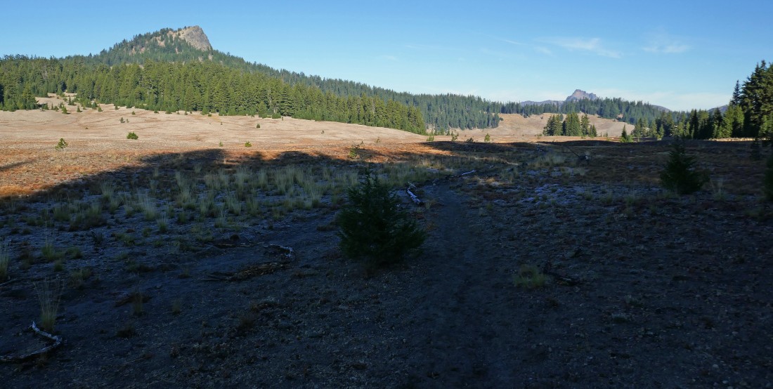
Hiking NW as I near the west side of Le Conte Crater... thinking of Sting's 'Fields of Barley'... of course it isn't barley.
|
Still on the Le Conte Crater Trail... looking north beyond the Le Conte Crater to South Sister... with the massive 'Rock Mesa' lava flow at the base of South Sister... and looking NE to Broken Top on the right horizon.
|
After hiking a total of 3.5 miles I'm getting ready to leave the Le Conte Crater Trail and head west... cross country for The Wife on the left. The Husband is in the distance on the right horizon.
|
|
After hiking a total of 3.7 miles I have stepped across the Pacific Crest Trail in the foreground... here looking north to South Sister... with the tippy top of Middle Sister on the far left horizon. The massive 'Rock Mesa' lava flow really stands out in the foreground.
|
Heading cross country... I will stay in the open as long as possible as I head for the flat treed south ridge on the left in the photo.
|
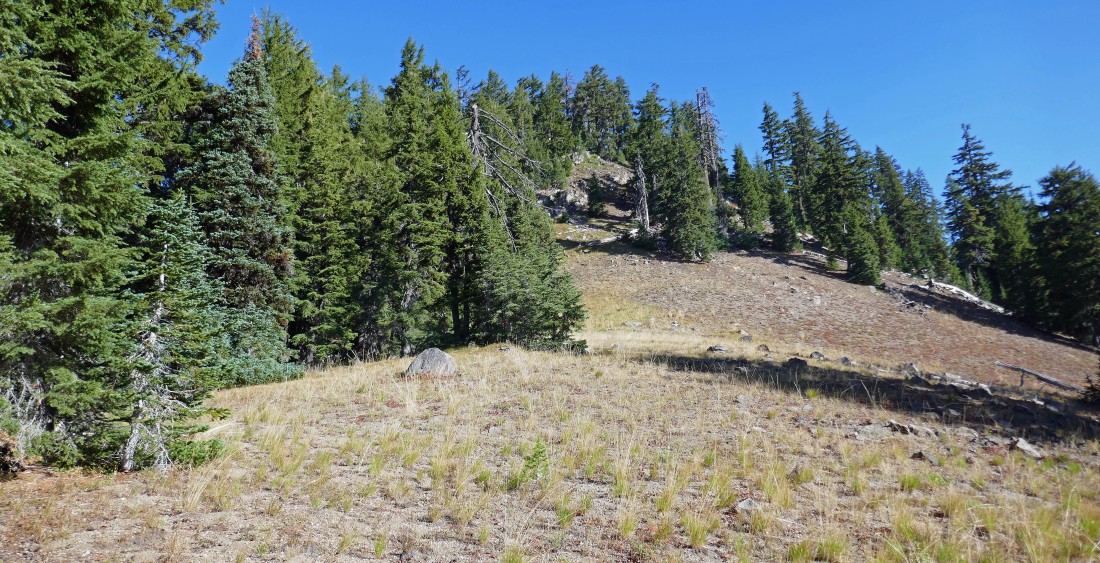
On the south ridge of The Wife... time to start hiking north as the terrain will steepen from here to the summit.
|
Gaining elevation on the south ridge of The Wife... here looking SE across the Wickiup Plains to Mount Bachelor in the haze.
|
The south ridge eases a bit as it nears the summit.
|
|
After hiking a total of 5.2 miles, Frank (I met him a half hour before summiting) is standing on the summit (7054') of The Wife... with Middle Sister on the far left, South Sister in the center and Broken Top on the far right horizon.
|
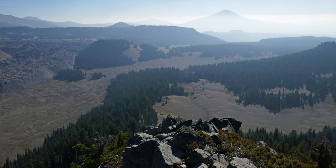
On the summit of The Wife... looking SE across the Wickiup Plains to Mount Bachelor. The Le Conte Crater is in the left-center foreground.
|
On the summit of The Wife... here looking north at The Husband in the left foreground... and Middle Sister on the far right.
|
We took the short walk over to the false summit of The Wife... here looking back at the true summit... with South Sister on the left... and Broken Top directly beyond the true summit.
|
Back down from the steep south ridge of The Wife... more or less tracing our steps back to the cars at Devils Lake... the total trip was 10.5 miles, gaining 1861 feet of elevation.
|
