Misery Ridge - 11.3.2020
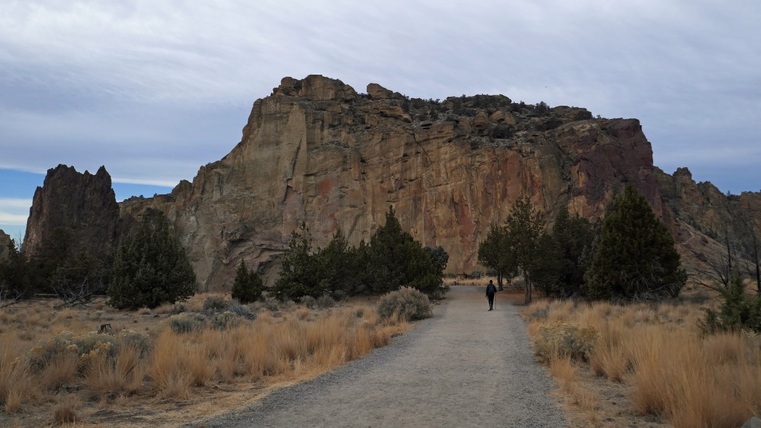
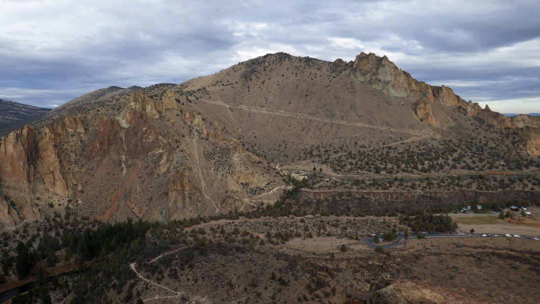
We parked at the fee area (room for at least 100 cars) in Smith Rock State Park... located in Terrebonne, Oregon... aceman is walking directly toward the Picnic Lunch Wall. Misery Ridge is on top of Picnic Lunch Wall... with Shiprock the dark brown formation on the far left of the photo.
|
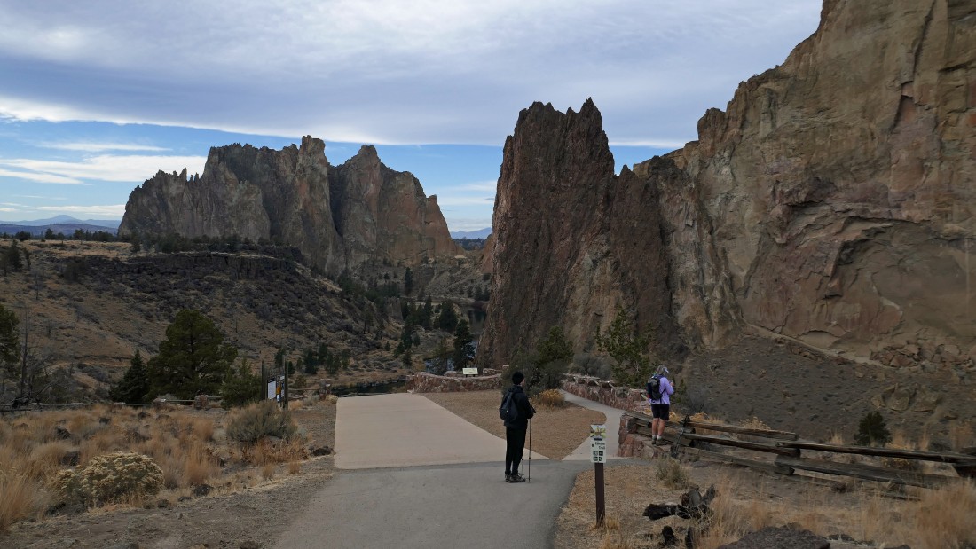
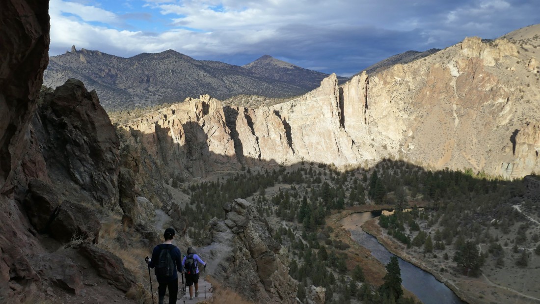
aceman and Denali Girl are getting ready to give up 200 feet of elevation and hike down to a bridge crossing of the Crooked River... the Smith Rock formation is in the distance on the left... with Shiprock being the dark brown rock formation in the center of the photo... and part of the Picnic Lunch Wall on the far right.
|
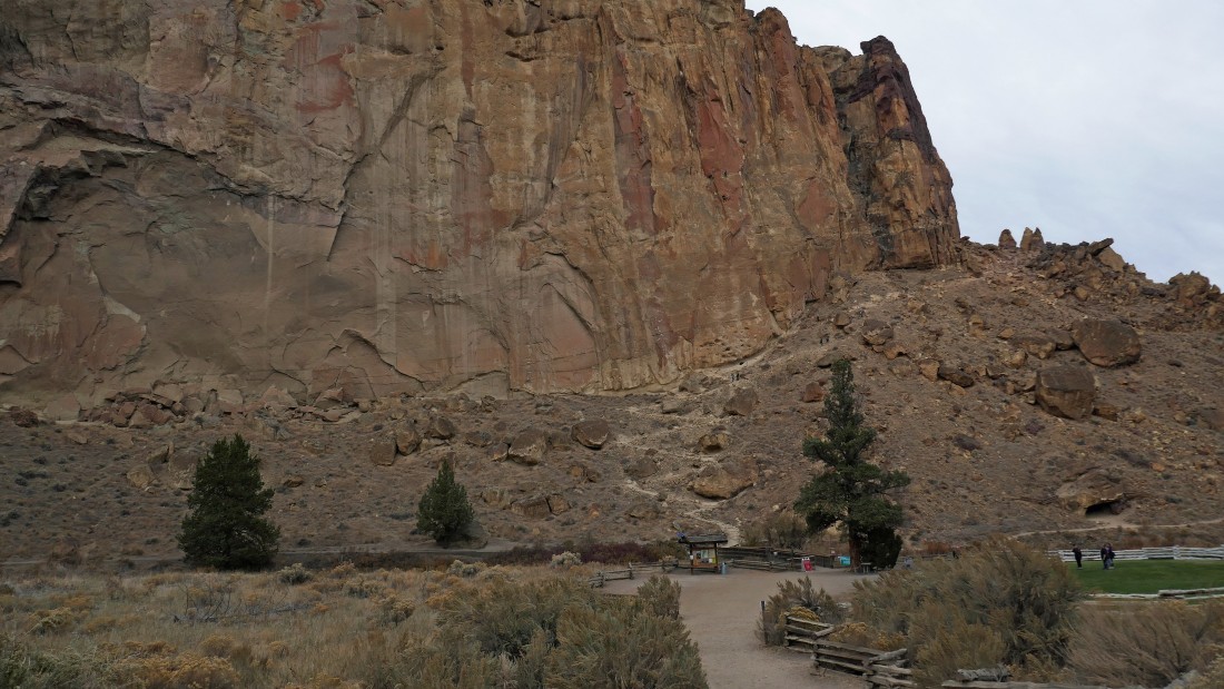
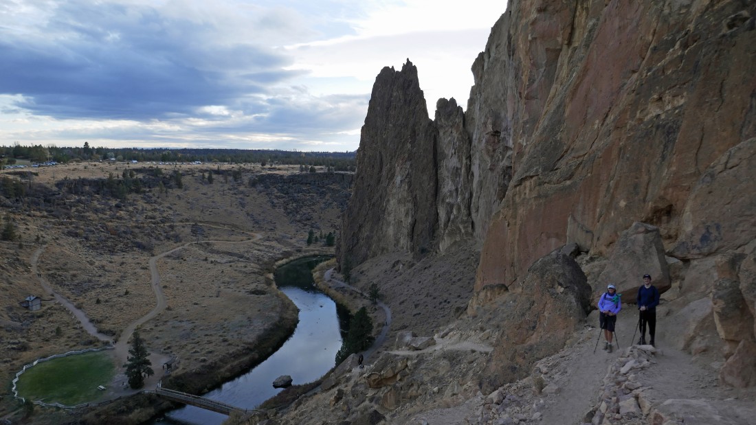
We have given up the 200 feet of elevation... on the other side of the Crooked River we can see the direct route that leads up to Misery Ridge... but we will come down that way at the end of our hike.
|
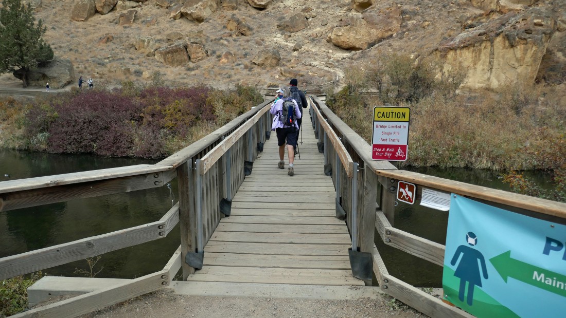
Making the bridge crossing of the Crooked River.
|
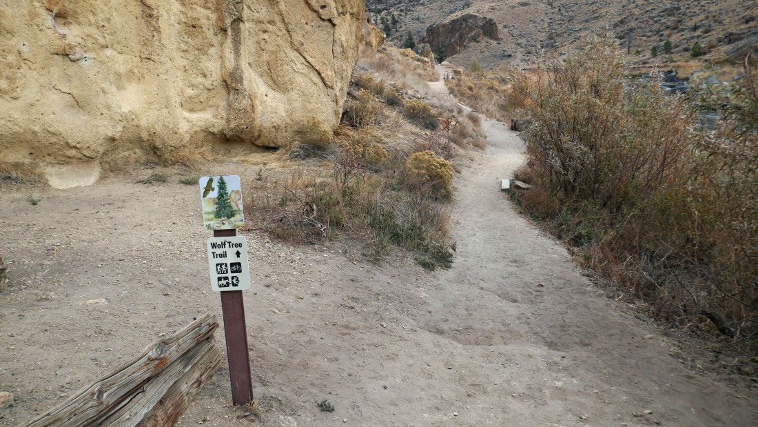
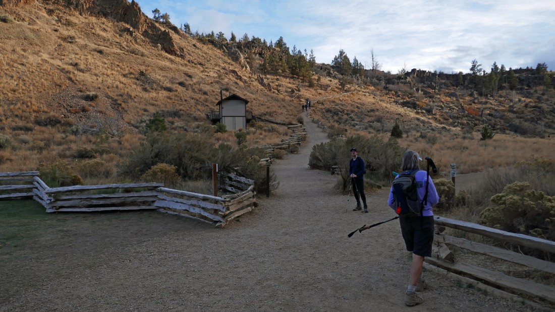
After hiking a total of .3 miles we have crossed the river and will start hiking on the Wolf Tree Trail.
|
|
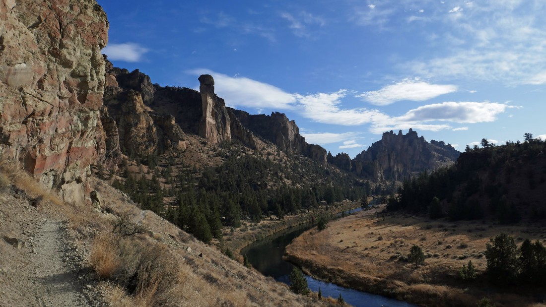
Hiking north on the Wolf Tree Trail as it follows along the Crooked River... a little later we will be traversing along a path near the top of the rock formations in this photo.
|
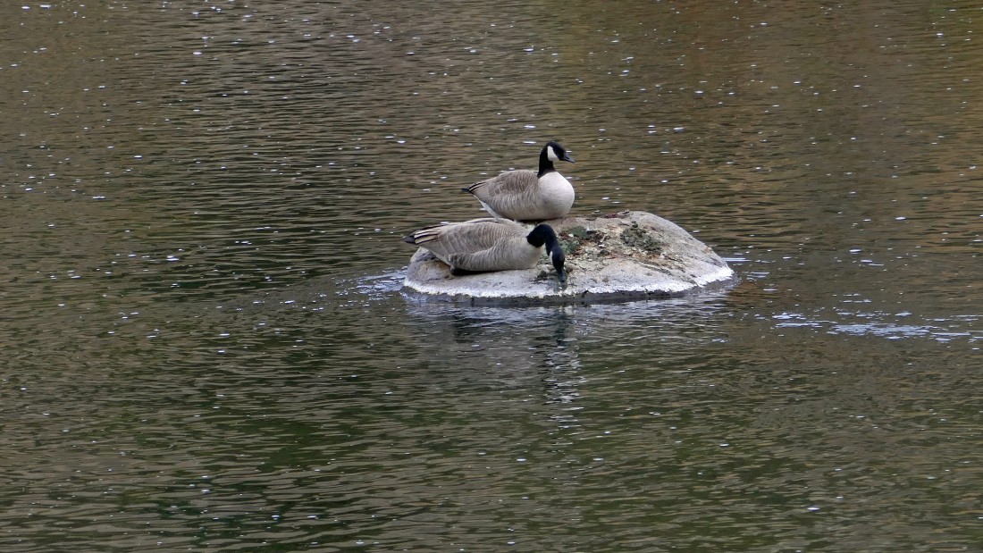
Canadian Geese... resting on a rock in the Crooked River.
|
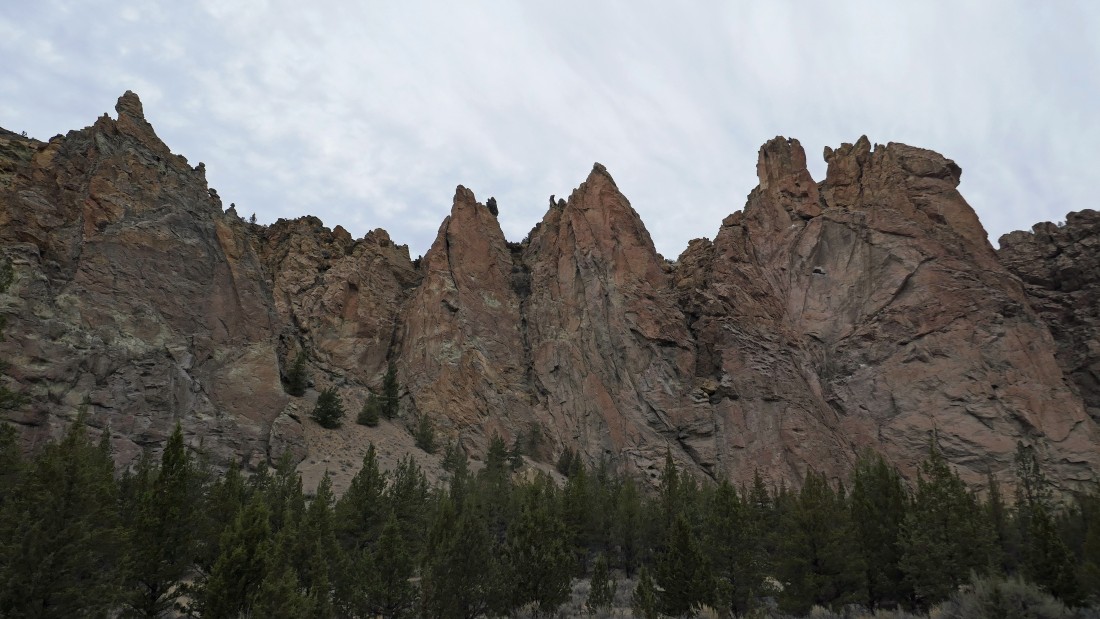
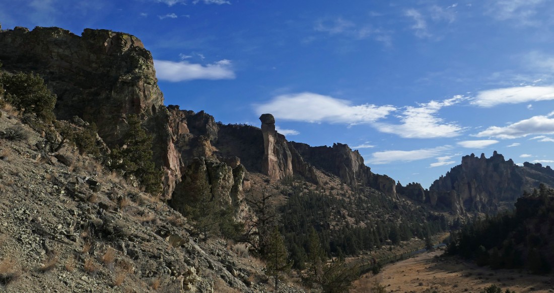
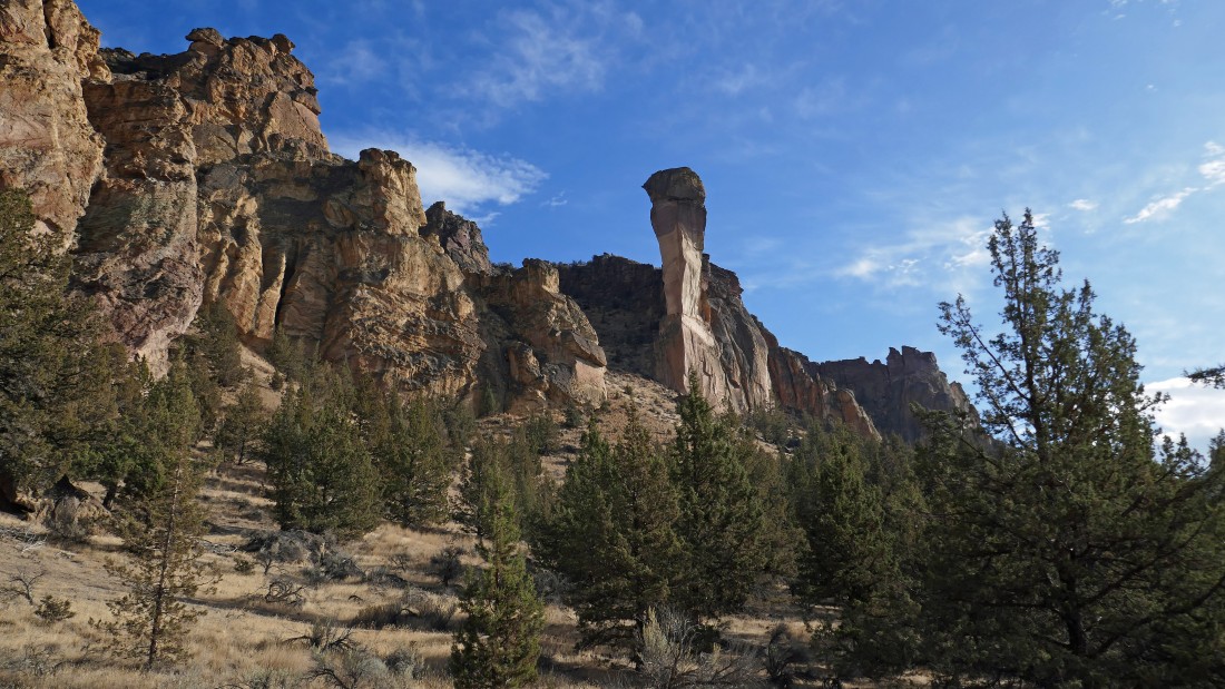
Continuing to hike along the Wolf Tree Trail... enjoying the amazing rock formations called The Monument Area of the park.
|
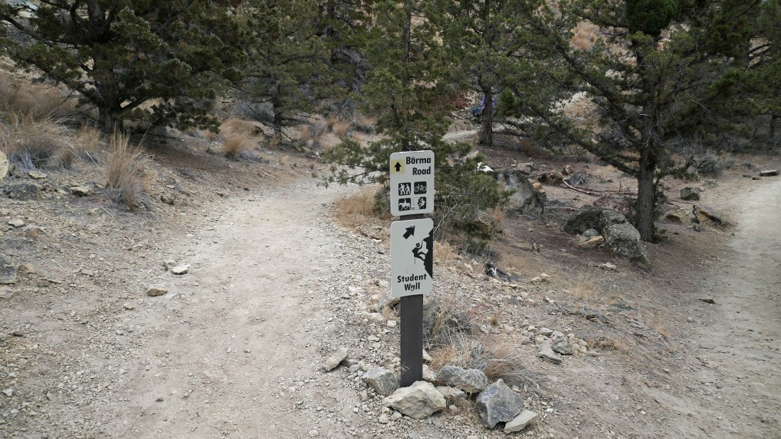
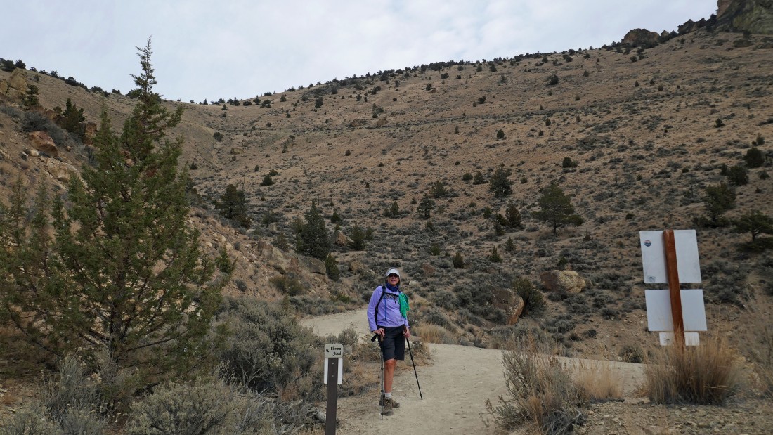
After hiking a total of 1.2 miles we will leave the Wolf Tree Trail and start hiking on the Burma Road Trail.
|
Gaining elevation now... as the Burma Road Trail heads uphill from the Crooked River.
|
After hiking a total of 1.4 miles we will leave the park for awhile as we continue uphill on the Burma Road.
|
Continuing to gain elevation on the Burma Road... as we hike underneath rock formations called 'The Marsupials'.
|
Continuing to gain elevation on the Burma Road... looking back at Smith Rock State Park.
|
Nearing what will be our high point for the day on the Burma Road... with Black Butte and Three Fingered Jack on the far left horizon.
|
After hiking a total of 2.3 miles we have reached our high point (3580 feet) for the day.
|
From our high point we are looking west along the rugged ridge line of Smith Rock State Park... with Misery Ridge out there in the center of the photo... Mt. Bachelor, Broken Top and the Three Sisters are on the center horizon.
|
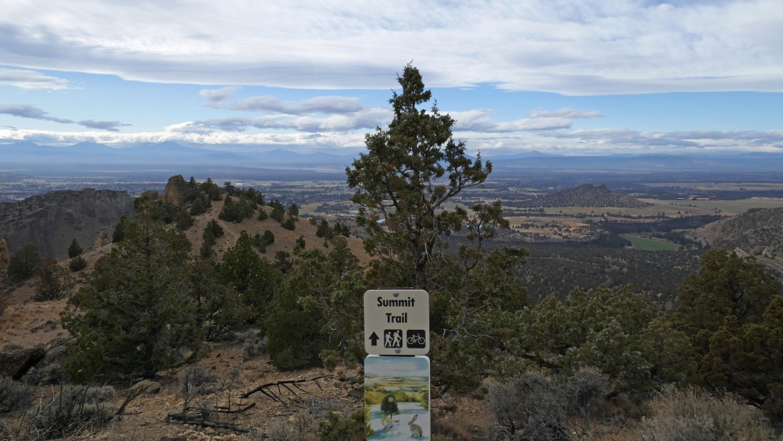
Leaving the Burma Road we will re-enter the park by taking the Summit Trail... using a combination of it and some nice paths to contine along the ridge as we make our way over toward Misery Ridge.
|
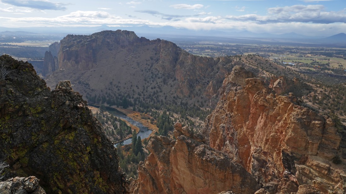
Hiking along the ridge... looking down on the Crooked River (where we were earlier in the day) and over to the trail switchbacking its way up to Misery Ridge on the left. We will be coming down those switchbacks at the end of our hike.
|
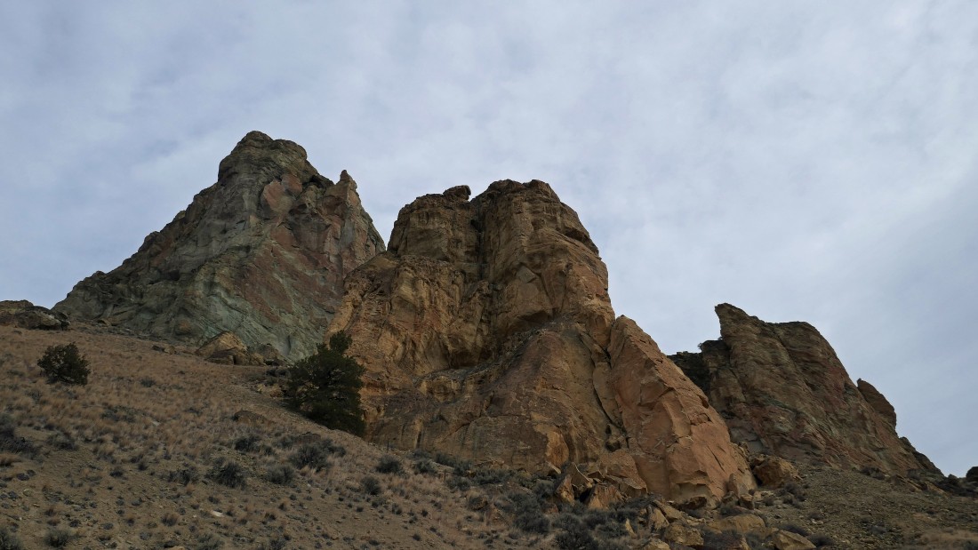
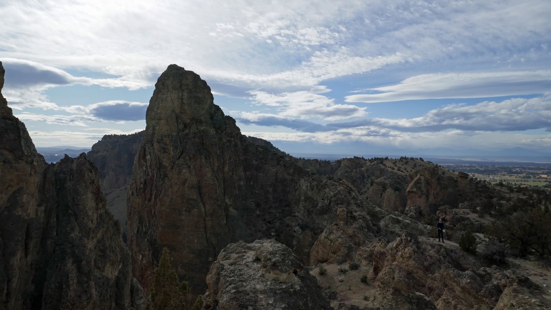
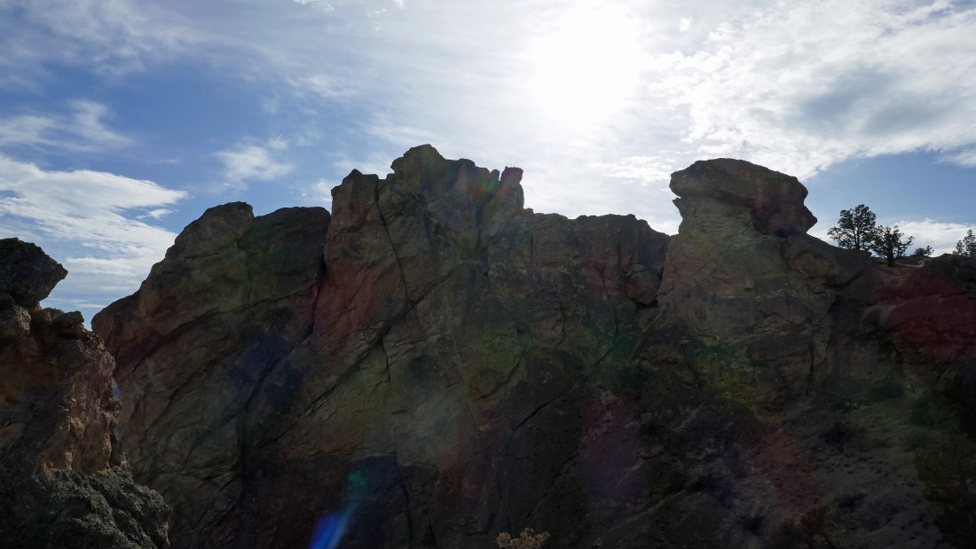
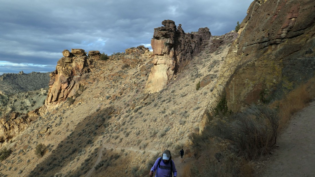
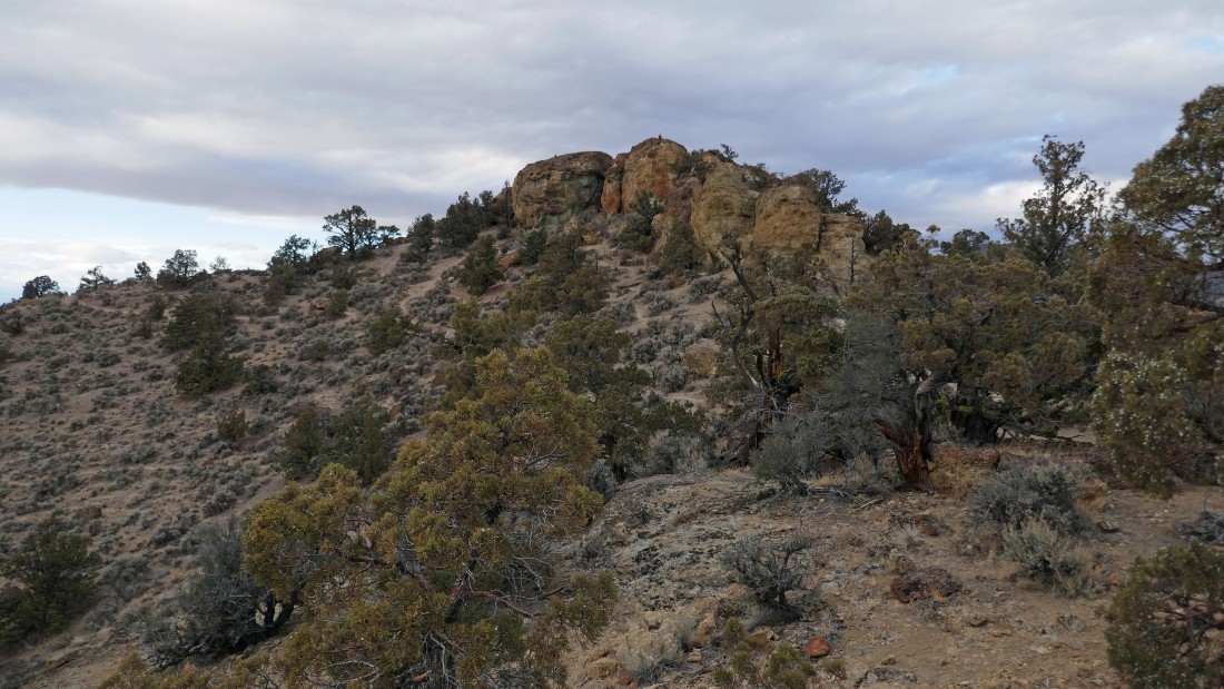
Awesome rock formations as we continue along the ridge.
|
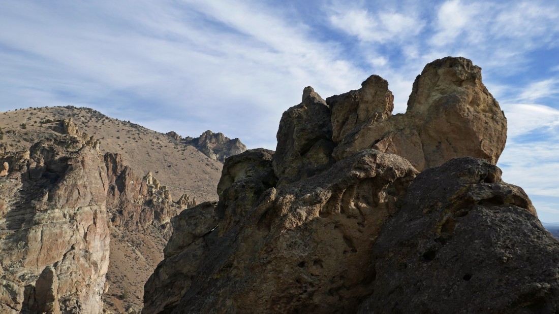
aceman hangs out near the top of the rock formations called the Monument Area of the park.
|
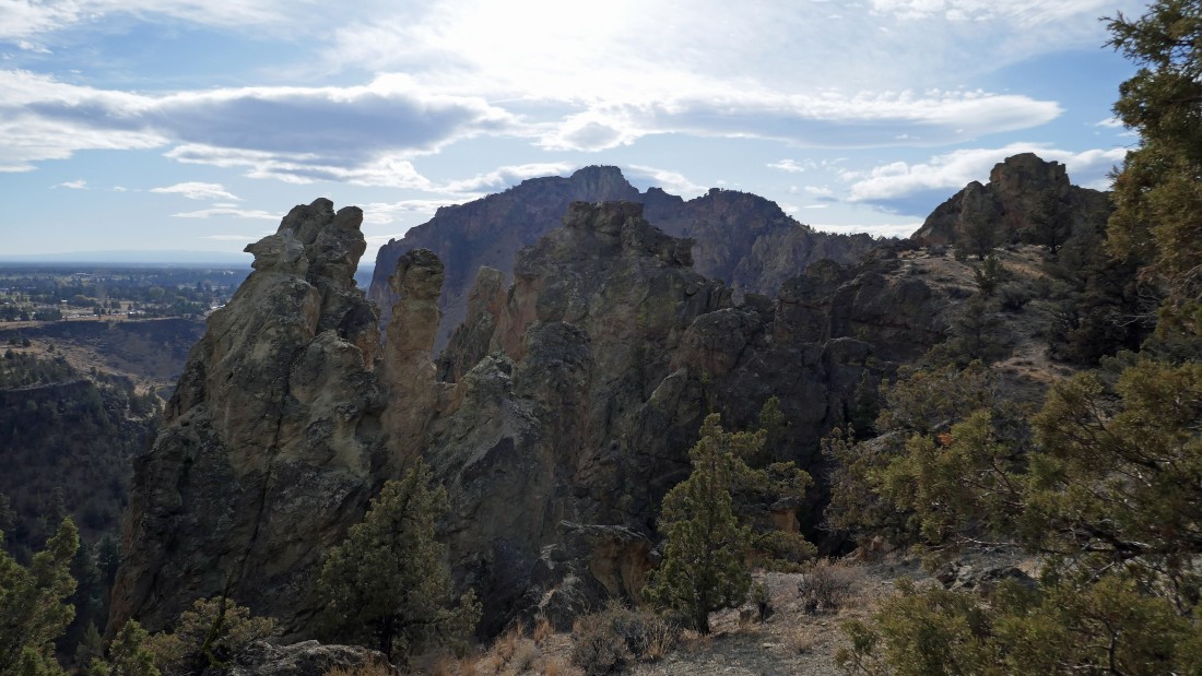
More incredible rock formations in The Monument Area of the park.
|
Looking back at our route down from the Burma Road.
|
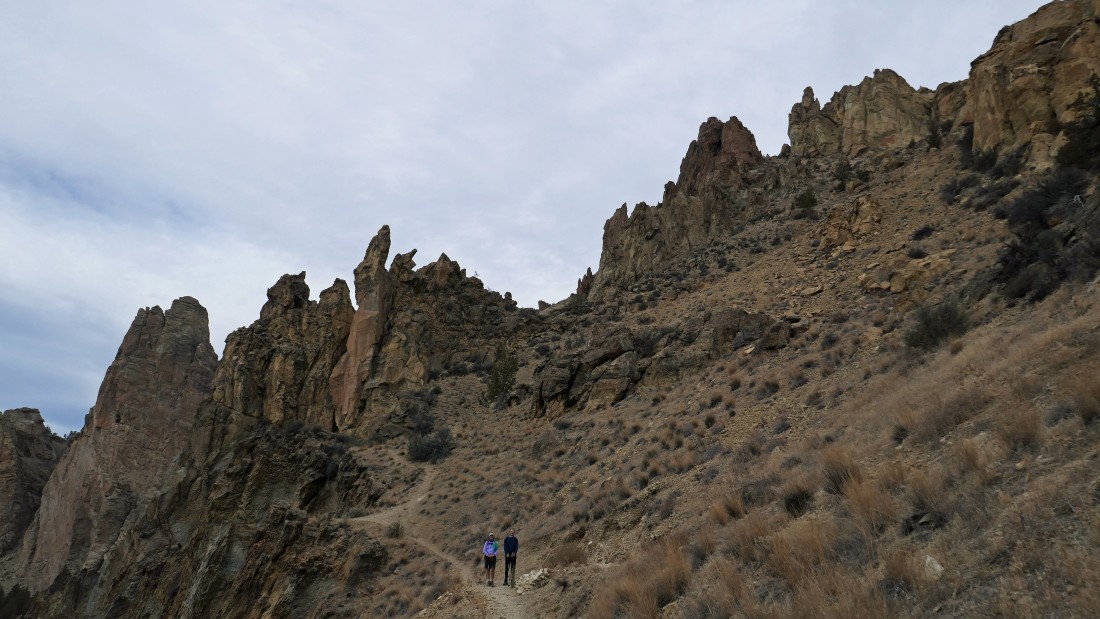
aceman takes a break as we continue along the ridge... heading for Misery Ridge in the distance.
|
We are heading for what looks like a toadstool on the right.
|
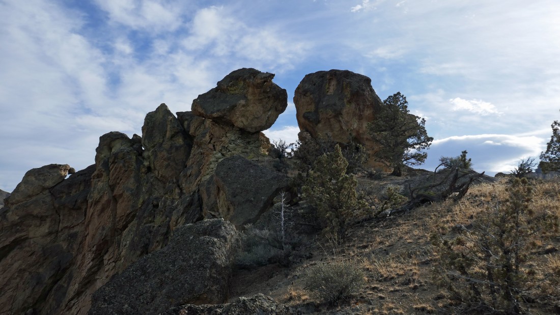
That toadstool turned out to be two toadstools... I will have to go up and check it out.
|
I'm between the two toadstools... looking back toward a chunk of the Burma Road and The Marsupials.
|
Standing between the two toadstools... looking along the ridge toward Misery Ridge in the center of the photo... time to get off of the paths and rejoin the Summit Trail... which will take us over toward the Misery Ridge Trail.
|
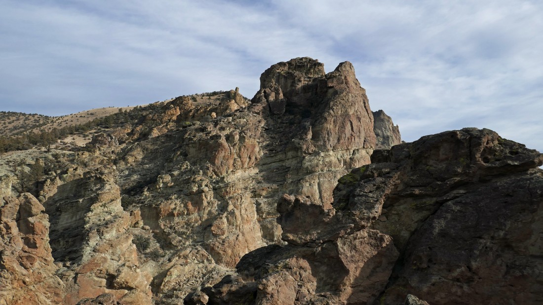
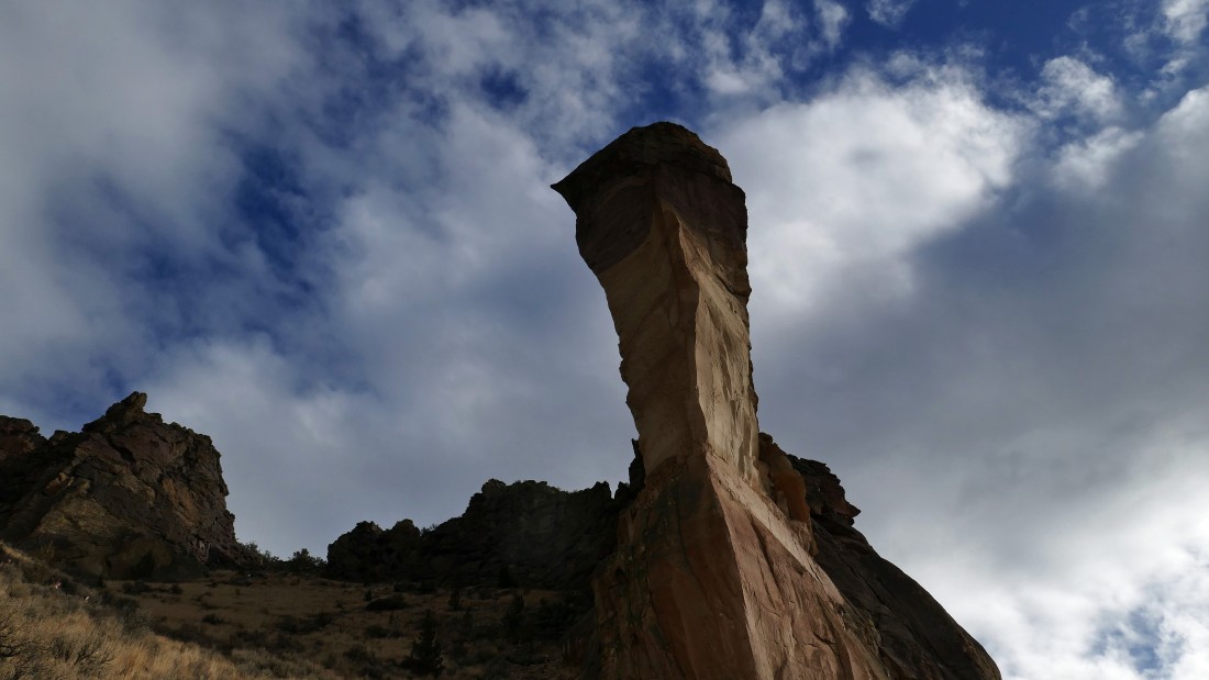
On the Summit Trail... heading toward Monkey Face in the center of the photo.
|
Getting closer to Monkey Face.
|
Nearing the base of Monkey Face.
|
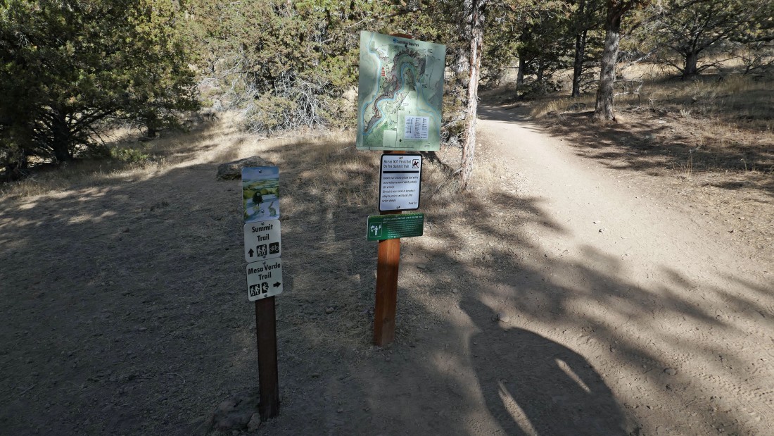
After hiking a total of 3.9 miles we will leave the Summit Trail and take the Mesa Verde Trail.
|
After hiking a total of 4.3 miles we will leave the Mesa Verde Trail and start switchbacking up the Misery Ridge Trail... here at the base of Monkey Face.
|
Switchbacking our way up the Misery Ridge Trail.
|
Gaining elevation on the Misery Ridge Trail.
|
Switchbacking our way up the Misery Ridge Trail.
|
Almost up to Misery Ridge.
|
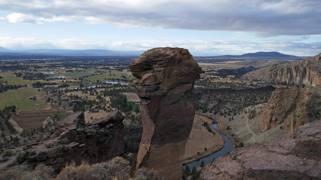
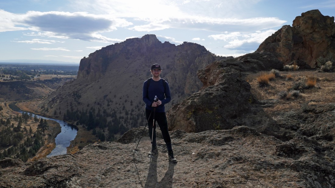
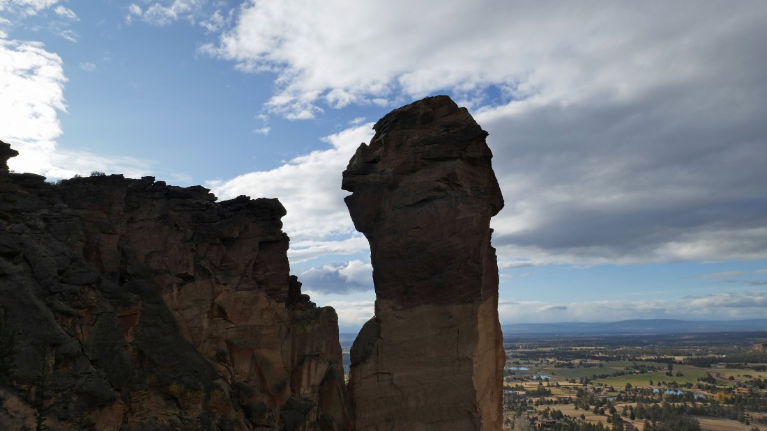
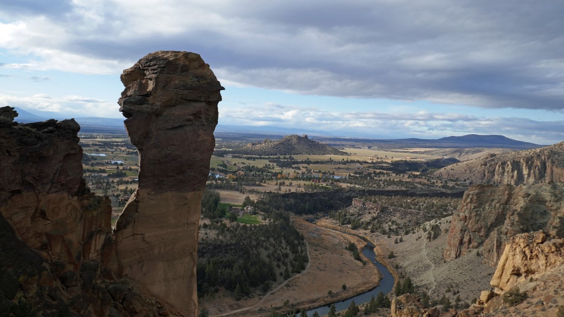
After hiking a total of 4.5 miles we are on Misery Ridge... with a nice look at the east side of Monkey Face.
|
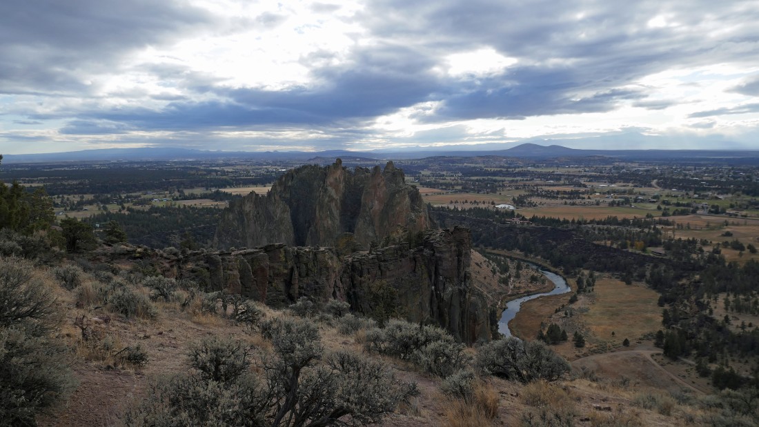
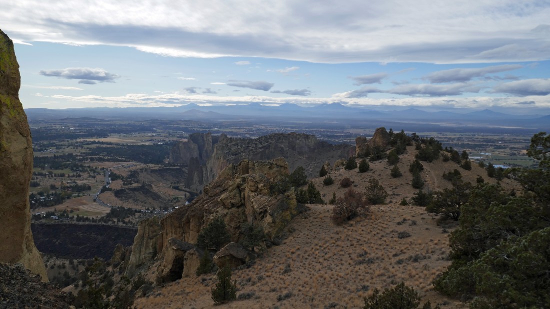
Looking at the Smith Rock formation from Misery Ridge.
|
Looking at the Smith Rock formation from Misery Ridge.
|
Looking back at the high point on Misery Ridge.
|
From Misery Ridge we are looking over at the Burma Road as it gains elevation underneath The Marsupials.
|
Heading down the east side of Misery Ridge on the Misery Ridge Trail... Gray Butte is out there on the horizon in the center of the photo.
|
Heading down the Misery Ridge Trail... with The Monument Area of the park stretching across the photo.
|
Almost back down to the bridge crossing of the Crooked River.
|
We have made the bridge crossing of the Crooked River... now we will need to gain 200 feet of elevation back up to our car... the hike was a total of 5.6 miles, gaining 2068 feet of elevation.
|
