Pinto Wye Arrastra, Point 3852, John's Camp & Gold Hill Mine - 1.3.2021
|
We parked at a paved pullout on Park Boulevard... located 100 yards NE of the Pinto Wye in Joshua Tree National Park... then crossed the road and started hiking west... there is no trail.
|
Continuing to hike cross-country... now hiking north in search of the Pinto Wye Arrastra... a historical landmark.
|
Continuing to hike north.
|
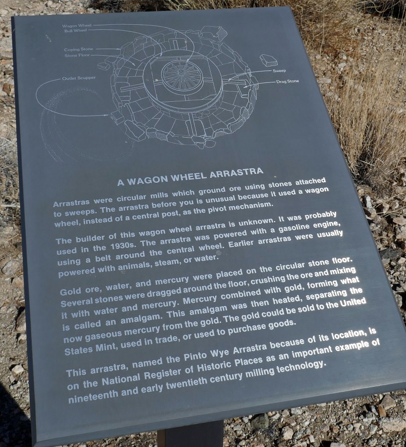
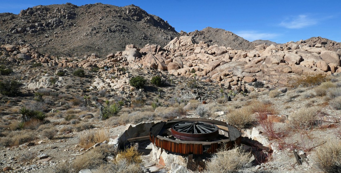
After hiking .9 miles we have found the sign talking about the Pinto Wye Arrastra.
|

Golden Eagle, Star Dancer and Denali Girl immediately started to do some mining.
|
|
The Pinto Wye Mine is 30 yards further up the hill from the arrastra... so lets go take a look.
|
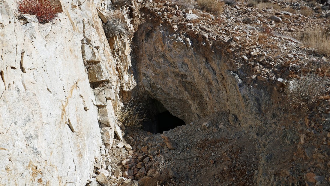
The Pinto Wye Mine... was able to go in 6 to 10 feet... then it was filled in... since I'm half way up the hill, I will go on up to the summit.
|
On the summit area of Point 3852 above the Pinto Wye Mine... might as well go on out to the true summit.
|
On top of Point 3852... looking down Park Boulevard toward the north entrance of the park and the town of Twentynine Palms... Twentynine Palms Mountain is on the far right... with the east end of Queen Mountain on the left.
|
On top of Point 3852... here looking south... with some of the Pinto Mountains on the left... Pleasant Valley dominates the photo in the distance.
|
|
On the Point 3852 summit area... looking across the valley to 'Oz' in the 'V' in the center of the photo.
|
A closer look at 'Oz' from the summit area of Point 3852.
|
I have returned to the arrastra from the top of Point 3852.
|
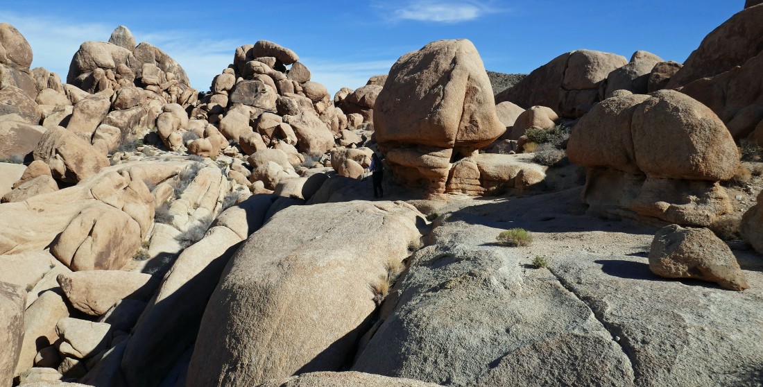
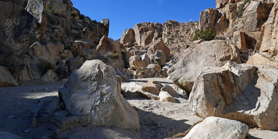
We continued hiking west from the Pinto Wye Arrastra... and after hiking a total of 2 miles we have reached what Star Dancer calls Cliff City.
|
A pano shot of the large cave at Cliff City.
|
Awesome rock at Cliff City.
|
Star Dancer and Golden Eagle relaxing at Cliff City.
|
A broader look at Cliff City.
|
We have continued south from Cliff City... looking for a wash that will take us to John's Camp and the Gold Hill Mine.
|
Continuing to hike south from Cliff City... and after hiking a total of 2.7 miles we can see what appears to be a wash that will take us to John's Camp.
|
|
Now hiking west in a wash and canyon... in search of John's Camp and the Gold Hill Mine.
|
The canyon just seems out of place here.
|
After hiking a total of 3 miles we have come out of the canyon and are continuing to hike west in the wash.
|
After hiking a total of 3.4 miles we have found the Gold Hill Mine... note the huge pile of tailings on the left.
|
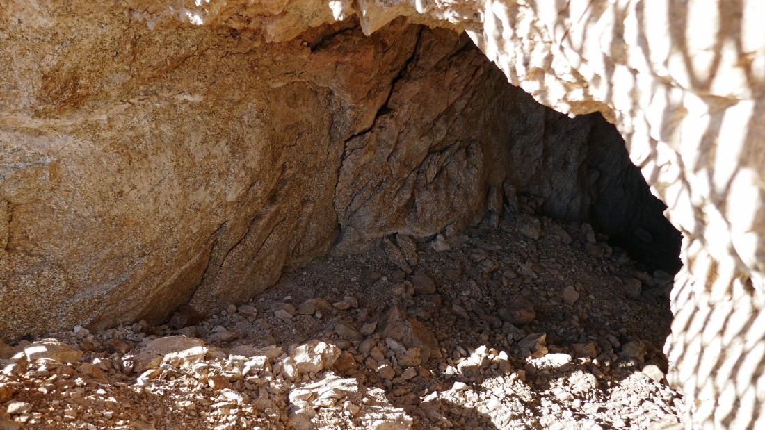
The entrance to the Gold Hill Mine... it was all filled with boulders after about 5 feet.
|

We left the mine and were backtracking... when we found all that remains of John's Camp.
|
Tracing our steps back toward the car... getting ready to reenter the canyon portion of the wash.
|
Continuing back down the canyon... part of the Pinto Mountains on the horizon.
|
Almost out of the canyon.
|
Instead of going back to Cliff City and the Pinto Wye Arrastra we continued to hike east from the canyon... taking a more direct route back to our cars which are parked out there beyond Denali Girl... the total hike was 5.3 miles, with 890 feet of elevation gain.
|
