Quail Mountain and Mount Minerva Hoyt - 1.5.2021
|
We parked on the side of Park Boulevard in Joshua Tree National Park... after driving Park Boulevard 3.9 miles from the west entrance to the park... Quail Mountain is on the right... with Mount Minerva Hoyt in the middle... and the much lower Point 4624 in the left foreground.
|
Heading south from where we parked... here looking back to memorize the rock piles so that we would know where to hike towards on the way back to the car if the GPS failed... did I mention that this is basically a cross country hike.
|
The first 1.5 miles of the hike is on fairly flat terrain as we cross Quail Spring for the entrance to Johnny Lang Canyon in the sunshine on the far right... Quail Mountain is on the right... with Mount Minerva Hoyt on the left.
|
Denali Girl points toward our targets as we near the entrance to Johnny Lang Canyon.
|
After hiking a total of 1.5 miles we are entering Johnny Lang Canyon... here looking back to where we parked near one of those rock piles on the horizon.
|
|
Entering Johnny Lang Canyon... looking at the map at home I thought we might be going up to the ridge on the right very soon... but seeing it in person made us hike further up the canyon before going up to the ridge. Mount Minerva Hoyt is the high point up there in the left center part of the photo.
|
After hiking up the canyon for approximately a quarter mile, we headed up for the ridge that separates Quail Mountain and Mount Minerva Hoyt.
|
Looking back down Johnny Lang Canyon toward Quail Spring as we gain elevation up to the ridge that separates Quail and Minerva Hoyt... Point 4695 is in the right foreground.
|
Denali Girl working her way up to the ridge.
|
Almost on the ridge here... looking up Johnny Lang Canyon on the left... with Mount Minerva Hoyt the third obvious high point from the far right.
|
|
Denali Girl working her way up to the ridge.
|
On the ridge after hiking a total of 2 and a quarter miles... Quail Wash and Quail Spring dominate the desert floor.
|
Heading south on the ridge that separates Minerva Holy (left) and Quail (right)... Point 4624 is in the foreground... with Point 4986 further up the ridge.
|
After hiking a total of 3 miles we have reached Point 4986... but, uh, the terrain looks somewhat more involved getting to Quail on the right... but very straight forward to get over to Minerva Hoyt on the left.
|
Denali Girl decided to pass on Quail and just do Minerva Hoyt... but I decided to give up some elevation and head for a gully that looked like it might get me up to a ridge that would lead to the Quail summit.
|
|
Heading for Quail... here looking back at the summit of Mount Minerva Hoyt on the far right... Denali Girl is somewhere on the ridge.
|
The Quail summit is above... looks like several options are available... I will try to get up to the ridge on the right without having to give up any elevation.
|
Heading for the saddle up there on the right... which will put me on the NE ridge of Quail Mountain.
|
Looking back over at Mount Minerva Hoyt as I gain elevation on the NE ridge of Quail Mountain... thinking a little bit about the route I will use to go over to Minerva Hoyt after doing Quail.
|
Only a short ridge walk to the Quail summit.
|
|
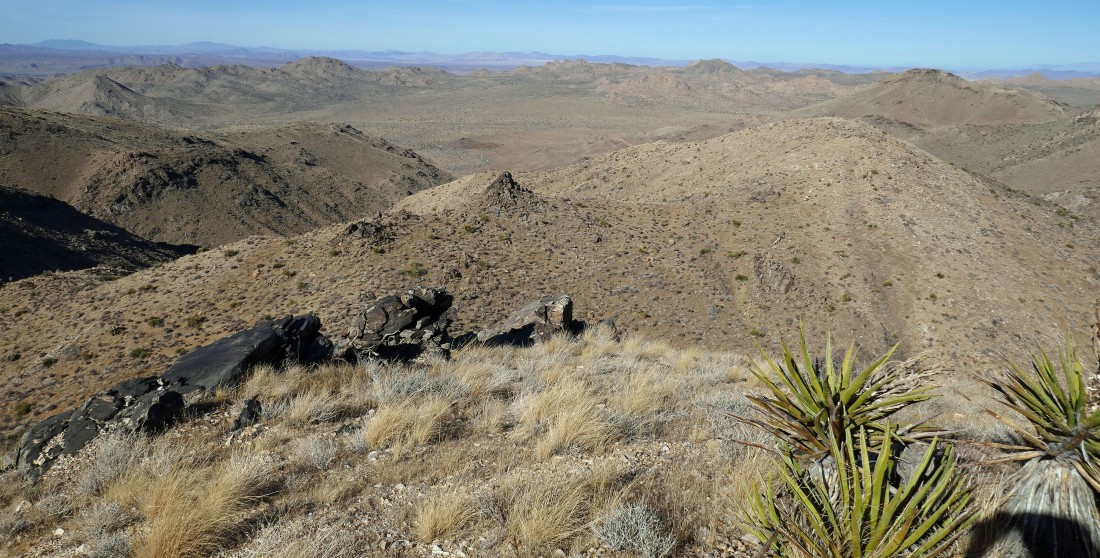
After hiking a total of 4.5 miles I have reached the 5813 foot summit of Quail Mountain... here looking SW across a stretch of the Little San Bernardino Mountains to the San Jacinto Mountains on the left horizon... with a snow capped San Gorgonio Mountain the high point in the San Bernardino Mountains on the west horizon on the right.
|
From the Quail summit I'm looking SW and south beyond a stretch of the Little San Bernardino Mountains to a dusty (or smoky, or pollution, or what) Coachella Valley that goes down to the Salton Sea... with the Santa Rosa Mountains on the right horizon.
|
Looking NE toward Minerva Hoyt on the left... and looking SE across Lost Horse Valley to Ryan Mountain on the right.
|
A broader pano than the previous photo... I think I see the route over to Minerva Hoyt... down to the right... then across the photo over to Minerva Hoyt... trying not to give up too much hard earned elevation.
|
I have left the Quail mountain summit... now heading for Mount Minerva Hoyt on the horizon.
|
|
Getting closer to Mount Minerva Hoyt... I actually found an obvious path that probably links up the two mountains.
|
After hiking a total of 6.1 miles I have reached the summit (5405') of Mount Minerva Hoyt... here looking north down Johnny Lang Canyon to the SE across Lost Horse Canyon to Ryan Mountain... also a nice view of Lang Mine Peak.
|
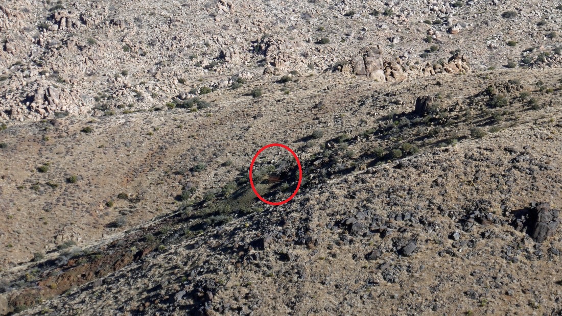
A closeup of the Lang Mine... a couple hundred feet below Lang Mine Peak (5041')... I was there in 2018... a very deep mine shaft, but closed to the public.
|
Looking NE to Lang Mine Peak on the far left foreground.
|
Looking west to Quail Mountain from the summit of Mount Minerva Hoyt.
|

Denali Girl signed the Mount Minerva Hoyt summit register and headed back to the car before I arrived... so now I'm heading down Minerva Hoyt's north ridge... here looking back up at the Minerva Hoyt summit on the far left.
|
There will be some ups and downs on Minerva Hoyt's north ridge.
|
After hiking a total of 7.5 miles I am off of Minerva Hoyt's north ridge... and have reached a gully wash that I will follow over to Johnny Lang Canyon.
|
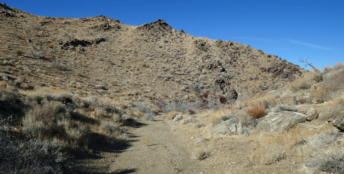
After hiking a total of 8 miles I am almost out of Johnny Lang Canyon.
|

Out of Johnny Lang Canyon... leaving a 1.5 mile hike back to our car... the total hike was 9.7 miles, gaining 2756 feet of elevation.
|
