Silver Bell Mine and Golden Bell Mine - 1.8.2021
|
From the north entrance pay station to Joshua Tree National Park we drove 4.6 miles to the Pinto Wye... where we turned left onto the Pinto Basin Road and drove 7.9 miles... where we parked at a paved turn-out that had an exhibit sign about the Silver Bell Mine... the mine is up there directly above Denali Girl's head.
|
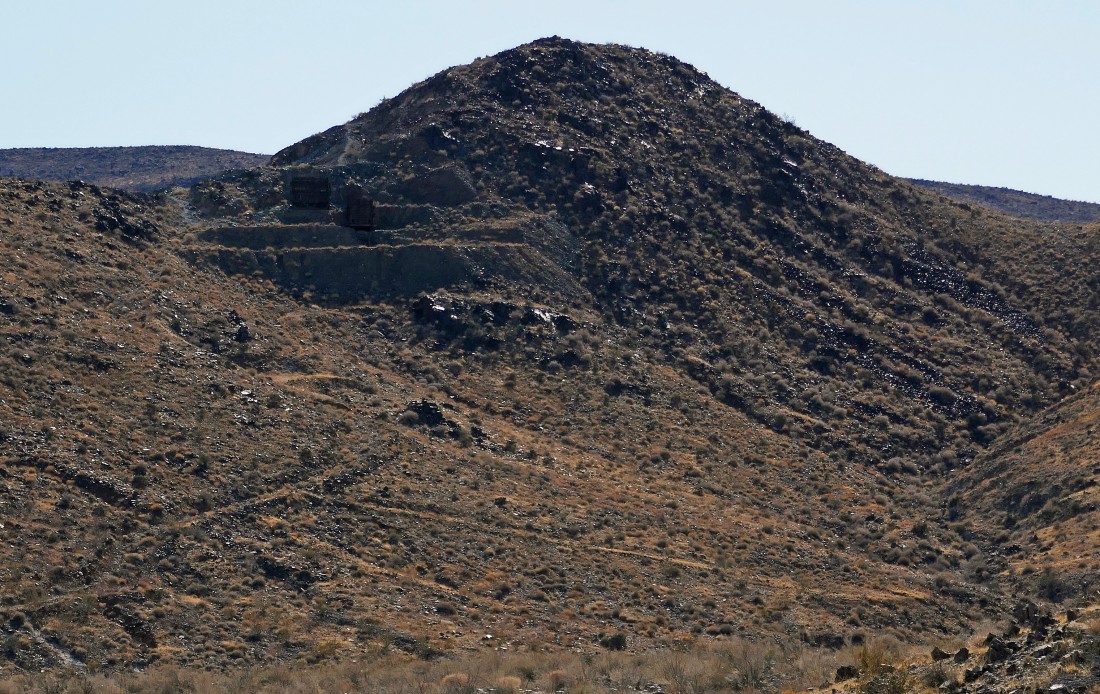
A closer look at the Silver Bell Mine from our parking spot... look closely and you can see two structures that are called tipples... see the next photo for info on tipples.
|
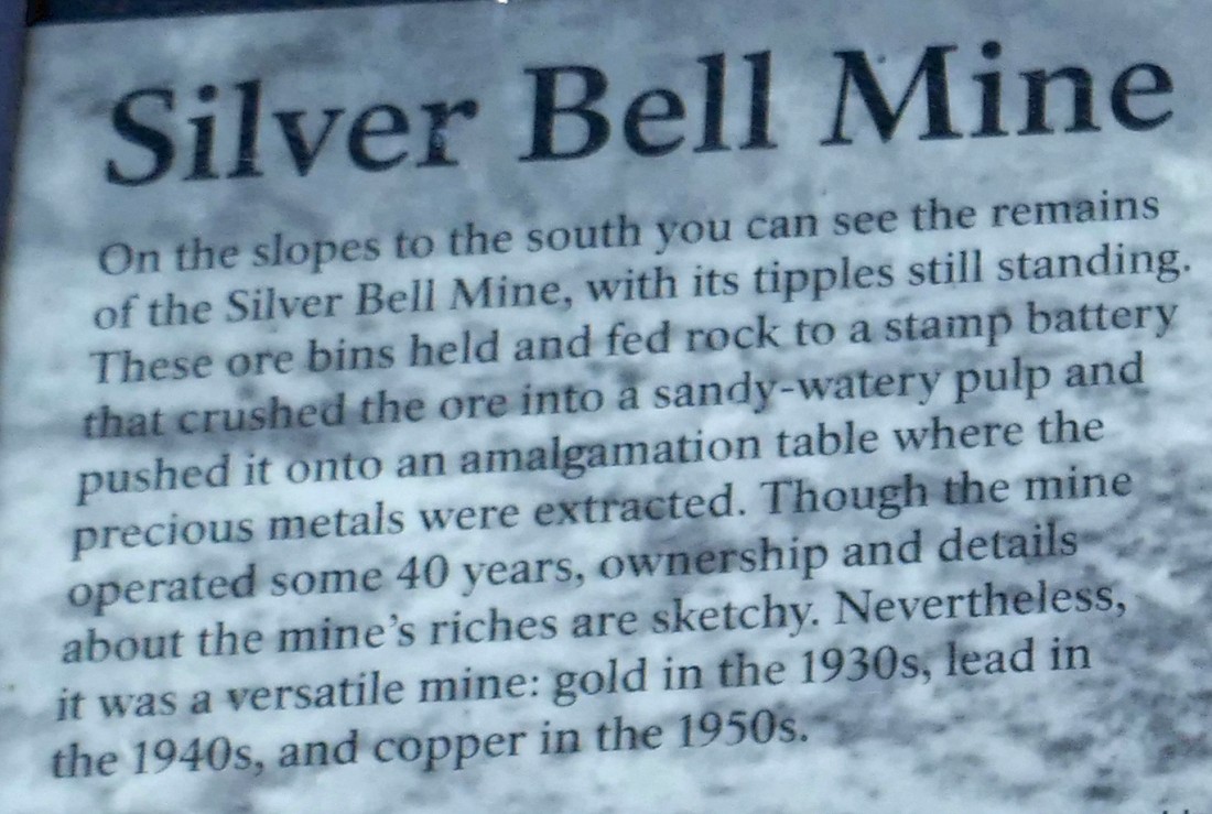
Info on the tipples at the Silver Bell Mine.
|
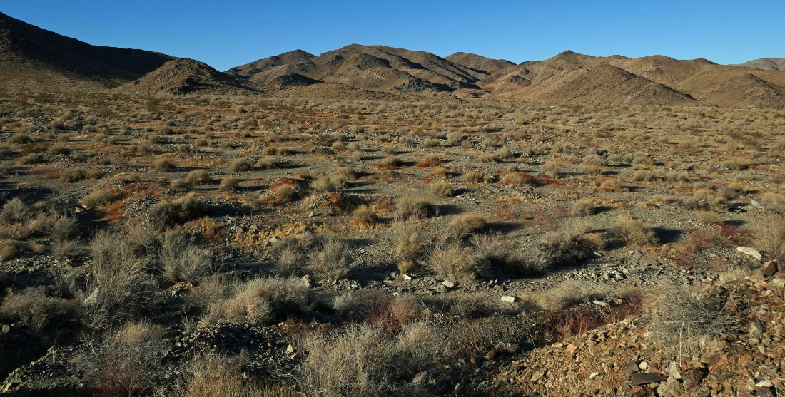
Hiking south toward the Silver Bell Mine... here looking east down Wilson Canyon to the Pinto Basin... with Pinto Mountain the high point on the left-center horizon.
|
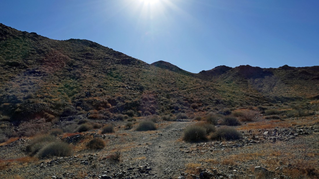
After hiking a third of a mile we are getting ready to leave the desert floor and start hiking up to the Silver Bell Mine.
|
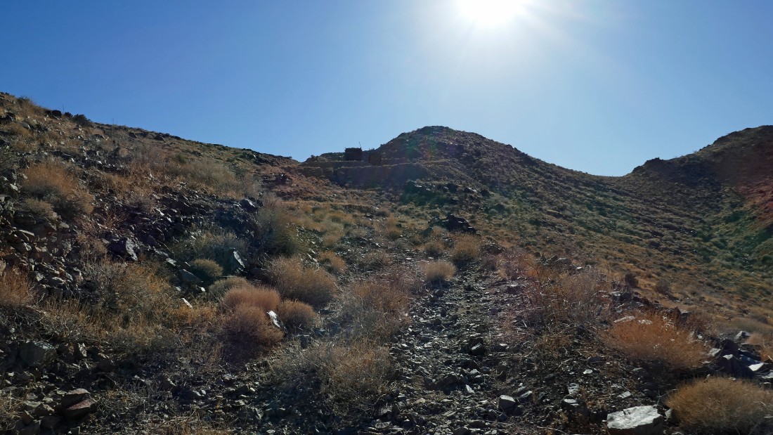
Gaining elevation on the trail up to the Silver Bell Mine.
|
Continuing up on the trail to the Silver Bell Mine... here looking back to the north... across Wilson Canyon to the Pinto Mountains.
|
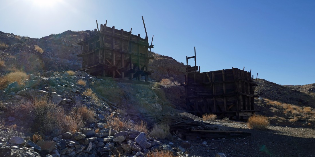
The two tipples at the Silver Bell Mine... for the most part the mine shafts are up above the two tipples.
|
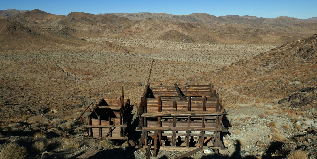
Above the two tipples now... looking back at our route up to them.
|
After hiking .7 miles we are on the high point (~3000') above the two tipples... here looking east at Pinto Basin... with the Pinto Mountains on the left... and the Hexie Mountains creeping into the photo on the right.
|
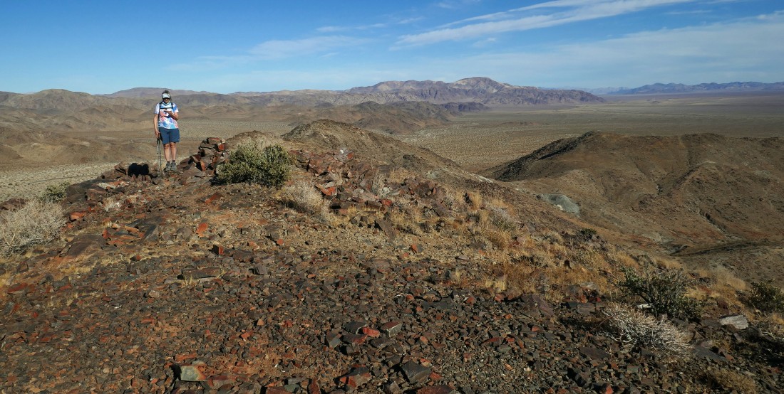
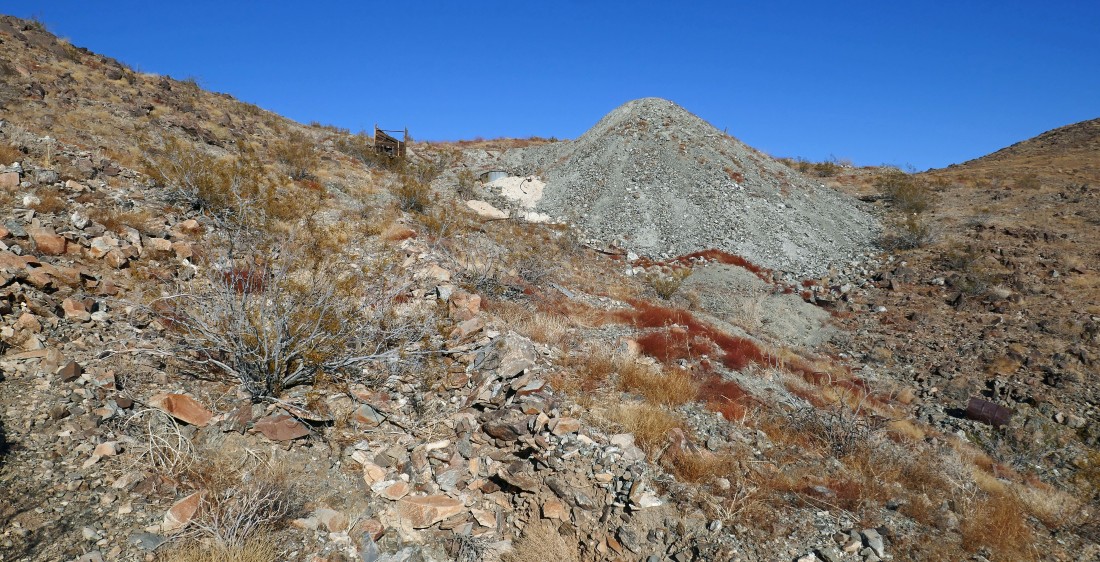
Denali Girl standing on our high point (~3000') above the two tipples at the Silver Bell Mine... we can see a pile of gray tailings down below on the right that belong to the Golden Bell Mine... with Pinto Mountain really standing out on the center horizon.
|
This pano shows more of the Hexie Mountains coming in from the right... with Pinto Basin and Pinto Mountain on the left.
|
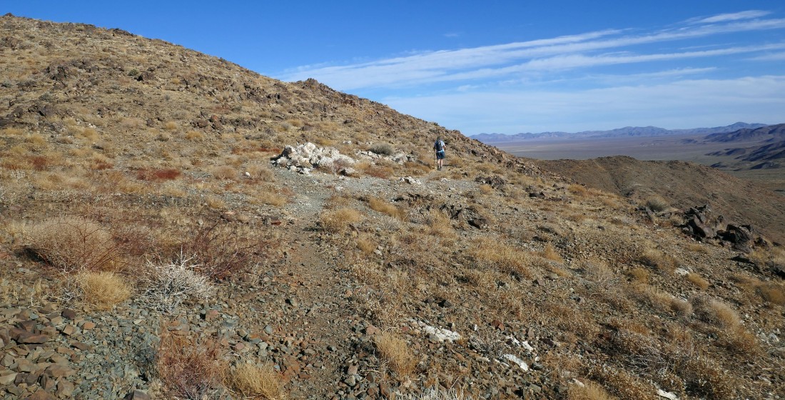
Denali Girl is coming down from our high point above the Silver Bell Mine... All of the mine shafts at the Silver Bell Mine were totally filled with rock and dirt... in others words, there were no visible shafts... perhaps because they were too close to Pinto Basin Road.
|
We decided to hike over and down to the Golden Bell Mine to check it out.
|
Denali Girl on her way from the Silver Bell Mine to the Golden Bell Mine which is visible down to the right... with Pinto Mountain and Pinto Basin in the distance.
|
|
Looking back at the Silver Bell Mine as we continue our way to the Golden Bell Mine.
|

We will need to give up some elevation to get over to the Golden Bell Mine... one very careful step at a time... with Pinto Mountain visible through the gap.
|
After giving up 250 feet of elevation it is time to head uphill to the first mine shaft at the Golden Bell Mine... looks like there is a tipple there also.
|
After hiking a total of 1.3 miles we have reached the tipple at the first Golden Bell Mine shaft... there are a couple more shafts up near the top of the hill on the left... but let's check out the shaft up above on the right edge of the photo.
|
The first mine shaft at the Golden Bell Mine... looks like this one is covered by an iron grate.
|
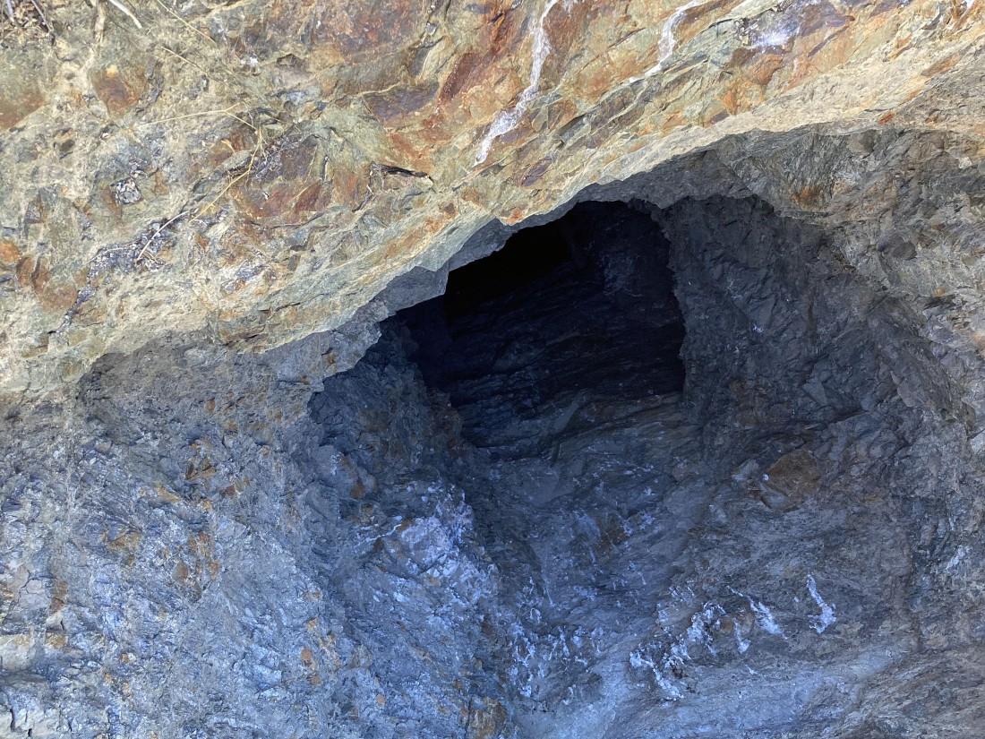
Denali Girl took this photo by placing her cell phone camera through the iron grate... this shaft was at least 60 feet deep.
|
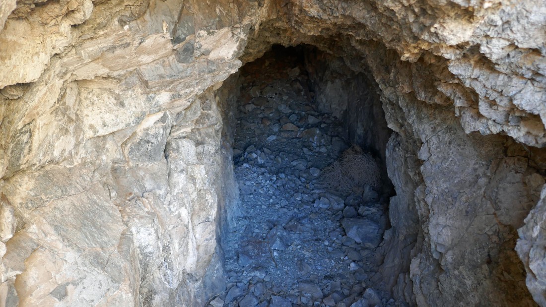
This shaft went straight into the hill just beyond the iron grate... maybe went 20 feet into the hillside.
|

Denali Girl went into the hillside shaft... and then decided to come back out.
|
Denali Girl is heading uphill from the first shaft to check out the two higher shafts.
|
Looking back down at the first shaft we visited at the Golden Bell Mine.
|
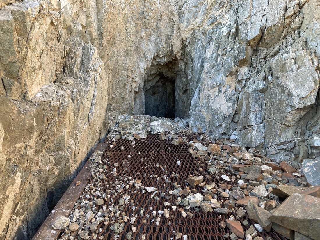
The iron grate covers a shaft that goes down at least 60 feet... while the one beyond the grate goes about 20 feet into the hillside.
|
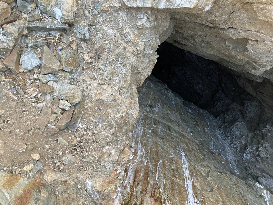
Looking through the iron grate... down the second shaft at the Golden Bell Mine... at least 60 feet deep... the third shaft was much the same.
|
Continuing above the higher mine shafts at the Golden Bell Mine... when we get up to the ridge we will head cross country back to our car.
|
On the ridge above the Golden Bell Mine... time to head down to the desert floor and find the trail that we used at the beginning of our hike.
|
After hiking 1.7 miles we have rejoined the trail that will get us back to our car... the total hike was 2 miles, gaining 568 feet of elevation.
|
