Mecca Hills Loop - 1.27.2021

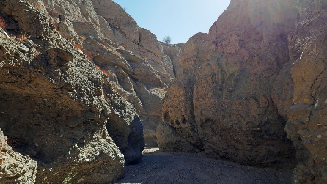
From the town of Mecca... drive east on 66th Ave... just before crossing the canal the road changes to Box Canyon Road... then drive 6.1 miles to an unsigned Sheep Hole Oasis parking area... we will hike over and enter the foothills to the right of the rock formation in the left foreground of the photo.
|
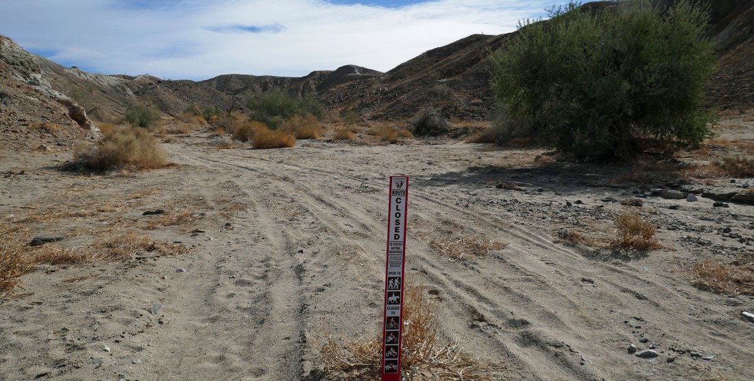
Entering the foothills of the Mecca Hills Wilderness... only open to hiking and horsing... but some folks didn't understand the sign.
|
Looking back as Denali Girl starts uphill shortly after leaving Box Canyon where we parked.
|
Hiking east on a ridge in the Mecca Hills... with canyons on both sides of the ridge.
|
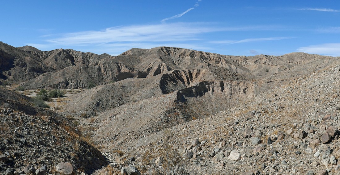
Continuing to hike east... the Salton Sea is starting to come into view on the horizon... with the Orocopia Mountains on the far left horizon.
|
|
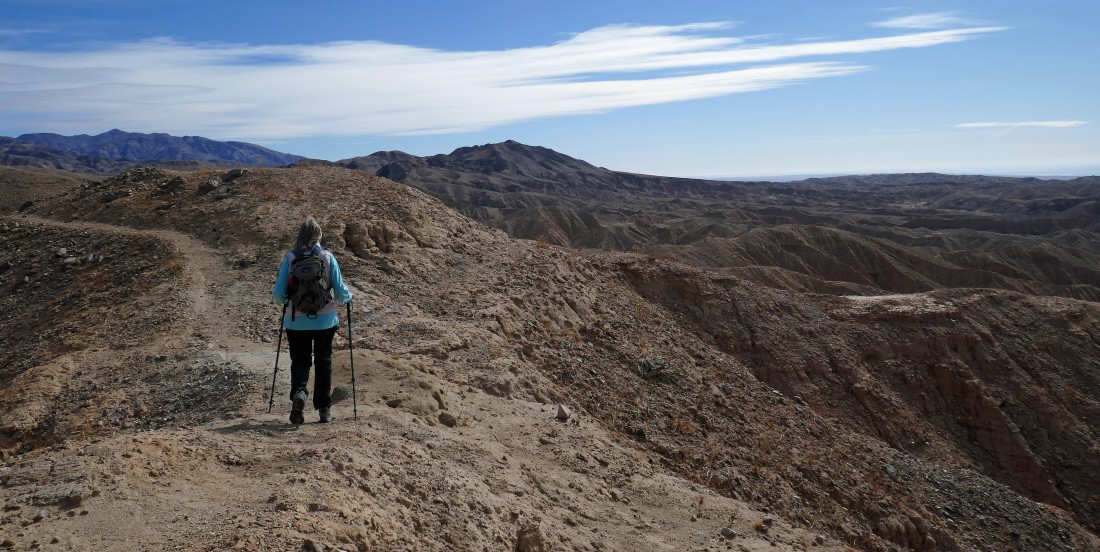
High enough now to get a broader view of the Salton Sea... with the Santa Rosa Mountains on the right horizon... the ridge route we used 3 days ago is in the foreground, stretching across the middle of the photo... and we will return to our car via this ridge at the end of our hike.
|
Her comes Denali Girl... following me as we gain elevation on our ridge hike.
|
After hiking a total of 1.3 miles we are taking a break at our high point (~1050')... this hike was advertised as offering great views of the Salton Sea which is more than 220 feet below sea level... from here we will start hiking south toward the sea... along the ridge that is left of where Denali Girl is sitting in the photo.
|
I left Denali Girl and am hiking south along this ridge... looking for a place to get us down into a canyon floor.
|
I was successful in finding a way to get off the ridge... as I look back and watch Denali Girl coming to join me.
|
|
Continuing to hike south on the ridge... I sent Denali Girl forward to make sure that is was safe to continue... just kidding, I thought it would make a nice photo.
|
Continuing to hike south on the ridge... looks like a feasible route down to the canyon out there on the right in the distance.
|

We are in the proximity of where we planned to get down into the canyon on our right... but the canyon runs over into the canyon on the left... and all of a sudden there are no guarantees that we can get through the canyon even if we can get down to it.
|
After hiking a total of 2 miles we will go down to the canyon floor and see if it will go.
|
Watching Denali Girl come down from the ridge to join me in the canyon... a steep, 60 foot drop of careful steps.
|
Denali Girl gets ready to enter the part of the canyon that was unclear if it would go several photos ago.
|
A narrow opening in the canyon... if it wasn't there, we would be backtracking and looking for another route.
|
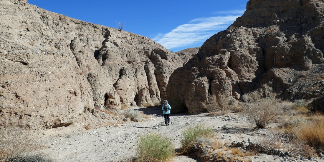
In the sketchy part of the canyon... but seeing the tracks of a dune buggy here was encouraging.
|
The canyon broadens... with interesting rock formations on both sides of the canyon.
|
The rock formation on the east side of the canyon entrance.
|
|
The rock formation on the west side of the canyon entrance... glad we weren't here when some of the rock collapsed.
|
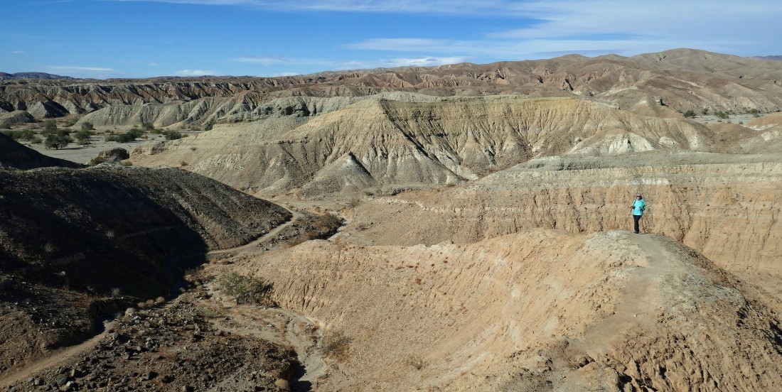
After hiking a total of 2.8 miles we have connected with the very broad Hidden Spring Canyon... connecting with where we were 3 days ago... now hiking west to connect with the foothills that will get us back to our car.
|
After hiking a total of 3.1 miles we are leaving Hidden Spring Canyon and taking a shortcut that will get us back to the foothills.
|
Heading for the foothill trail on the far left of the photo.
|
Looking back at Denali Girl as she gains elevation on the foothill trail.
|
|
Hiking north on the foothill trail.
|
After hiking a total of 4 miles we are almost at the high point on the foothill trail.
|

This plaque is on the high point of the foothill trail... Hank Koenig co-authored the book... '140 Great Hikes in and near Palm Springs'.
|
Heading down from the foothill trail high point at 'Koenig Rock'... heading for our car in Box Canyon in the distance.
|
Back in Box Canyon... with our car a stone's throw away... the loop hike was 4.5 miles, gaining 1106 feet of elevation.
|
