Zabriskie Point, Gower Gulch and Golden Canyon - 2.22.2021
|
From the Furnace Creek Inn in Death Valley National Park... drive south on Badwater Road for 2 miles to the trailhead for Golden Canyon... this trailhead is more than 80 feet below sea level.
|
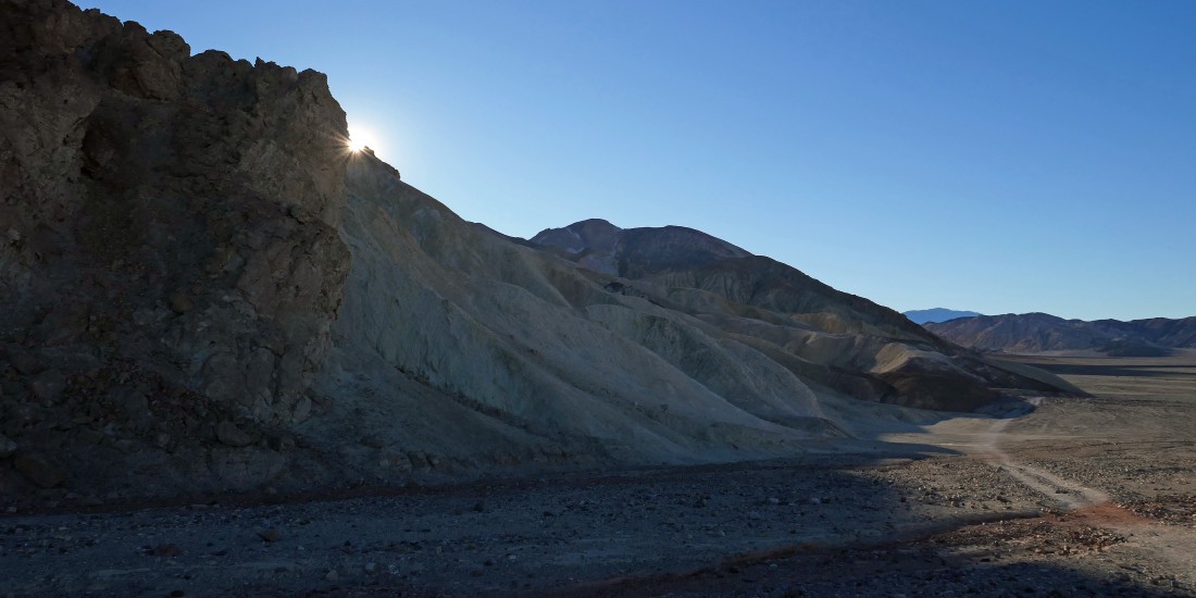
We will return to the Golden Canyon parking lot at the end of the day... but we will begin the loop hike by hiking south on an abandoned dirt road that parallels Badwater Road.
|
Continuing to hike south on the abandoned dirt road that parallels Badwater Road.
|
Looking SW across Badwater Basin to Telescope Peak (left center) in the Panamint Range... the high point in the park at 11,048 feet.
|
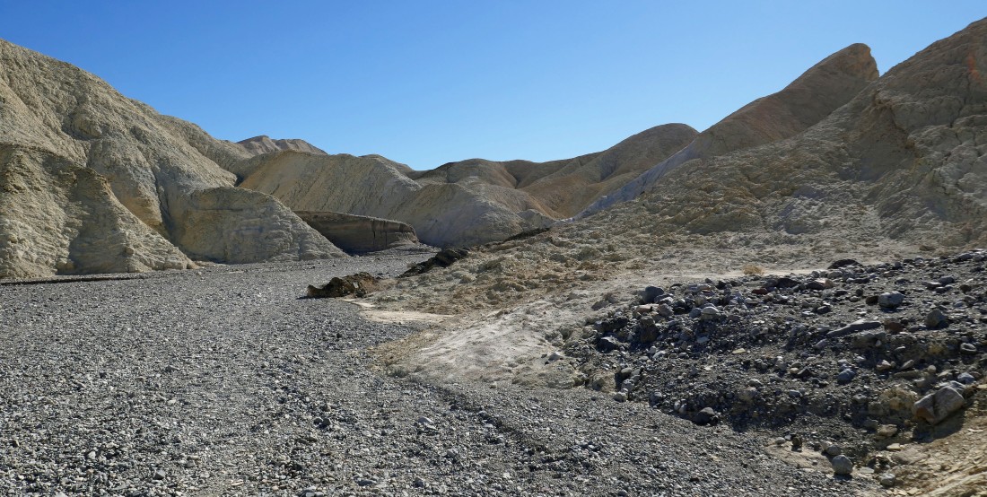
After hiking .8 miles we have turned to the east and are entering Gower Gulch.
|
Continuing to hike east in Gower Gulch.
|
Looking back across Badwater Basin as we hike up Gower Gulch... with Telescope Peak on the left horizon.
|
Continuing up Gower Gulch.
|
Here come the trouble makers up Gower Gulch... Nanda, Anna Purna and Denali Girl.
|
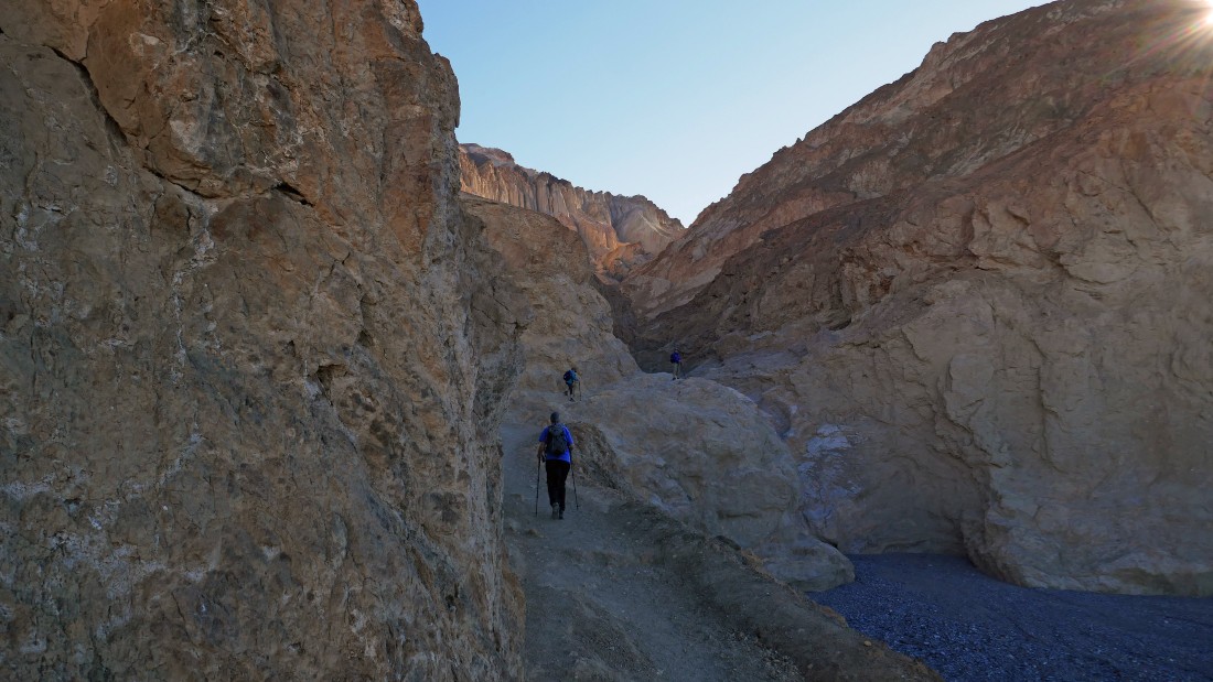
A little Class 2 scrambling is up ahead in Gower Gulch.
|
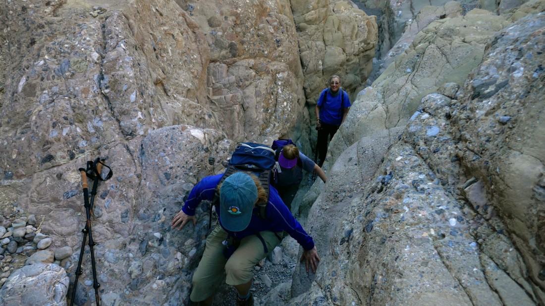
Scrambling in Gower Gulch.
|
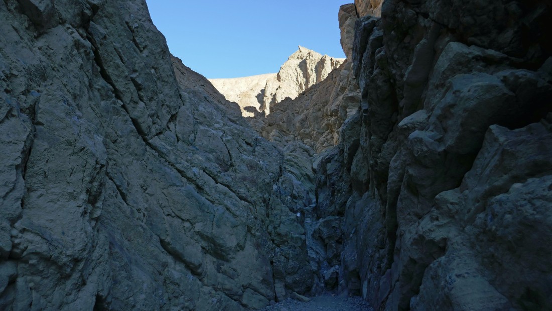
Hiking east in Gower Gulch.
|
Hiking east in Gower Gulch.
|
Hiking east in Gower Gulch.
|
Hiking east in Gower Gulch.
|
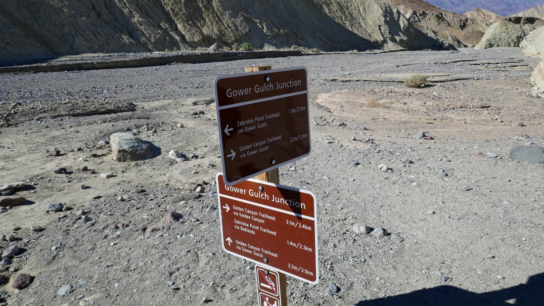
After hiking a total of 2.2 miles we have reached Gower Junction... we could loop back to the Golden Canyon Trailhead here... but we will continue east in search of Zabriskie Point.
|
Hiking east in Gower Gulch... with Manly Beacon on the horizon in the center of the photo... on our return to the car later in the day we will hike right past the beacon.
|
Hiking east in Gower Gulch.
|
I scrambled up a little bump from the floor of Gower Gulch and got this view... looking west, back down Gower Gulch to the Panamint Range on the center horizon... we are hiking in the Black Mountains, but to me it looks like the 'Chocolate Mountains' on the left.
|
Hiking east in Gower Gulch.
|
|
Another little scramble above the floor of Gower Gulch produced this view looking back down Gower Gulch to the Panamint Range on the horizon.
|
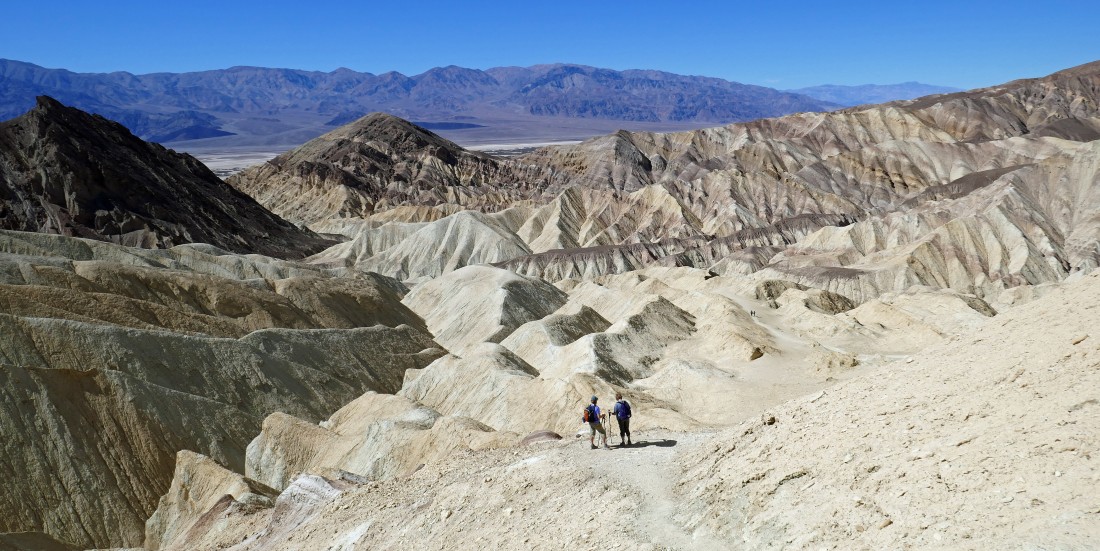
Looking SE from Gower Gulch at some interesting terrain... Nanda and I are going to go over that way to see what is going on.
|
Nanda follows an obvious path toward the peaks from the previous photo.
|
Nanda wraps up her off trail exploring on this bump that provided very nice views.
|
Looking west back down Gower Gulch from Nanda's Bump... with the Panamint Range on the center horizon... and Manly Beacon on the far right... this photo makes me want a chocolate sundae.
|
|
Nanda is leaving her bump and heading back to Gower Gulch... the Funeral Mountains are coming into view on the far left horizon.
|
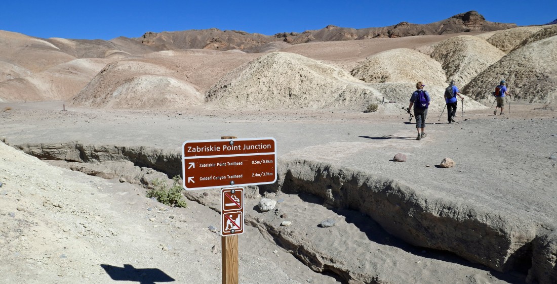
After hiking a total of 3.6 miles we have reached the Zabriskie Point Junction... we will continue to Zabriskie Point and then return to this spot to go back to the car via the Golden Canyon Trail.
|
We can see Zabriskie Point up there on the right.
|
Coming up out of Gower Gulch... with the Panamint Range on the horizon.
|
Out in the great wide open now... only a short walk remains to get up to Zabriskie Point... if you don't have time to do this hike, you can park your car here and make the short walk to Zabriskie Point.
|
|
After hiking a total of 4.2 miles we have reached Zabriskie Point... here looking west down Gower Gulch to the Panamint Range on the horizon.
|
Looking NW from Zabriskie Point... with Red Cathedral the high point out there on the far left.
|
Looking south from Zabriskie Point.
|
Back to the Zabriskie Point Trailhead... now we will trace our steps back down Gower Gulch and find the Golden Canyon Trail.
|
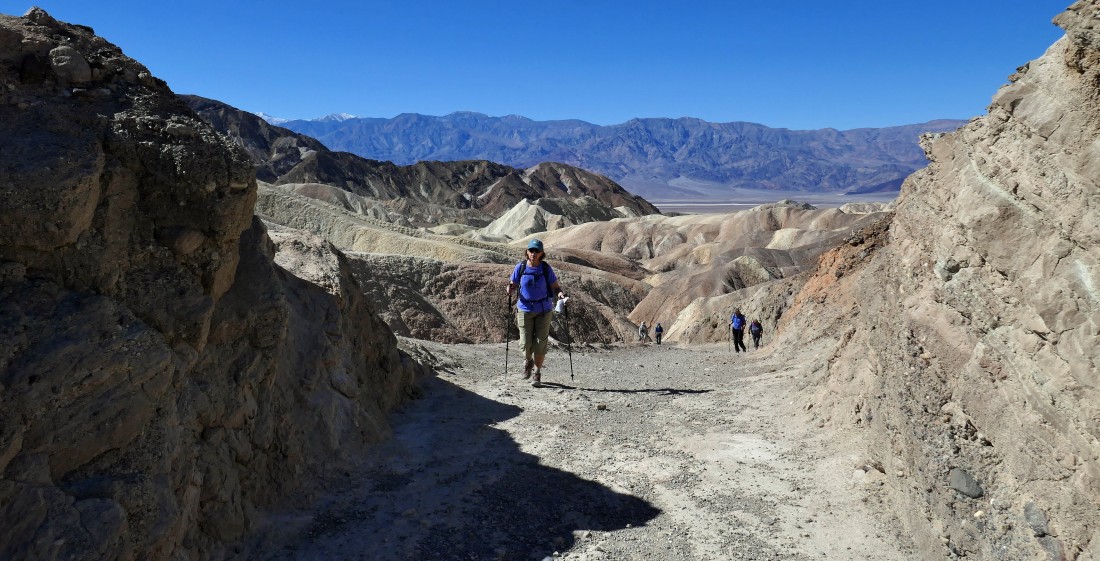
After hiking a total of 4.9 miles we have returned to the Zabriskie Point Junction and started hiking on the Golden Canyon Trail.
|
Looking back at Zabriskie Point in the center of the photo as we continue hiking on the Golden Canyon Trail... with Gower Gulch below on the right... and the Funeral Mountains on the horizon.
|
On the Golden Canyon Trail... it will take us over to Manly Beacon in the center of the photo.
|
On the Golden Canyon Trail... it doesn't look like we are heading for Manly Beacon... but we are.
|
Heading toward Manly Beacon.
|
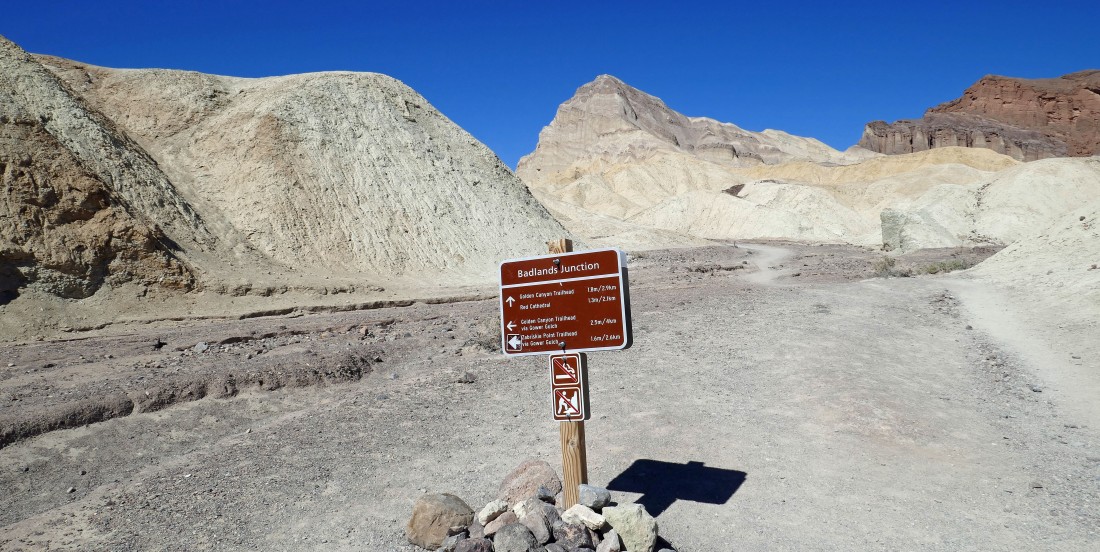
After hiking a total of 5.5 miles we have reached Badlands Junction... we will continue on the Golden Canyon Trail toward Manly Beacon.
|
|
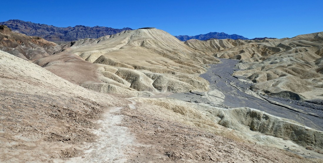
Continuing to hike on the Golden Canyon Trail... here looking back at Zabriskie Point which is barely visible in the center of the photo.
|
Hiking NW on the Golden Canyon Trail as we get closer to Manly Beacon... with Red Cathedral the high point on that red ridge in the distance.
|
Almost ready to touch the south side of Manly Beacon.
|
Hiking around the south side of Manly Beacon.
|
Hiking around the south side of Manly Beacon on the Golden Canyon Trail... we can see the gap in the mountains on the left that will get us back to our car.
|
|
Now hiking west on the Golden Canyon Trail... heading for the gap in the center of the photo.
|
Looking back at Manly Beacon as we head for the car.
|
Almost back to our car.
|
Back at the Golden Canyon Trailhead... the loop hike was 7.4 miles, gaining 1464 feet of elevation.
|
After our hike we decided to drive to the lowest point in North America... located in Badwater Basin... 282 feet below sea level.
|
