Teanaway Peak and Iron Peak - 6.22.2021

This hike/scramble begins at the trailhead for Iron Peak Trail #1399 in the Teanaway Area... the east end of Esmeralda Peak is in the left foreground.
|
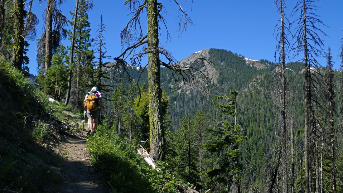
The Iron Peak Trail starts switchbacking very quickly... here looking across the valley at Koppen Mountain.
|
In less than a half-mile of hiking we got this view of Esmeralda Peak in the left foreground... and up valley to Fortune Peak and the south summit of Ingalls Peak.
|
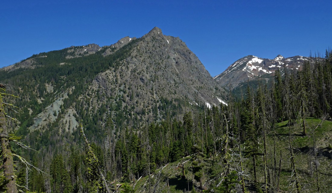
After hiking 2.75 miles we have reached Eldorado Pass... the pass that separates Iron Peak and Teanaway Peak... here looking at Iron Peak from the pass... with the Beverly Creek drainage on the left.
|
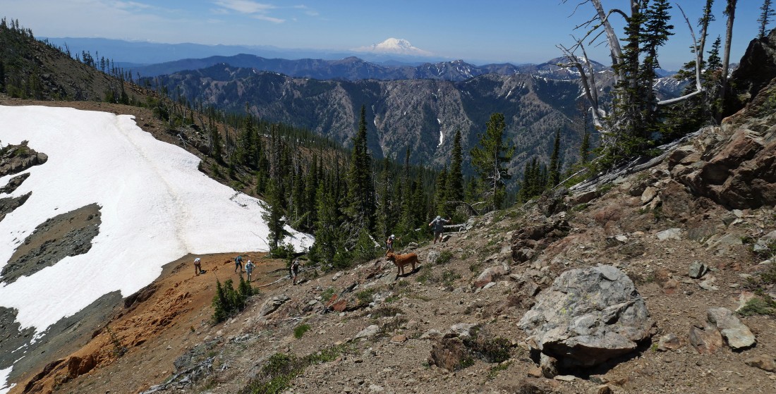
Leaving Eldorado Pass and following a path that will take us up to Teanaway Peak... here looking beyond some of the Teanaway Peaks (Yellow Hill, Humerus, Elbow and Jolly) to Mount Rainier on the horizon.
|

Looking back toward Eldorado Pass as we cross a snowfield on the southeast side of Teanaway Peak.
|
Continuing to work our way along the SE side of Teanaway Peak as we continue to gain elevation toward the 'Lone Tree' above... with Bills Peak on the right.
|
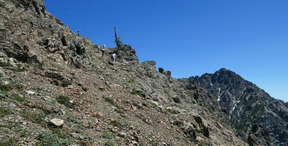
The 'Lone Tree' is where we reach the east ridge of Teanaway Peak and head for the summit.
|
Part of the Stuart Range comes into view at the 'Lone Tree'... looking beyond Bills Peak in the right foreground to Argonaut, Colchuck and Dragontail.
|

Denali Girl coming up from the 'Lone Tree'... with the Beverly Creek drainage below... and many more Teanaway Peaks beyond (Volcanic Neck, Three Brothers, Navaho, Bean, Earl, Judi and Mary).
|
|
Still climbing the east ridge of Teanaway Peak... now Mount Stuart and Sherpa Peak are visible to the left of the skinny tree... with Argonaut, Colchuck and Dragon tail to the right of the skinny tree... and part of Bills Peak in the right foreground.
|
On the east ridge of Teanaway Peak and heading for the summit above.
|
High enough now to see Fortune Peak and the three summits of Ingalls Peak in the distance on the left... with Mount Stuart dominating the photo.
|
Still gaining elevation on the east ridge of Teanaway Peak... with a nice view of the ridge that runs from Teanaway Peak over to Longs Pass and Ingalls Pass.
|
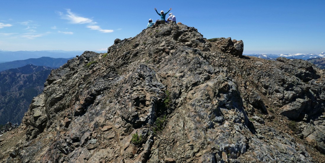
Almost ready to join BarbE, Sandra and rocman on the Teanaway Peak summit (6779').
|
|
After hiking a total of 3.2 miles we are on the Teanaway Peak summit... left to right... Sandra, BarbE, Karen, rocman, Sadie's Driver (blocking Mt. Rainier), MiddleE and Cooper (dog).
|
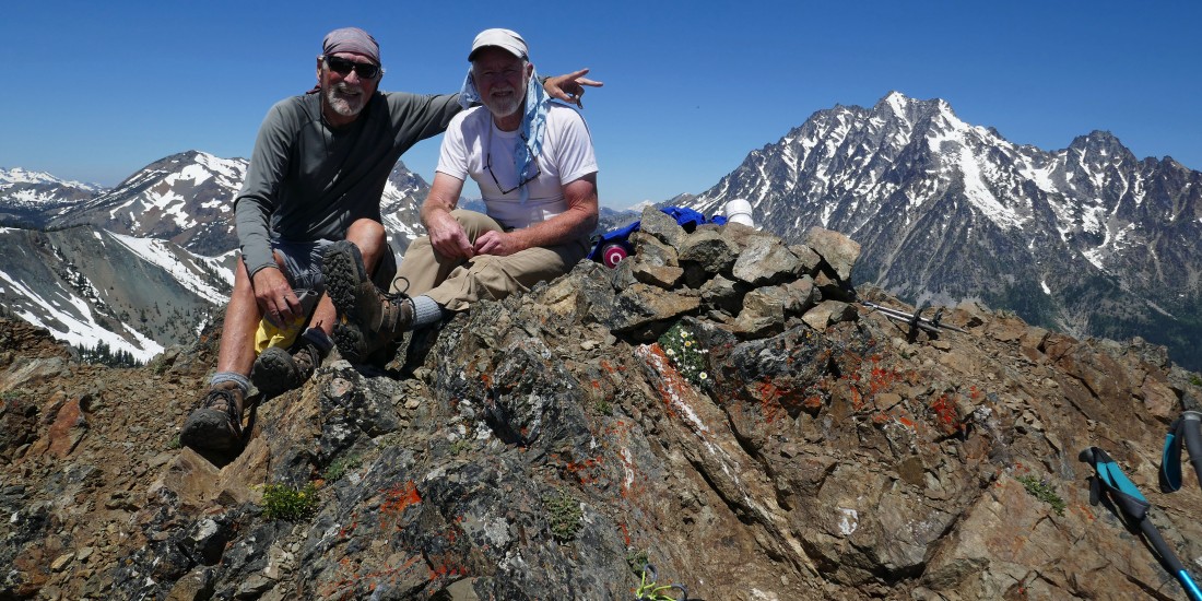
ragman and rocman... roommates at the University of Washington in 1973... and still reaching summits today!
|
Leaving the Teanaway Peak summit... with the Stuart Range on the horizon... left to right... Stuart, Sherpa, Argonaut, Colchuck, Dragontail, Little Annapurna and McClellan.
|
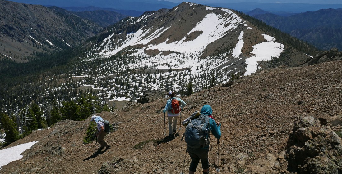
Tracing our steps back down the east ridge of Teanaway Peak... with Iron Peak (our next objective) beyond.
|
Now off of the east ridge of Teanaway Peak and tracing our steps across the SE side of the peak as we work our way back to Eldorado Pass.
|
|
After hiking a total of 3.5 miles we have returned to Eldorado Pass and are heading up to Iron Peak.
|
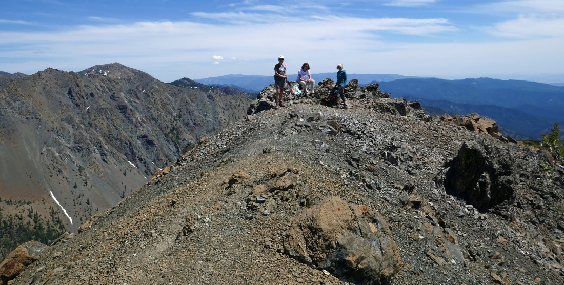
After hiking a total of 4.2 miles Karen, BarbE and Sandra are relaxing on the Iron Peak summit (6510')... looking beyond Marys Peak and Judis Peak on the ridge to the left to Earl Peak.
|
On the Iron Peak summit... looking at Mount Stuart and Sherpa Peak sitting between Teanaway Peak and Bills Peak in the foreground... foreground peaks on the far left include DeRoux and Hawkins... with distant peaks on the left including Hibox, Three Queens, Lemah, Chimney Rock and Daniel... with foreground peaks on the extreme far right being Devils Head and Volcanic Neck.
|
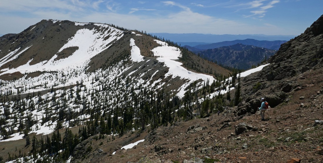
Tracing our steps back to Eldorado Pass... with Hawkins Mountain and the 5 summits of Esmeralda Peak in the foreground... with Mount Daniel (the high point in King County) the large snow covered mountain on the right center horizon.
|
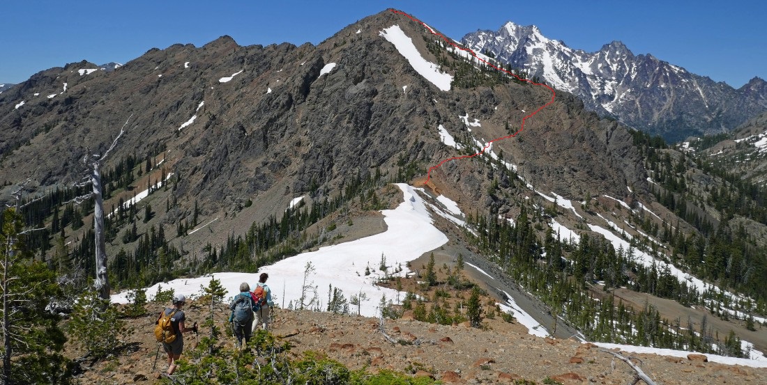
Almost back to Eldorado Pass as we get a pretty good look at the route we took from the pass to reach the summit of Teanaway Peak... from the pass we will make the 2.75 mile hike back to our cars... making the entire hike a 7.5 mile adventure, gaining 3088 feet of elevation.
|
