Lost Horse Mountain and Lost Horse Mine - 1.24.2022
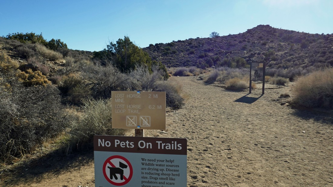
We parked at the trailhead for the Lost Horse Mine... located at the end of the Lost Horse Mine Road.
|
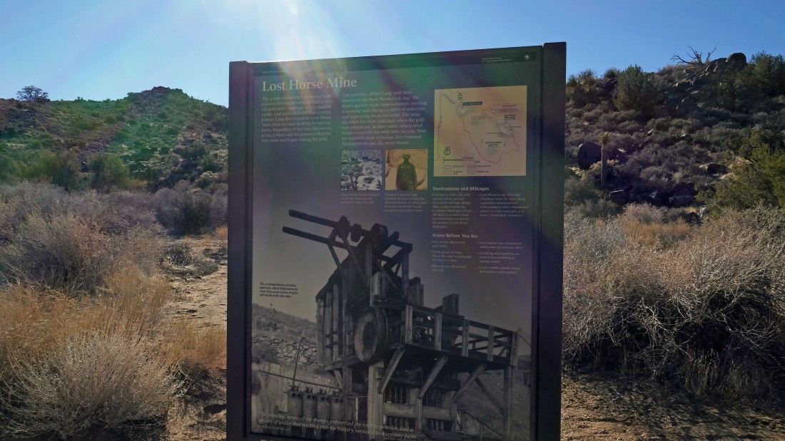
An information board at the trailhead for the Lost Horse Mine... history says that cowboy Johnny Lang discovered the gold mine in 1893 when he was looking for his lost horse.
|
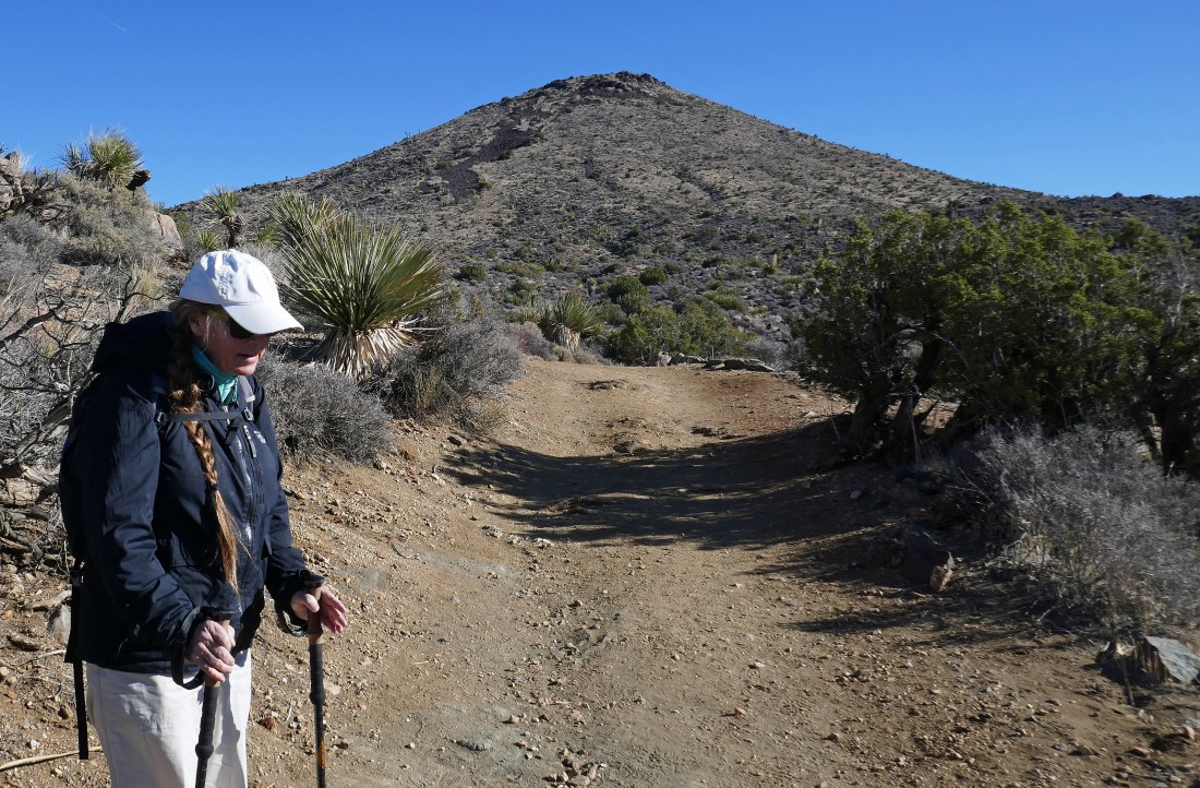
The road is closed at the trailhead, but acts as a trail now that continues 2 more miles to the mine... the bump out there in the distance is Point 5196.
|
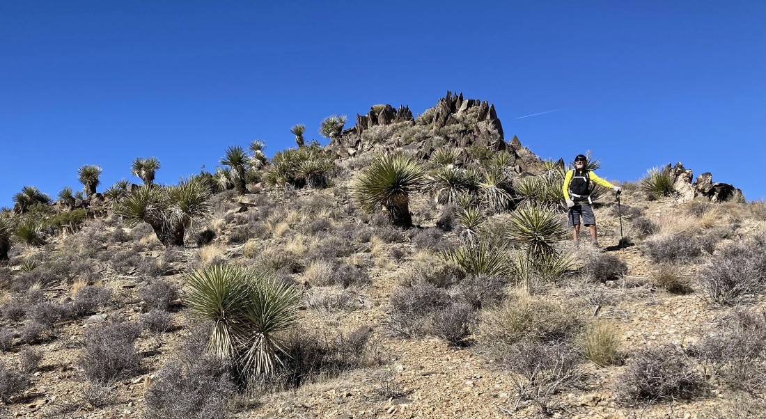
Hiking on the road (or is it a trail) in search of the Lost Horse Mine.
|
Looking back as we continue hiking... San Gorgonio Mountain is the snow covered peak on the horizon... Quail Mountain (the high point in Joshua Tree National Park) is the brown mountain in the center of the photo.
|
|
Continuing to gain elevation on the Lost Horse Mine Trail... with Ryan Mountain and Queen Mountain beyond the light brown bump in the far left foreground.
|
After hiking a total of 2 miles we have reached the Lost Horse Mine.
|
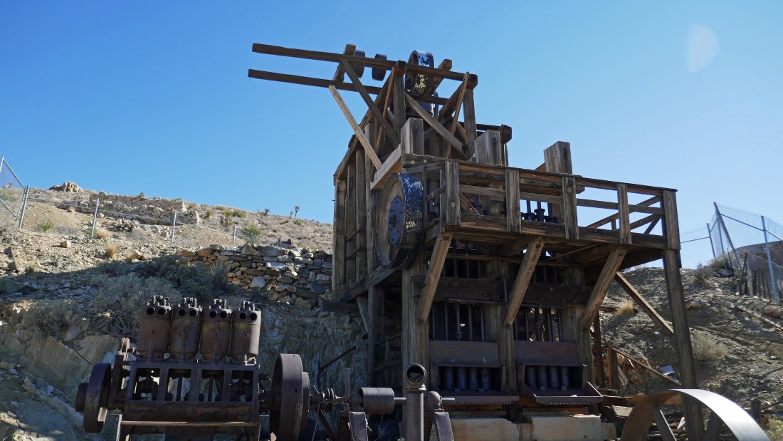
A closer look at the gold mine.
|
I gained another 100 feet of elevation up to Point 5188 and took this shot looking down on the mine... next we will hike up to the summit of Lost Horse Mountain (not in photo) and return to the car via the ridge in the foreground across the valley... San Jacinto Mountain is the snow covered peak on the left horizon... and San Gorgonio Mountain is the snow covered peak on the right horizon.
|
Looking north from Point 5188 to Ryan Mountain and Queen Mountain on the far left... and east to Malapai Hill which is the out-of-place pile of black rock in the right center of the photo.
|
|
Standing on Point 5188... now we will head over to the base of Lost Horse Mountain on the far left... climb up to the summit and then follow the ridge that runs left to right across the photo to get back to the car.
|
Denali Girl nears the little pass between Point 5188 and Lost Horse Mountain.
|
Denali Girl working her way up to join me on the summit of Lost Horse Mountain... the gold mine is visible in the dead center of the photo... with Ryan Mountain in the left center of the photo... Queen Mountain on the right center of the photo... and the Wonderland of Rocks to the left of Ryan Mountain.
|
After hiking a total of 2.5 miles Denali Girl is standing on the summit (5313') of Lost Horse Mountain... needless to say, the views are very broad... the red line shows our route up from the gold mine and the route that will follow the ridge back to the car.
|
From the Lost Horse Mountain summit... looking SW across the Little San Bernardino Mountains to the San Jacinto Mountains on the far left horizon... and NW to the snow covered San Gorgonio Mountain on the right horizon.
|
|
From the Lost Horse Mountain summit... looking south across the Little San Bernardino Mountains to the Santa Rosa Mountains on the center horizon... and SW across the Little San Bernardino Mountains to the San Jacinto Mountains on the right horizon.
|
Hiking NW from the Lost Horse Mountain summit... following the ridge that will take us over to Point 5288 as we work our way back to the car.
|

Looking down on the Lost Horse Mine as we hike along the ridge that connects Lost Horse Mountain to Point 5288.
|
Continuing to hike along the ridge... looking north to Ryan Mountain and Queen Mountain in the distance on the left... and looking NE across the desert to the Pinto Mountains on the right.
|
Still on the ridge... heading for Point 5288 in the right foreground.
|
|
Looking back at Lost Horse Mountain... and you can see the gold mine just below Point 5188 on the far left.
|
Denali Girl took this shot of me along the ridge on what we felt was like a fault line.
|
After hiking a total of 3.4 miles we are standing on the summit of Point 5288 and looking back at Lost Horse Mountain in the right foreground.
|
Standing on Point 5288 and continuing to hike along the ridge... looks like 3 more bumps to deal with in the next mile of hiking that will get us back to the car.
|
Finally we can see the parking lot... the total hike was 4.5 miles, gaining 1107 feet of elevation... half of the hike was on a trail... and the other half was cross-country.
|
