Norton Peak - 8.18.2023
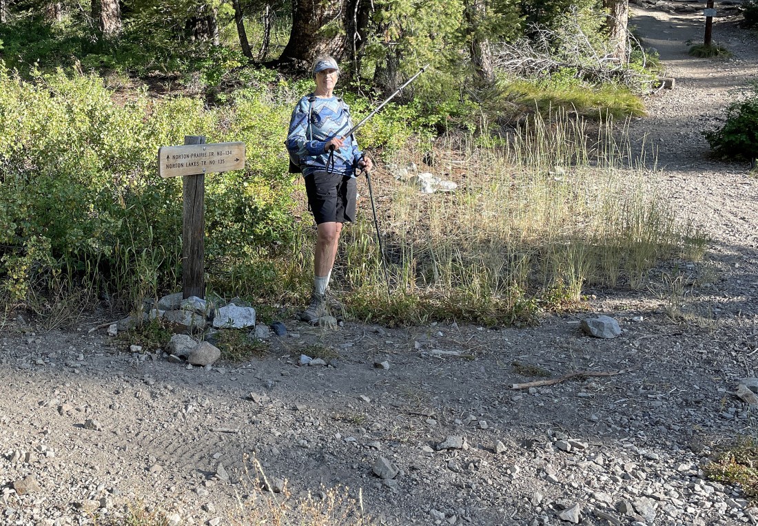
We drove north on Hwy 75 from Ketchum, Idaho for 15.2 miles... then turned left on Baker Creek Road and drove 5.7 miles... where we turned right on a road that went .9 miles to the trailhead for Norton Lakes Trail #135.
|
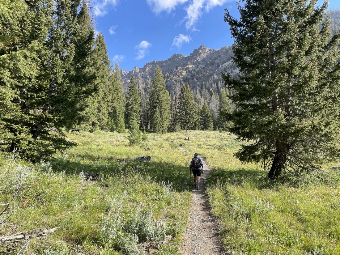
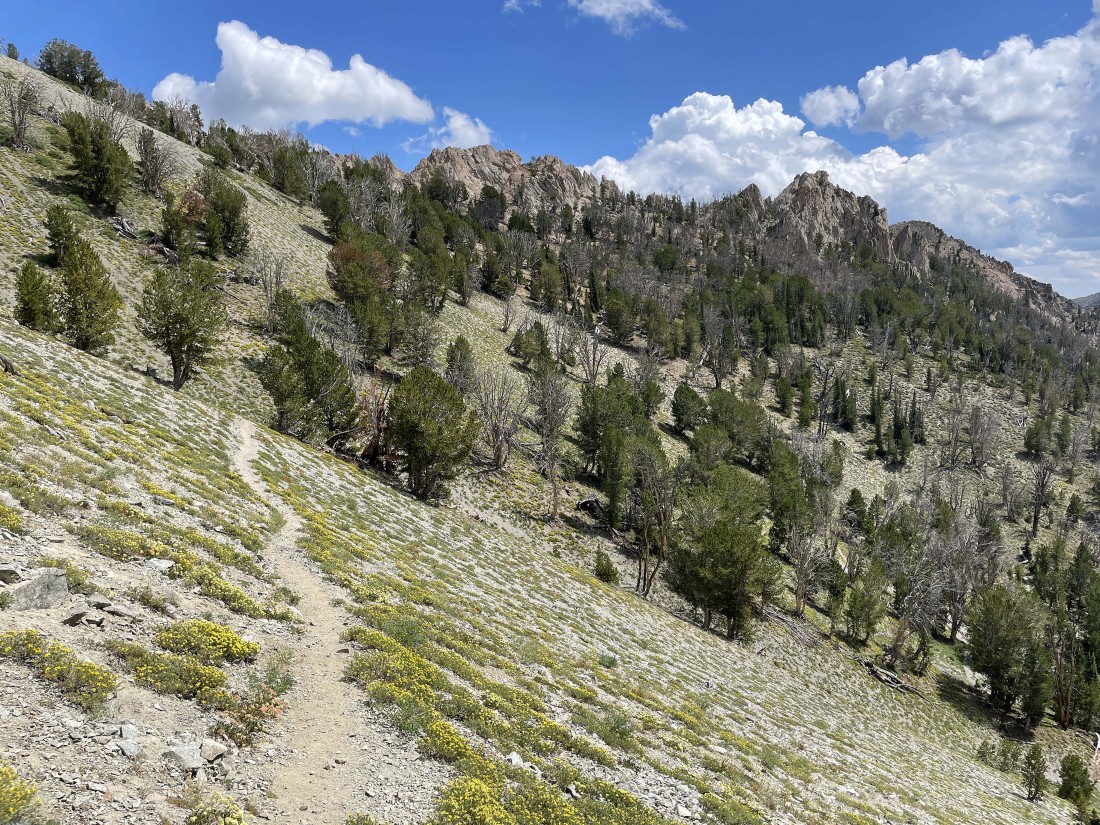
Hiking up the Norton Creek drainage with mountains on both sides of the drainage.
|
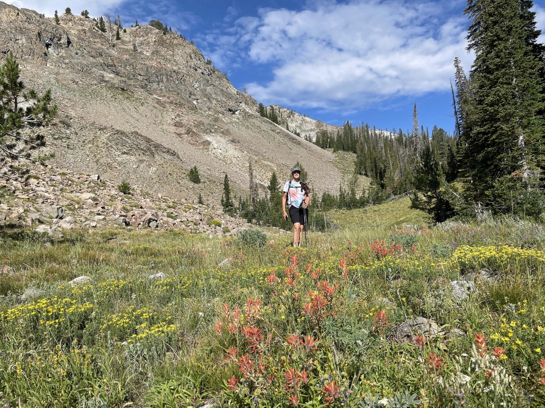
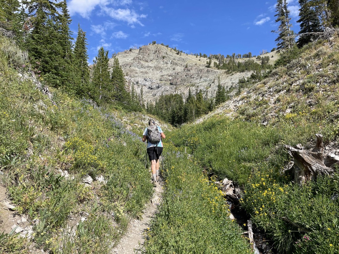
Denali Girl standing in a field of paintbrush and a yellow flower that I am not familiar with as we continue hiking up toward Norton Lakes.
|
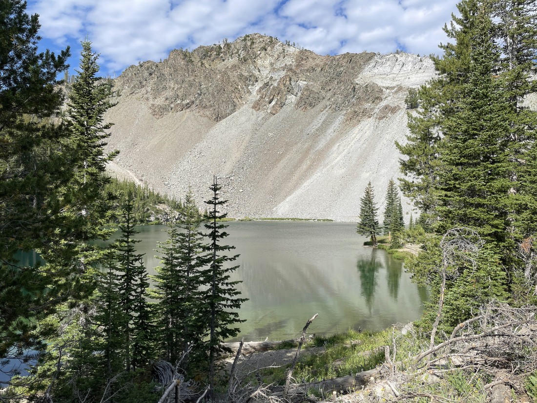
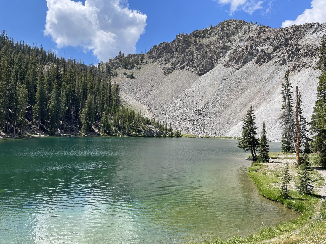
After hiking a total of two and a quarter miles we arrived at the Lower Norton Lake.
|
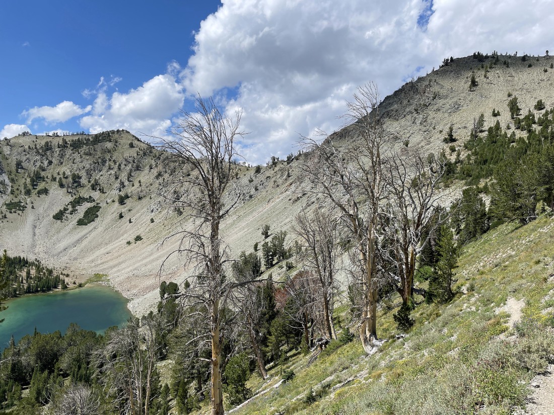
We have left the lower lake and are heading up to Upper Norton Lake... where Denali Girl will relax while I continue on up to the ridge above in search of Norton Peak.
|
|
After hiking a total of 2.5 miles we have reached Upper Norton Lake... where I will continue switchbacking my way up to the ridge on the far right.
|
Switchbacking my way above Upper Norton Lake... with every step bringing more mountains into view.
|
Continuing to switchback my way up to the ridge... with both Norton Lakes in view now.
|
Almost on the ridge now... I can see the lower lake, but not the upper lake.
|
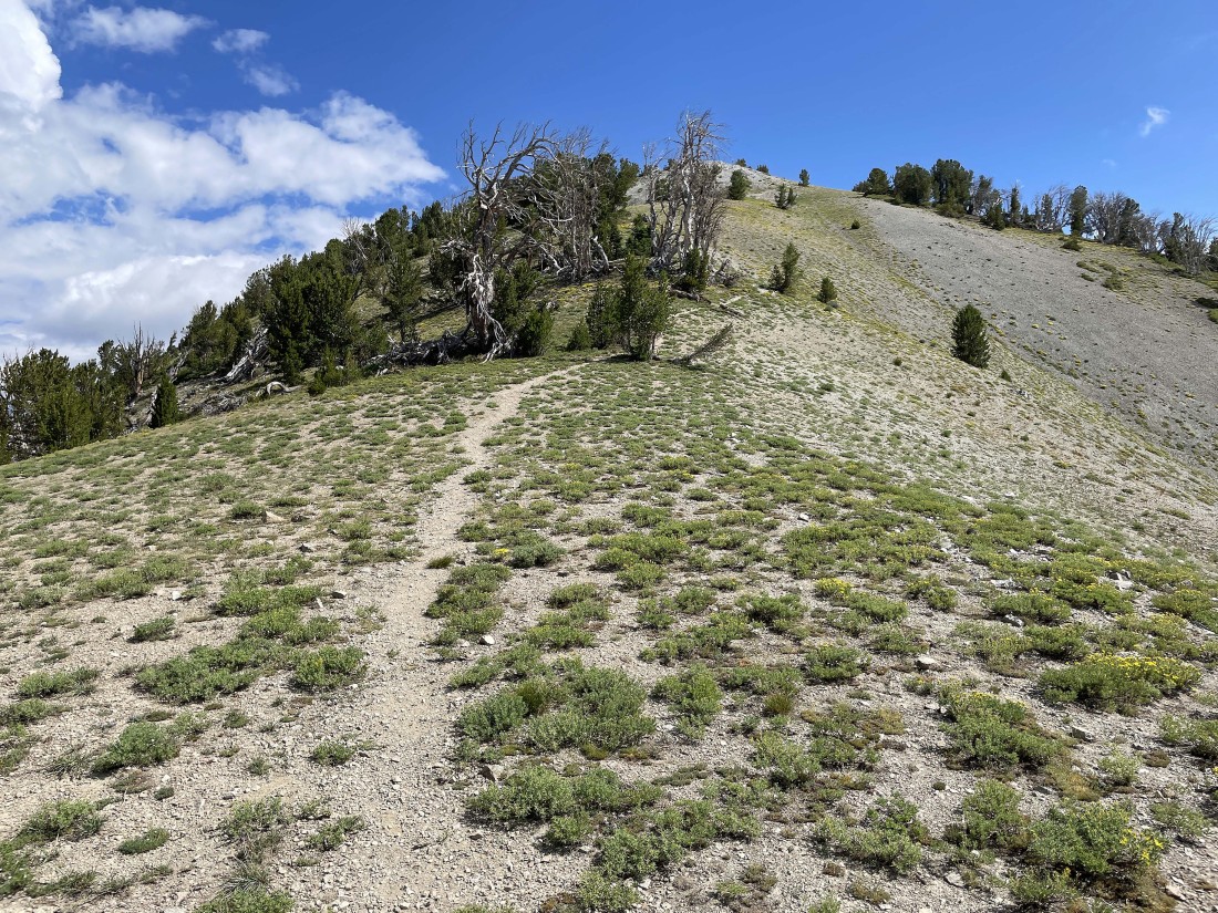
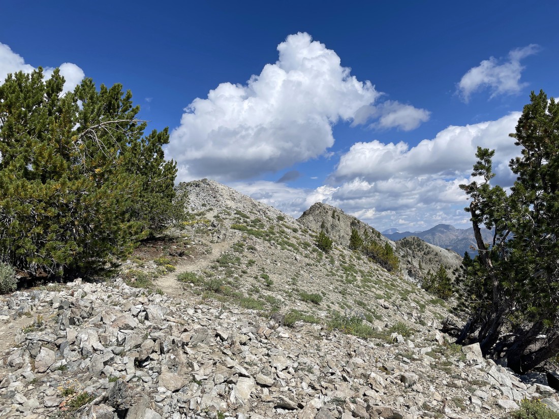
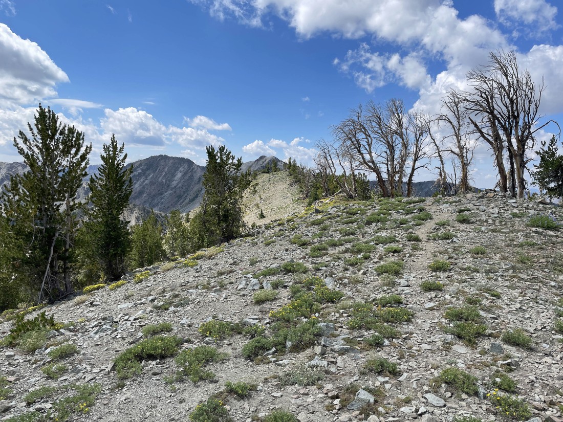
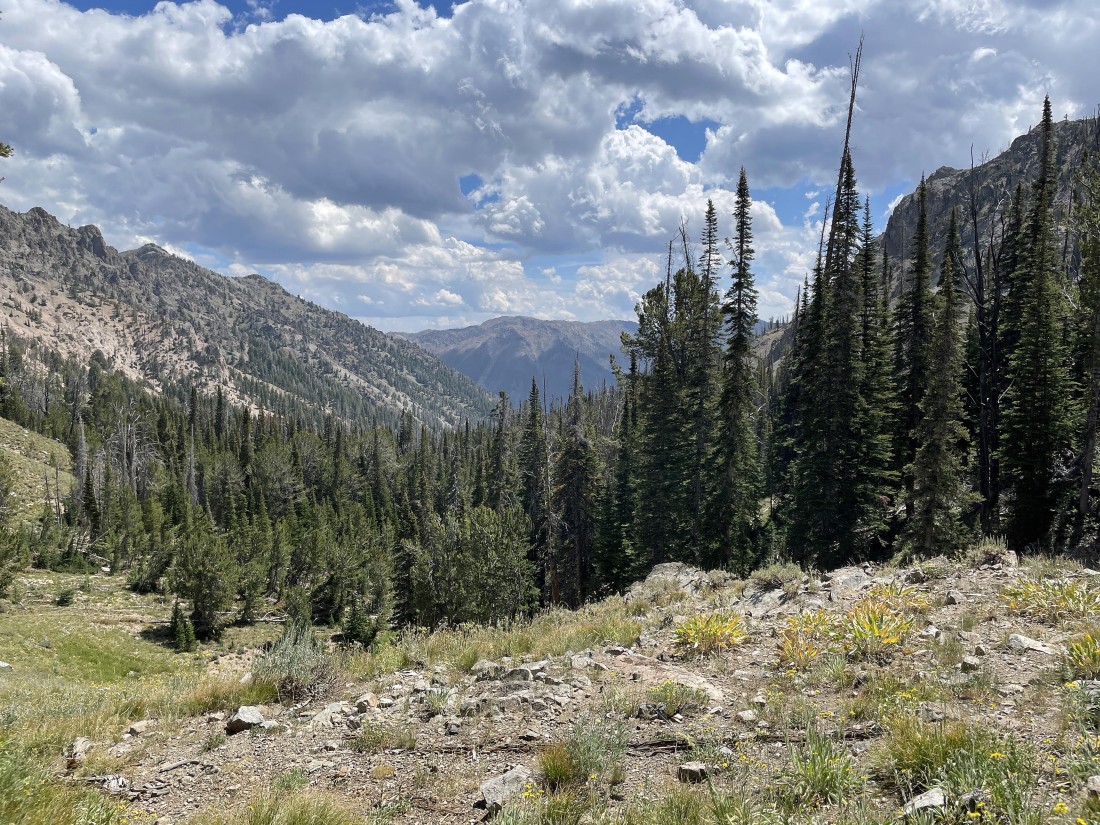
After hiking a total of 3.4 miles I have reached the low point on the ridge that separates the Norton Creek drainage and Miner Canyon... I can't see Norton Peak yet... but I will see it shortly as I continue hiking north along the ridge.
|
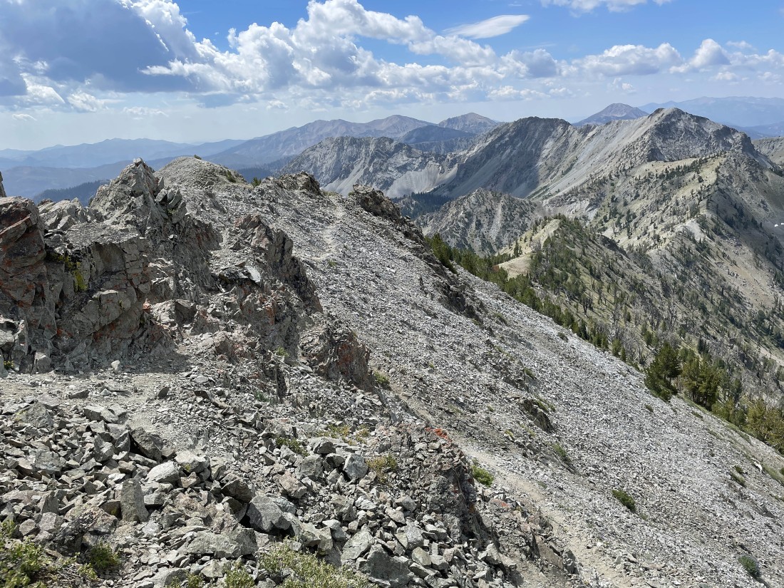
Nearing the south ridge of Norton Peak as the views broaden... looking back down on the right where the switchbacks put me on the ridge.
|
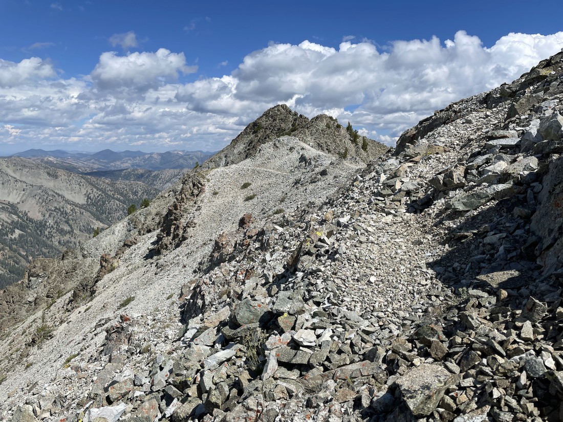
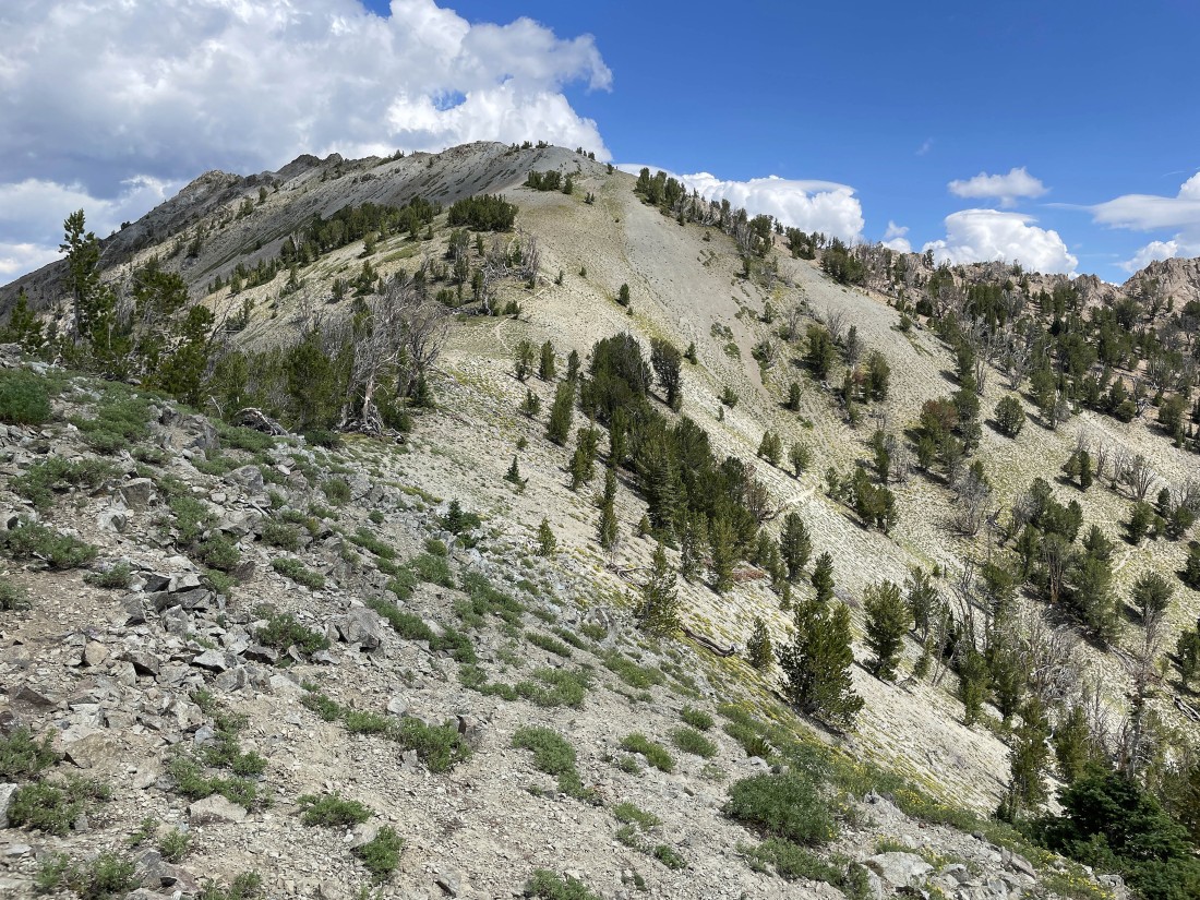
I have reached the south ridge of Norton Peak... and I think I can see the summit out there.
|
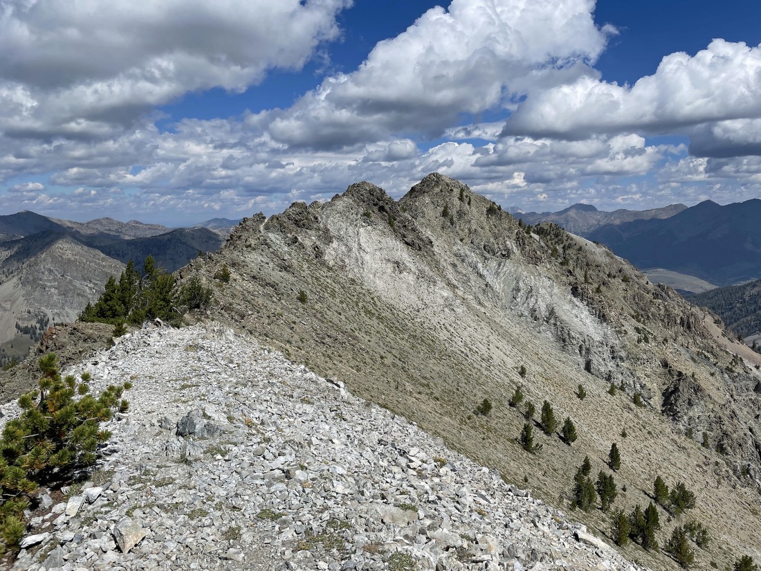
That was definitely the Norton Peak summit that I saw in the previous photo... but it looks like there will be a bit more work remaining to get over there.
|
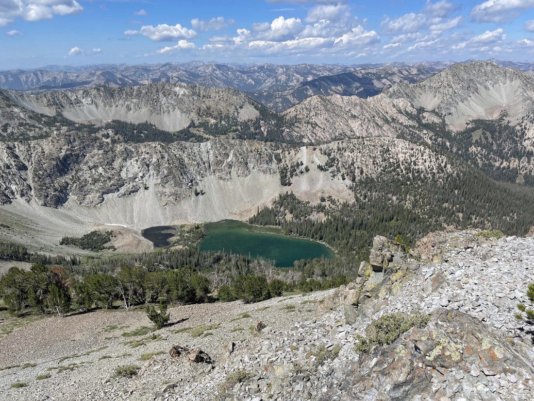
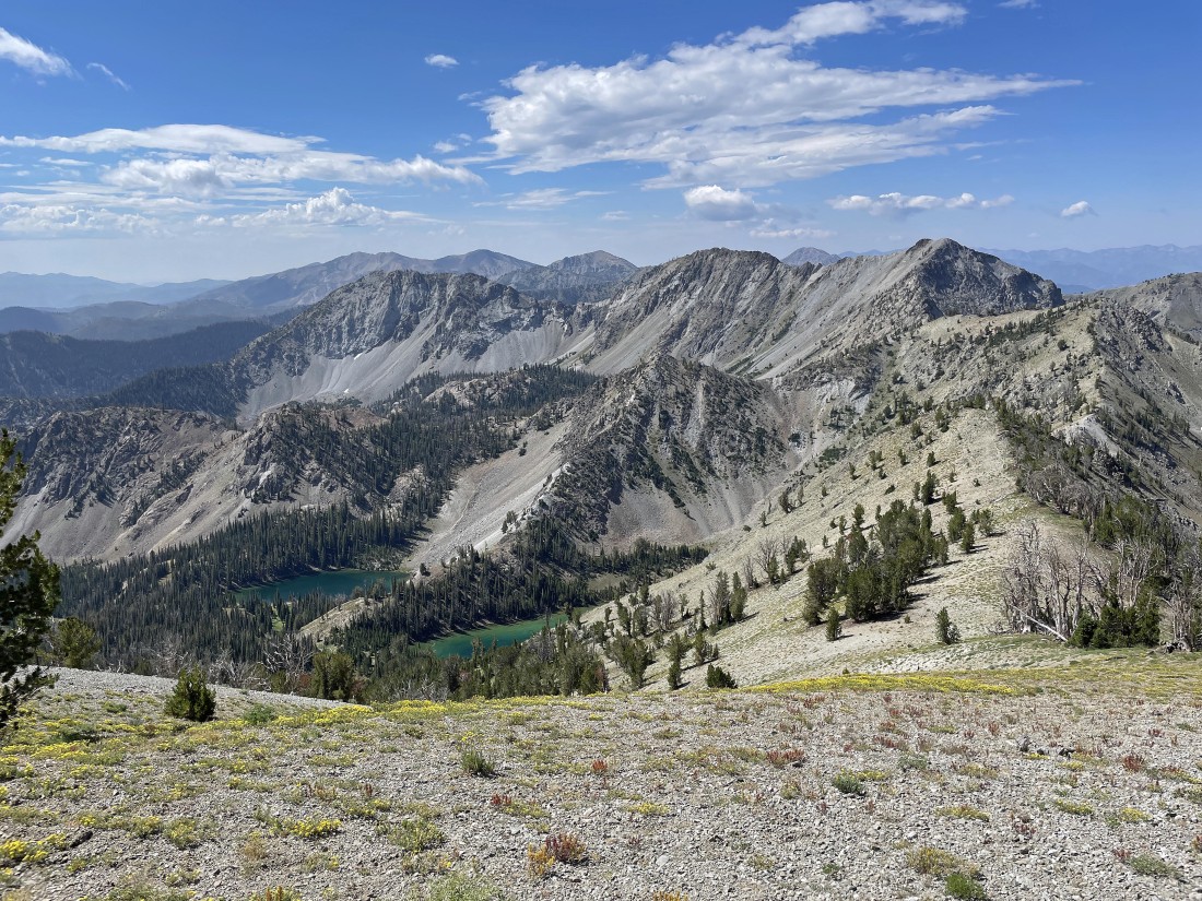
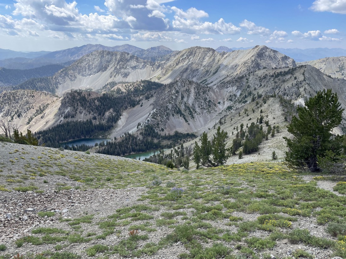
Looking down on Miner Lake and Miner Canyon from the south ridge of Norton Peak.
|
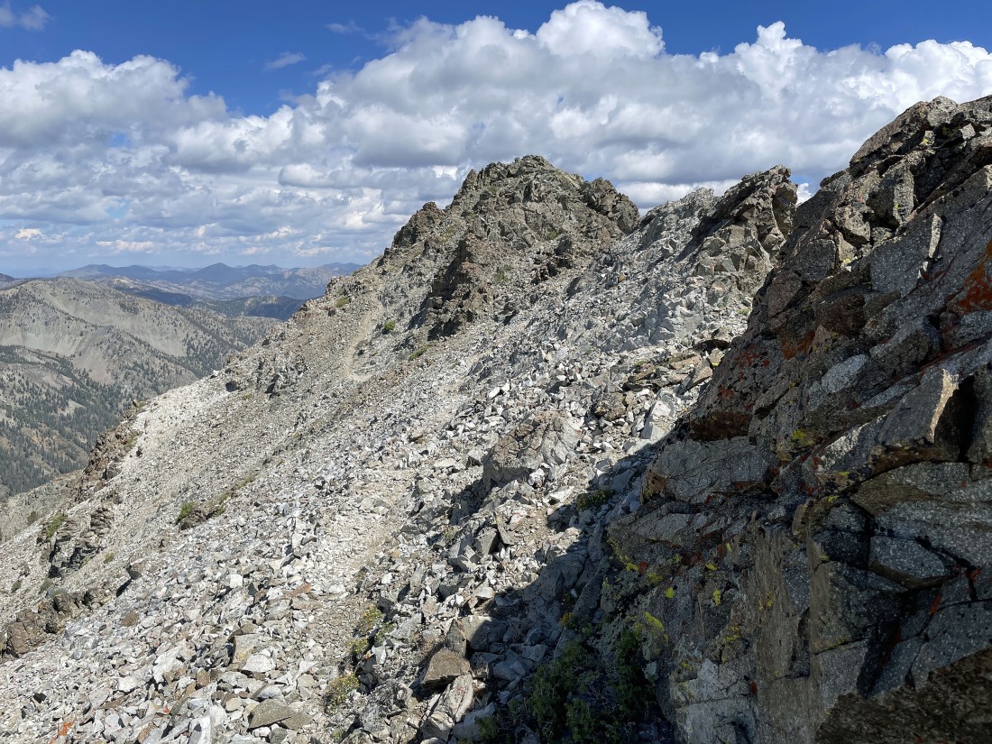
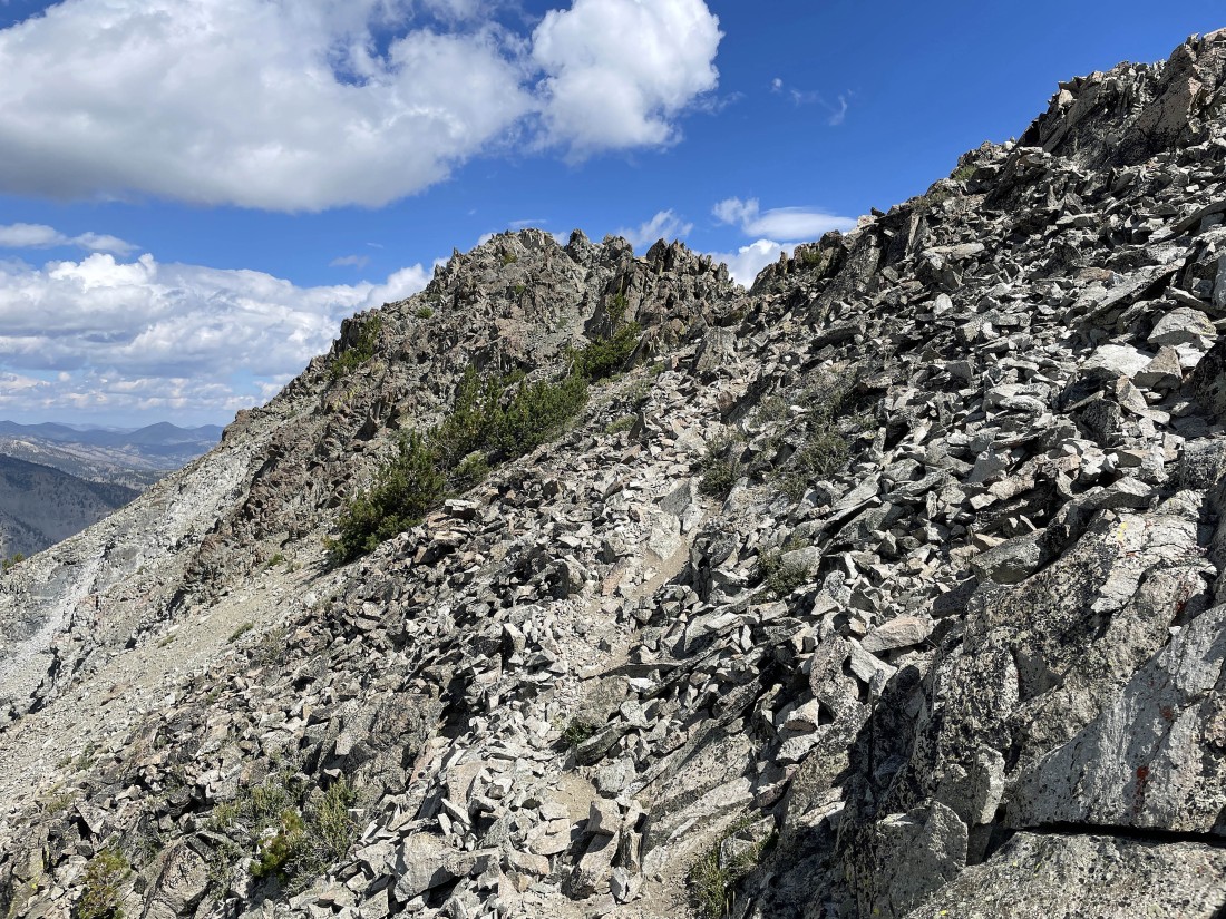
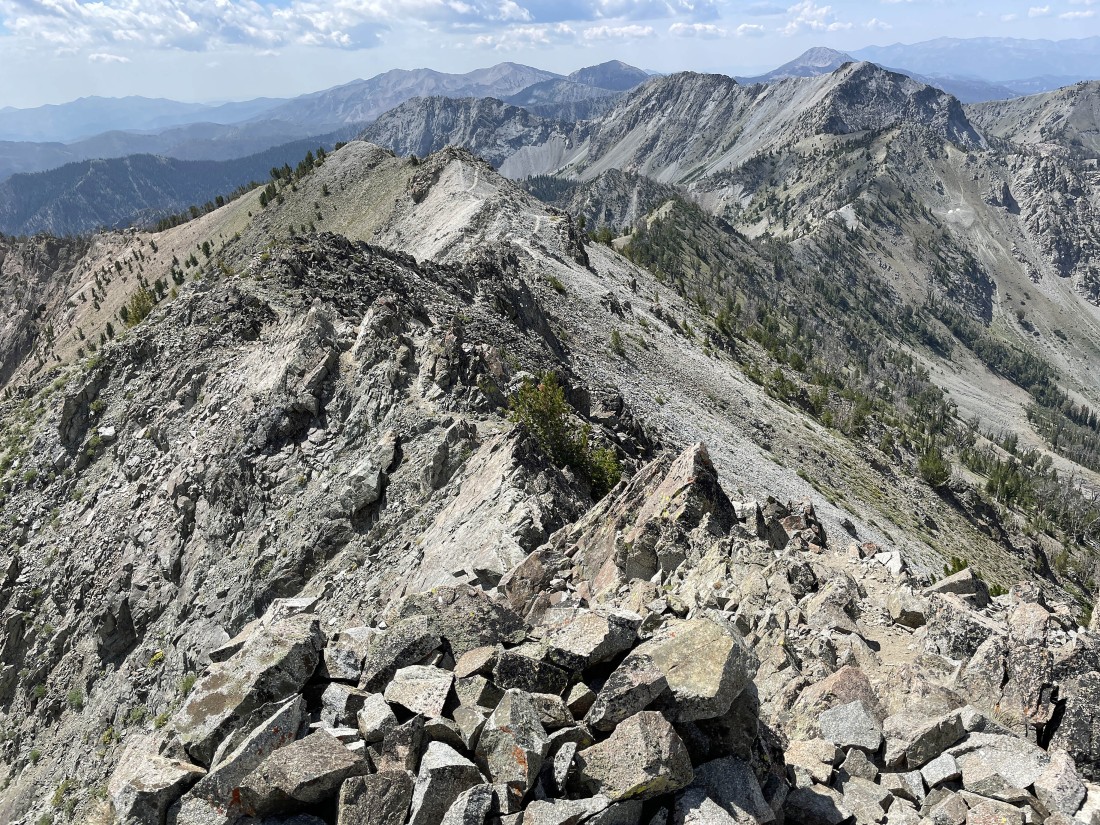
Continuing to hike along the south ridge of Norton Peak... reeling in the Norton Peak summit.
|
Definitely a few ups and downs along the south ridge of Norton Peak.
|
Getting closer to the summit of Norton Peak.
|
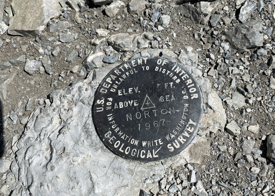
After hiking a total of 3.9 miles I am standing on the 10,336 foot summit of Norton Peak.
|
From the summit... looking west (left), north (middle) and east (right).
|
From the summit... looking east (left), south (middle) and west (right).
|
A closer look at the unnamed area on the east side of Norton Peak.
|
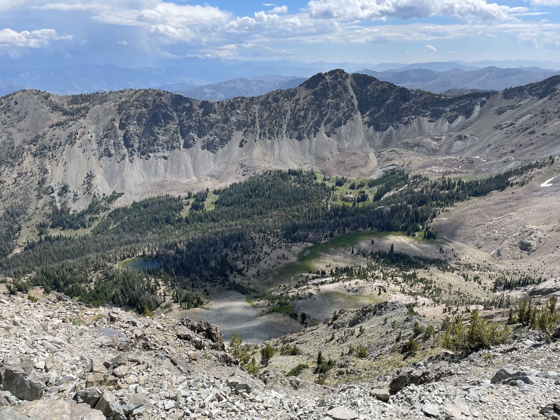
A closer look at Miner Canyon and Miner Lake on the west side of Norton Peak.
|
Time to leave the summit and trace my steps back along the south ridge of Norton Peak.
|
Continuing to trace my steps back along the south ridge of Norton Peak.
|
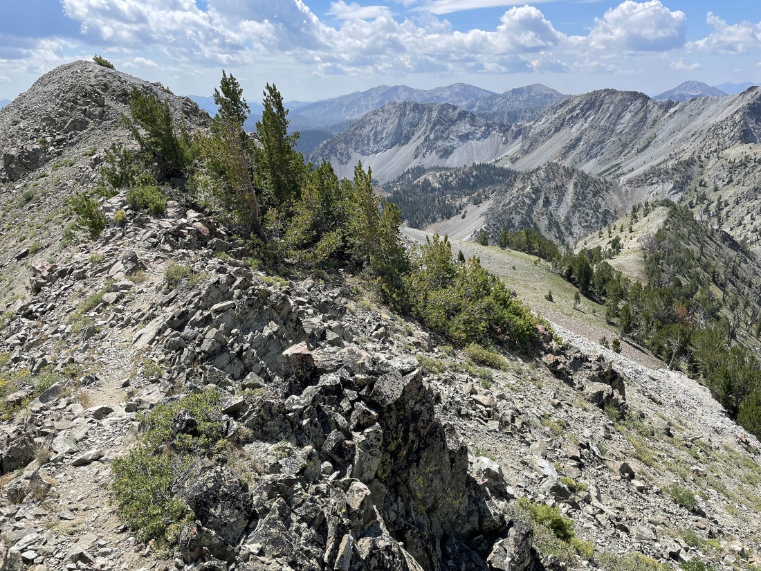
Continuing to trace my steps back along the south ridge of Norton Peak... I have a good view out there on the far right of where I reached the ridge above Upper Norton Lake.
|
On the right I'm almost back to the spot where I switchbacked my way up to the ridge from Upper Norton Lake... and when I get down there I'm going to take the 3 minute stroll over to the high point directly above the upper lake.
|
I'm back to where the switchbacks got me up to the ridge... and now I'm heading over to the high point above Upper Norton Lake.
|
Nearing the high point directly above Upper Norton Lake I'm looking back at the ridge hike that got me over to Norton Peak on the far left horizon.
|
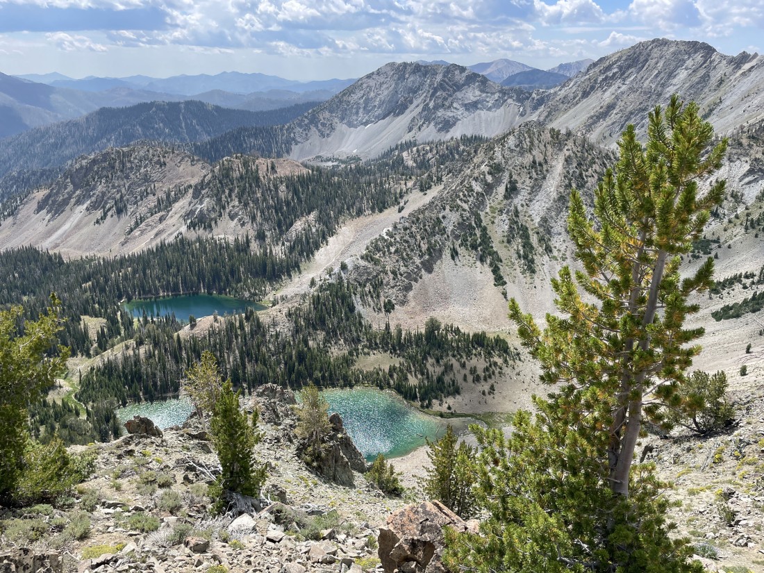
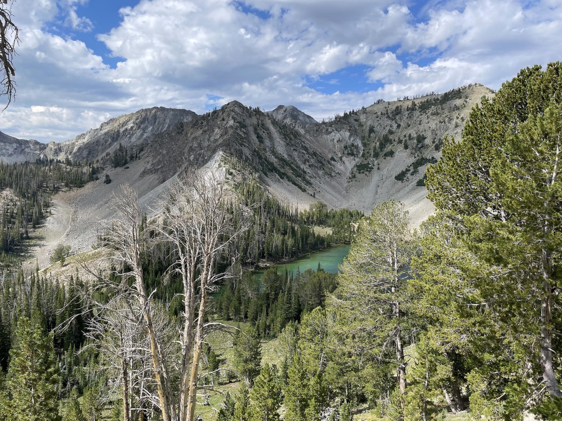
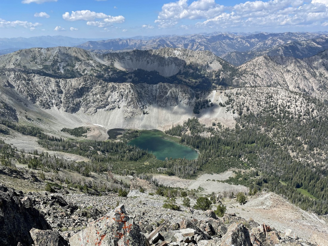
Looking down on Norton Lakes from the high point directly above the upper lake.
|
A pano shot from near the high point above Upper Norton Lake... with the Norton Peak summit on the far left horizon.
|
I have returned from the high point above Upper Norton Lake and begun to trace my steps back down the switchbacks to Upper Norton Lake.
|
Continuing to hike down the switchbacks leading to Upper Norton Lake... with the high point I recently visited up there on the far right.
|

After hiking a total of 5.6 miles I have returned to Upper Norton Lake.
|
After hiking a total of 5.9 miles I have returned to Lower Norton Lake.
|
I have left the lower lake... leaving a two and a quarter mile hike back down to the car... the total hike was 8.1 miles, gaining 2758 feet of elevation.
|
