Misery Ridge Peak - 11.10.2023
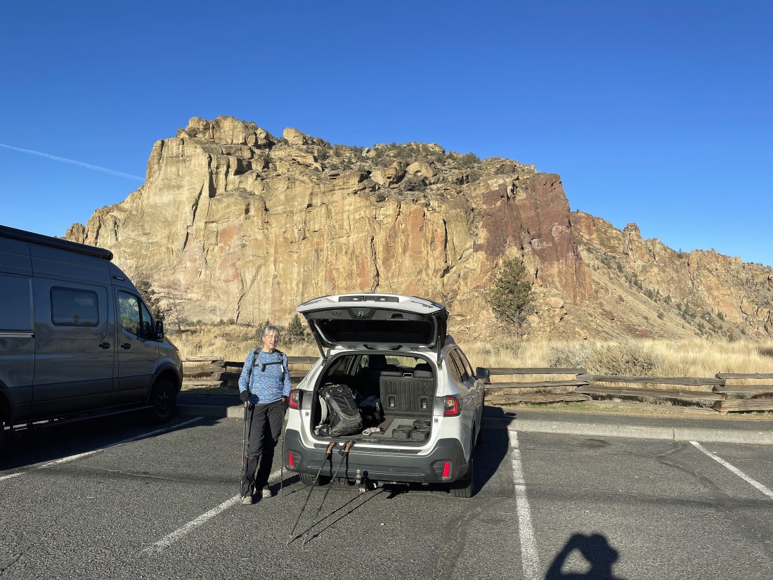
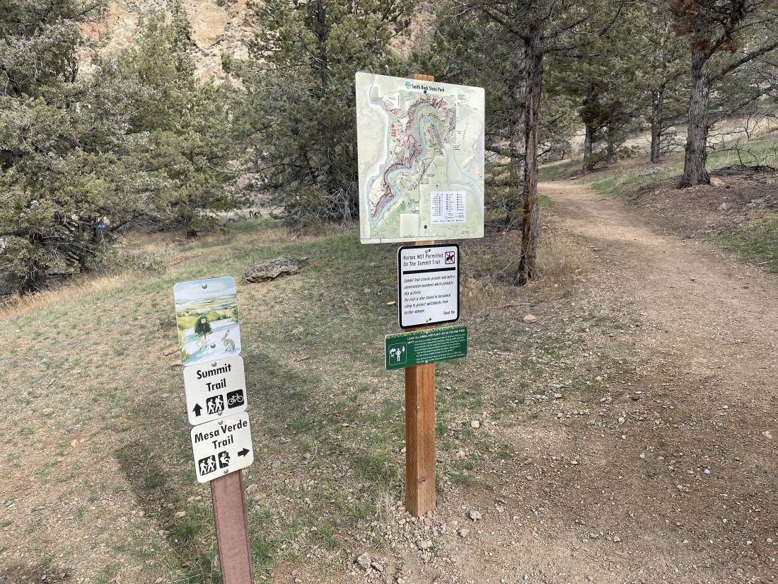
We parked on NE Crooked River Drive in Smith Rock State Park... located in Terrebonne, Oregon... and paid the $5 parking fee. In the distance is the 'Picnic Lunch Wall'... with Misery Ridge on top of it.
|
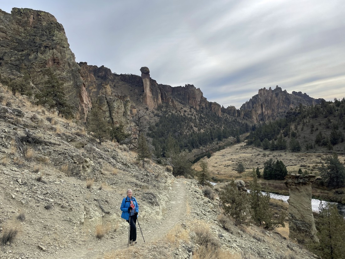
We left the parking lot one minute ago and are getting ready to give up 200 feet of elevation to reach the bridge crossing of the Crooked River. The entire rock formation on the far left is named 'Smith Rock'... with the 'Picnic Lunch Wall' in the foreground... and 'Shiprock' is the dark brown rock formation just to the left of 'Picnic Lunch Wall'.
|
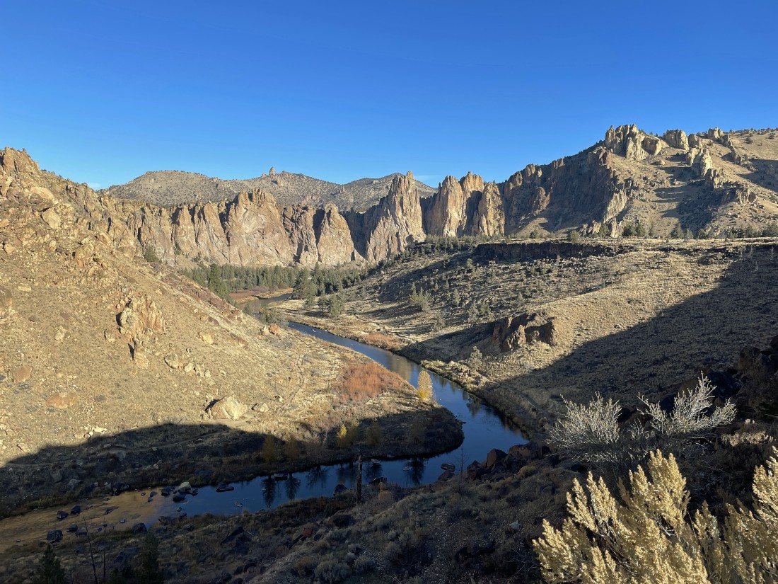
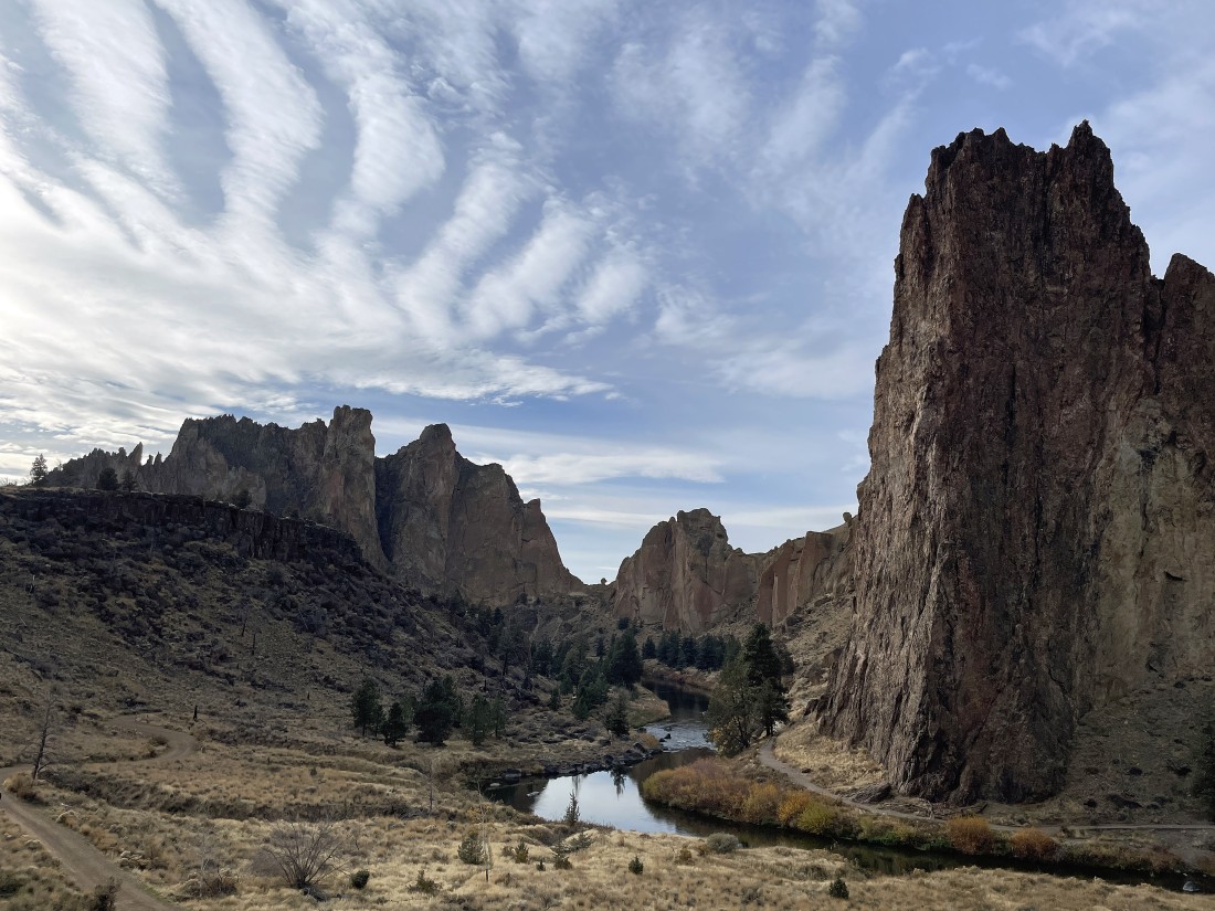
Giving up elevation and looking NE along the Crooked River at some of the awesome rock formations in the park.
|
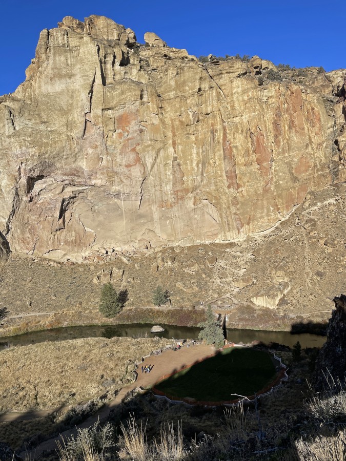
Heading down to the bridge crossing of the Crooked River... and looking over at the 'Picnic Lunch Wall'.
|
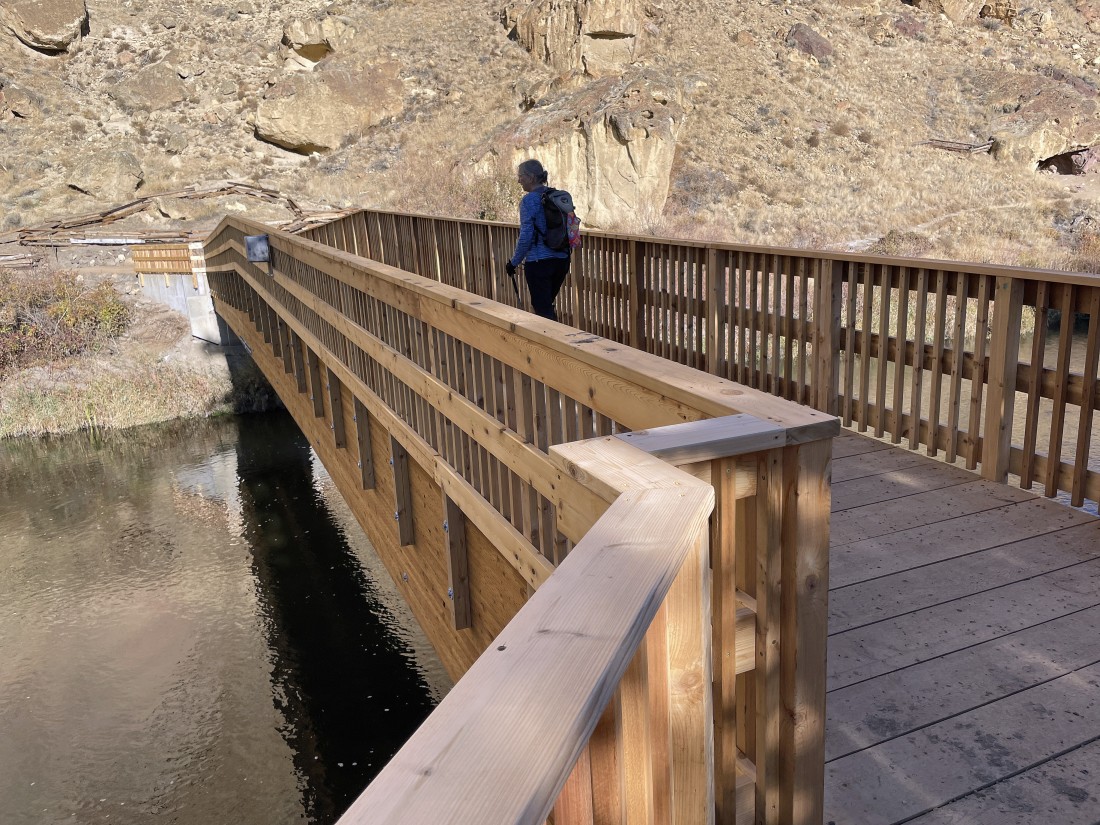
Denali Girl is crossing the Crooked River on the new bridge that was constructed this year.
|
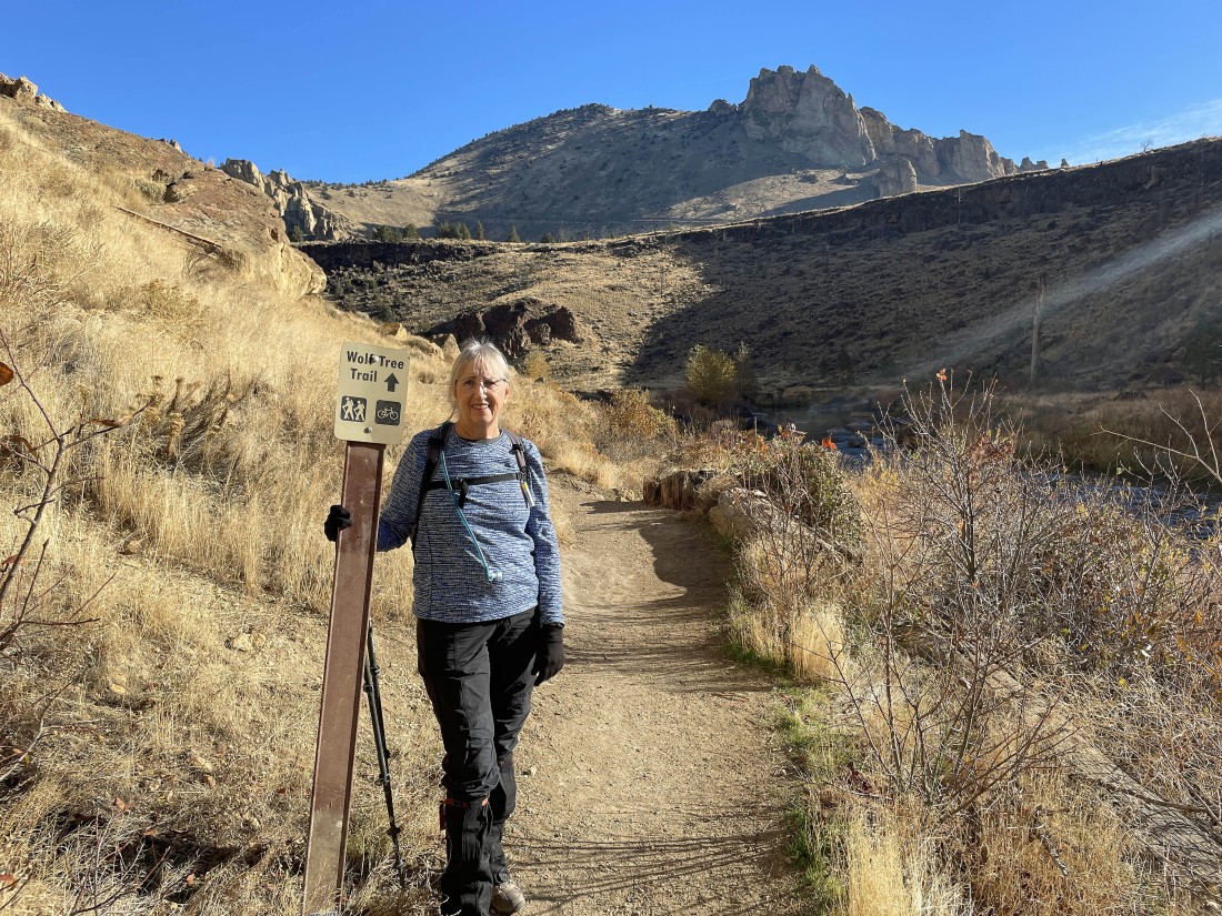
Immediately after crossing the bridge we are turning to the right (NE) and starting to hike along the Crooked River on the Wolf Tree Trail... with the Marsupial Crags on the horizon.
|
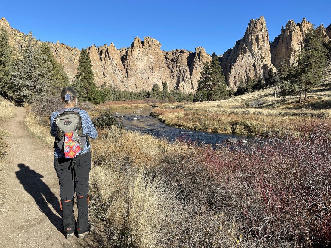
Continuing to hike on the Wolf Tree Trail as it follows along the Crooked River... with the rock formations on the far right referred to as the 'Monument Area'.
|
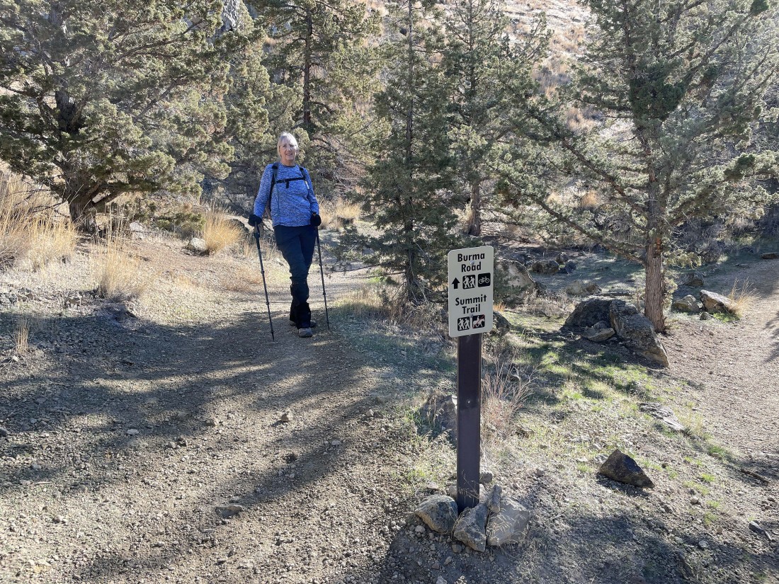
After hiking a total of 1.2 miles it is time to leave the river and head uphill in search of Burma Road and the Summit Trail.
|
On our way up to Burma Road which will take us up to our high point for the day where we will connect with the 'Summit Trail'.
|
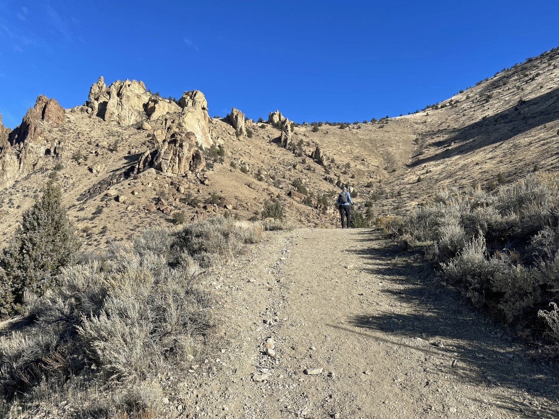
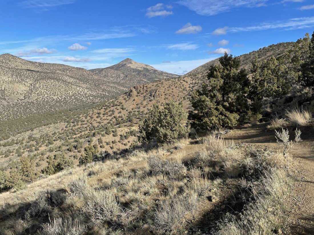
After hiking a total of 1.6 miles we are out of the park and gaining elevation on the Burma Road... heading for our high point of the day up there on the horizon in the center of the photo.
|
|
Still gaining elevation on the Burma Road... here looking back into the park... with Misery Ridge in the left center of the photo.
|
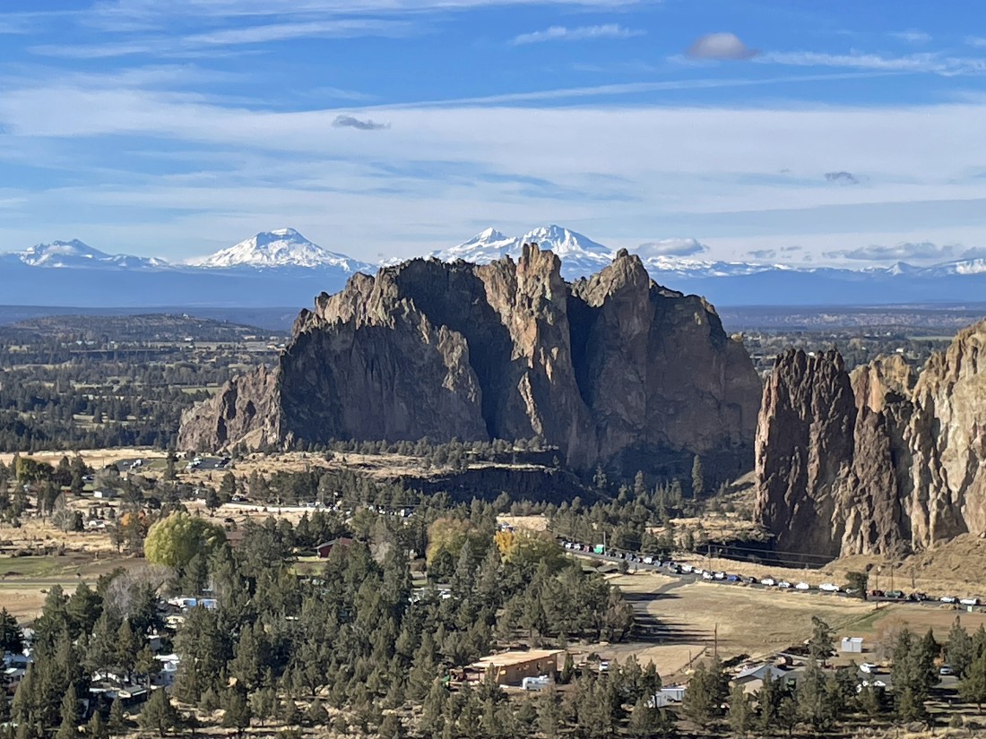
A closeup... looking beyond the Smith Rock formation to the Cascade Mountains on the horizon... left to right... Broken Top, South Sister, Middle Sister and North Sister.
|
A pano taken from the same place as the previous photo... still gaining elevation on the Burma Road.
|
Still on the Burma Road... and almost to our high point fro the day.
|
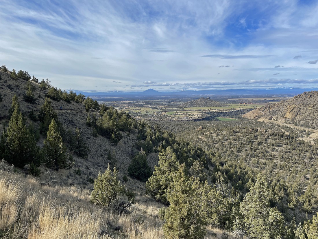
After hiking a total of 2.5 miles we have reached our high point (3580') for the day... here looking west beyond the park, Terrebonne and Sisters to the Cascade Mountains on the horizon.
|
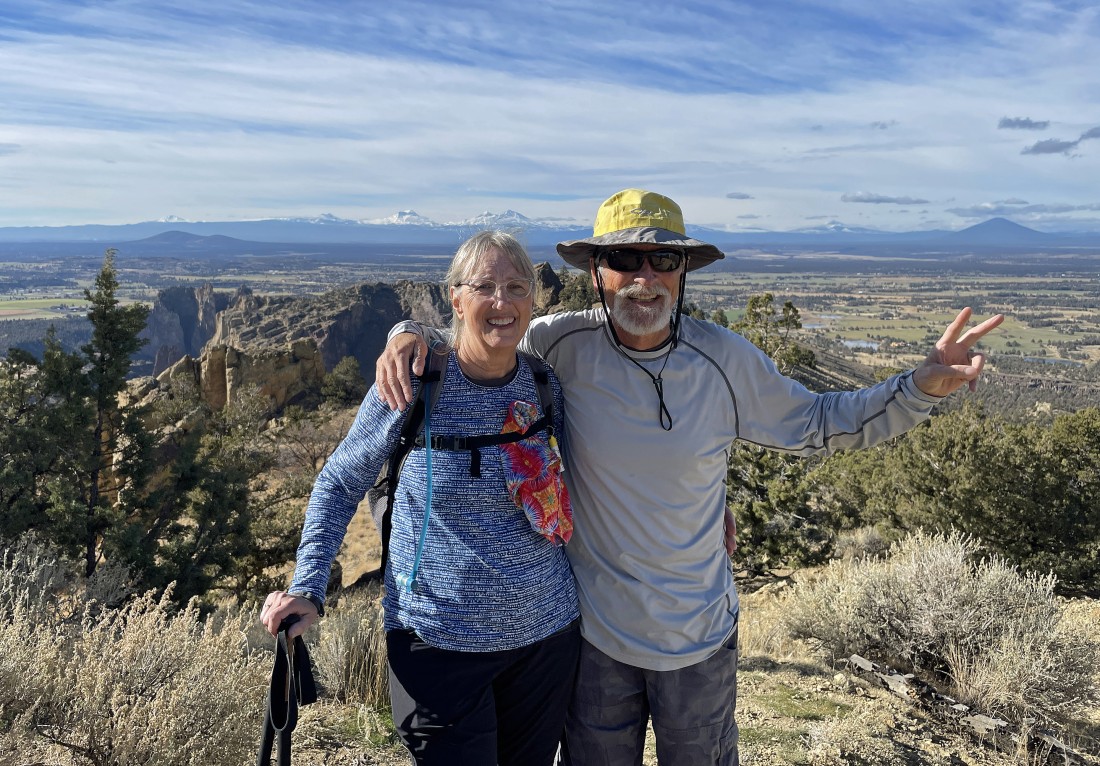
Greetings from Denali Girl and ragman from our high point for the day... that is Black Butte in the distance on the far right (above my peace sign).
|
From our high point we have started hiking downhill on the 'Summit Trail' as we switchback our way back down near the Crooked River... and that is Gray Butte in the distance.
|
Continuing to switchback our way down near the Crooked River... with a large portion of the Crooked River National Grassland in the distance. Black Butte stands out on the horizon.
|
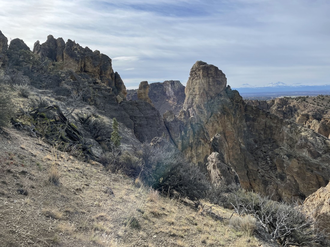
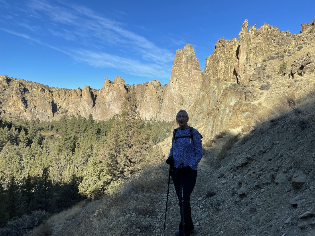
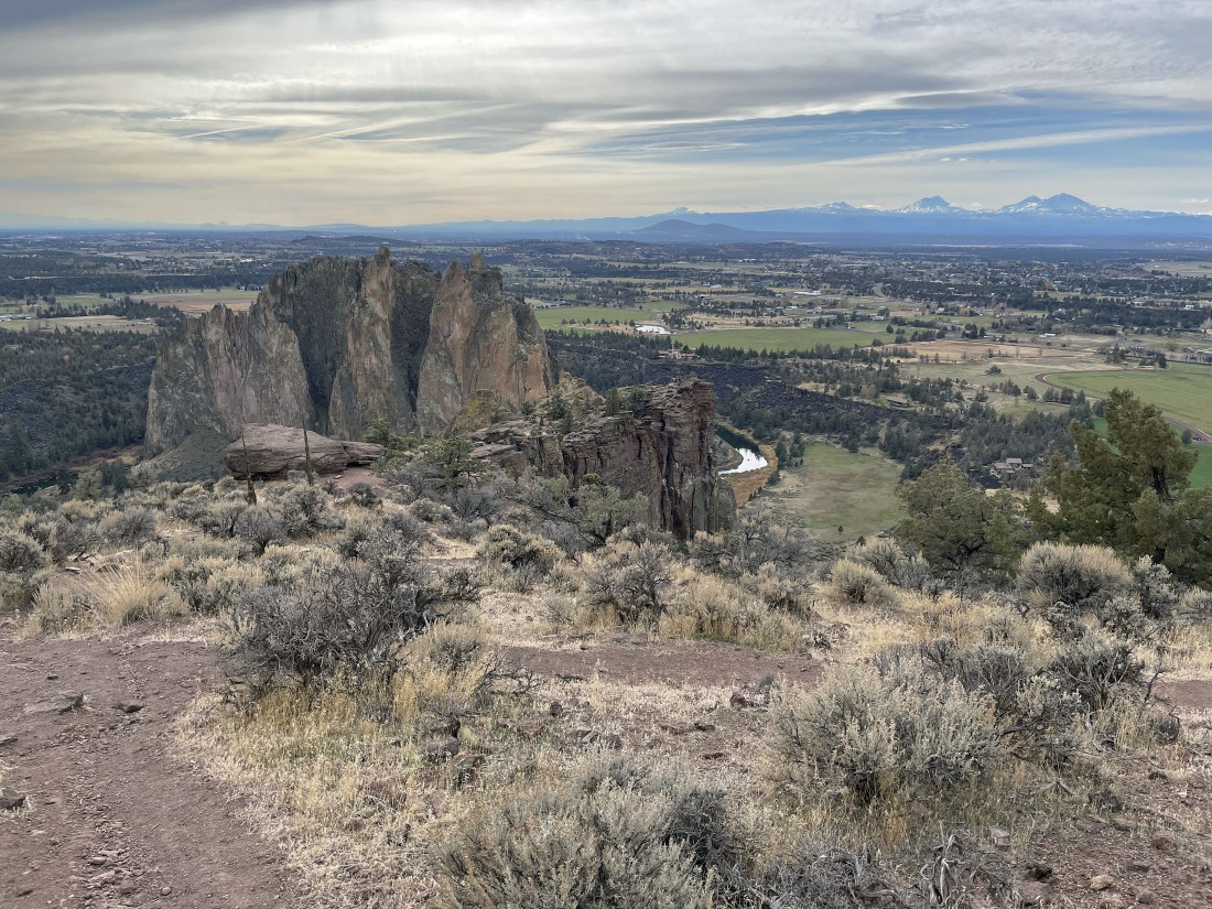
Earlier on our hike we were on the south side of the park... now we are on the north side of the park... and our next target is Misery Ridge Peak which is visible looking through the gap in the foreground out to the horizon in the center of the photo.
|
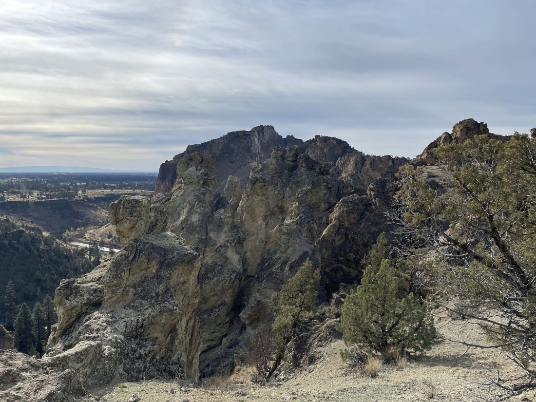
Misery Ridge Peak is waiting for us.
|
Looking back to where we came from as we continue to lose elevation.
|
Looking south as we continue to lose elevation on the north side of the park.
|
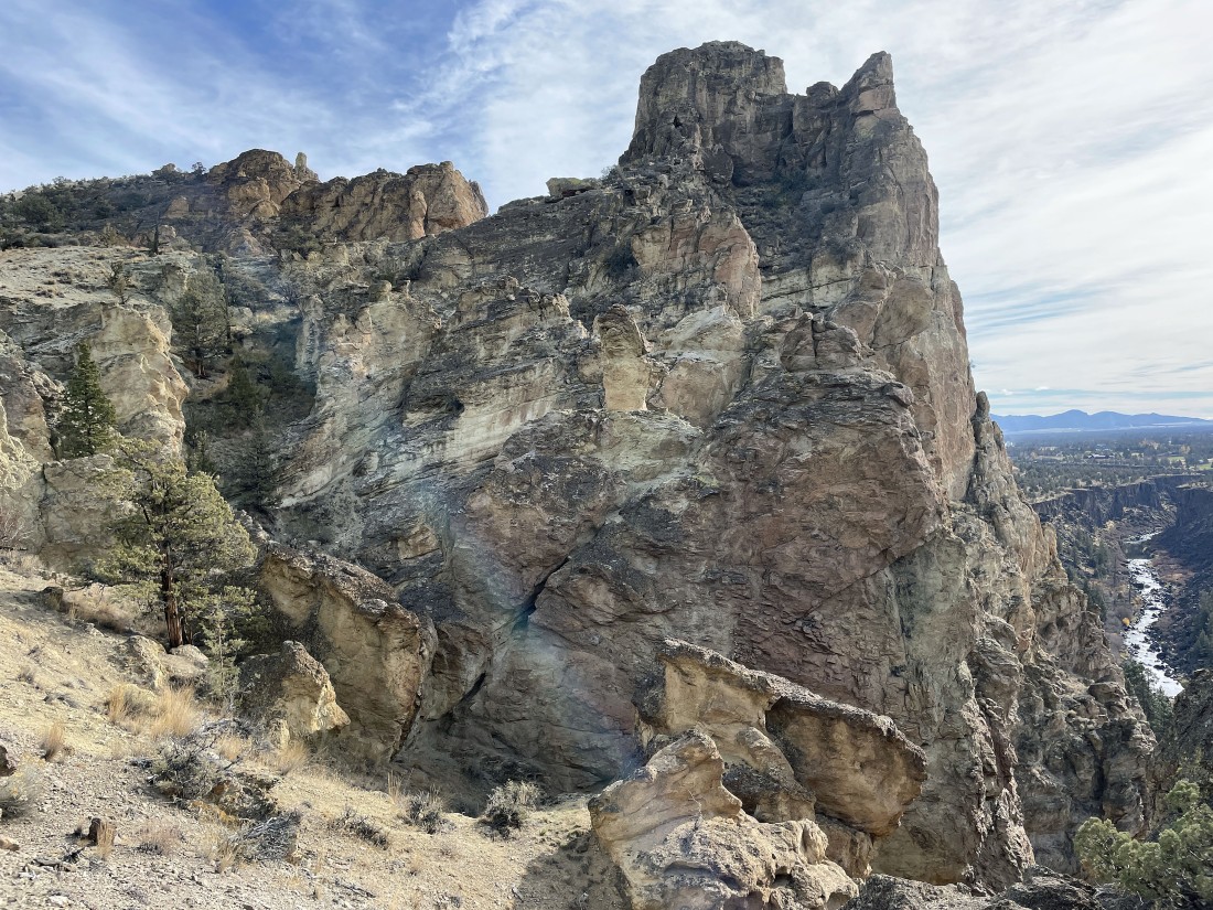
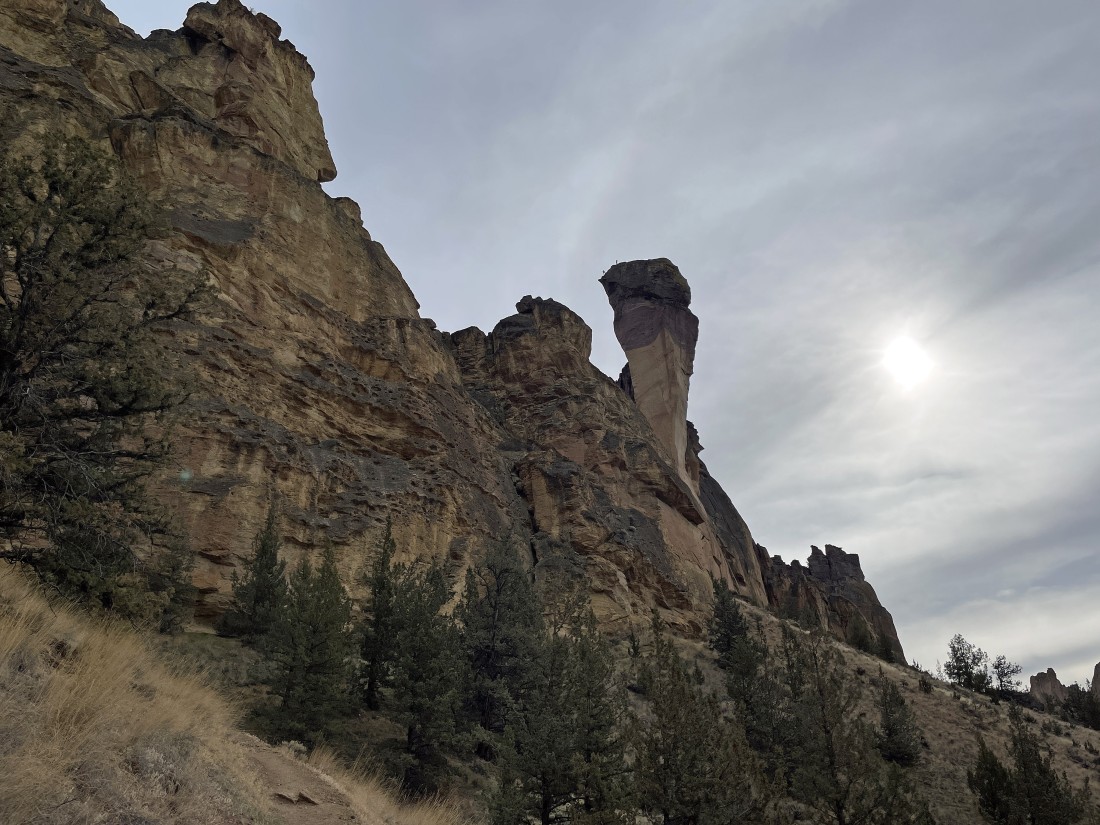
Almost down to the Crooked River on the north side of the park... with 'Monkey Face' in the distance directly above Denali Girl.
|
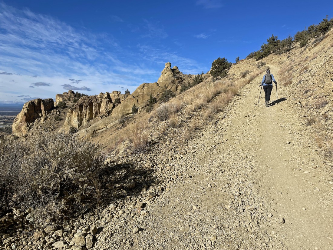
After hiking a total of 4.8 miles we will leave the 'Summit Trail' and begin gaining elevation on the 'Mesa Verde Trail'.
|
Gaining elevation on the 'Mesa Verde Trail'... and I think we see climbers on Monkey Face.
|
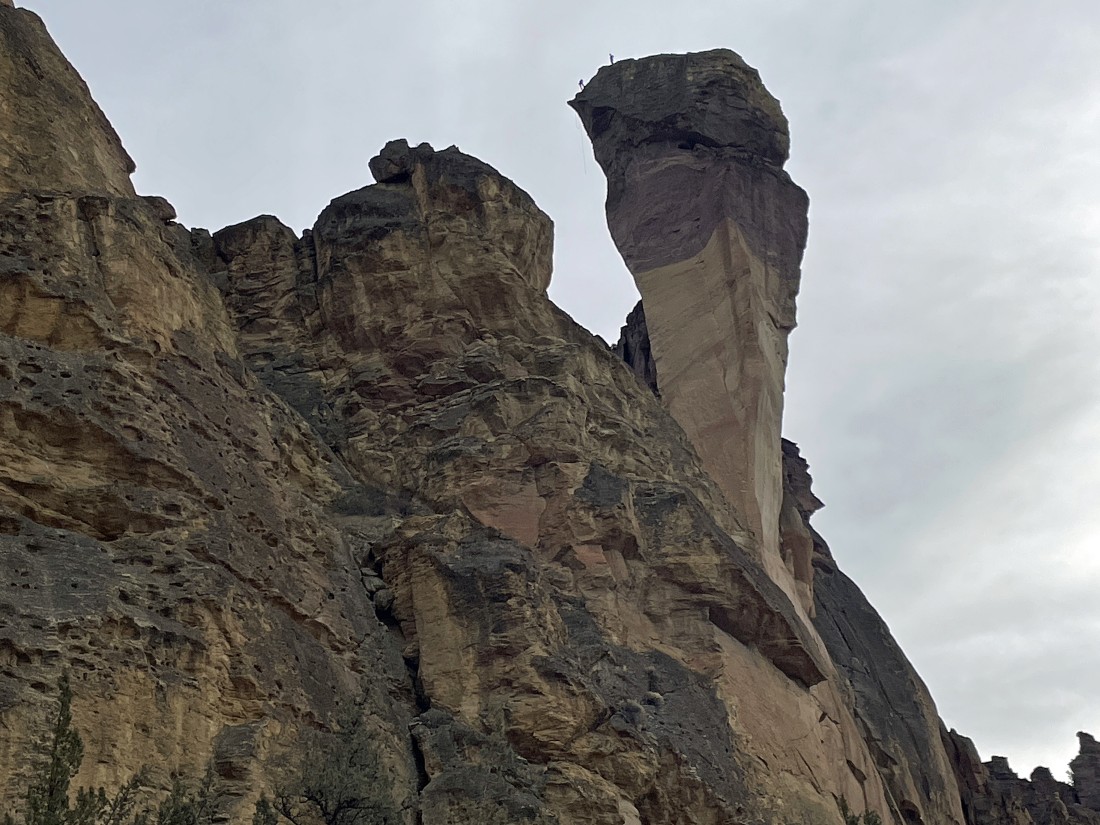
A closeup of the previous photo... checking out the climbers on Monkey Face.
|
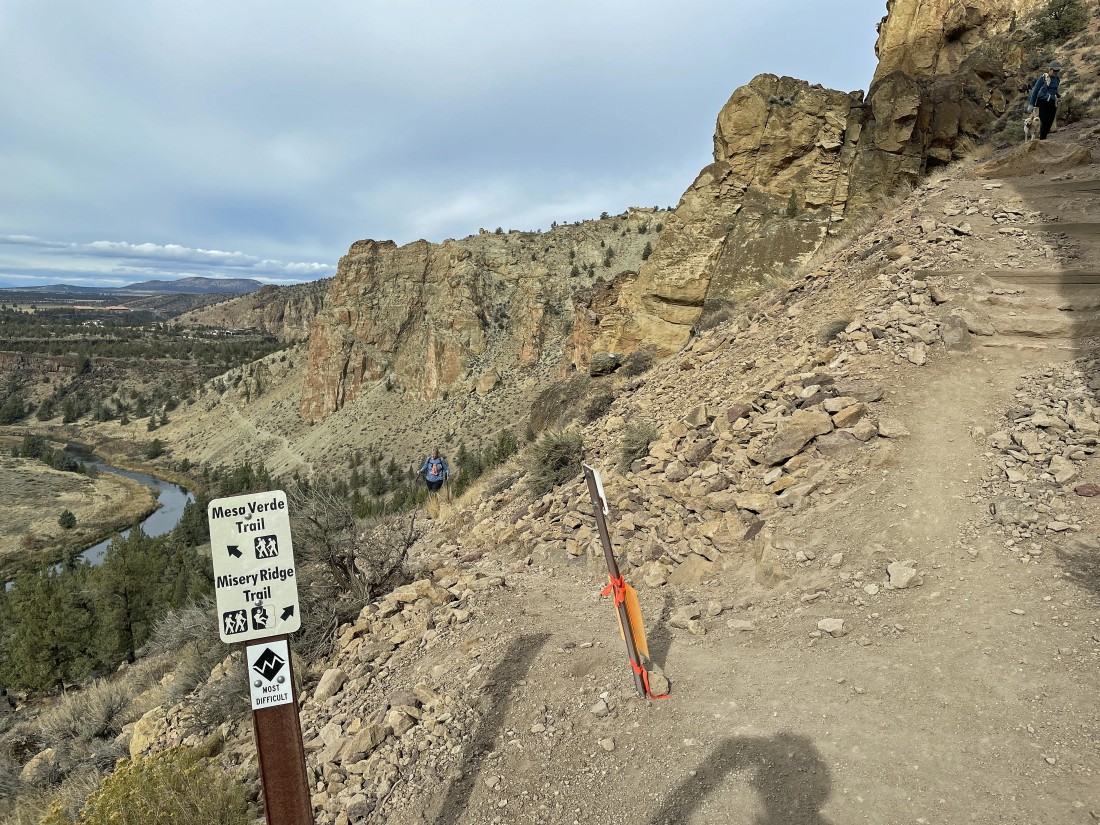
After hiking a total of 5.1 miles we are leaving the 'Mesa Verde Trail' and continuing to gain elevation on the 'Misery Ridge Trail'.
|
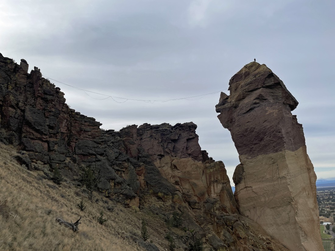
Whoa... that isn't rock climbers... that is slackliners... with the slackline stretching from Misery Ridge over to Monkey Face.
|
The slackline will need to be tightened... or I won't be willing to cross it.
|
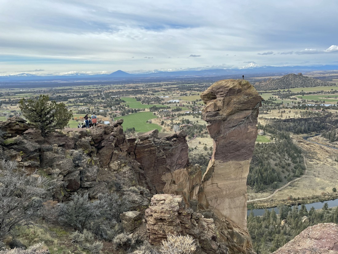
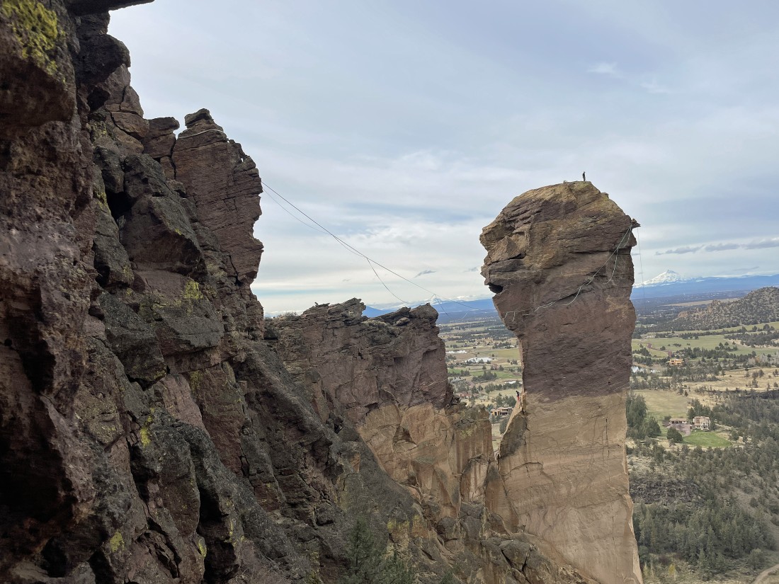
We are now on Misery Ridge... and the slackline has been tightened... but I think I will wait to do it on another day.
|
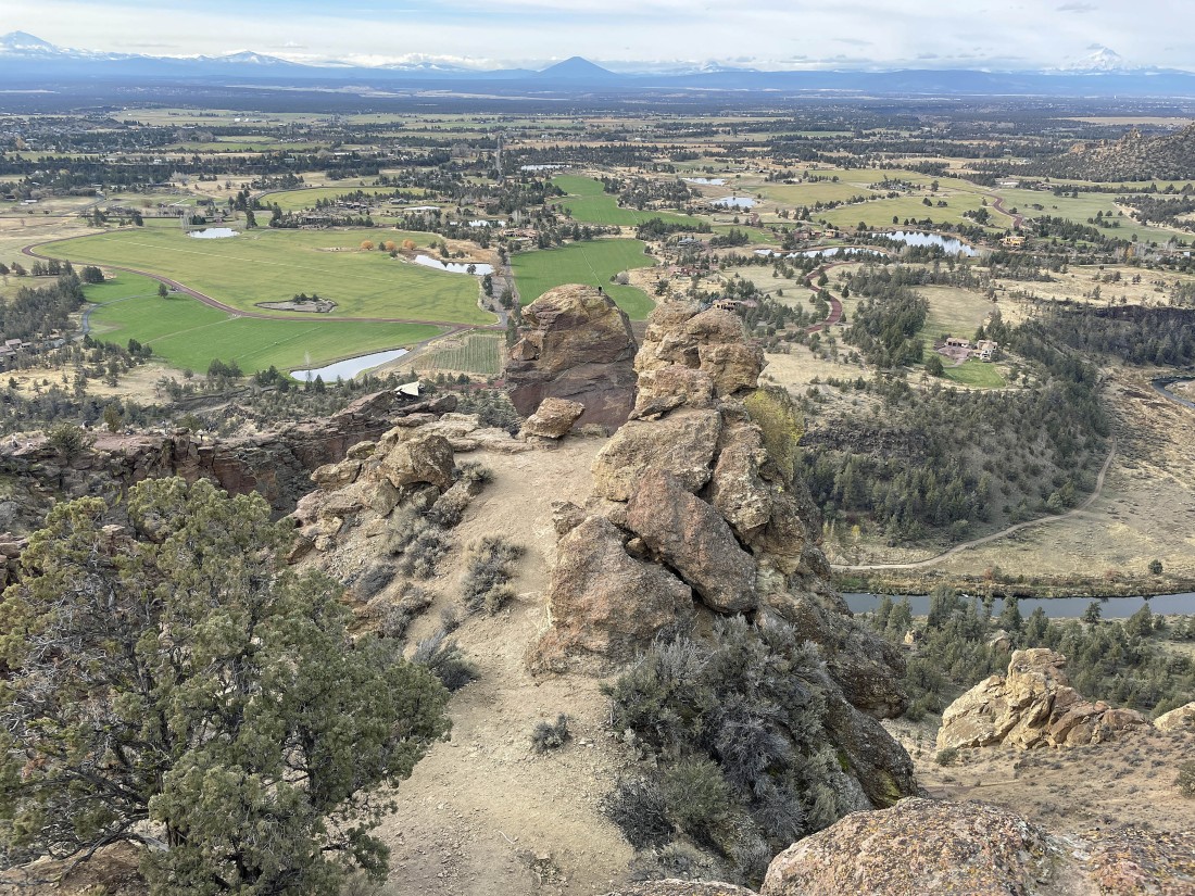
We are nearing the summit of Misery Ridge Peak.
|
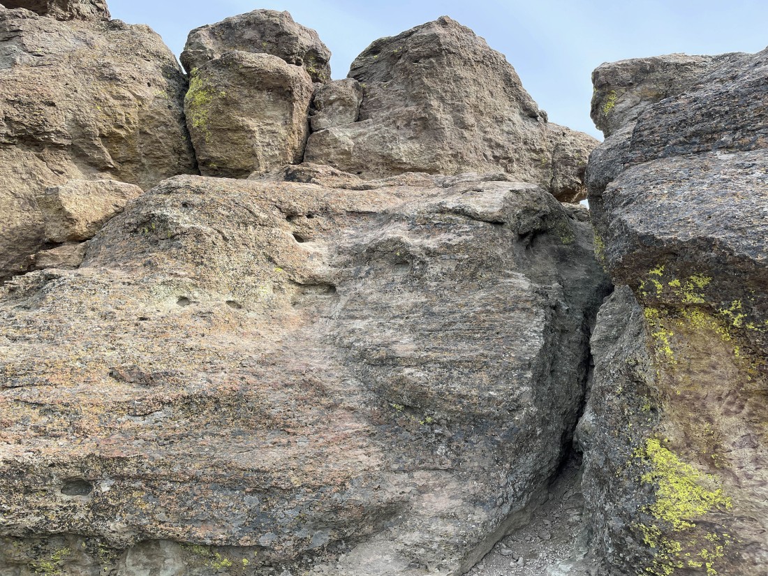
The last chunk of rock to deal with in order to reach the summit of Misery Ridge Peak.
|
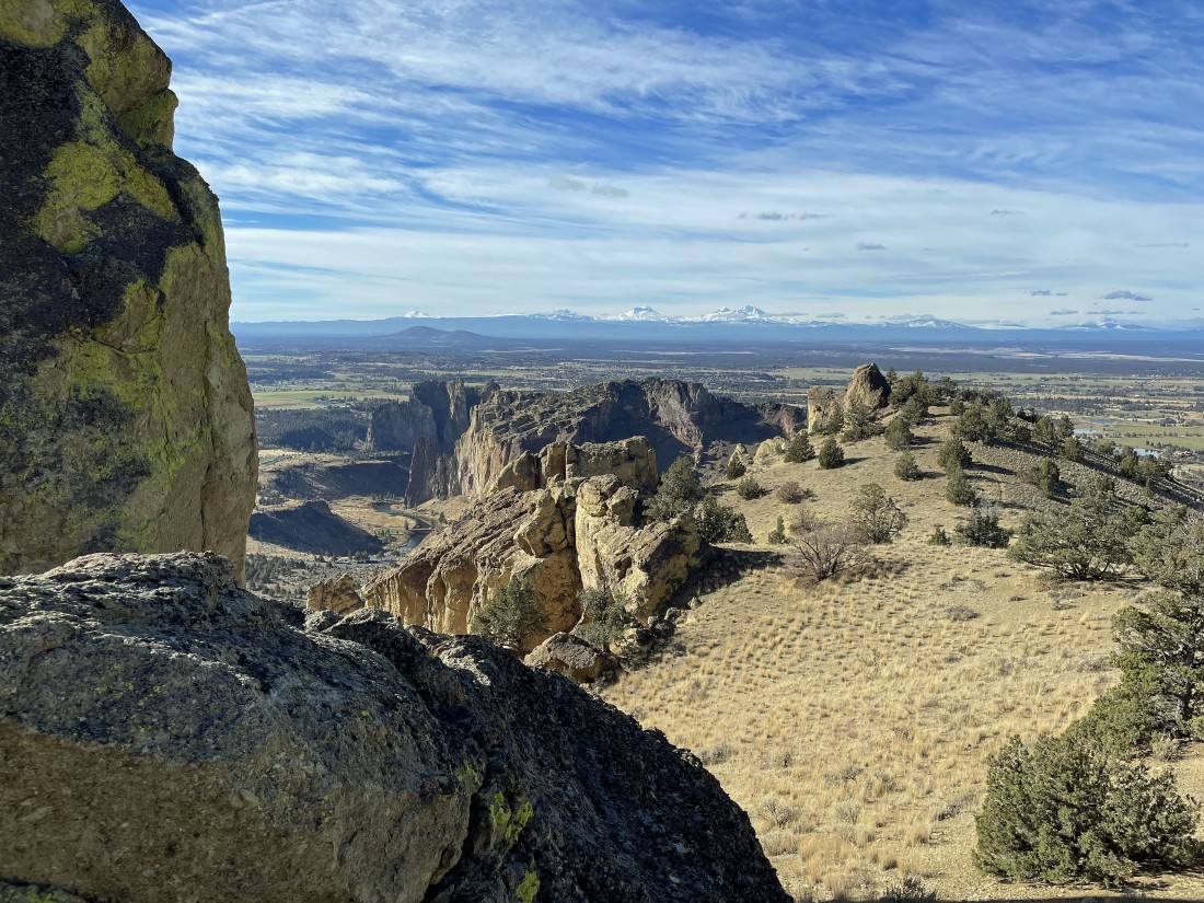
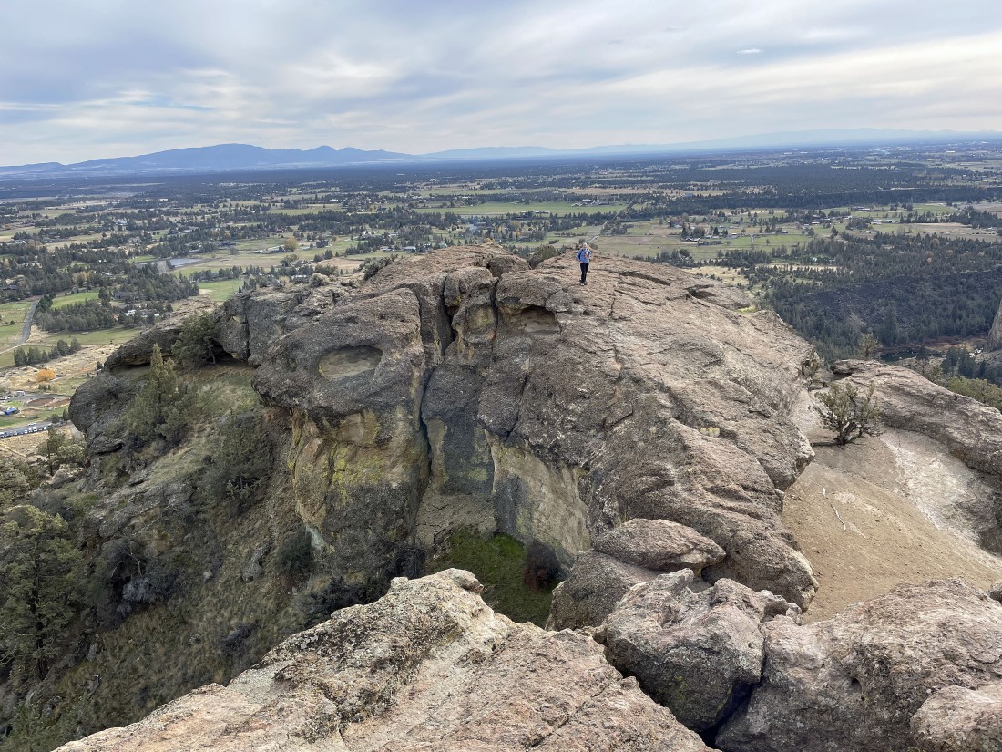
After hiking a total of 5.4 miles I am standing on the summit (3360') of Misery Ridge Peak... here looking out to the slackliners on Monkey Face... with the Crooked River National Grassland in the distance... and the Cascade Mountains on the horizon... Mount Jefferson (the second highest mountain in Oregon) is on the extreme far right horizon.
|
From the Misery Ridge Peak summit I am looking east (left) to the Marsupial Crags... and SW (right) toward the towns of Terrebone and Redmond.
|
From the summit of Misery Ridge Peak... looking SW (left) toward the towns of Terrebone and Redmond... looking west (right-center) to the Three Sisters in the Cascade Mountains... looking NW (right) to Mount Jefferson in the Cascade Mountains.
|
Waving to Denali Girl standing near the summit of Misery Ridge Peak.
|
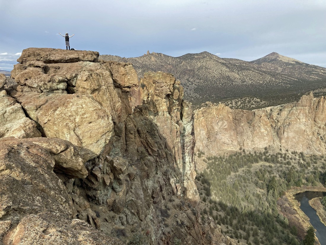
Denali Girl took this photo of me on the summit of Misery Ridge Peak... with Gray Butte on the far right horizon... with a small section of the Crooked River down below.
|
Leaving the Misery Ridge summit area and will now continue taking the 'Misery Ridge Trail' as we head back to the car on the south side of the park.
|
Almost ready to begin hiking steeply downhill on the 'Misery Ridge Trail'.
|
Yes... the 'Misery Ridge Trail' is very steep.
|
|
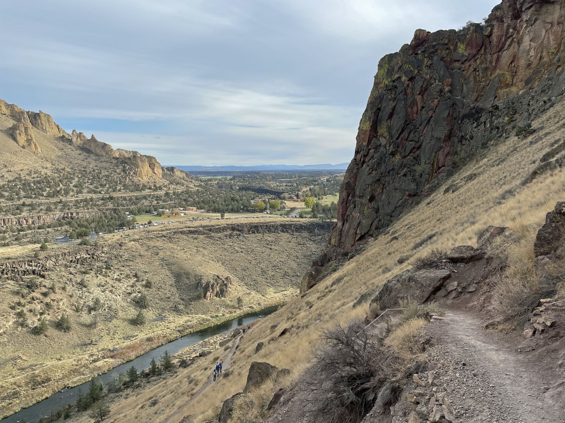
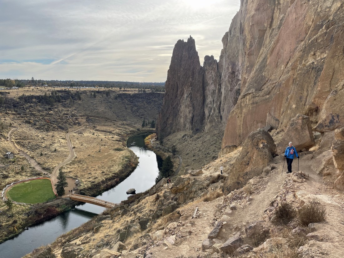
Continuing to hike steeply downhill on the south side of the park... with the Crooked River below... and the Marsupial Crags on the horizon... and you can see the Burma Road below the Marsupials.
|
Continuing to lose elevation on the 'Misery Ridge Trail'.
|
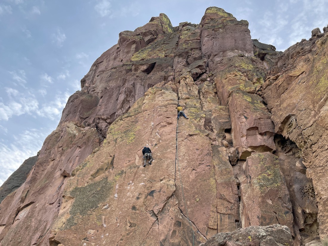
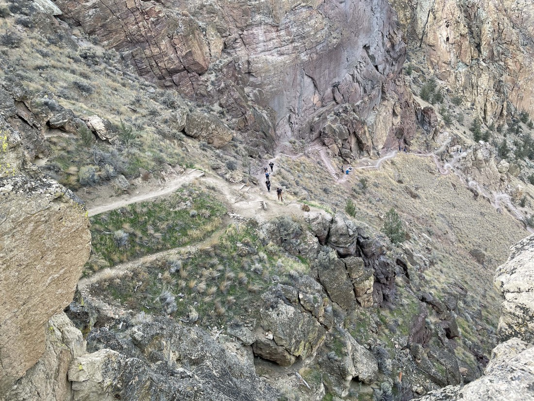
Continuing to lose elevation... and here watching climbers on the 'Red Wall'.
|
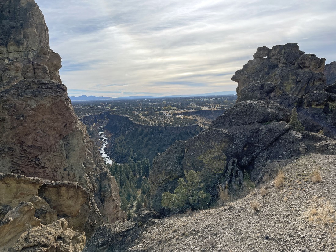
We can see the bridge below... where we will close the loop portion of our hike... with the dark brown rock formation in the distance called 'Shiprock'.
|
We have crossed the Crooked River and are gaining 200 feet of elevation back up to our car... the 'Shiprock' formation is in the right foreground... with 'Asterisk Pass' out there in the middle of the photo... with the 'Smith Rock' formation on the left... the total hike was 6.3 miles, gaining 1876 feet of elevation.
|
