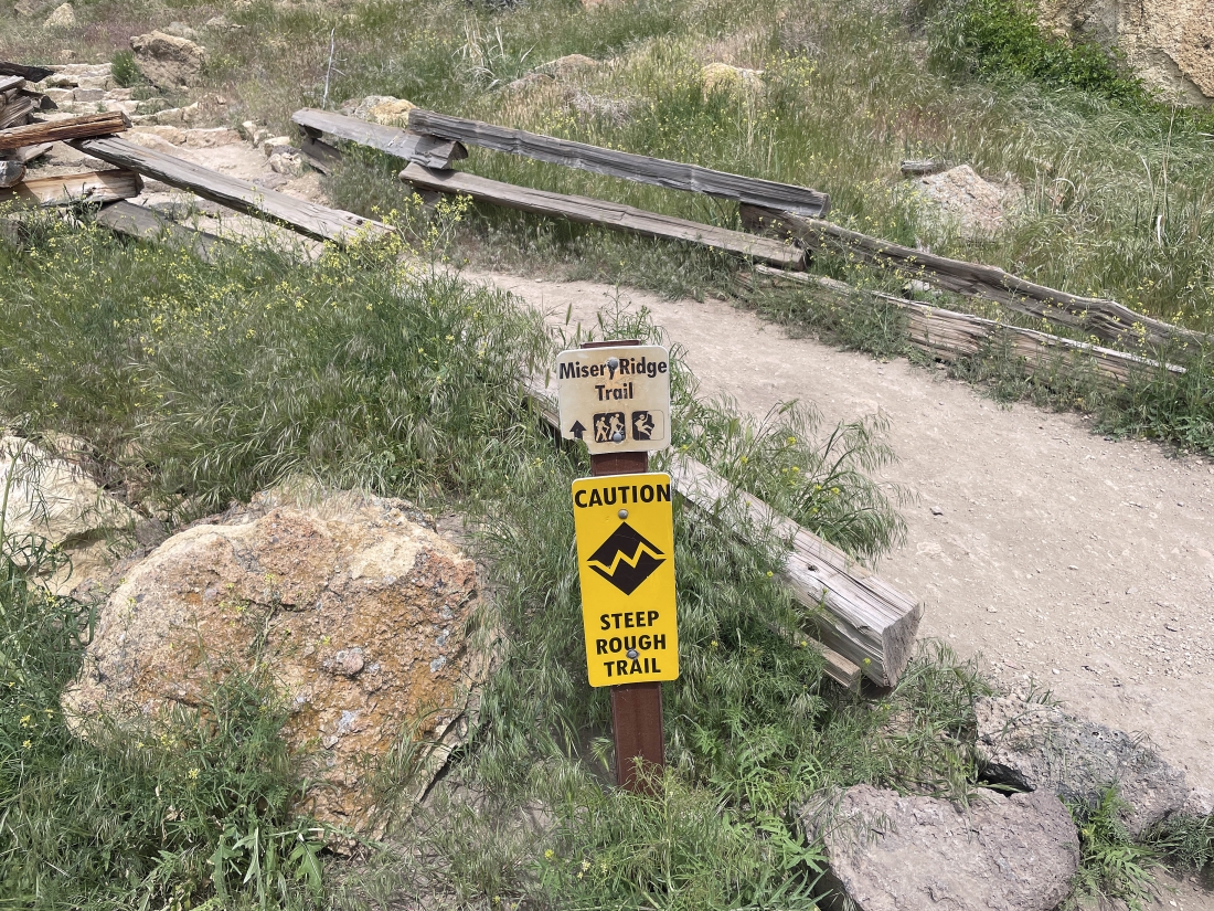
Misery Ridge - 5.21.2024
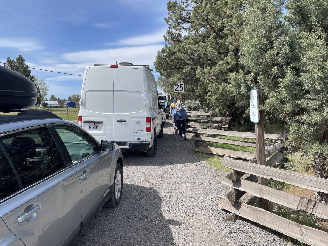
We parked along the side of NE Crooked River Drive in Smith Rock State Park... and there is a $5 parking fee.
|
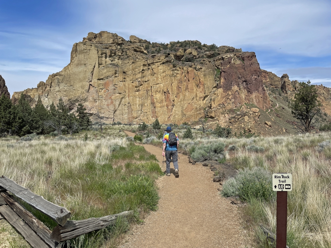
After hiking a short distance along NE Crooked River Drive we left the road and started hiking on the Rim Rock Trail.
|
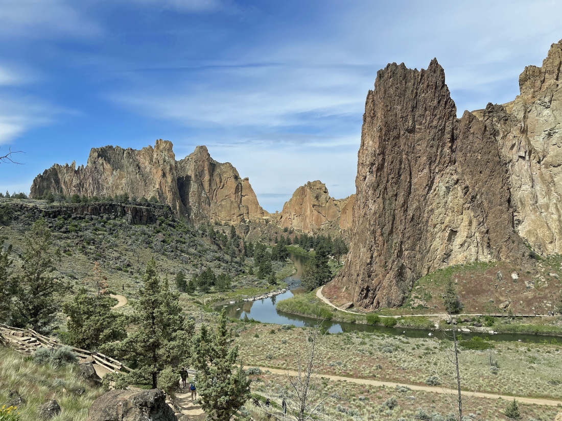
After hiking a tenth of a mile on the Rim Rock Trail and another tenth of a mile on the Canyon Trail we are getting ready to take 'The Chute' trail down to the Crooked River... the Picnic Lunch Wall dominates the middle of the photo... with Ship Rock the dark brown rock formation just to the left of the Picnic Lunch Wall... and the huge Smith Rock formation is on the far left horizon.
|
Head down 'The Chute'... the pass out there in the middle of the photo is Asterisk Pass... named because there is a huge boulder in the middle of the pass.
|
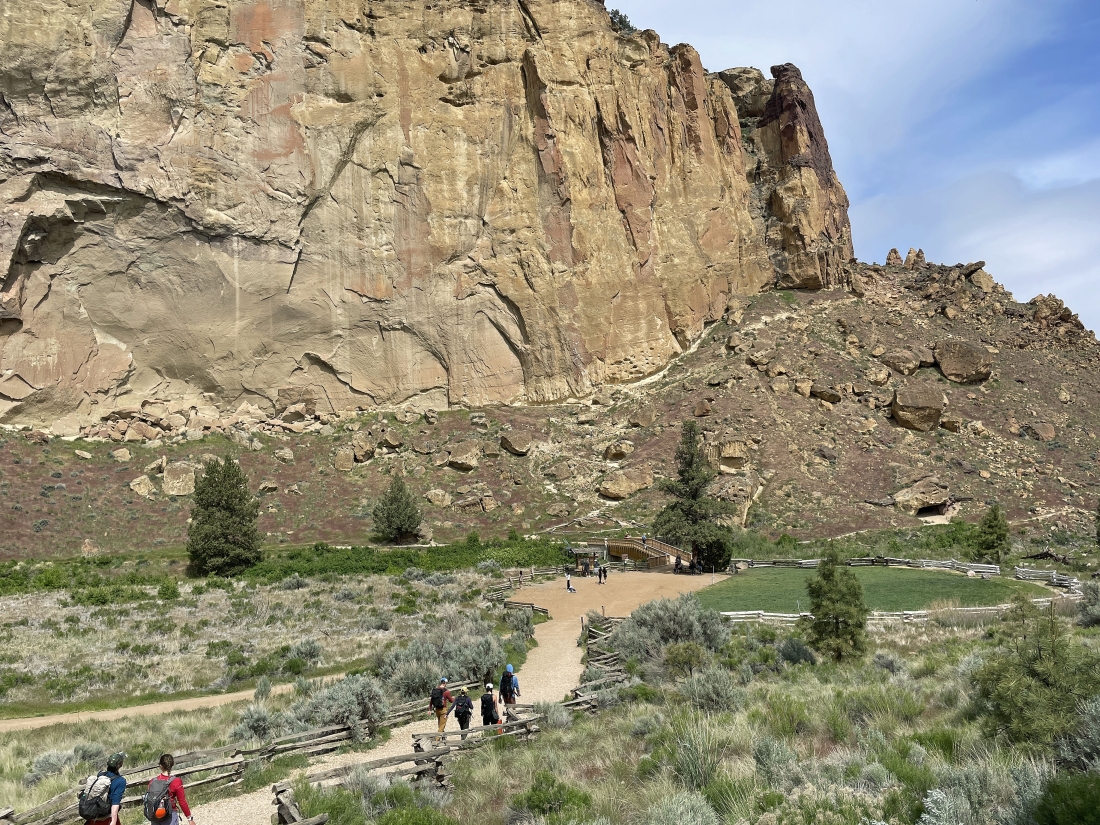
Getting ready to cross the Crooked River and head up the switchbacks toward the Picnic Lunch Wall.
|
We have crossed the Crooked River and will start gaining some steep elevation on the Misery Ridge Trail.
|
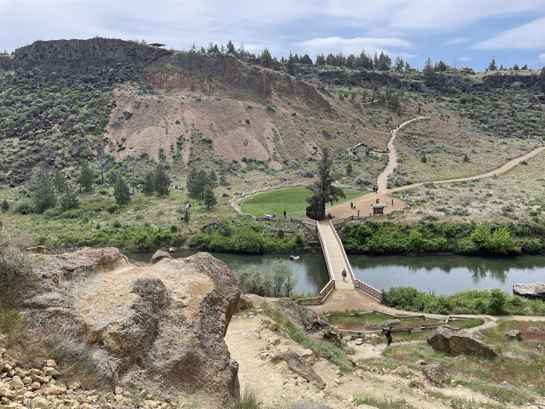
Switchbacking our way up the Misery Ridge Trail... here looking back down at the bridge crossing of the Crooked River and over to where we came down 'The Chute'.
|
Hiking underneath and around the Picnic Lunch Wall as we continue to gain elevation on the Misery Ridge Trail... the rugged looking rock formations on the right horizon are the 'Marsupial Crags'.
|
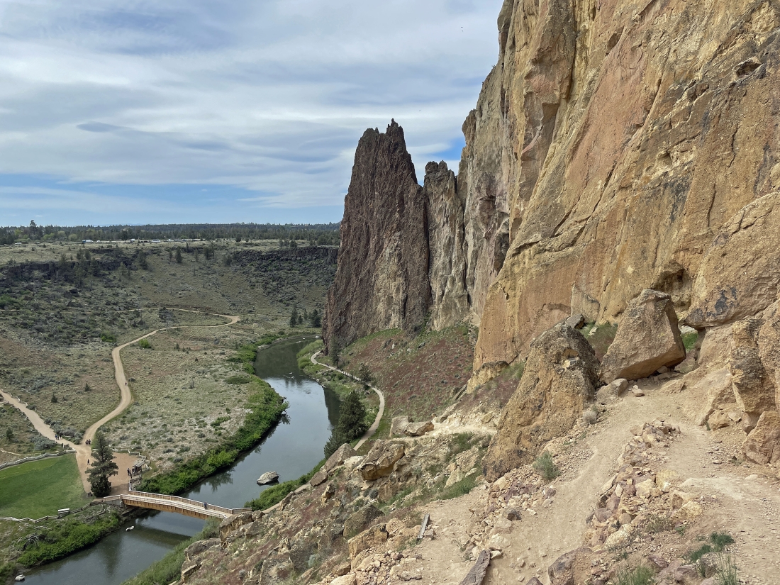
Gaining elevation underneath the Picnic Lunch Wall... here looking back out to the dark brown 'Ship Rock' and down at the bridge crossing of the Crooked River.
|
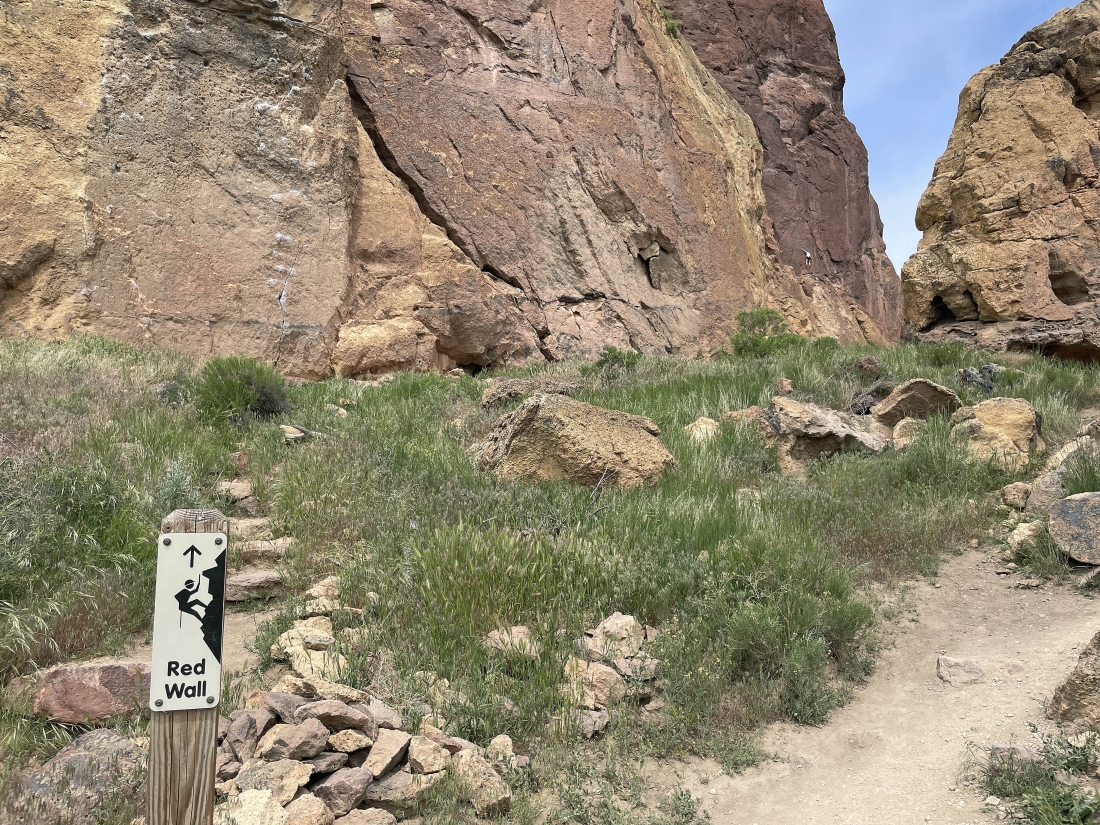
We have hiked beyond the Picnic Lunch Wall and are getting ready to pass underneath the Red Wall... you can see one climber on the Red Wall over on the far right. The Red Wall is one of the easier climbing areas in the park.
|
|
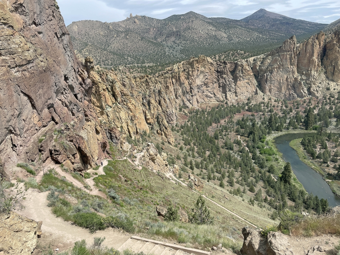
After hiking underneath the Picnic Lunch Wall and the Red Wall we have started switchbacking again... here looking down on the Crooked River... and out to the Marsupial Crags on the right horizon... with Gray Butte the high point on the left horizon.
|
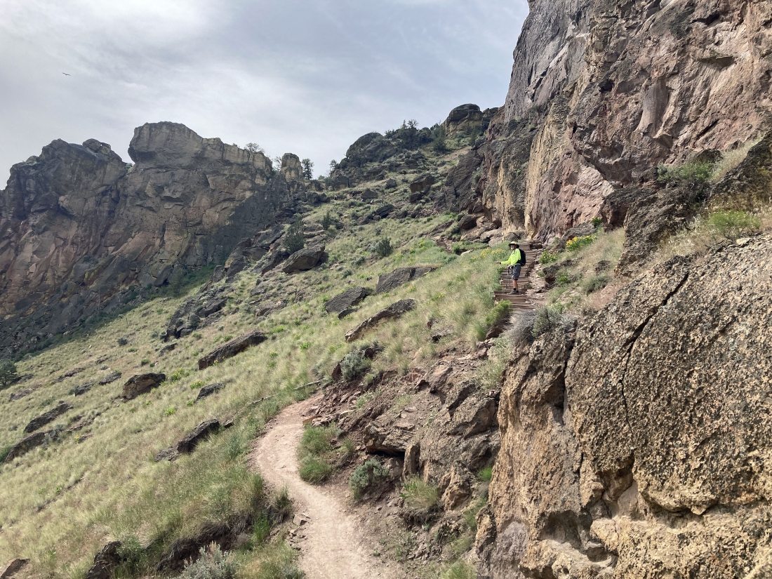
Looking down at Denali Girl as she switchbacks her way up the Misery Ridge Trail... with Gray Butte on the far right horizon.
|
Denali Girl took this photo of me as I'm almost done with the steep elevation gain.
|
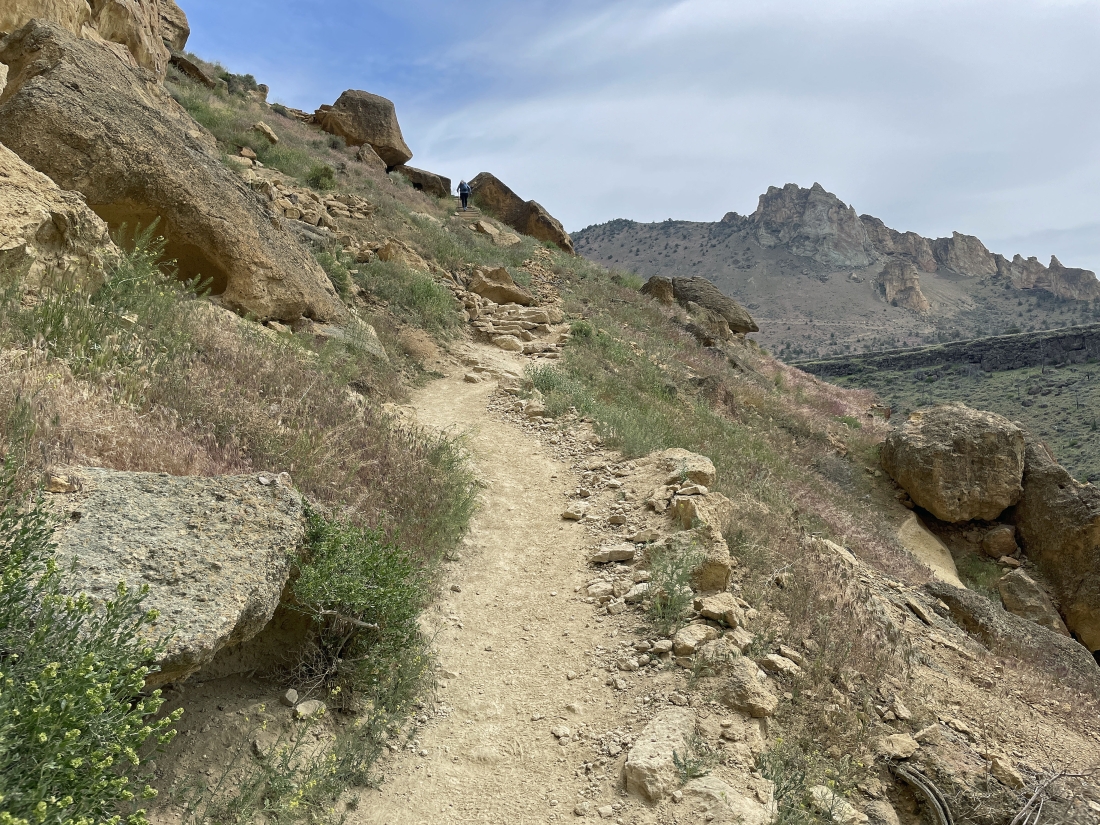
We are basically done with the elevation gain on the Misery Ridge Trail... here looking east to the Marsupial Crags... and SE across some of the country side of Terrebonne, Oregon.
|
From the top of the Misery Ridge Trail I am looking at the area's high point in the middle of the photo... I've done it a few times, but not today. We will stay on the Misery Ridge Trail and hike over to the Monkey Face rock formation.
|
|
After hiking a total of one mile we have arrived at the Monkey Face rock formation... we came up the east side of Misery Ridge and now we can see some of the switchbacks on the west side of Misery Ridge.
|
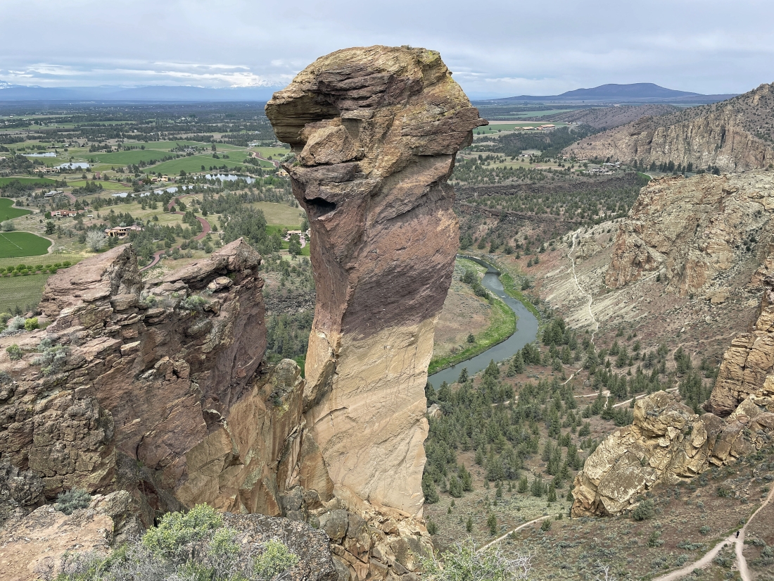
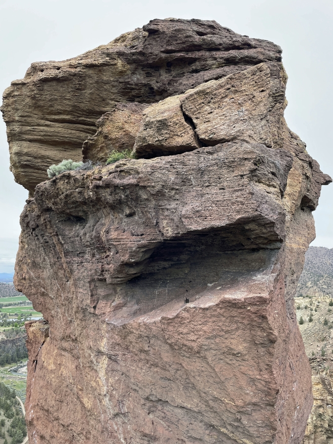
A closer look at Monkey Face... Denali Girl and I will hike out along the little bumps in the left foreground to get a closer look at Monkey Face.
|
Looking back at Denali Girl as we work our way out to the little bumps mentioned in the previous photo.
|
I'm a stone's throw from Monkey Face, but I can't go any further.
|
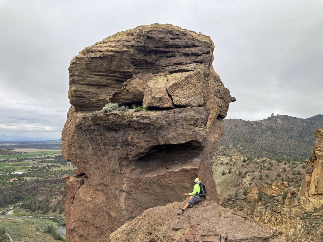
Denali Girl got this shot of me on the edge.
|
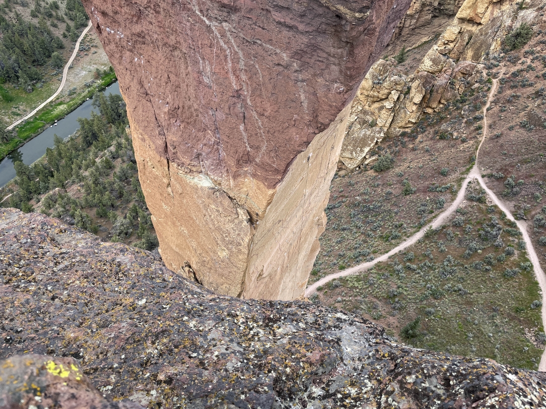
I took this shot looking down toward the base of Monkey Face.
|
A good photographer would not have cut off the top of Monkey Face... but I'm not a good photographer... we have begun to trace our steps back to the car as we look over to some of the switchbacks on the west side of Misery Ridge.
|
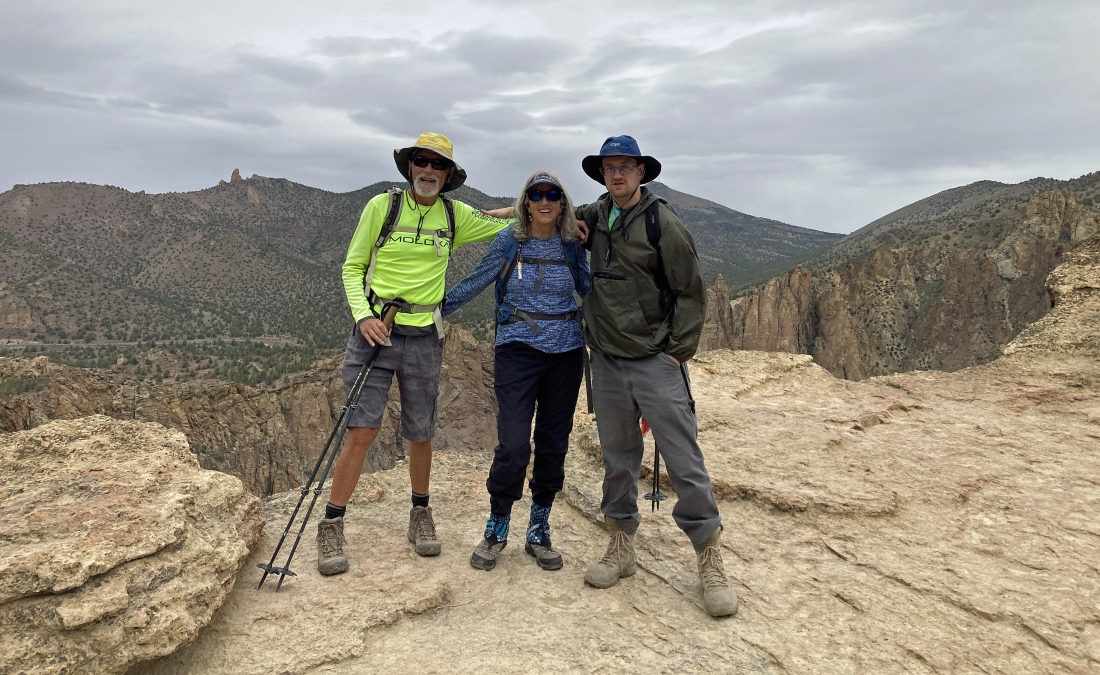
ragman, Denali Girl and aceman on the east side of Misery Ridge... getting ready to begin switchbacking our way back to the car.
|
Tracing our steps back to the car on the east side of Misery Ridge.
|
Almost back down to the Crooked River... but we will still need to gain 220 feet of elevation to get back up to the car. The hike was a total of 2 miles, gaining 938 feet of elevation.
|
