South Sister - 8.11.2025
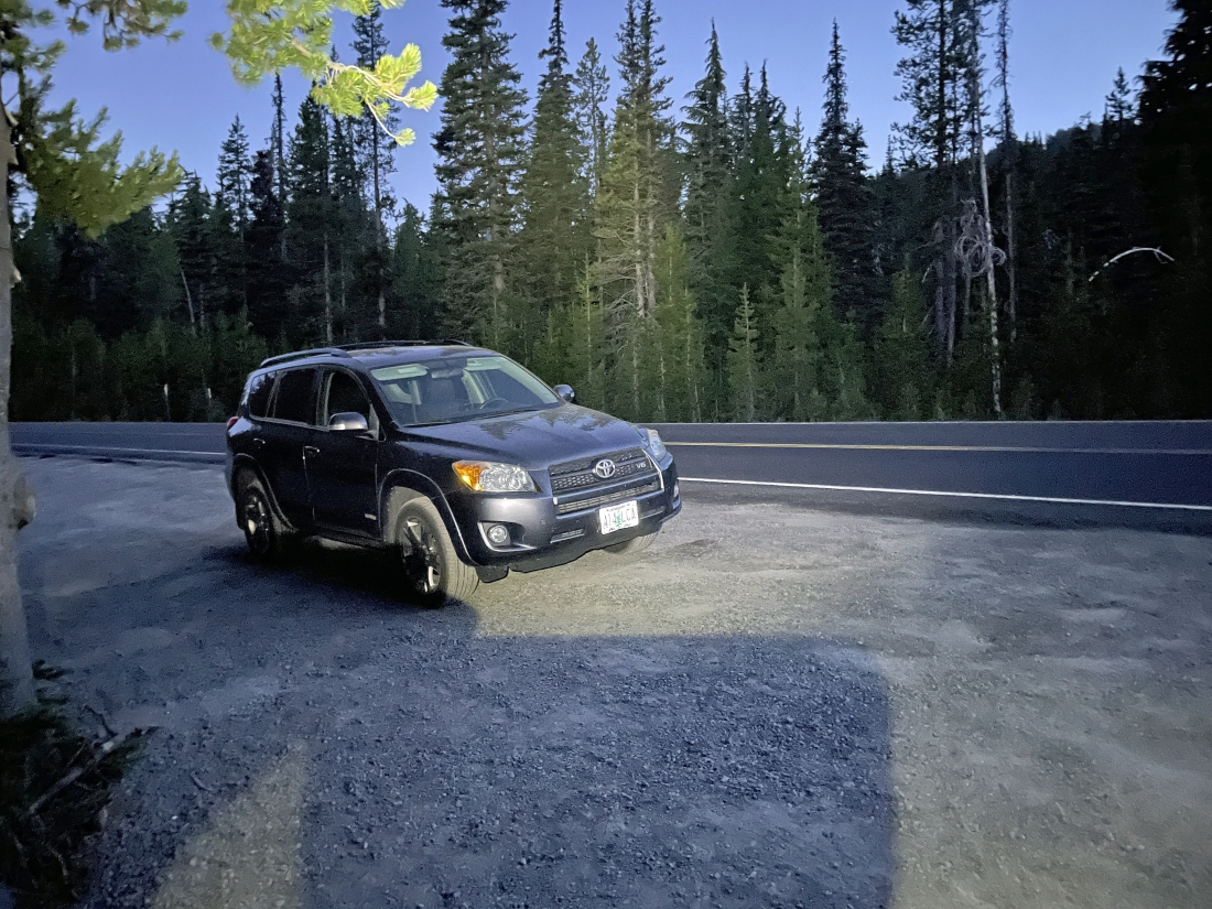
It is 5:30am and I parked at an elevation of 5,450 feet on the south side of the Cascade Lakes Highway... a short distance from the northern tip of Devils Lake. This is the same place I parked the previous 4 years when doing South Sister. I will cross the highway to find the South Sister Climber Trail #36.
|
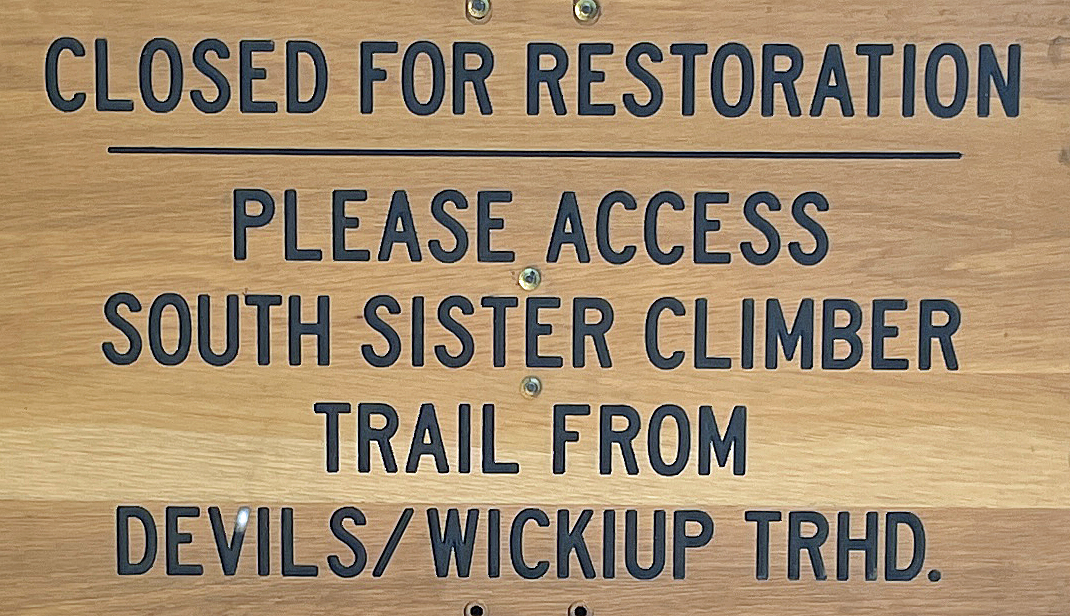
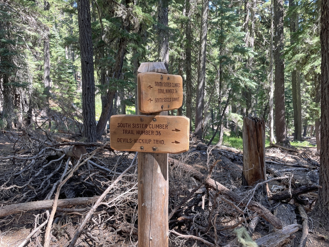
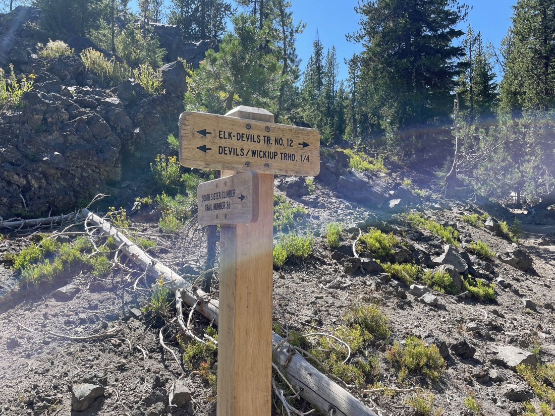
This is the sign just on the other side of the highway from where I parked. Well... it is 5:30am and I have no idea where to find the Devils/Wickiup Trailhead... so I will continue to hike up the section of the trail area that is under restoration.
|
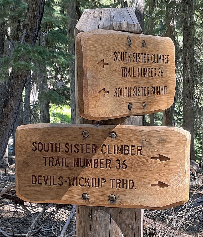
After hiking a little more than an eighth of a mile from where I parked I reached the end of the area that is under restoration and joined the South Sister Climber Trail #36. When I come back down I will take this new section of trail to get back to my car.
|
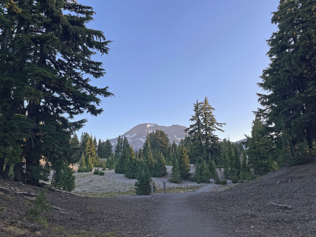
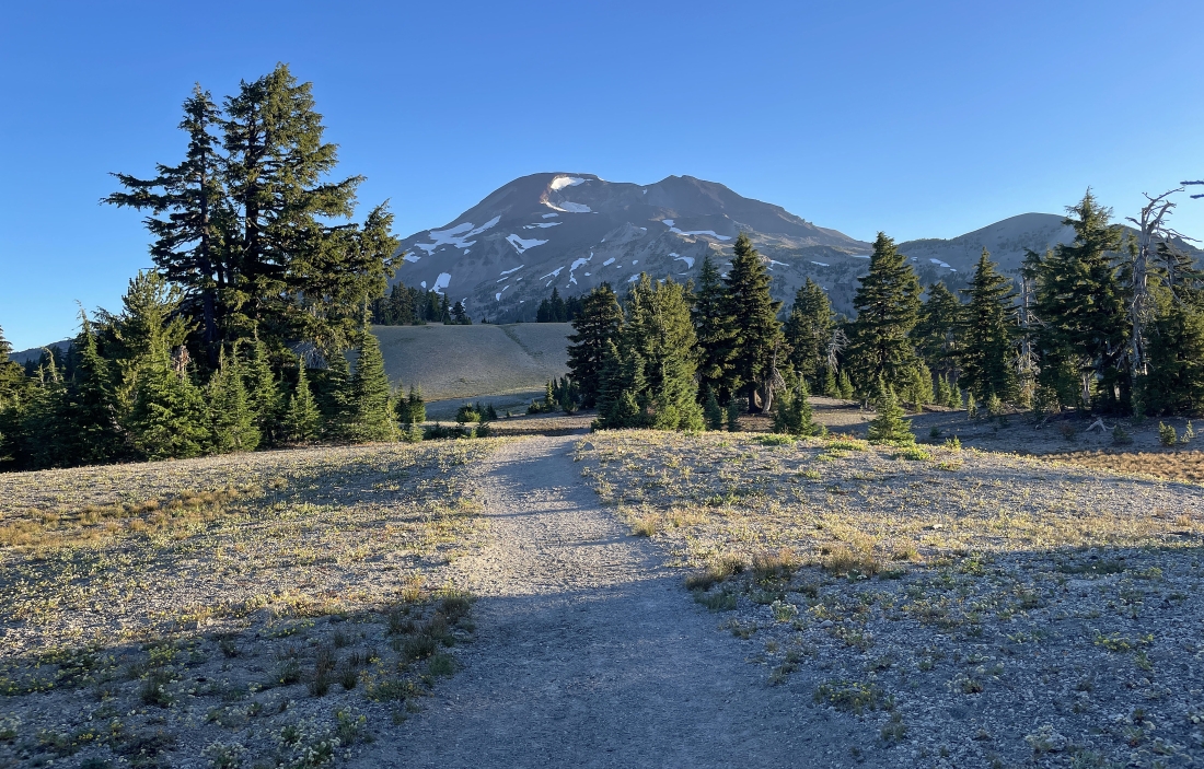
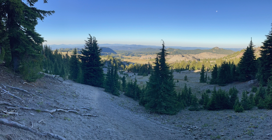
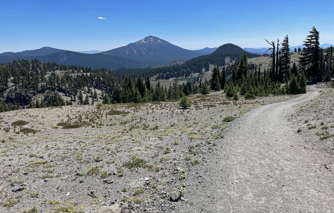
After hiking a total of 1.7 miles and gaining 1,200 feet of elevation, I got my first look at South Sister... getting ready to do the next mile and a quarter across a flatish plateau that goes above Moraine Lake.
|
Hiking north toward South Sister... across the flatish plateau above Moraine Lake.
|
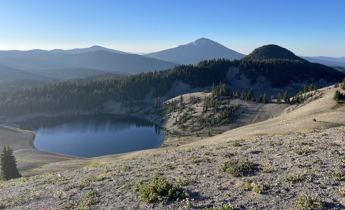
As I continue hiking across the flatish plateau I am looking down on Moraine Lake... with Devils Hill in the right foreground... and Mount Bachelor on the horizon in the middle of the photo.
|
Still on the flatish plateau above Moraine Lake I am getting closer to South Sister... watching the sunshine hit the Lewis Glacier near the summit area of South Sister.
|
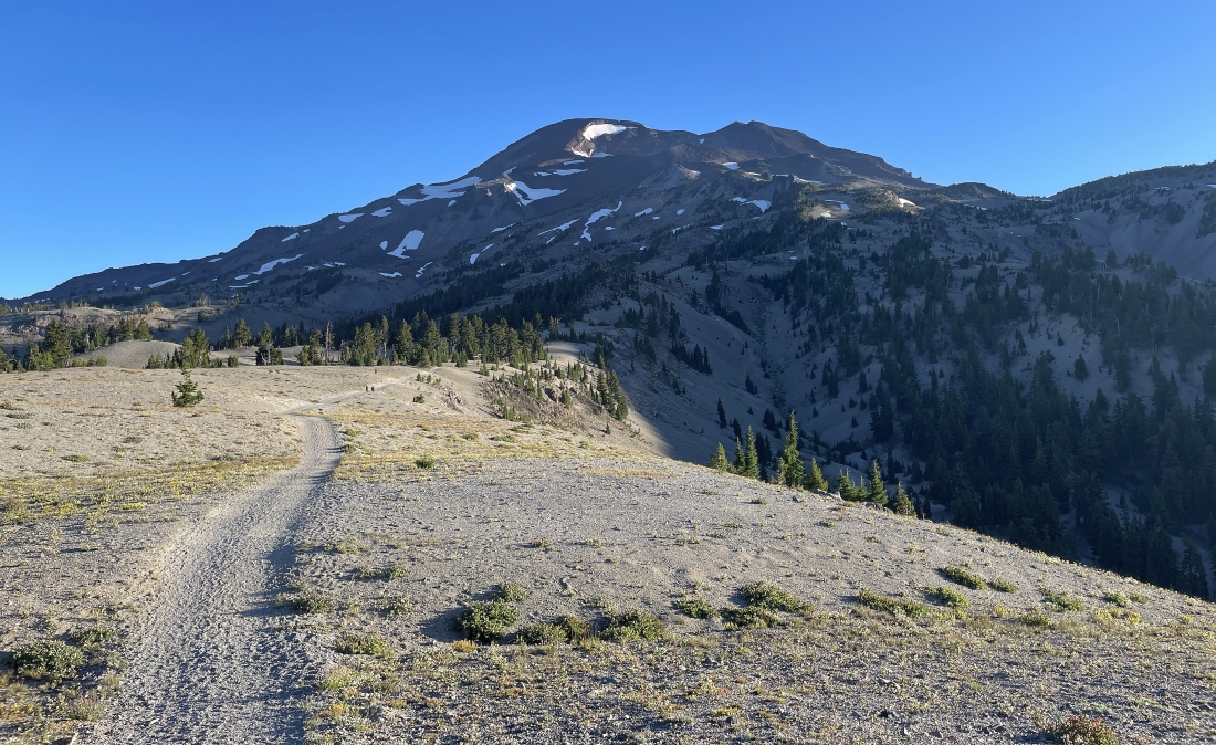
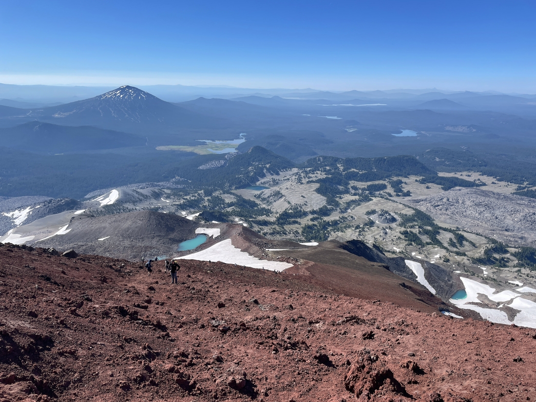
After hiking a total of 3 miles I am at an elevation of 6,930 feet... looking back across the flatish plateau at Mount Bachelor on the far left horizon... with Devils Hill in the left-center of the photo... getting ready to start gaining some serious elevation.
|
Gaining elevation and looking west over to the right... looking beyond 'Rock Mesa' and 'Wickiup Plain' to 'The Wife'... with the moon high above 'The Wife'.
|
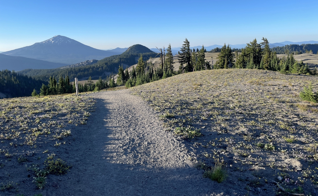
Continuing to gain elevation... looking back at Mount Bachelor on the far left horizon... and starting to see some of the lakes accessible via the Cascade Lakes Highway.
|
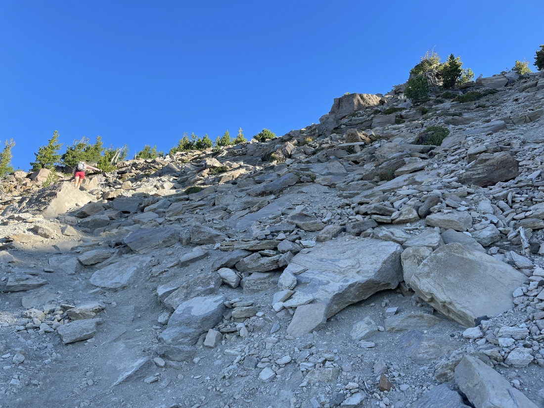
Gaining elevation on steep terrain.
|
Looking down below to the flatish plateau on the left... with Rock Mesa and Wickiup Plain on the right... with Mount Bachelor on the far left... the lake below Mount Bachelor is Sparks Lake... and the Cascade Lakes Highway lakes are getting more visible.
|
Gaining elevation on steep terrain.
|
Gaining elevation on steep terrain.
|
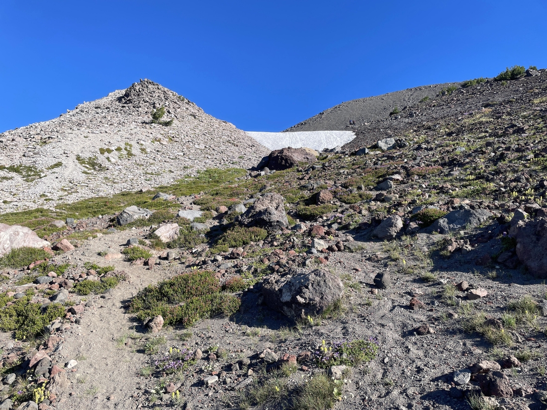
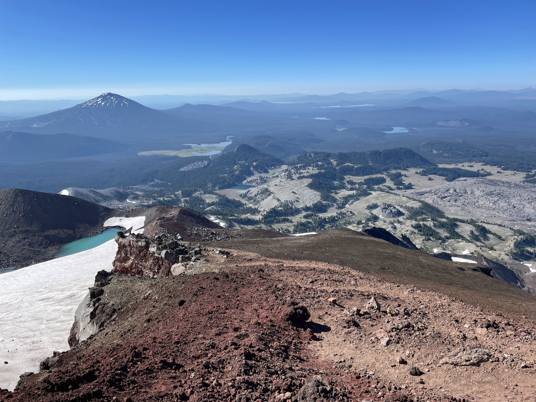
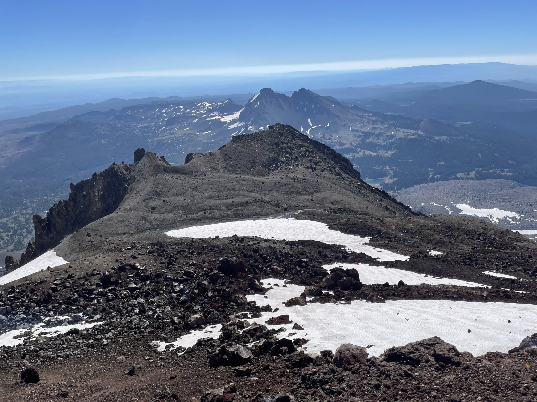
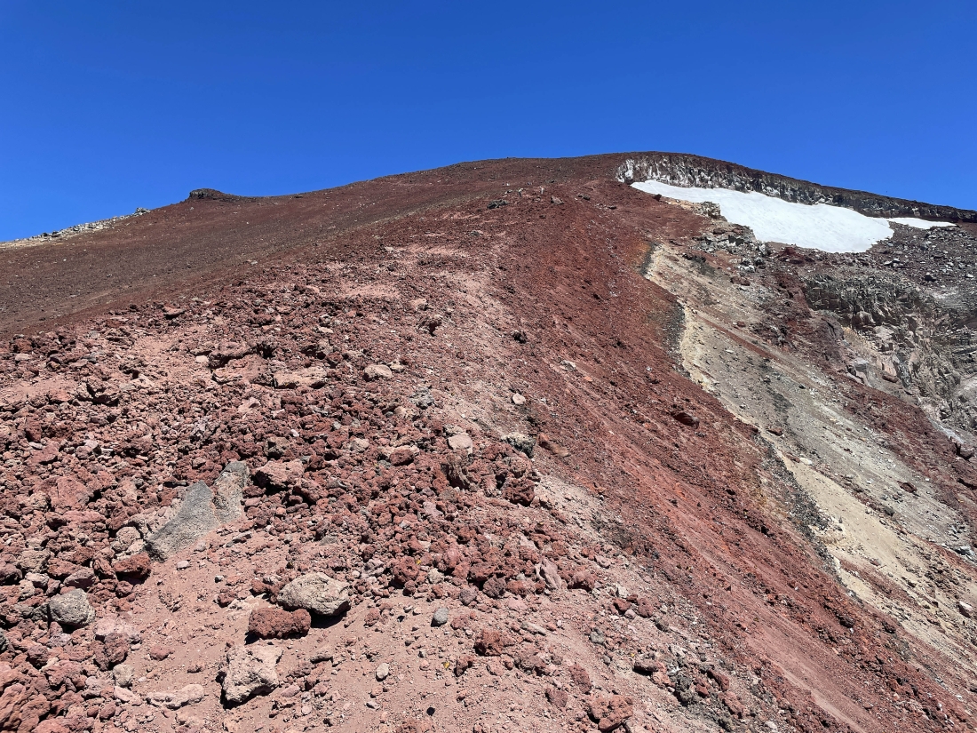
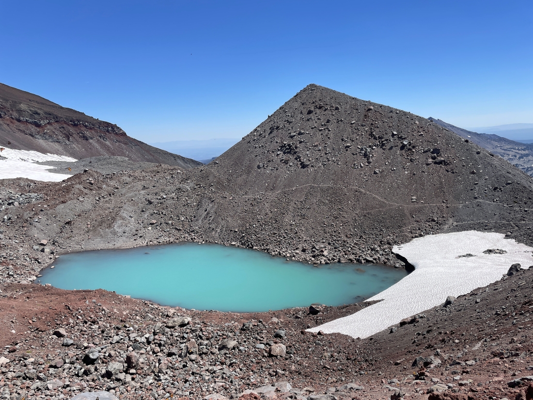
After hiking a total of 4.6 miles I am at 8,860 feet of elevation... looking down on the Lewis Glacier Tarn... with Lewis Glacier Peak ( 9,017 feet ) in the right foreground... the next .8 miles has been nicknamed 'The Red Mile'... and it will take me up past the Lewis Glacier to the crater rim of South Sister.
|
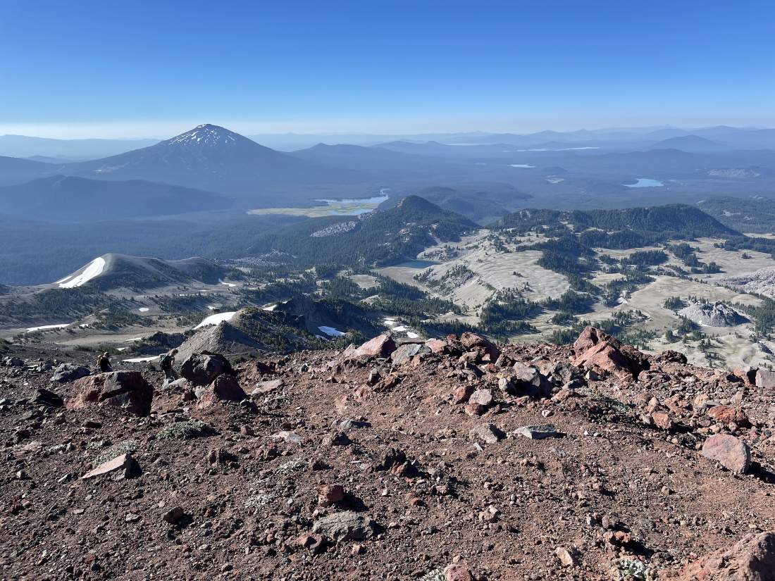
Heading up 'The Red Mile'... here looking back down at the flatish plateau above Moraine Lake and beyond to Sparks Lake and Mount Bachelor on the left... with the Cascade Lakes Highway lakes ( Elk, Hosmer, Lava, Little Lava, Crane Prairie Reservoir, and Wickiup Reservoir ) visiible in the distance on the right.
|
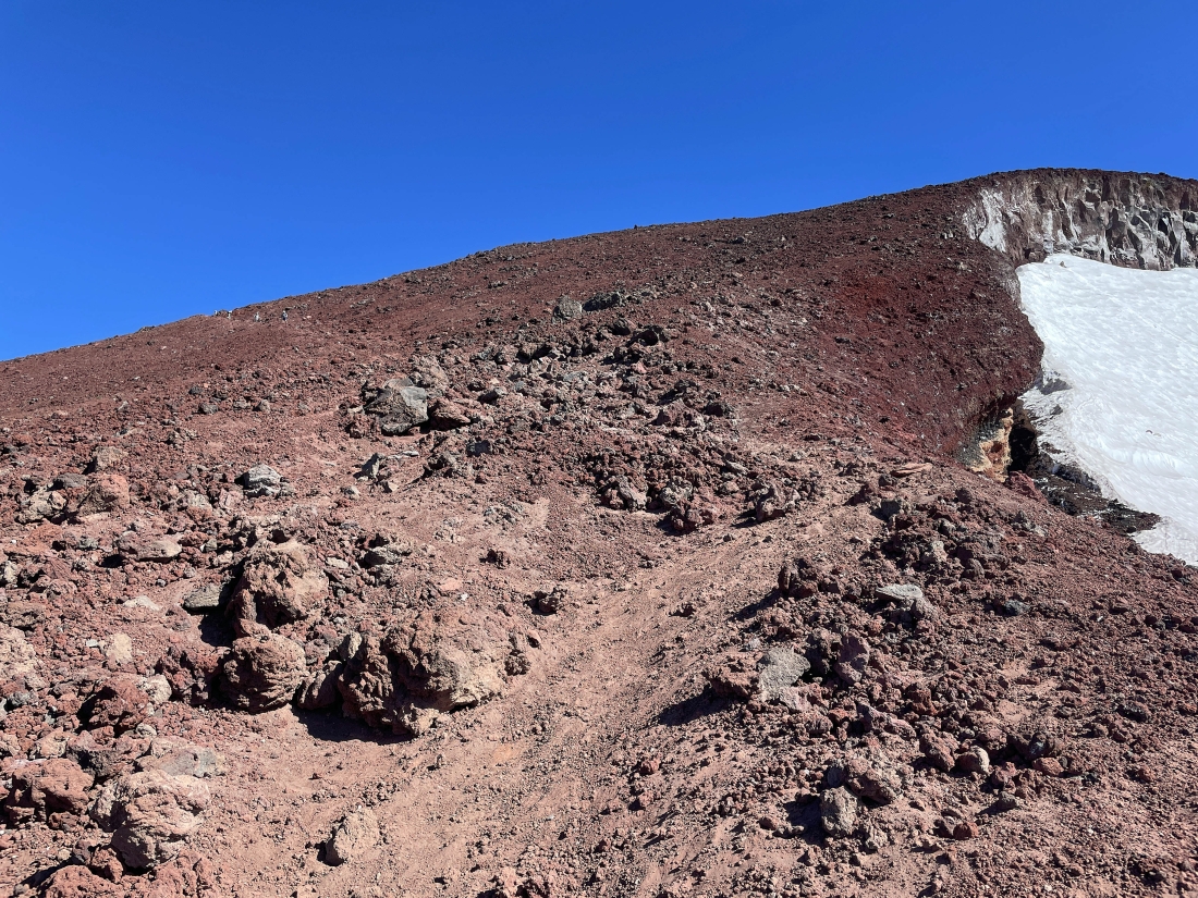
Heading up 'The Red Mile'... with part of the Lewis Glacier on the right... and a piece of the Clark Glacier on the far left.
|
Gaining elevation on 'The Red Mile'... here looking back down at the Lewis Glacier Tarn and Lewis Glacier Peak in the foreground... with Broken Top in the distance on the far left horizon... with Mount Bachelor on the left-center horizon.
|
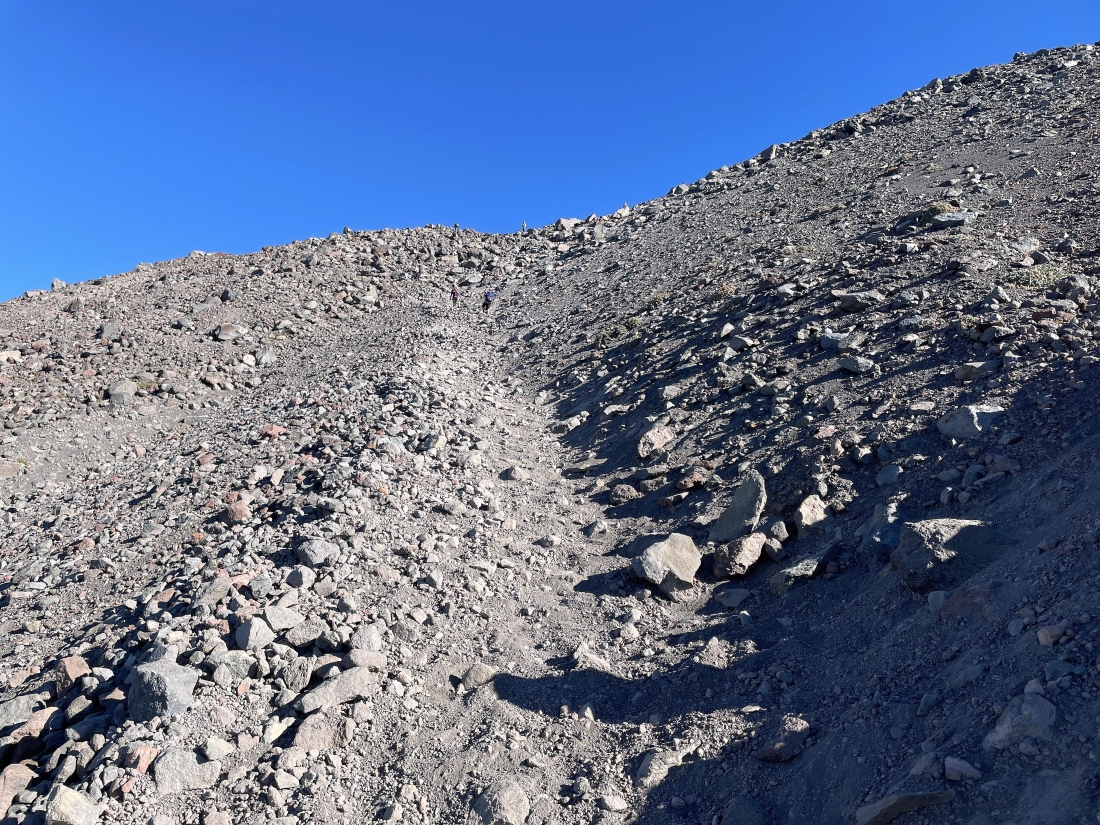
Looking back as I continue to gain elevation on 'The Red Mile'.
|
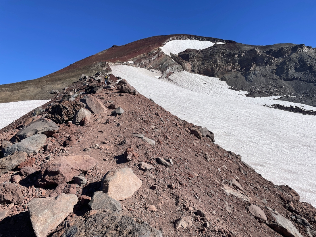
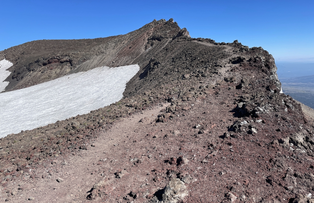
Getting ready to leave the steep terrain that borders the left side of the Lewis Glacier and angle my way on up to the crater rim of South Sister.
|
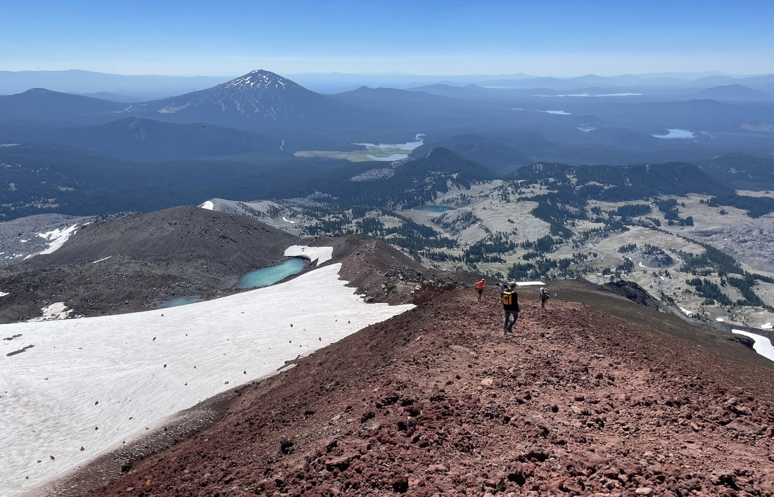
Nearing the crater rim of South Sister... here looking back down at roughly 20 other hikers that are working their way up 'The Red Mile'.
|
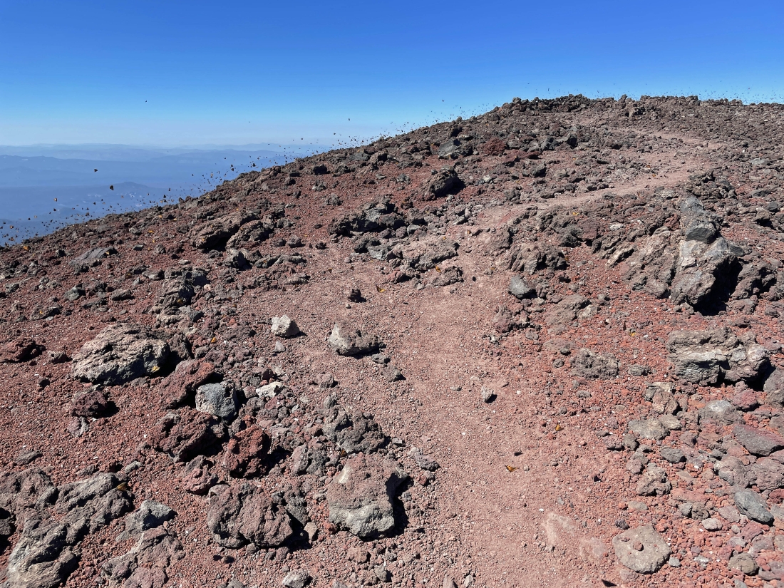
I have reached South Sister's crater rim after hiking a total of 5.4 miles and gaining 4,740 feet of elevation. 'The Red Mile' was really only .8 miles gaining 1,330 feet of elevation. The South Sister summit is over there on the crater rim. Several football fields could be held in the crater. I will not go across the rim to the summit. I will get over there by going along the rim to the right ( counter clockwise ).
|
Hiking along the crater rim on my way over to the summit of South Sister... here looking beyond Hodge Crest ( 10,039 feet ) in the foreground to Broken Top ( 9,175 feet ) in the distance.
|
Working my way up to the summit of South Sister.
|
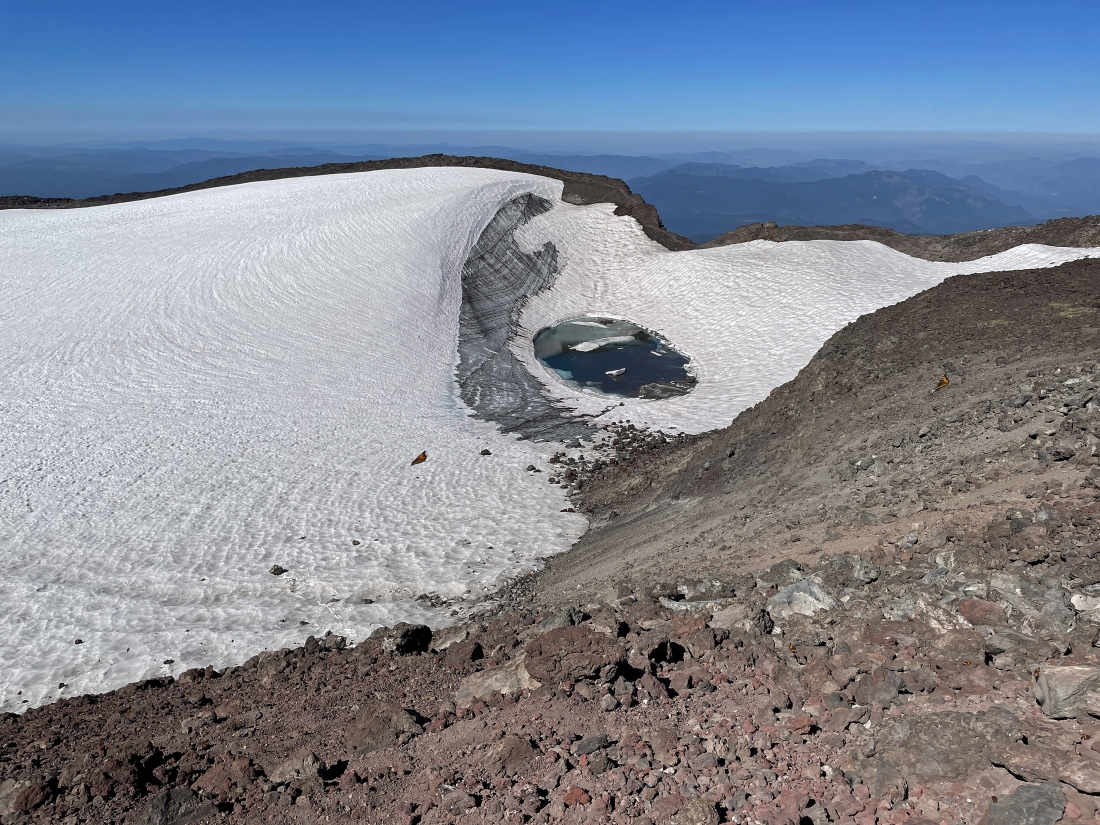
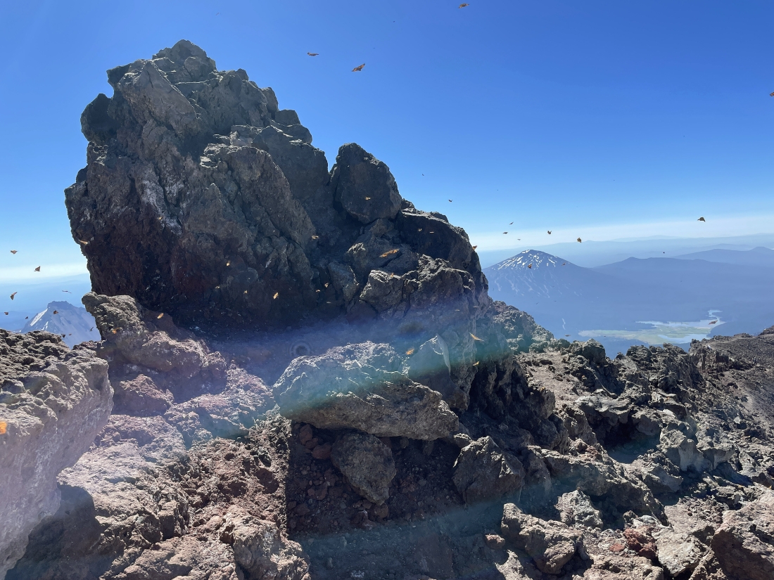
Almost to the summit of South Sister... here looking down into the crater at the 'Teardrop Pool'.
|
|
I have hiked just past the South Sister summit to take this photo of Middle Sister (left) and North Sister (right)... looking down on the Chambers Lakes... with Broken Top in the distance on the extreme far right... also notice the butterfly in the photo.
|
Looking back at the summit on the left... with most of the crater visible.
|
Looking down on Chambers Lakes and out to Middle Sister and North Sister... and notice all of the Monarch Butterflies in the photo. I saw at least a thousand butterflies up at the crater.
|
I had someone take this photo of me on the 10,358 foot summit of South Sister... with Mount Bachelor on the horizon just to the left of my head... with Hodge Crest just to the left of my peace sign... and Broken Top out there on the left... and more butterflies. Reaching the 10,358 foot summit was a 5.9 mile hike, gaining 4,921 feet of elevation.
|
Tracing my steps back around the crater rim... this is a terrible photo... but look at the Monarch butterflies... I saw hundreds of them on this hike near the crater.
|
|
Continuing to trace my steps back around the crater... here looking at Hodge Crest in the left foreground... with Broken Top beyond Hodge Crest... with Mount Bachelor on the horizon in the left-center of the photo.
|
Kind of a so-so photo... but notice at least 100 butterflies traveling just above the lava. I feel like I saw thousands of them instead of hundreds.
|
Leaving the crater rim of South Sister and heading down 'The Red Mile'... Broken Top is in the distance on the far left and I can see two of the three Green Lakes below Broken Top.
|
Heading down 'The Red Mile'... notice the Monarch butterfly in the upper left corner of the photo. I assume the butterflies are either spawning or migrating... or both.
|
Looking up 'The Red Mile' as I head down it.
|
Heading down 'The Red Mile'... what looks like rocks on the Lewis Glacier are really butterflies.
|
Just above the Lewis Glacier Tarn... with Lewis Glacier Peak on the other side of the tarn... notice the hiking path that goes across the bottom of the peak... that path leads down to the Green Lakes.
|
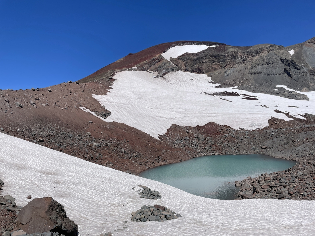
My last look at the Lewis Glacier Tarn before I continue tracing my steps back down.
|
Heading back down steep terrain... looking for the flatish plateau down there in the right-center of the photo.
|
Continuing to trace my steps down... with the flatish plateau down there in the middle of the photo.
|
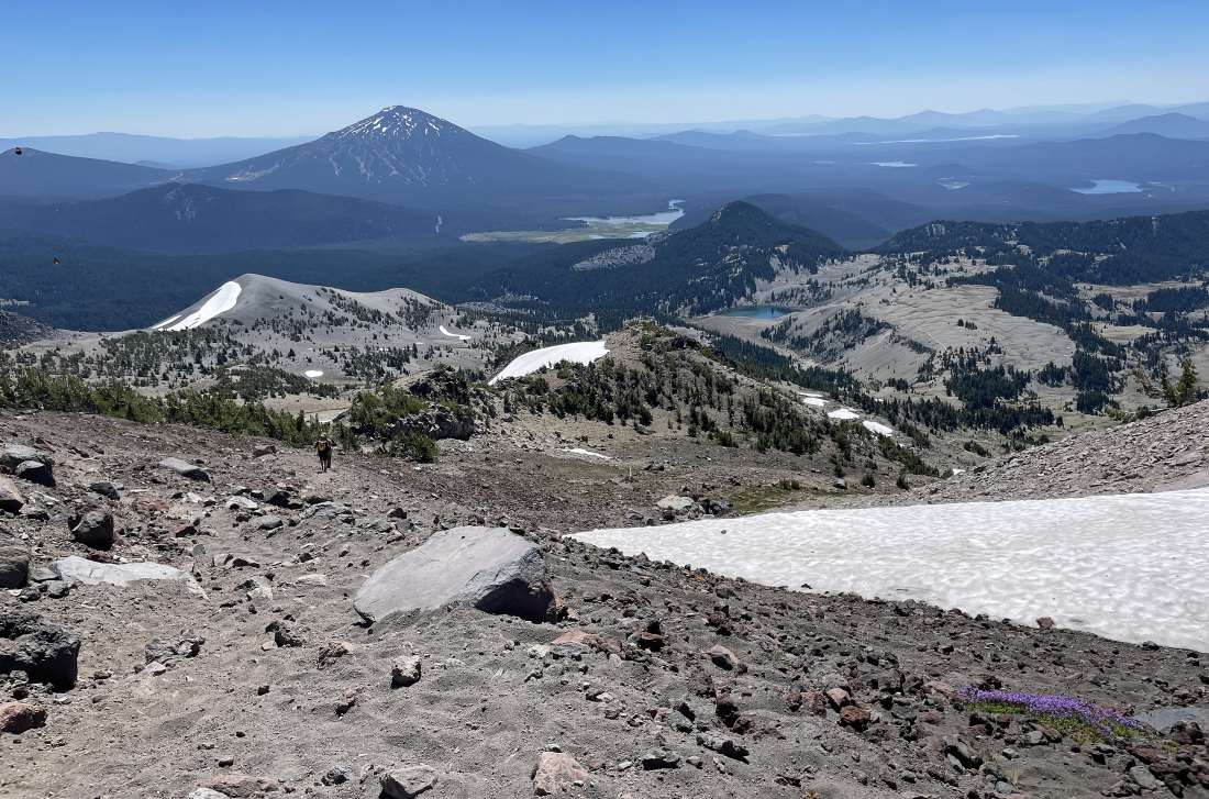
I have reached the flatish plateau... with Mount Bachelor out there on the middle horizon... with Devils Hill in the right foreground... and Tumalo Mountain on the horizon to the left of Mount Bachelor.
|
Continuing to hike along the flatish plateau... looking back at South Sister on the left and Broken Top on the right.
|
Looking down on Moraine Lake as I continue hiking on the flatish plateau... with Broken Top on the left... and Mount Bachelor and Devils Hill on the right.
|
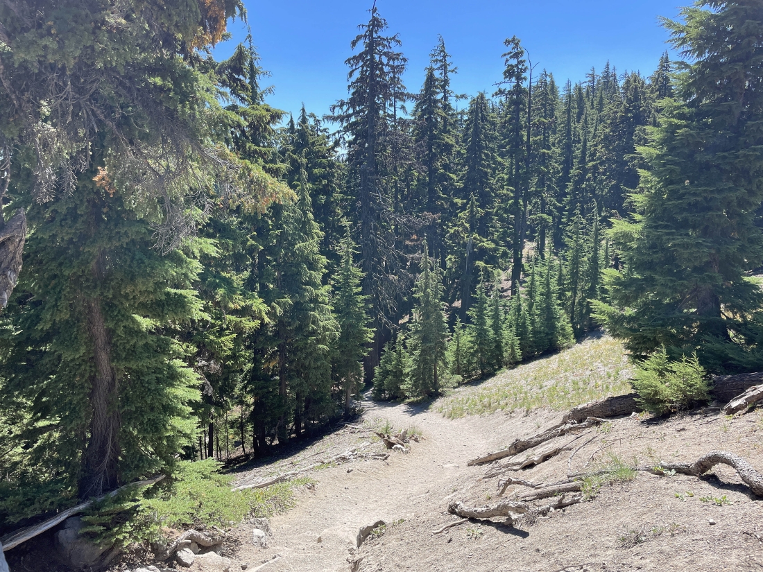
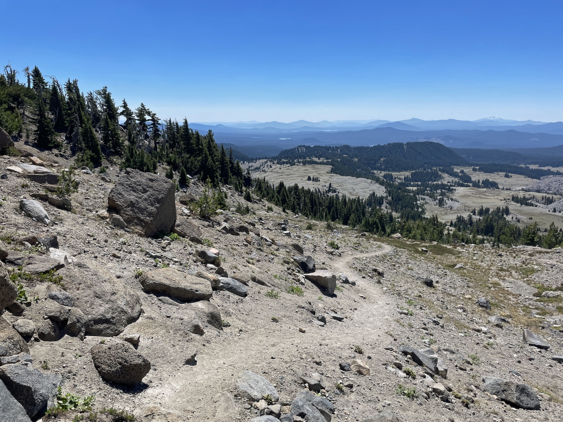
Leaving the flatish plateau and heading down into the forest.
|
I have returned to the trail sign that I found this morning at the top of the restoration area... so I will not go back down the restoration area... instead I will head for the Devils/Wickiup Trailhead.
|
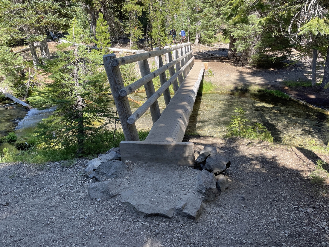
Crossing the Tyee Creek which feeds into Devils Lake.
|
Heading to the Devils/Wickiup Trailhead.
|
The Wickiup Trailhead which is very close to the underpass in the next photo.
|
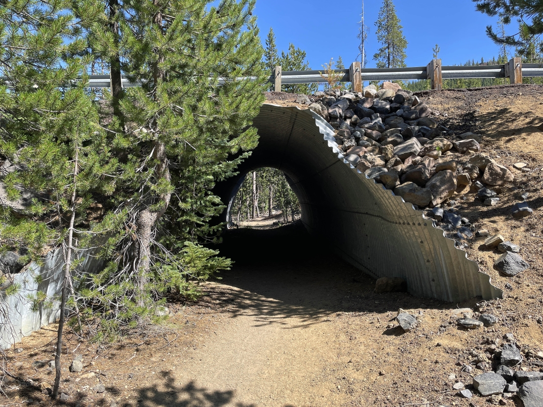
The underpass that goes underneath the Cascade Lakes Highway. A forest service worker told me that the reason the South Sister Climbing Trail #36 uses this acces from the Devils Lake Parking Lot is that hikers no longer have to cross the highway... instead hikers can go underneath the highway... in my opinion I would rather cross the highway and use the restoration area than use the Devils/Wickiup Trailhead from the Devils Lake parking lot. Until this restoration thing the round trip was 11.8 miles... now it is 12.6 miles.
|
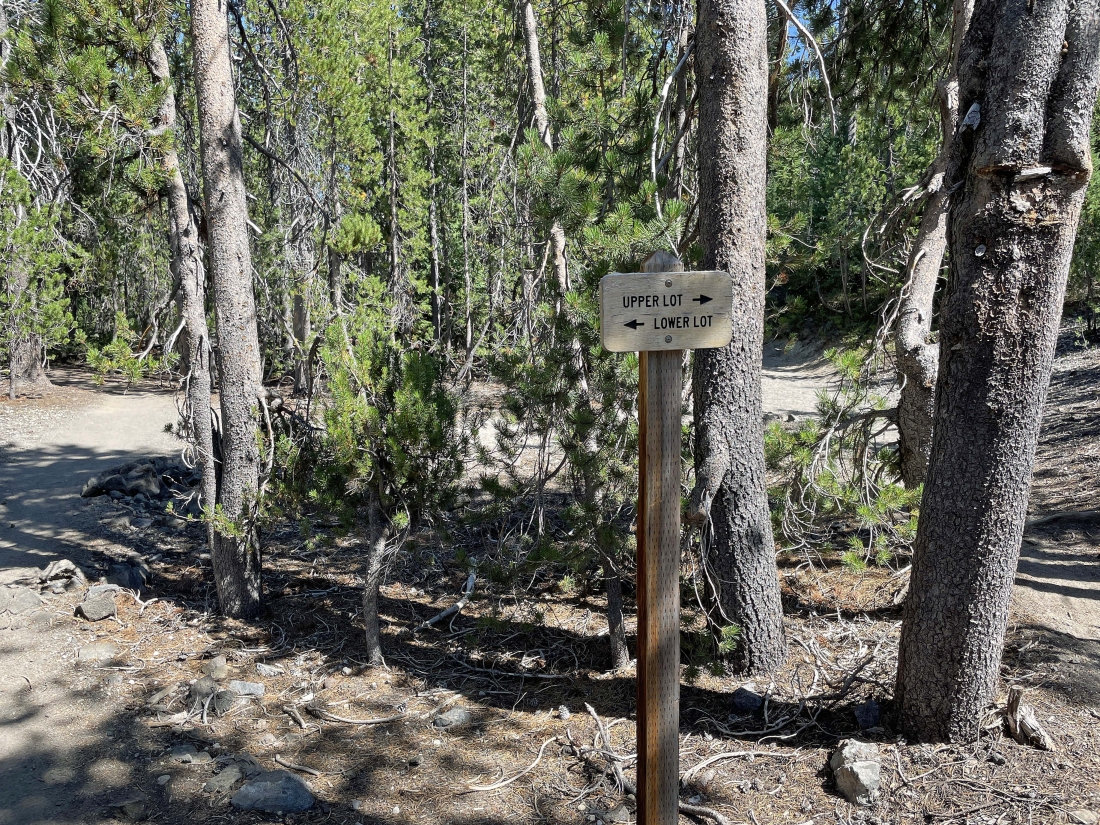
At Devils Lake there is a lower lot and an upper lot... both are about the same distance to the Devils/Wickiup Trailhead... and the parking lots are very close to this sign... the hike was a total of 12.2 miles, gaining 4,987 feet of elevation.
|
