Snoqualmie Mountain East - 9.12.2025
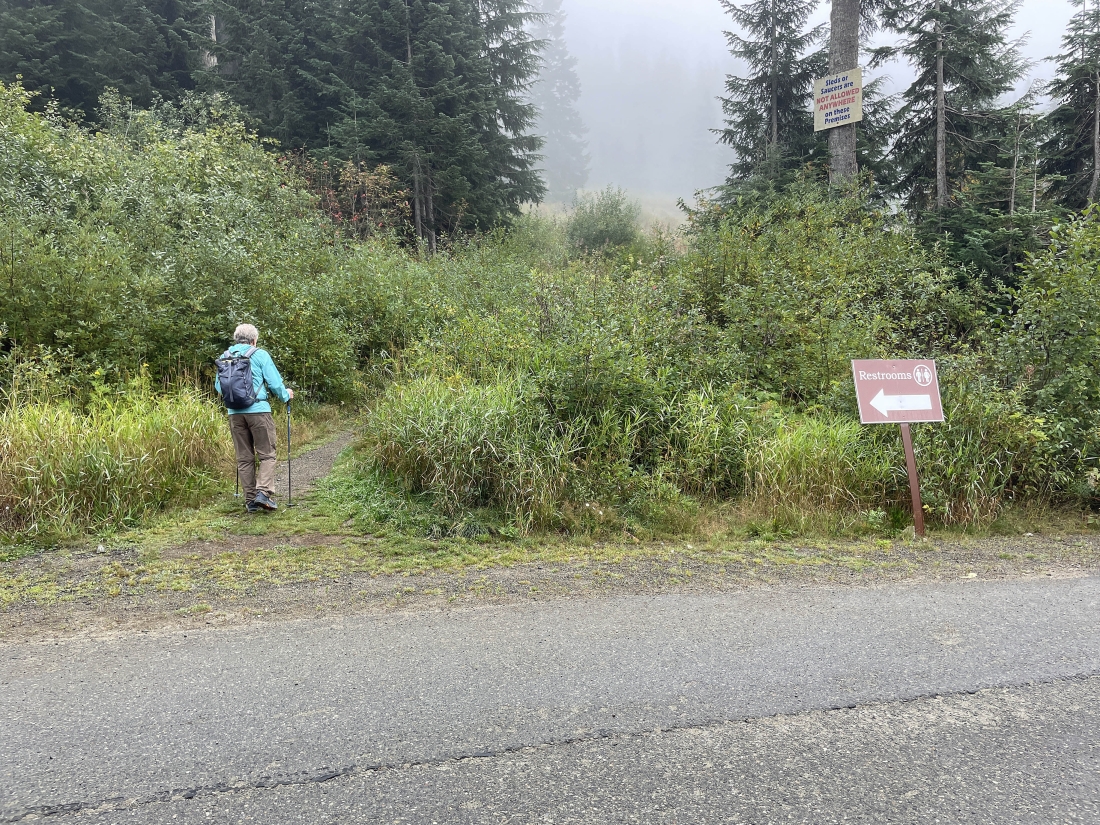
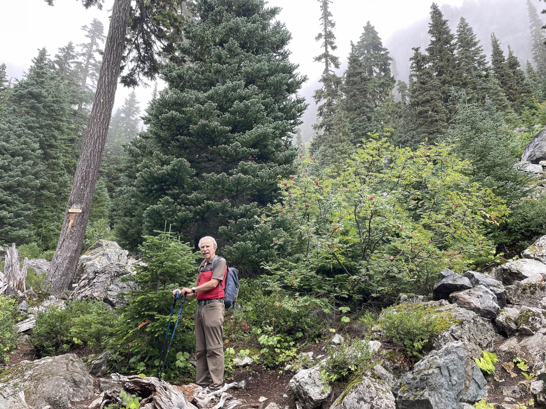
We parked in the main parking lot for the Alpental Ski Area... then crossed the access road and walked a short distance to find the unsigned trailhead that is very overgrown... but look for a sign high on a tree that says 'Sleds or Saucers are not allowed anywhere on these premises'... this unsigned trail is referred to as the 'Snoqualmie Mountain Trail'.
|
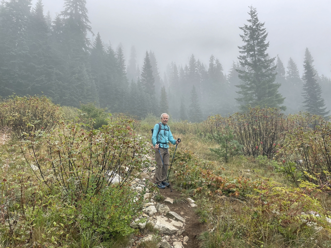
Continuing up the unsigned trail.
|
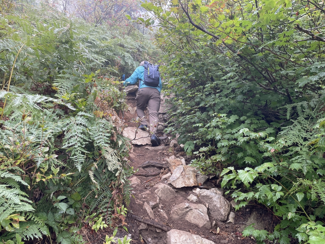
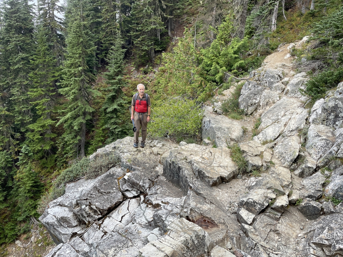
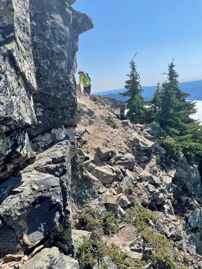
After a short distance on the unsigned trail the terrain gets very steep.
|
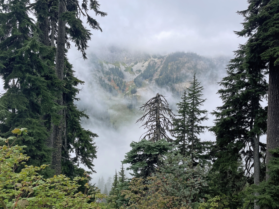
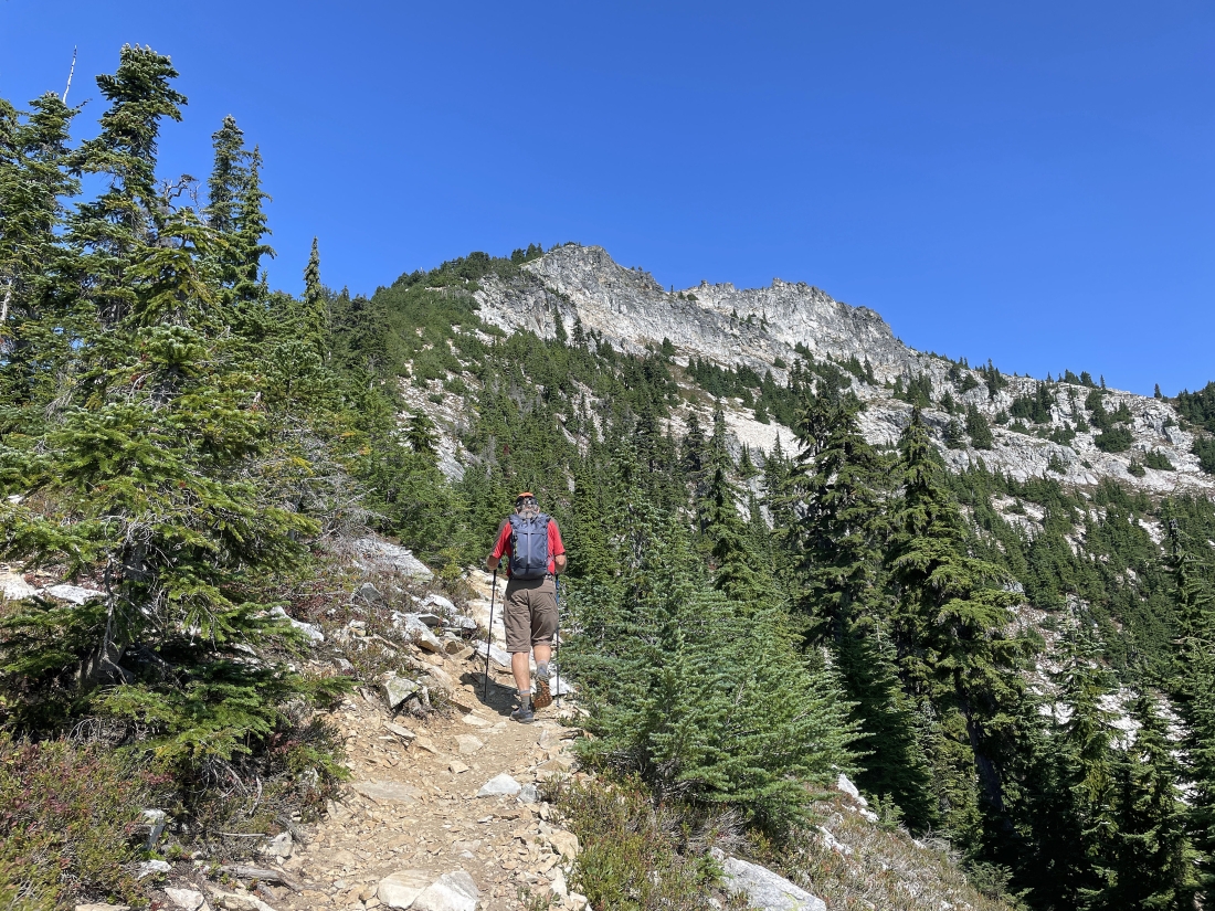
Gaining elevation quickly and looking across the valley at the Alpental Ski Area.
|
After hiking six-tenths of a mile and gaining a total of 1,180 feet of elevation we have reached an area where hikers can leave this trail and head over toward Guye Peak... but we will continue on up to Snoqualmie Mountain.
|
We are crossing the stream that comes down from the valley that divides Snoqualmie Mountain and Cave Ridge.... we are at 4,440 feet of elevation... having gained a total of 1,340 feet of elevation in three-quarters of a mile.
|
Looking across the valley at the Alpental Ski Area on the east side of Denny Mountain.
|
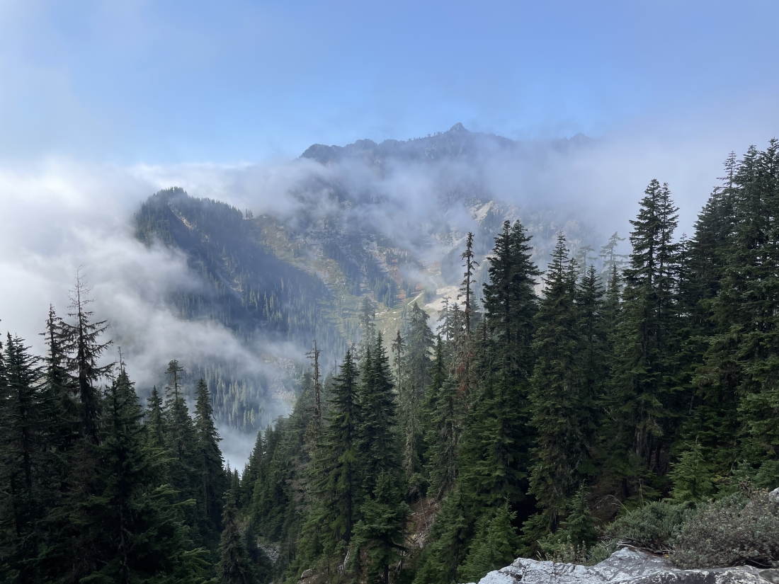
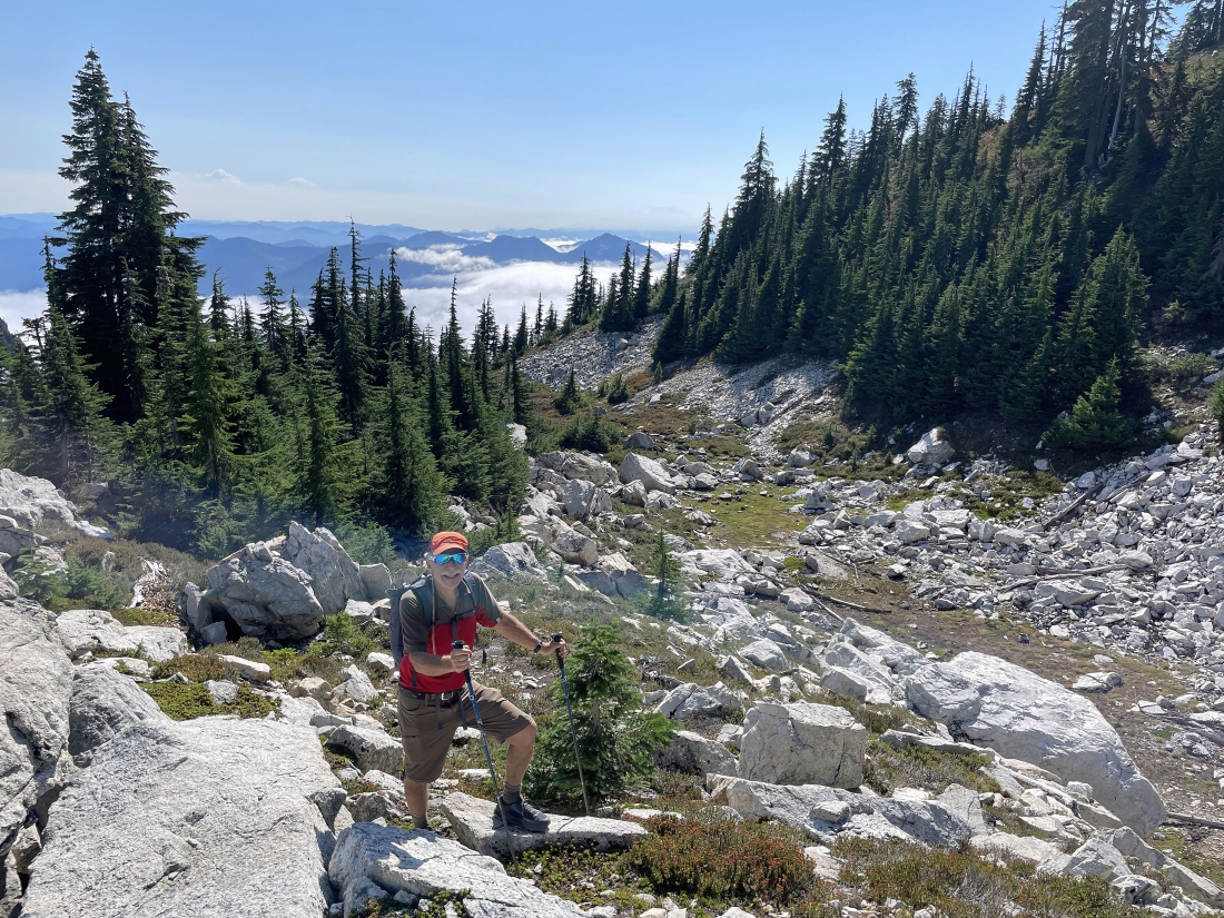
Pretty much out of the trees now... looking NE up the valley that separates Cave Ridge from the south side of Snoqualmie Mountain.
|
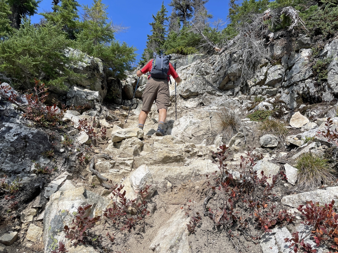
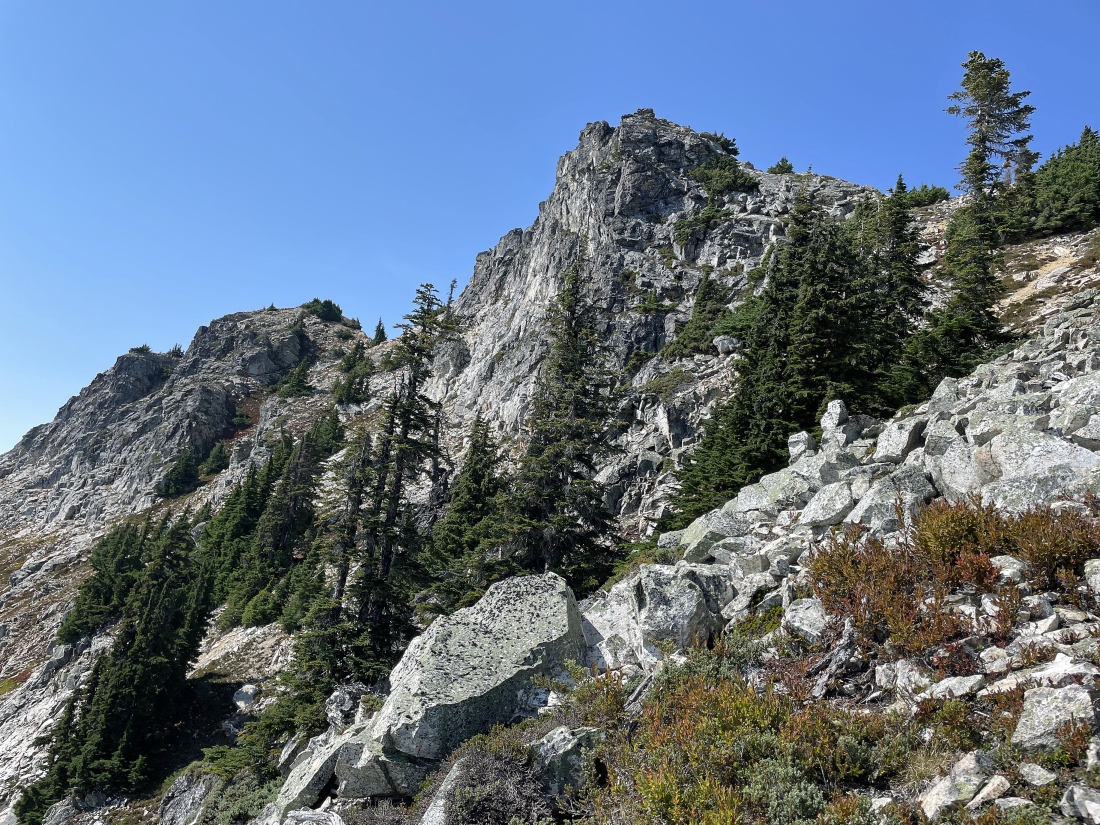
The trail remains very steep.
|
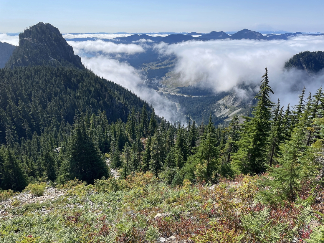
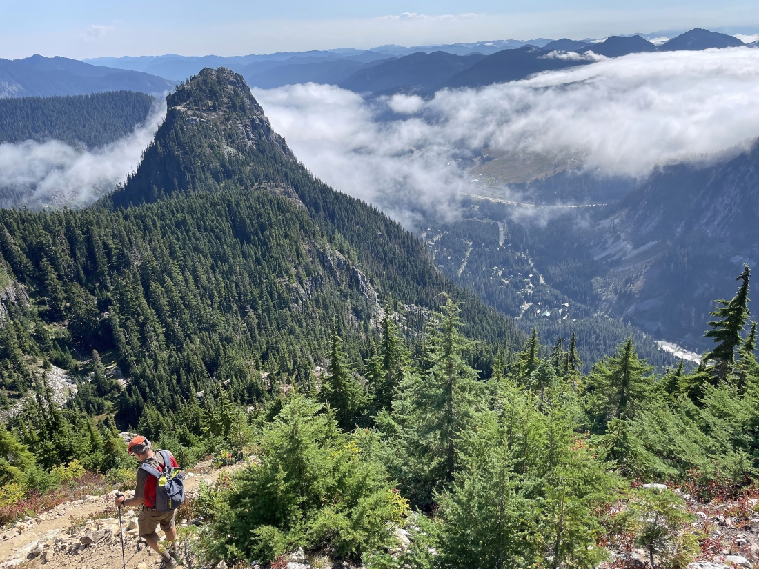
Continuing to gain elevation... here looking back down at Guye Peak on the left... with some of the Snoqualmie Pass ski area down there in the middle of the photo... with Tinkham Peak and Silver Peak the highest peaks just above the clouds in the right-center of the photo.
|
Continuing to gain elevation on Snoqualmie Mountain... and left-to-right on the horizon... The Tooth, Hemlock Peak and Bryant Peak.
|
Continuing to gain elevation... here looking east to Red Mountain in the left foreground and SE to Kendall Peak in the right foreground. Part of the Pacific Crest Trail crosses the middle of Kendall Peak.
|
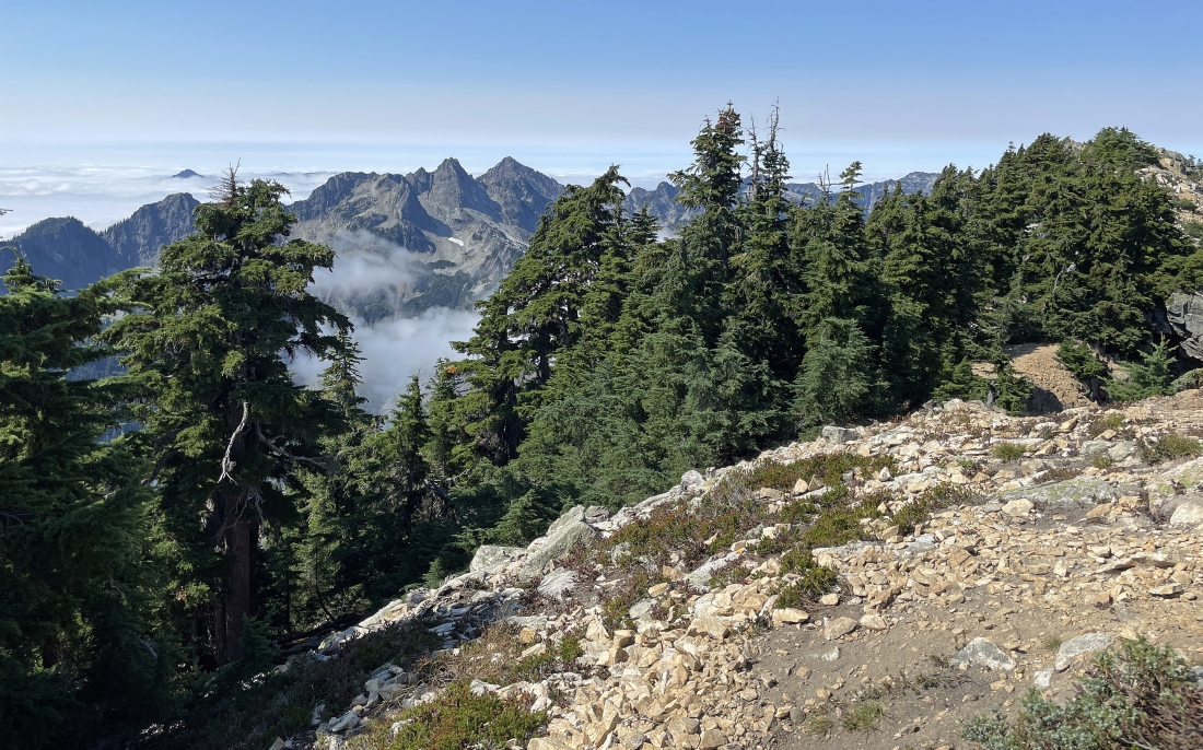
Continuing to gain elevation... and now we can see the Snoqualmie summit areas above.
|
Looking SW to Denny Mountain in the left foreground... and just beyond Denny Mountain the two summits of Granite Mountain are on the horizon. The Tooth, Hemlock Peak and Bryant Peak are in the middle of the photo... with Chair Peak partially hidden on the far right.
|
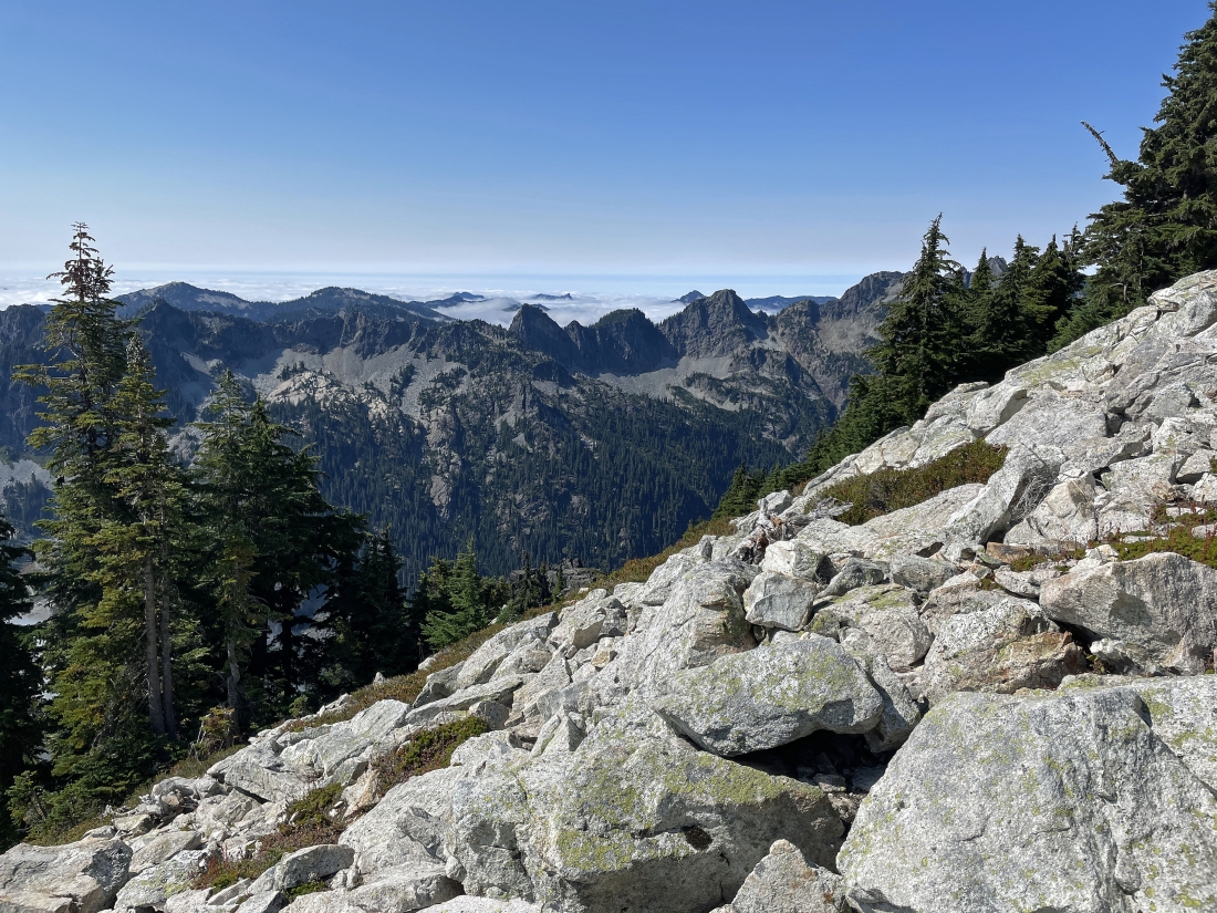
Looking back down at Guye Peak... and in the distance beyond the tip of Guye Peak and the clouds we can see part of Keechelus Lake.
|
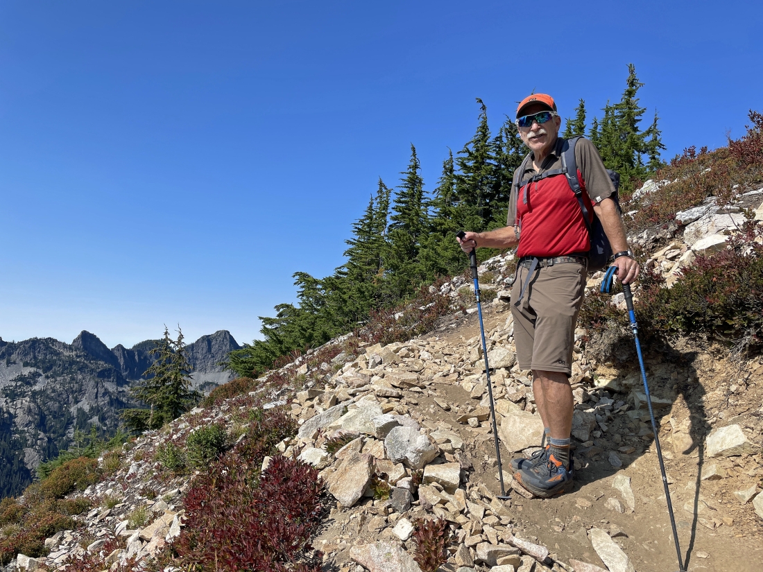
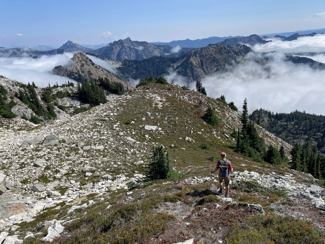
After hiking a total of 1.5 miles we have reached one of the false summits of Snoqualmie Mountain at 6,273 feet... having gained a total of 3,170 feet of elevation... here looking over at the east summit in the middle of the photo... in the last few years the east summit has been recognized as the highest summit of Snoqualmie Mountain.
|
On the left we are looking east to the east summit of Snoqualmie Mountain... in the middle of the photo we are looking south... down on Cave Ridge and Guye Peak in the foreground... with Denny Mountain and the two summits of Granite Mountain to the southwest on the extreme far right.
|
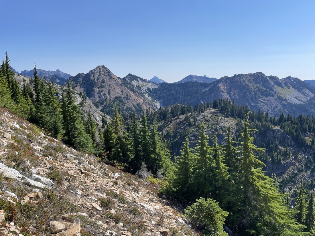
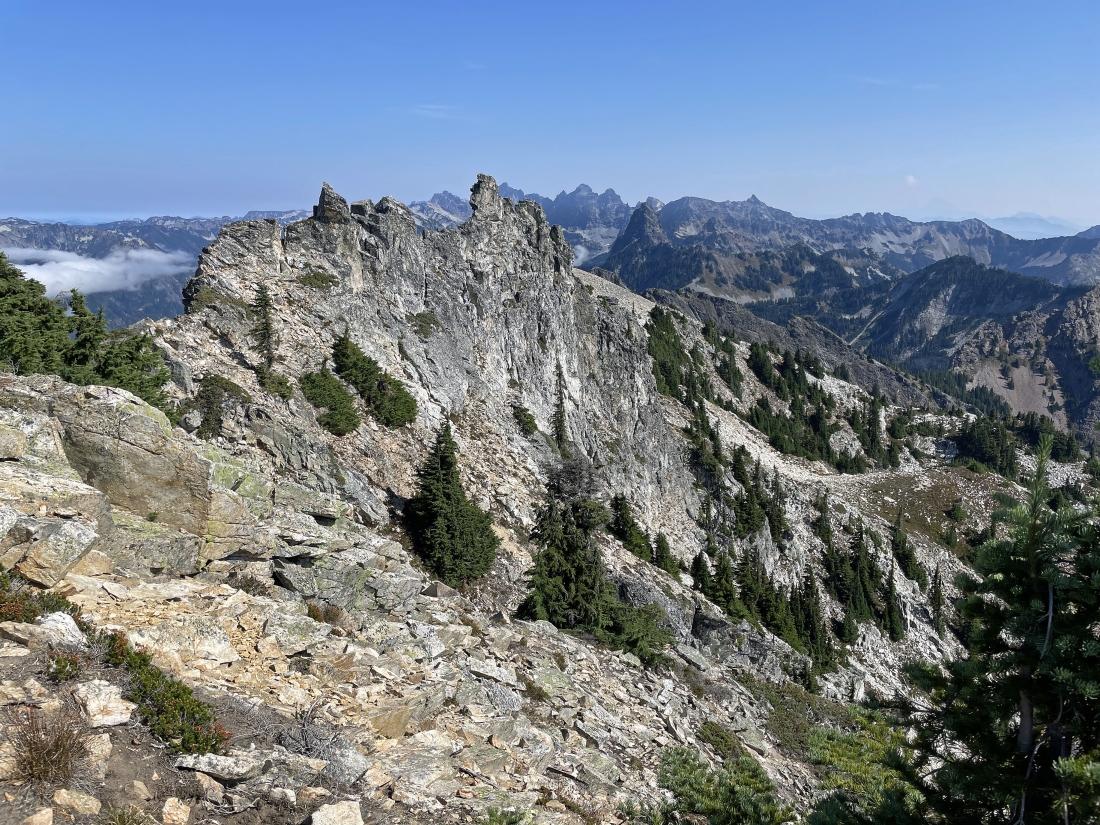
On the far left we are looking west to Hemlock Peak and Bryant Peak... with Chair Peak and Kaleetan Peak in the left-center of the photo... and what used to be called the highest summit of Snoqualmie Mountain in the right foreground.
|
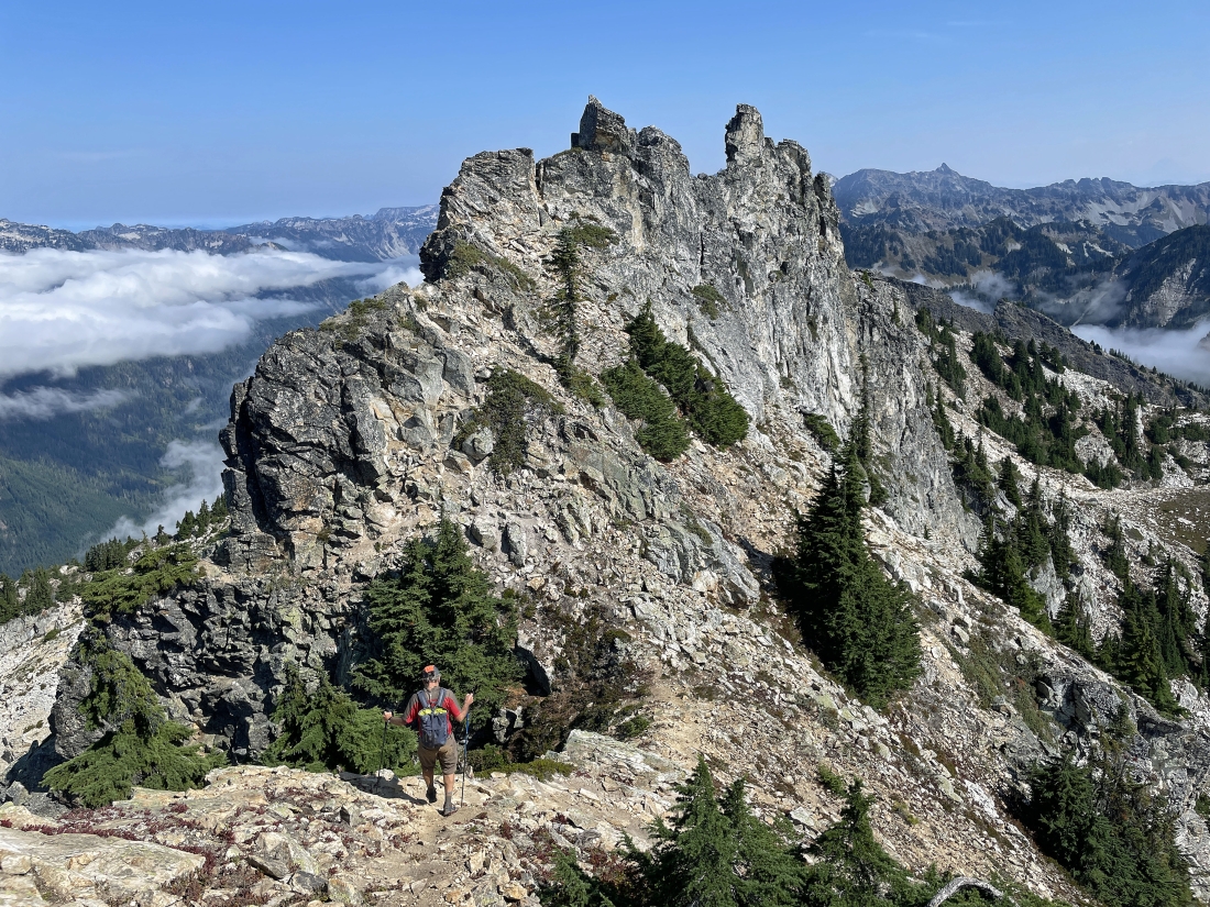
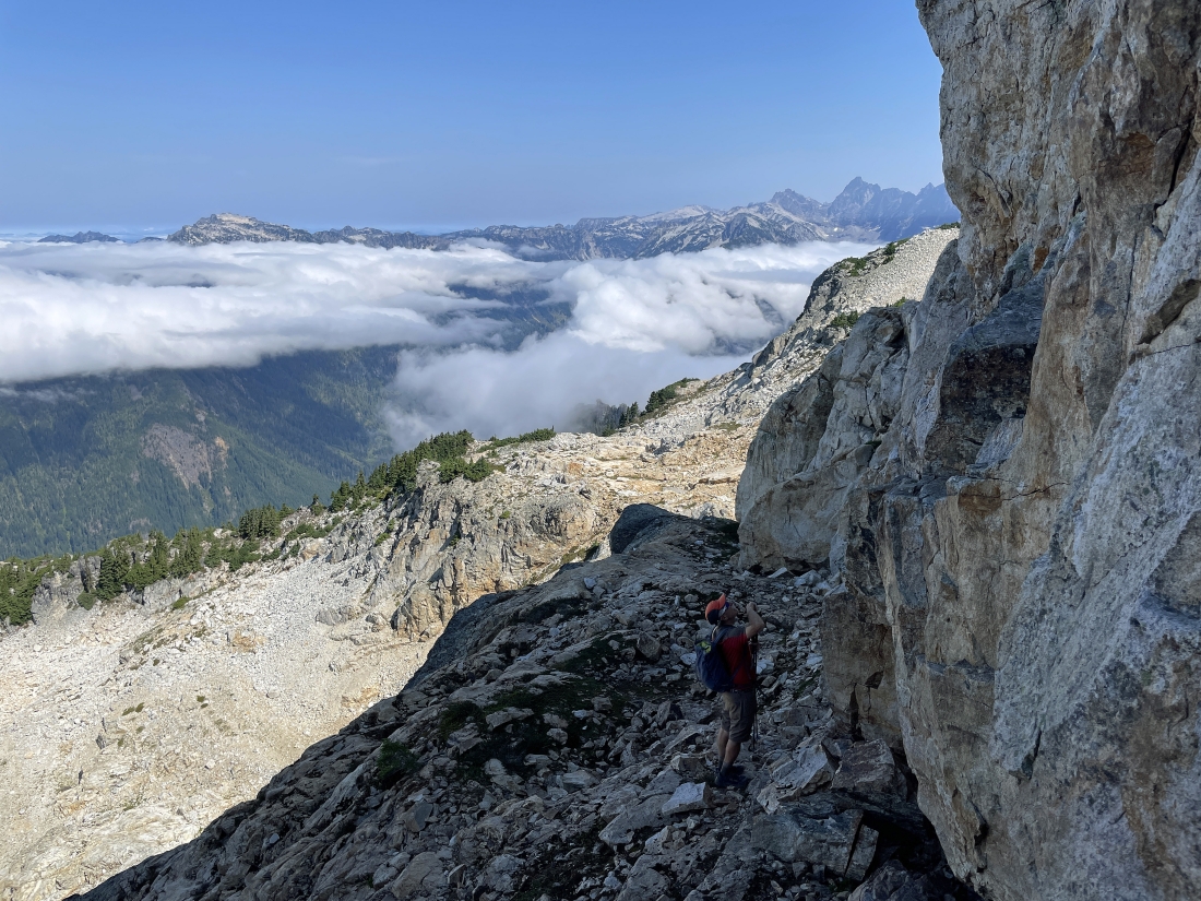
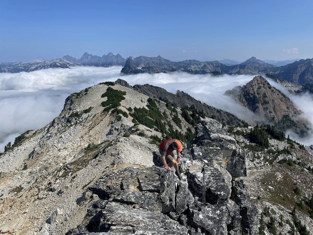
iraman is giving up a little elevation on his way over toward the east summit of Snoqualmie Mountain... the pointy peak on the right horizon is Chikamin Peak... with the Four Brothers on the far right horizon.
|
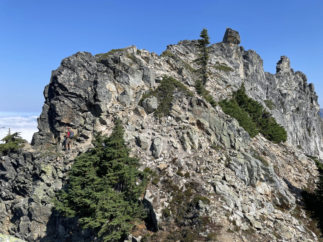
iraman works his way over toward the north side of the east summit.
|
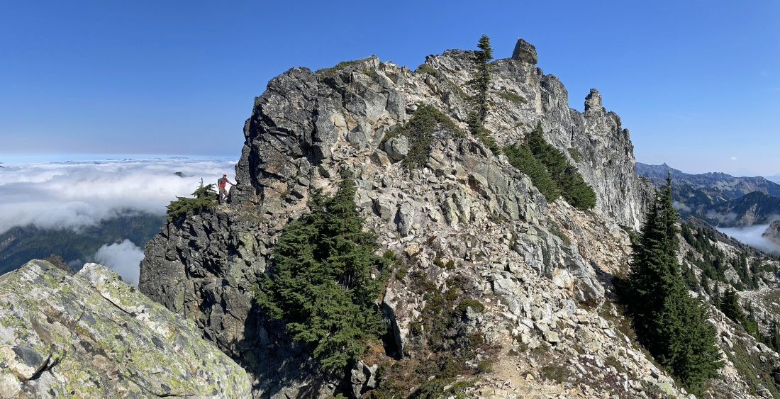
iraman waits for me to come over and join him before we continue down onto the north side of the east summit.
|
iraman took this shot of me coming over to join him.
|
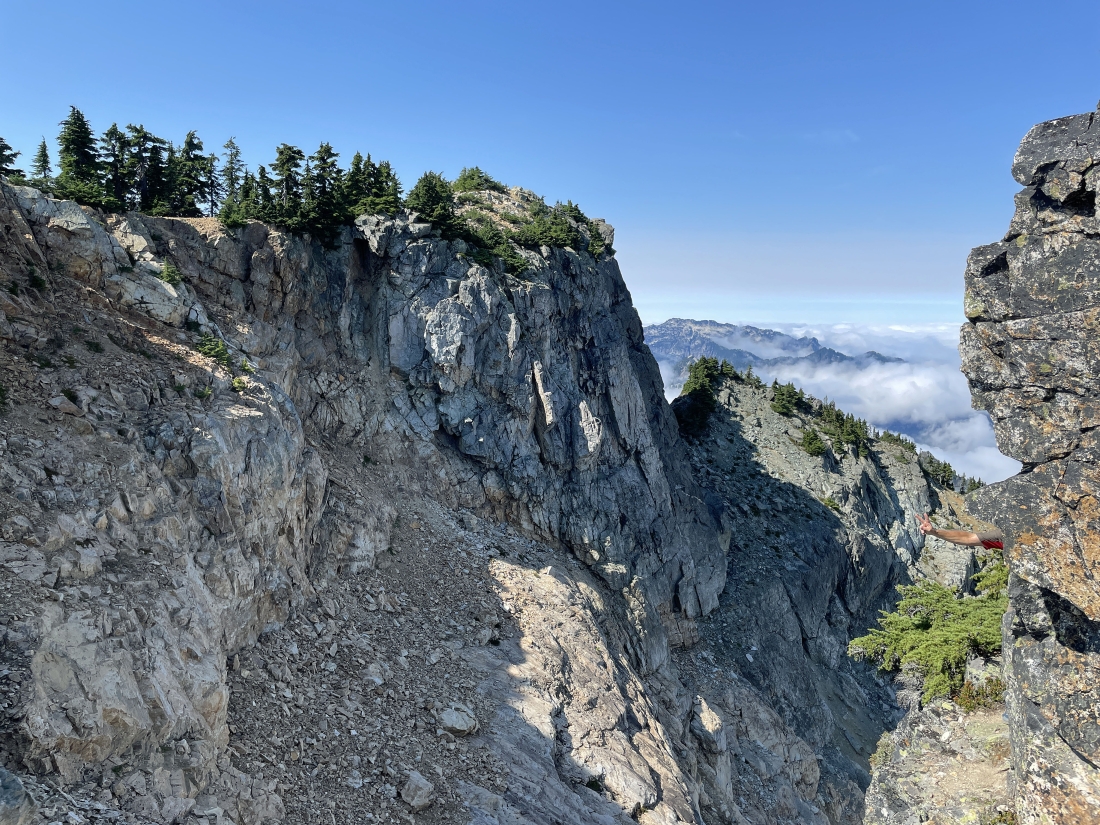
I'm heading over along this narrow ledge to join iraman who is giving me the peace sign... and here we are looking over at what used to be called the true summit of Snoqualmie Mountain.
|
Now we are on this ramp on the north side of the east summit of Snoqualmie Mountain... and we will give up a little elevation to work our way over to the east side of the east summit.
|
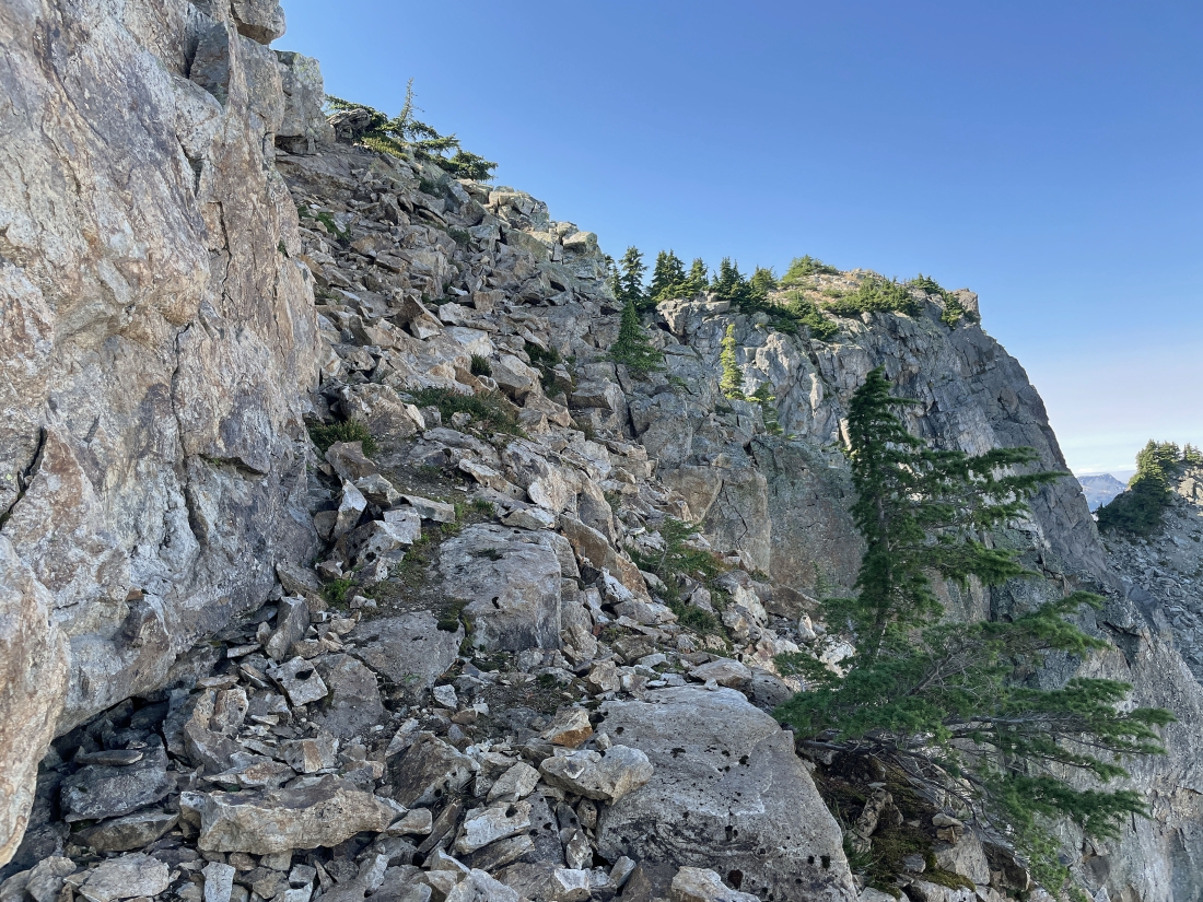
Looking back up the ramp that we have just come down on the north side of the east summit... with what used to be called Snoqualmie's true summit up there on the right.
|
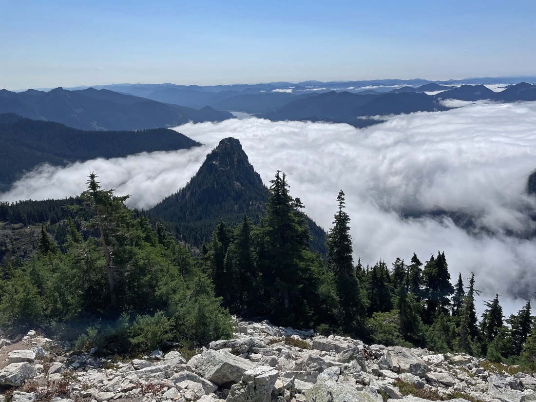
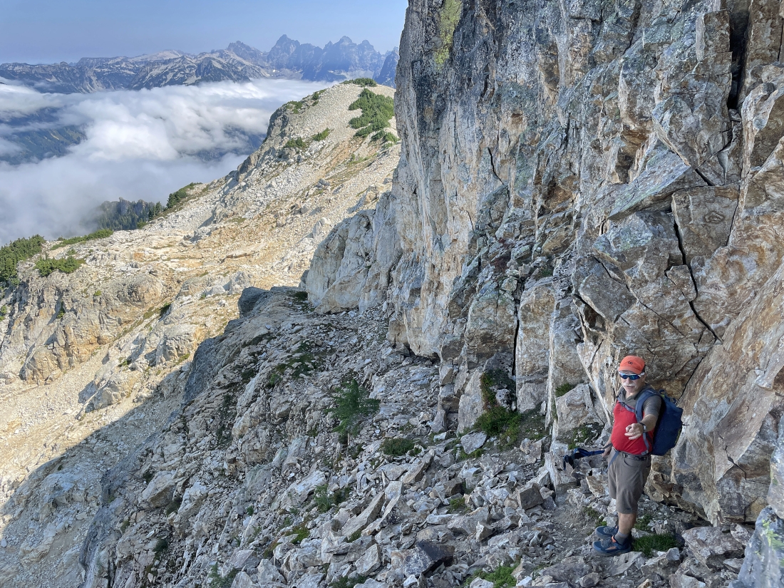
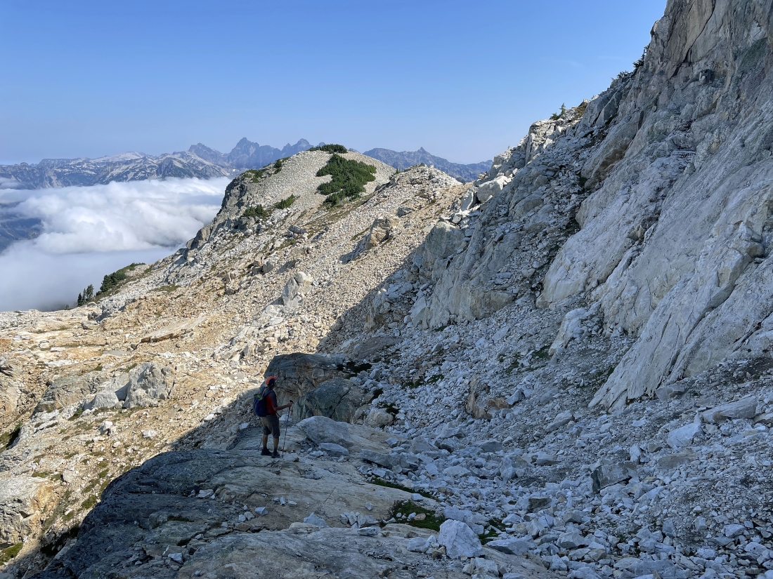
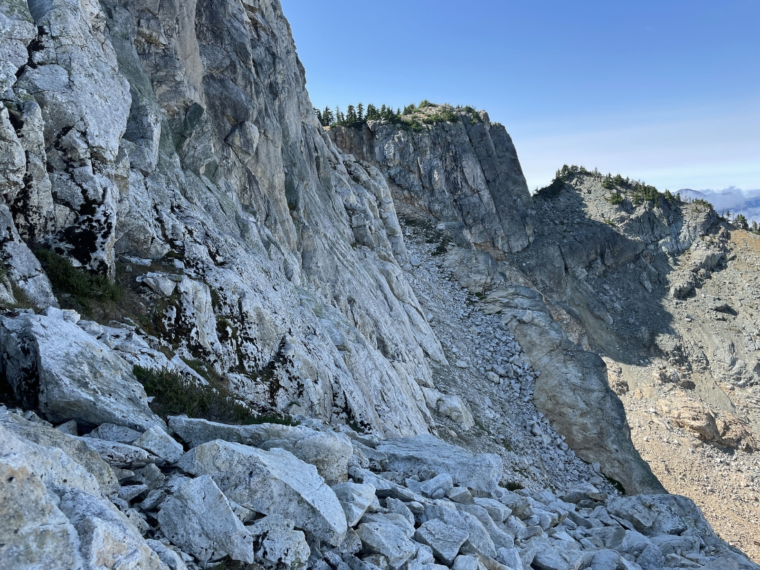
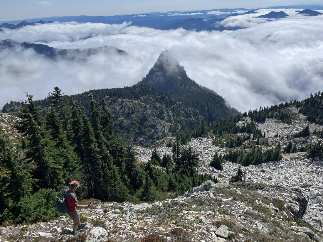
Continuing down the ramp on the north side of the east summit... iraman is looking for a route up to the east summit... but it isn't going to work here. Pretty sure that Big Snow Mountain is on the far-left horizon... with Chimney Rock on the far-right horizon.
|
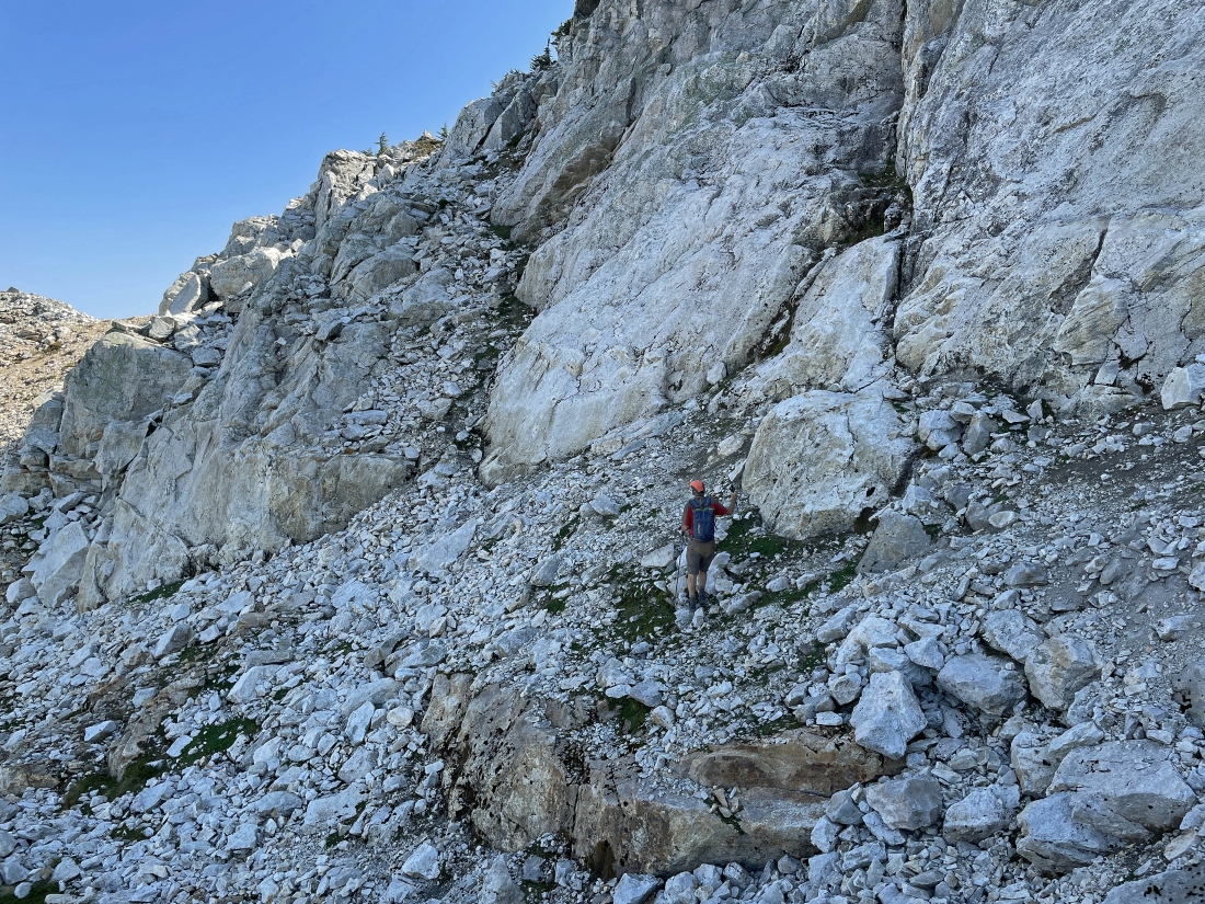
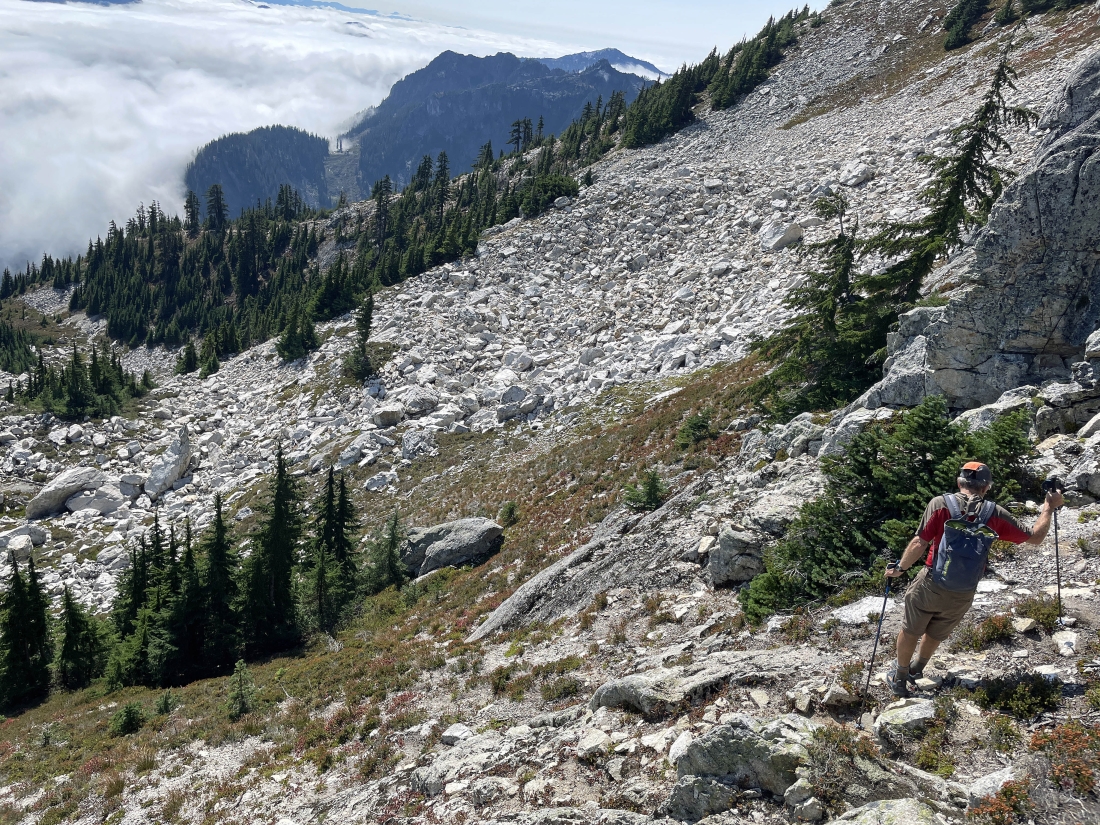
We have continued down to approximately 6,120 feet on the north side of the east summit... and iraman sees a potential route that will get us up to the east side of the east summit. The bump out there in the middle of the photo is referred to as the 'Snow Dome' on some maps.
|
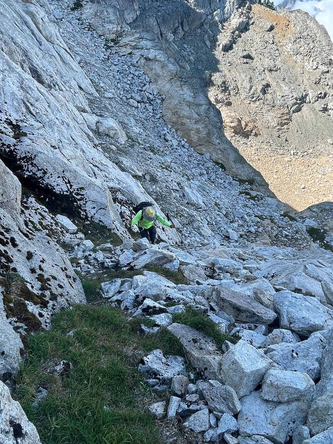
Heading over to kind of a gully that will get us up to the east side of the east summit.
|
iraman is almost up to the top of the gully that will get us on the east side of the east summit.
|
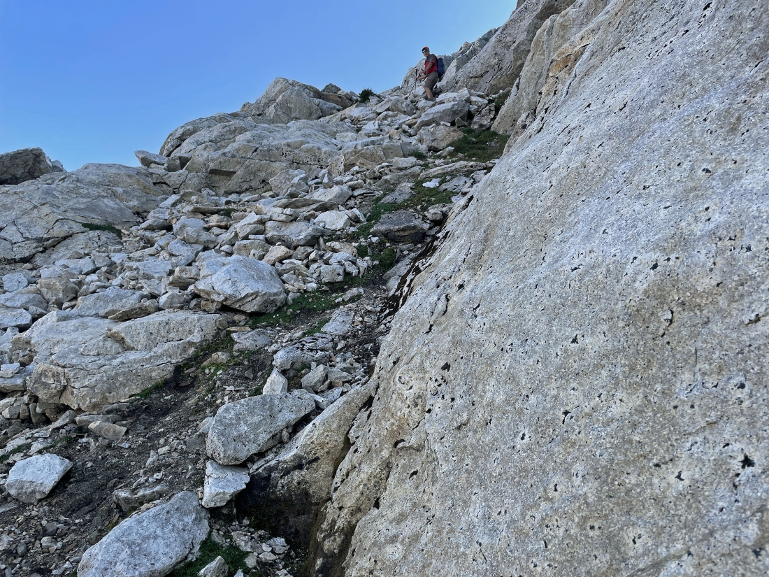
I'm almost up to the east side of the east summit... here looking over to what used to be called the true summit of Snoqualmie Mountain... and looking at the ramp on the north side of the east summit that we used to get over here.
|
iraman took this photo of me coming up the gully to join him on the east side of the east summit.
|
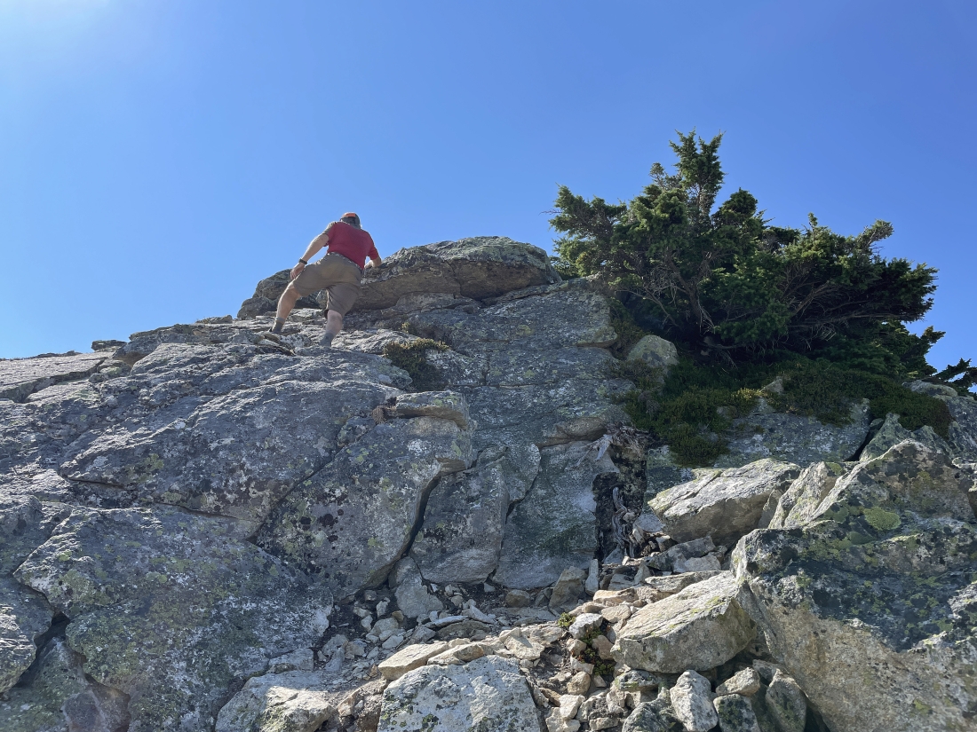
iraman has started to ascend the east summit of Snoqualmie Mountain.
|
iraman continues up the east side of Snoqualmie's east summit.
|
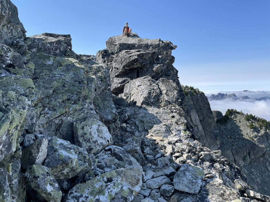
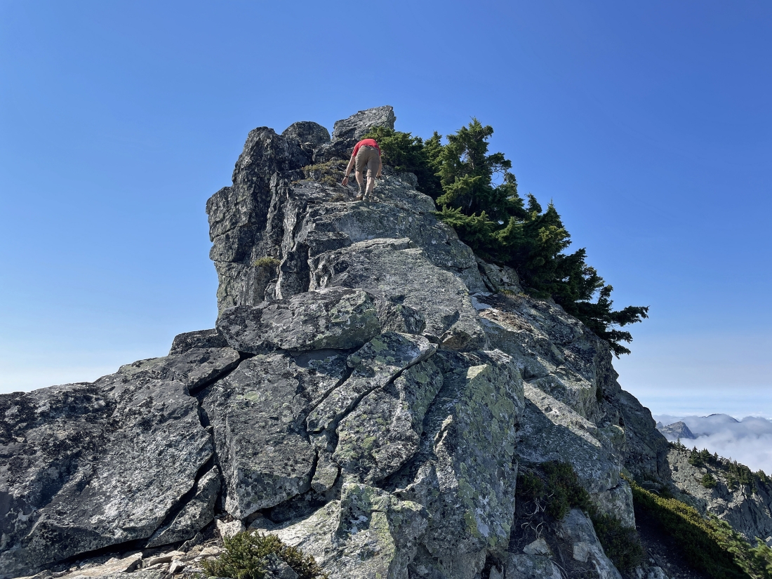
iraman relaxes on the east summit of Snoqualmie Mountain... and I believe that is Mount Roosevelt in the distance on the far right.
|
iraman relaxes on the 6,286 foot east summit of Snoqualmie Mountain... looking over at what used to be called the true summit.
|
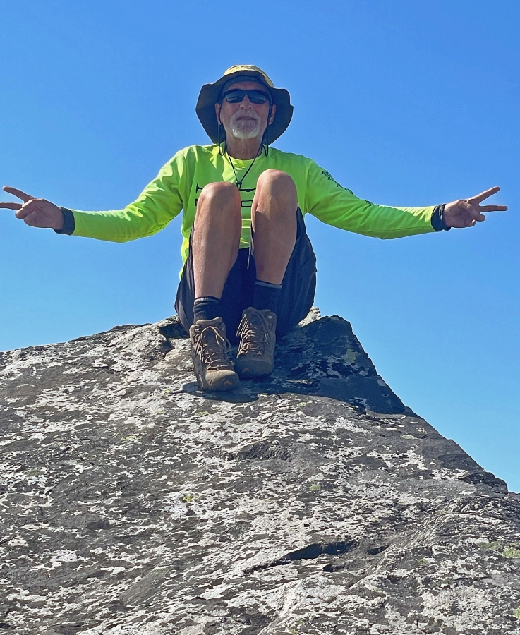
I was there also.
|
Heading back down from the east summit... more or less tracing the steps that we used to get up to the summit.
|
We will take a cross-country route on the way back to join the main trail we used to get up to the false summit area of the mountain.
|
Continuing down.
|
Looking back up at the east summit as we head down... now we are on the south side of the east summit.
|
Heading over to the ridge on the far right where we will rejoin the main trail... but we do have a lot of rocks to deal with to get over there. Looks like the clouds want to cover Guye Peak.
|
Working our way over to the main trail... Denny Mountain is out there in the distance... with Granite Mountain on the horizon beyond Denny.
|
Almost over to the ridge where we will rejoin the main trail... with Tinkham Peak and Silver Peak just beyond the clouds.
|
Back on the main trail... with every step being downhill from here.
|
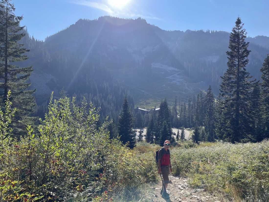
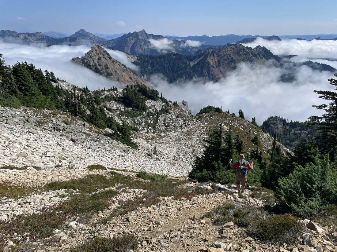
Almost back down to the Alpental Ski Area... the hike/scramble was a total of 3.4 miles, gaining 3,400 feet of elevation.
|
