Misery Ridge - 4.26.2026
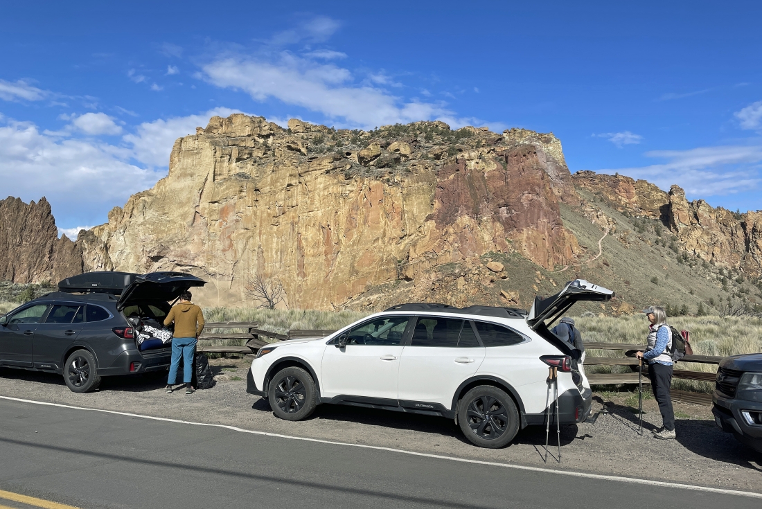
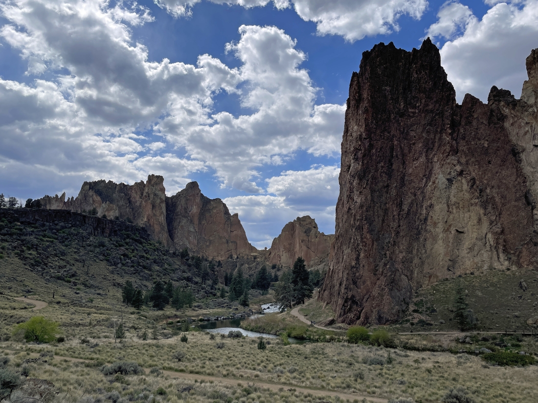
We parked on the side of Northeast Crooked River Drive in Smith Rock State Park... here looking out to the massive Picnic Lunch Wall which is below Misery Ridge.
|
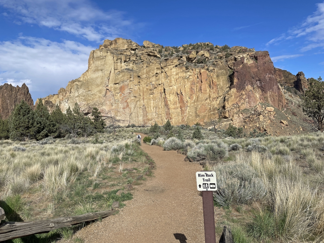
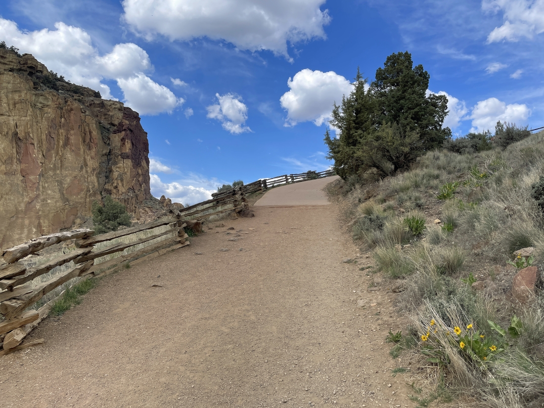
From where we parked we walked the Northeast Crooked River Drive for a very short distance where we left the drive and took the Rim Rock Trail... heading toward the Picnic Lunch Wall.
|
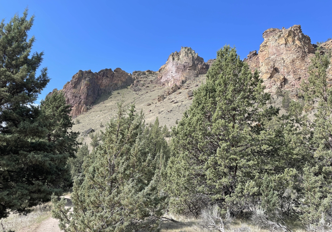
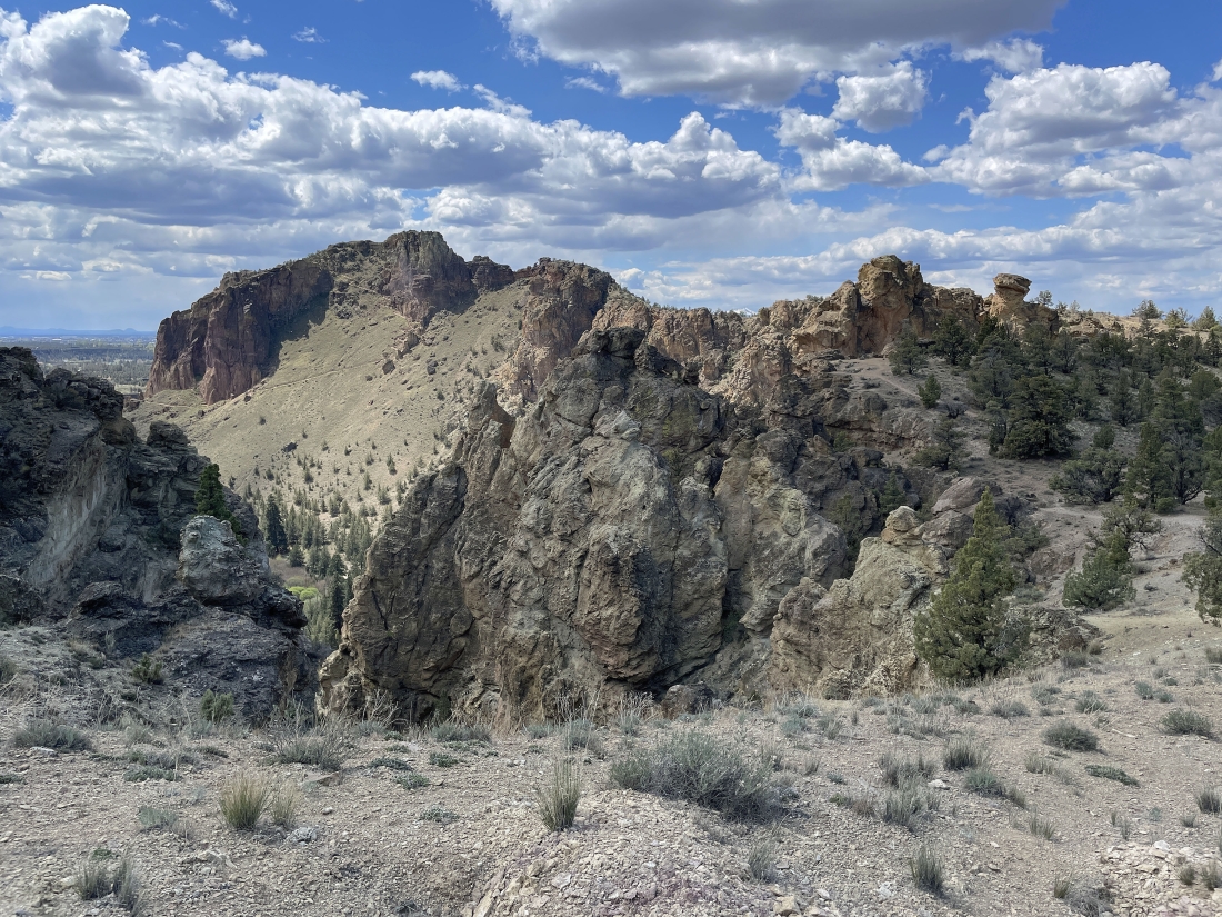
We only hiked the Rim Trail for a very short distance and getting ready to take 'The Chute' Trail which will take us down to the Crooked River... the huge rock formation on the extreme far left horizon is 'Smith Rock'... the dark brown rock formation in the left-center foreground is 'Ship Rock'... the massive rock wall in the middle of the photo is the 'Picnic Lunch Wall'.
|
We are getting ready to head down 'The Chute' Trail which will take us down to the bridge crossing the Crooked River below... on the other side of the bridge below you can see the switchbacks that start steeply uphill on the Misery Ridge Trail... we won't be going up that trail... but we will be coming down that trail at the end of our hike.
|
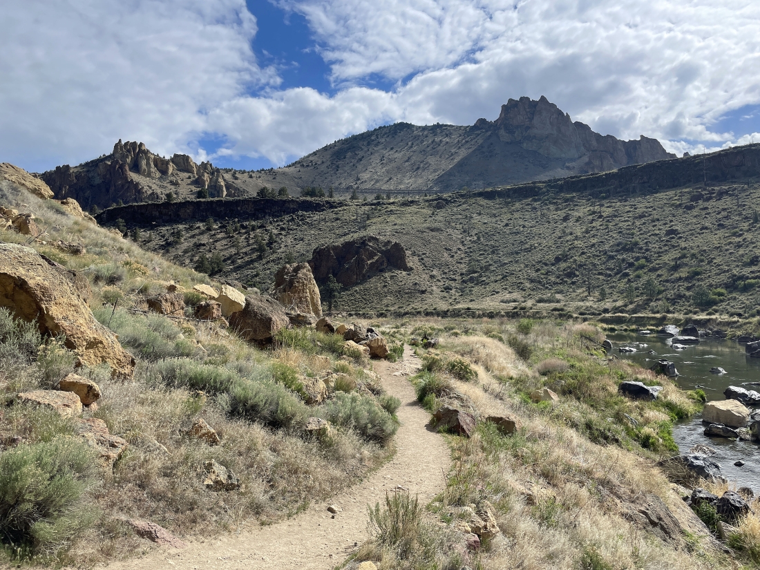
We have crossed the bridge over the Crooked River and took a 90 degree right turn onto the Wolf Tree Trail which we will follow along the river for 1.4 miles... heading for the Burma Road which will take us up to the flatish area on the left-center horizon. That is the Marsupial Crags on the right-center horizon.
|
|
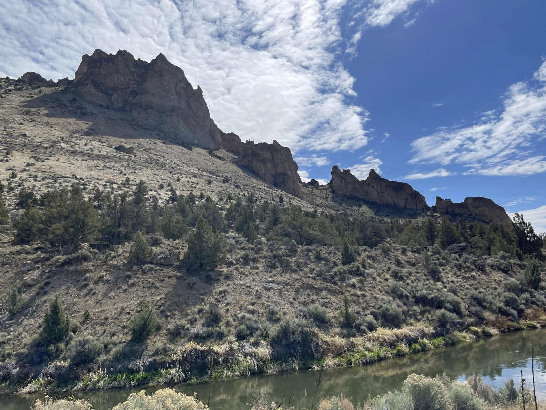
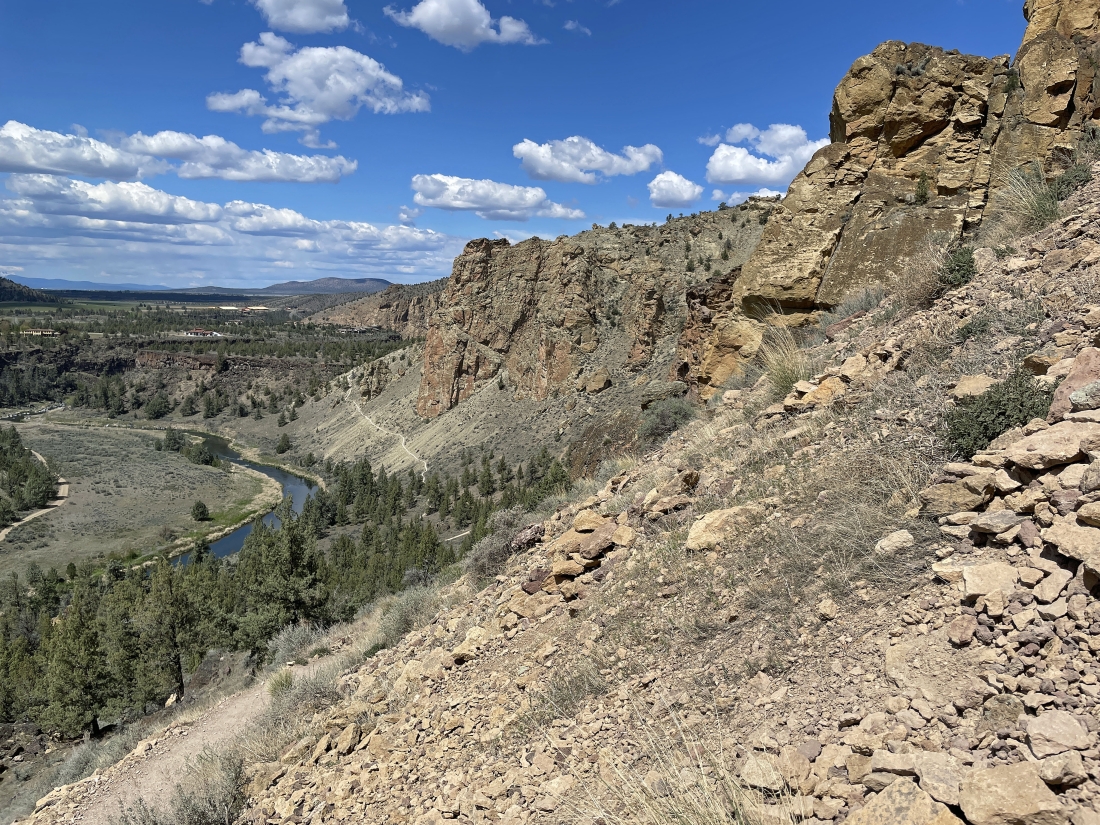
Following along the Crooked River on the Wolf Tree Trail and looking up at the Red Wall... the Misery Ridge Trail goes just below the Red Wall for awhile... then wraps around it and switchbacks up to Misery Ridge.
|
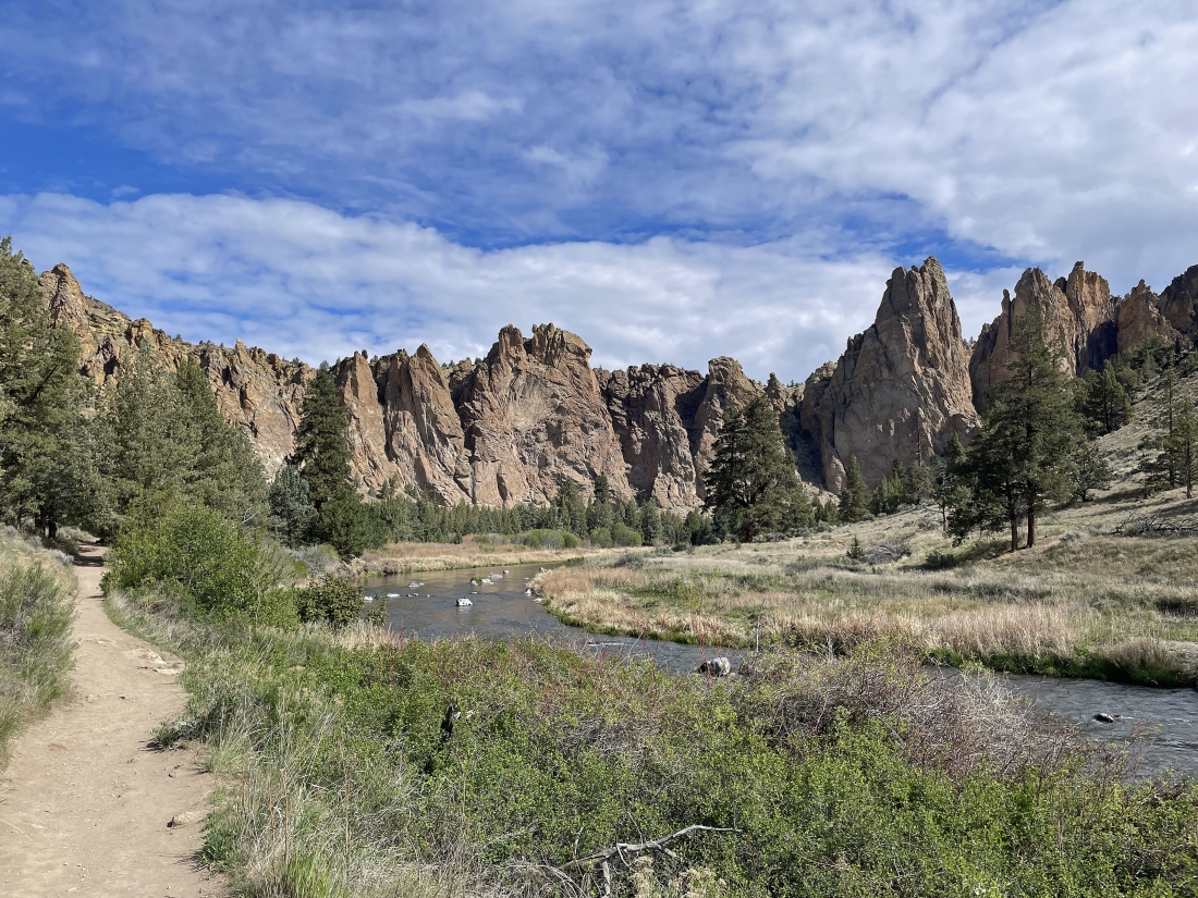
Hiking north along the Wolf Tree Trail... admiring the rock formations along the way.
|
Continuing to hike north along the Wolf Tree Trail... here looking back at the Red Wall on the far left... and the area just to the right of it where the Misery Ridge Trail switchbacks up to Misery Ridge.
|
Still on the Wolf Tree Trail... but we have started gaining elevation from the Crooked River... here looking back at Misery Ridge on the far left horizon.
|
Still gaining elevation from the Crooked River and heading up to Burma Road... with the Marsupial Crags on the horizon... the crags and Burma Road will be outside of Smith Rock State Park.
|
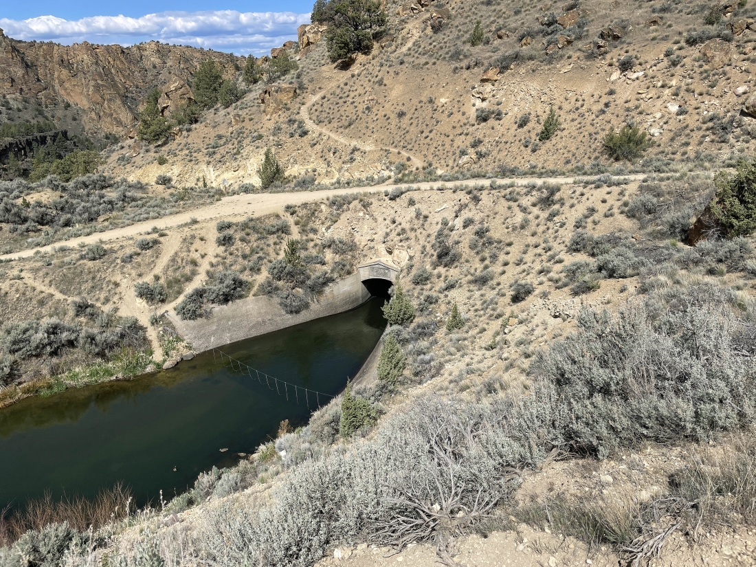
We have reached Burma Road after hiking the Wolf Tree Trail for 1.4 miles... here we are looking down on the 'North Unit Main Canal' which was constructed in 1945... and the water runs through the mountains.
|
Outside of the park and gaining elevation on the Burma Road as we follow it below the Marsupial Crags... with Smith Rock and Misery Ridge standing out in the distance. The snow covered pyramid shaped mountain on the horizon in the middle of the photo is Mount Jefferson... the second highest mountain in Oregon.
|
Getting ready to reach our 3,580 foot high point of the day after hiking Burma Road for three-quarters of a mile.
|
From our high point we are looking out and down at Burma Road which got us up here... with part of the 'North Unit Main Canal' down below and part of the Marsupial Crags in the upper left corner of the photo.
|
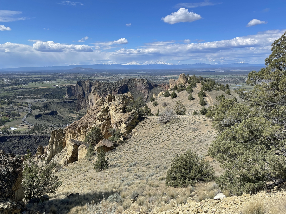
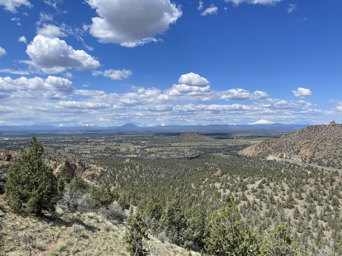
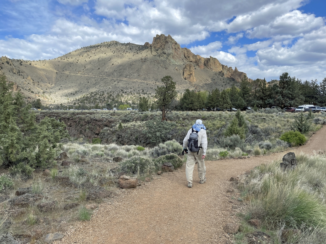
We are at our 3,580 foot high point outside of the park... here looking SW into the park and we will be heading for the point in the right-center foreground... the Cascade Range with some snow covered peaks is on the very distant horizon.
|
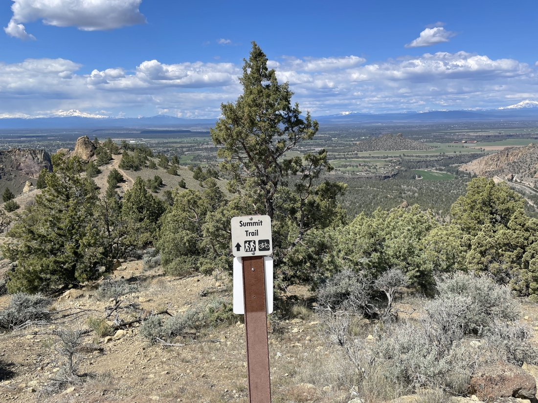
From our 3,580 foot high point we will re-enter the park from the Burma Road by taking the Summit Trail.
|
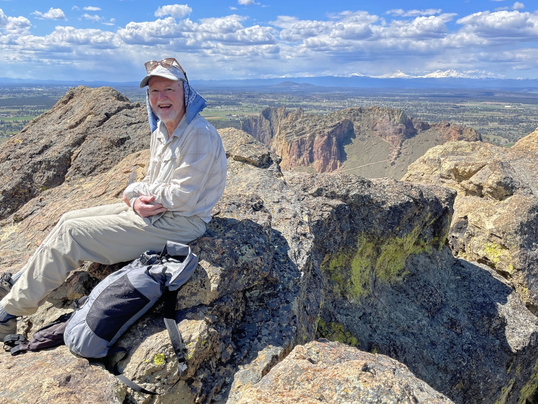
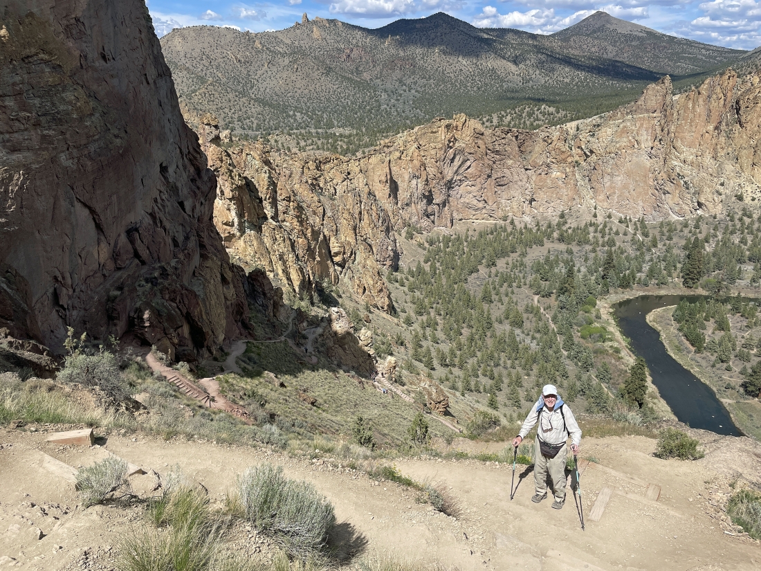
rocman is enjoying the 3,530 foot point located a quarter mile west from our high point on Burma Road... this point is a very short distance off of the Summit Trail. In the distance on the right you can see the switchbacks that lead up to Misery Ridge... and you can see the snow covered Three Sisters Mountains on the right horizon.
|
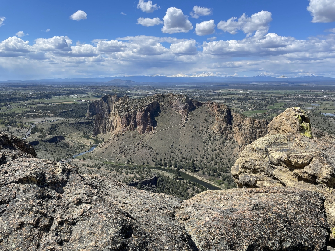
This photo was taken from the same place as the previous photo... just showing more terrain.
|
I stood up above rocman in the previous photo where I can look down on the Crooked River as it winds around the rock formations in Smith Rock State Park.
|
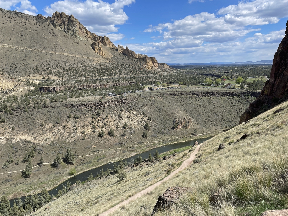
We are continuing to hike down the Summit Trail... here looking NW across the town of Terrebonne to the Cascade Mountains on the horizon.
|
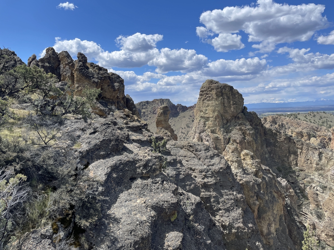
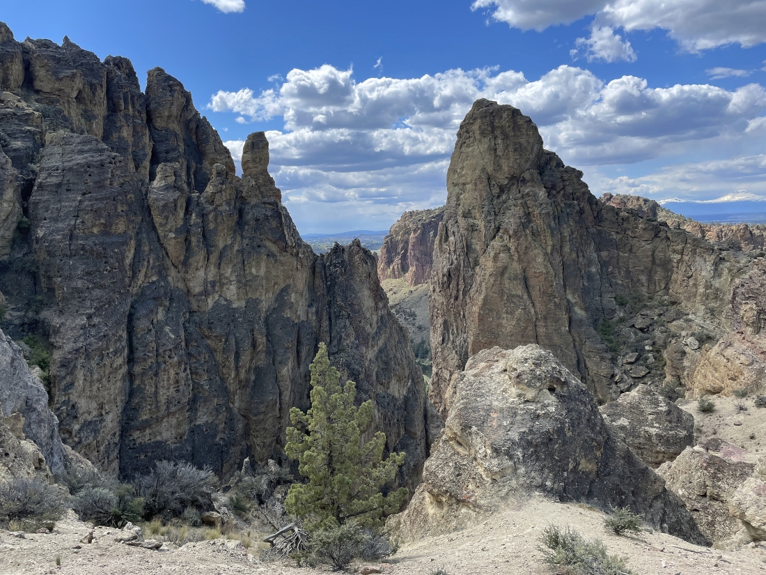
Awesome rock formations as we continue to hike down the Summit Trail... and we can see Misery Ridge in the distance through the gap in the middle of the photo.
|
Continuing to hike down the Summit Trail.
|
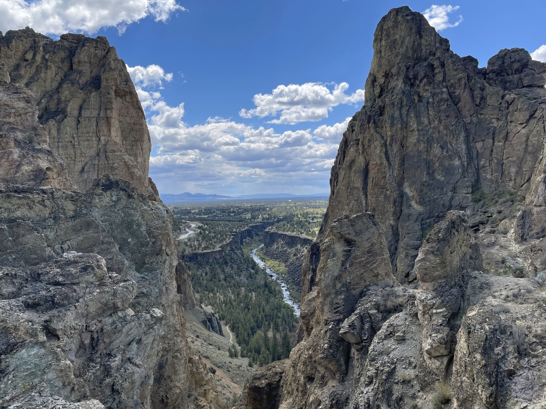
Continuing to hike down the Summit Trail... here looking down at part of the Crooked River and part of the North Unit Main Canal which is above the Crooked River.
|
Continuing to hike down the Summit Trail... here looking over at Misery Ridge on the far left.
|
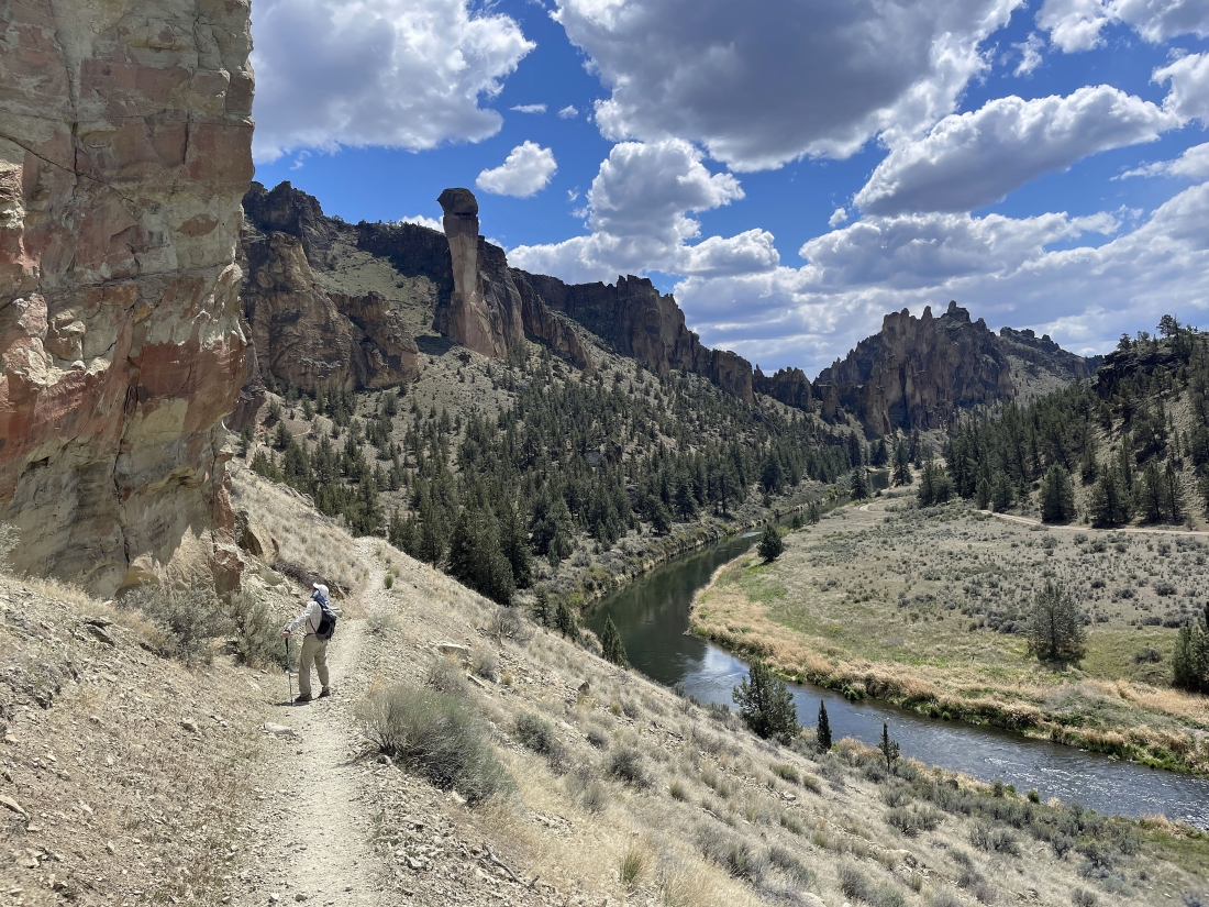
Continuing to hike down the Summit Trail... getting closer to the Crooked River... and now we can see the Monkey Face rock formation.
|
After hiking the Summit Trail for 2.4 miles we have joined the Mesa Verde Trail which will take us over to the base of Monkey Face.
|
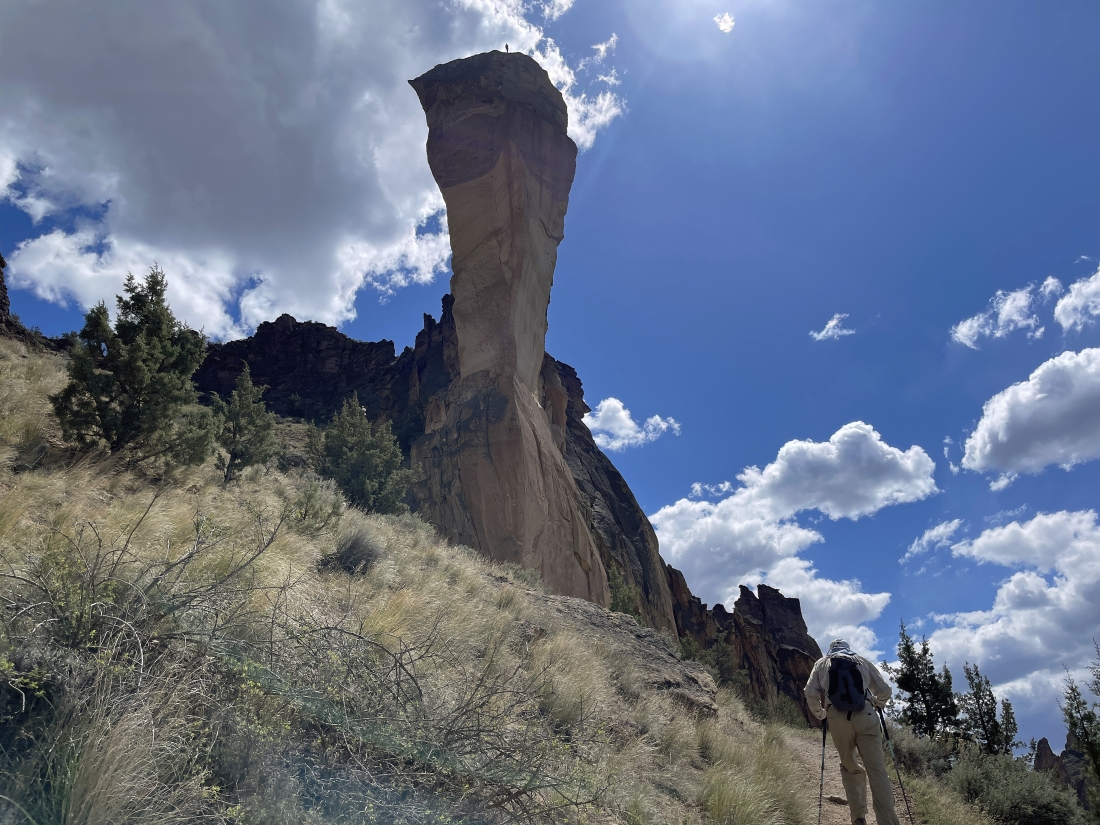
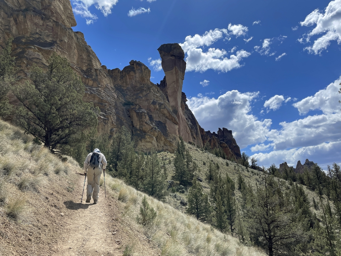
Nearing the base of the Monkey Face rock formation... and we can see a person up on the summit of Monkey Face.
|
We have reached the base of Monkey Face... here looking back at a small portion of the Summit Trail that almost got us back down to the Crooked River.
|
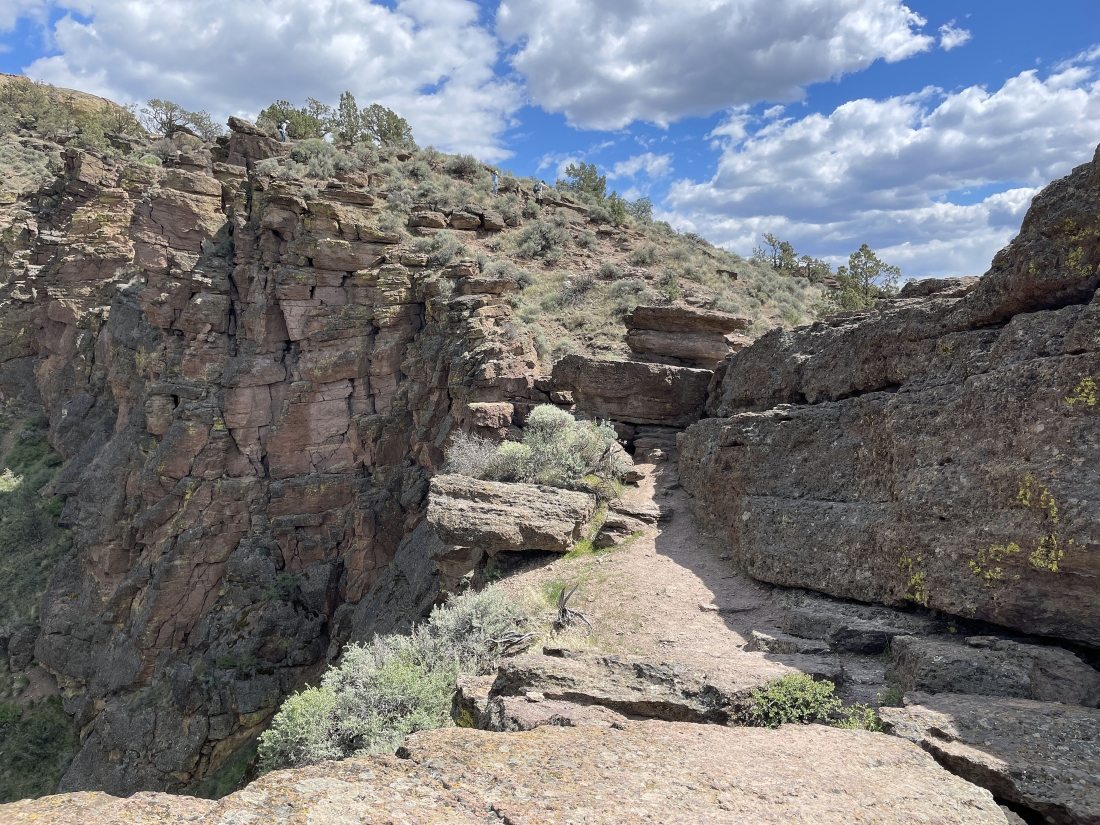
After hiking the Mesa Verde Trail for a quarter mile we have joined the Misery Ridge Trail which will take us up to the top of Misery Ridge along the north side of Monkey Face.
|
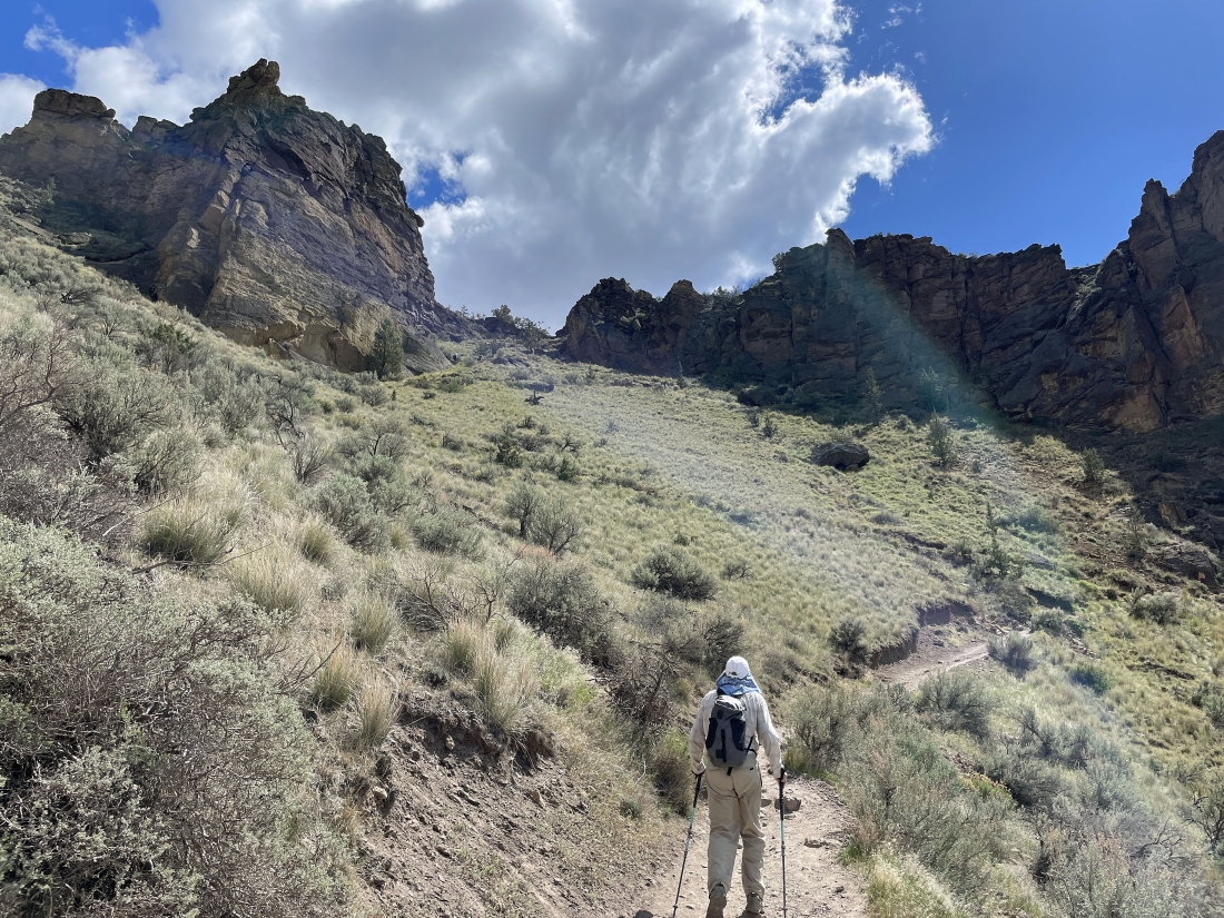
Gaining elevation on the Misery Ridge Trail as we switch-back our way up the north side of Monkey Face.
|
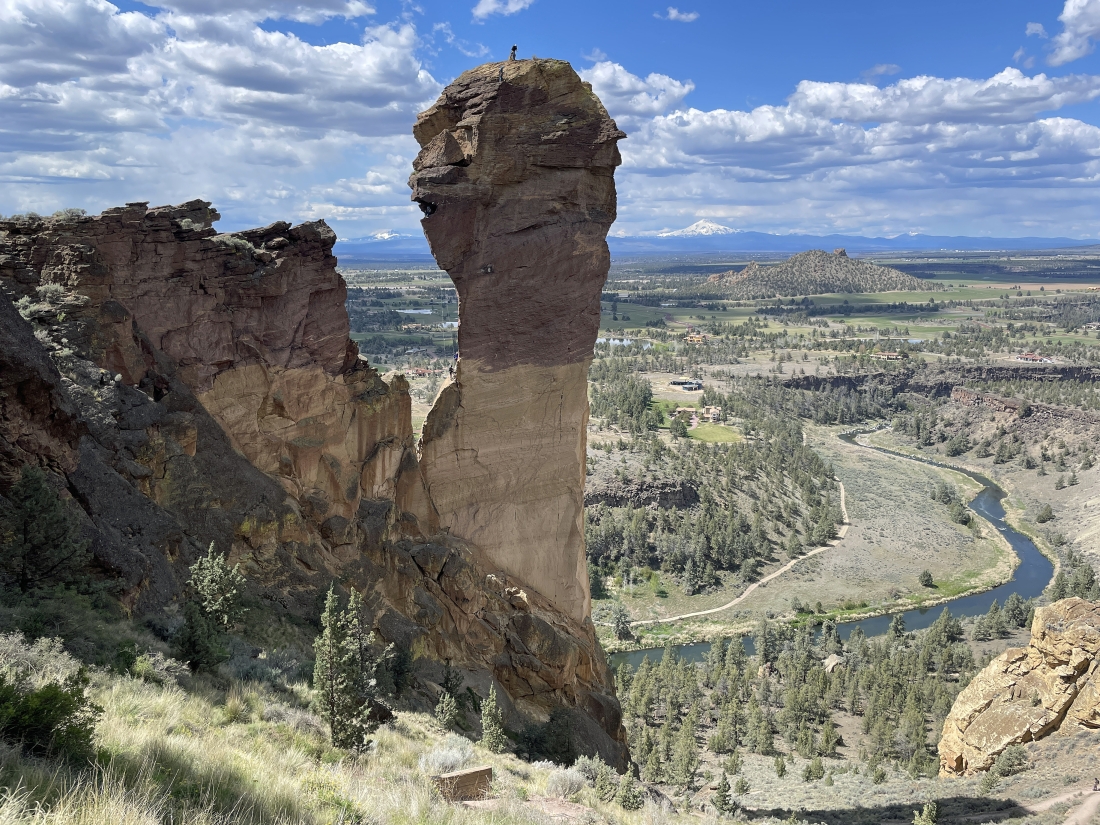
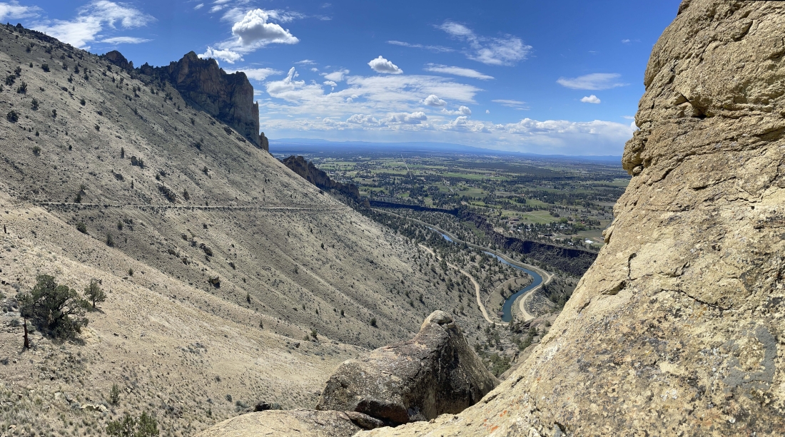
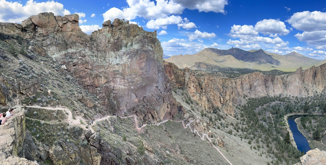
Almost up to Misery Ridge... when we get up there I am going to scramble out to the point in this photo that is only a stone's throw from Monkey Face... with the Crooked River down below... Coyote Butte out there in the sunshine and the snow covered Mount Jefferson on the horizon.
|
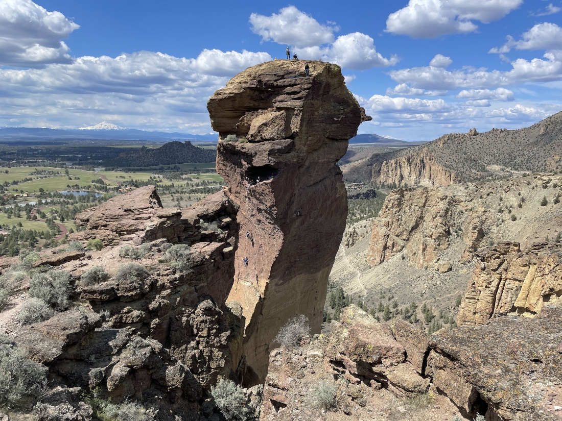
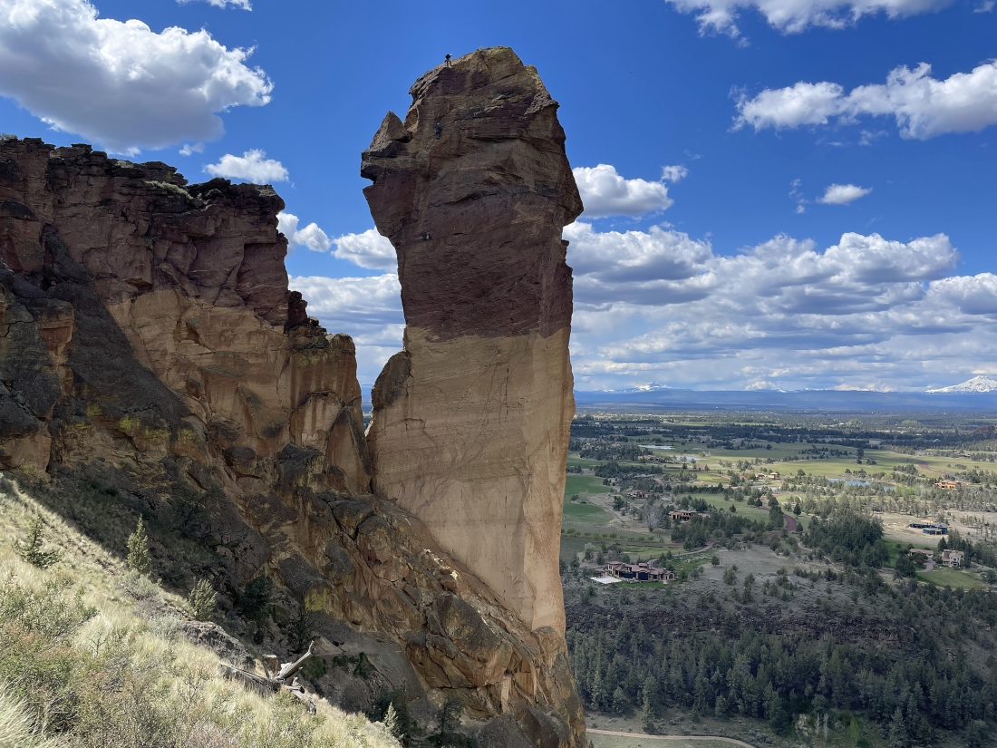
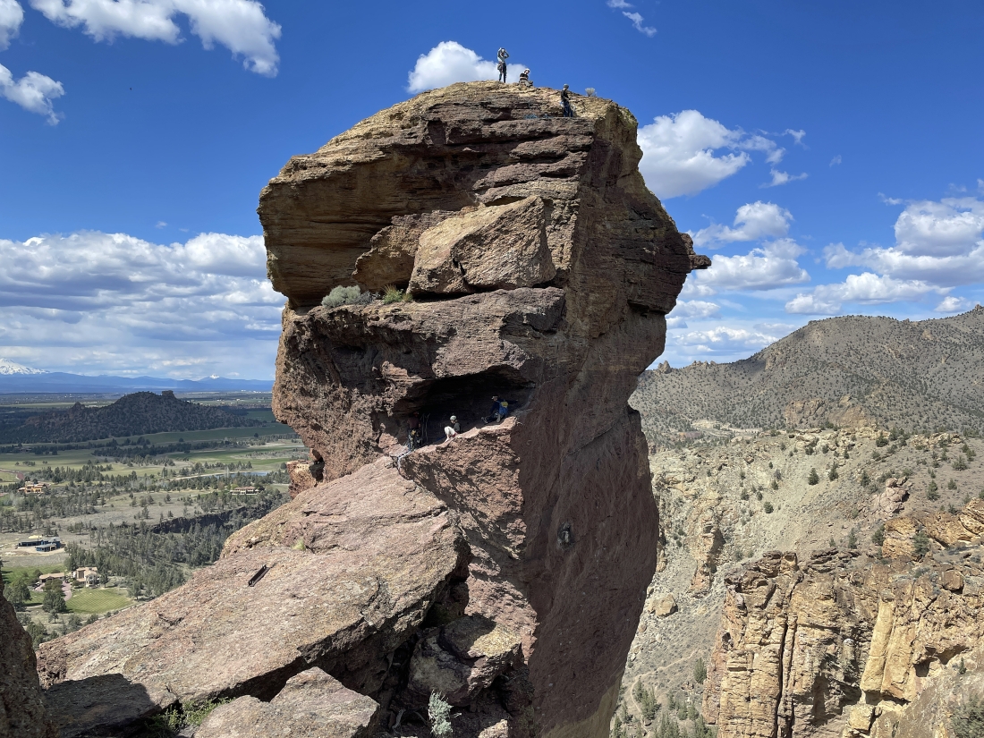
We have reached the high point of the Misery Ridge Trail... and I have left the trail and working my way over to Monkey Face... I can see 7 climbers on Monkey Face in this photo.
|
Getting closer to where I can talk to the climbers.
|
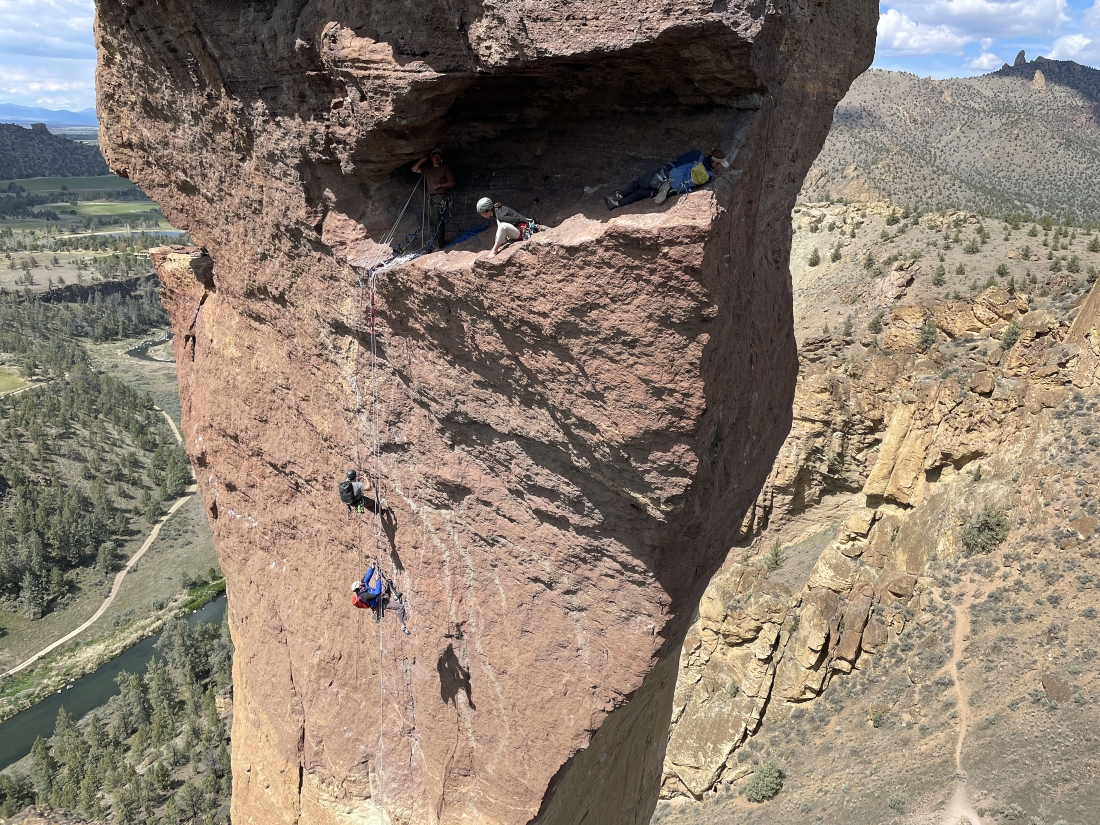
Hi to the climbers on Monkey Face that are relaxing maybe 60 or 70 feet below the summit.
|
Leaving the climbers on Monkey Face and heading back up to the Misery Ridge Trail.
|
|
Still on the Misery Ridge Trail after hiking away from Monkey Face on the west side of Misery Ridge... now looking out to the east side of Misery Ridge... with Burma Road and the Marsupial Crags over on the far left... and we can see lots of cars where we parked earlier in the day along the Northeast Crooked River Drive.
|
On the east side of Misery Ridge and getting ready to hike down the switchbacks on the east side of the Misery Ridge Trail... with part of the Crooked River down below.
|
rocman heading down the switchbacks of the Misery Ridge Trail on the east side of Misery Ridge.
|
The Misery Ridge Trail flatens out a bit after a lot of switchbacks... but there will be more switchbacks around the corner ahead... you can see part of the Burma Road and most of the Marsupial Crags in the upper left corner of the photo.
|
We have passed by the Red Wall rock formation and getting ready to deal with more switchbacks on the Misery Ridge Trail that will take us down to the bridge crossing of the Crooked River.
|
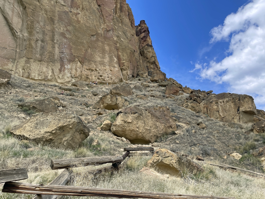
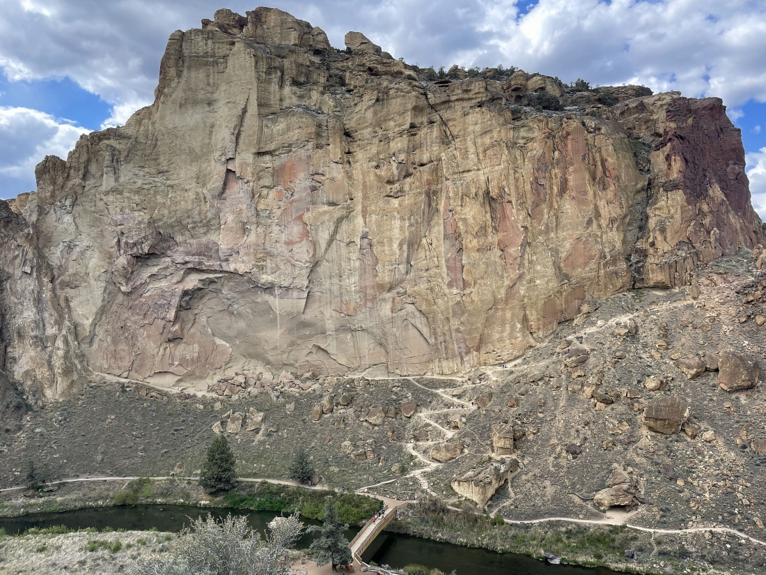
After hiking the Misery Ridge Trail for one mile we are off of it and getting ready to cross the Crooked River... here we are below the Picnic Lunch Wall and looking back up at the portion of the Misery Ridge Trail that we have just come down.
|
We have just crossed the Crooked River... here looking out to the huge Smith Rock rock formation down there on the far left... with the Ship Rock rock formation in the right foreground... getting ready to take 'The Chute' trail up to the area where we are parked.
|
Almost to the top of 'The Chute' trail.
|
At the top of 'The Chute' trail and looking down at the bridge crossing the Crooked River... a little while ago we came down those switchbacks below the Picnic Lunch Wall... and a lot earlier in the day we had taken the Wolf Tree trail that runs along the Crooked River from the bridge to the right side of the photo.
|
rocman is almost back to where we parked... and you can see the Burma Road gaining elevation underneath the Marsupial Crags out there on the horizon... the hike was a total of 6.5 miles, gaining 1,884 feet of elevation.
|
