Scatter Peak - 9.28.2008
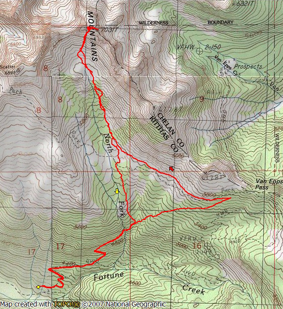
We drove incredibly rough roads 4W301 and 4W302 for a total of 2.3 miles... then parked and walked 4W302 for .5 miles to trail #1339... eventually connecting with and hiking the County Line Trail #1226.2 for ~1 mile... then cross country to the summit.
