Mount Mastiff - 10.21.2010
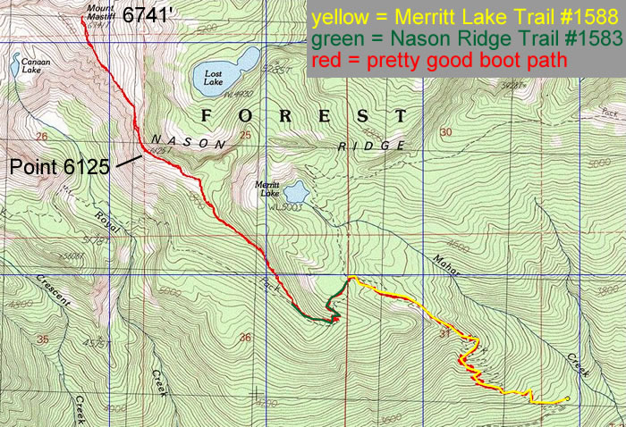
rodman's GPS route of our trip to Mount Mastiff... using parts of the Merritt Lake and Nason Ridge trails and finishing up on a pretty good boot path to the summit... 10 miles roundtrip, gaining 3907 feet of elevation.
