Mount Mastiff - 10.21.2010
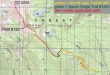
rodman's GPS route of our trip to Mount Mastiff... using parts of the Merritt Lake and Nason Ridge trails and finishing up on a pretty good boot path to the summit... 10 miles roundtrip, gaining 3907 feet of elevation.
|
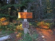
Drive east from Stevens Pass on Hwy 2 and look for a Merritt Lake sign near milepost 76 that will put you on FS road 657... drive 657 for ~2 miles to the end of the road and the Merritt Lake Trailhead (3100').
|
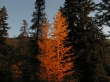
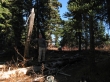
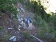
No... this isn't a larch tree.
|
After hiking on the Merritt Lake trail #1588 for two miles (~4880'), we turned SW on the Nason Ridge Trail #1583.
|
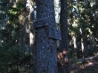
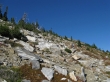
Hike trail 1583 for ~.5 miles to its high point (~5440') and look for a good boot path on the right... rodman is standing at this spot in the photo... look closely for nails in the snag he is leaning on.
|
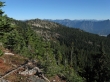
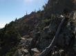
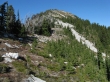
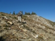
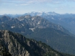
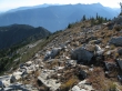
Views to the east improve as we continue on good boot path towards Point 6125.
|
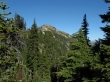
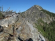
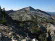
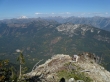
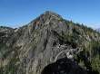
First good look at the summit area of Mount Mastiff as we continue towards Point 6125.
|
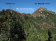
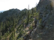
Nearing Point 6125 we can see the crux of the trip... the 200 yard stretch of Class 2/3 that runs from Point 6125 to the north side of two gendarmes.
|
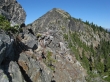
We are looking at Mount Mastiff from Point 6125... the ridge to get over there looks a little intimidating, but it will turn out to be fairly easy.
|
A bad pano from Point 6125... but it gives perspective for Rock Mtn (left), Mt. Howard (center) and Mt. Mastiff.
|
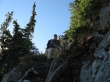
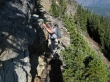
rodman in the Class 2/3 section.
|
more of rodman in the Class 2/3 section.
|
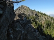
It will be Class 2/3 until we get past the two dark colored gendarmes.
|
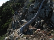
rodman and a veggie belay.
|
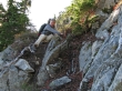
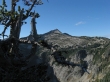
Steeper than it looks.
|
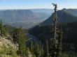
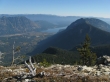
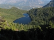
Lost Lake below... with Lake Wenatchee starting to appear in the distance.
|
We've made it past the two gendarmes... it will be smooth sailing from here to the summit.
|
rodman on easy terrain now... following good boot path.
|
rodman nearing the Mount Mastiff summit.
|
Lake Wenatchee and Fish Lake from the Mount Mastiff summit (6741').
|
Mt. Howard from the Mt. Mastiff summit area.
|
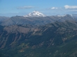
A closeup of Glacier Peak from the Mastiff summit.
|
In the top center of the photo I think we are looking at Mt. Fernow, Seven Fingered Jack and Mt. Maude... with Seven Fingered Jack and Mt. Maude looking like one mountain... possibly Bonanza Peak on the left edge of the photo.
|
Looking across Labyrnith Mountain to (I think) the Monte Cristo group.
|
Perspective... showing some of the broad views north and east from the Mastiff summit.
|
rodman packing up from our nice viewpoint on the north side of the summit area.
|
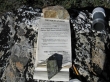
The summit register was placed in July 2000... still plenty of room for signatures.
|
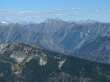
Heading back down towards Point 6125... the Chiwaukum Mountains across the valley.
|
Back at the Class 2/3 section... looking over at Point 6125.
|
rodman working the Class 2/3 section... and standing on my head.
|
rodman scrambling in the Class 2/3 section.
|
Looking down on Lost Lake.
|
Gnarly trees and a scrambling rodman.
|
Mt. Howard... taken near Point 6125.
|
Mount Mastiff from Point 6125... a couple hours of hiking will get us back to the car.
|
