Mazama Ridge - 2.27.2012
This map shows the approximate route of our trip to Mazama Ridge via Narada Falls... ~6 miles roundtrip... gaining ~1500 feet of elevation.
|
|
|
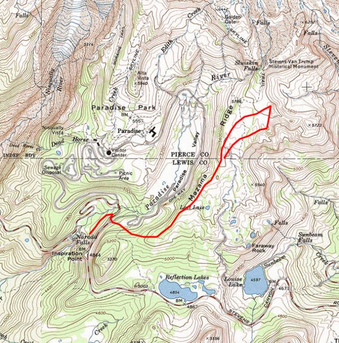
Mazama Ridge - 2.27.2012
This map shows the approximate route of our trip to Mazama Ridge via Narada Falls... ~6 miles roundtrip... gaining ~1500 feet of elevation.
|
