Red Mountain - 7.25.2012
rodman's GPS route from 2005... the same route that we took on this trip... 6 miles roundtrip, gaining 3037 feet of elevation.
|
|
|
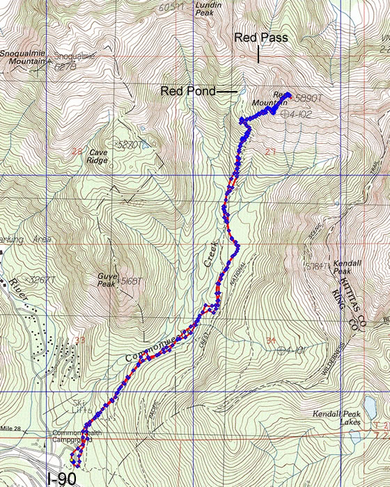
Red Mountain - 7.25.2012
rodman's GPS route from 2005... the same route that we took on this trip... 6 miles roundtrip, gaining 3037 feet of elevation.
|
