Red Mountain - 7.25.2012
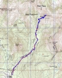
rodman's GPS route from 2005... the same route that we took on this trip... 6 miles roundtrip, gaining 3037 feet of elevation.
|
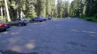
Park (3000') at the Pacific Crest Trail parking area on the north side of Snoqualmie Pass.
|
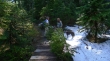
larman, Snowdog and Izzy on the abandoned trail leading into Commonwealth Basin.
|
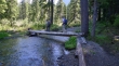
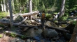
We didn't expect to find this bridge in Commonwealth Basin... someone has done some work here in the last couple of years.
|
Snowdog trying to find the trail... looking for sawed logs.
|
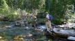
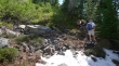
Crossing the creek a second time to get back on the abandoned trail in Commonwealth Basin.
|
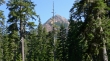
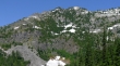
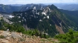
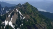
Our first good look at Red Mountain from Commonwealth Basin.
|
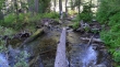
One last crossing of Commonwealth Creek before starting uphill again.
|
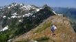
Snoqualmie Mountain as we are now gaining elevation in earnest on the way to Red Pond.
|
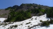
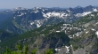
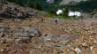
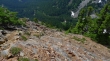
Red Mountain and avalanche debris near Red Pond.
|
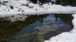
Red Pond reflection... the pond is still mostly under snow.
|
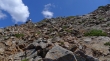
We have backtracked a short distance from Red Pond and started up Red Mountain on an obvious path.
|
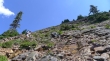
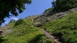
Snowdog and larman on steep terrain now... but still on an obvious path.
|
larman and Snowdog checking out the terrain.
|
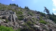
The path led us over to a SW rib that we will follow for a short distance.
|
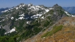
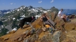
Our first good look at Kendall Peak from the SW rib of Red Mountain.
|
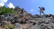
Leaving the SW rib and traversing underneath the Red Mountain summit.
|
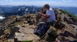
Snowdog on the summit... as larman nears it.
|
Izzy, Snowdog and larman on the Red Mountain summit (5890').
|
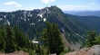
Mt. Thomson in the foreground... Middle Fork Snoqualmie peaks on the left... Chimney Rock and Lemah behind Thomson... Chikamin and Four Brothers on the right.
|
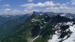
Snoqualmie Mountain (center) and Lundin Peak (right) from the Red Mountain summit.
|
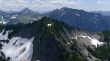
The North side of Kendall Peak... with the crest trail cutting across it... the start of the Kendall Katwalk is on the far left.
|
Three Queens on the left... Alta Mountain on the right with the top of Hibox peaking above it.
|
Looking across Cave Ridge to foreground peaks... Denny Mountain (left), The Tooth, Hemlock and Bryant... behind are Granite Mountain (left), Tusk O'Granite, McClellan Butte and Mt. Defiance.
|
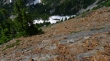
A closeup of the north side of Kendall Peak and the crest trail cutting across it... Keechelus Lake on the right.
|
Izzy, Snowdog and larman chilling on the summit of Red Mountain... Snoqualmie Mountain and Lundin Peak are behind.
|
Leaving the Red Mountain summit now.
|
Snowdog and larman heading down... don't send any rocks down on them... Red Pond is down there in the snow somewhere.
|
larman is a speck in the middle of the photo.
|
I can see Red Pond now... still a few hundred feet of steep terrain left before I can get to easier terrain... leaving 2.5 miles to get back to the car.
|
