Mac Peak - 9.12.2012
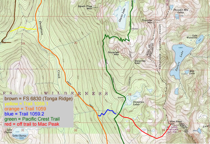
The big picture... using the Foss River Road #68 and FS 6830 to reach the start (3640') for the Deception Creek Cutoff trail #1059.1... then using trails #1059 and #1059.2 to reach the PCT... where we headed south for about 30 steps before heading cross country for Mac Peak.
