Mount Si - 11.27.2012
A topo map of the area... the red line is the main trail... 8 miles roundtrip, gaining 3400 feet of elevation.
|
|
|
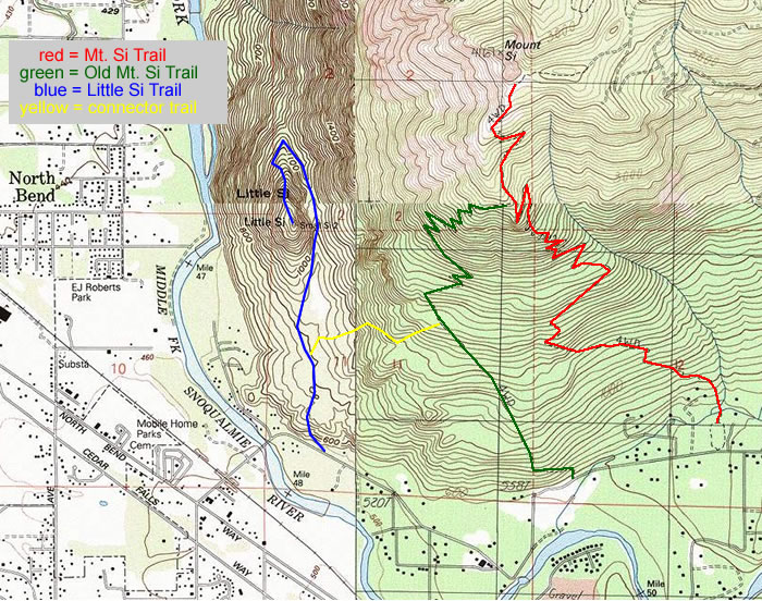
Mount Si - 11.27.2012
A topo map of the area... the red line is the main trail... 8 miles roundtrip, gaining 3400 feet of elevation.
|
