Previous
|
Next
|
Thumbnails
2014 Hikes and Climbs
All Photo Galleries
Axis Peak - 5.21.2014
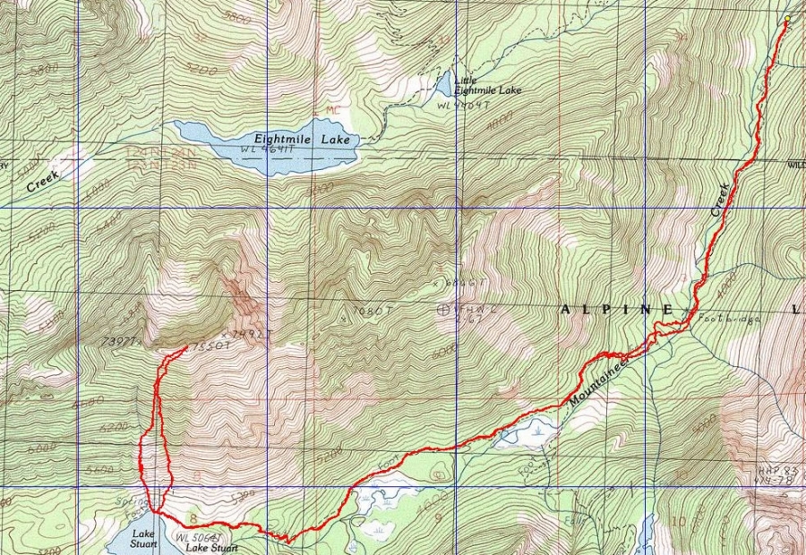
rodman's GPS track of this hike/climb in October 2009... basically the same route that we used on this trip... 11.2 miles roundtrip, gaining 4297 feet of elevation.
Hiking Database
Photo Galleries
Calendar Database
Sitemap
Search My Site